
Mesa Butte via Curley Sand Ridge
This adventure finds us in an area of Kananaskis we’ve never really explored before. Our destination is Mesa Butte, a broad grassy hill located in a sea of gently rolling ridges just west of Millarville. Our route not only takes in that summit, but also two separate ridges leading to it, which will provide us with a good workout and plenty of fun.
We start off at the North Fork Provincial Recreation Area, near the eastern border of Kananaskis. It was closed, along with most other campgrounds in the region, due to flood damage. In late June record rain fall and melting snow pack turned most creeks, streams and rivers into raging torrents, and the resultant flood waters caused considerable damage. It’s going to be a long time before Kananaskis, no Southern Alberta, is back to normal.
The trail we take is one of the harder routes up Mesa Butte. There are easier ones and shorter ones, but we wanted to challenge ourselves, so we combine the Mesa Butte route (Route 64C in Gillean Daffern’s Kananaskis Trail Guide, volume 4) with parts of the Curley Sand trail (Route 63). This will have us going up and over not one ridge, but two, before we even tackle Mesa Butte. Then, on the way back, we’ll do it all over again in reverse. We’re gluttons for punishment.
Starting off we cross the road and head west in a meadow. There is no visible trail here and only a few signposts let you know you are heading in the right direction. This is the Curley Sand trail, which will take us up and over Curley Sand Ridge.
Shortly we’re in the trees and the trail becomes more distinct. It passes through some boggy areas which are muddy quagmires. Because of this I worry this is going to be a hellish nightmare of a hike but fortunately as soon as we gain elevation, which happens quickly on, the trail improves greatly.
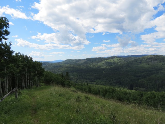
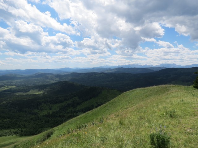
In the trees, we zig-zag up Curley Sand Ridge and before long are on top. Walking through lovely meadows carpeted with flowers, we have good views to the west (the east side is forested.). We see Threepoint Creek below, looking calm now, but a few weeks ago it was a torrent, bursting its banks due to a deluge of rain.
Before long the ridge peters out and we plunge into the trees, heading down gently as we go. Not long after crossing a bridged stream, we come to a very faint junction, easily missed if you are not paying attention. Turn hard right and head up the next ridge.
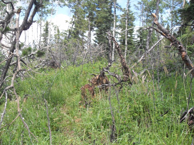
Initially the going is easy. The trail here is sort of faint and with the lush undergrowth it appears there is sometimes no trail at all. This is a new route, only appearing in the newest Kananaskis trail guides, so it’s not well known or very defined. I am sure over time that will change however.
So far the way up has been easy, but at the top of the second ridge we run into a tangle of dead fall, which requires a bit of work to get through. Fortunately this ridge is short and before long we’re clear of the mess. I believe the hill has no name, so we’ll call it Deadfall Ridge, a fitting title I’d say. At its northern edge Mesa Butte comes into view.
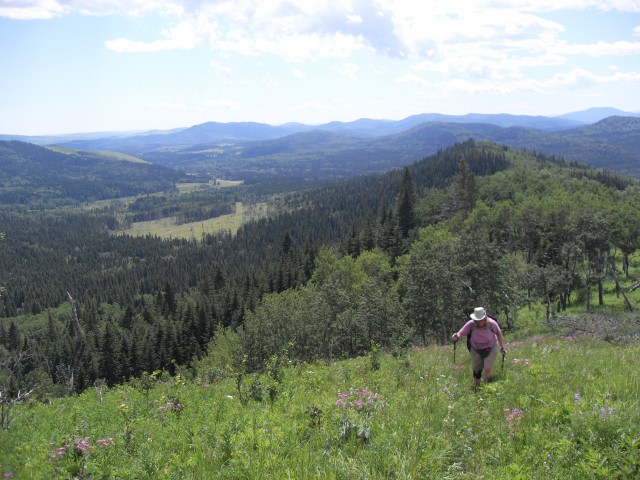
Dropping down (again) through a reclaimed cut block, we’re now directly below our objective. Heading back up again, we’re in the trees for a bit before breaking out onto grassy slopes, which lead to the summit. This is the steepest section of our hike, but the footing is solid and after a few final pushes we’re on top.
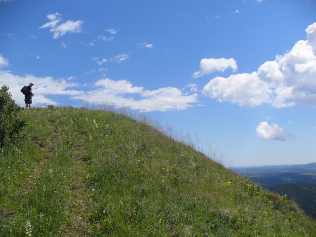
Mesa Butte’s south facing slopes are open and the views quite pleasing and far reaching, especially considering how little elevation is gained. The east and west sides are partially forested but occasional views can be found between the trees. The north side is heavily wooded obscuring everything in that direction.
The top is broad and flat and is often the case in the area, windy. And today is no exception and we take refuge in the trees, where we enjoy lunch. Connie found some strawberries on the way up, which make for a nice dessert and in spite of their tiny size, they’re big on flavour.
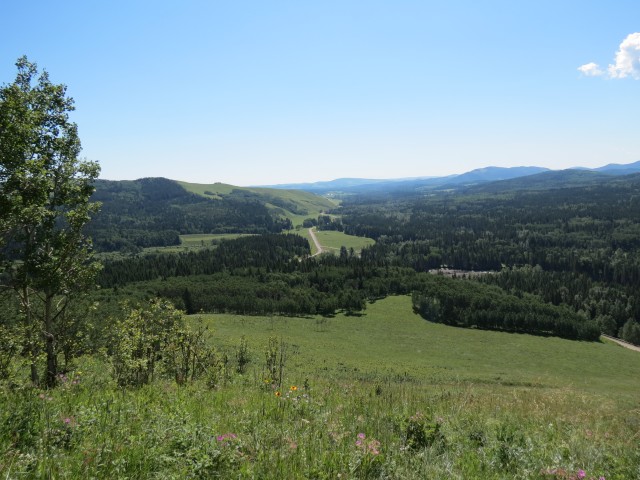
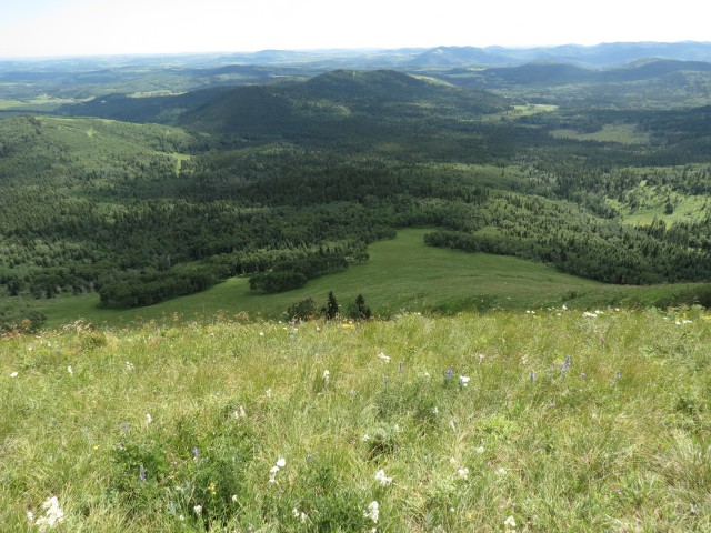
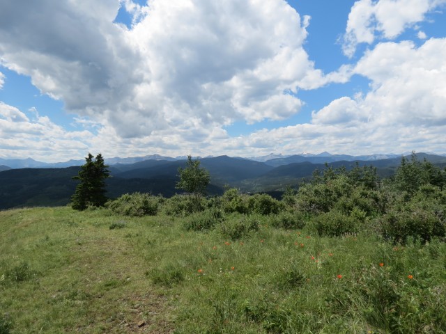
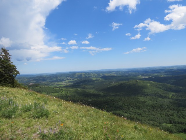
After lunch we take in the panoramas. To the west there is an endless sea of rolling green hills and then grey barren peaks further off in the distance. To the south, it’s more rolling hills extending to the horizon. The two ridges we came up can be seen to the right and if we look hard, we can even see our car parked in a meadow at the base of a small hill. To the east, there are more hills, and beyond them, prairie. If I skirt around a large tree on the steep slopes, Calgary can be seen.
Everything around us is green and lush and the summit is awash with flowers, especially Indian Paintbrush and Tiger Lillies.
The wind at the top not only cools us, but it also keeps away the hordes of flies that were pestering us the whole trip. There we no mosquitoes, surprisingly, just these flies. They don’t bite and would just buzz around you annoyingly.
This trail is supposed to be quite popular, but we only saw one other group on the summit. They looked to have come in from the easier 64A or B routes (Kananaskis Trail Guide, volume 4). We however did meet some other hikers and horseback riders on the Curley Sand portion of the trail.
This hill has officially been refereed to as Square Butte since the 1990s, but even today most know it by its earlier name, Mesa Butte – not to be confused with a “new” Mesa Butte to the south. In spite of the government forcing this change, everyone still calls by its original title, including hikers and map makers. The government campground at the western base of the hill is still known as Mesa Butte as well, proving that many are convinced the hill’s name change was an error in judgement.
Heading back down and into the trees again we leave the wind behind. But without wind, it’s back into the flies. In fact we become so numb to them we are mostly able to ignore the buzzing cloud that surround us.
On the trip back Connie manages to find a four leaf clover, one of many she’s discovered this year. I don’t know how she does it. We also spotted lots of mushrooms, many growing on animal poop.
Retracing our steps, we drop down, climb up, drop down, climb up then drop down one final time before we’re back at the car. Both Connie and I were feeling strong so it was not the chore we thought it could be. I doubt many summit Mesa Butte using the route we took. But we’re crazy.
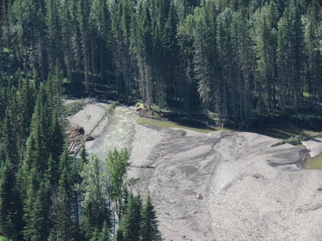
As mentioned Threepoint creek had recently flooded and further east down that watercourse, we discovered a motorhome that was swept away by the rushing waters (last picture below). Wow!
To see some other modest ridges and hills we’ve been up, follow these links…
Windy Point Ridge.
Sandy McNabb XC ski trails to Pine Ridge.
Deer Ridge.
If you wish more information on this route, by all means contact us!
Date of adventure: July, 2013.
Location: Kananaskis west of Millarville.
Distance: 10km round trip.
Height gain from start: 315m.
Height gain cumulative: 580m.
NOTE: all heights and distances are approximate.
Reference: Kananaskis Trail Guides by the Dafferns.
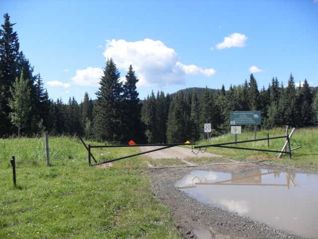
The our adventure begins at the North Fork Campground. It was closed due to flood damage.
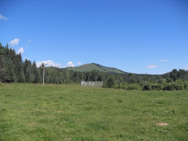
Mesa Butte in back, our destination.
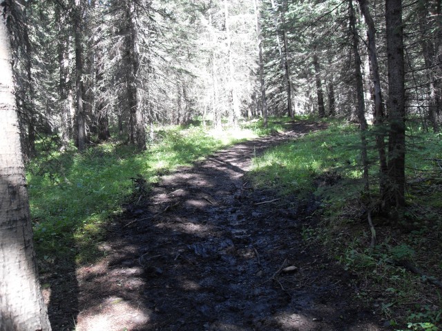
The lower trail was a quagmire of mud and cow poop.
Looking east from the meadows on Curley Sand Ridge.
Looking down at Threepoint Creek, calm now, but a couple weeks ago a raging torrent.
Looking south.
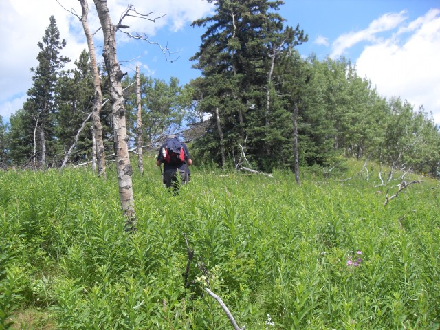
Heading up the second ridge, the trail is overgrown in places.
Connie follows me up – Curley Sand Ridge directly behind her.
The top of the second ridge was a tangle of deadfall.
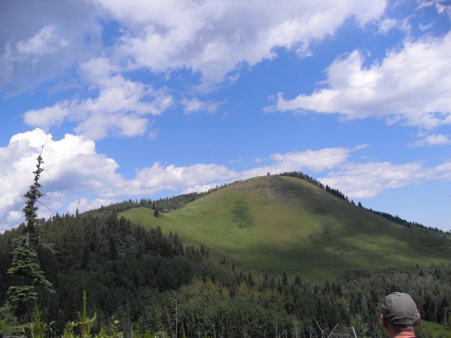
Mesa Butte, also called Square Butte, comes into view. We’ll follow the left ridge up.
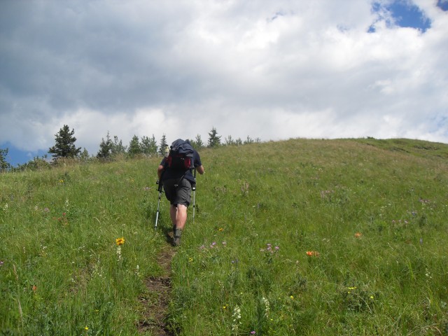
The last bit is fairly steep.
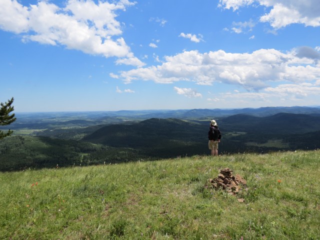
Reaching the summit.
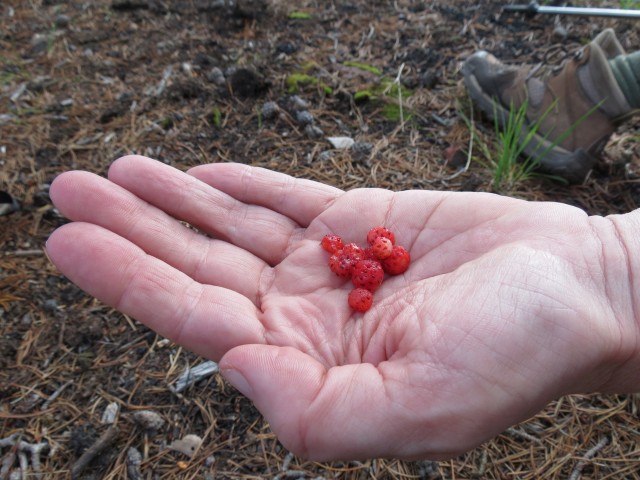
We find some wild strawberries. Yummy!
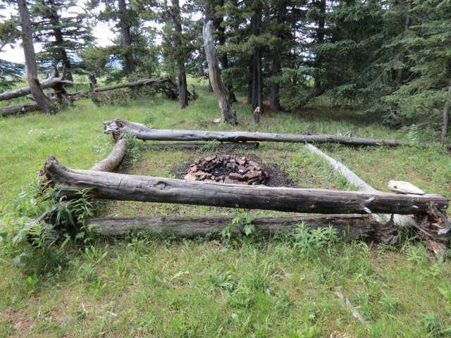
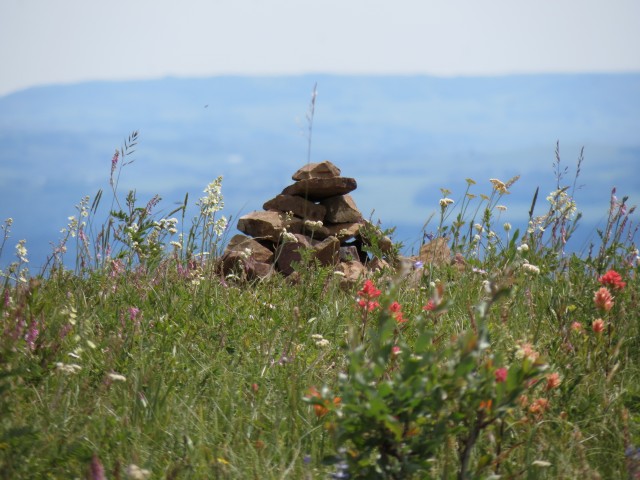
A fire circle (or is that a fire square) at the top.
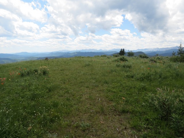
On the broad flat summit, looking southwest.
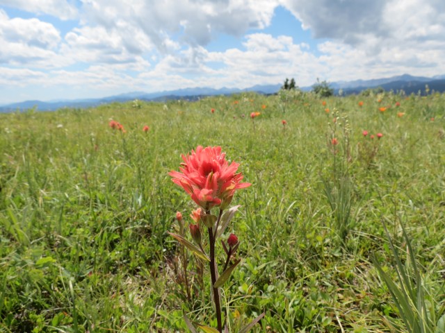
Indian Paintbush.
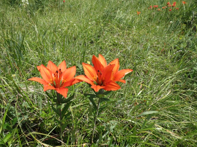
Tiger Lillies, there were lots of them.
Our starting point is the small meadow to the right of and at the base of the hill in centre.
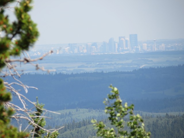
Calgary can be seen in the distance.
The view west is partially obscured by trees.
The south facing top is open and grassy.
Rolling hills to the east of Mesa Butte.
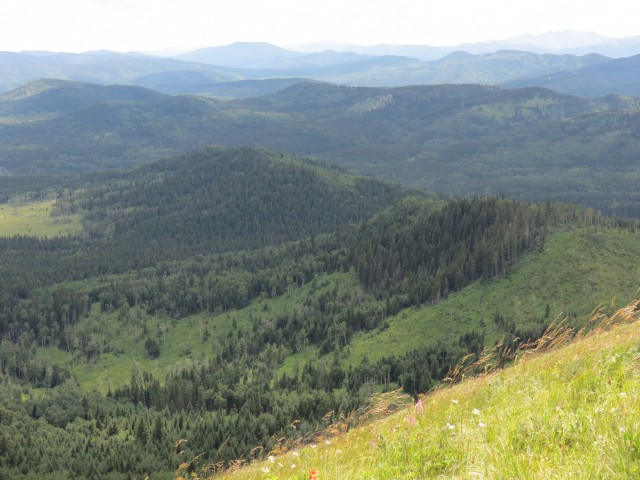
In the foreground are the two ridges we came up.
There were flowers everywhere.
Enjoying the view.
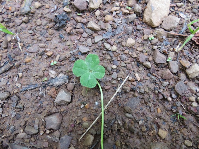
Connie discovers another four leaf clover, one of many she’s found this year.
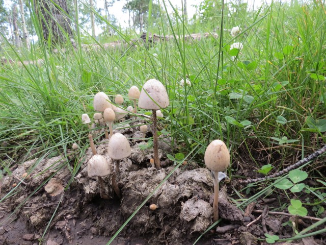
Poop and mushrooms.
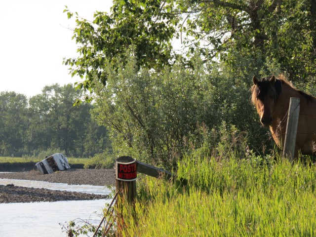
Further down Threepoint Creek, a motorhome swept away by the recent flooding.
")


Did this following your route last week. Got lost a couple times and had to negotiate dense deadfall, fought hoards of mosquitoes, but had enjoyed every minute.
Good, glad you had a fun time. So the skeeters are finally out in force? I expected they’d be out given all that rain recently.
That motorhome picture is so sad. :<
The damage from these floods is amazing.
The kids and I do this hike every fall.
This a favourite hike for us and we’ve been up many times but your route is far too ambitious for us. :> We’ve taken the shorter trail from the well road.
What ever trail you take, it’s a nice little hike. Thanks for posting!
I am pretty sure we were the ones you met near the summit. We posing for a group picture when you passed us by. It was me, my wife and our two daughters. Holy cow, we came in from the campground and thought it hard. Amazing, you did those ridges before and after, both on the way up and back. Amazing!
It was nice to meet you then and thanks for dropping by the website now. Yea, we wanted more of a workout so did those other ridges, and anyway we’re a bit crazy too.
Looks like an interesting trail. I didn’t know about this one but will have to check it out for sure. Great photos too!
Thanks, it’s a pleasure to share them with you!