
Calgary to Chestermere (and back) canal pathway cycle
For all the hikes and summits we do, we also like to bike on occasion (not nearly enough in fact). With many parts of of Kananaskis closed completely due to flood damage and the few open trails in various states disrepair for the same reason, we decided to forgo that area and try something closer to home. Wanting solitude, we choose to ride the irrigation canal pathway that travels from Calgary to the bedroom community of Chestermere just east of town. It’s a fairly quiet route overall.
You’ll never hear a trip like this described as exciting or exhilarating, but it’s still a pleasant jaunt.
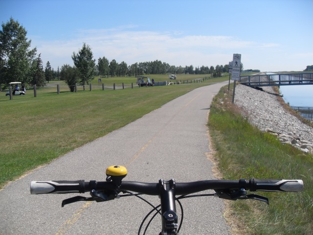
This entire journey is along a flat easy to ride pathway. Travelling this paved route you’ll pass industrial areas, farmer’s field, tree plantations, golf courses, wetlands, and encroaching housing developments. Most roads you encounter pass over the pathway, save for a couple.
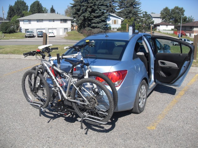
We’ll begin our adventure at Glenmore Trail and Ogden Road and it appears others like this as a staring point too. As we unloaded the bikes we saw others doing the same. The parking lot here belongs to a hotel and strip mall, but it’s large with lots of spaces. I doubt they mind as long as you park away from the businesses at the far end of the lot.
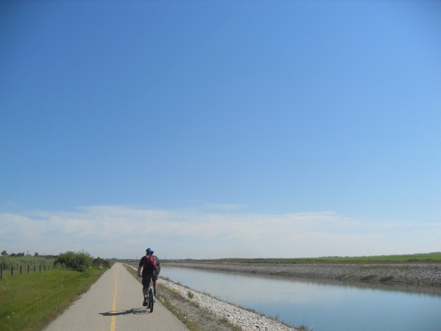
Immediately crossing Glenmore Trail, you’ll head east across a road bridge, where you enter the pathway proper along the canal. At this point you’re heading south for a bit before swinging east and then finally north east. The canal meanders as canals are apt to do.
The going is smooth and fast and we make good time. Passing under Barlow Trail we stop to watch Cliff Swallows, whose mud nests can be seen far above on the underside of the bridge. It’s amazing how chaotic the scene is and birds fly about, barely missing each other. How in the world they know which nest is which is beyond me. Swallows eat on the fly, mostly consuming bugs (so they are our friends).
On the opposite side of the canal is the CPR mainline. A train can be seen sitting and Connie points out a container that appears to balancing precariously. It’s not however and is being supported by two containers underneath, just one of them is a bulkhead style can, which was hard to see until we were right across from it. This looks like a dangerous way to load them, but it’s fine.
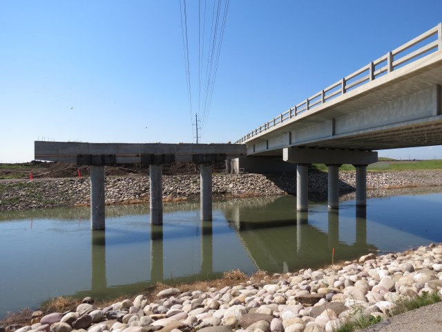
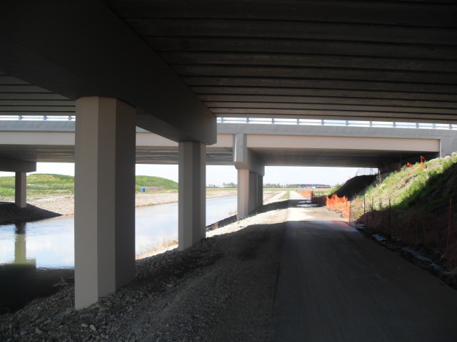
Trending east now, we pass under a few more bridges. One is under construction and new second span being added. To a Calgarian, this sort of thing is common place and at any one time a huge chunks of infrastructure are being worked on. In fact, if you travel somewhere without passing construction, consider yourself lucky.
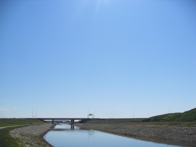
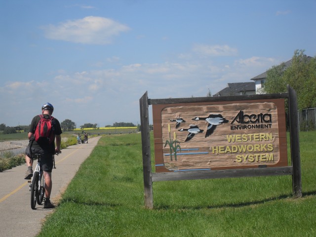
Along here we’ve been passing through industrial areas and our views have been of factories, trucking terminals and trains. Before long however, we’re amongst farmer’s fields and wetlands, all of that stuff behind us. There are a few tree plantations here too. We pass under Stoney Trail, a yet unopened section of the ambitious Calgary ring road. Just past here are some locks and a side canal heading south.
We’ll pass a few more rural roads, which we’ll have to ride across. Watch for traffic!
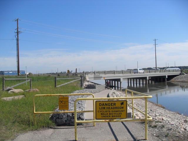
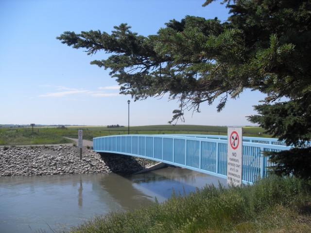
Coming to busy Glenmore Trail (again) and ducking under it – and I mean duck or you’ll loss your head – before long we’re at the Heritage Glen Golf Course. We’ll pass right through the centre of it in fact. We’re tempted to purchase a beer from the concession cart, stationed right by the pathway. Mmmm, that would be nice! Watch for errant balls here (ANOTHER reason to wear a helmet) and those crazy golf-cart drivers who may cut out in front of you.
Beyond the golf course now, we’ll travel through a fairly rural area for a next few kilometres. How long before it becomes an industrial park or housing tract however is a big question on my mind, With Calgary’s explosive growth, it’s just a matter of time I’d guess. Along here there are a few wetlands, oddly devoid of birds. Any others time we’ve cycled here, we’ve seen many.
We continue past some pastures and the horses there are so happy to see that they run to the fence and whinny for our attention. Hoping for a treat perhaps, or even a good petting, they ham it up for the camera.
Before long we come to some canal locks followed by a train bridge. The track belongs to the CNR and this branch travels east of here to Lyalta, not terribly far away – formerly it went all the way to Saskatoon Saskatchewan but the centre section has been abandoned for a few years. This will be our lunch spot on the way back.
Just past here the town of Chetermere comes into view and the next kilometre or two, we’ll ride beside a new housing development. Like Calgary, Chestermere is experiencing incredible growth and it would not surprise me if the two ended up butting up against each other at some time in the near future. Only a few kilometres separate the two – as the crow flies, not by the more circuitous route we took. This is the most busy section of the path.
The canal enters Chestermere Lake here, a man made body of water surrounded by the town. It’s shallow, warm and often weed choked, abuzz with the sound of jet skis and boats. It’s a busy place, sort of a superhighway for the nouveau rich and their noisy water craft.
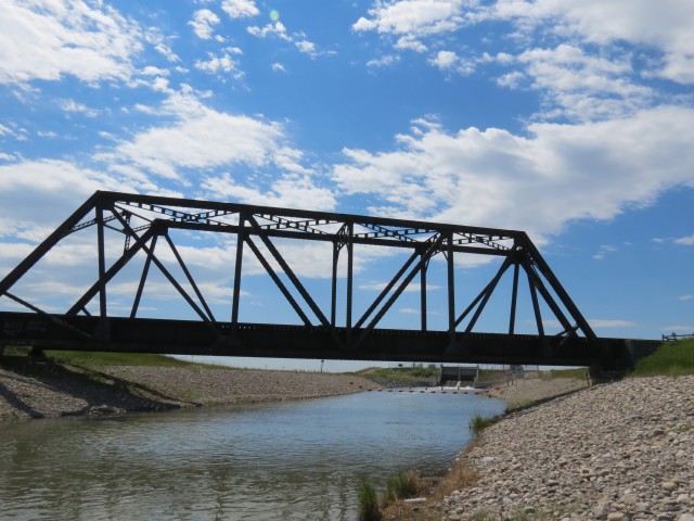
Heading back, we stop at the train bridge for lunch. By this point, the heat was a little beyond our comfort level (as I’ve said before heat is our Kryptonite) and on the way back we take our time and cool off under bridges. Slow and steady.
On this trip we saw only perhaps two or three dozen people, most near the Chestermere end. This trail can be roller bladed, and even walked if you wish, but the later would be a fairly dull trip – too flat with little to see. We saw lots of water birds in the canal, including on mother duck with TEN ducklings!
Interestingly the canal did not seem to have been damaged by recent flooding, unlike most water courses in the region. It was however silted up and brown. Lots of water birds can be seen along its banks, in particular geese and ducks, many with broods. You can and are allowed to canoe or kayak the canal, but I have never seen anyone do that.
Chestermere Lake is actually a reservoir for the irrigation network, known as the Western Headworks System of the Western Irrigation District, and two other canals leave the lake on their way east to dryer parts of the region. Without this live giving water farming would be a challenge in those areas.
This pathway can be followed much further than we travelled and it’s possible to get all the way to Bowness Park, some 46km from Chestermere without leaving it. There are of course lots of offshoot paths along the way too.
Oddly, I had no flats this trip – a first for me.
We used a different part of this same path to access a view point overlooking a flood damaged railway bridge and to see that report, follow the link below…
Collapsed Bonnybrook train bridge.
Further up the CNR tracks is a very unique grain elevator and to see a report about it, click this link…
Buffalo 2000 grain elevator Lyalta Alberta.
To see some other bike themed reports, go here…
Stoney Trail, a hellish journey.
Fix a flat in no time flat.
A little of Lille and Mine Number 1.
A fine article you’re sure to like…
Beachwood Estates.
If you wish more information on this route, by all means contact us!
Date of adventure: July, 2013.
Location: Pathway system between Calgary and Chestermere.
Distance: 33km return.
Our starting point is the parking lot on the corner of Glenmore Trail and Ogden Road.
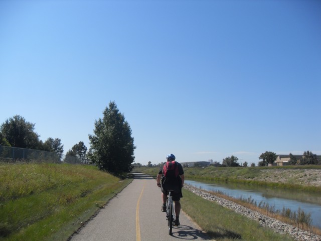
We’ll parallel this canal the whole trip.
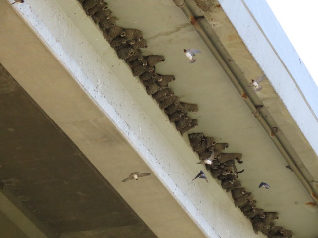
Cliff Swallows under the Barlow Trail bridge.
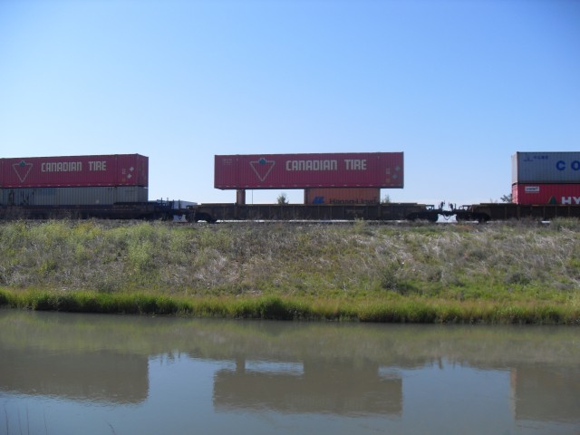
The top container looks be precariously balanced (but isn’t).
One thing you can always count on in Calgary – road and bridge construction.
Coming up to a yet to be opened section of the Stoney Trail ring road.
Ducking under Glenmore Trail.
Passing through Heather Glen Golf Course, we are temped to buy a beer from the concession cart (left of bridge).
A pretty typical view.
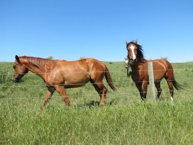
Some friendly horses beg for attention.
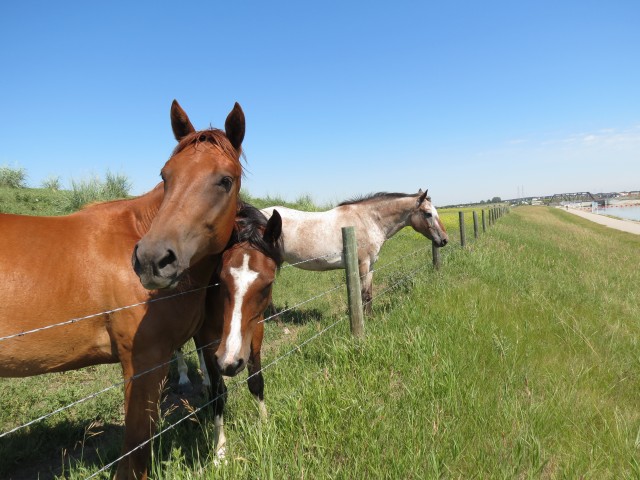
They were just so happy to see us.
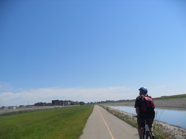
Entering Chestermere, we pass a new housing development.
At this bridge the canal enters Chestermere Lake.
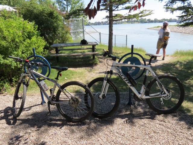
Our trusty steeds.
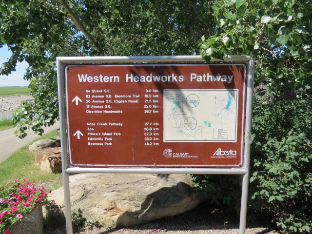
One can travel quite a long distance without leaving this pathway.
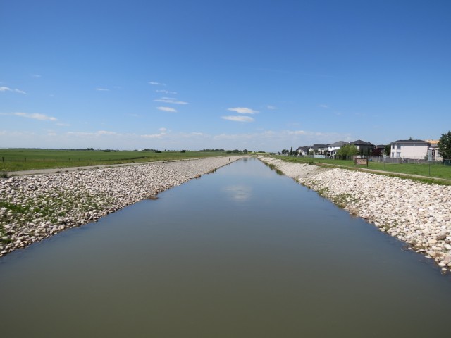
Looking west down the canal and the route we came up.
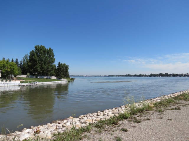
Chestermere Lake, from our turn around point.
Heading back.
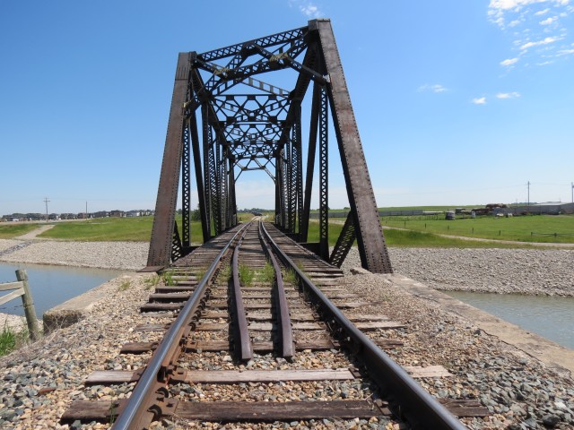
We pass over some tracks belonging to the CNR.
Our lunch spot.
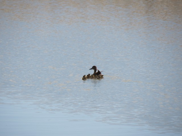
We counted ten ducklings. Quite a brood.
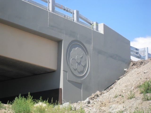
A wild rose, the symbol of Alberta, on a new bridge.
Taking refuge from the heat under the Stoney Trail bridge.


: Magnesium Chloride")


How good is the path in winter, and how long does it take to go only one way?
It’s 20-30 clicks one way, depending on where you start, so travel time varies. Plan for a couple hours I guess. Last time we checked the path is not plowed in winter and ice build up can be a problem, unless there’s an extended chinook which sometimes clears up accumulations. Proceed with caution and report back if you have any updates.
There are tire tracks from 17 Ave to glenmore trail, then bike tracks everywhere else, except from township road 240 to the lake which is completely clear
Doesn’t sound too bad and thanks for the update. Hope you had fun.
No worries, I sure did, I took the max purple home from the other city
Right, I forgot they’re running to Chestermere now at certain times. Convenient!
Neat, I didn’t know this path was here!
Having done it many times…it’s a great ride.
I’m hoping to try this route this weekend. Any idea how many kms it is?
And what a great story, thanks!
At the bottom of the article – 33kms round trip if you start where we did, at Glenmore and Ogden Road. Enjoy your ride!
Any bathrooms or water fountains along the path ?
Sometimes there are port-a-potties at the Chestermere end. We did the trip yesterday and saw none this time. No water I’m afraid. Bring lots of your own. Or a straw to drink from the canal. Haha. No, don’t do that!
If you add the loop around the lake, Chestermere’s newly opened Anniversary Park is at the far end with washrooms and a water fountain. Unfortunately, it’s hit and miss at this time of year when it comes to being open. During the height of the summer season, it’s facilities are usually available by 10am. Oh, and the park has a wee sand beach and outdoor rinsing shower as well. On a hot weekend, the place is packed with locals and likely, knowledgable Calgarians. There’s also a Tim Horton’s and Safeways across the road from there if those facilities are locked up. I usually pack my own water and lunch. There is also a Porta-Potty in the park’s parking lot and another one behind a wood screen at the shady picnic area on the southwest corner of the lake where you take the bridge to begin the lake loop. I use the Chestermere run about three times a week fully loaded for training for a long tour so know it well. I start from my backyard in the inner city and it’s 51 miles return (but I dodge back toward Inglewood to add mileage before zigging over to the Riverwalk area). Enjoy! I was admiring 5 fox kits and their parents today along the route and sometimes encounter coyotes and mule deer besides seeing birds/waterfowl on migration. Late March-early April is a great time to see trumpeter swans on the marshes or on the lake proper. I even had a badger cross 20 feet in front of me near the golf course once. I rate the route as anything but boring if you like wildlife and cloud watching (or tornado watching — I spotted the infamous spiral cloud last year on my return run). I like the wind for training but others have a different opinion on the subject. 🙂
Post of the day! Thanks, that clears up the biffy thing. Not on the pathway itself but close at times. That’s quite the jog! A lot of people consider the route mundane. No way, one can have fun anywhere they are.
Chris, you actually illustrated how close the first Chestermere biffy is. Go to the “Our trusty steeds” photo of your two bikes and look at the upper left-hand corner of that shot — that’s a portion of the Porta Potty’s roof. There’s a fox that’s often seen crossing the bridge in that vicinity to go on hunting sprees in the nearby fields. It dens in an adjacent residential area of Chestermere but goes food foraging in the countryside. Folks should also know that the industrial section of the route before the Glenmore Inn is a wildlife hotspot where I often see a coyote or two, deer and a resident male pheasant in all his colourful glory (you can often hear his loud screeching call during spring mating season). It’s also a renowned hangout for the homeless or downtrodden — especially on a sunny day around the benches and bridge south of the Inn — but those guys are generally harmless. A word on riding safety, too: many wives/girlfriends are sweet-talked into a jaunt out to Chestermere without realizing how tiring it might be and end up drafting their partner’s bike to save energy. DON”T DO THAT!! Last year I saw two women on the side of the route with injuries due to hitting the rear tire of their partner’s bike and crashing. EMS ambulances were called out in response in both cases. It’s no disgrace to turn around at some point until your fitness improves. On the subject of the industrial area again: the best riding conditions include a good easterly wind because the drywall recycling facility (I assume that’s what it is) creates lung-filling clouds of gypsum plaster across the pathway on a still day or one with a westerly of any strength. People with existing breathing problems may not appreciate that assault. Overall, though, the Chestermere run is a great ride and virtually people-less during the week or on a rainy weekend day (like last Saturday when I had it all to myself). Ride on!
Well lookie there, you are so right and I stand corrected. But, I’ve biked the pathway since that article was published in 2013 and I swear there are none there now. Of course, I was not looking for a biffy, so I could be wrong (haha, a first for me). Yes, I notice the pathway north of Glenmore is a little gritty. You are right, no worries, although some of those boys sure make a mess. Yes, the drywall place. Everything coated in a fine white dust. Agreed again, even though it’s an easy ride, it’s long and one should always know their fitness level before trying it. I love your comments, very well thought out, detailed and engaging, and wish you would do so more on other posts at BIGDoer.com.
I did the Chestermere trail a few times last year and enjoyed it. I’m just wondering if it was affected by the flood or is it open? Thanks,
Lee Anderson
It did not sustain any real damage and is fine to ride.
Hello Madame/Sir,
Is there any way that I could talk to you in person in order to get an idea of the route after crossing Deerfoot by the overpass (pedestrian ) near Max Bell arena (red and yellow bldg) and head south on the ridge to Dover and continue to do so .
All advise is highly appreciated
regards
Probal
I’ll email you the route. It’s not hard to follow or complicated at all.
Hi: I am new to biking and calgary area
I would like to bike from chestermere to the stampede grounds. Could you kindly send me the route ? Thanks
No problem, I’ll email you about this.
If you’re still active, do you mind emailing me the route too? New to biking so always looking for new trails.
Happy to help! We emailed you a map. Have fun!
I love biking this pathway! It’s quiet mid week and I can ride without seeing anyone.
Right on, I like the less busy paths too.
I’ve done the entire route, from Chestermere to Bowness Park and back. Easily 90kms. Talk about being sore!
That’s a mighty long trip!
Great Blog! I’ve recommended this bike route to many. You are right, it’s not in anyway exciting, but it’s a great path if you like solitude. Go during the week and you’ll see no-one.
Thanks for posting!