
Jura Creek
This wonderful hike follows the often dry Jura Creek though a deep slot canyon, cascading pools, gravel flats and boulder fields to an interesting and significant geological formation. Along the way, you can also expect to find fossils.
This is not a strenuous hike, and in fact we picked it because we wanted something fairly easy this day. None the less, the loose footing on the creek bed means you’ll work harder than if you were on a packed down path.
Start your aventure at the obvious parking spot below the power lines across from the Greymont plant entrance, just east of Exshaw. Don’t park where Jura Creek itself crosses the highway, it’s too dangerous there.
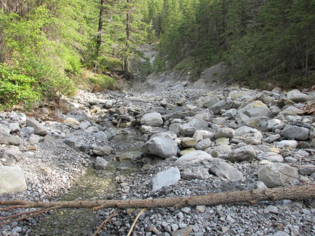
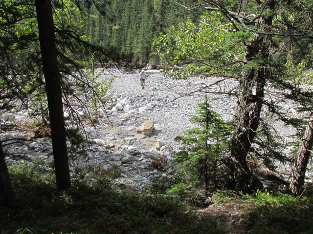
Heading west, follow what ever 4*4 track you wish, they all end up pretty much at the same spot anyway. Drop down into the creek bed and turn north. There is a broad gravel flat here showing recent damage from flooding (a common theme this year in Kananaskis). Evidence of heavy equipment working to clean up the mess is also seen.
This section of the creek, at most times of year is dry, the water following a path under the porous limestone bedding. In fact most of the route is devoid of water, except for the lower or first canyon, which we’ll soon arrive at.
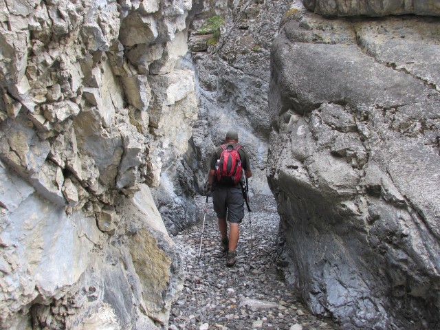
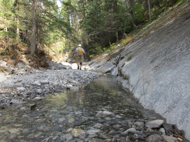
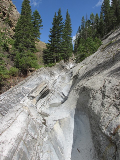
Entering it, expect to get wet feet. On our visit the water was quite shallow however, a trickle really, and there were lots of strategically placed stepping stones and logs to help us along. In the spring it could be too deep and fast flowing to enter and so there is a by-pass trail here when conditions are dangerous. Take the canyon if you can though, it’s a delight.
In places the walls are so close that one can easily touch both with outstretched arms. At each bend the water has scoured out huge polished bowls, which I have fun exploring. The high water mark is well above our heads showing what a monster this creek can be at times, in spite of appearing pretty placid o our visit.
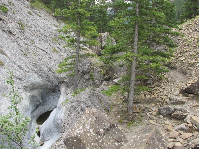
Where the canyon opens up briefly one encounters huge car-sized blocks that appear to have come down recently from the cliffs high above.
Occasionally, a few pools and chutes have to be tackled head on, but they aren’t terribly challenging. You can easily shimmy up them.
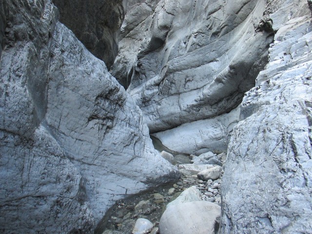
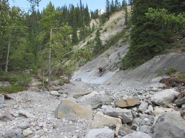
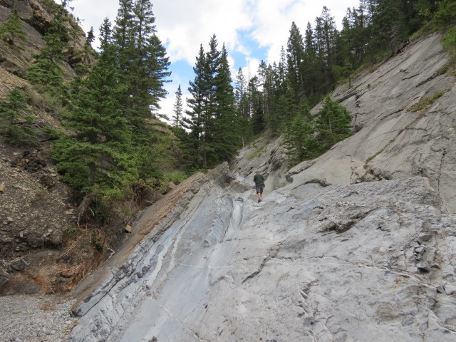
Before long, to soon in fact (it’s fun), the canyon ends becoming instead a narrow valley. Eventually it broadens too and at that point the creek bed becomes dry again. There are smooth gravel flats here, and boulder fields, lots of evidence of flooding and a few fallen trees. None the less, the going is easy. There are occasional by-pass trails in the woods if you’d like to avoid the loose footing of the creek bed.
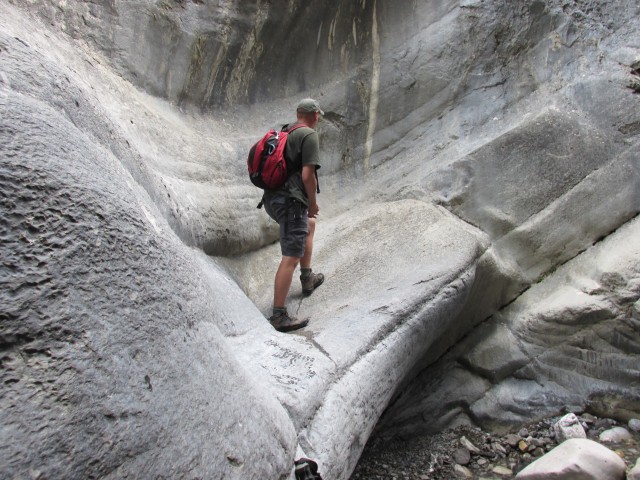
At times, smooth gently sloping slabs can be found in the valley and I have fun playing on them. These are part of the Palliser Formation, which we’ll talk about shortly.
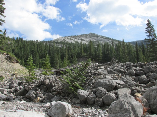
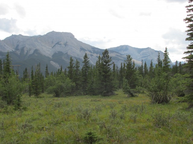
For the next kilometre or two, the going is pretty mundane although one can catch a glimpse of some of the mountains that rim the valley, Goat Mountain (I think) one of the most prominent seen from this angle. Mostly however, you’ll see trees and cliffs and rocks. Lots of rocks.
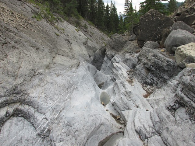
The valley starts narrowing again and rounding a corner, we come to a geographically significant place. Here, three separate formations meet, something ones does not find every day – at least so well exposed and defined. There is the earlier mentioned Palliser Formation, the grey material on your right. To the left is a thin section of the Exshaw Formation, the black almost coal looking shale material and above it is the more brown-ish Banff Formation. Lots of large blocks and slabs from the latter seem to have tumbled down here recently – watch for falling rocks!
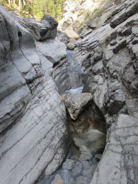
The creek here has cut an odd path, pouring down though another slot canyon above, though a series of plunge pools before cascading over the smooth slabs to the gravel beds below. Water only flows here at spring runoff or at times of severe rain. Some of the deeper pools hold stagnating water.
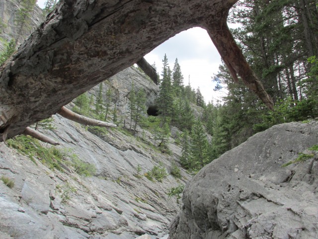
The Palliser slabs have eroded in such a way that one can walk up the steep walled valley here with ease, via a series of ledges. Half way up, and ever narrowing it, becomes a notch and then another slot canyon, a very narrow one. From here it’s impassible, further turning into a deep steep walled gorge. There is a by-pass trail though, heading to the left and from it one can look down into the narrow confines of this second canyon (aka the upper canyon).
At the top, the valley opens up dramatically. If you wish to go further, Jura Creek changes personality though and it’s nothing but an endless sea of huge boulders and unless you are a glutton for punishment and like scrambling over and squeezing between them, it’s not worth going on. Make this your turnaround point.
Returning back down, we have lunch (and of course wine) below the second canyon and I spend some time looking for fossils which apparently are quite common here – to photograph – and I find none. I do notice a few nodules, sandstone I think, in the Exshaw shale, which are interesting enough though.
The trip back is uneventful, but we do notice a cave high up the valley that we did not see on the way in. It looks huge. Interesting!
Back at the first lower canyon, we thoroughly enjoy our return trip through it as much as we did the trip in.
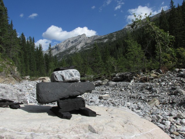
At the broad open flats further on we take time to enjoy the mountains around us. To the Northeast is Door Jamb Mountain and Loder Peak (connected by a ridge). The trail head for these is the same parking spot we used. To the west, the barren summit of Mt McGillivray looms above us. Beside it is Pigeon Mountain, a place we’ve been up. It looks too steep and precipitous to be climbed, but one can easily hike up the gentle back side.
We saw only a few people on the trail this day but overall I hear it’s quite popular. My understanding is the local MD may restrict access to the parking spot and fine those who use it, which they see as being dangerous. Rather than cut everyone off, I think an official parking spot, safely off the highway, would be a better alternative than closing it down completely (which I don’t see working anyway).
In addition to hikers, I understand geology students often visit Jura Creek on field trips.
Not far away in Canmore is another interesting river canyon, and to see a report on it, click the link below…
Cougar Creek.
If you liked this report, check these out as well…
Grotto Canyon.
Junction Hill recon.
If you wish more information on this trail, by all means contact us!
Date of adventure: August, 2013.
Location: Kananaskis near Exshaw, AB.
Distance: 8km round trip.
Height gain maximum: 240m
Height gain cumulative: 240m
Technical bits: The canyon can be tricky depending on water level.
NOTE: all heights and distances are approximate.
Reference: Kananaskis Trail Guides by the Dafferns.
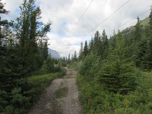
The start of the Jura Creek trail.
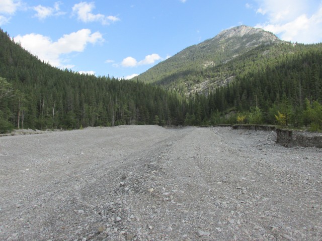
Dozer sculpted gravel flats.
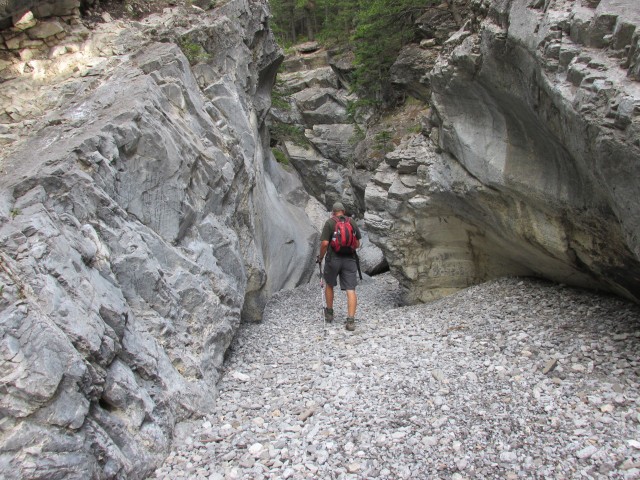
Entering the slot canyon.
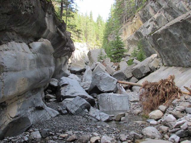
Signs of recently fallen rocks. BIG rocks.
Some shallow water in the canyon but in other places the creek is dry.
I look at the water-smoothed walls.
We make our way up the sometimes very narrow canyon. I can touch both walls here.
We have to shimmy our way up this chute.
The canyon opens up.
For most of the route, we walk on gravel flats and hop over boulders.
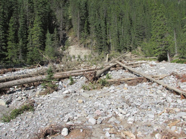
Trees brought down by recent flooding.
The valley widens. I believe it’s Goat Mountain in back.
Some times we leave the creek bed and follow easier trails in the woods.
I have fun on some slabs.
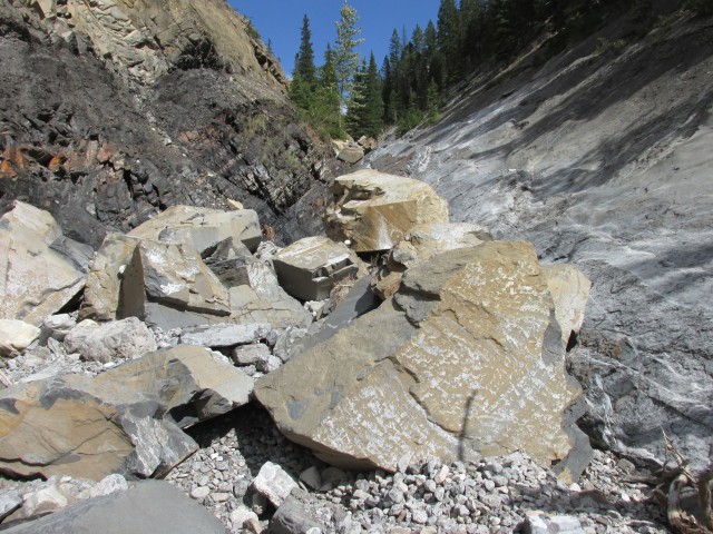
These rocks appear to have come down recently.
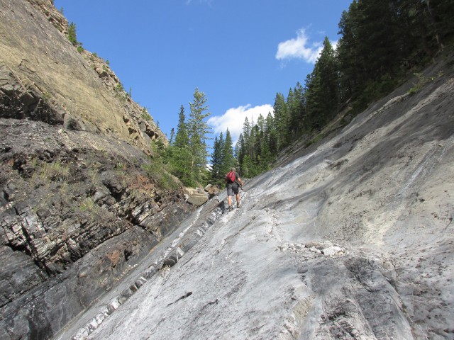
I make my way up. At this point, three separate geological formations meet.
Water scoured pools below the second upper canyon.
I check out more pools higher up.
Above the second canyon, the whole valley is a huge boulder field.
Looking down from the top of the second canyon.
This deep gorge on the left is impassible and is avoided by following a trail above it.
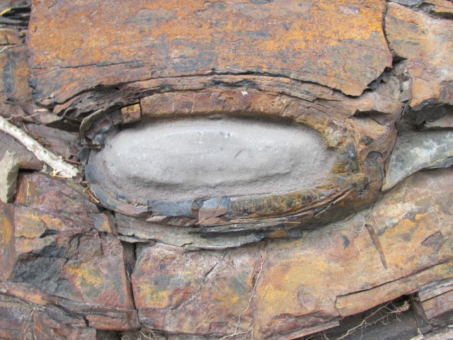
A nodule in the “Exshaw” formation.
A cave only visible on the way out.
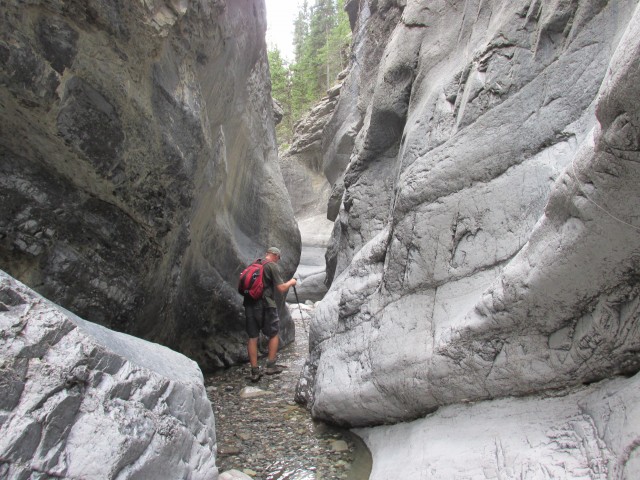
Back in the lower canyon, we get our feet wet.
Left of centre, Mt. McGillivray and on right, Pigeon Mountain.


")


I am working in between graymont and exshaw right now and a busload of geologists on a field trip asked me the other day if they could walk to the edge of the mine property to look at a formation.They informed me the top few feet of white sediment is actually from the crater lake volcanic eruption over 7700 years ago.
Those crazy geologists! Wild party animals all.
Connie & Chris – I enjoyed your write up – good to see it hasn’t been damaged much since the flood. I have used a photo of the cave entrance (under your fair-use guidelines) in my own blog write up on backcountryblog.ca, and provided a link to site at the bottom of the post. It has a lot of info on the Jura Cave in particular (my area of expertise!)
Regards
Awesome, happy to share content. I never knew this little cavity had a name. I’ve only explored one cave, however Connie and I do a lot of mine exploration (we’re experienced at it – so readers, no emails on how dangerous it is). It’s otherwise a similar pastime to yours. Very cool!
Hi Chris & Connie,
I wanted to thank you again for sharing content – I have re-posted a few of your articles with backlinks at the top and bottom of all posts. I wanted to drop you a line and make sure that was still OK with you.
I also wanted to let you know about a research request for information from a PhD student at the UofA that you might be interested in. I have agreed to support his request for info from the general public regarding archeological finds and sites. He is basically looking for locally submitted photos of finds as part of Alberta’s Archaeological Survey.
Regards,
Eli
Backcountryblog.ca
Thanks, that’s very interesting.
We went to Jura Creek yesterday and had a wonderful time! We found the parking space and happy to find no parking ticket when we got back. Thank you very much for the write up and informing me about the parking area. We live in Houston and going back home today so the hike yesterday was the perfect closing to our visit in Alberta.
Awesome, glad you had fun!
Wonderful article and pictures! My husband and I are planning to hike Jura Creek, but we’ve been hearing discouraging stories of people getting tickets. We actually already went pass by the plant and tried to figure out a place to park, but couldn’t find one that looked safe enough. Did you park right across the plant, on the side of the road?
I’ve heard talk of them restricting parking at the trail head and fining people, but I don’t believe it’s been implemented yet. There is ample safe parking, just east of the creek on the north side of the road opposite the plant, and under the power lines where they head off into the trees. You’ll probably see other cars parked there and it’s also used by people climbing nearby mountains too. There were no “no parking” signs there when we passed by it last week and many cars were parked there. I have a feeling they’ll set up official parking at some point rather than restricting access altogether. There will be a lot of unhappy people otherwise.
Thank you a lot for sharing this and what an amazing place! Husband and I went late Aug 2013. Excellent day, clear sky, the canyon is something to see. What a great hike. Well worth the effort.
You said it, what a neat place.
Very easily followed trail.
Lots of snow when we visited in June, just before the floods. Recommend hiking late July or any time after. An easy trek with only a couple hard parts. We thoroughly enjoyed it.
Just before the floods, thank goodness.
This was our first trek in Kananaskis after moving here from Ontario, and it was thoroughly enjoyable. Thanks for the write up, it inspired us to do this hike.
Awesome, glad you had fun!
Not only great pictures, what a great write up! You have a wonderful easy-to-read style. It’s like I was with you the whole time!
Thank you, that’s a great compliment.
Sun, blue sky, green trees, grey peaks – what a perfect day! I have read of the devastation from torrential rains and flooding but it looks like this creek was spared a lot of damage.
Compared to others, this watercourse was not that badly damaged. It was still a mess in places though.
Great pictures!