Normally you’d only find us here either early in the spring or late in the fall, when more westerly trails, which are more interesting, are under snow or inaccessible due to seasonal road closures. With Connie feeling a little off due to her acupuncture treatment from the day before, she asked that we do something fairly easy with little elevation gain. With that in mind, the Sandy McNabb trail network west of Turner Valley seemed like a good possibly.
Used in winter by XC skiers, and mostly horseback riders the rest of the year, the trails can also be hiked. Looking at the detailed map available online, I devise a meandering route to get us to the top of Pine Ridge at the most northerly edge of the network. While not exciting or terribly challenging, it’ll still be a fun outing to a nice scenic destination.
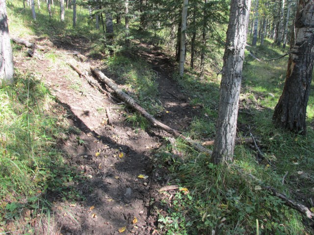
Before we start, keep in mind there are a huge number of trails here. Each junction has a map, but given all the possibilities I think it would still be possible to get lost. In the summer it’s best to hike the higher trails only and not just because they are more scenic (but that’s a good reason). The lower trails can be wet or muddy even in dry weather and they get chewed up, not only by the horses, but also by cows that summer-range here. With that in mind, I pick a route that avoids most of the messy parts, but also affords the best views. There will be some elevation gain, but nothing much really.
↓ ↓ ↓ ↓ Scroll down for photos and to comment ↓ ↓ ↓ ↓
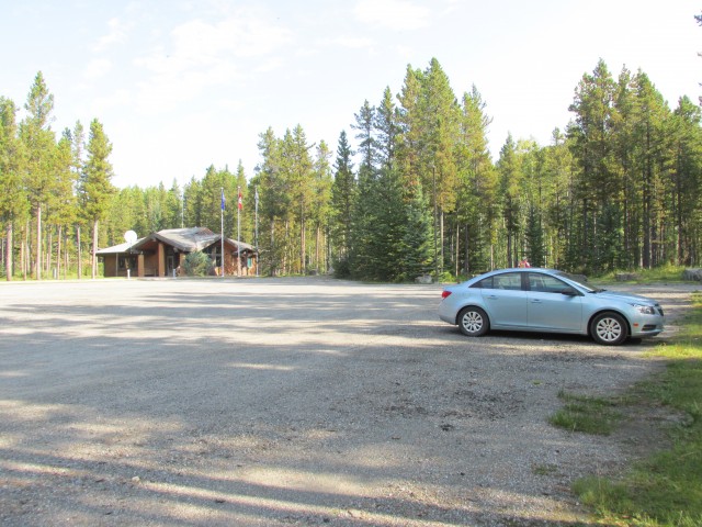
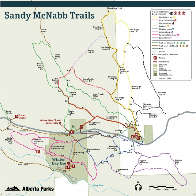
Our route starts at the Sheep River Information Centre and takes in the west leg of Pine Ridge Loop, then the Long Prairie Ridge trail, a part of the Death Valley trail, then the a small section of the Long Prairie Loop trail, then Balsam Link. From there we rejoin the Pine Ridge Loop, to the view point where we take the Pine Ridge Trail out and back, before returning by the east leg of the Pine Ridge Loop trail back to our starting point. The Sandy McNabb trail network is complex but if you take care, it not too daunting.
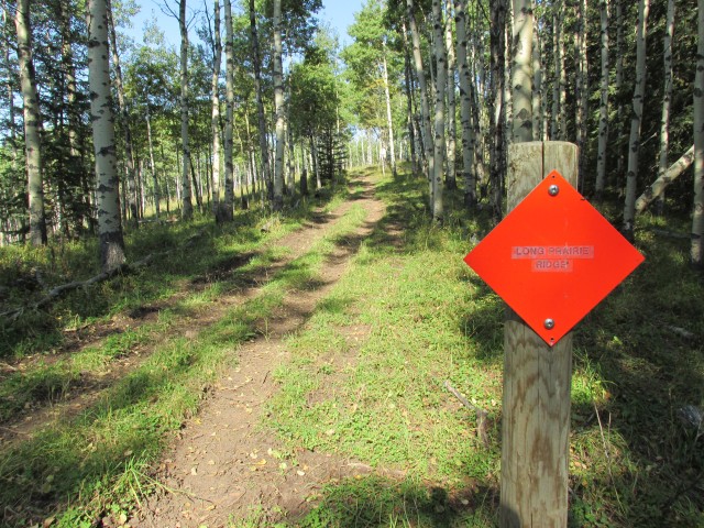
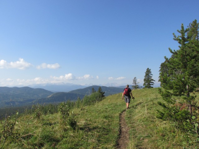
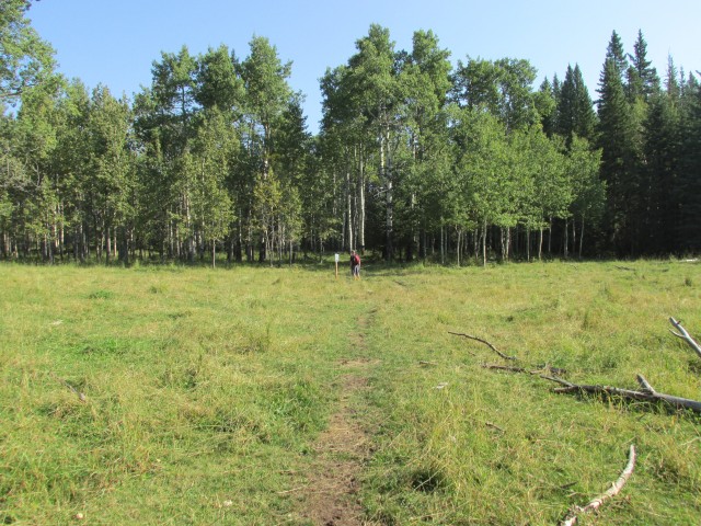
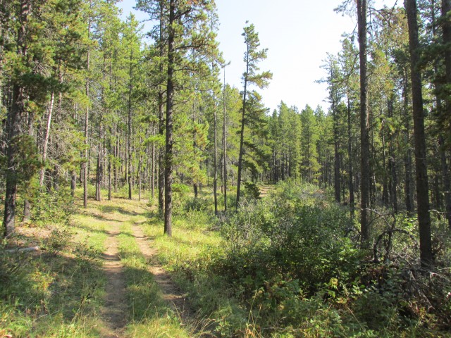
Starting out at the east edge of the parking lot, the trail heads out for a few dozen metres. At the first of many junctions we turn north (left) on the west leg of he Prairie Ridge Loop. Just passed a cattle gate (one of many), we turn left, then almost immediately right. Head up the marked Long Prairie Ridge trail, quickly passing one more junction (stay straight). The trail gains some elevation and before long breaks out of the trees.
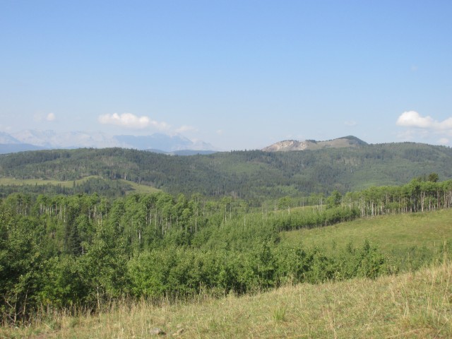
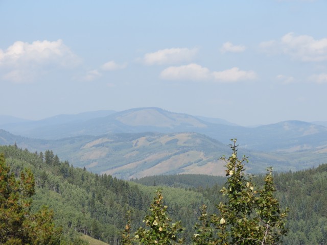
From here, we have a good view to the west. The big mountains still seem far away and on this visit were somewhat obscured by haze (smoke from forest fires maybe?). Rolling hills in front include Foran Grade Ridge and Windy Point Ridge. Views in other directions are obscured by trees.
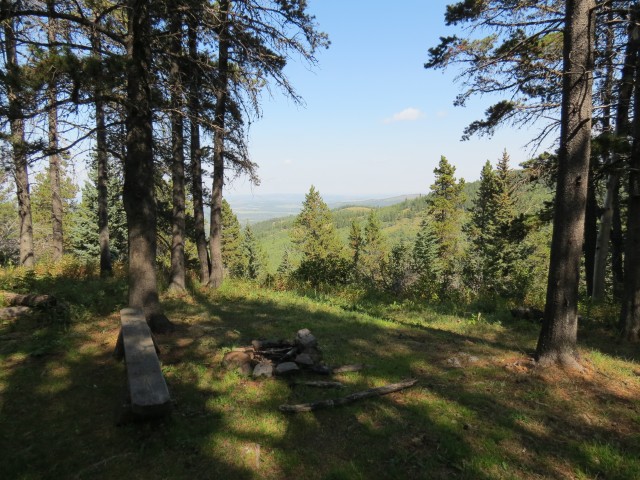
Following the gently undulating ridge, we soon come to a junction. At this point we turn right on the Death Valley Trail, which comes in from the valley below. Most of the elevation you’ll do this day has already be done now – none the less, expect to gain a little more later on. From here we head back into the trees for the most part and stay in them except for a few viewpoints later on.
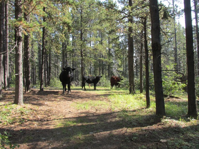
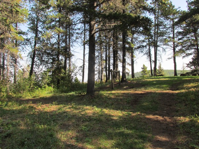
At a four way junction turn right (east) and head down gently. Passing more junctions, we take a trail called Balsam Link, which connects to an upper section of the western leg of the Prairie Ridge Loop we were on earlier. Gaining some minor elevation here, we come to a junction guarded by some cows. Expect to find bovines anywhere on the trail and we’d see many more after these ones.
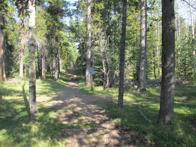
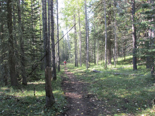
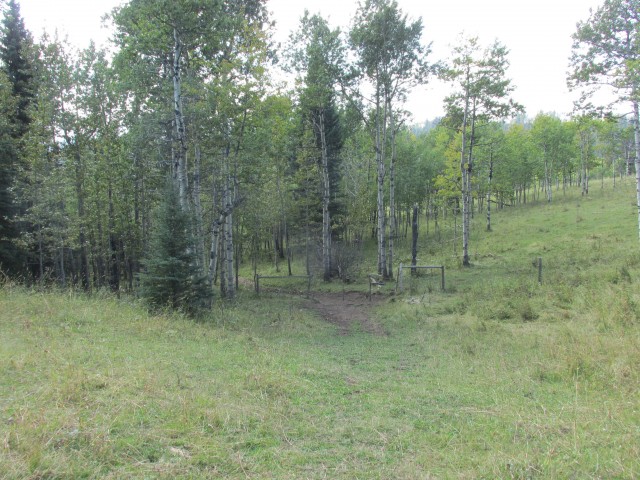
Lower sections of the trails are typically in Aspen trees or meadows, while higher up, Pines dominate.
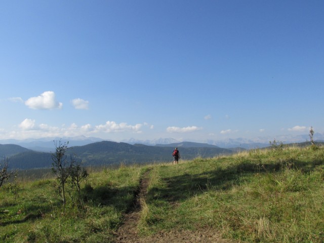
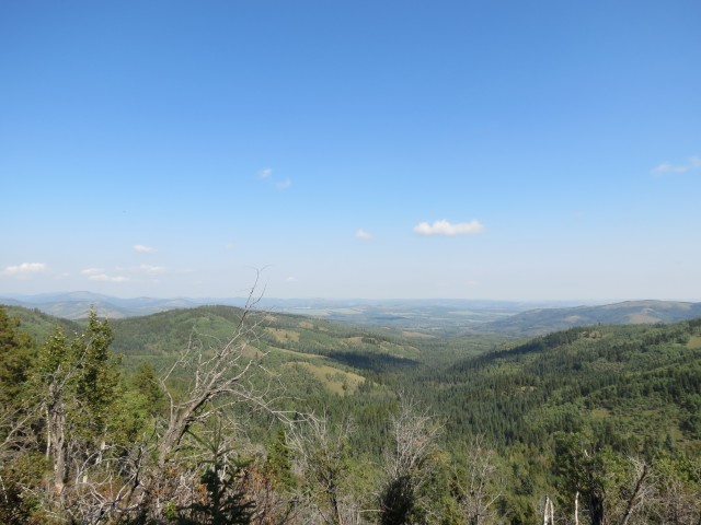
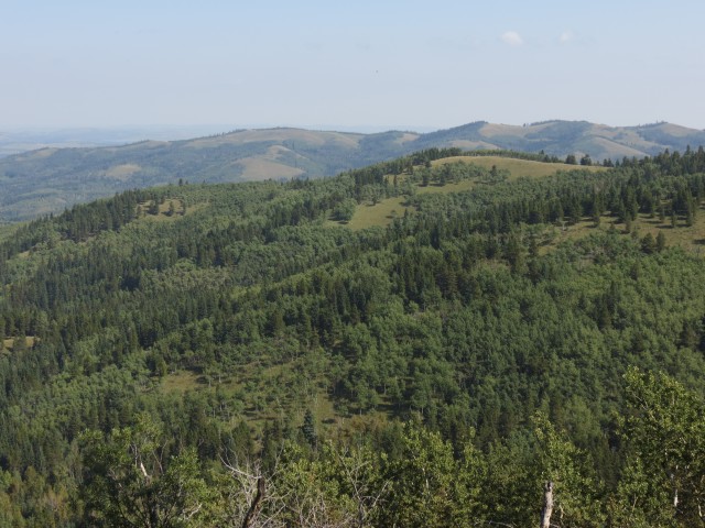
Reaching the Pine Ridge Loop highpoint, a new trail heads off to the left (north). It was constructed only a few years ago and it follows the ridge crest for some distance. We’ll only go as far as an excellent view point perhaps a kilometre in – it faces roughly northeast and is much better than the tree-crowded viewpoint at the Prairie Ridge Loop highpoint. From here progressively smaller rolling hills extend to the prairies. On a clear day, and this was NOT one of them, you can see all the way to Calgary.
Also seen from this fine view point are some places we’ve been to, including Mesa Butte to the north (link below) and Carry Ridge directly to the east – at the very edge of Kananaskis.
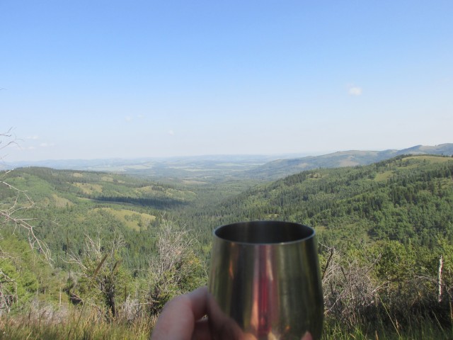
Enjoying some fine wine, which we bring on EVERY hike, we take time to soak it all up. Connie, in spite of feeling sluggish and off from her acupuncture session, seems to be doing well and has rebounded some. None the less, she’s had her limit. No problem, we can turn around and anyway we’ve gained all the elevation we would this day and the trip back is easy and all downhill.
On the way back we’ll follow the eastern leg of the Prairie Ridge Loop trail all the way back to the parking lot. Higher up, the trail is in the trees and is dry and the going easy. Further down, it’s wet in places and muddy and chewed up. But it’s not that bad and we make good time.
Dropping down steadily, we pass a good number of unhappy cows (unhappy with us I guess), we pass through some cattle fences, and before long we’re back where we started.
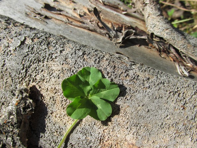
Along this trip, we saw a number of horseback riders, but no hikers. Horse and Cow poop is a problem on this trip too – keep an eye open for road apples and cow chips! As usual, Connie found a multi-leaf Clover this trip, this one with five! That’s the second five leaf clover she’s found this year!
While was one of the more mundane trails we’ve done, it’s by no means bad. As mentioned before though, it’s best to hike them in the shoulder season. Or when you’re feeling less than ambitious. Or when you are feeling a little under thee weather, as Connie was. We still did 12+kms and 300m of elevation, give or take a bit – not bad considering.
We only sampled a small number of the Sandy McNabb trails. There are many, many more, allowing one to do loops of varying lengths.
If you wish more information on this trail, by all means contact us!
Date of adventure: September, 2013. Location: Kananskis near Turner Valley, AB. Distance: 12km out and back. Height gain maximum: 300m Height gain cumulative: 350m NOTE: all heights and distances are approximate.
This adventure begins at the Sheep River information centre.
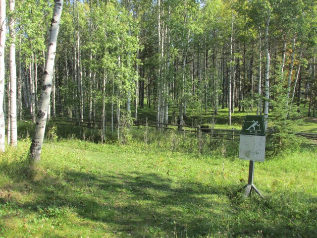
The Sandy McNabb trails are used for XC skiing in the winter.
Connie finds a five leaf clover, her second of the year.
We head up Long Prairie Ridge.
Nice views to the west.
The mountains were a little hard to see due to hazy conditions.
The long treed hill is Foran Grade Ridge and sticking out above it is Windy Point Ridge.
All junctions have maps, but there are so many trails one could still become lost.
Checking the map at another junction.
Being horse trails (in summer), some sections get chewed up.
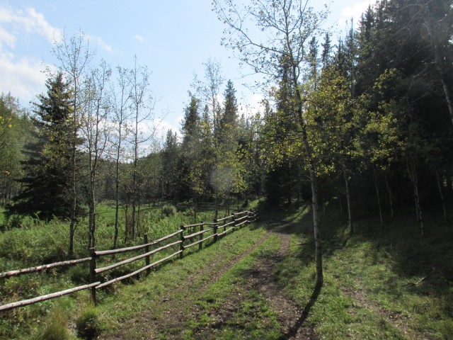
Connie follows me up the Balsalm Link section of the trail.
We have some company. Moo!
On the suitably named Pine Ridge Loop trail.
At the lookout, we take a new trail heading left (north).
Mesa Butte, a place we’ve visited, in back.
Rolling hills in the northeast.
Carry Ridge in back is another place we’ve visited.
Enjoying some wine, as we always do.
Another fine viewpoint.
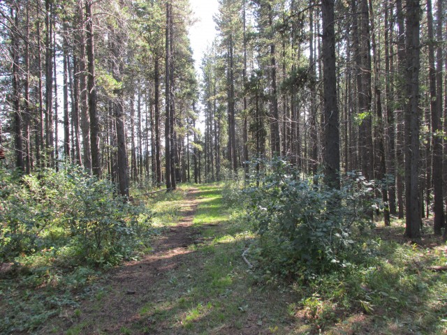
Most of the trail is in the trees.
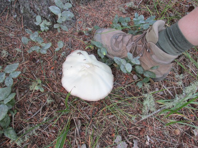
We found some big mushrooms along the trail.
Along the way, we pass through a few cattle gates.
Almost back at the car, another fun hike coming to an end.
Our route, starting at the parking spot on the far right, follows the Long Prairie Ridge trail, heads up Balsam Link, then the west leg of Pine Ridge Loop, then Pink Ridge Trail itself (out and back), before returning on via east leg of Pine Ridge Loop. Whew!
We used to do something called the "pointless challenge" 🤪 and miss those days. It was so much silly fun and often frustrating as heck. In these we'd invite people to send in random photos of obscure locations, but not give any information, and then we'd track where it was and shoot something similar.
Most of these came from old family collections, as was the case here. Anyone up to resurrecting the series?
In hindsight, why didn't we pose someone in our shot?
Pointless: “Devoid of meaning (or) senseless” Merriam-Webster.
If you like what we do and want to support this ongoing project (12 years now), go here: https://www.BIGDoer.com/help-the-society/ Thanks to Connie for making this post possible.
Exploring history with Off the Beaten Path with Chris & Connie. Photo: ca1970 and 2014. Posted by Connie.
Captured on a cold, cold day many years ago. We've been passing this old house for decades and it's little changed in that time. At some point we expect to drive by and it'll be gone.
Exploring history with Off the Beaten Path with Chris & Connie. Photo: 2017. Posted by Connie.
When retired old railway cars usually get cut up for scrap. Sometimes, however, they find their way into the hands of the general public or whomever. Flat cars make good bridges, and boxcars can be transformed into storage buildings and the like. Case in point here. We see them used like this often enough and in this case, it's part of a corral.
Incidentally, this boxcar dates from 1950 and this was found by tracing the old road number, which is still visible.
Exploring history with Off the Beaten Path with Chris & Connie. Photo: 2017. Posted by Connie.
This central Alberta racetrack was never a commercial operation but instead just a fun place for car enthusiasts in the area to get together. Early '70s or thereabouts and it only lasted a few years. Even thought it's been abandoned for that long, there is no doubt what was here.
You know we like the the obscure stuff and this one fits the bill perfectly. Found by accident while backroad cruising and the history comes thanks to local car guy Mike.
Exploring history with Off the Beaten Path with Chris & Connie. Photo: 2022. Posted by Connie.
On top of little Myrtle Mountain in the Kimberley (BC) Nature Park.
There's some good wilderness fun to be had here and nice views as you can see, but the real reason we came is mining history. The whole area near the ski hill was extensively worked over a century ago and we were looking for evidence of this. We didn't find much in the area searched, but it's a big chunk of property and we hope to return to cover more ground again soon. Of all the subjects we cover, mining related is a favourite.
Still, it was a good hike and that can't be bad. Look to the comments for more info 👇.
Exploring nature and history with Off the Beaten Path with Chris & Connie. Photo: 2022. Posted by Connie.
It's a strange curiosity in south Kananaskis, there on a hillside and we have no idea who created it. We asked around and no one's completely sure about its history. In the past it showed the Canada 100 logo from 1967 but in 2017 someone changed it to reflect the country's 150th.
That's our friend Emily from DanOCan.com having a look.
Exploring history with Off the Beaten Path with Chris & Connie. Photo: 2017. Posted by Connie.


")


Great hike for the shoulder season. Accessible all year round.
Pine Ridge makes for a worthwhile destination. The views aren’t bad at all.
Not bad at all!
We passed you on horses and you gave us one of your cards. We got lost on these trails, even with the maps!
Nice to meet you! And yes, it’s a maze of trails.