What an awful sky. It’s just so grey and hazy and the colours are so flat. It’s not a great day for photography. It is however, a great day to explore – every day is – and on this urban adventure, we take in the west trail in Edworthy Park. Along the way, we pass green spaces, tree farms, natural wooded areas and an historical site. We’re in the big city, but along many sections of this trail it feels like we’re alone, deep in the woods.
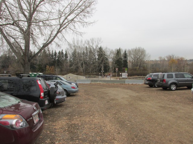
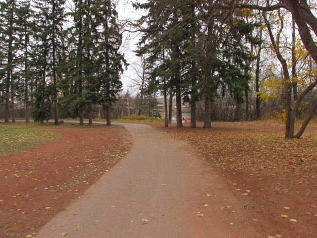
We start at the south parking lot, a busy place. Immediately, we head across the tracks and follow the paved pathway as it heads north, before turning west just before the Bow River. Along here we’ll pass picnic tables and playgrounds. At a foot bridge, which allows access to the park from across the river (a second starting point), stay straight leaving the pavement behind.
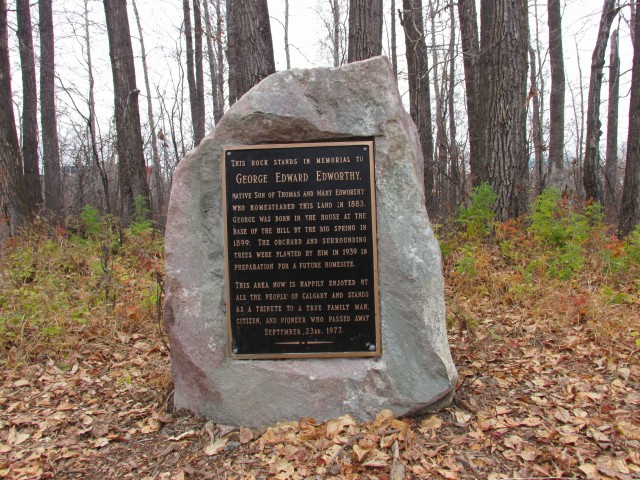
Paralleling the river and passing a small apple orchard, we walk next to a row of trees planted long, long ago. These date from the time when the park was a homestead. Continuing on, we pass a large grove of trees planted in orderly rows – a tree farm in the park. There is a memorial plaque here that makes mention of George Edworthy, the person who at one time lived here and whose family the park is named after. His parents, Thomas and Mary Edworthy homesteaded the area in the 1880s and the land remained in the family until the early 1960s when it became the wonderful park we see today. The park is huge and very wild in places and is a great resource.
↓ ↓ ↓ ↓ Scroll down for photos and to comment ↓ ↓ ↓ ↓
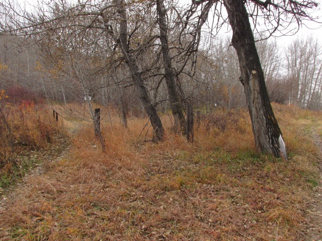
At two large spruce trees, we head south across the train tracks (any time is train time). But first, we examine some remains at their base – some concrete foundations and a cellar pit. These were in some way connected to the Brickburn Brick factory which was located right across the tracks. The exact purpose of this building however is unknown.
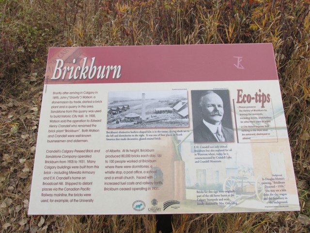
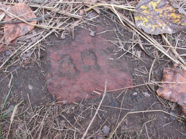
Across the tracks now, we are at the site of the Calgary Pressed Brick and Sandstone Company, which operated (sometimes intermittently) from 1905-1931. Outside of a some broken bricks – some marked with the word “Calgary” or “Cal” or “ary depending on how broken then are – there is little left to explore at the site. None the less, one can still imagine the hustle and bustle of the old days when the factory was running full out, making up to eighty thousand bricks per day and employing a up to a hundred workers. It was a busy place – now it’s forgotten and empty.
Not easy to see due to trees, there is a large scar on the hillside above the plant where the company extracted the clay for the bricks. An interpretive sign at the site gives the visitor a little history about the plant.
Sold far and wide these bricks were of course used to construct many buildings in Calgary too, with a couple noteworthy ones being the Lancaster Building and Mewata Amoury. Both still stand.
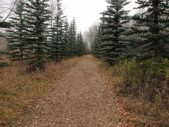
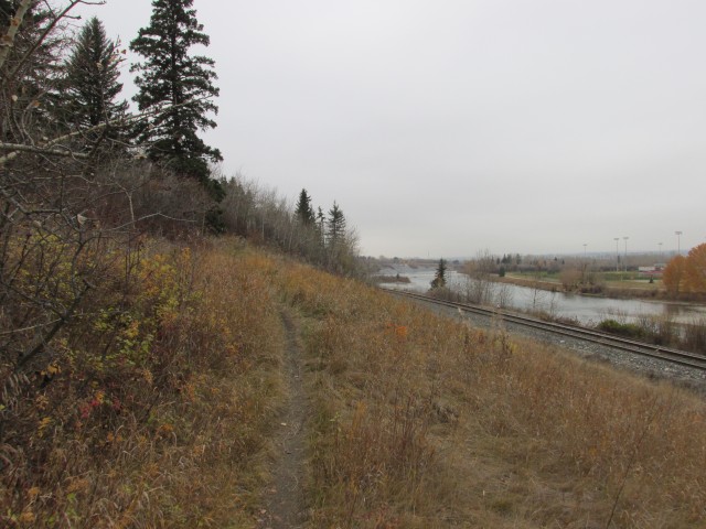
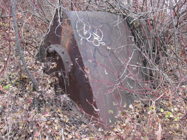
Moving on, we follow the CPR tracks for a short time, leaving the park proper behind. Coming to a junction, take the left branch that heads up gently into the trees, passing an old riveted tank of some sorts along the way.
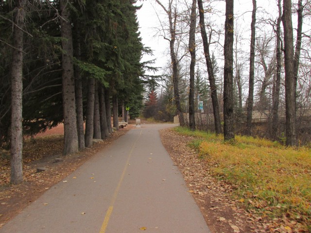
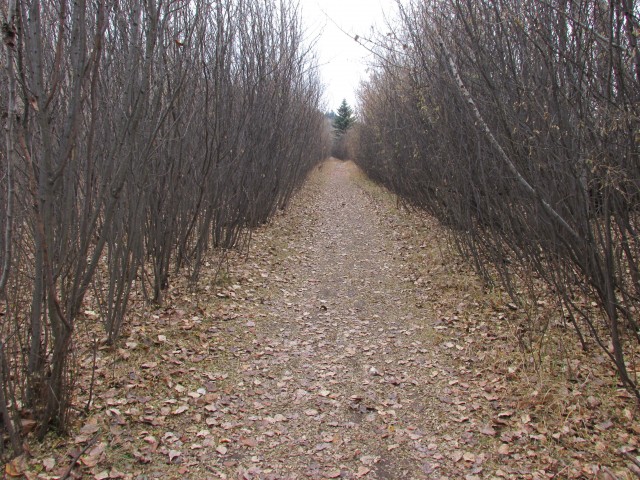
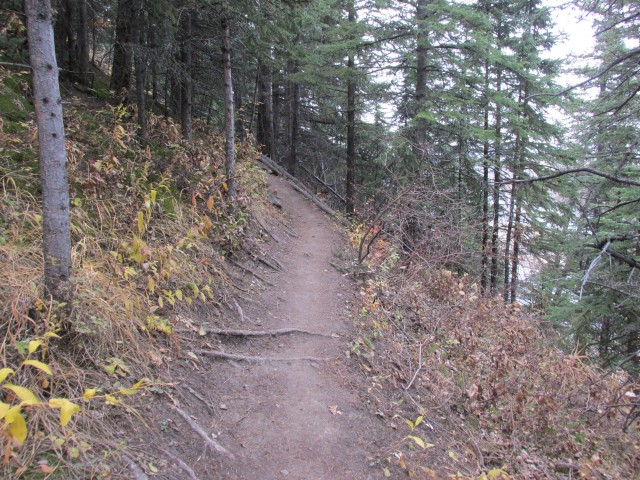
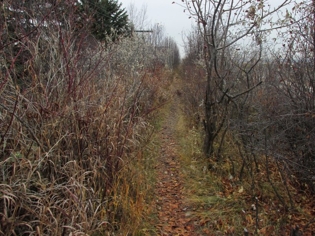
For the next while the trail is in the trees and if it were not for the noise from the busy Stoney Trail on the hill above, it would be easy to imagine we’re anywhere but a big city. Occasional breaks in the trees also remind one that they are still in an urban setting and houses and roads and businesses can be seen across the river. We’re in a green oasis, inside the city.
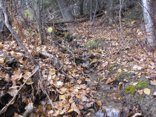
You’ll cross a couple streams as you head west. Spring fed they run pretty much year round. In the Edworthy area there are many of these – odd for such an urban area.
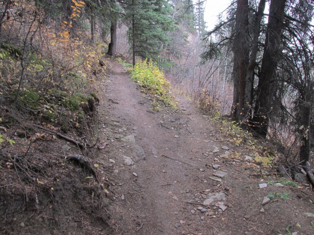
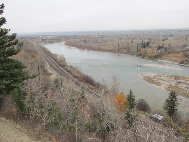
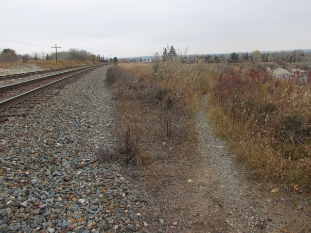
Along here the now narrow trail drops down then heads up several times in succession, in roller coaster fashion. There are some steep parts. It appears we’re following the old railway telegraph line and cut off poles can be found here and there. The tracks are just north and below of us though the trees. I think at this point we are technically on CP property whose tracks we parallel.
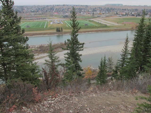
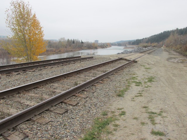
At a view point we have a good view of Shouldice Park across the river, with it’s baseball, soccer and football fields. Not much further along is a second view point, this one looking west. From here we can see something interesting, a section of CPR track that was clearly damaged by the spring 2013 floods. We’ll get a close look of that shortly.
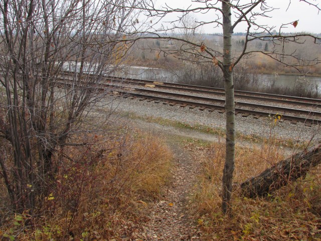
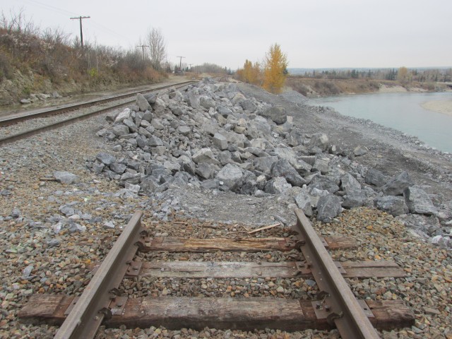
The further we go, the less distinct the trail is. In this section, the old telegraph poles were left in place. A fence on our left parallels our route. Before long, we drop down to the tracks once, then a second time a bit further on, where we get to see the railway damage noted earlier. The main track was clearly washed out or undermined and is severed at this point, with the passing siding being used in it place as a bypass route. A large amount of rip-rap has been brought in to replace the bank and stabilize the roadbed, which was badly chewed up by the rushing waters. Quite a mess that will take some time to clean up (the flood was in June).
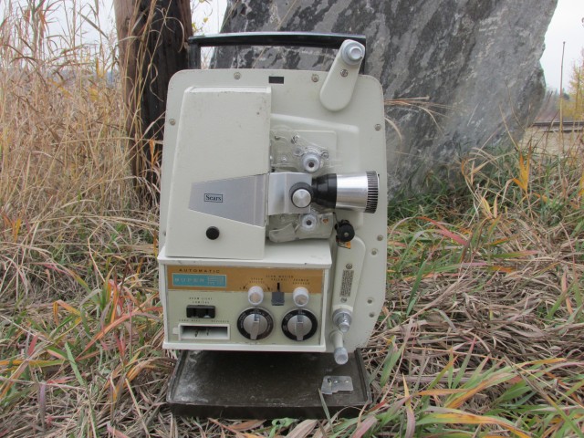
Nearby I find an old 8mm projector. I wonder how this junks ends up in such an odd place. There are no roads in.
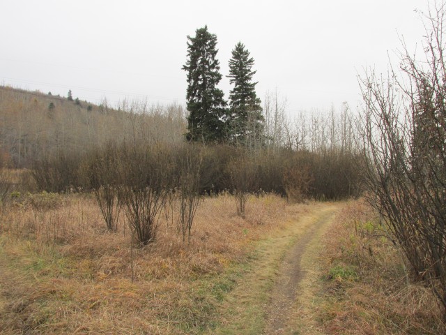
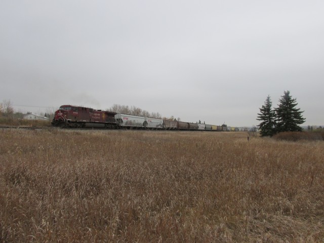
Next we head into a field which I believe was once the site of a home or small farm. The way the trees are laid out hints at human activity. It’s here we get to see the first train of the day. Across the tracks was at one time a second brick factory (1912-14), but no evidence could be found of it.
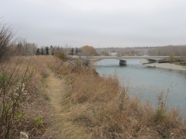
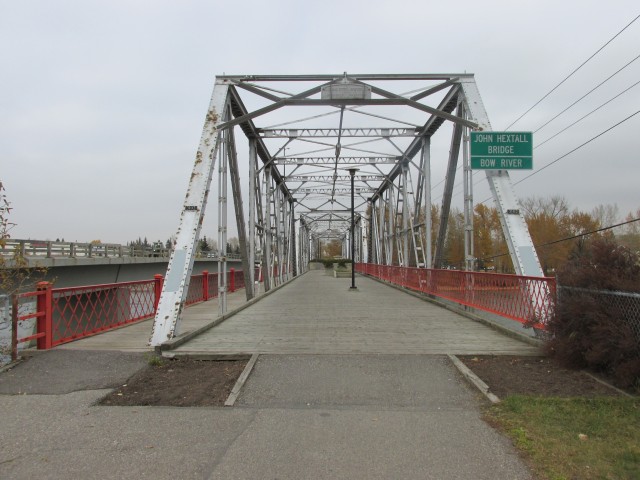
Coming to the Trans Canada Highway bridge, we pass under it, then cross the walkway on the north side, before intercepting a paved bike path which takes us to our objective a short distance away. Our goal is the Hextall Bridge (formerly Shouldice Bridge), once the main route intro Bowness, but now used only by pedestrians and bikes. Built in 1910, it once carried a trolley line in addition to the road. Woefully narrow, it was replaced in the 1980s and the new bridge sits right beside it.
This became our turn around point, but if you wish you could continue on, following the pathway system that takes you into Bowness or east along the Bow River. There are a lot of options.
Speaking of railway flood damage, to see the CPR Bonnybrook Bridge, which was also overwhelmed by flooding and partially collapsed, check out this link… Collapsed Bonnybrook train bridge.
CP Rail now has no trespassing signs at the railway cross point to the remains of the Brickburn site which all that remains are some broken bricks in the path on the South side of the rail line. On the North is the remains of a small cement building. The descriptive Brickburn sign is long gone. I’ve heard of people being fined for trespassing in the area. Not really worth the effort to visit but the walk there from Edworthy Park is pleasant and takes about 10 minutes.
Brickburn at night. Not a soul around. The dogs led me to a cul-de-sac hidden behind a hill, through a pathway mostly overgrown with bushes and trees. Not an easy place to find, maybe 600 ftsq. I sat on a stone there for several minutes just enjoying the quiet as the dogs sniffed around the area. Then continued west past what appears to be an old metal water wheel embedded in the bottom of the stream. Shhh… this might be my new favorite winter night dog walk!
An amazing time! Sitting in quiet, in the woods, does amazing things for the body and soul. Now what’s this? A waterwheel? Are we on the same trail? I don’t recall anything like this. Might have to revisit the trail.
I am not sure how far the river cut into the bank, it’s not clear given all the work that’s been done since, but that’s a good point. Of course, unlike the Bonnybrook Bridge whose damage was below water, track shifting or the bank collapsing here would have been plainly visible (I assume) and spotted by someone before a train passed over. Surely they must have had track and roadbed inspectors out in places were the river encroached on the line.
We used to do something called the "pointless challenge" 🤪 and miss those days. It was so much silly fun and often frustrating as heck. In these we'd invite people to send in random photos of obscure locations, but not give any information, and then we'd track where it was and shoot something similar.
Most of these came from old family collections, as was the case here. Anyone up to resurrecting the series?
In hindsight, why didn't we pose someone in our shot?
Pointless: “Devoid of meaning (or) senseless” Merriam-Webster.
If you like what we do and want to support this ongoing project (12 years now), go here: https://www.BIGDoer.com/help-the-society/ Thanks to Connie for making this post possible.
Exploring history with Off the Beaten Path with Chris & Connie. Photo: ca1970 and 2014. Posted by Connie.
Captured on a cold, cold day many years ago. We've been passing this old house for decades and it's little changed in that time. At some point we expect to drive by and it'll be gone.
Exploring history with Off the Beaten Path with Chris & Connie. Photo: 2017. Posted by Connie.
When retired old railway cars usually get cut up for scrap. Sometimes, however, they find their way into the hands of the general public or whomever. Flat cars make good bridges, and boxcars can be transformed into storage buildings and the like. Case in point here. We see them used like this often enough and in this case, it's part of a corral.
Incidentally, this boxcar dates from 1950 and this was found by tracing the old road number, which is still visible.
Exploring history with Off the Beaten Path with Chris & Connie. Photo: 2017. Posted by Connie.
This central Alberta racetrack was never a commercial operation but instead just a fun place for car enthusiasts in the area to get together. Early '70s or thereabouts and it only lasted a few years. Even thought it's been abandoned for that long, there is no doubt what was here.
You know we like the the obscure stuff and this one fits the bill perfectly. Found by accident while backroad cruising and the history comes thanks to local car guy Mike.
Exploring history with Off the Beaten Path with Chris & Connie. Photo: 2022. Posted by Connie.
On top of little Myrtle Mountain in the Kimberley (BC) Nature Park.
There's some good wilderness fun to be had here and nice views as you can see, but the real reason we came is mining history. The whole area near the ski hill was extensively worked over a century ago and we were looking for evidence of this. We didn't find much in the area searched, but it's a big chunk of property and we hope to return to cover more ground again soon. Of all the subjects we cover, mining related is a favourite.
Still, it was a good hike and that can't be bad. Look to the comments for more info 👇.
Exploring nature and history with Off the Beaten Path with Chris & Connie. Photo: 2022. Posted by Connie.
It's a strange curiosity in south Kananaskis, there on a hillside and we have no idea who created it. We asked around and no one's completely sure about its history. In the past it showed the Canada 100 logo from 1967 but in 2017 someone changed it to reflect the country's 150th.
That's our friend Emily from DanOCan.com having a look.
Exploring history with Off the Beaten Path with Chris & Connie. Photo: 2017. Posted by Connie.

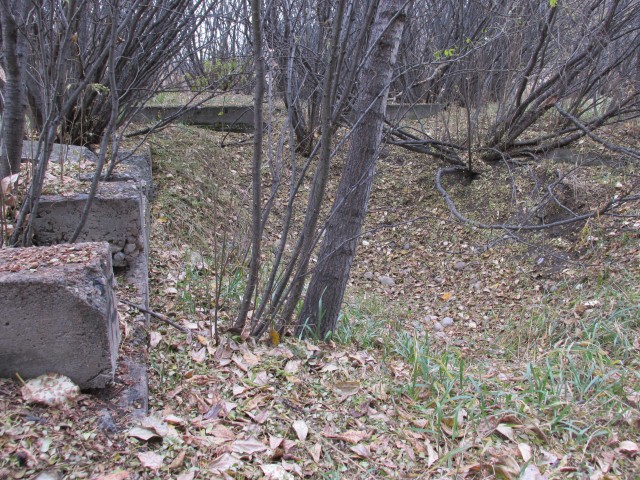


CP Rail now has no trespassing signs at the railway cross point to the remains of the Brickburn site which all that remains are some broken bricks in the path on the South side of the rail line. On the North is the remains of a small cement building. The descriptive Brickburn sign is long gone. I’ve heard of people being fined for trespassing in the area. Not really worth the effort to visit but the walk there from Edworthy Park is pleasant and takes about 10 minutes.
We’re not surprised I guess.
A lot of older posts on this site are outdated and probably should go bye-bye, but that would mean work and we’re lazy!
Brickburn at night. Not a soul around. The dogs led me to a cul-de-sac hidden behind a hill, through a pathway mostly overgrown with bushes and trees. Not an easy place to find, maybe 600 ftsq. I sat on a stone there for several minutes just enjoying the quiet as the dogs sniffed around the area. Then continued west past what appears to be an old metal water wheel embedded in the bottom of the stream. Shhh… this might be my new favorite winter night dog walk!
An amazing time! Sitting in quiet, in the woods, does amazing things for the body and soul. Now what’s this? A waterwheel? Are we on the same trail? I don’t recall anything like this. Might have to revisit the trail.
They had quite a few out – a little ways east of where you started, the water came up over the bank and was lapping at the tracks.
Wow! Thanks for posting.
The power of the river is amazing. If the bank was undercut it was good a train didn’t pass over and fall into the river!
I am not sure how far the river cut into the bank, it’s not clear given all the work that’s been done since, but that’s a good point. Of course, unlike the Bonnybrook Bridge whose damage was below water, track shifting or the bank collapsing here would have been plainly visible (I assume) and spotted by someone before a train passed over. Surely they must have had track and roadbed inspectors out in places were the river encroached on the line.