
Bull Creek Hills
Our first summit of 2014! Yeah! This day’s objective is the Bull Creek Hills, located in the foothills in the southern half of Kananaskis Country. It’s an interesting and not terribly hard climb and along the way you’ll pass through dense woods and hike up grassy open slopes. Once at the top, you can stay put or can continue on to explore a series of connecting summits or high points. It’s up to you.
It’s sometimes very windy in the area. Fortunately, on our trip things were for the most part calm. Let’s hope that’s the case if you should visit. The first part of the route is along the Grass Pass trail. The remainder is a mix of faint trails, game trails with some route-finding thrown in for good measure. There is little chance of getting lost, however.
To start, park on the side of the highway, just under 4km west of the Kananaskis Park boundary sign. In the past, you’d start at the Sentinel day use area nearby, but it was washed away (no, obliterated) in the spring 2013 floods. I am not sure if it’ll be rebuilt.
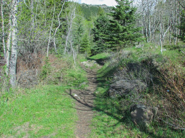
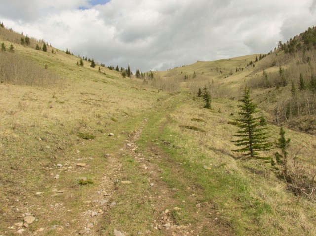
Follow the obvious path heading north into the trees. Almost immediately, you’ll start gaining elevation, and with the exception of a few short flat spots here and there, that is how things will be for the rest of the trip. To the pass, you’ll be travelling along an old exploration road.
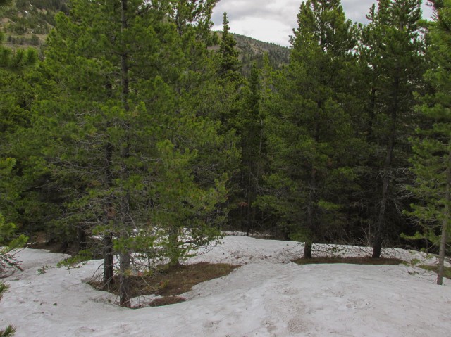
This is a horse trail, also frequented by cows, so expect mud and poop. Spring melt also means in places it’s more like a stream. Overall though, it’s fairly well drained and not terribly bad, all things considered. For a time, we’re in the woods. In one spot we pass a small grove of giant trees right alongside the trail. Soon, things open up.
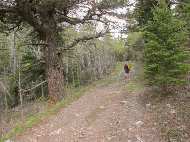
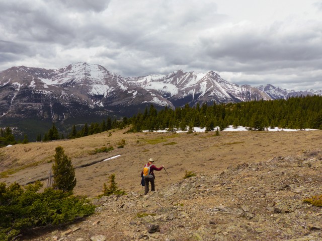
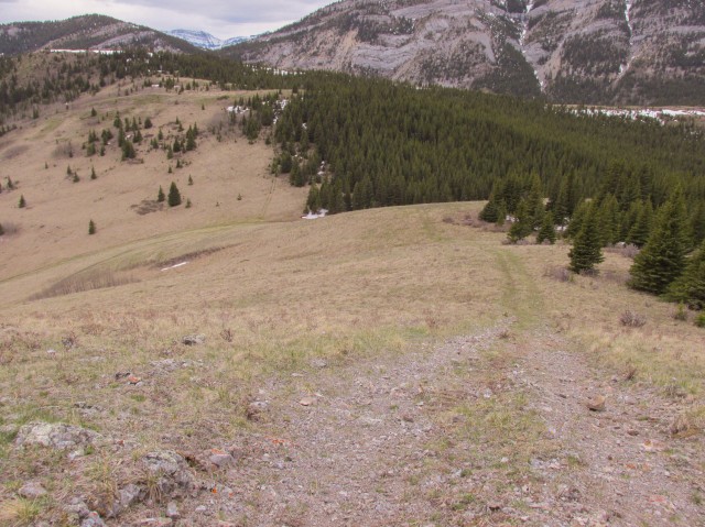
Making our way up a grassy draw, in no time we’re at the trail’s namesake, Grass Pass (an aptly named place). From here one can continue up and over the opposite side or you can head directly west to claim a modest ridge, or you can go in a southeasterly direction to the famous “Boundary Pine” located on a small hill overlooking the highway and the Highwood River. Or, like us, you can head up the grassy ridge directly to the east. You can tackle it head on, or traverse it some (using another old exploration road) before turning north and heading up that way. The latter allows you time to rest your legs a bit before getting back to the climbing. After all you’ve just gained several hundred metres of elevation.
Along here, we have a view of the Grass Pass trail below and see a good dozen or so hikers making their way up. Some went up the smaller ridge to the west and some went towards the Boundary Pine. Others must have turned around. They were all gone when we returned.
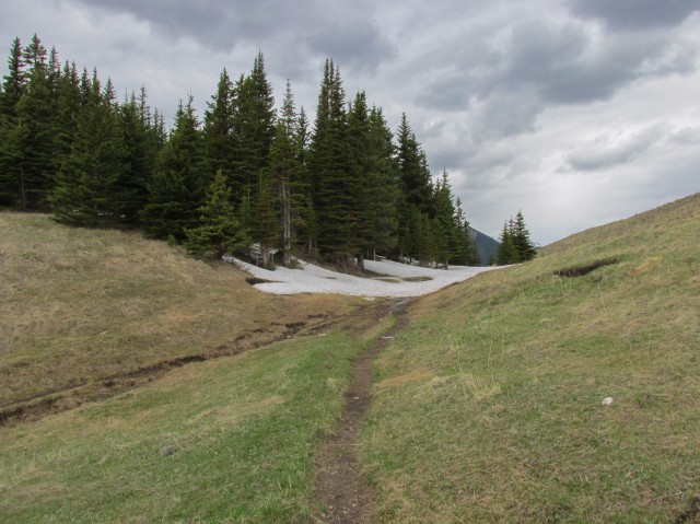
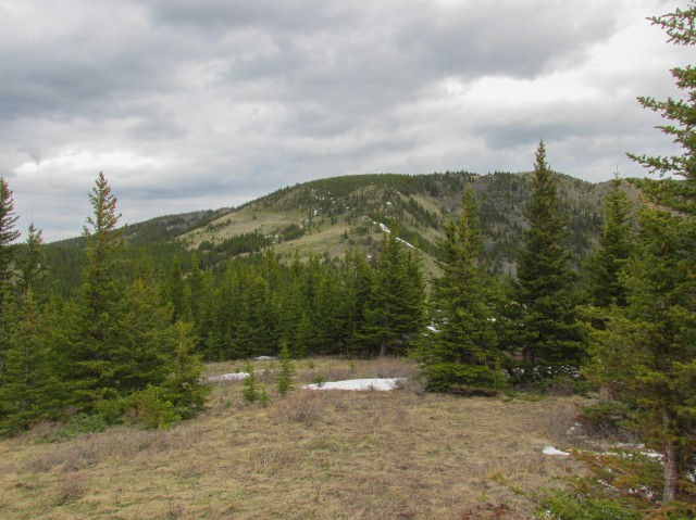
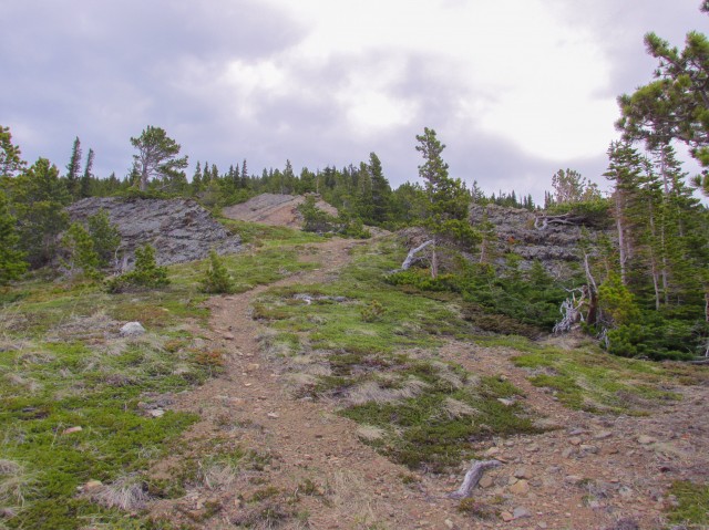
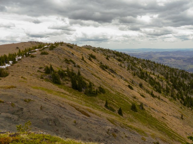
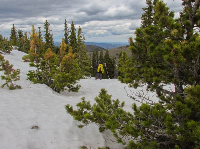
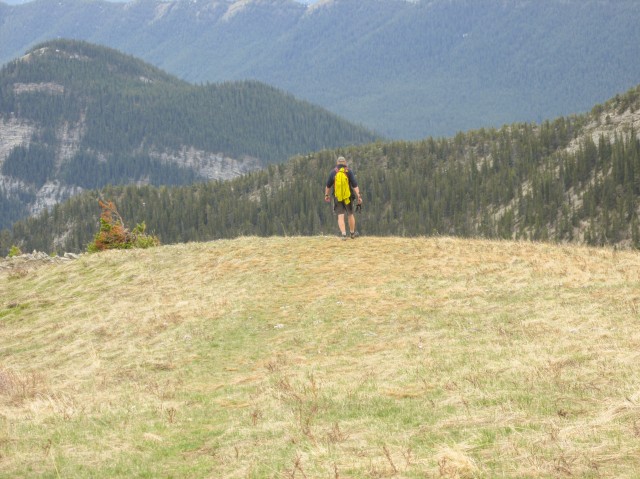
Soon the day’s goal comes into view. The trail here is intermittent, but the route is always obvious – go up. It’s mostly open and grassy but here and there we’ll have to pass through some dense groves of small trees. In one spot, there ridge undulates a bit, losing perhaps 40-50m in the process. Not a big deal though. In the trees we have to contend with some deep snow pack however. Along here, we find an odd cage-type structure. We’ve seen these elsewhere in Kanasaskis, often high up on a hillside or ridge, and frankly are not completely sure their purpose. Research tuns up nothing either. Anyone care to chime in?
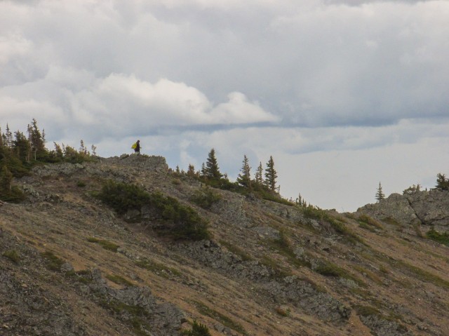
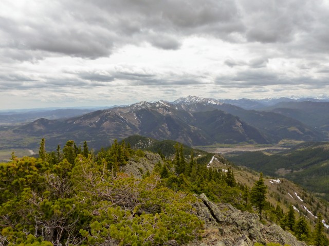
Next up is the steepest part of the route. There is some loose rock, but nothing too worrisome. A long rib of the Bull Creek Hills can be seen in east and looking close, we see a hiker heading down it.
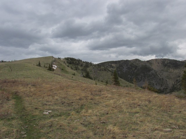
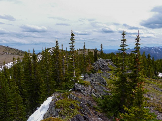
For a time we’re back into the trees (and deep snow) but before long we break out onto the ridge top proper. To the left (west) is two high points, which we’ll visit shortly. For now though, we’ll head east for the time. At the middle summit, Connie decides to stay put while I continue on.
There are three more high points to the east, two roughly the same height as the one we’re currently on and one a bit higher (or so it looks). I hope to bag all, but manage only two. The third and what appears to be the highest point (but only by a little bit) is inaccessible due to very deep snow between myself and it. In fact, along this section of the route, there is waist deep snow in many, many places. More postholing!
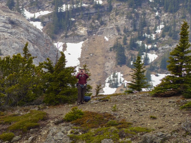
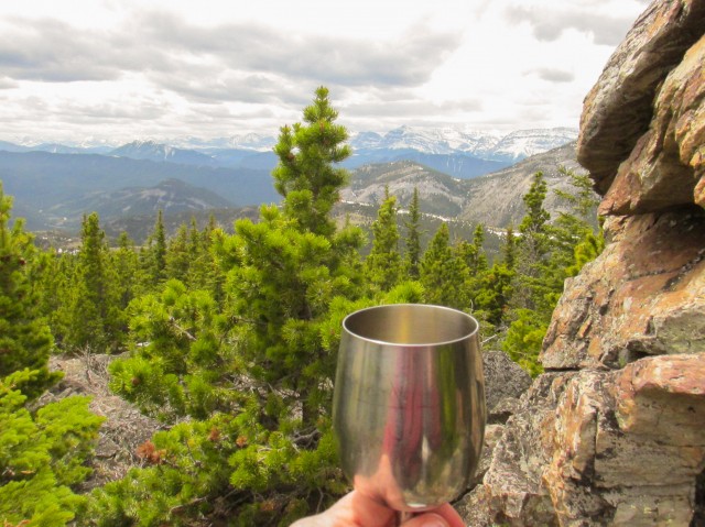
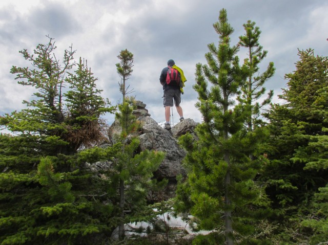
Back with Connie, we head to the the first of two westerly high points where we find a nice sheltered spot to have lunch. Soaking it all up, we enjoy the views, with some wine – champagne actually, celebrating our first summit of the season. We always bring wine. While Connie relaxes further (and she deserves it), I head to the most westerly summit, a rocky spine mostly in the trees.
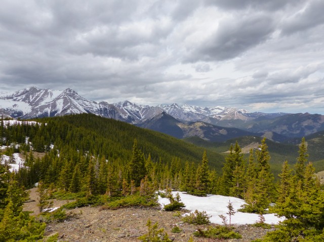
Heading back, I take an inventory of known peaks that can be seen around us. To the west is Holy Cross Mountain and beside it, Mt Head. Both can be summited by competent scramblers. Further north is Patterson’s Peak. We don’t have a view directly north or northeast due to the trees. To the south and southwest are an endless sea of modest ridges and low rolling hills. Many, like Mount Mann not far away as the crown flies, will likely be objectives for us in the future – I understand most can be climbed. Directly south, the tallest mountain seen in that direction is Mt Burke. To the southeast the hills turn to prairie. There is still lots of snow on the higher mountains but lower down, things are greening up well.
Heading back, we follow the same route we came up on. We make one exception and near Grass Pass we head down a steep grassy slope, instead of the lesser slope with a traverse we did coming up.
In no time, we’re back in the trees. The warmth of the day has melted more snow and the trail-cum-stream we came up earlier in now more like a river in places. We have to rock hop at times to keep from getting wet feet. Along here we see a huge fungus on a tree – it’s easily a metre in height.
Before long we are back at the car. When we started were were the only vehicle at the trailhead and on ending it was the same. Those other hikers we saw earlier were long gone.
We did the Bull Creek Hills as an out and back. You can also do a horseshoe shaped route, heading up the way we did, while going down one of two easterly ribs (remember we saw a lone hiker on one earlier). Once at the bottom, you will have to walk down the highway a bit to get back to your car though.
There are many, many great hikes in this region of Kananaskis. So many in fact that we’ve only just scratched the surface in respects to exploring them all. Some of the favourites we’ve visited include Mist Ridge, Picklejar Ridge and Mt Lipsett, all summits you’ll want to check out too.
The Bull Creek Hills often come into season early, thanks to the prevailing winds that keep the slopes clear most of the time. In fact, they can often be climbed all year round.
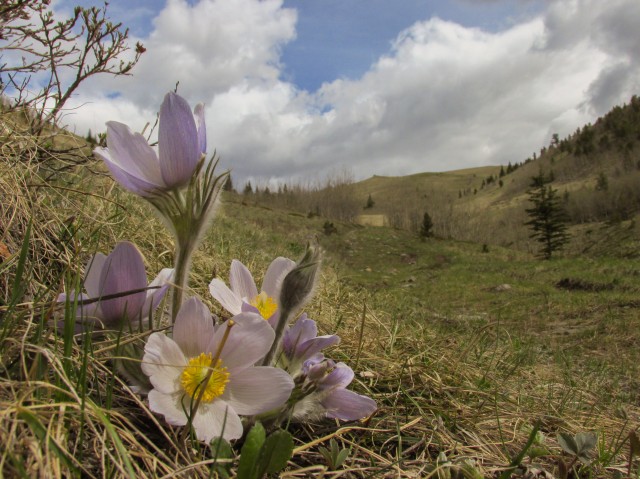
On this trip we saw a lot of Prairie Crocuses. They are a sure sign of spring and are often the first flower seen. They are sometimes so eager to bloom, they will grow through the snow.
A creek to the north was formerly known as Bull Creek and it’s here where the hills took their name. Unbeknownst to me until I wrote this report, there is nearby the remains of a crashed airplane. Fascinating, I’ll keep it in mind for next time.
I have to say I am proud of Connie this trip. She’s still suffering from our 2011 car accident, but last year also got diagnosed with Grave’s disease. This makes it hard for her climb (a symptom is muscle weakness), but in spite of that she did it and did it well.
Check out some other summits and hikes we’ve visited in the area…
Junction Hill recon.
Cataract Creek.
Raspberry Ridge.
If you wish more information on this trail, by all means contact us!
Date of adventure: May, 2014.
Location: Kananaskis AB, west of Longview.
Distance: 12km.
Height gain maximum: 730m
Height gain cumulative: 830m
Technical bits: Some loose spots.
NOTE: all heights and distances are approximate.
Reference: Kananaskis Trail Guides by the Dafferns.
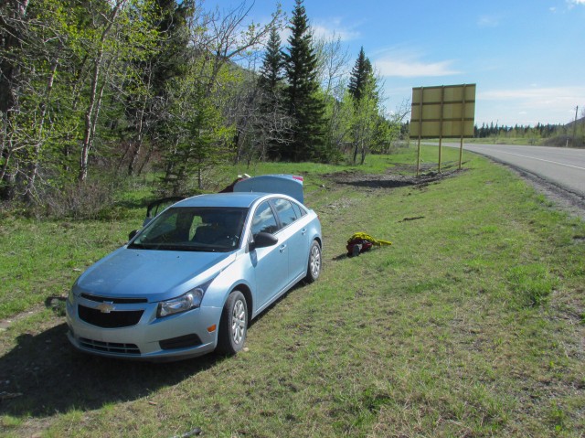
The start of our journey, at the Grass Pass trailhead.
Things are greening up nicely.
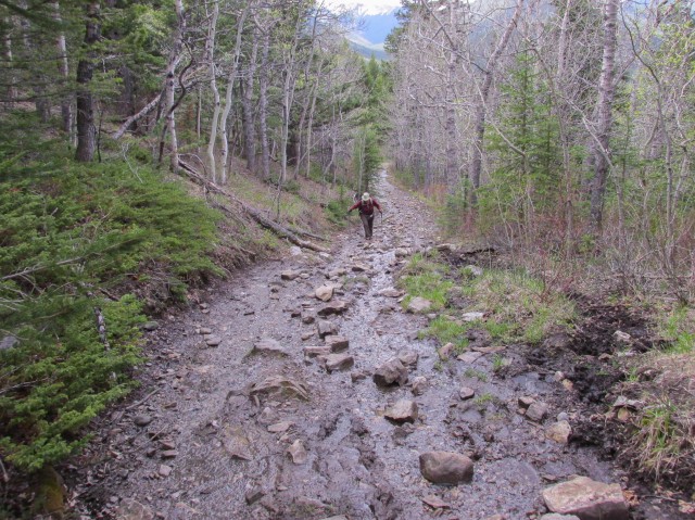
Sometimes the trail is more a stream.
Passing a huge tree.
We soon break out of the forest.
The Prairie Crocus is often the first flower seen in the spring.
Leaving the Grass Pass trail at (where else), Grass Pass itself.
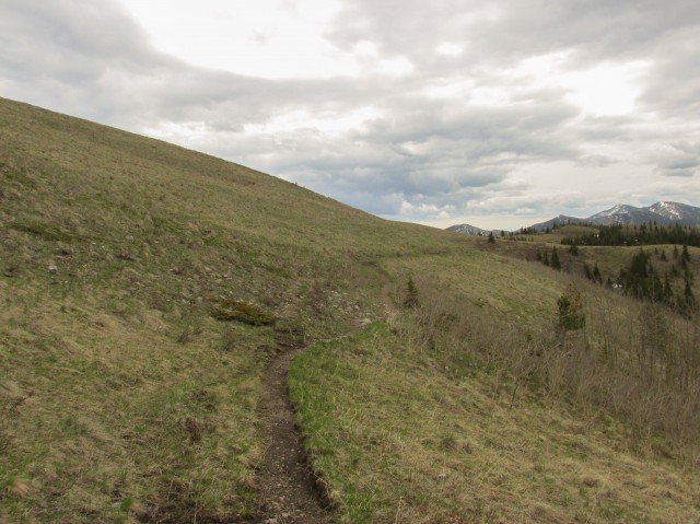
We’ll traverse this slope for a while.
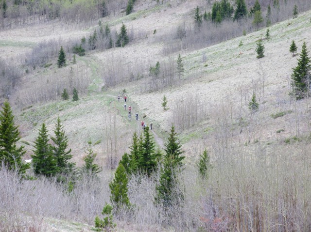
A large group of hikers on the Grass Pass trail.
Our objective comes into view.
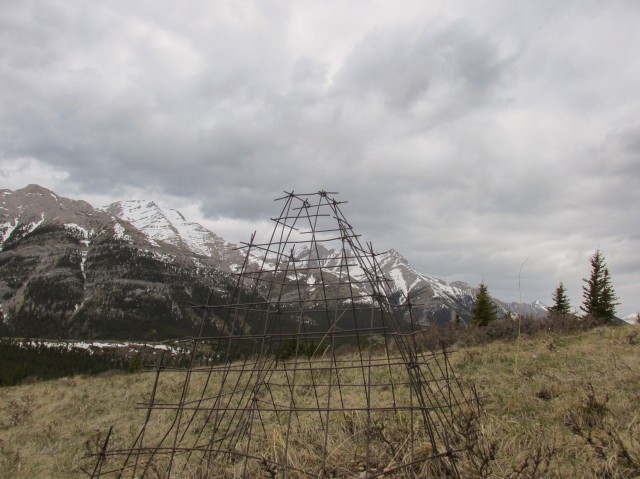
These cages are seen all over Kananaskis but we are not certain of their purpose.
Into the trees…
And into the snow…
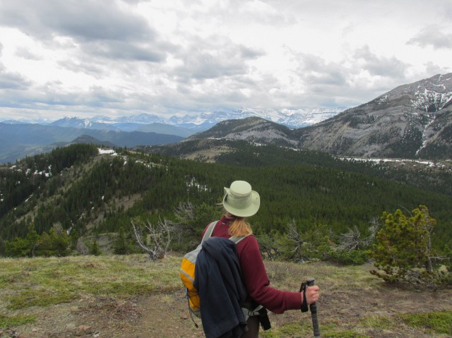
Connie soaks up the views.
The trail here is pretty steep.
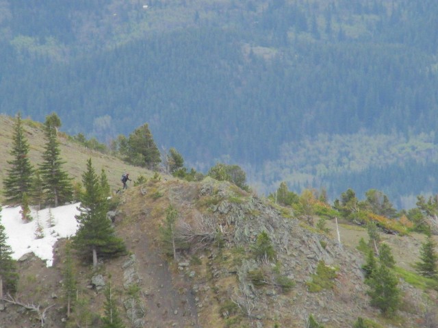
A hiker is spotted on the Bull Creek Hills east ridge.
From the summit…
I leave Connie behind and post-hole my way along the ridge top.
One of four high points, of five, visited this trip.
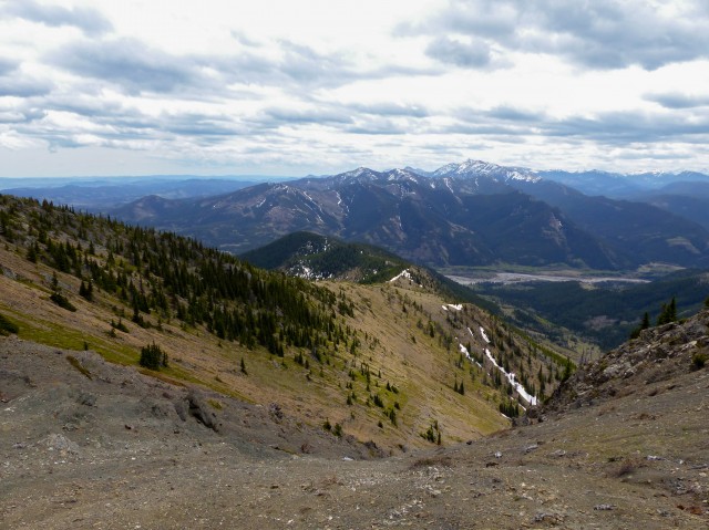
The Highwood River is seen far below – Mt Burke is the highest mountain in back.
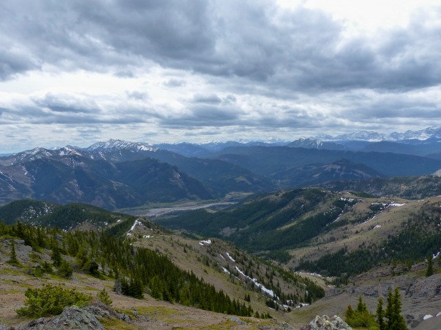
An endless sea of ridges and hills to the south.
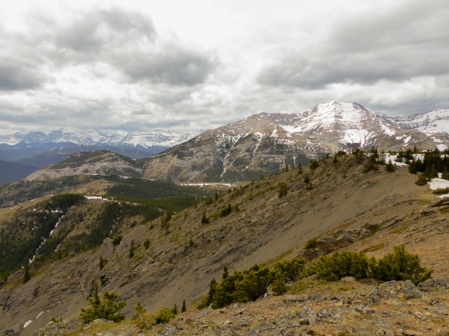
Looking west, we see Holy Cross Mountain in back.
Looking back at Connie…
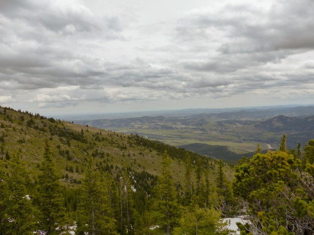
Low hills and prairies to the southeast.
Looking down the east ridge.
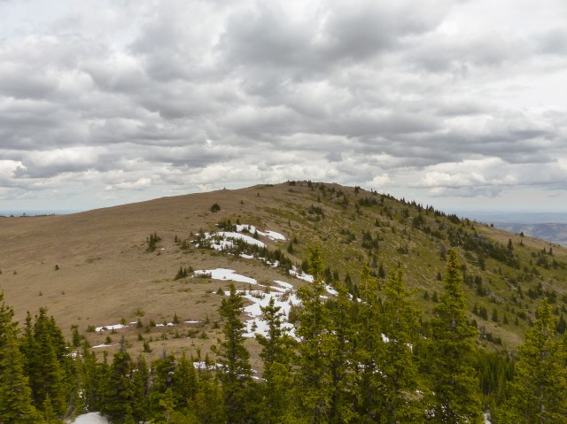
I did not visit this high point, due to deep snow between myself and it.
Looking northwest, with Mt Head on the left.
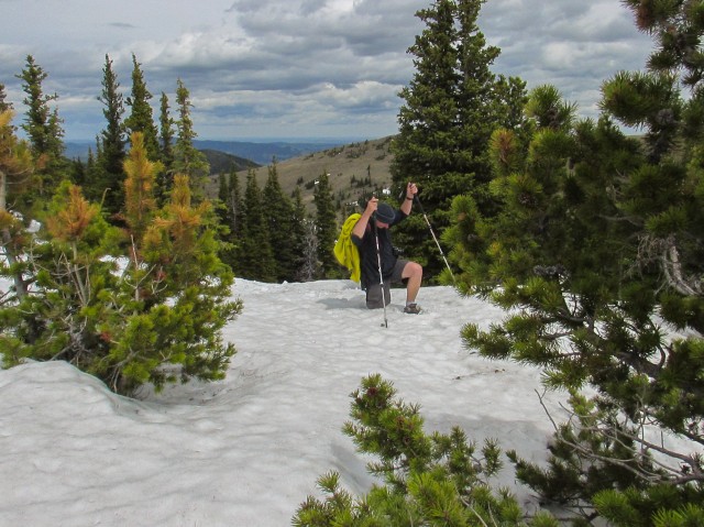
More postholing.
Looking for a suitable lunch spot.
On the west most high point, looking back.
We bring wine for every hike.
One last look before we go.
Heading down…
Almost back at Grass Pass.
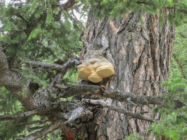
A huge fungus.
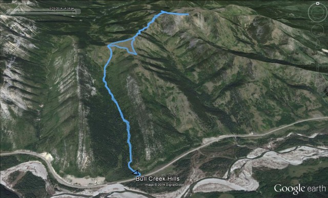
Our route.


")


Stolen from another blog about the area:
“The cage you mention is used for research. The principal behind this equipment is to erect it in some prime habitat, in this case probably elk habitat. The animals are able to eat the grass outside the cage, but not inside. Periodically, a researcher will come along and measure the amount of vegetative mass inside the cage and compare that to some random spot nearby. The difference can be used to compute level of use of that particular area’s habitat by the graze species. If you look close, you can see there is taller and thicker grass inside the cage due to lack of use for graze. Ranchers sometimes do the same in their pastures but with a less scientifically precise method.”
Ahhh, that explains it. I’ve been meaning to look into it deeper, but time has been the enemy. Now we know! Thanks so much for commenting.
(via Facebook)
A wonderful hike, for sure. I did it in August of 2008 on the hottest day of the year and came down severely dehydrated because my 3L of water wasn’t nearly enough. The back of my legs ended up so sunburned I couldn’t properly walk or sit for about a week — the only comfortable position was lying on my stomach. I want to do it again one day when it is less hot and when there is no snow.
I easily down 4-6L per hill/mountain. Dehydration is an awful feeling!
British Columbia seen to get all the glory. After looking at your blog, I don’t say that anymore. Alberta is awesome!
So true, many people, Albertan’s included don’t really know just how stunning the province is. I love BC too though! And Sask. And…
Gorgeous! This is going on the list 🙂
It sure be on a lot of people’s lists.
If you were on the hill on the 25th, that was me and my dog, you caught hiking down the east ridge.
Awesome, I’d like to do the hike as a loop one time, coming up one side and going down the other.
Great pics Chris and Connie! Still lots of snow on them there peaks.
Yes and it some places it’s pretty deep. When I was postholing I sunk up to my waist!
Another hike to add to my list. Lovely!
It’s a good one!