
Powderface Ridge
I’ve been told the views from Powderface Ridge are amazing. We’ve heard nothing but good things about the place. So why the in the world did we pick a cloudy day to tackle this trail? Are we crazy? Well maybe…yes, a bit…but that’s another story. We heard that the clouds may break in the afternoon and were willing to take the chance that upon topping out, (hopefully) we’d be greeted with nothing but blue skies and stunning vistas. With any gamble, you win some and lose others. This time we lost. It rained almost constantly and the fog was so thick that at times visibility was only a few metres.
The trail is official, meaning it has signs and is maintained (dead fall removed, etc). It’s also quite popular as it turns out and in spite of the bad weather, we passed many people on the trail. All I am sure were hoping and praying as we did, that the sky would open up and the rain would stop. Most of these hikers it seems were headed to the south high point of Powderface Ridge. Only ourselves and one other couple headed to the true summit. It not much more work, and has better views (or so I am told – recall that fog).
The first half of the trail is moderately steep with no breaks of any sort. Once below the south end of the ridge proper, things become easier for a time.
Amazingly, this trail popular with mountain bikers, although we saw none this day. It’s a bit hardcore if you ask me – push, push and push to the summit followed by a screaming brake-smoking descent back down the way you came. Yikes!
The trail for the most part is well drained (good). There are still lots of loose rocks to contend with, some mud here and there, and roots whose job it is to trip you up. Nothing too challenging however.
The Powderface Ridge trail is located at the end of Highway 66 west of Calgary, just east of the Little Elbow Campground at the junction of the Powderface Trail road (closed while flood damage from 2013 is repaired). There is a small parking area here, which is your trail head.
Immediately head up into the trees. As you gain elevation, you’ll pass through some small meadows here and there but for the most part the views are limited. For now. Once at the col between the south outlier of Powderface Ridge and the true ridge to the left do things open up. For a time anyway and soon it’ll be back into the trees again.
At a large cairn head down and left into the trees. If you like you can make a side trip to the grassy/rocky high point on your right. Most people, it seems, make this their goal and turn around after visiting it. Not us, we wanted to visit the true summit, still a kilometre or two away and some hundred plus metres higher.
Along here it starts raining and always the optimists, we hope it’ll only be temporary. Things will be all good once we get to the summit. Yes, all good. We want to see those views and have travelled too far to give up now. With high hopes, we press on.
But the rain doesn’t stop and for the rest of the trip it’ll pour and pour and pour some more, so much that even with our rail ponchos, we’ll be completely soaked by the time we’re back at the car. And the fog? We’d not be free of it once we reached this point.
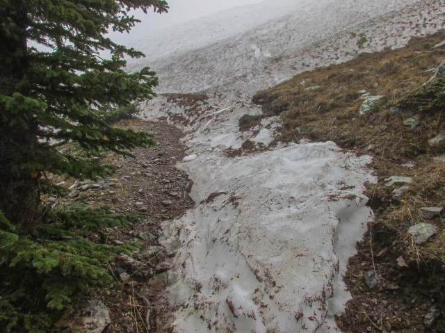
Disappointingly, the trail heads down for a time, but not for long. At one point we pass by a large slump damaged by spring 2013 rains. A large section of grassy slope, trail and all, gave way and slid down the mountainside. A new trail has formed through the mess. There is still many snow patches along this section of trail. It’s mid-June for goodness sake and we’re not that high up!
The trail here rises and falls bit, always in the trees, then at a switchback, heads up steadily until the summit is reached. Almost at the top, we’re blocked by a high wall of snow. It’s firm enough to hold us and we kick-step our way up. Outside our prints and those of another couple who passed us earlier, there are no others to be seen in the snow, suggesting few people have made it to the summit this season. Hmm, that’s odd. I would have thought it more popular. It’s not that hard a hike.
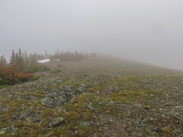
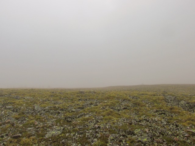
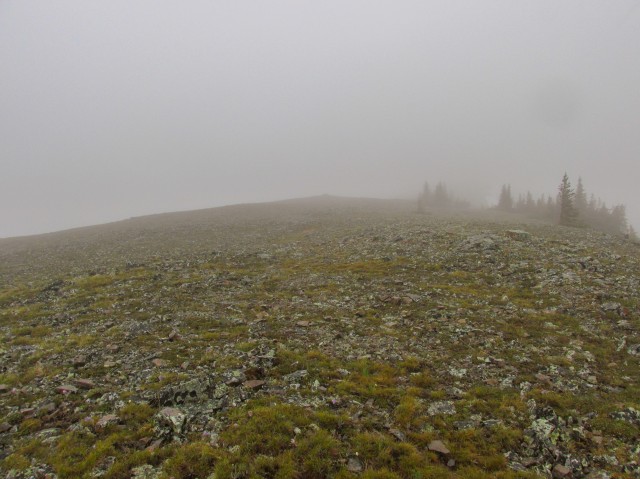
Once on the open ridge top, we’re greeted with, guess what, more fog. The relentless rain stops for a few minutes, allowing us to take some pictures. Pictures of fog. I have to record the summit, right? Even if the views suck. We spent all that work getting here, I can’t simply turn around now without getting a few shots off. Honestly, we’re high up and the views are supposedly something else. All around us are mountains and hills…
After a quick lunch in a somewhat sheltered spot below a cliff band just under the summit, we head back. About this time the temperature drops and now not only are we wet but also miserably cold. What fun! Connie and I stop a few times to rub our aching hands they are so numb.
We make good time heading back down and in no time are back at the car.
The ridge was named after a local First Nation’s family who once lived in the area.
We are not done with Powderface Ridge and vow to return. We have to check out those views we were told were so wonderful. We want to see them and we want to share them with you. The rain meant the cameras couldn’t be brought, save for a couple times when the showers stopped momentarily. Even then the only thing to see were clouds and fog. Not really good fodder for a trip report. Stay tuned…
We made it back…
Powderface Ridge (2)
Check out these ridges we’ve hiked…
Bull Creek Hills.
Mesa Butte via Curley Sand Ridge.
Picklejar Ridge.
If you wish more information on this trail, by all means contact us!
Date of adventure: June, 2014.
Location: Kananaskis AB, Elbow River area.
Distance: 12km out and back.
Height gain maximum: 640m.
Height gain cumulative: 720m.
NOTE: all heights and distances are approximate.
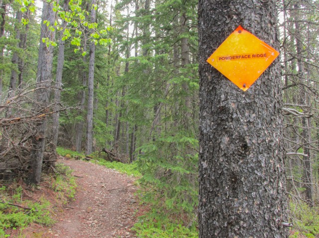
At the start of the Powderface Ridge trail.
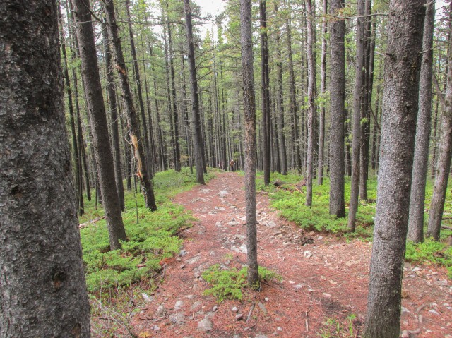
At first, we’re in the trees.
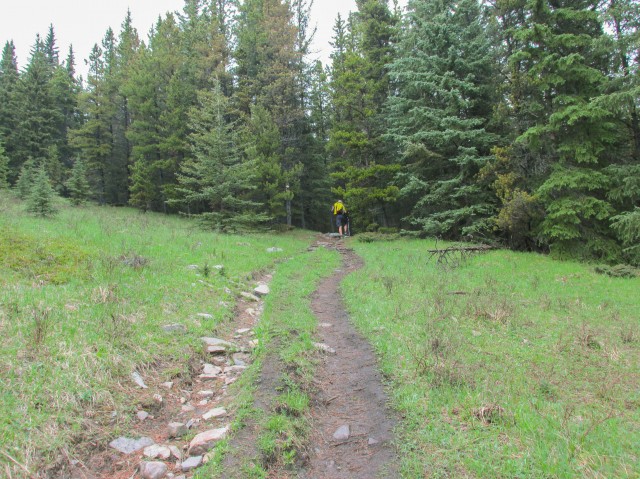
Breaking out into a meadow.
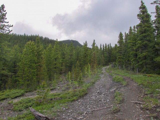
Back into the trees…
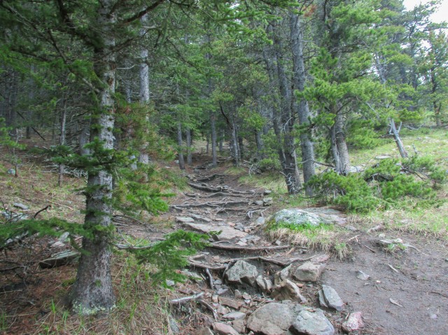
Obstacles on the trail include rocks, mud and these roots.
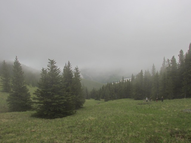
The fog moves in – note the group of hikers below.

The rain starts…
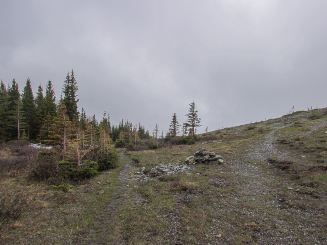
The trail heads left into the trees.
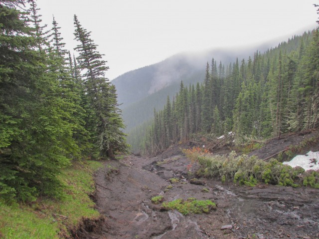
A large slump.
A wall of snow blocks the way.
On the top of Powderface Ridge.
I am told the views here are stupendous. Sigh…
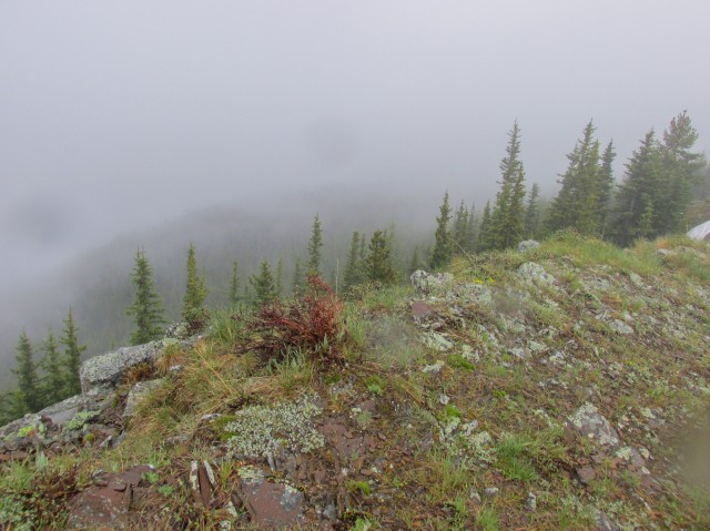
Mist and clouds all around.
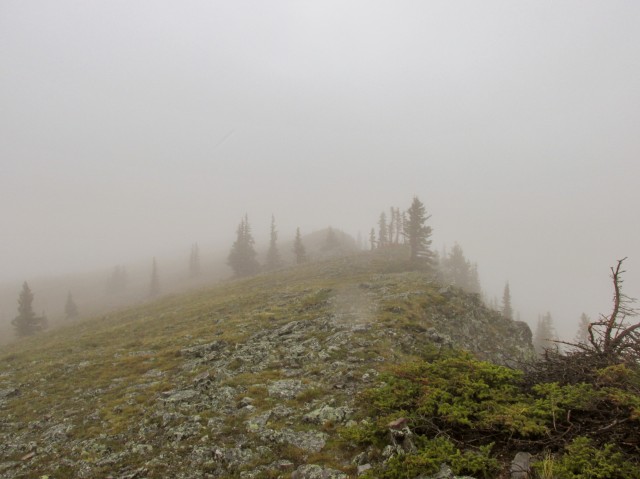
Heading north on the ridge crest.
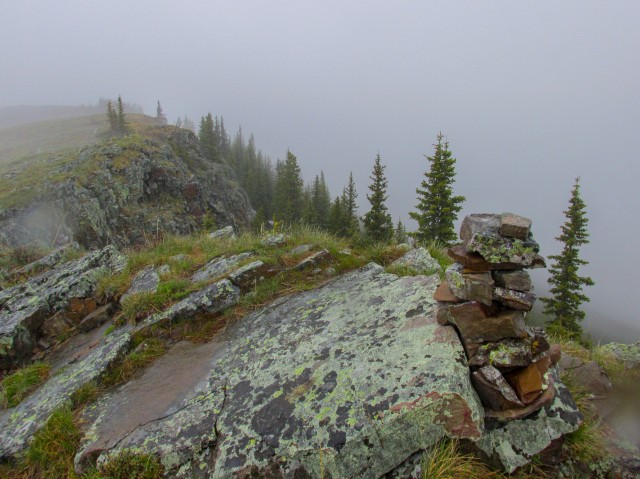
The summit cairn.
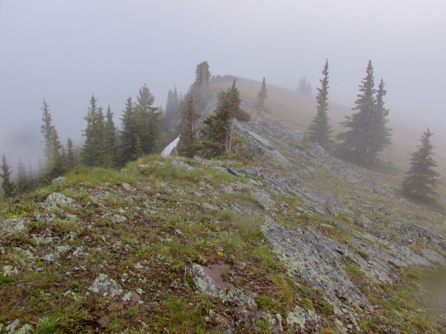
Honestly, it’s a long way down.
What a bummer. We’ll have to return.
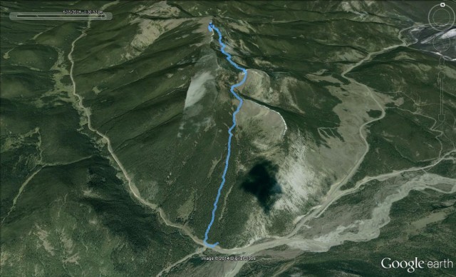
The route we followed…


")


I had that same view hiking in Scotland!
Hilarious!
One of my favorite hikes! I did this hike last year and like on your trip it was cloudy, Still had a great time though.
Agreed, even with no views, there is still a good time to be had.
At least it wasn’t windy! It can get bad up there.
I’ve heard. Maybe it would have blown away the fog!
How long was the hike to get to that spot? If the views are as good as others say, I’d like to give it a try.
We always take our time, and I think the round trip took about five hours. Including the lunch break.
The views you missed are breathtaking. I’ve been up on a clear blue sky day and it was impressive.
Don’t remind me! :>