
Forget-me-not Ridge
Forgetmenot Ridge (or Forget Me Not Ridge, or Forget-me-not Ridge) is that large flat topped mass that sits southeast of the Elbow River Recreation area, just above where the the Big and Little Elbow Rivers meet. These combined courses, known as the plain old Elbow River, eventually finds its way into Calgary, becoming the city’s water supply and later emptying into the Bow River just east of downtown.
I’ve seen other trip reports on this ridge and decided it would be a good outing, Connie was sick so I tracked it alone.
It’s a simple matter getting to the top and there are no route finding challenges at all and the going is fairly easy. Well easy in regards to finding one’s way – there is still all that “up” to contend with.
To access this trail go to the Little Elbow recreation area at the end of Highway #66. There is a large parking lot just east of the camping area – not the picnic spot but rather the next one in. This is where you start your adventure. Your goal can be seen to the southeast.
To begin head south to the river and then temporarily go westbound until you get to the pedestrian bridge that crosses the Little Elbow River. Turning east, avoid all junctions heading south. Eventually you’ll come to the other arm of the Elbow River (the Big Elbow, or simply “The Elbow”). You’ll have to ford it which may not be easy during runoff. Once on the other side, on a wide horse trail, continue on until you come to a junction marked with a cairn.
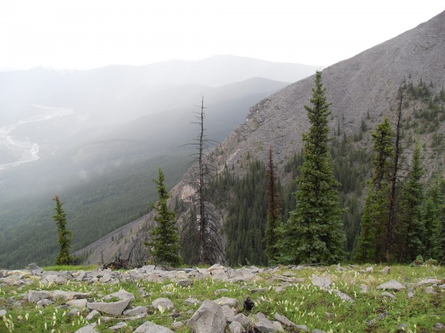
Take the right trail, a single track that immediately heads up. Up to now there has been no elevation gain. Heading ever higher, much of it on loose scree, pass the infamous rock tree (see pics). Shortly after that the trail levels out a rib, a nice break from the plod up. From here you can head south, gently traversing up the hillside toward the south high point. Or like me, you can head east and up to the north high point. This path skirts a tree island.
The clouds came and went all day and they sometimes obscured the view.
Once on top you realize just how massive and flat this ridge it. Numerous ribs interconnect and extend for many kilometres and all are flat or nearly so. You could wander around all day forgetting you are at the top of a mountain. Many flowers blanket the area.
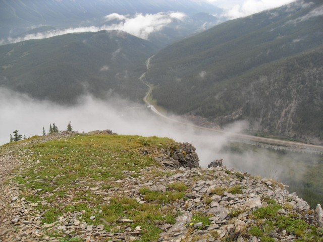
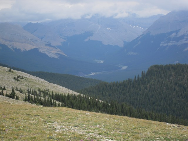
In spite of being a modest sized hill there are some superlative views from the top. To the west there are larger barren peaks – Mt Glasgow, Mt Cornwall, Outlaw Peak and Banded Peak. The latter stands out amongst the rest and looks much like one of the pyramids in Egypt. Below them are the extensive gravel flats of the Elbow (Big Elbow) River, the one you crossed earlier, and it joins the Little Elbow at the northern base of Forget-me-not Ridge.
To the north are the Nahahi and Powderface Ridges. A bit further east is Prairie Mountain and behind Moose Mountain, both places we’ve been up. Directly east are small rolling hills and ridges…and the McLean Creek OHV zone, a sometimes noisy place.
Of course, those clouds we spoke of earlier moved in while at the top and I was unable to photograph most of the peaks mentioned. All were shrouded in mist with only their dull grey and faint silhouettes to be seen. Trust me though, when the weather is nice the views are amazing. In fact they were no so bad even this visit.
If you like, you can continue south to Forgetmenot Mountain. It’s a little higher than the ridge and is the former site of a fire lookout. I planned to do this but a nasty thunderstorm rolled in and I had to make my escape. It had been raining off and on all day, but the full-on storm was too powerful to mess with. Lots of lightning and thunder! Making a run for it, in no time I was in the trees.
I recommend this trail. You get an amazing view for what is very little work. I saw only a couple other people on the mountain and I really enjoyed the solitude.
Parts of the trail mentioned are shared with horses and bikes, although I never passed either. Keep an eye open for them and be sure to step aside when they pass.
If you liked this report, take some time to read on about these ones…
Missinglink Mountain.
Return to Eagle Hill.
Raspberry Ridge.
If you wish more information on this trail, by all means contact us!
Date of adventure: July 2009.
Location: Kananaskis, Elbow River area.
Distance: 14km return. You can go further along the ridge if you like.
Height gain from start: 705m (which as usual contradicts other trip reports I’ve seen by 20-40m).
Height gain cumulative: 705m.
Technical bits: Loose scree on trail.
Notes: You have to ford one arm of the Elbow River, which could be hard in the spring.
Reference: Kananaskis Trail Guides by the Dafferns.
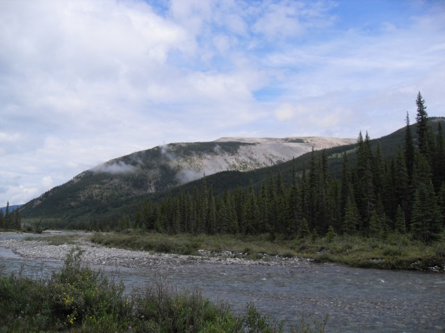
The destination for today, Forgetmenot Ridge.
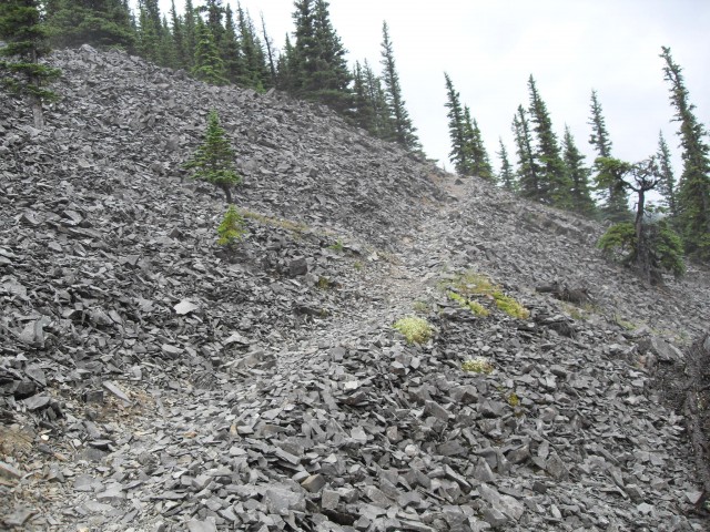
The trail up is often in scree.
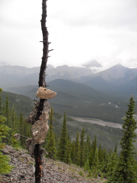
The infamous rock tree.
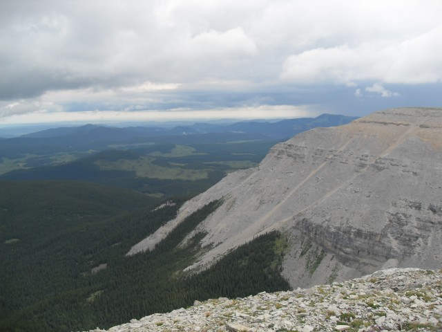
The Powerface Trail “highway” can be seen in the north.
Even with the clouds sometimes obscuring things, the views were nice.
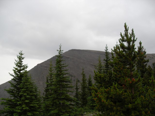
The north summit of Forgetmenot, my goal.
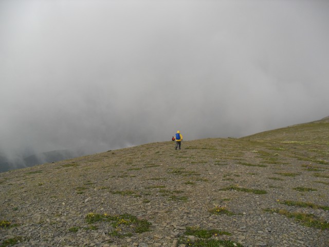
Some company…and the rain.
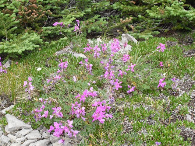
There were flowers everywhere but I only shot these.
To the west was a sea of grey peaks.
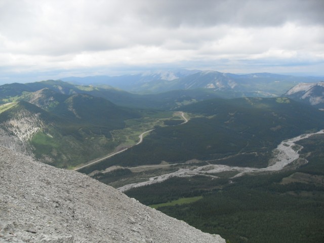
The view to the southeast.
Looking somewhat northeast with the Elbow River below.


")


This is the type of hiking I love. Give me a ridge with a view and clear weather and you have a perfect day!
A glorious day! Wonderful pics! Just love it!