
Jumpingpound Loop
With both Connie and myself feeling a bit under the weather, we decided that a short n’ easy hike was in order this day. Fitting the bill was Jumpingpound Loop in the Sibbald area of Kananaskis. It’s a not a terribly exciting outing, there are few places where the trail is not in the trees, but it’s still got its own charms. It’s short, relatively so, and can be done in a few hours and with little elevation gain, it’s not much of a workout. And it’s fairly close to town.
A perfect trail for how we feel.
Located at the extreme eastern edge of Kananaskis on Highway 68, south of the TransCanada, the area in which the trail is located in mostly comprised of heavily forested low rolling hills. In season longer than most, when the white stuff covers trails in the west, this one is often dry and snow free.
The Jumpingpound Loop can be done in either direction, but we chose to hike it counterclockwise. There is a short-cut trail about half way in should you wish to make a shorter loop. You can start the trip at many locations. We picked the Pinetop Recreation Area.
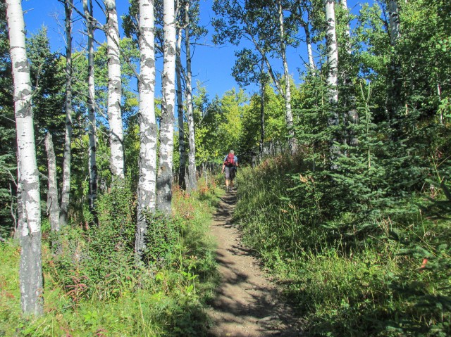
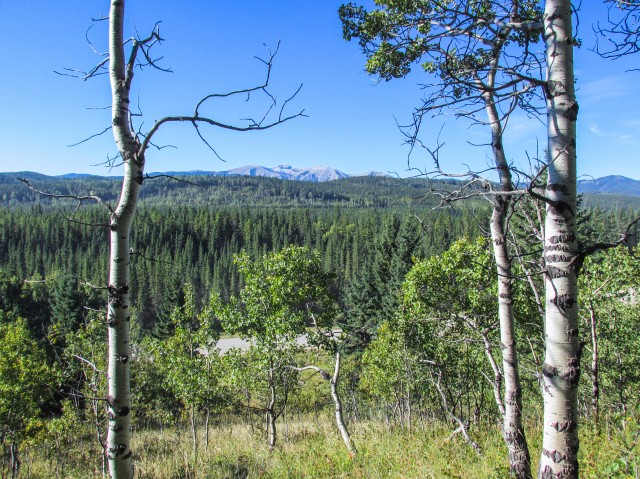
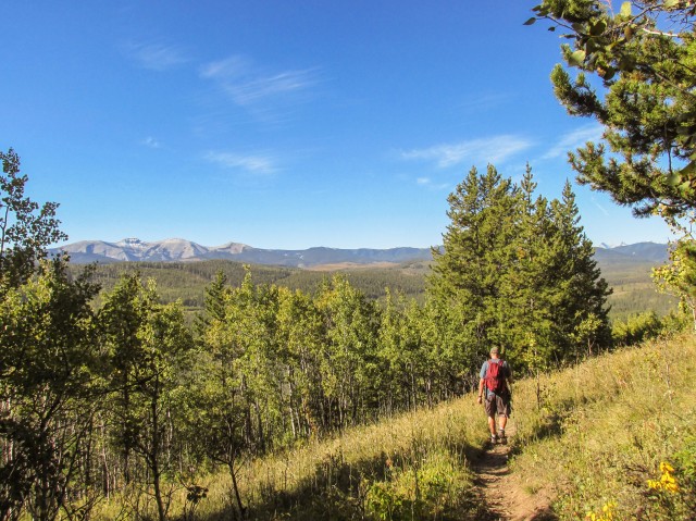
The trail heads north into the trees, then almost immediately crosses the highway (gravelled and dusty). Right after it climbs upward, but only for a short time, and then trends west. For most of the north leg of the loop, the trail traverses a hillside. The views are limited, but every now and then a break in the trees allows one to see bare topped Moose Mountain to the south and the more forested Jumpingpound Mountain and Cox Hill roughly to the southwest. Much large peaks in behind are obscured from this angle.
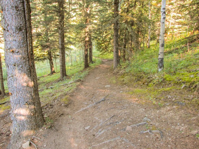
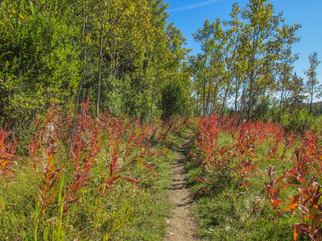
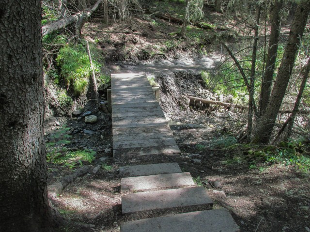
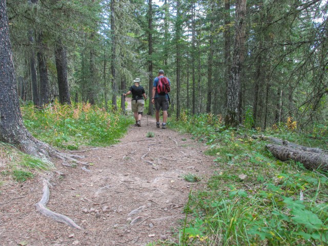
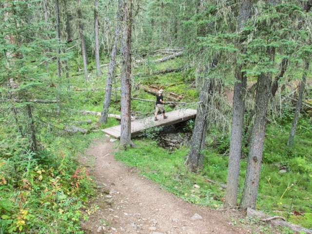
The trail undulates and meanders though alternating conifer and aspen woods. At one point it passes behind a children’s summer camp. At times, we’re close to the road, which can be heard but rarely seen. There are a few creek crossings, all of which have logs or bridges over them. This is an official trail, so in addition to that, dead fall is removed and other maintenance done and the route is marked with signs and maps. The route seems well drained for the most part, so there were few muddy areas but that could change if it rains a lot or in the spring.
Free range cattle roam the area so expect the occasional run in with them. Worse are the dreaded land mines they leave behind. This is also a bike trail so keep an eye and ear open for cyclists as well.
In no time we pass that cut off trail mentioned earlier. Perhaps a half hour later we come to the highway again. The trail crosses the road and turns west, flanking a low, somewhat boggy area. Now we’re heading east. Before long, at the Pine Grove Camping Area, we join up with Jumpingpound Creek which has come in from the southwest. We’ll parallel that waterway for the rest of our trip but given the dense woods, we don’t often see it. The southern half of the route is mostly flat, save for a couple times where the path dips down to cross some streams.
We find a fallen tree and make this our lunch spot (we always bring wine too). Your meal stop should be one element in an overall enjoyable adventure.
Heard every now and then along the whole trip was the sounds of gunfire (more like canon fire) coming in from a nearby rifle range. The boom-boom and rat-a-tat-tat was a little distracting.
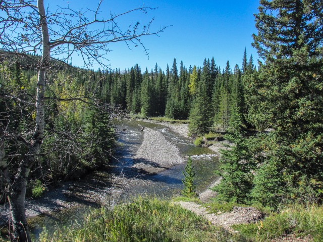
At the Jumpingpound Creek Recreation Area, the shortcut trail comes in from the north. At an overlook I survey some damage from the spring 2013 floods. Uprooted trees, some of them quite large, are scattered about in a haphazard fashion, having been brought here by the rushing waters of Jumpingpound Creek.
In no time we’re back at the car. We saw perhaps a half dozen cyclists and as many hikers this adventure, so based on that, you should expect something similar. Jumpingpound Loop seems to be a moderately popular trail, but is probably quieter during the week.
A lot of mushrooms were seen along the trail. I only wish I could identify them better (something for my winter studies). An edible seen, in great quantity, were rose hips. They’re not bad tasting, but you need a lot of them to make a meal. There is little flesh on the fruit. It’s mostly seeds, which aren’t typically eaten.
It’s not known where the name Jumpingpound comes from but it’s clearly First Nation’s in origin. I heard that it’s in reference to a buffalo jump at Jumpingpound Creek’s mouth but I have found little factual data to back that up.
I was quite surprised just how much I liked the this hike. I worried it’d be too mundane, but it was actually quite enjoyable. Not exciting, but pleasant enough in its own right. The wonderful blue skies we had this day made things even better.
To see some other hikes in the area, go here…
Return to Eagle Hill.
Jumpingpound Mountain north trail.
If you wish more information on this trail, by all means contact us!
Date of adventure: September, 2014.
Location: Kananaskis AB, Sibbald area.
Distance: 9.5km loop.
Height gain maximum: >100m.
Height gain cumulative: 250m.
NOTE: all heights and distances are approximate.
Reference: Kananaskis Trail Guides by the Dafferns.
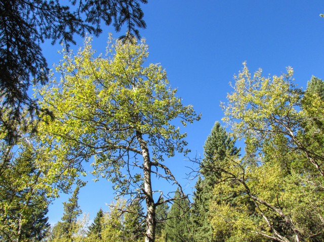
The Jumpingpound Loop trail is mostly in the trees.
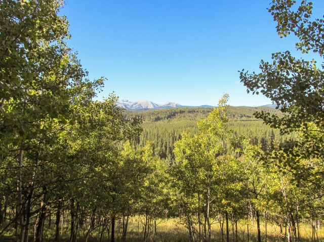
The view south.
We hiked the trail counterclockwise.
This area of Kananaskis has lots of low rolling hills.
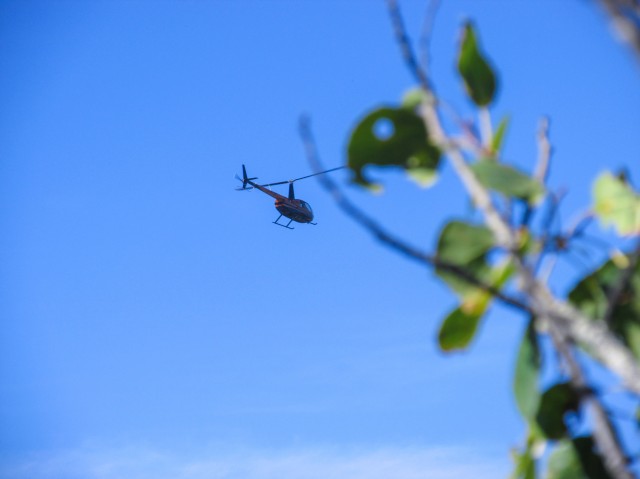
A helicopter passes overhead.
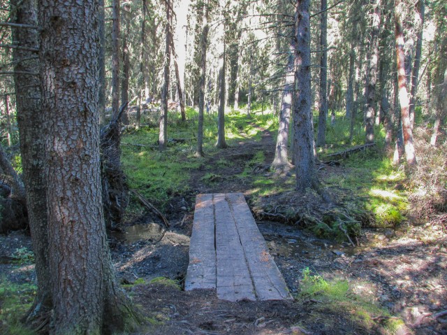
All creek crossings are bridged.
At an open meadow.
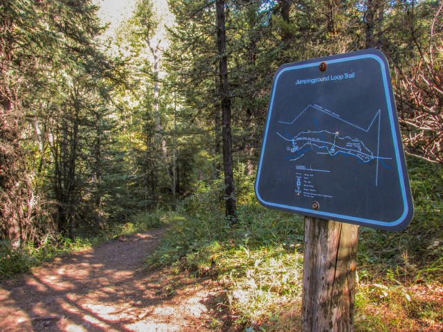
There are maps at every junction.
It was a gorgeous blue sky day.
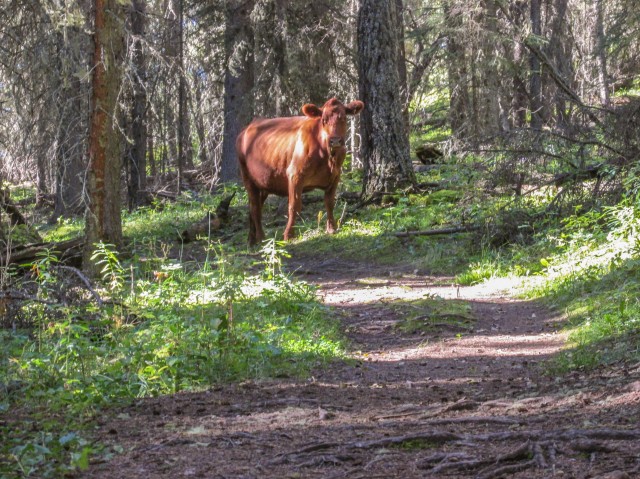
We have company.
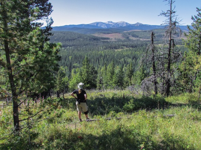
Connie eyes up Moose Mountain, far to the south.
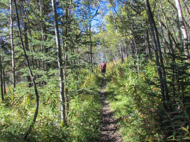
An enjoyable stroll through the woods.
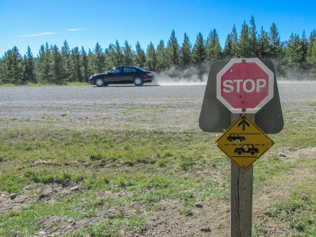
We cross highway 68.
On the lower half of the loop.
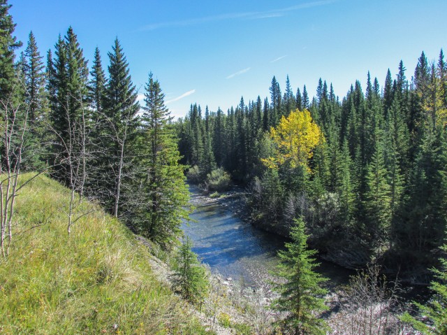
We parallel Jumpingpound Creek for a time.
Looking for a suitable lunch spot.
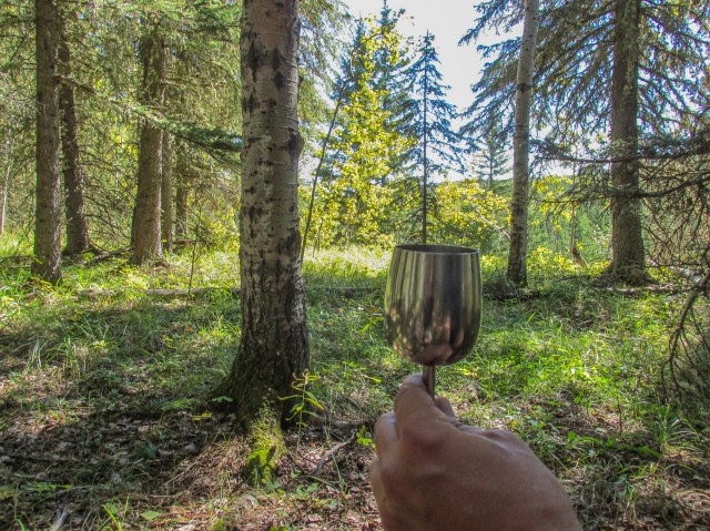
We bring wine wherever we go.
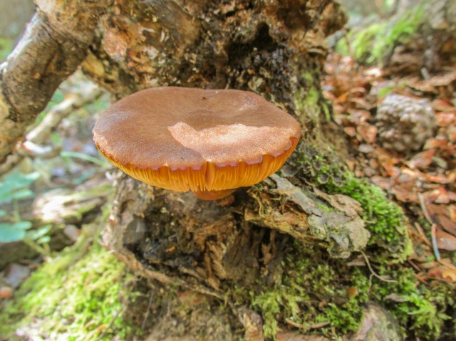
There were lots of mushrooms along the trail.
Dropping down to a small stream.
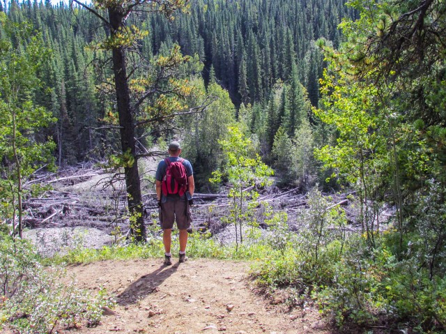
I survey the flood damaged creek below (note all the fallen trees).
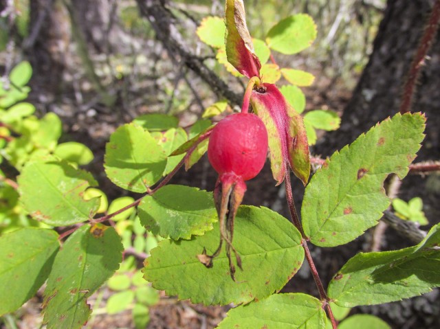
Rose hips can be eaten if needed and are plentiful in the area.
It’s not an exciting trail, but we liked it anyway.
Our hike almost at an end.
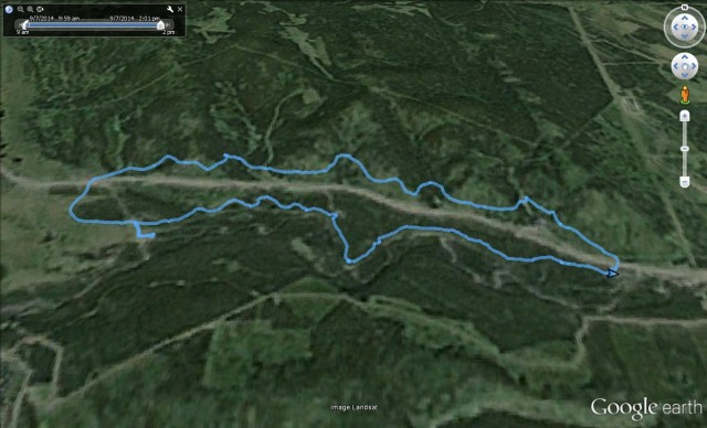
Our route…


I’ve done this hike multiple times and it’s always a good one for those days when you just don’t feel like going through the effort to summit something. It’s on my list of “first hikes” for Emily when she moves here and as she gets conditioned to living life at this altitude.
Good, start her off easy!
One of my favorite hikes! I’m not hardcore like you guys! Looks like you had a really clear day to enjoy the views. I last did this hike in August and it was pretty hazy and smokey from forest fires, unfortunately. Still had a great time though.
It’s a nice hike, better then I thought it would be.
Hard to think that a week later the place is under snow!
All that snow is such a bummer. Not to mention the mess made from all those broken trees. I bet Kananaskis is a mess because of that.
Where you live is so beautiful!!!
We’re so lucky!