
Greenhill Mine Ridge
The unofficially named Greenhill Mine Ridge or simply Greenhill Ridge, a modest sized bump that was once mined for coal, offers some surprisingly good views from its lowly summit. This hike follows a series of old roads, 4×4 tracks with the occasional bit of bushwhacking thrown in for good measure. Along the trail we pass a good number of mining relics going back many many decades. Perfect, we love combining hiking with history.
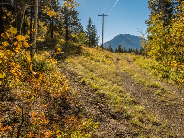
The trailhead is located along the (dusty) Grassy Mountain road. Park off to the side at a wide bend right beside the Crowsnest Pass Golf and Country Club course.
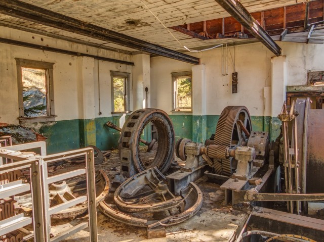
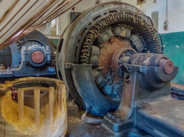
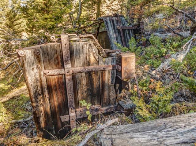
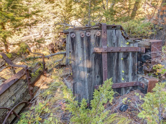
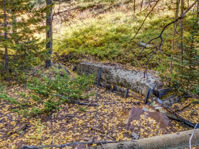
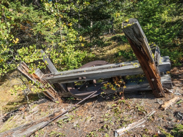
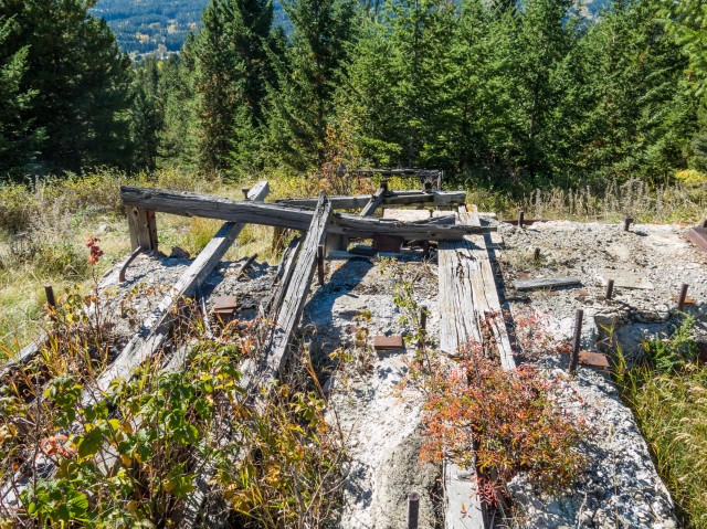
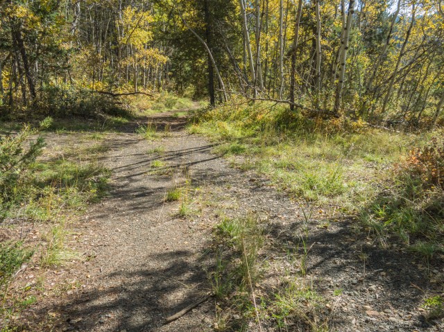
Head east into a clearing and before long intercept a rough coal strewn road. Turn left here. In no time you’ll come to a fence and soon after the remains of a large hoist house. This building held the machinery, large motors acting on winding drums via some huge gears, that powered the tramway that brought coal down from the upper workings. It was not unusual for a coal mine to have several levels and mining many “faces” at a time allowed the operation to be more efficient and productive.
The Greenhill Mine, owned by West Canadian Collieries, operated from 1913-1957. This was an underground mine, as were most mines in the Pass. It’s not known exactly what era the remains we’ll explore date from, but they’re probably from later in that company’s history. Once brought down, the coal would be taken, by truck presumably, to the nearby Greenhill Mine surface plant for processing. You’ll drive by that site on your way to this hike and it’s worth exploring as a side trip.
Take time to check out the hoist house building and the equipment inside but be careful it’s a dangerous place. Take only pictures and disturb nothing. The first thing that comes to mind on entering is what an unsafe working environment, not to mention a noisy one, it must have been when the hoist equipment was operating. All those open gears and moving parts, ready to rip off an arm or crush a body.
Later in the hike you’ll find more remains of the cable way connected to this hoist, higher up on Greenhill Mine Ridge.
Backtrack to the fence, which you’ll have to get through somehow and take the road heading left. Almost immediately come to a junction – head soft left away from the power line. At the next junction, this one a four way, head up. The track coming in from the left will used on the return trip.
The road turns right and levels out for a time. At a clearing you’ll come to more mining remains. There is a slack dump (for junk coal, fines and contaminated material) which tells us a mine entry used be located nearby. These are always back filled however, when a coal mine closes, so its exact location on the hillside is hard to determine. Old coal cars are scattered about and a few foundations can be found in the bush. I was told an old boiler was located nearby, but I could not find it. There are a nice views of the Crowsnest River Valley in the west here, but wait, at the top they get much better.
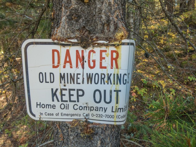
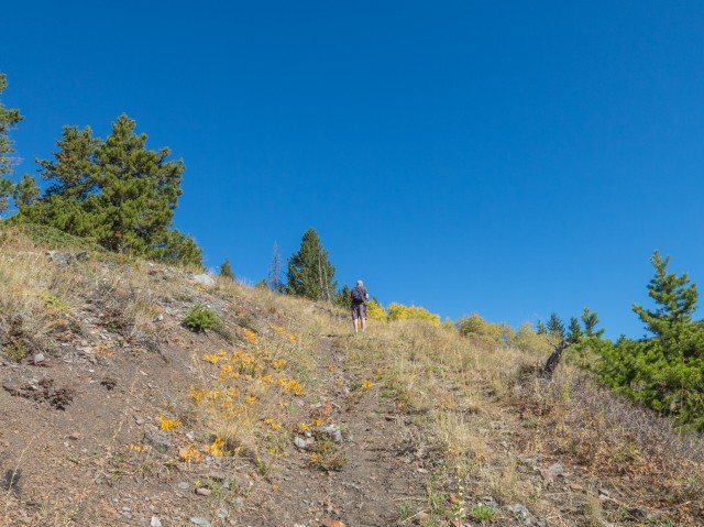
Heading roughly southeast-ish, you’ll meet up with a larger power transmission line. Where it dips down into a valley, head hard left following a ridge crest through the trees. This is the only bushwhacking you’ll do. Before long a road comes in from the left (which will be incorporated into your down route). Follow it right as it heads ever upwards. Along here, and all the way to the summit, watch for signs warning of dangerous mine workings. Specifically subsidence pits – these are slumped areas where a underground tunnel has collapsed creating a crater like depression on the surface. We tried photographing some, but they ended up looking just like the surrounding ground. Some are plainly visible from Google Earth however.
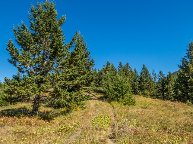
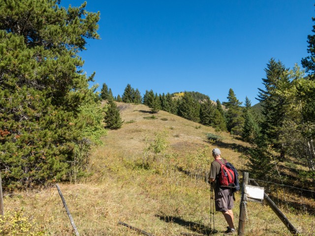
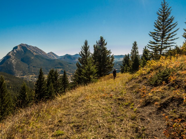
At a drift fence gate (always close them by the way), the route up reverts to more of a 4×4 or cat track. It’s here we get our first view of the summit, still a ways off. Up until now, the path up has mostly been gentle, but from here to the summit, there will occasional steep parts. Nothing too bad though.
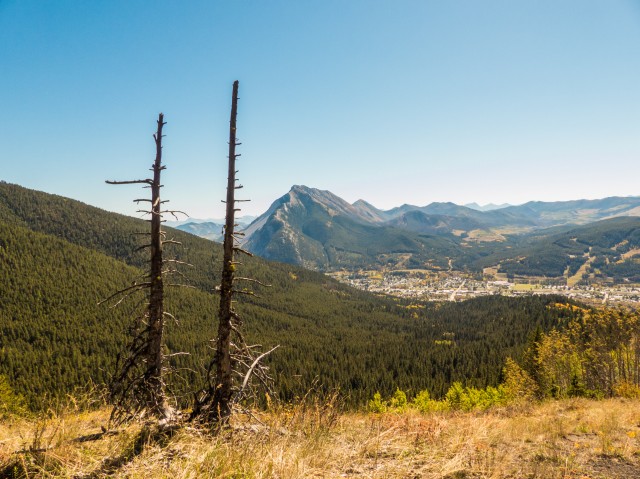
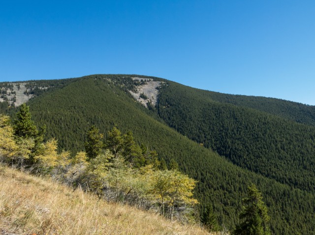
The forest starts to thin as you go up and up and up. To the west, northwest and south the views are good. Trees block you from seeing anything in the north. Bluff Mountain (sometimes called Goat Mountain) blocks the view in the east.
As you gain height you’ll see lots of side roads (tracks) splitting of from the one you’re on. Ignore them and just continue up the ridge crest. In places you’ll pass more mining artifacts – foundations, piles of wood planks, bricks and the like, plus a section of the old tramway, including a guide wheel and cables.
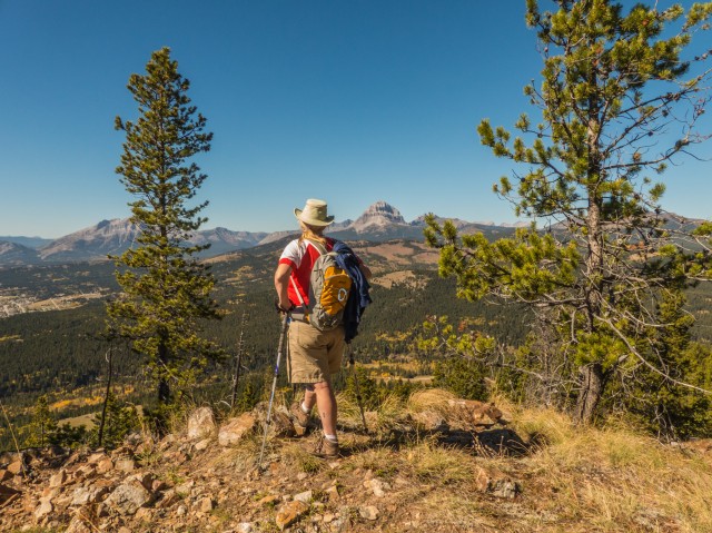
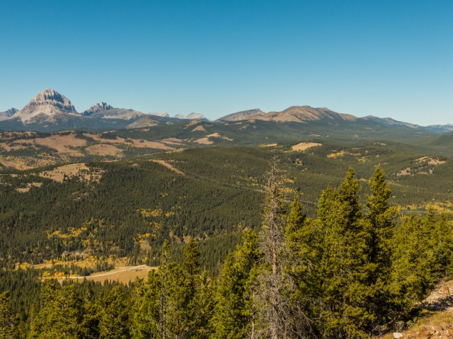
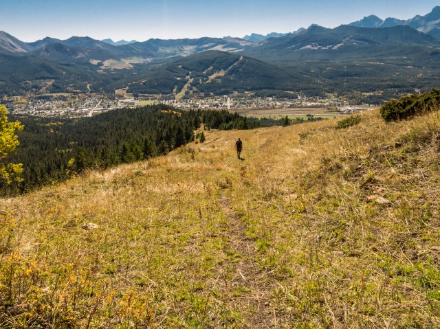
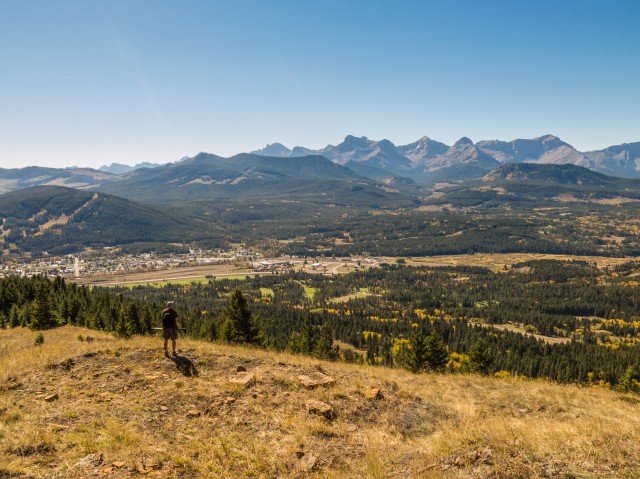
Before long you’re at the summit. Hooray! Hills, ridges and peaks of note seen from here include Turtle Mountain (we’ve climbed it), Mounts Coulthard, Parrish and McLaren and Andy Good and Chinook Peaks in the south and southwest. Directly west we can see Sentry Mountain, the Crowsnest Radio Tower on Crowsnest Ridge and the twin summits of Mount Tecumseh and Phillipps Peak. Also seen is Crowsnest Mountain, the area’s most recognizable peak and in front the modest sized Wedge Mountain. To the northwest are lots of rolling ridges including McGillivray Ridge and Mesa Butte. A number of those mentioned here are on our to-do list.
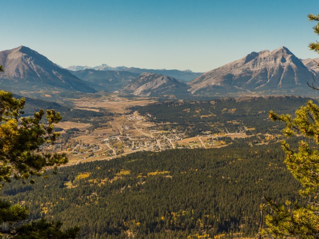
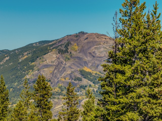
Also seen from Greenhill Mine Ridge are the towns of Blairmore and Coleman, the region’s small ski hill, the Crowsnest River and a number of lakes off to the west. The old Coleman Collieries surface plant can also be spotted – recall coal mining was once big in the area…and it could be again (read on). To the north and partially hidden by trees, we see the old Grassy Mountain (surface) Mine, which operated in the 1940s and 50s, and today is being reevaluated. It may reopen, which if it does, would make it the first coal mine to operate in the Pass since the Tent Mountain Mine closed in the early 1980s.
Take time for some lunch, we always do, and enjoy the vistas. To head back follow the same route to the point where you earlier intercepted the one road while bushwhacking. Turn hard right here, passing a subsidence pit, and head in a roughly northwesterly direction.
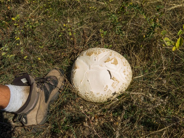
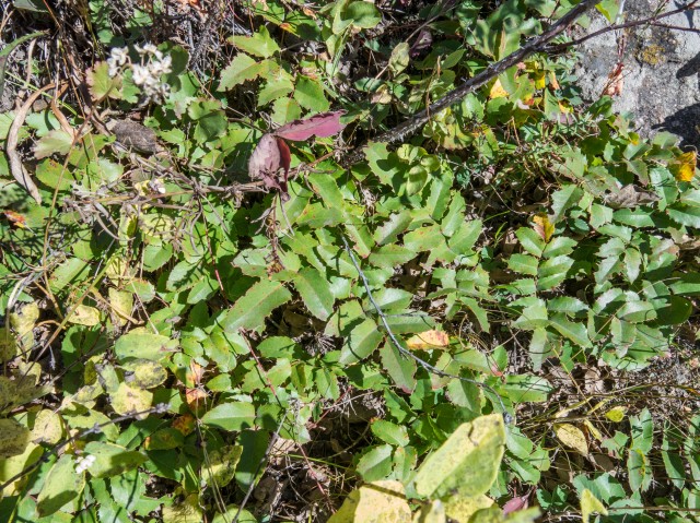
At a clearing we found a giant puffball the size of which we’ve never seen before. It was huge! Also seen here is the plant Oregon Grape (I mistakenly called it Holly earlier, thanks RyanE), which based on our own rather lackadaisical observations, is not the most common plant out there. At least around here anyway.
The road zigs left. Under the transmission lines you’ll find two large bull wheels, the foundation of a tram tower, spools of cable and other mining relics. The hoist house you visited earlier can be seen directly below. I’ve been told another mine entry was located here, but I couldn’t seem to find any evidence of it.
The road heads down and soon reconnects with the path you can up on. From there it’s a short walk back to the car.
If you like easy ridge walks and mining history and nice views, this trip is for you. While it appears in one hiking guide, it does not look like many people hike Greenhill Mine Ridge (there wasn’t even a summit cairn). So it’s a nice one if you like solitude or places off the beaten path. We love hiking these more obscure routes!
Check out these similarly themed posts…
Sunken (Lost) Creek to Dibble Mine.
One Mine Ridge.
Having a gas on Mt Gass.
If you wish more information on this trail, by all means contact us!
Date of adventure: September, 2014.
Location: Crowsnest Pass, AB.
Distance: 6.5km there and back.
Height gain maximum: 420m.
Height gain cumulative: 420m.
NOTE: all heights and distances are approximate.
Reference: Hiking the Historic Crowsnest Pass, by Jane Ross and William Tracy.
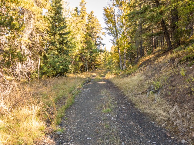
We start off on this old road.
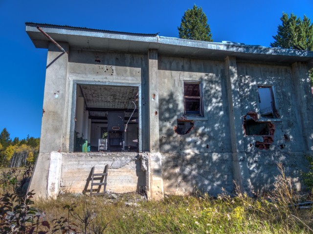
The hoist house for the upper Greenhill Mine.
The operation closed in the 1950s.
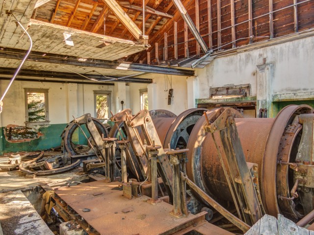
The hoist drums.
Remains of the driving motor on left.
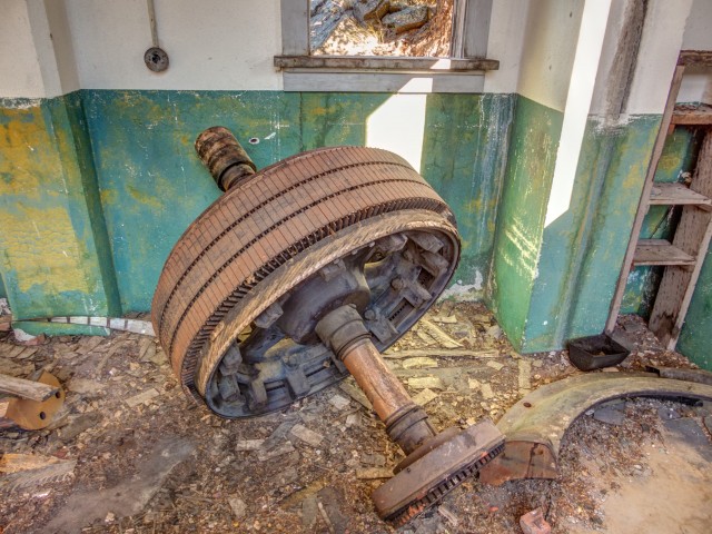
A motor rotor (say that ten times fast).
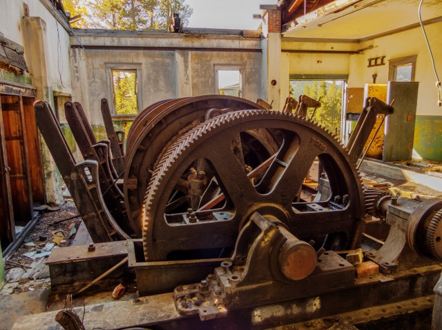
A huge gear.
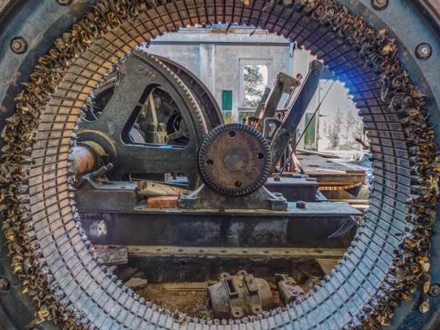
An attempt at being creative.
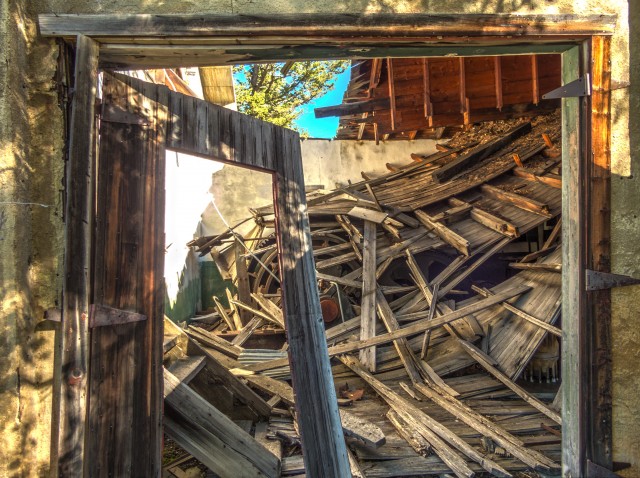
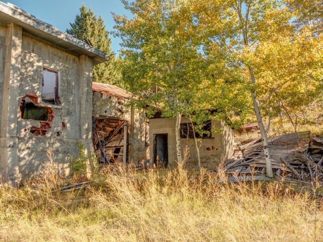
In another part of the building the roof has collapsed.
Underneath the debris.
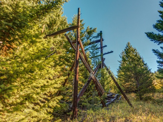
Supports for the old power line.
The hoist sits at the bottom of Greenhill Mine Ridge.
Backtracking a bit, we take the left fork here.
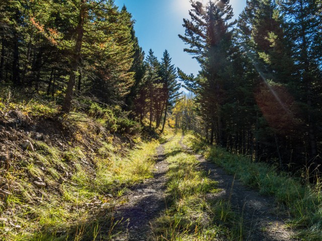
Most of the hike was along old roads like this, or 4×4 tracks.
Coal cars at one of the upper workings.
These have been rotting away here for many decades.
Some foundations were found in the bush.
These warn of dangerous subsidence pits.
Heading up.
The summit can be seen right of centre.
The going is sometimes steep, but always pleasant.
Remains of a cableway, almost at the summit.
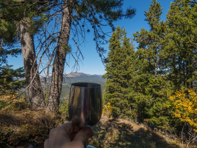
Time for wine!
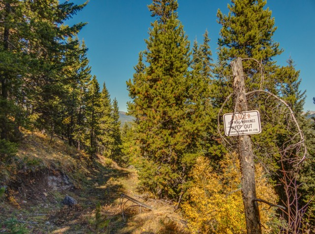
More warning signs.
Connie checks out Crowsnest Mountain.
We been up Crowsnest Ridge (bump in centre).
Many other hills and ridges begging to be explored.
The old Grassy Mountain coal mine in the north may reopen.
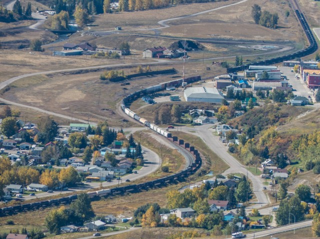
A train passes the remains of the Coleman Collieries plant (top centre and left).
Turtle Mountain in back.
Bluff Mountain to the east.
Heading back down.
Nice views to the southwest.
On an old 4×4 track.
The biggest puffball we’ve ever seen (that’s a size 12 boot).
A small patch of Oregon Grape.
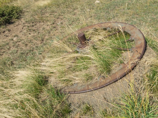
A bull wheel from the cableway system.
Tram tower remains.
Almost back down.
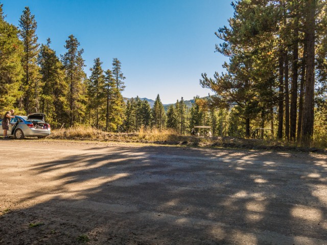
We parked next to the Crowsnest Pass golf course (note the cart roof).
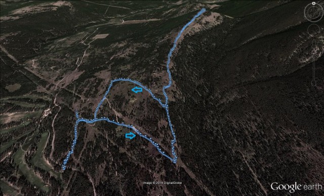
Our route…


I really appreciate your photographic and textual capture of the area history. Really nice!
The warning signs posted by Home Oil Company Ltd, however, leave me a bit confused. According to online archival material posted by the Glenbow Museum:
“Major James Lowery, who came to Alberta from Ontario in 1905, founded Home Oil Company in 1925, to drill for oil in the Turner Valley oilfields. By 1945 he had built it into the largest independent company in Canada. Robert Arthur Brown Jr., 1914-1972, owner of Federated Petroleums, successfully gained control of Home Oil by secretly buying its shares in 1950 and 1951. In 1955 Home Oil and Federated Petroleums amalgamated, with Brown as president. Extensive exploration was undertaken and a major oilfield was discovered in the Swan Hills. Home Oil also became a major stock holder of Trans-Canada Pipelines. Brown was a founder of the Independent Petroleum Association of Canada. In 1966 Home Oil discovered gas in Yorkshire, England, and in 1968 invested heavily in Alaskan oil stocks. The Alaskan investment did not pay off and resulted in near-bankruptcy for the company. In 1971 Consumers’ Gas of Toronto took over Home Oil although Brown remained chief executive until his death.”
I am not aware that Home Oil was involved in coal exploration or mining?
Thanks for taking the time to browse our website. Cool history lesson! Many oil firms took an interest in coal mining either directly or via a subsidiary. It was a natural extension of what they did. Looking at old records, other notable petroleum companies also held an interest in the Pass over the years. Home Oil, it seems, never mined but just held an option on the old Western Canada Collieries lands.
Awesome machinery!
The hills in the Crowsnest are dotted with old mining gear.
Sunny Bou’s website shows he and Bob Spirko did this trip recently. They took a slightly different route, and mention yours, which I actually prefer based on your photographs, travels through posted private property. Our club would like to do the ridge this spring but don’t want to trespass.
We did not see any no trespassing signage via our route. We did pass through a couple barbed-wire fence gates but these only had signs asking that it be closed properly and that stock may running wild be in the area. We feel it important to respect land owner’s wishes and if we see a sign saying no entry, we don’t go. It’s that simple. All explorers should do the same.
Great photos! Another one that I will have to explore before it’s gone. By “holly” do you mean Oregon Grape? It is much more common in the Kootenays. I don’t see it much in Alberta.
Oh, you are right, Oregon Grape. I have no idea what I was thinking there. Fixed it, thanks.
Haha, you bring wine. I bring a beer every time I hike a mountain and when I go other to cool places. We think alike.
Sometimes we bring beer too!
quite enjoyed this, wish that is how I was spending my day
It’s quite the nice hike.
I want to tell you Chris and Connie, you’re some pretty damn good photographers.
Beautiful country you live in.
Thanks, we try hard at it but always remember to keep it fun too.
Those photos are fantastic!
They did turn out well.
A very interesting selection of shots. It must be 20 years since I explored that coal mining site. It looks like the vandals have been there more recently and messed around
Yes, vandals have done their part. In the hoist building the big ol’ motor has been torn apart for one by them. The roof is also collapsing, but that’s due to age I guess.