
Barrier Lake Lookout
The hiking trail heading up to the Barrier Lake Lookout is often the first route in Kananaskis with some elevation to come into season in the spring. While snow often blankets other peaks, this small mountain is usually snow free by May, or at least mostly snow free. As a result it’s a good early season conditioner and we’ve been up it many times.
A lot of people bash this trail, but I find it likable. Even in spite of the often monotonous fire road and the large crowds that are seen on the weekends. Actually, once you get past the repeater station view point, about two thirds up, the crowds thin out quick and for the last bit of elevation you rarely share the trail with anyone. Often your only company at the top is the fire spotter, assuming they are available to chat (and they often aren’t when on duty).
The start of this adventure is the at the Barrier Lake dam day use area on Highway 40, less than 10km south of the Trans Canada Highway. The parking lot is often busy, so finding a spot for your car can be a challenge.
Head across the dam and if you are lucky, there won’t be a cold wind blowing. We’re never that fortunate and even in summer the wind down the valley can be quite chilling and it makes this section of the hike seem awfully long.
At the power line right of way continue heading west. If you go left (south) you will meet up with the Stoney trail – named after a First Nation’s fellow and not after the rocks found along the trail, although there are those too. Heading up, soon you’ll come to another junction, a four way. Head up here.
The trail here is a fairly mundane thing and there is nothing exciting, nor challenging, but it is a good workout. Climbing steadily, but never too steep, the trail switchbacks a number of times. At the junction with another trail, coming in from the right, the route turns hard north.
The trail is much steeper on this section and it heads up to an open meadow, where you have your first views. This spot is where the old Pigeon Fire Lookout once stood. Long gone and superseded by the newer lookout that is your objective, head past here leaving the old horse trail behind. These animals were formerly used these to bring supplies into those working at these lofty structures.
Heading very steeply now, the path braids a bit and then heads up a minor rock band. There are lots of steps and hand holds but if the trail is wet this can section can be quite slippery. There are lots of roots here to trip over too.
Just past this hard section is a radio repeater station, or as I often hear it called, the drive in movie screen. I’m still not completely sure how it works. Just beyond is a nice lookout point on the top of some cliffs. There are nice views of Mt Baldy to the east, Barrier Lake below and many more peaks to the south. To the north, there are lowly treed ridges and hills. Oddly, many people turn around here. Perhaps they run out of steam or they just don’t know that a little bit higher up even better things await.
To continue on, go around the back side of the big screen and head roughly west, avoiding some large fissures in the bedrock. The trail is faint in places but soon becomes more distinct. On this final section it often braids too, but no matter which path you choose, you’ll always be heading in the right direction.
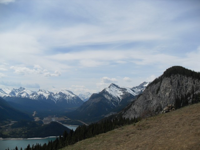
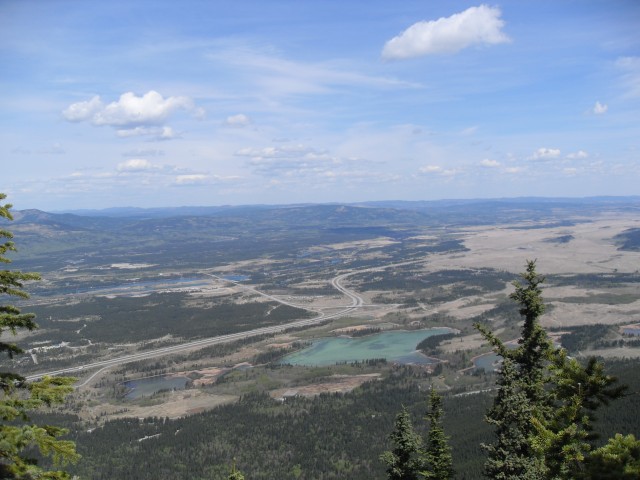
Leaving the crowds behind, and always heading up, it’s not long before we are at the current lookout. There are great vistas to the north and Mt Yamnuska is the most obvious peak across from you. Below there is the busy Trans Canada Highway, the CPR railway mainline and the Bow River. To the east are the plains and the west, lots and lots of big, barren mountains.
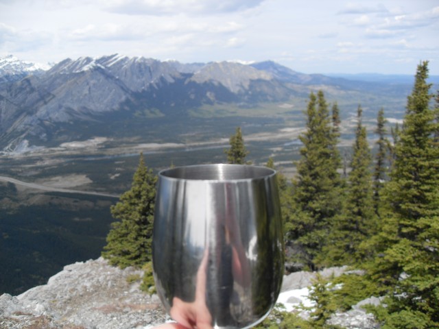
Those people who go this far often turn around at the helicopter pad, but if you go a bit further west the views are even better. That is if the fog has not rolled in – it often does on this trail – or at least the times we’ve been on it. This day however, were were treated with a wonderful blue sky.
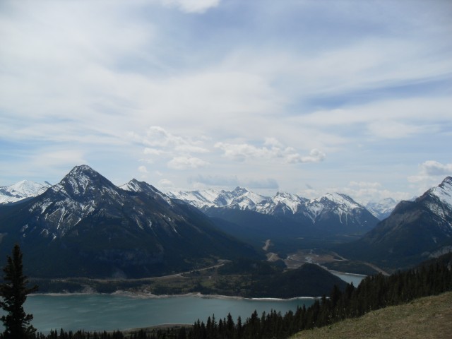
From out lofty perch, we could make out the usual suspects to the west, Grotto Mountain, The Three Sisters, Pigeon Mountain, Wind Ridge (we’ve visited both), and many others. Below is the small unofficially named Biffy Mountain so called because of the outhouse like structure that sits on top.
Enjoying the solute, we have lunch and soak up the views. On the way down, pass the many (often unprepared) people heading up.
The summit on which the lookout sits is called Yates Mountain, although I have never heard anyone refer to it by that name. Most seem to call it the Barrier Lake Lookout Mountain, or Barrier Lake Mountain or something like that. Further adding to the confusion, a connecting ridge off the mountain is known as McConnell Ridge, a name which also seems be used to refer the mountains as a whole. More confusion still – Barrier Lake can not be clearly seen from the Barrier Lake Lookout. But wait there is more – Pigeon Lookout, mentioned earlier, was never located on Pigeon Mountain, which sits nearby, but instead was on the mountain we just climbed.
To see some other high places we’ve visited, follow these links…
Sandy McNabb XC ski trails to Pine Ridge.
Moose Mountain.
Picklejar Ridge.
This one…
Beachwood Estates.
If you wish more information on this trail, by all means contact us!
Date of adventure: May 2010
Location: Kananaskis AB, Bow Valley area.
Distance: 12km return.
Height gain from start: 680m.according to my GPS – on other trip reports I have seen anywhere from 600-750m and everything in between.
Height gain cumulative: 680m.
Technical bits: None.
Notes: Bikes on the trail, keep a watch for ones coming down. The trail is steep and bikes fly down.
Reference: Kananaskis Trail Guides by the Dafferns.
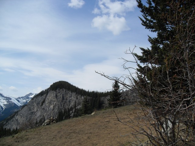
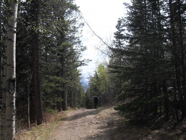
After the mundane viewless fire road, this is a welcome sight.
At the old Pigeon Fire Lookout location.
Barrier Lake and Baldy Mountain.
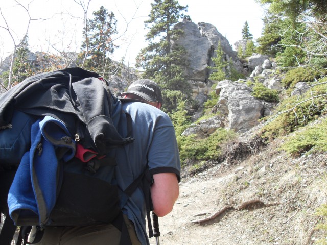
Up we go! This is the steepest part of the trail.
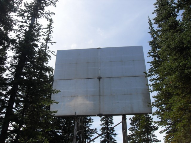
Odd place for a drive in movie screen – actually a radio repeater.
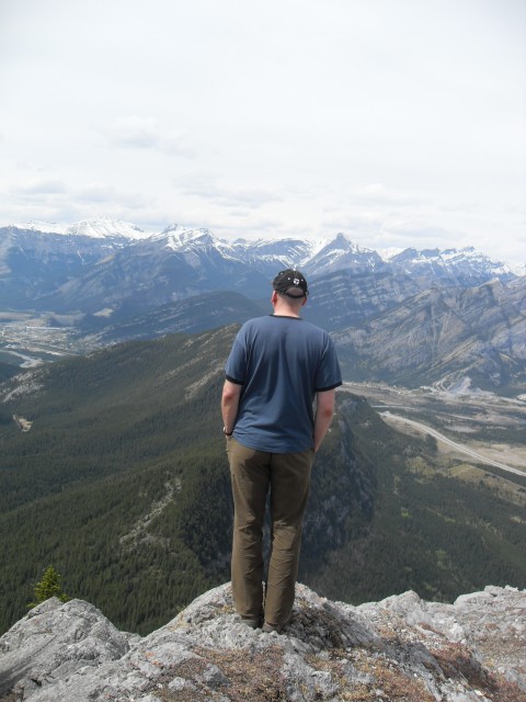
The view from “Yates Mountain”.
Looking north across the Bow Valley and the Trans Canada highway.
Looking west with the small Biffy Mountain directly in front.
The unremarkable trail when heading down.


")

")


This is a fun hike. The kids and I have made it part way up before getting as far as the the rocky outcropping overlooking Barrier Lake. We did not know you could go higher still and we’ll have to do that next time.
Access to Barrier Lake Lookout is, I believe, still limited due to that nasty flooding this spring. You may have to postpone your trip up until next year.
One of our favorite hikes, we did this last week. We snuck in by biking from the Rafter 6 Ranch, and then hiked up the normal route. Access from the dam is closed so this was the only way in.
We’ve done it three times and we like it lot. Since access is limited you must have had the place to yourself. I’ve never seen it quiet there.
I haven’t done this hike but it sounds like the perfect one to take my Dutch visitors on next summer. Thanks for the idea!