Even in winter months, we still get out and hike. More times than not we stay in town, but given there are a huge number of public pathways to choose from in this fair city, this works out well. Often though, these types of outings are rather dull and mundane affairs, at least from a stand point of sharing them with others, and as such we don’t document them all.
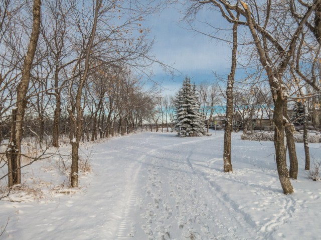
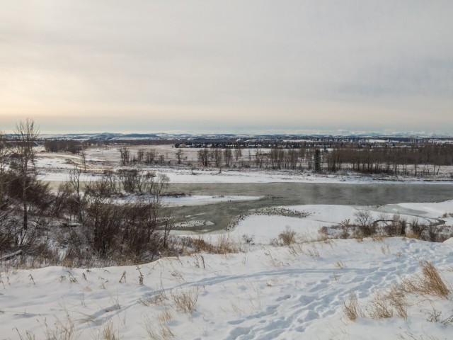
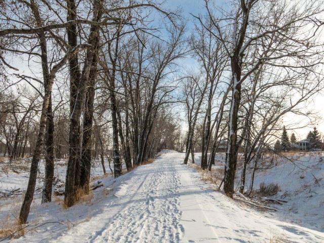
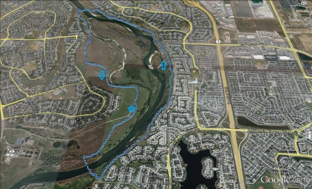
Today we’re visiting the eastern fringes of Fish Creek Provincial Park and some other nearby green spaces. We’ll be paralleling the Bow River the whole time, heading up one side and back on the other. While there are many possible entry points we’ll start near the community of Deer Run. On this trip, we’ll pass through wooded areas and open treeless flood plains and at times it’s hard to believe we’re in the city. None the less, this is an urban hike.
That’s one thing we like about Calgary, you can often escape the city in the city.
↓ ↓ ↓ ↓ Scroll down for photos or to comment ↓ ↓ ↓ ↓
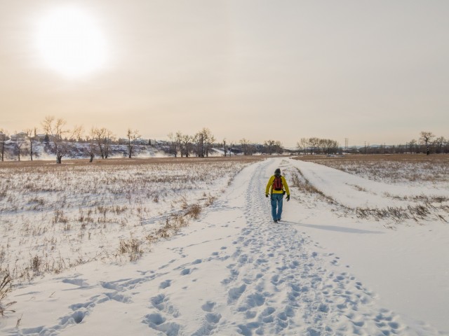
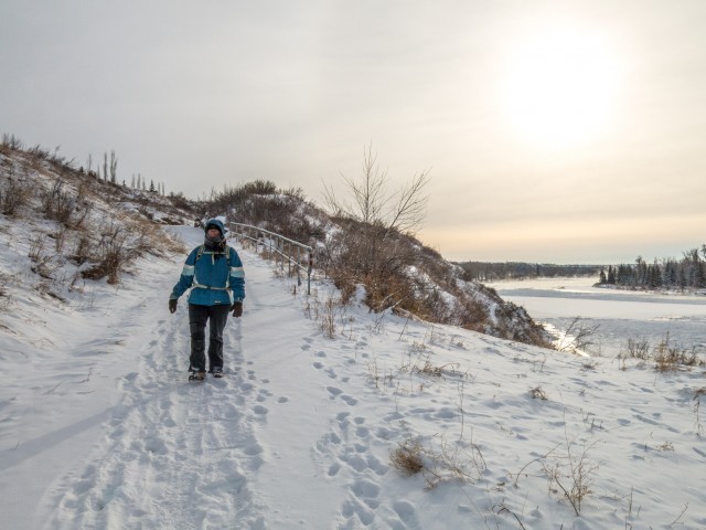
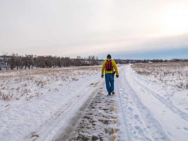
This day it was a balmy -21c before the windchill was factored in. Brrrrrr! Regardless of the temperature, we get out. Lots of layers and a steaming thermos of hot chocolate always help on trips like this.
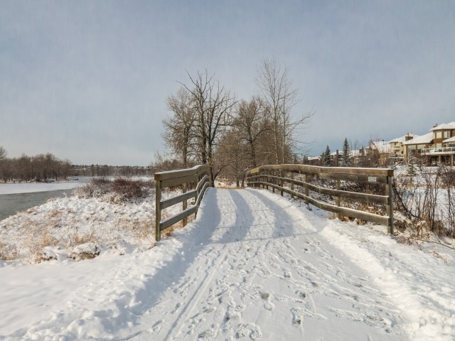
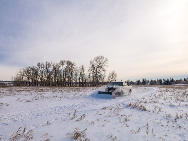
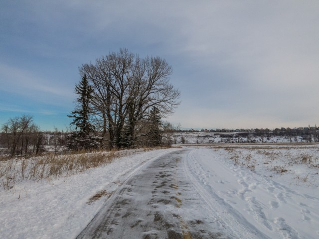
From the parking lot, we take the paved path heading south and towards the river. There was still snow on the ground from the previous night, but it was not a problem. Many of the paths we’ll take, but not all, get cleared and near the end of our journey we’d pass a plow truck.
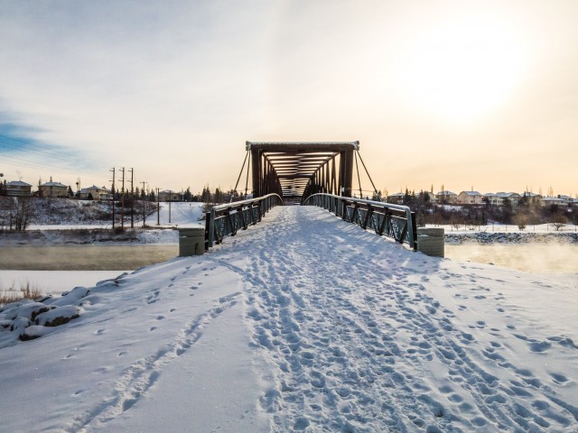
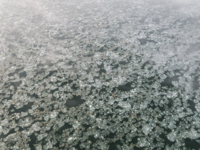
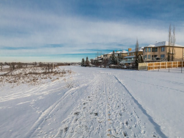
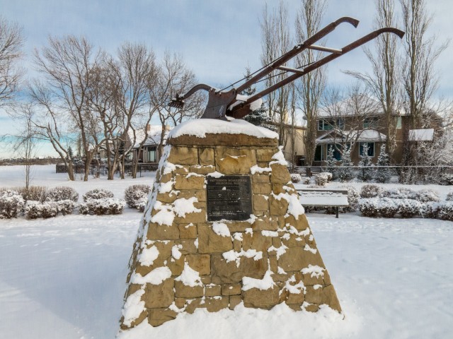
Coming to a pedestrian bridge, we cross over the steaming waters, then quickly zig-zag up a high escarpment and on topping out head left (north). For the next kilometre or two, we’ll pass behind many houses. Except at one point that is, where there is a clearing, which was at one time the site of an old homestead. This was the Patterson Farm, which operated for many years, up until the 1970s, back when the land here was actually quite rural and well away from the city.
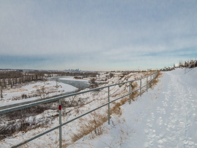
This section is technically not in Fish Creek Park but we can always see it across the Bow River.
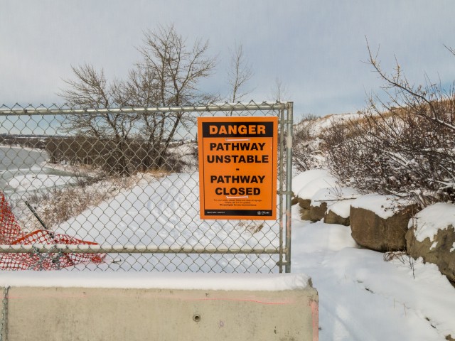
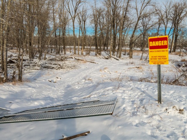
In places, the pathway has sustained some damage, sections have slumped a bit, which we have to detour around. A nearby roadway acts as a bypass route.
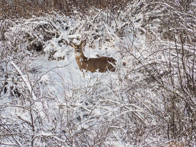
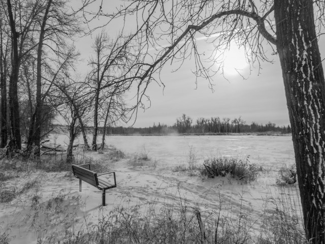
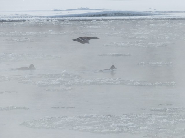
Dropping down to a wooded flat, we spot a couple deer nearby. It’s amazing how much wildlife there is in Calgary. Earlier we saw coyote (too quick to photograph), and later lots and lots of birds, including an eagle, a pheasant (both also too fast to capture) and a huge number of ducks and geese and other waterfowl. We catch a quick lunch in the trees here. This section of green space is called Douglasbank Park.
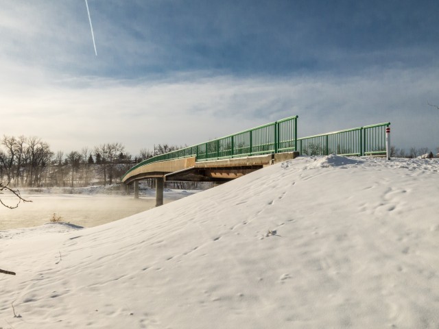
We come to another foot bridge. It was only recently repaired, after sustaining a good deal of damage during the spring 2013 floods. The approaches got washed away.
After crossing it we turn left again (south). We see signs of flood damage here, undercut drainage culverts, lots of debris, fallen trees and so on, a year and a half after that awful event happened. It’ll take time to fix that mess.
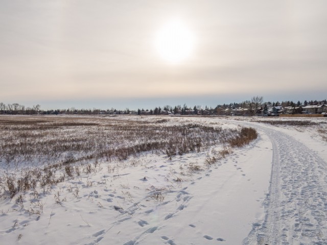
The next section is quite flat and mostly devoid of trees. As such the wind can be nasty here and at times it blew very hard. For the next little bit, the path is well away from the river.
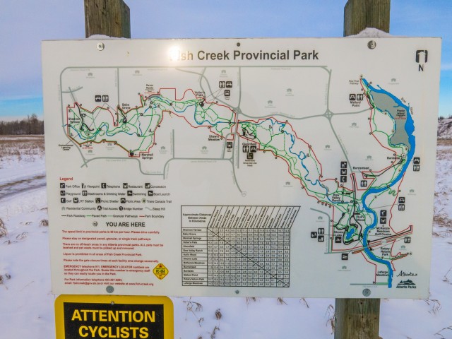
In no time we’re back at the car. It was not a long trip, our GPS said nine kilometres, while a map sign listed it as about seven. The last section we hiked is part of the TransCanada trail system. Again, this was not terribly exciting adventure, but as anglers are heard to say “the worst day fishing is better than the best day working” and the same holds true for what we do. We had fun, we always do. And the exercise is most welcome.
Fish Creek Park, and Calgary as a whole, has a huge network of walking trails and pathways. There is enough to keep one busy for a long, long time. We’re lucky in that respects.
If you wish more information on this trail, by all means contact us!
Date of adventure: January, 2015. Location: Calgary, AB. Distance: Our GPS said 9km, the park map, 7km. Height gain cumulative: >100m. NOTE: all heights and distances are approximate.
You guys walked pretty close to our Sanderson condominium development! Judging by your Google map reference you were not far away! Looks like an cold day. Great writeup!
This central Alberta racetrack was never a commercial operation but instead just a fun place for car enthusiasts in the area to get together. Early '70s or thereabouts and it only lasted a few years. Even thought it's been abandoned for that long, there is no doubt what was here.
You know we like the the obscure stuff and this one fits the bill perfectly. Found by accident while backroad cruising and the history comes thanks to local car guy Mike.
Exploring history with Off the Beaten Path with Chris & Connie. Photo: 2022. Posted by Connie.
On top of little Myrtle Mountain in the Kimberley (BC) Nature Park.
There's some good wilderness fun to be had here and nice views as you can see, but the real reason we came is mining history. The whole area near the ski hill was extensively worked over a century ago and we were looking for evidence of this. We didn't find much in the area searched, but it's a big chunk of property and we hope to return to cover more ground again soon. Of all the subjects we cover, mining related is a favourite.
Still, it was a good hike and that can't be bad. Look to the comments for more info 👇.
Exploring nature and history with Off the Beaten Path with Chris & Connie. Photo: 2022. Posted by Connie.
It's a strange curiosity in south Kananaskis, there on a hillside and we have no idea who created it. We asked around and no one's completely sure about its history. In the past it showed the Canada 100 logo from 1967 but in 2017 someone changed it to reflect the country's 150th.
That's our friend Emily from DanOCan.com having a look.
Exploring history with Off the Beaten Path with Chris & Connie. Photo: 2017. Posted by Connie.
April 13th 2024, the Beer Parlour Project visited the Viking Hotel, Viking Alberta and it too was an awesome time. There's Rob Pohl with his curious view camera and in the other photo Chris is seen interviewing local character Doug.
The Viking dates back to the 1930s and replaced a hotel on this same lot, which had earlier burned down.
Incidentally April 13th is also Chris and my 28th anniversary. Chris said he forgot this when scheduling this but that's fine and it doesn't matter where we celebrate but that we celebrate.
Exploring history with Off the Beaten Path with Chris & Connie. Photo: 2024. Posted by Connie.
April 12th 2024, the Beer Parlour Project visited the Warspite Hotel, Warspite Alberta and it was a great success. They put up our sticker and look for it if you ever drop by. This will be another chapter in what will be a multi-year adventure documenting small town hotels all over the west. We chat with owners, patrons, old timers, local characters and we learn about the building too.
It's believed this one is 100 years old in 2024 and we'll confirm details during the research phase done later.
When we're done we'll have a huge collection of digital and film photos, plus voice recorded interviews for an art exhibit and a book is likely.
Exploring history with Off the Beaten Path with Chris & Connie. Photo: 2024. Posted by Connie.
This little stone house was built in the 1910s and while it's not exactly clear when last occupied, research suggests it was empty only a couple decades later. This is a dry area of the Alberta and most settlers moved out by the '30s. Trees in back were planted by the folks that lived here and there's no others around as far as the eye can see. In fact, there's nothing but natural prairie in every direction. When the word "remote" comes up, this is the place they're speaking of.
Look to the comments for more info and to see a stone smokehouse also on the property 👇
Exploring history with Off the Beaten Path with Chris & Connie. Photo: 2017. Posted by Connie.


")


You guys walked pretty close to our Sanderson condominium development! Judging by your Google map reference you were not far away! Looks like an cold day. Great writeup!
Your company seems to have a lot of projects on the go. It was cold, but we’re tough (and a bit crazy).