
Prospector (a plan B hike)
This was a plan “B” hike, quickly decided upon given our original goal, a modest sized hill/mountain would soon be surrounded by clouds and likely covered in snow due to ever worsening weather conditions. Better stay low, and better avoid any steep slopes. We didn’t know this when heading out, but we knew it on arriving.
Let’s make the best of it…
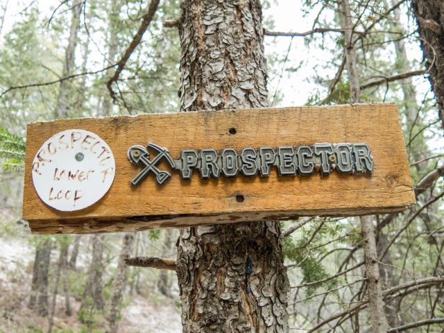
Goodbye Exshaw Mountain, hello to Prospector, a trail really suited more for mountain bikes, but since we’re in the area anyway and we’re looking for something to do, what the heck, we’ll hike it. We didn’t think we’ll see any bikes this early in the season anyway (turns out we were sort of wrong), but even so we’re mindful of their possible approach. It’s their playground. This trail runs below Exshaw Mountain and later Exshaw Ridge.
This trail is nothing exciting, nor will likely come with glowing recommendations, but if you’re in the area and want something quick and easy to do, and it’s not peak biking season, it’s a pleasant enough jaunt, and at worst, a good workout. That’s how we look at it. No matter the trail, no mater how exciting or not, have fun!
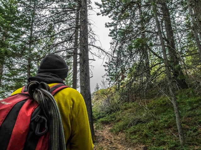
To start, find the gravel parking lot right in town just off the highway to the north of the store on the west side of Exshaw Creek, an often dry water course. Cross the bridge – not that it’s needed this day, there is nothing flowing – and head east towards the base of Exshaw Mountain using a trail and later a residential street. After the last house on the left, head up (cairn of sorts), some times steeply, on the obvious tail.
Had we wished to continue on to Exshaw Mountain we’d simply go straight up from here – there is no trail but the way is obvious. It’ll have to wait for another day.
The trail now undulates in a northerly direction. The going is nice and easy with some modest ups and downs here and there. At an opening in the trees, one of only a couple we’d have this day, we get a good look at the town and the huge cement plant in back. That operation is a noisy place and even deep in the trees, we’d often hear its drone. How do the residents, all of which live very close to this industrial giant, deal with the din? I’d go crazy. Further back, right above the smoke stacks, is Pigeon Mountain, a place we’ve been up and would like to return to. Check that report to see the cement plant and the huge quarry scar, from way up there.
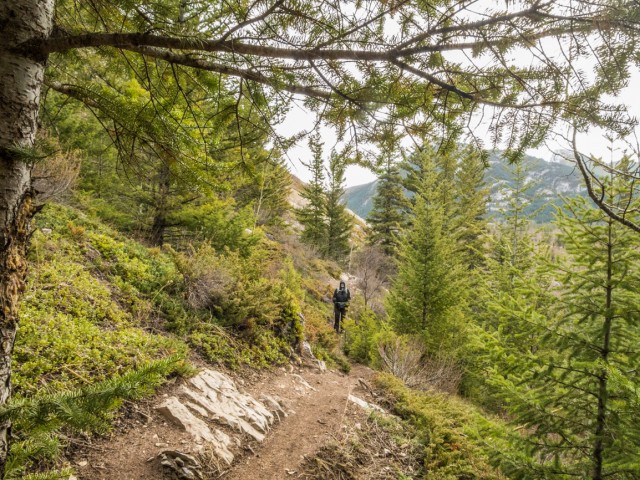
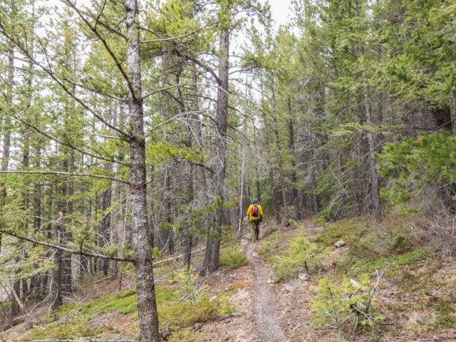
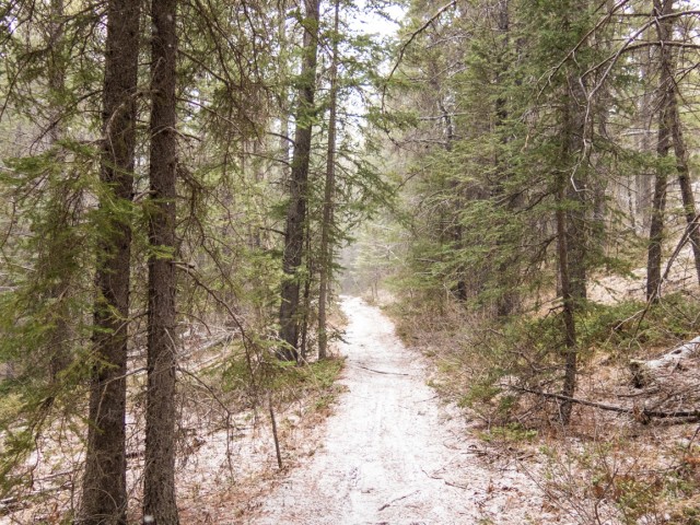
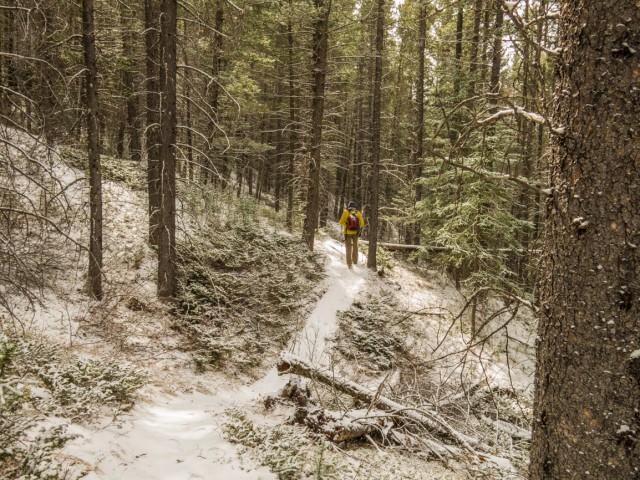
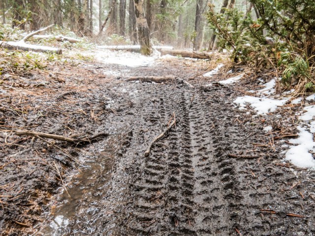
The trail crosses some bare rock slabs and for the most part levels out. Along here we see the first flowers of spring, Prairie Crocuses, a sure sign better weather is not far away. Plunging into the dense forest, trees are all we’ll see for many more kilometres to come. Every now and then we’d come across a mountain bike obstacle – remember this is their playground.
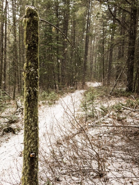
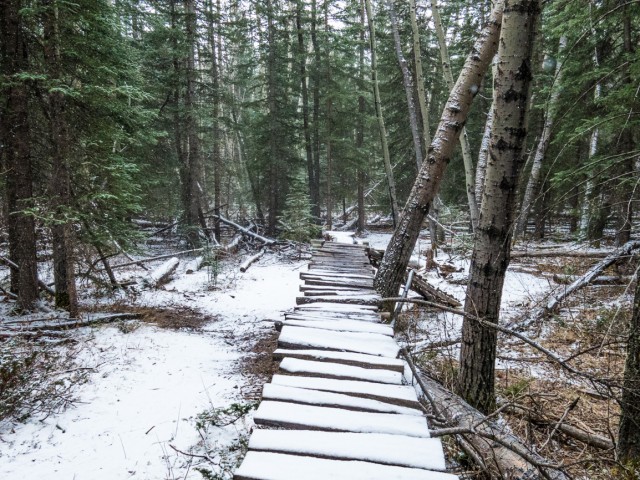
We come to a four way junction (signed – most are) and head shallow right. We pass a side trail, the access route for Exshaw Ridge and later some other junctions, all of which ignore – stay the course is the rule. The snow until now was only flurries, but it starts coming down harder. At times it’s almost a white out.
At a large drainage, the trail loops up and back upon itself. Along here are a few short steep sections that are slippery from the snow. We find a nice log to sit on and take time for lunch, which of course includes wine. There is always time for wine. For a brief moment the clouds open up and the sky turns blue. Then almost immediately it’s back to the snow.
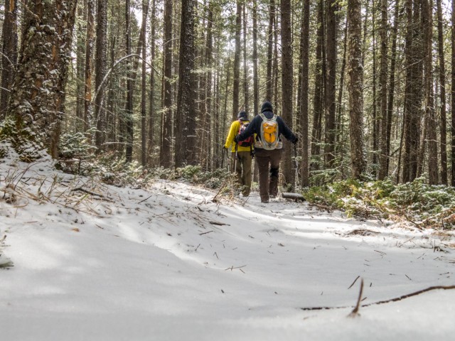
We soon join up with the trail we came in on, then not long after leave it, taking the obvious route heading down. Along here we see signs of bikes having passed recently, fresh tracks in the snow, but not the riders and their steeds themselves. Soon we’re at a power line right of way, the creek below us, the Lafarge Cement plant in clear view now, and a former hill, now flattened, where they quarry the limestone material needed by the operation, directly west of us.
Dropping down further to Exshaw Creek, we’re soon back in town. Evidence from the disastrous spring 2013 floods can be seen here – chewed up banks, lost of gravel and boulders spread everywhere and more recent flood mitigation efforts. In no time we’re back at the car. By our standards this was a short trip. It was over and we were only getting warmed up.
I would not recommend hiking Prospector Trail except when the potential for bike traffic is low (shoulder season, quiet weekdays). Even so keep an eye and ear open for them as they could be moving fast.
More exciting hikes can be found here…
South End of Lawson.
Headwall Lakes.
Windtower.
If you wish more information on this trail, by all means contact us!
Date of adventure: April, 2015.
Location: Exshaw, AB.
Distance: 8km round trip.
Height gain maximum: Did not record.
Height gain cumulative: estimate 100-150m.
NOTE: all heights and distances are approximate.
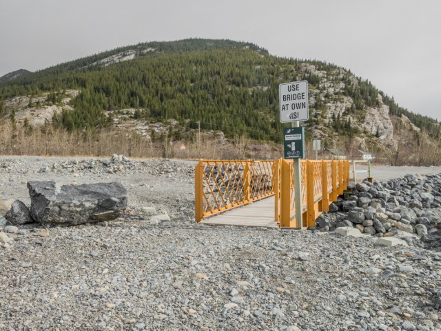
The bridge across the often dry Exshaw Creek.
Starting up.
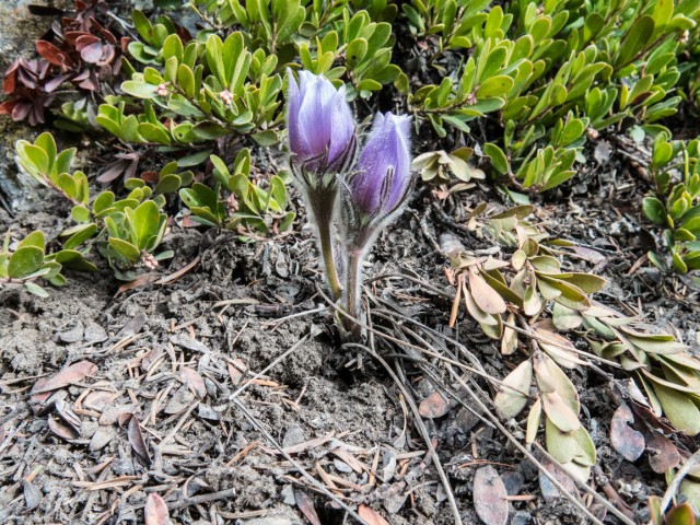
Prairie Crocus, the first flowers of spring.
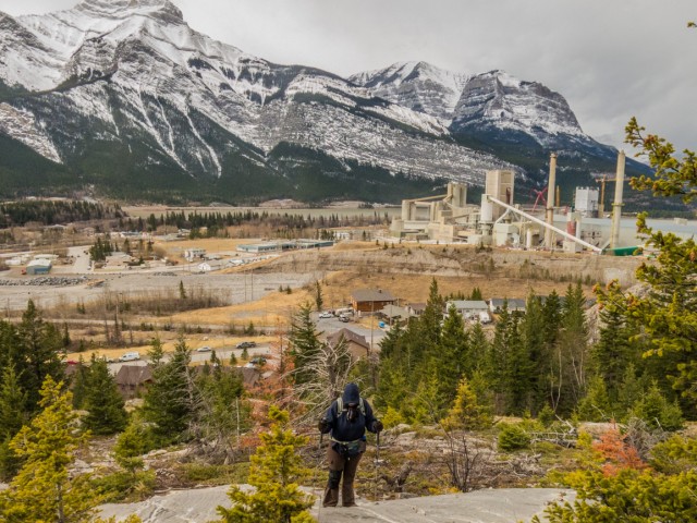
The town’s huge cement plant is seen in back.
A little more up, then things level out.
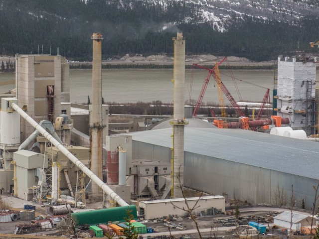
The plant is undergoing some sort of expansion, just as the economy hits the skids.
A pleasant section.
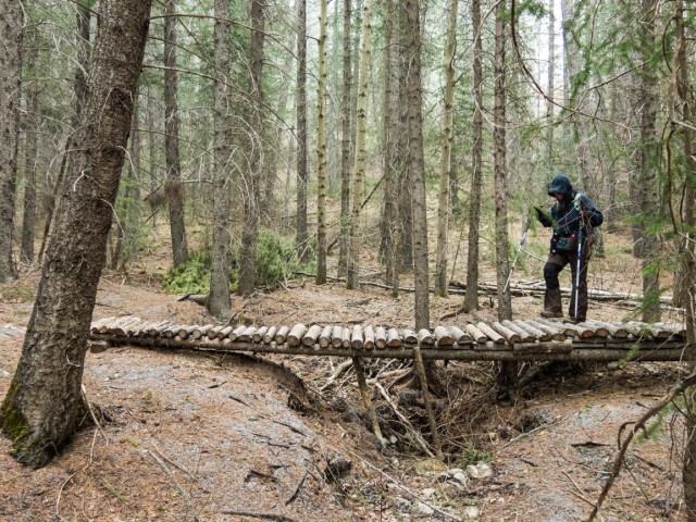
Crossing over.
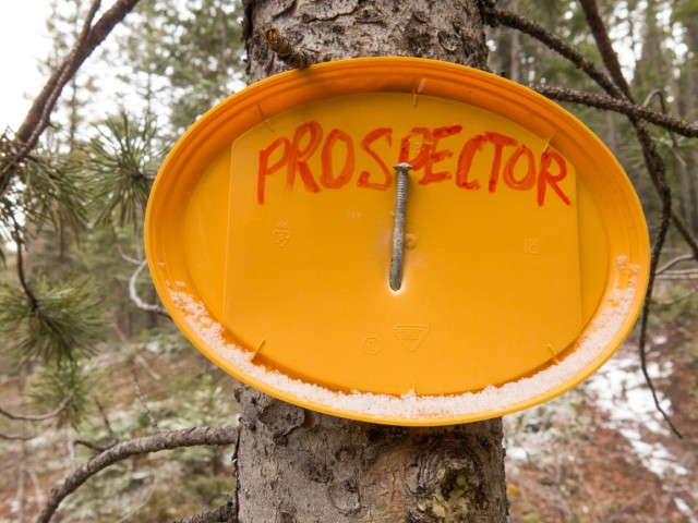
Many junctions are signed.
The snow starts…
The going is always easy.
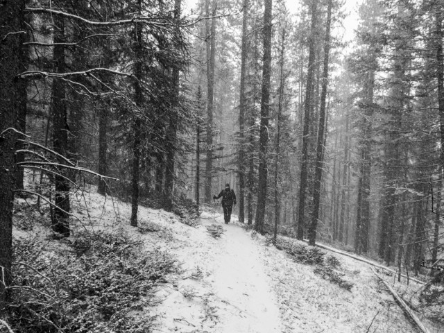
Now it’s a snow squall.
Even with the white stuff, it was a pleasant jaunt.
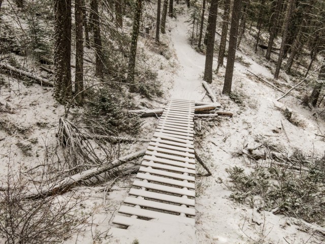
A spindly bridge over a gaping gorge.
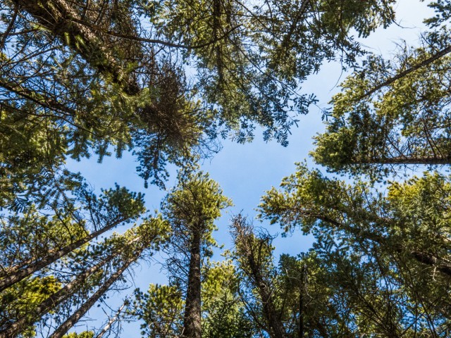
We’re rarely out of the trees.
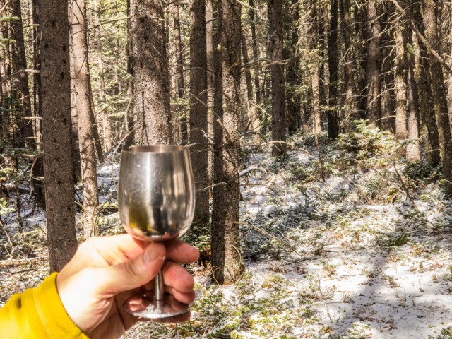
Time for wine!
For a brief moment there are blue skies.
We have company.
These obstacles remind us this is more a mountain bike trail than one for hiking.
Another junction.
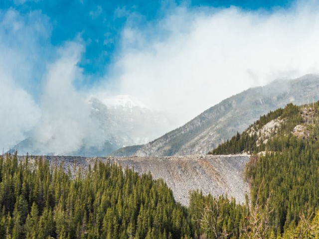
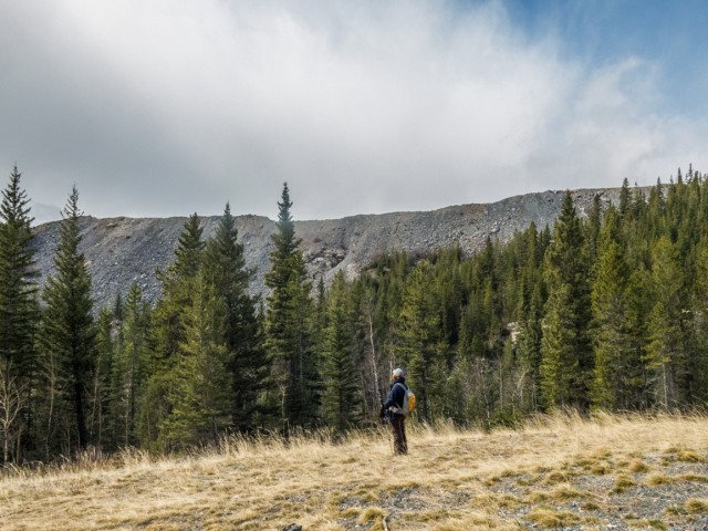
The cement quarry.
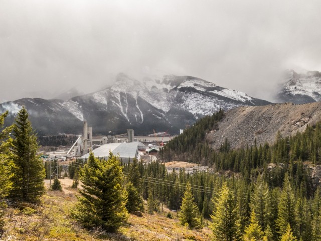
The plant comes back into view (we could hear it before we saw it).
The hill in behind has been flattened.
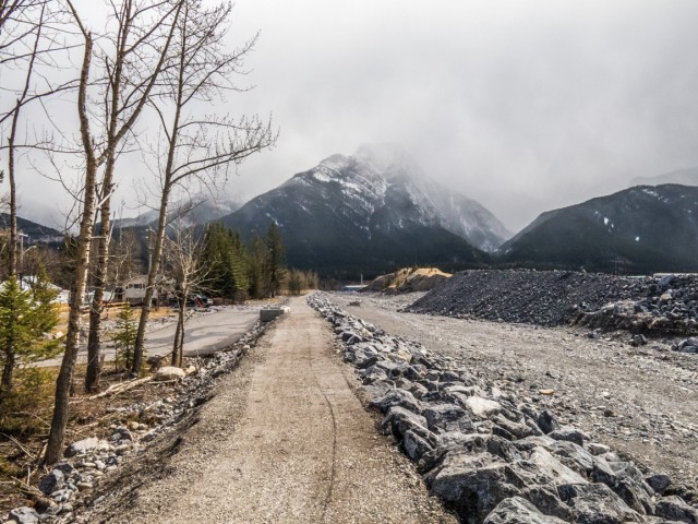
Exshaw Creek flooded badly in 2013.
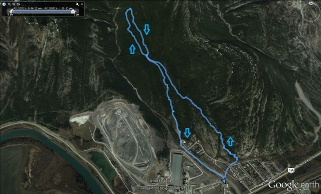
A circle-8 route of sorts. Note the quarry scars.


")


Thanks very interesting website!
Thanks, glad you like it and come back often!
Hello. Anyone know the current condition (Aug. 2015) of Prospector for mountain biking?
Thanks!
I spoke with some biking friends last evening and they say it’s in great shape. Hope this helps!
Thanks for the reply Chris. We had heard that there were some no trespassing signs or closed trails, therefore wanted to make sure.
Let us know if you hear anything else.
Thanks!
No one mentioned anything. Hopefully there are no problems.
We’ve been waiting for your first hike of the season. Nice!
Nothing spectacular, but still pleasant.