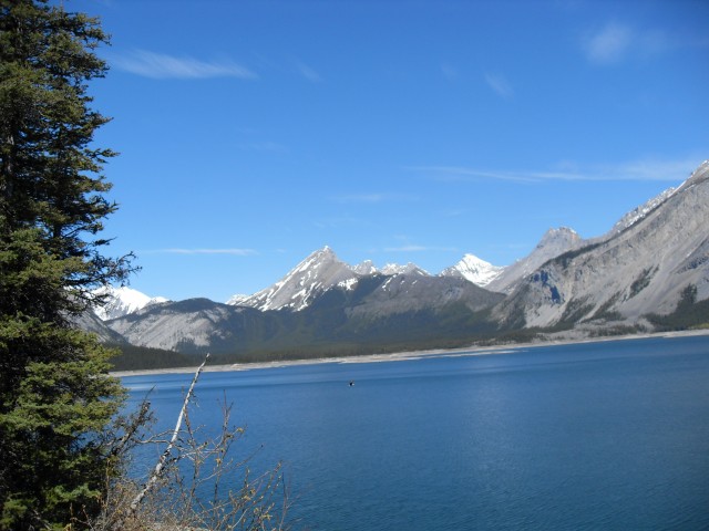
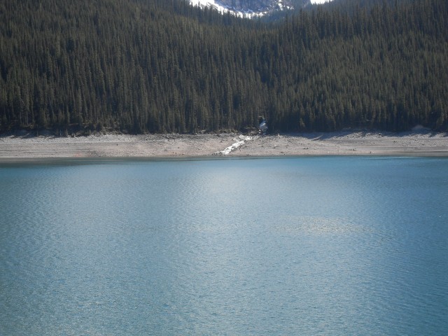
Upper Kananaskis Lake in the glorious summer
This trail in Peter Lougheed Provincial Park has much to offer, with cool and moist forests, towering peaks, an expansive rock garden and rewarding views into deep blue (or green) bays. And all these are yours for the taking simply by following a long but non-challenging trail around Upper Kananaskis Lake.
Connie and I have done this hike many times. This visit however, the light was cooperating with us giving stunning colours to the pictures we’d take.
You can start the trail from many locations, but we prefer to begin from the south parking lot and go clockwise.
The trail initially follows the lake shore crossing a couple of bridged streams along the way, Sarrail Creek and Rawson Creek. Near the latter crossing is a moderate side trail to Rawson Lake, a stunning place in itself, so I am told. We have never been, but hope to some day.
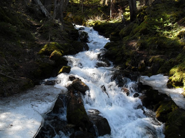
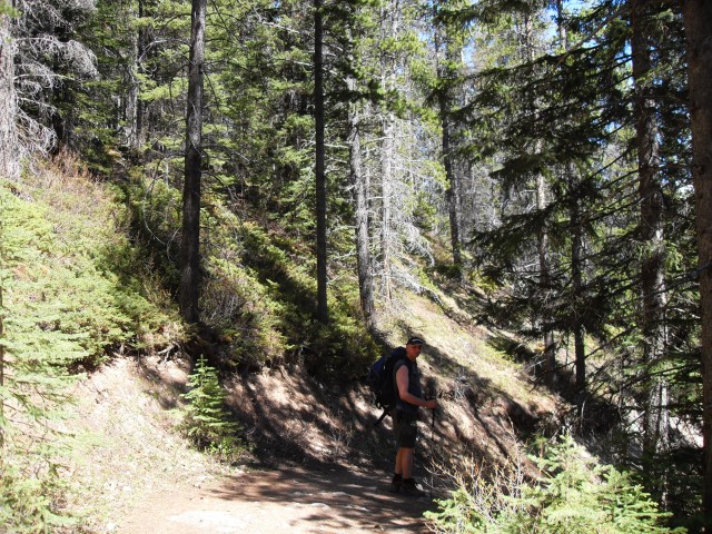
As we get further west, we leave the shore and gain a small bit of elevation. The south trail we are on, with a few exceptions, travels through dense forest here. At one point an unmarked short and rough side trail to heads to Hidden Lake – which is not really that hard to find. This is interesting place since it has no visible outlet, instead draining through the porous limestone that is so prevalent in the area. A waterfall on the far shore emoties into the lake from the slopes above.
Back on the main trail, it’s not long before you come to the Upper Kananaskis River, with a bridge just above a series of step falls. Near the rushing waters it’s hard to hear much, so keep your eye’s open for bears. They seem to hang out in this particular area – we’ve seen one and heard of others who have as well.
Not far beyond the river crossing, and now heading east, you come to The Point back country campsite, a wonderful spot to connect with nature. There are perhaps twenty sites here begging for you to spend the weekend. We have lunch at this point in the trail, with wine, and make a toast to Mount Lyautey that towers over us. What a great view!
Near here is an amazing side bay, rocky and deep green or blue in colour, depending on the light.
Not long after that, you break out into the rock gardens, a slide area below Mt Indefatigable. The event must have been eons ago, however even in that time, little grows in the area. It’s a stunning and starkly beautiful place and it’s chilling to think just how powerful nature is. For those who scramble, Mt Indefatigable is a relatively non-technical summit. Across the lake is Mt Sarrail, another stunning high peak.
From the rock gardens, you follow an easy undulating trail until it meets up with an old fire road, emerging out of the woods at a small dam at the north lake parking lot. The going here has been so easy, the kilometres just melt away.
Just before the pavement the trail heads west temporarily, traversing a high sometimes open path above a lovely bay before turning south and dropping down to near lake level. The rest of the trail is mostly flat and easy going. Near the end, you cross a large earthen dam not far from your parking spot.
On this trip we saw a huge Bald Eagle. It was so close we could almost touch it, but by the time we broke out the camera, is was pretty much gone. Too bad, it was majestic. These raptors are, I am told, fairly common here.
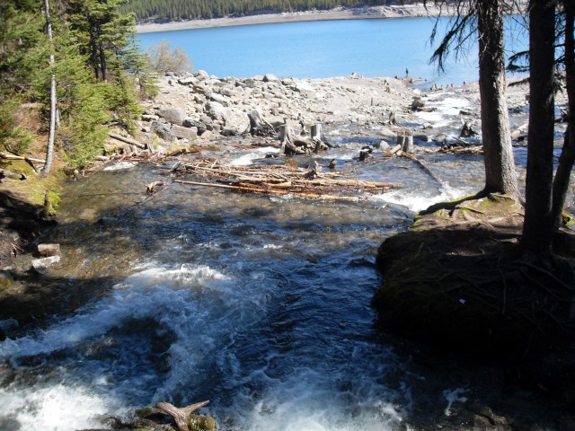
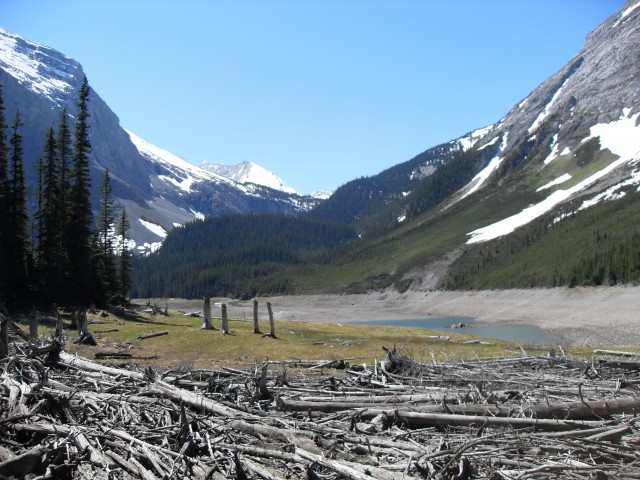
Along the entire way, you can see the bleached bones of many dead trees that used to dot the now flooded valley. The Upper Kananaskis Lake is man made and rises and falls a great deal. The fishing here as I understand it, is pretty good too and you’ll see lots of small boats with anglers on board as you trek around the lake.
Peter Lougheed Provincial Park has an extensive network of drive in campsites and these can be pretty busy on a weekend. But once on the trail, you don’t see a huge number of people.
Compare the pictures here with another trip we took around the lake, on not nearly as nice a day…
Upper Kananaskis Lake.
Check out this hike in the area…
Upper Kananaskis Lake to The Forks.
If you wish more information on this trail, by all means contact us!
Date of adventure: June, 2010.
Location: Peter Lougheed Provincial Park, Upper Kananaskis Lake.
Distance: 16km loop.
Height gain from start: negligible.
Height gain cumulative: 100m or so.
Technical bits: None
Notes: We’ve seen a bear and lots of evidence of same on this trail over the years. Bring your bear spray and travel in groups.
Reference: Kananaskis Trail Guides by the Dafferns.
Sarrail creek emptying into Upper Kananaskis Lake.
Rawson Creek.
Tried to catch a Bald Eagle. Can you see it?
Hidden Lake, which is not that hard to find.
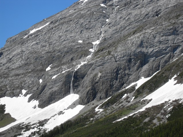
A small waterfall that empties into Hidden Lake.
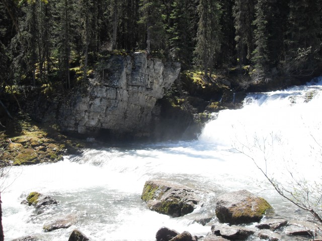
Upper Kananaskis River at the crossing.
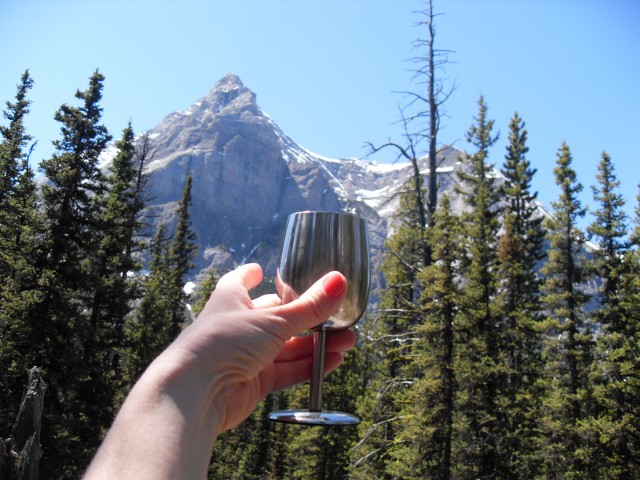
Toast! The striking Mt Lyautey behind.
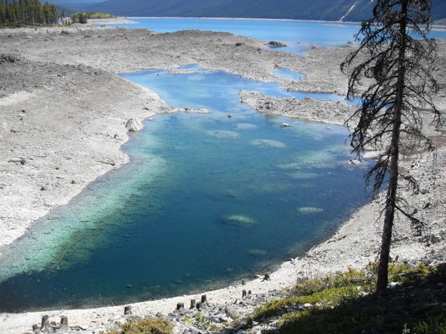
A gorgeous side bay.
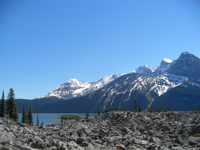
The expansive rock garden below Mt Indefatigable (behind me).
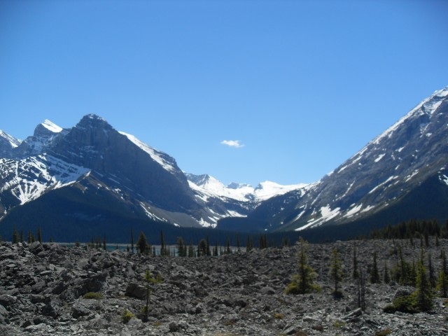
More of the rock garden.
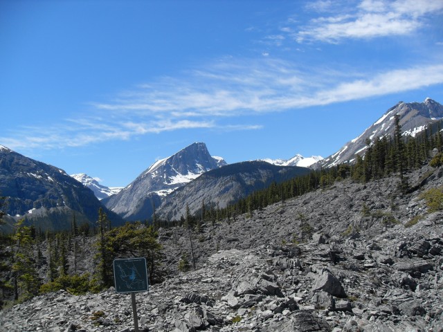
The slide area is rugged and beautiful.
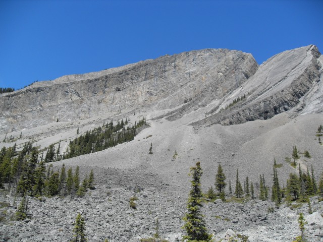
All these rocks in front were once part of this mountain (Mt Indefatigable).
Yours truly.
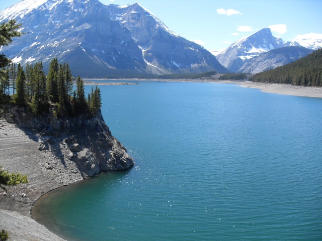
The stunning views west across the lake. Mt Lyautey on the left.
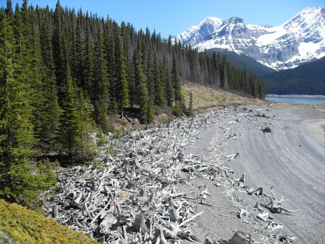
The many bones of long dead trees.
Sarrail creek from across the lake.


Gorgeous!
I would love to kayak here!
We are on in moderate shape. Do you think this trail could be done by us?
It’s about 16km around, so if this worries you it might be a good idea to make it an out and back. Starting form the north parking lot for example, a trip to the slide are is fairly short and easy, but you are still rewarded with some nice views.
Great pictures as always, makes me a little bit homesick.