
Green Mountain
An article by Chris & Connie.
A mere bump in the Kananaskis Foothills, beside the Sheep River, west of Turner Valley, is lowly Green Mountain. It’s modest in stature and mostly forested, but the south facing aspect is open allowing great views of rolling hill and ridges and tall barren peaks off in the distance. Getting the is part of the fun and along the way hike along the lip of a spectacular gorge and later take in a picturesque waterfall.
Most people access Green Mountain via the Sheep Trail from the Indian Oils day use area (aka the normal route). We elect to to mix it up a bit instead, using an old logging road, what hiking guides refer to as “Teskey Road”, that meets up with aforementioned trail part way in. Our route means fording the Sheep River – the normal route is now sans bridge anyway, so consider it no big deal.
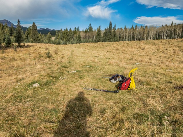
Park at the entrance to the University Research station at Gorge Creek. Drop down to the river and cross nearly anywhere. Brr!!! Don’t do it at runoff. Once on the far bank, find a small meadow. Head south in the grass and just before you bump into a hill, the old logging road can be seen coming down from the right.
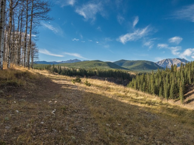
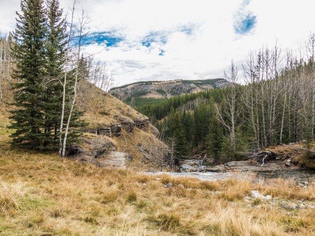
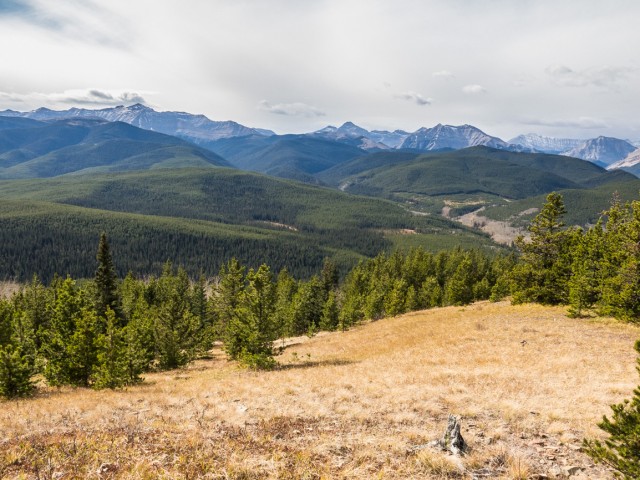
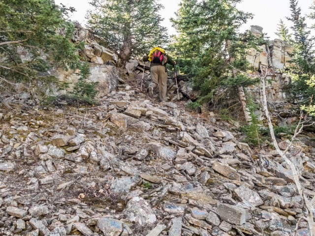
Head up on a faint path, gaining elevation at a steady pace. Curving south, it’s a final steep push, and you break out of a trees. To the right is an amazing deep canyon, the river running far, far below. Don’t venture too close to the edge, it’s a long drop down! A wall of mountains, off in the west, comes into view here.
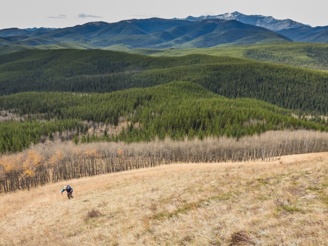
Pass through a drift fence, leaving the gorge behind, enter the trees, and soon after a large meadow. The trail is faint here, but the way obvious. Back into the trees again the old logging road is wide and mostly level here and presents no real difficulties. Turn around to see Missinglink Mountain (technically Dot Mountain the southern ridge of Missinglink).
At a cutline meet up with the official and well marked Sheep Trail (red or orange diamonds) coming in from the left. Continue south-ish in the trees yet again (occasional open areas). There are many side roads here, some of which will also get you where you need to go, but stick with the marked route, even if does not appear the most trodden. At one point, Green Mountain comes into view, but only briefly.
After a time, drop down and turn left into a meadow at a three way junction (continuation of the Sheep Trail heading west – the normal route used to access Green Mountain). Scenic Dyson Falls is located here. Photo op time!
Rock hop across Dyson Creek. Follow the road as it head ups and soon after come to a junction. To the right is the old pack-trail route up to the Junction Mountain Lookout. Go left on yet another old road. The trail is sometimes muddy here. Drop down to a small stream and soon on come to a junction marked by a small metal arrow tacked to a tree. Go left leaving the official route behind.
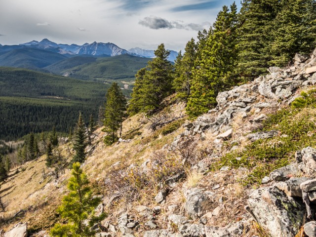
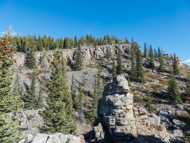
Soon enough, at a boggy area, the road ends. From here on the route is not always obvious. In meadows and in other places the trail will be faint, while other times it’s quite clear. Take care. Head east gaining elevation at an easy rate. At the base of a steep grassy slope, topped by some rock outcroppings (called the “Castle” by some) the trail pretty much fades away. No problem, just turn left and head up. In fact you can head up earlier, at many places, we just picked this spot as good.
The summit is at the top of a cliff band. We choose to head left around them passing through the “Castle” and soon, after a small climb, coming to a nice meadow. This south facing open area, not quite at the summit, will be our lunch spot.
Before chowing down however, we explore the flat-ish plateau of Green Mountains a bit and wander about aimlessly to see what we can see. We also look for the actual summit, which we know is close by but in the trees. We eventually find it. No views here but an break in the forest a bit to the east is the highest spot with a view (our meadow is only slightly lower). Bushwhacking through the thick forest towards the south, we hope to reach the top of those cliffs seen earlier, but miss them completely. Oh well, no biggie.
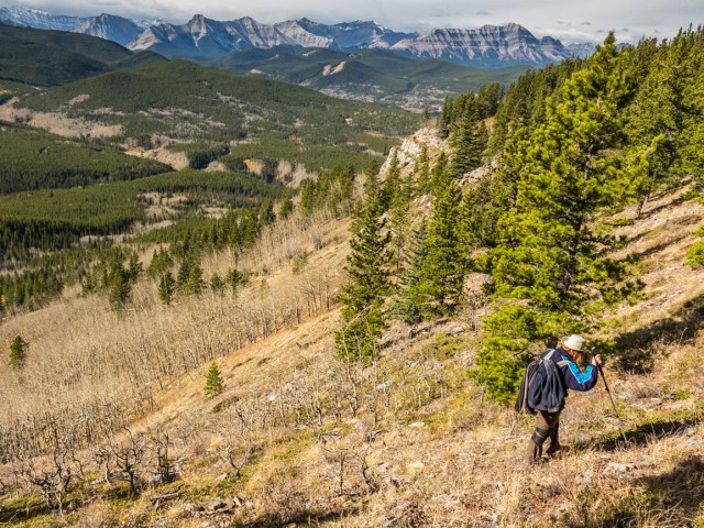
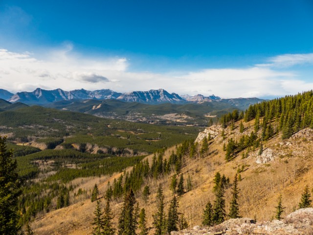
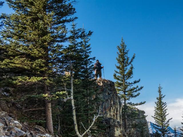
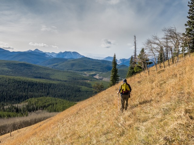
The only unobstructed views from Green Mountain are to south. It’s all heavily treed foothills extending off for forever. The fire lookout on Junction Mountain can be seen as can Dyson Falls, recall you were just there, in the valley below. Directly west is Mount Hoffmann, also a small bump like the one you’re on. Further on are big peaks, Shunga-la-she, Mount Burns and many others. Views east and north are blocked by dense woods. Even though not all directions are open what you can see is pretty decent. Not bad views from a humble foothill. The best panoramas, in fact, are from the castle, that rock outcropping lower down and passed through earlier. Take the time to climb up them.
Enjoy Green Mountain as long as you like then retrace your steps back to the parking spot. Our trip back was completely uneventful. We took our sweet time.
Green Mountain is not a lot of things but it’s still a worthwhile objective. We thought it great with lots to see even in spite of its low wooded summit. Our approach was also a load of fun. We really loved that stunning gorge and think you will too. It alone is worth the price of admission. Dyson Falls is nice too.
Modest mountains and small hills can be fun too…
Mount Mann.
Carry Ridge.
Return to Eagle Hill.
If you wish more information on this train, by all means contact us!
Date of adventure: October, 2015.
Location: Sheep River area, Kananaskis AB.
Distance: 13km by our route.
Height gain maximum: 330m.
Height gain cumulative: 340m.
NOTE: all heights and distances are approximate.
Reference: Kananaskis Trail Guides by the Dafferns.
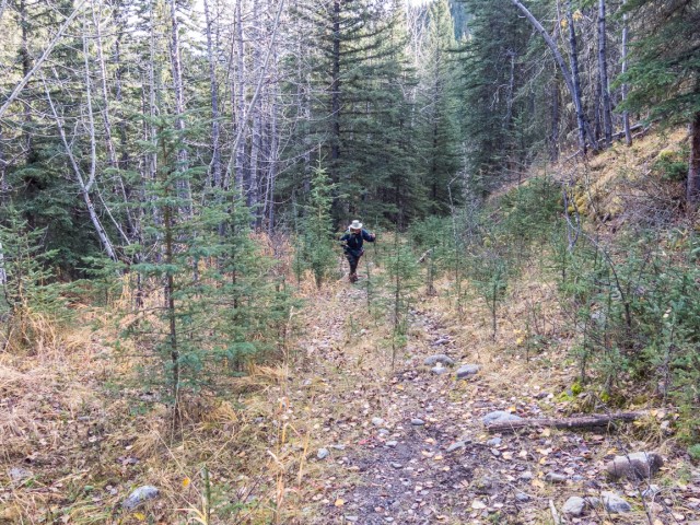
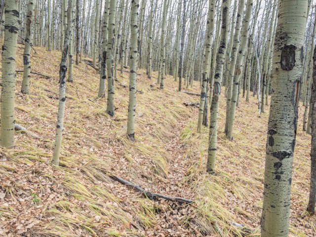
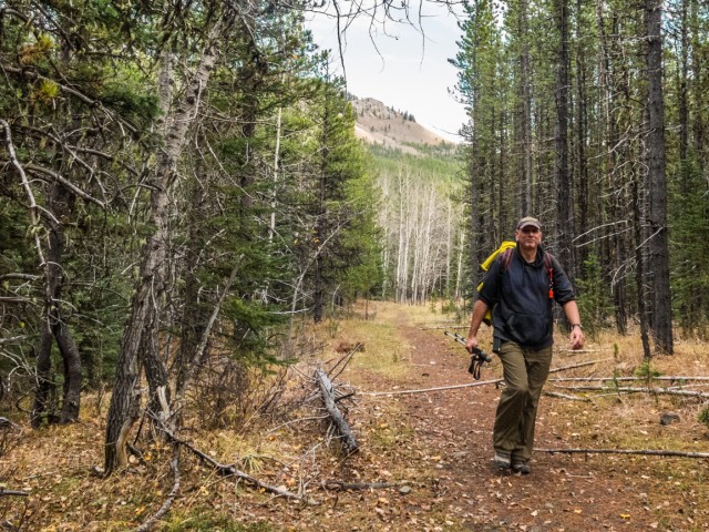
On “Teskey Road”.
Breaking out of the trees, we’re on the lip of a deep gorge (right).
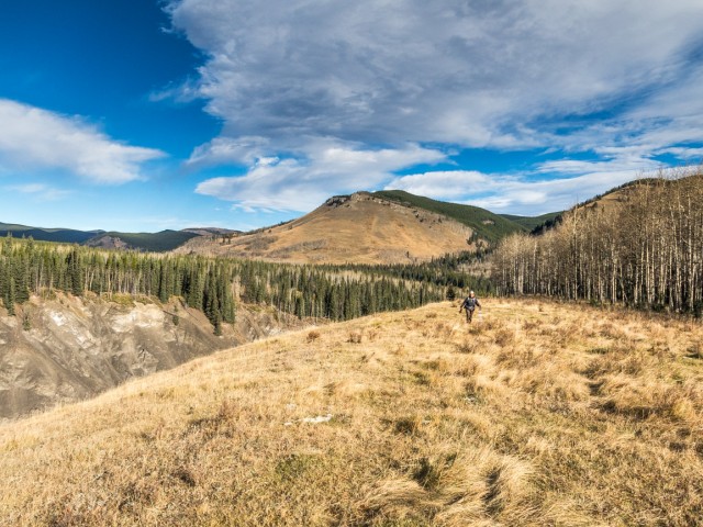
Oddly named Missinglink Mountain in back.
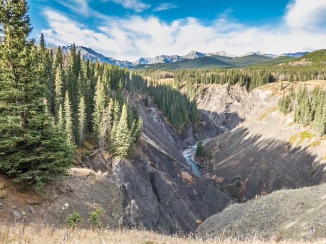
It’s a long drop down!
Taking a break in a meadow.
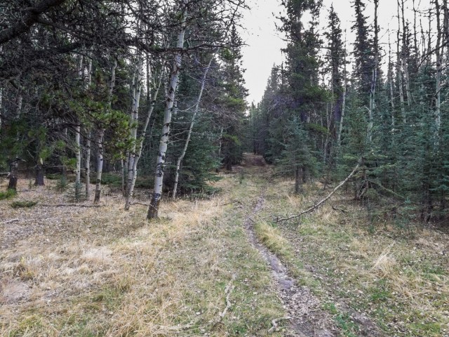
Most of the time, you’ll be in the trees.
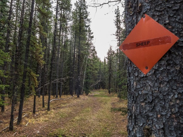
Connecting up with the Sheep Trail.
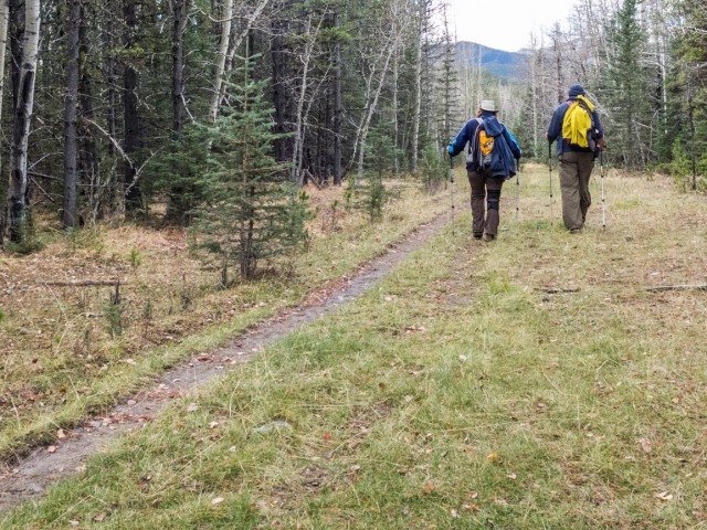
Enjoyable hiking.
Green Mountain comes into view.
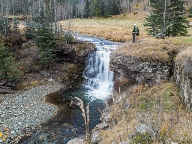
Scenic Dyson Falls.
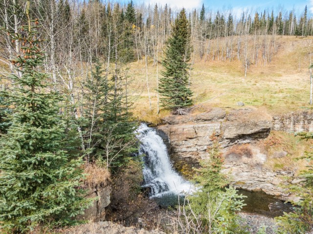
Another view.
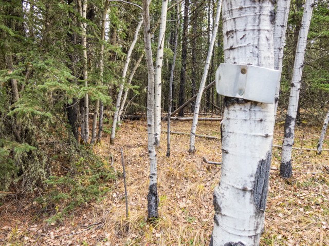
At this (hard to see) metal arrow, head left.
This part of the trail is faint in places.
Climbing up a grassy slope.
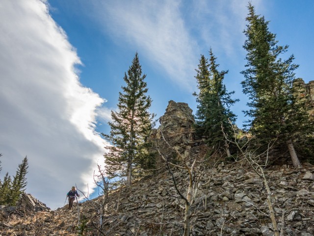
Passing a rock outcropping.
Looking west.
Our lunch spot, just a wee bit lower than the treed summit.
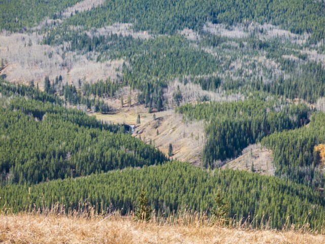
Dyson Falls can be seen from above.

Looking for the summit.
The highest spot not in the trees.
The highest point on Green Mountain.
Heading up to a viewpoint.
The best panoramas are from the “Castle”.
The summit is top right and in the trees.
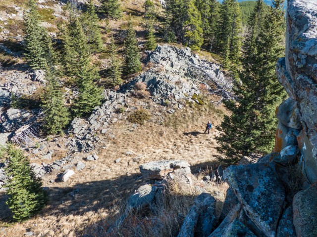
Connie below.
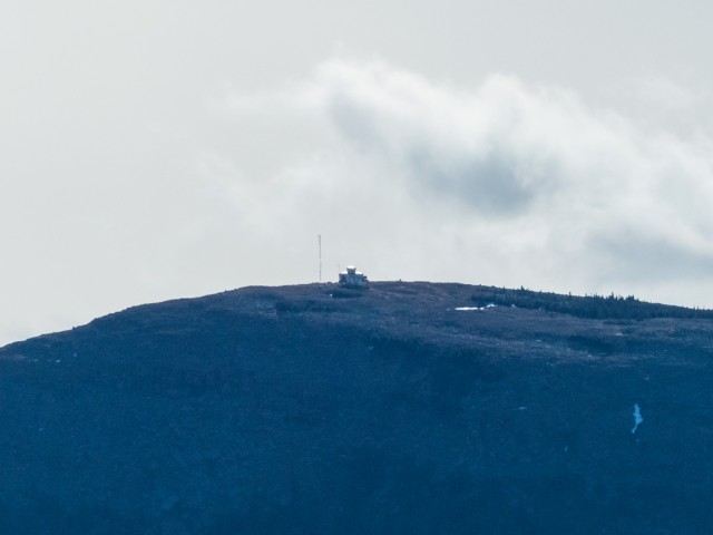
The Junction Mountain Fire Lookout in the south.
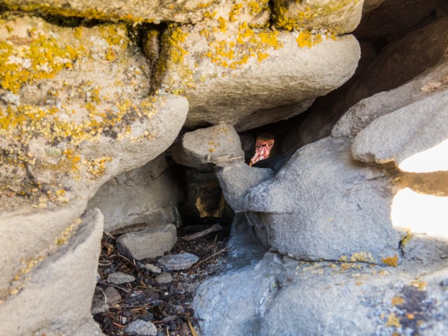
Playing on the rocks.
Hi there!
Heading back down.
A stroll in the woods.
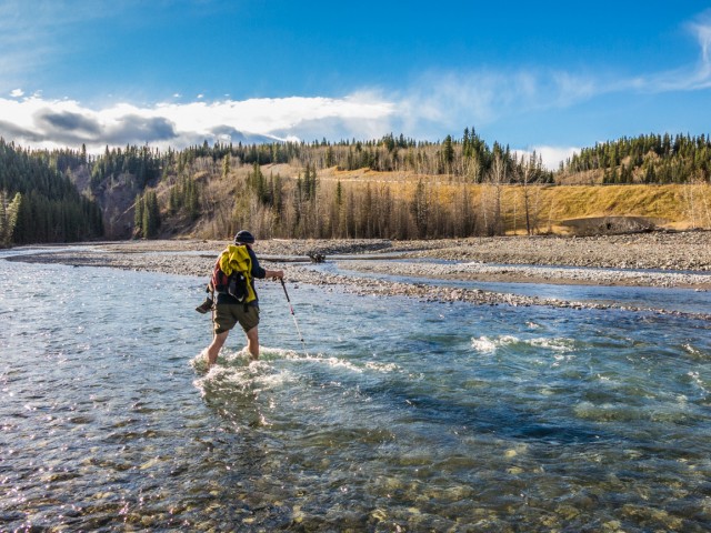
Crossing the chilly Sheep River.
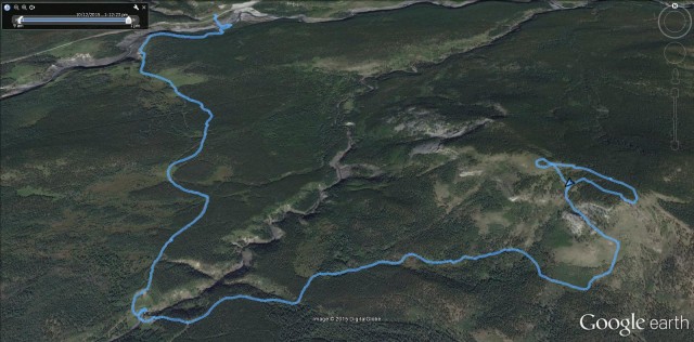
Our “not the normal” route up Green Mountain.


(via Facebook)
Ah, I see you took a creative route. I was thinking “I did Green Mountain a few years ago and didn’t need to ford the creek, but I started at Indian Oils.
With the bridge at Indian Oils now gone, washed away in the 2013 floods, you’ll now have to get you feet wet even if you start there.
One to add to the to do list!
Not big or showy, but lots of fun!https://www.bigdoer.com/wp-admin/edit-comments.php?comment_status=moderated#comments-form