Cox Hill
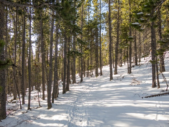
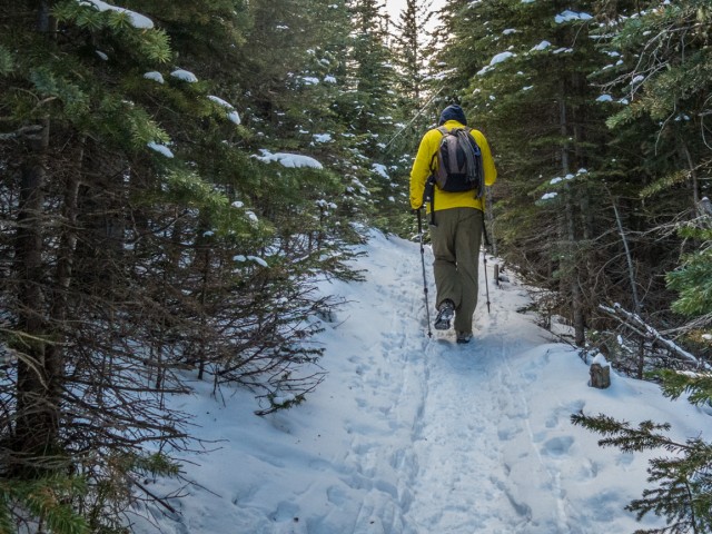
A modest height bump in the Sibbald region of Kananaskis, Cox Hill is most often summited via the north approach. The trail is official, so it’s well maintained, is wide and has a fairly gentle grade the whole way. It’s quite doable even if snow is on the ground (like on our trip). Most of the time the route is in the trees with little to see, but don’t let that be a worry. Once near the summit the forest thins and the views open up, way up. All that work was worth it! Enjoy!
Parking is at the Dawson Day Use area on the gravel Powederface Trail road south of Highway #68 (also part gravel). The last click or so was very icy on our visit.
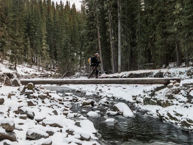
To begin the adventure, head north past the biffies to the trail head. Drop down to Jumpingpound Creek and cross it on a log bridge. Note the damage from floods a couple years back. Continue on the wide path and at a three-way junction turn right (left is the Tom Snow Trail). Turning left on a cut line, start the climb. Note the logging scars to your left. Hard left trending north and leave the cut line behind.
The trail switchbacks a number times and save for a couple nice flat spots here and there where one can catch their breath, continues to climb steadily all the way to the summit. The ground underfoot is solid and stable even with a covering of snow. With all those trees, roots on the trail can be a hazard. Don’t trip!
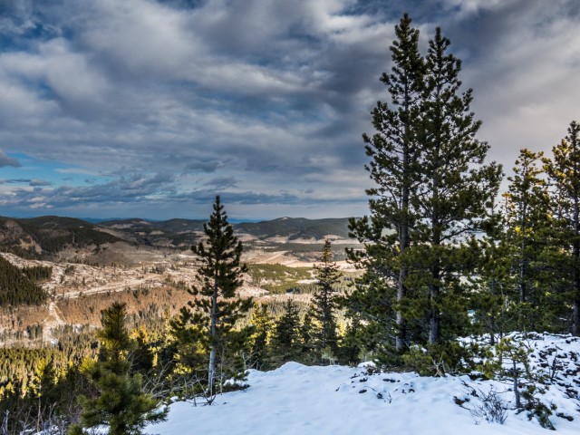
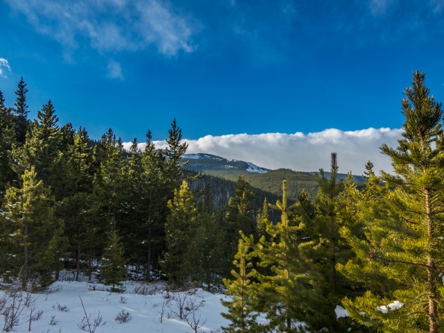
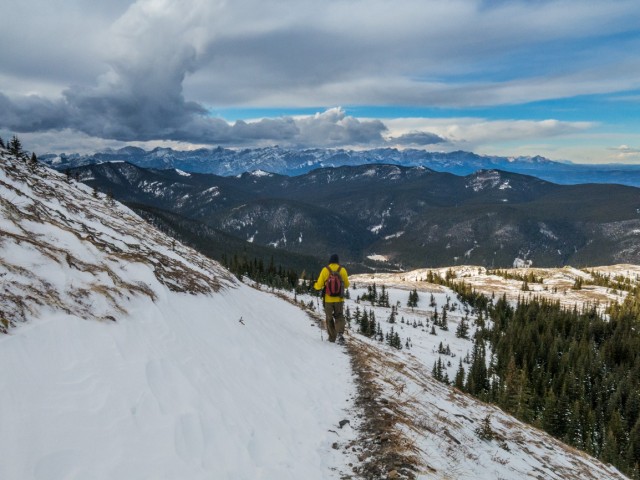
The trees thin in places, offering up the occasional view. Mostly all you’ll see are trees though. Two times the trail drops down. But only by a little.
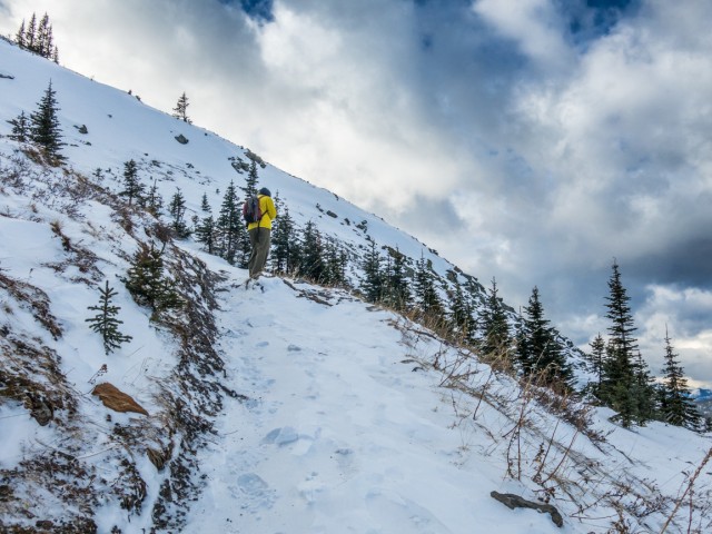
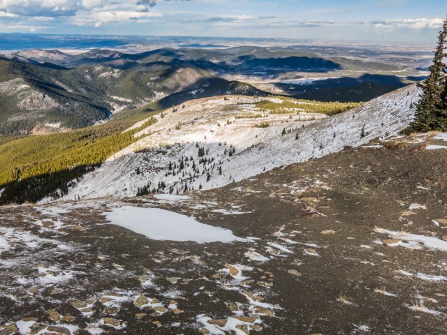
Come to the top of a treed ridge. The trail and the general terrain get more rocky here. Continue on through a tree tunnel and soon on, break out of the woods altogether. From here on in, the terrain is mostly open open.
It’s often quite windy on Cox Hill, we know that both from experience and by speaking with others. It’s so commonplace in fact, it’s legendary! This day was no exception and we had to really bundle up against the weather, once we left the protection of the forest behind, or risk freezing. The gusts and the cold plus icy stabs from whipping snow were near insufferable. But we deal with it. That’s what we do. Of course, we brought some mulled wine to enjoy at the top, which helped ease the pain. It always does.
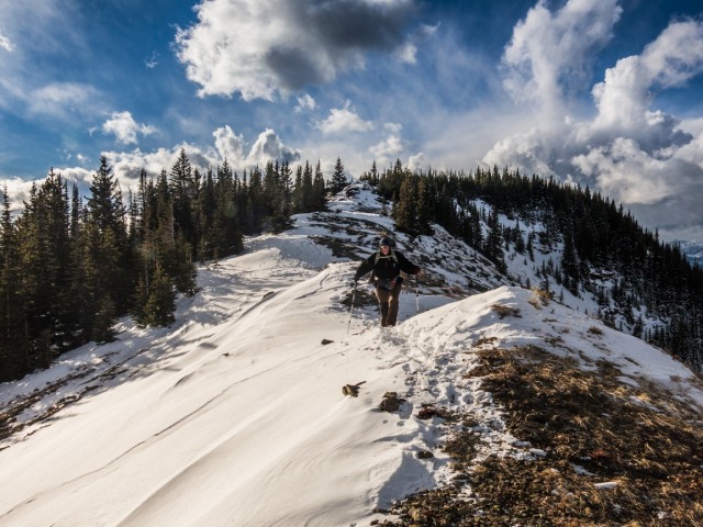
The trail was snow covered the whole way up but was well packed and neither deep nor slippery. The wind in open areas pilled up drifts along the trail in places, so some postholing was needed. A zig-zag heads up a steep barren wind-blasted hillside. Hold on to your hat here!
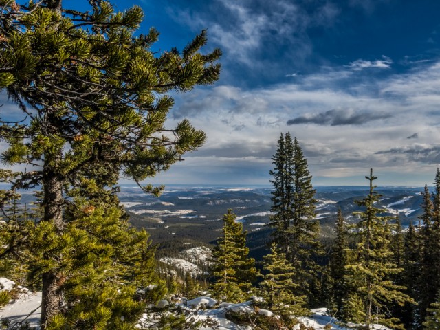
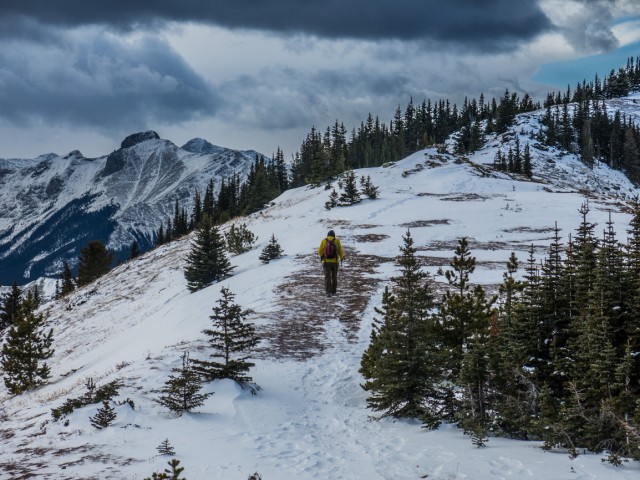
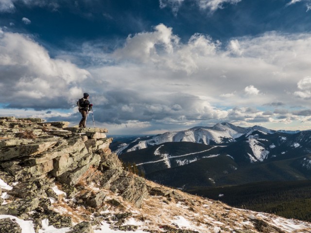
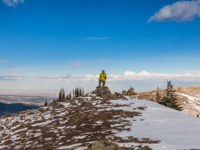
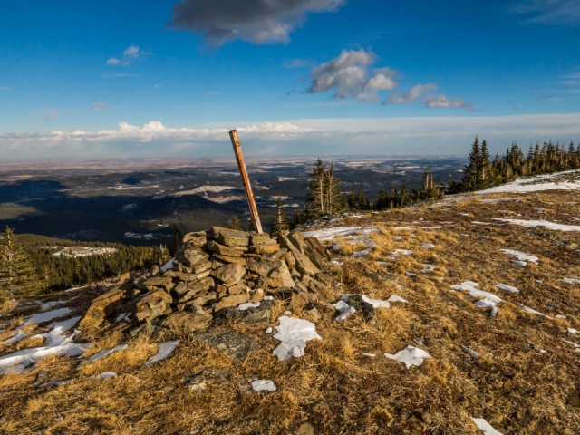
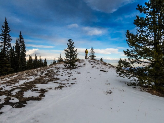
Top out on a ridge. Head left briefly to take in the views there. Continue south, the top now clearly in view. Pass through some trees, walk just below a rocky ridge crest, climb some boulders, it’s more trees and ta-da, welcome to the summit. It’s mostly broad and flat and of course windy, always blowing in an easterly direction. If it’s not tied down, nailed down, held onto, it’ll be blown all the way to Saskatchewan. Honest.
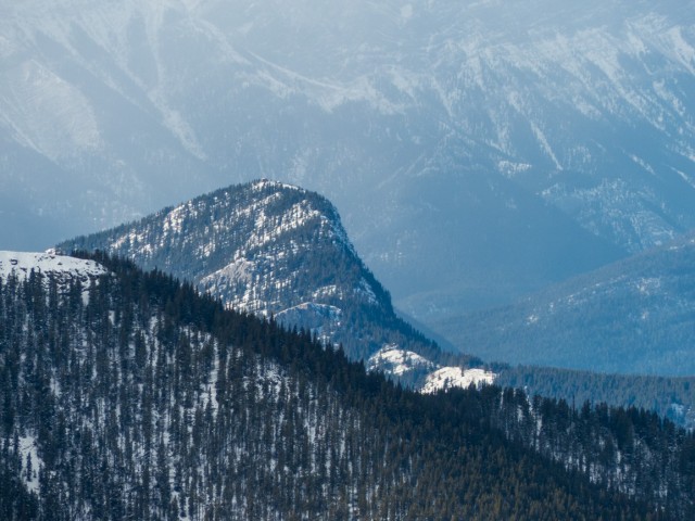
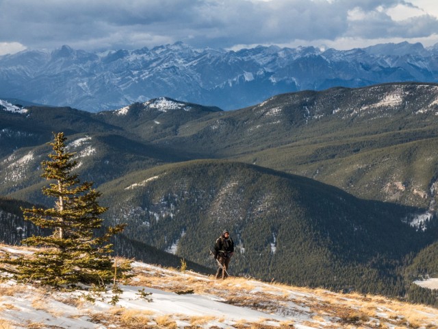
A connecting ridge ties together Cox Hill and Jumpingpound Mountain to the south. Why is taller Cox a hill and lower Jumpingpound a mountain? A question for the ages. An obvious trail comes in from that direction and is another way to get here. Doing both summits in one day would be a nice objective, assuming you have the time and energy. Further south Powderface Ridge can be seen.
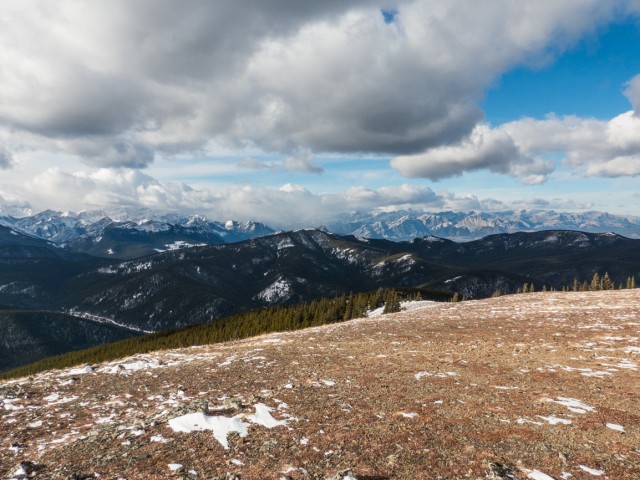
In the west is a near impenetrable wall of barren rocky peaks. Mount Baldy, Belmore Brown, Tiara Peak and Compression Ridge are just some of the summits seen. Turning more northerly, we can see flat faced Yamnuska and in front lowly Eagle Hill. The Barrier Lake Lookout can be seen on Yates Mountain. This is the front ranges, a series of hills, ridges and towering mountains of many sizes and personalities. Lots of variety. That’s why we love it.
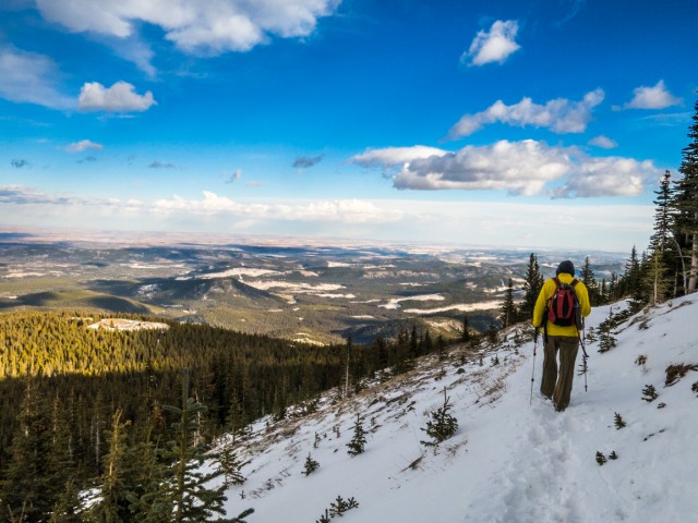
To the east the hills transition to the plains. Calgary can be seen off in the distance. Cut blocks and gas plants can be seen in various places below. They’re all rather ugly I guess, but essential. Moose Mountain, home to another fire lookout dominates the scene directly east. Like Cox Hill, it’s often done in winter. To its right is Prairie Mountain.
If you plan for lunch in the summit, given the always windy conditions, you may need to take shelter in the trees. We had to.
When you are ready to leave, and only then, retrace your steps back to your car. It’s hard to go. There is a possibility to extend the ridge walk on the way down – just before plunging back into the trees there is a open rocky rib that trends west-ish before doubling back and presumably one would be able to follow it and connect up further down with the official trail via a short bushwhack. We had enough with the cold wind and so dismissed the notion. The trees may not be scenic but they did offer protection.
This trail is popular year round. This day however was pretty quiet and we saw only two other small groups. In summer, it’s well used by cyclists in addition to hikers, and equestrian riders I guess can make an appearance too.
We visited Cox Hill on Remembrance Day. At 11am we paused…
More reports like this…
Three Lakes Valley.
Greenhill Mine Ridge.
Wind Ridge
Winter comes to Burstall Pass.
If you wish more information on this trail, by all means contact us!
Date of adventure: November, 2015.
Location: Kananaskis AB, Sibbald area.
Distance: 13km there and back.
Height gain maximum: 725m (some online reports say over 800m).
Height gain cumulative: 750m.
NOTE: all heights and distances are approximate.
Reference: Kananaskis Trail Guides by the Dafferns.
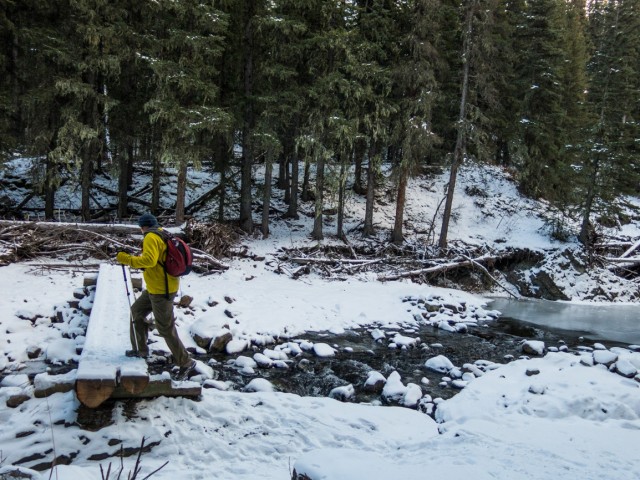
Crossing Jumpingpound Creek.
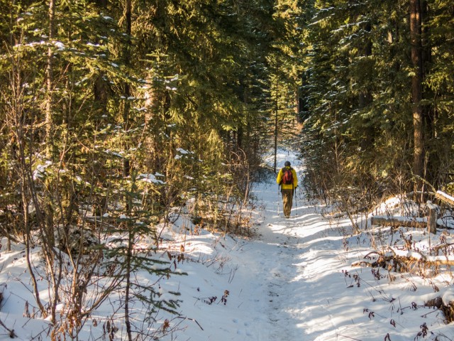
Most of the time the trail is in the trees (but the view at the end is worth it).
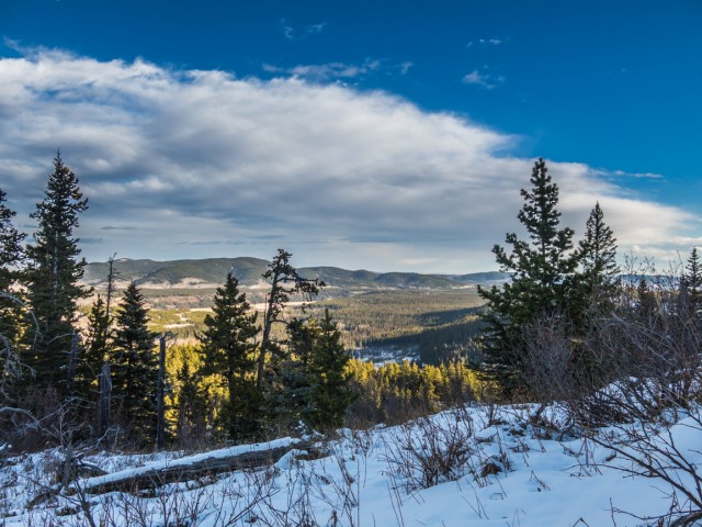
At a break in the trees – looking north.
We’re facing sort of north west-ish here.
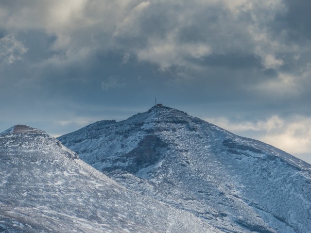
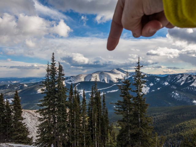
We catch a glimpse of the summit (centre).
More fun in the trees.
Gaining elevation steadily the trees briefly thin affording us this easterly view.
The tree tunnel.
Heading up a switchback.
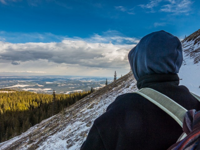
The scenery: awesome, the wind: insufferable.
The summit is close at hand, just off frame to the right.
The fire lookout on Moose Mountain.
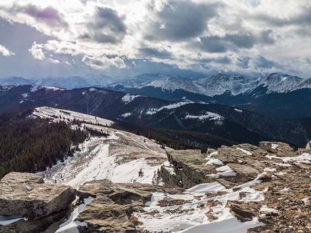
Jumpingpound Mountain, the ridge mid-ground running left to right.
On the summit.
Looking northwest.
The Barrier Lake Lookout on Yates Mountain (look close – centre).
At 11am we paused…
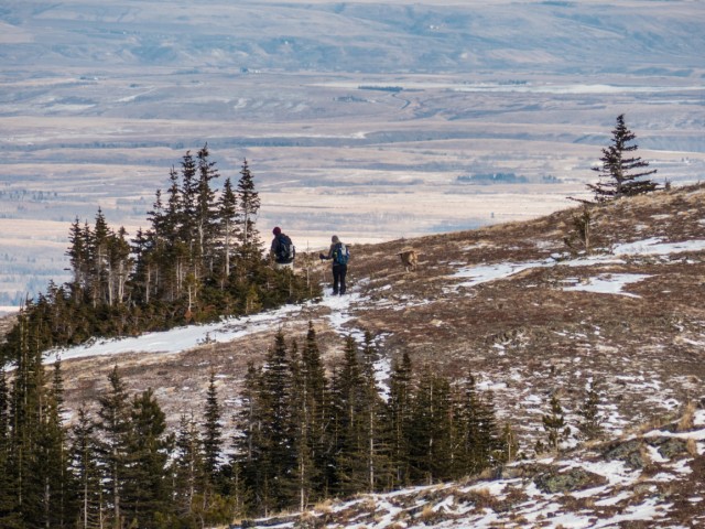
We saw two other groups on Cox Hill this day.
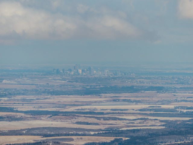
Calgary some distance away.

Modest size Eagle Hill, centre.
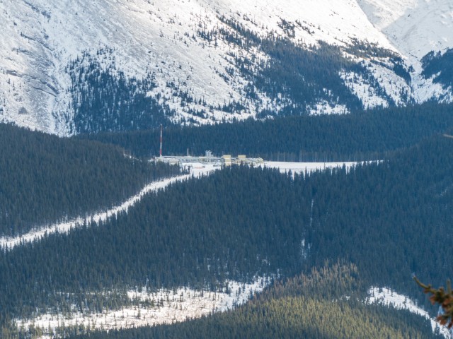
A number of gas plants and wells can be seen from the summit.
That’s Moose Mountain.
The trailhead is somewhere down there.
Coming down.
I can’t think of a better place to spend the day.
The last high point before dropping down.
Cox Hill can easily be done in winter (but bundle up for the wind).
Mountains transition to the plains.
We’ll soon be back in the trees – the view is to the west.
A viewpoint part way down.
Almost at the car.
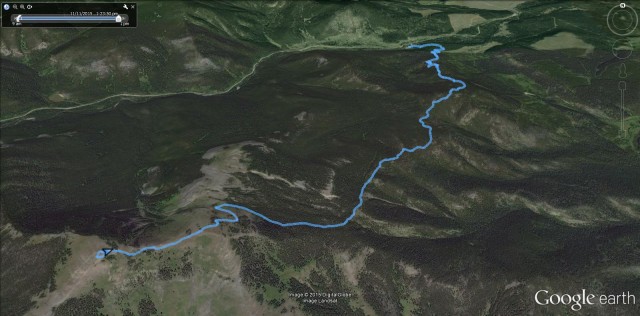
The route up Cox Hill.


Hiked it in the 80s!
It’s listed in a 1980s Daffern hiking book we have, so the trail has been around for a time.
A great day, even with the wind!
No argument from me!
(via Facebook)
Thanx for sharing another adventure with us! I could feel that wind!
It was brutal. But we still had a great time.