
Sheep River to Burns Mine part 1
The following report is a two-parter that combines some of our favourite activities, hiking and history exploring. This adventure finds us on the Sheep River Trail, a long distance route that parallels its namesake river for many dozens of kilometres. The section we followed takes us from the Junction Mountain parking lot at the end of Highway 546 to a mine site some ten kilometres away.
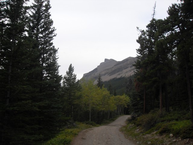
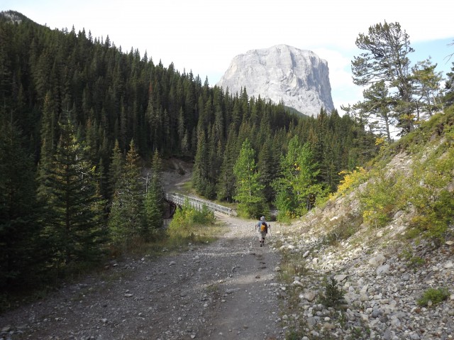
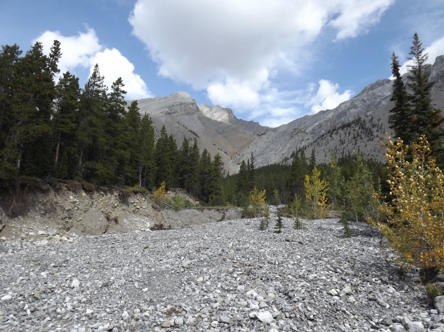
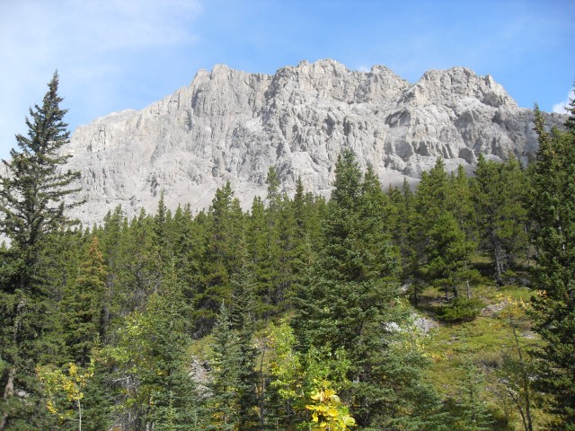
Some sections of the trail are single track but along here it’s the former road leading to the Pat Burns Coal Mine. It’s nice and wide and is in good shape. Long closed to vehicles it is used not only by hikers but also horseback riders, cyclists and scramblers headed for the mountains that flank the valley (some of the latter passed us). Actually as a hiking trail, it’s pretty pedestrian but I still like it. The views of the surrounding peaks are stunning, with Gibraltar Mountain being the dominate one. It looks surprisingly like the Rock of Gibraltar, hence its name.
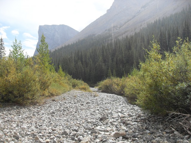
The whole trip the road shares the valley with the Sheep River and in places there are small falls and deep pools to be glimpsed in the gorges below.
The trail/road itself is easy going, mostly flat with a few short steep sections. It’s well drained with little mud or messy stuff. Even so, I can’t image how challenging this crude road would be for those travelling it back when the coal mine was operating.
Along the way there are some side trails breaking away from this route, especially near the start, but these can be ignored. This trip stays on the obvious road the whole time.
From the parking lot, walk up to the gated gravel road that heads west and stay with it until the end. Well above the river here, the road eventually drops down to that water course a couple kilometres in. Along here Connie finds…you guessed it…a set of bear tracks. She always finds some! The river can be heard gurgling below and occasionally we catch a glimpse of it. The deep blue or green pools seen far below are stunning.
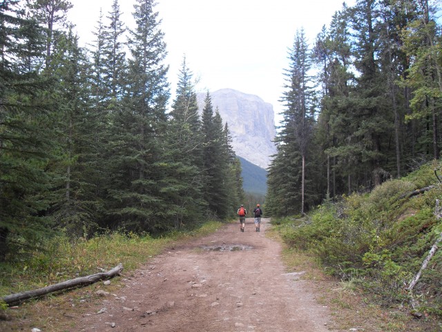
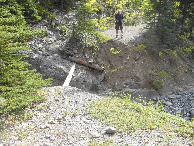
A few kilometres in takes us to the first crossing of the Sheep River, this one bridged. The current deck was built upon the concrete piers of the original coal road bridge. On either side of the structure are some short but steep hills, which must have been a thrill for those piloting the supply wagons.
Further Sheep River crossings are unbridged, but that is no problem since the waterway upstream, at this time of year anyway, is neither wide nor deep. You can rock hope across it with ease – ditto for the small side streams that cross the road. One crossing of the Sheep further up is usually totally dry, the river being underground at that point. Many rivers and streams in the region intermittently run below the surface in places, due to the porous limestone bedding.
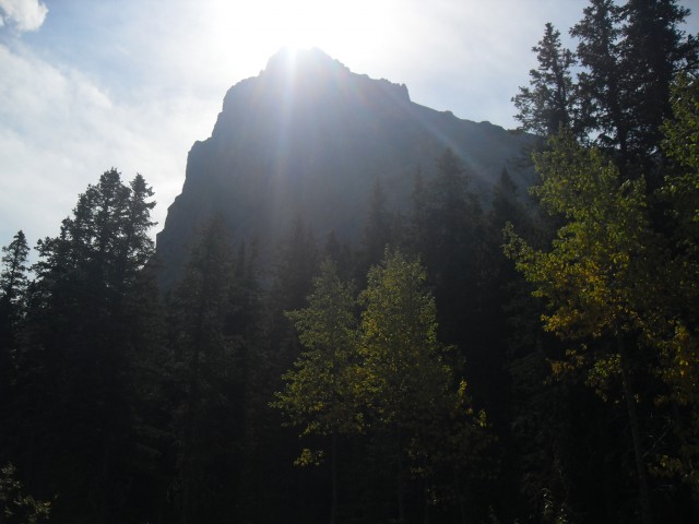
Along here the trail rises and falls, switching valley sides on at least a couple occasions. The going is fast and easy and while the trail itself is unremarkable, the views in the Sheer River valley are something else. The whole way mountains and ridges tower over the trail. Since it’s fall, many of the trees are a brilliant yellow.
At each river or stream crossing you can see the remains of the road bridges that once existed there. These are long gone, and only a few rotted logs and embankments to show they were ever here. At one crossing we find a number of old horseshoes hanging from some trees. Along one section of the river, a huge log jam shows just how powerful the river can be at times. One thing you notice when near the water is just how crystal clear and clean it is.
The were a lot of edible berries found along this trail. The awful tasting Buffaloberry was the most common (bears like them), but there was also Blackcurrant (also yuck), Wild Raspberry and Strawberry. There we lots and lots of mushrooms too, but I have no idea of the species of them – mushroom identification is a too hard for my little brain.
Shortly before the mine site, you enter private property. Posted signs remind you of that. Surrounded on all sides by Kananaskis, this parcel of land is owned by the descendants of the original Burn’s Mine operators. You are still allowed access to the land however.
Right after you come to a field with a couple coal piles and this is where this report ends. For the next one we’ll explore the mine itself. It’s a very interesting place that operated for a few years around World War One.
To read part two, follow this link…
Sheep River to Burn’s Mine part 2.
To see some other trails in the area we’ve hiked, follow any of these link…
Ridge north of Green Mountain.
Mount Hoffmann.
If you wish more information on this trail, by all means contact us!
Date of adventure: September 2012.
Location: Kananaskis, Sheep River area.
Distance: 22km return from our turn around point.
Height gain from start: 160m.
Height gain cumulative: 250m (some ups and downs).
Technical bits: None.
Notes: None.
Reference: Kananaskis Trail Guides by the Dafferns.
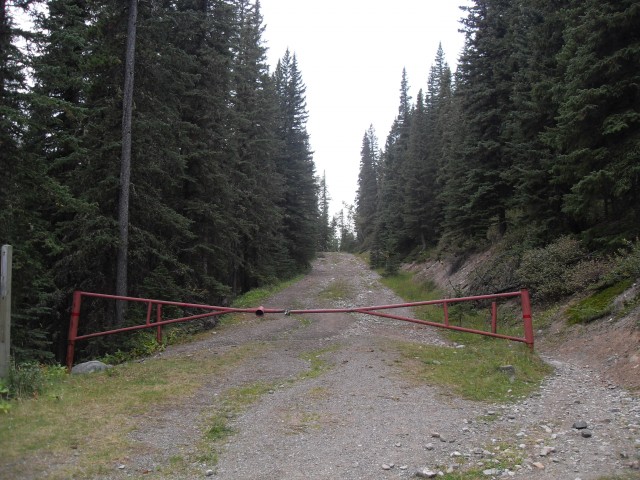
The Sheep Trail at the end of Highway 546.
We follow an old mine road deep into the mountains.
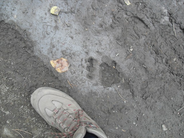
Connie always finds bear tracks.
The trail is in fine shape and the going easy.
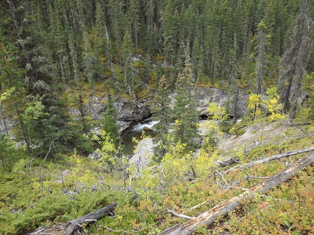
The Sheep River far below.
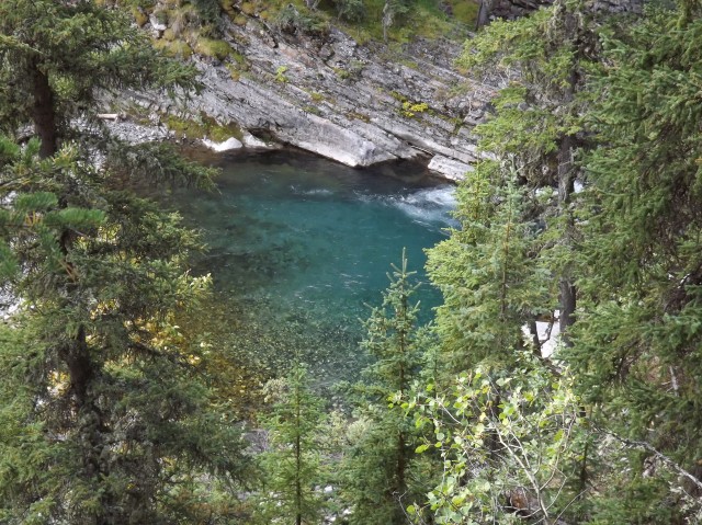
A gorgeous deep blue pool.
The first crossing and the only one bridged. Gibraltar Mountain in back.
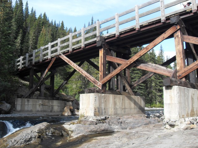
The current bridge was built on the piers an older one.
Looking up a dry stream bed.
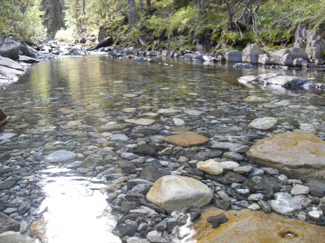
The water is crystal clear.
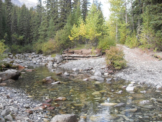
Remains of an old bridge.
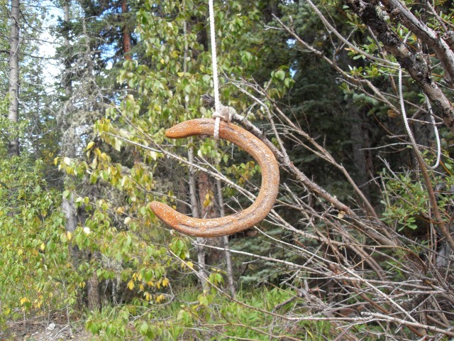
Found along the trail…
Another former bridge site.
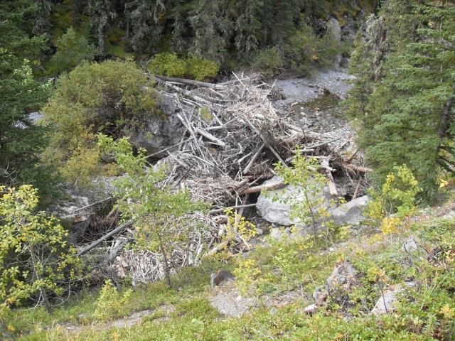
A huge log jam shows how powerful the river can be.
The views in the Sheep River valley are superb.
Gibraltar Mountain looms over the valley.
Along here the Sheep River runs underground.
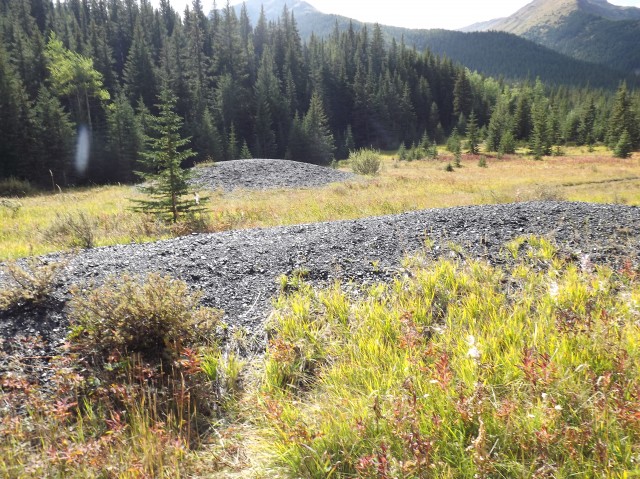
Coal piles at the Pat Burn’s mine site.
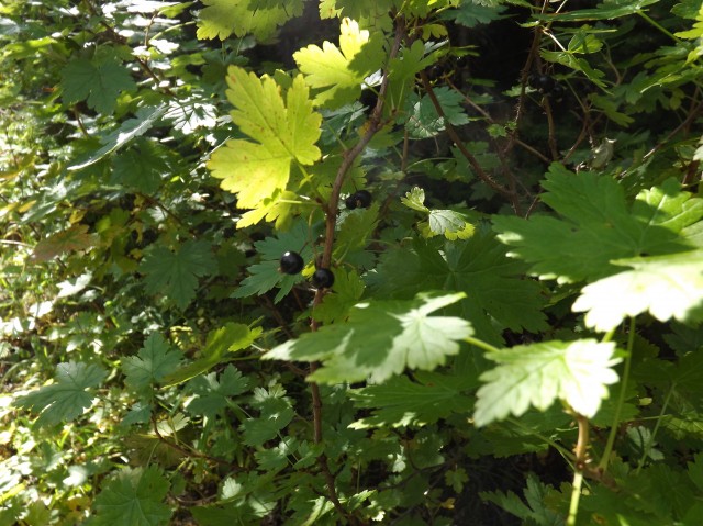
Blackcurrant, edible but sometimes bitter.
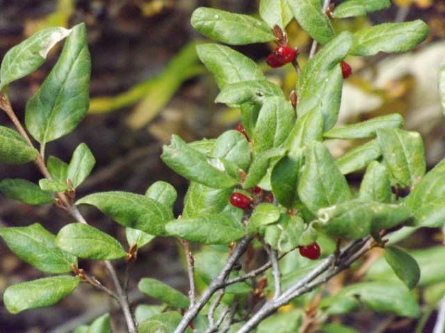
Buffaloberry, also edible but awful tasting. Bears seem to like these for some reason.
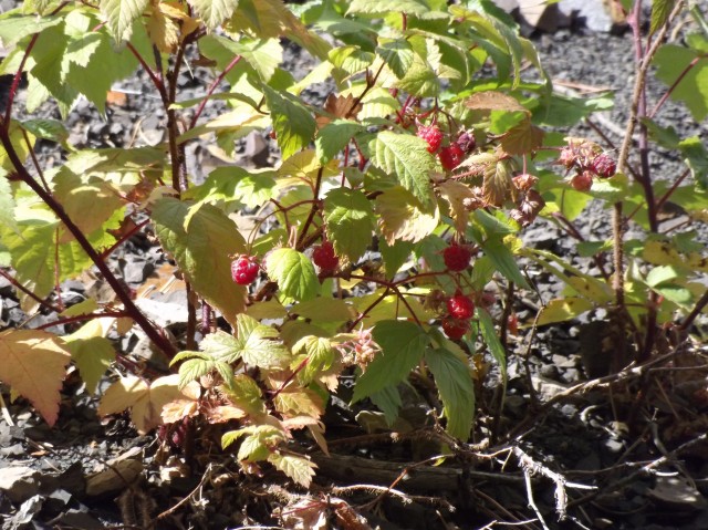
Wild Raspberries. Yum!
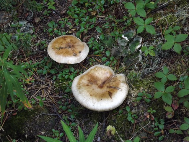
There were mushrooms everywhere.


Back in the mid 70’s we used to drive that road from Little Elbow to Bluerock. Usually we crossed the Sheep at a low level crossing because the bridge was in terrible shape. Once, due to high water, we were forced to use the bridge. My friend drove, while I moved planks from behind the truck to the front – filling in the holes in the decking!
Oh my, someone who actually drove the road! I heard people did it…in legend. You guys must have been crazy. Thanks so much for sharing memories.
Tried to get to the mine today, after the 2013 flood the Sheep River was rebuilt and very nice. The trail after the bridge was very rocky and one of the river passes was quite dangerous with lots of boulders now in the river bed. It was amazing to see just how powerful the river can be at times. We made it just past Gibralter Mountain before we ran out of daylight. Again, spectacular scenery!
It’s a spectacular place for sure. I have not been since the flooding. I heard things were messed up pretty good in places because of it. The area around the coal mine is private property and not part of Kananaskis and while open to visitors before, I guess it’s now supposed to be off limits. Not sure if they put up fences or just signs or what.
Thanks for posting, great article!