The Pat Burns Coal Mine is situated deep in the mountains far up the Sheep River valley, and is certainly is the most stunning location of any coal mine this author has seen. While the operation was ultimately a failure, it’s certainly a winner for explorers like us. What a great place to soak up the past!
Coal was discovered at this location just past the turn of the twentieth century, but it took many more years for any development to happen. Real work started around 1913 and the intentions were to develop the mine concurrent with building of a railway to the site. Trains, then as in now, are the only way to transport bulk commodities like this economically.
In the meantime, the mine was developed, some coal stockpiled, and some test shipments sent east by wagon.
↓ ↓ ↓ ↓ Scroll down for photos and to comment ↓ ↓ ↓ ↓
But the railway never came, although some grading was done near Turner Valley. After a few years more, all work at the mine slowed and then finally stopped altogether and by the early 1920s it was done for. Without the railway, there is no way this operation could compete with others in the province. Coal from mines in Canmore, The Crowsnest Pass, Bankhead and the Drumheller areas could be sourced for less. So even, while this coal here was of high quality, there would never be demand unless they could get it to market cheaply. That’s what killed the plan.
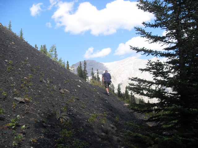
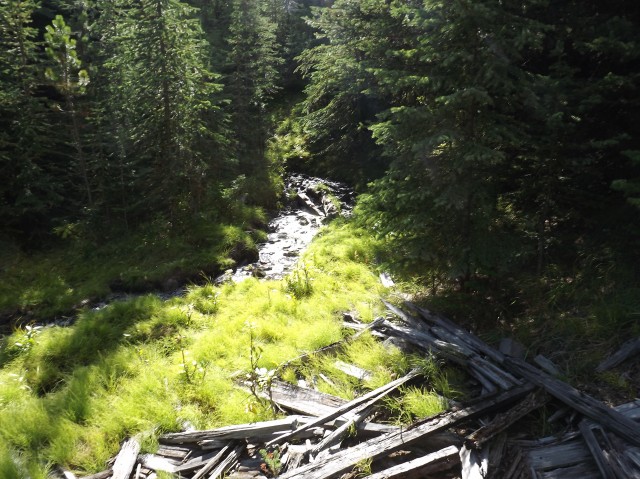
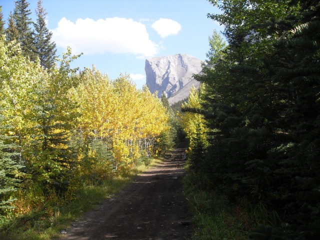
Fast forward and almost a hundred years after the mine first opened, we visit the site. Access is by the decommissioned mine road. It’s couple hour hike, or you can bike in or a ride a horse.
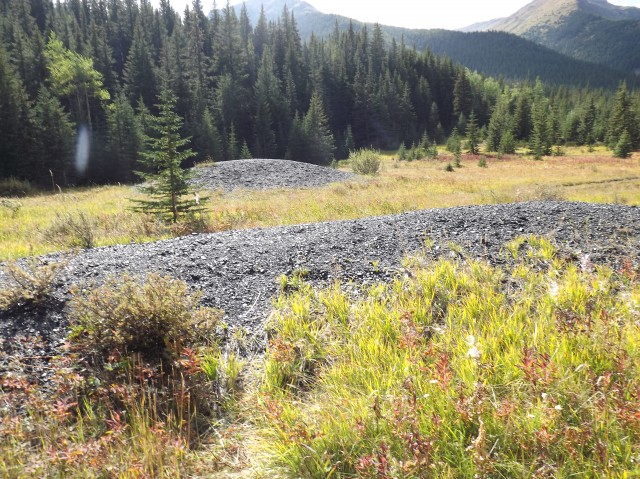
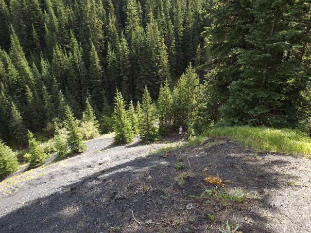
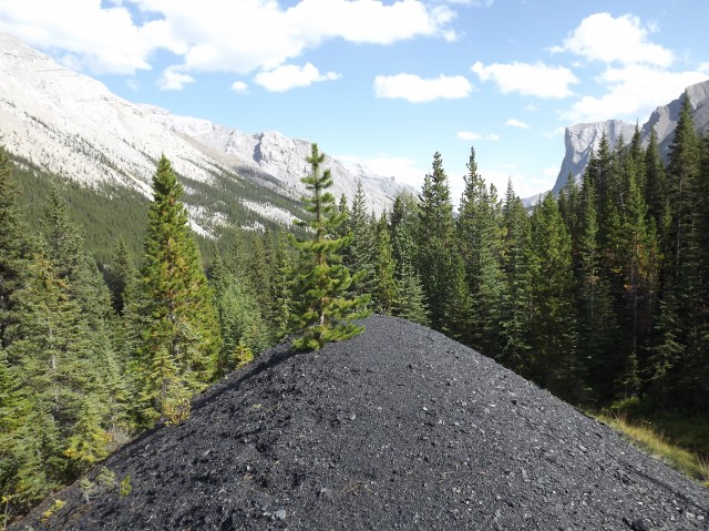
The first evidence of the mine are a couple small coal piles in a meadow. Here in this flat area was the housing for the miners, offices and so on. Nothing much otherwise remains today.
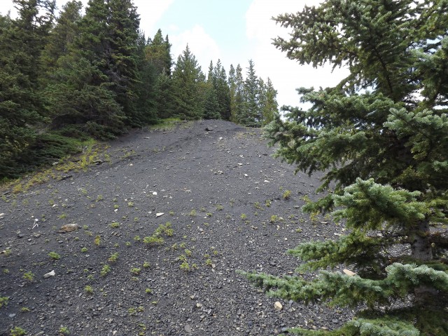
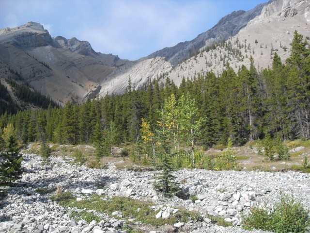
Most people who visit here think this is all there is to the Burns mine site, but it’s not, and higher up on some slopes to the south are two separate workings perhaps under a kilometre apart. It’s a bit of a steep hike to get to them and the trails are somewhat overgrown in places. Because of this, these two areas receive few visitors.
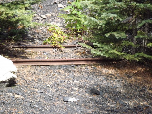
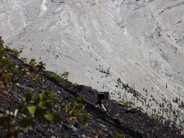
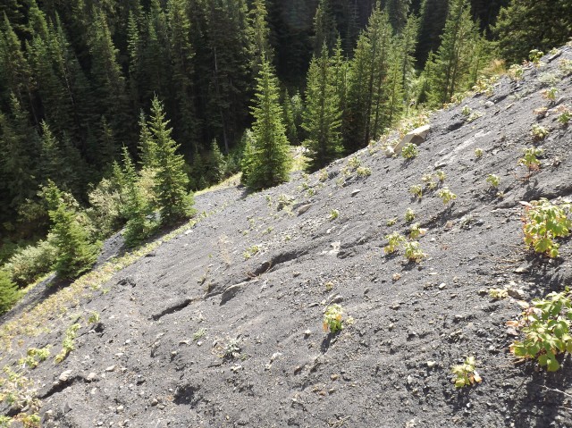
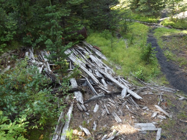
First we explore the east workings, situated on a steep hillside a couple hundred metres above the trail we came in on. There appears to be two levels at this location, one right above the other, with a large slack pile separating them. The lower workings still have rails coming out of the collapsed entrance. How the coal was transported from here down to the loading point at the town site is uncertain. Typically a tramway system is used, but no evidence could be found to confirm that.
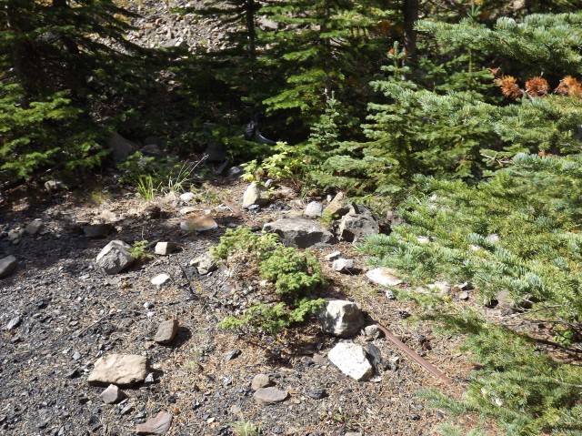
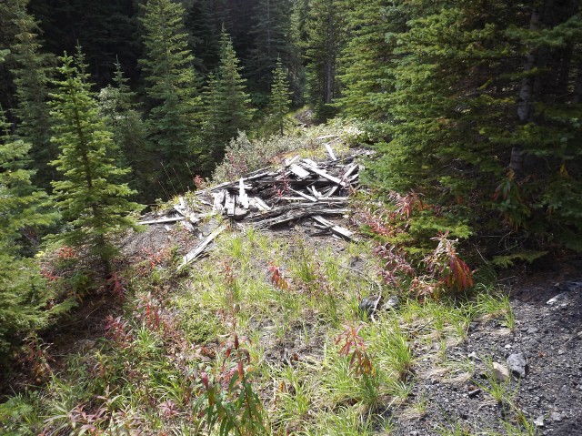
Scattered about here are the remains of a few buildings, old metal bits and not much else. Wild Raspberries grow on the coal slack. While enjoying lunch, I take a moment to make a time lapse of the clouds as they flow and billow past the mine site.
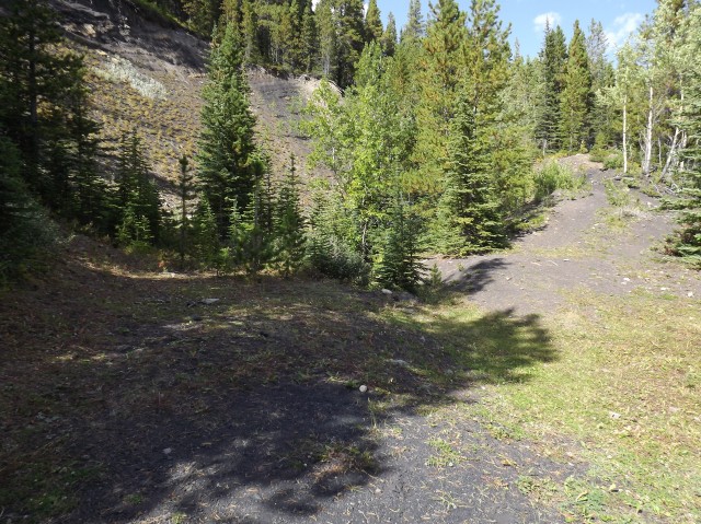
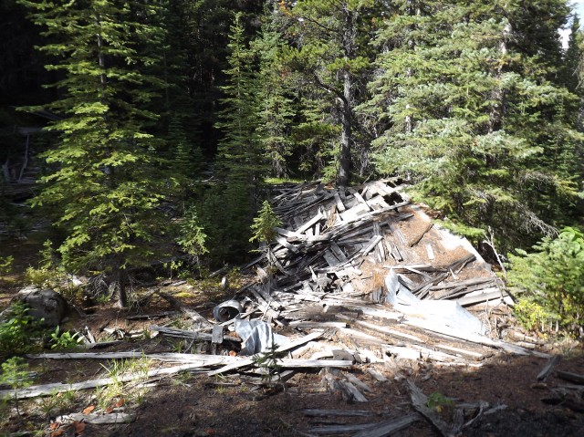
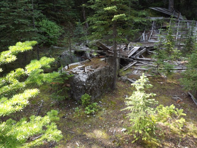
The second set of workings are situated a little lower on the mountain and to the west and judging by the amount of slack, debris and collapsed buildings it seems this was the main area of the Burns Mine operation.
The whole west site is littered with pipes, most of them flattened. It can be assumed these may have been used for ventilation (critical in a coal mine). An awfully stinky sulphur spring flows from the collapsed mine entrance here.
Be sure to comment on this post (below pictures).
It’s possible the east and west workings were connected underground, but it’s only a guess at this point. It’s not unusual for mines to have many access points.
The Pat Burns associated with this mine is the same person behind the company Burns Meats. He had his fingers in many enterprises and has quite a legacy in the area.
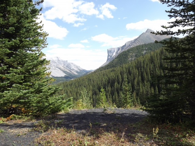
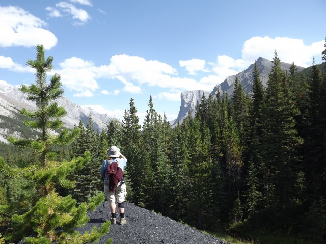
On the way out, we get a final look at Gibraltar Mountain. It’s easy to to spot, with it’s very broad near vertical face. Somewhere up there is the remains of a mine employee. On a day off, this person along with some other coworkers attempted to summit the mountain (using the easier back side), and along the way managed to fall over the edge. He’s still there, a sobering thought.
Heading back, reluctantly, we make our way to the car some ten clicks way, thoroughly happy with the adventure that has just unfolded. While the trail back is mostly unexciting, the views are good and they make it all worthwhile.
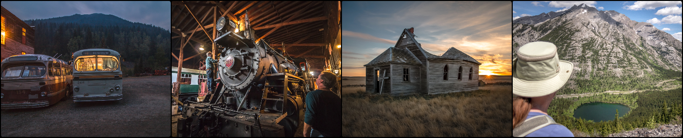
The Legion Hall and Monarch Garage, Loverna Saskatchewan, early 1990s (not 1970s as shown) and the same view in 2017. There's not much going on in Loverna these days, but long ago it was a very active and vibrant community. This was shot between takes while working on the Telus Documentary "Forgotten Prairie" by Rueben Tschetter.
Check the comments for more information. Original image thanks to and copyright Philip Brown.
Exploring history with Off the Beaten Path with Chris & Connie. Posted by Connie.
It's no secret Team BIGDoer is Boler obsessed but we're actually not owners, funny as it sounds. We can only dream and you know if we could, we would. The only thing holding us back from buying one, like the nice example seen here, is the cash to actually make the purchase and a proper vehicle to haul it around. Other than that, we're good to go!
Exploring history with Off the Beaten Path with Chris & Connie. Photo: 2021. Posted by Connie.
When exploring old farm properties, we always check out any nearby low lying areas or coulees. In case they hold any treasures. Jackpot! This is usually where farmers dumped retired old cars and equipment no longer needed. Out of sight, out of mind.
This car's a little more special than usual and is an uncommon post-WW2 Nash. A 600 we believe, but we're not the greatest at this. Scroll down to the comments to see a closer look and a comparison shot of a restored example.
Exploring history with Off the Beaten Path with Chris & Connie. Photo: 2014. Posted by Connie.
While on the subject of old Hotels and the Beer Parlour Project, here's Len, proprietor of the Elk River Inn (aka the Hoz) in Hosmer BC back in 2022. It's one of the first places visited by our group and sadly, we just found out the fellow passed away a few months back. This image was shot on film with an old-fashioned view camera.
During the interview Chris mistakenly called it the Elk Valley Inn and got an earful from Len. He was such a character and with an infectious dry wit! With his passing the business closed and we're not sure what the future holds in store. Look for a bonus photo of him in the comments.
Exploring history with Off the Beaten Path with Chris & Connie. Photo: 2022. Posted by Connie.
The Beer Parlour Project will be on the road this coming weekend and up by Edmonton. Team BIGDoer and photographer Rob Pohl, with his big view camera, are visiting the Warspite Hotel, Warspite Alberta the evening of April 12th and the Viking Hotel in Viking Alberta on the 13th.
We'll get to know some history, interview local characters and old timers, down a few chicken wings and with our cameras capture a little slice of Canadiana. These businesses are a throwback to another time and we're chronicling as many as we can while they're still here. It's 12 down with maybe a 100 to go.
If you're in the area, drop by and chat! Watch for the Beer Parlour Project Website coming soon.
Exploring history with Off the Beaten Path with Chris & Connie. Photos: 2023 (Coleman Grand Union Coleman AB & traditional Beer Parlour glasses). Posted by Connie.
Javascript is required for this site to function. Please enable it in your browser settings and refresh this page.
Please log-in to continue... This allows unrestricted access to every post @BIGDoer.com, popups are eliminated, commenting is on and the "contact us" page is enabled.
Your social site may send you a routine notice of login.
Or signup, here: Subscriber Register ___ BIGDoer.com: Serving up POP HISTORY & other McFun!…(Mmmm, yummy bite-sized pieces.) One million plus words & tens of thousands of photos!


")
")


Pat Burns had nothing to do with Burnco, completely different Burns.
Thank you for pointing that out – it took 10k visitors for someone to notice! Not sure how it slipped past the fact checkers but it’s been corrected.
You bring memories alive with your photos and stories. Coal was a lucrative business once. It is too bad the Company was too far from markets.
Coal’s a dirty word present day, but back when this mine was planned, it was the future.
Have you been to Saunders yet?
We’ve scouted the place and plan to return.
What an amazing piece of industrial archaeology. A most interesting find and love that time lapse!
One word.. Great! Two words.. Very awesome! Three words.. I love it!