
Bull Creek Hills – East Approach
A series of summits interconnected by ridges in the Highwood area of Kananaskis, the Bull Creek Hills are a great hiking objective at any time of the year. There are many ways up including this lesser used approach, tackling an easterly rib straight on. Trails on this route are sometimes sporadic and faint, and there is some loose stuff, so it’s best suited for confident outdoor types. Still, the going is pretty easy overall. An unavoidable up and over a small hill at the start adds to the cumulative elevation.
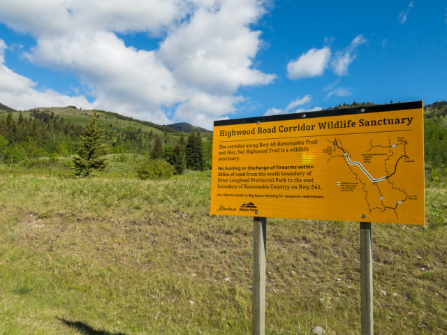
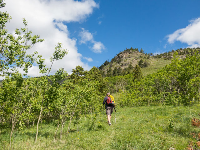
The traihead is right at the entrance to Kananaskis on Highway #40, west of Longview, where the foothills and plains meet. In fact Bull Creek Hills are the first real bumps of any size when coming in from that direction. Park at the pull off just past the cattle guard by the sign and flags. Look north and see your objective far off in the distance. Head west a bit and pick up a trail heading right. The fun begins.
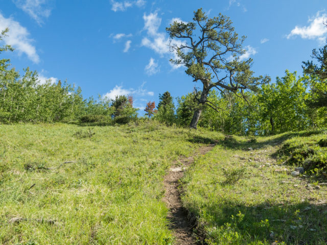
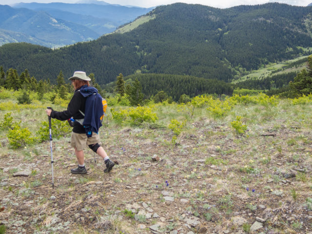
Climb at a steady pace though open meadows and aspen groves, passing many wind-beaten limber pines along the way. Soon on drop down and enter a more heavily treed area. Come to Marston Creek. Hope across, hit a meadow, and head west for a short time.
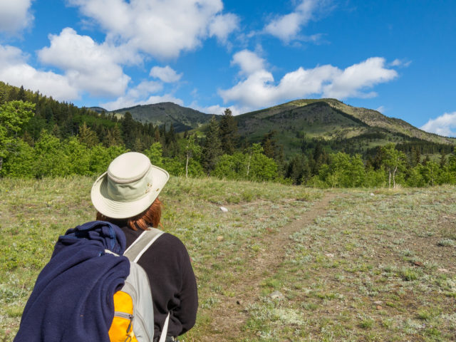
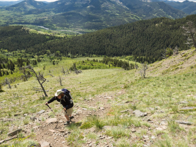
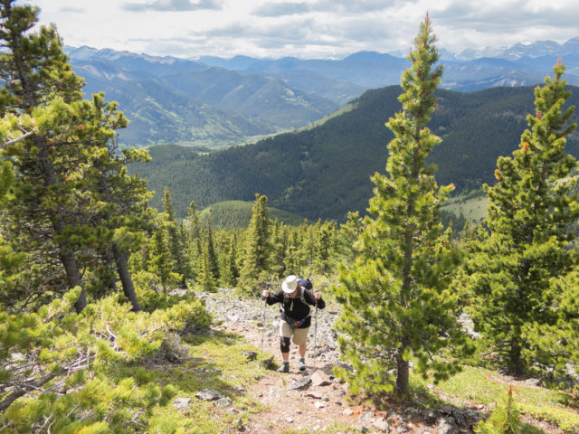
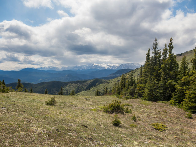
Coming to a grassy slope, turn right leaving the trail behind and head up steeply. You’ll parallel the Kananaskis border fence here. For the next while the grade rarely lessens. Huff and puff on. At a rocky outcropping, head for a break on the right side (trail appears). In the west notice a parallel rib, heavily treed from this angle, but open to the west, which can also be used to summit Bull Creek Hills or alternately as a descent route. We may come back to try that loop sometime. The views start to open up here and they only get better as you gain elevation.
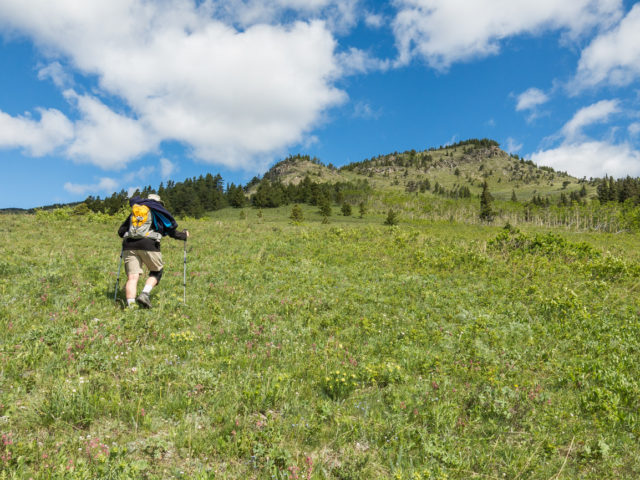
Continuing on the grade levels out briefly. Look left and see the summit, seemingly no closer then when you started. Hop over the downed border fence. At a rock band, trend left into the trees or right on steep grassy slopes. Or if scrambling is your thing, face them head on.
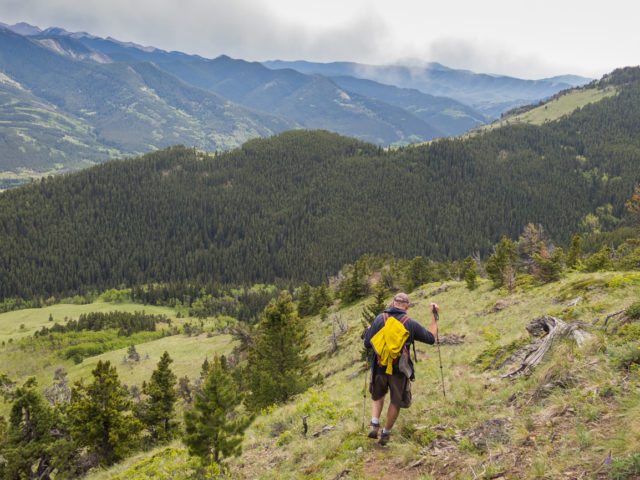
There are no real trails for the next while. Well there are some but they come and go and are often easily lost. If all else fails, just keep heading up. It’s obvious. Where the ridge widens, the grade levels off. It’s now broad and flat and the going easy. Stunted wind-ravaged trees remind one, up here it blows. A lot! Hold on to your hat.
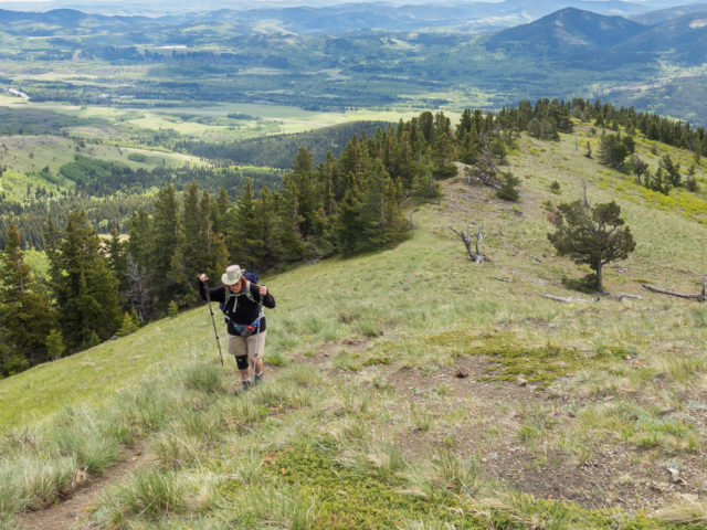
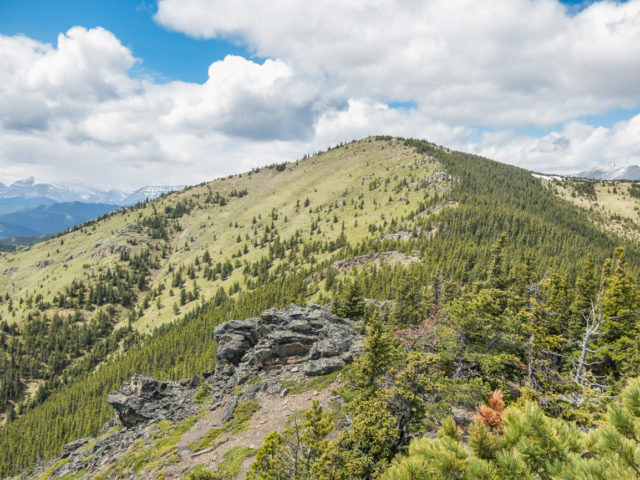
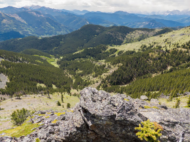
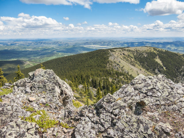
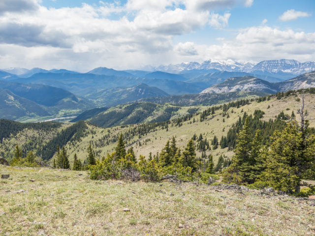
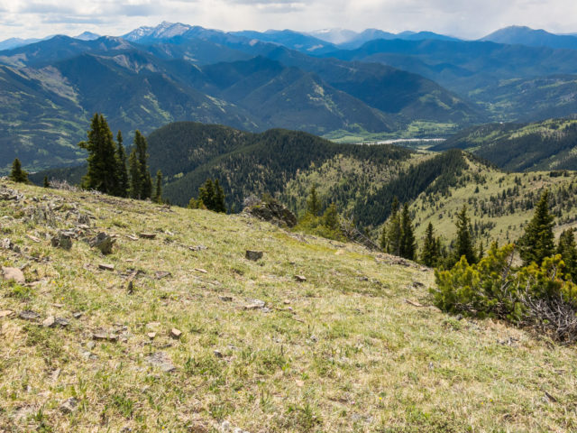
The highest summit of Bull Creek Hills can be seen to your left. You’ll be there soon enough. Rolling hills and ridges transition to the plains in the east. Calgary is a bit further north in that general direction and can be seen if you look hard. The Highwood River can be followed far below (south and east)
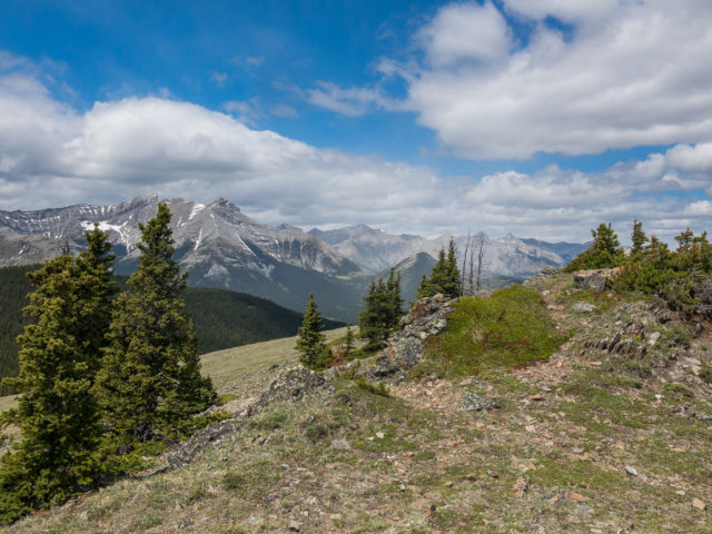
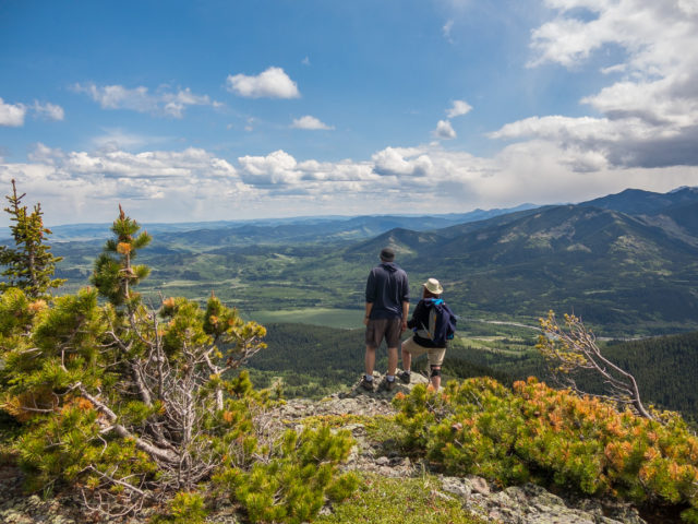
Trending left, it’s up and over a small rocky bump (our lunch spot later), a brief drop down and then a final push to the summit. Work your way through a series of rock outcroppings and soon on top out at the summit, marked by a survey post. The views here are stupendous all around.
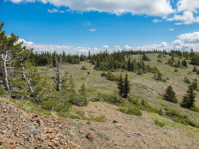
To the north are remote and seldom visited hills and ridges extending off for some distance. To the east, the entire ridge you just came up can be seen. The route up that parallel ridge is clear as well. We considered using it on the descent but though it’d be better tackled another day.
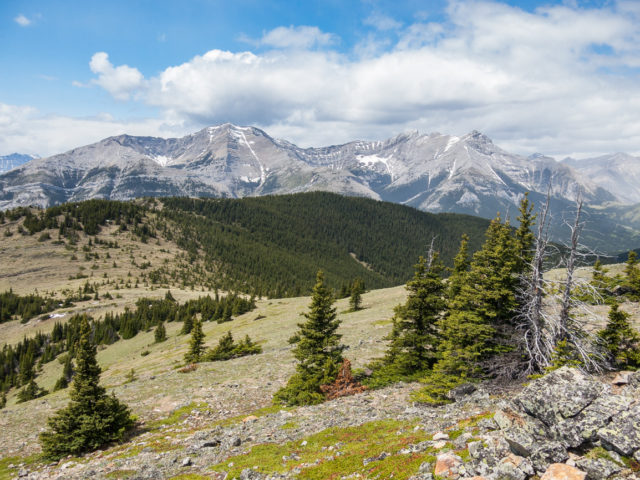
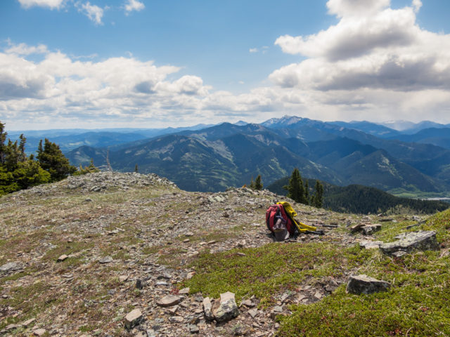
Directly west Holy Cross Mountain dominates the view. To its north is Mount Head. Closer in are the three westerly summits of the Bull Creek Hills. They are somewhat lower and can easily be reached from this main summit. We visited them in the past when were used the more westerly Grass Pass approach, the more popular route up Bull Creek Hills.
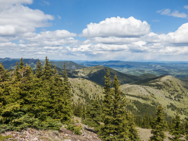
Closer in is Gunnery Ridge (unofficial, a name we gave it) and in behind a small lump of rock called Gunnery Mountain. Across the Highwood River and highway is Mount Mann. Other hills and ridges worth mentioning in that area include Coyote Hills, Raspberry Ridge and Hells Ridge. In that same general direction, almost at the Alberta/BC border is a near impenetrable wall of barren rock. While we had good weather overall (well it was windy, but that’s expected here) it was storming badly there, a spring snow storm dropping some of the white stuff at higher elevations.
Tragic bit of history: in the early 1950s a military training aircraft crashed on the north side of Bull Creek Hills, somewhere not terribly far from the summit, killing two airmen. I understand nothing is really left of the wreckage today. We didn’t investigate further.
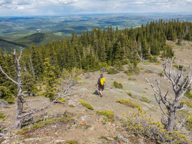
Retrace your steps back to your car. It appears that one could drop down from here to the headwaters of Marston Creek, if they wanted to make a hasty retreat off the summit. But why would you do that? Best to extend a ridge walk as long as possible.
We headed down into the trees, out of the wind, to enjoy our lunch before heading back. This is a ritual for us, the topping on the cake, fine eats with a view, good company and wine. Ahhhh, satisfying!
We saw one other group on Bull Creek Hills this day but they took a different line than us and we never got that close to each other. It was nice and quiet and peaceful and we pretty much had the place all to ourselves. Love the solitude. This hike can often be done all year round.
The hills take their moniker from nearby Bull Creek. Or rather what was once was Bull Creek, interestingly now officially renamed Cutthroat Creek, leaving the hills without their namesake today.
The more common Grass Pass (westerly) approach…
Bull Creek Hills.
More like this…
Cox Hill.
Missinglink Mountain.
One Mine Ridge.
If you wish more information on this route, by all means contact us!
Date of adventure: May, 2016.
Location: Highwood area, Kananaskis AB.
Distance: 11km return.
Height gain maximum: 770m.
Height gain cumulative: 910m
NOTE: all distances and heights are approximate.
Technical bits: loose stuff, moderate route finding challenges.
Reference: Kananaskis Trail Guides by the Dafferns.
The summit of Bull Creek Hills in back just left of sign.
We head up and over a small hill.
The true summit is left.
A steep push.
We’ll head towards that rock outcrop.
Elevation is gained quickly.
This is the most easterly ridge of Bull Creek Hills.
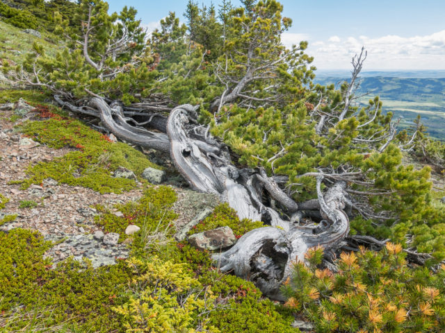
a wind-twisted pine.
Some loose bits here and there.
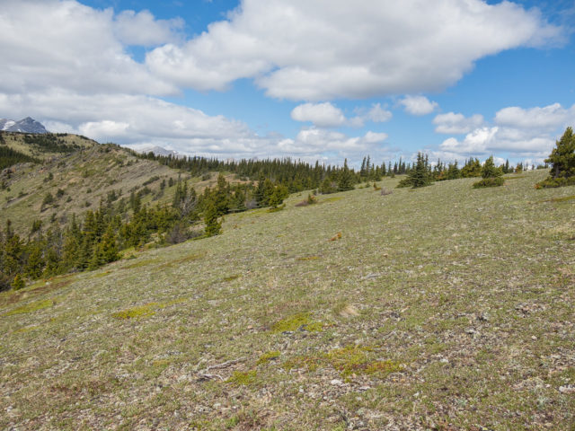
The grade eases and the ridge widens.
Connie follows…
The summit is not far off now.
Looking down and south.
The ridge we came up.
Remote hills in the north.
Holy Cross Mountain (back left) and Mount Head (back right).
Gunnery Mountain – small lump of rock right of centre.
The ridge in centre will also get you to the summit.
From here one can continue to the western summits (follow grass ramp in back).
We’ll soon head down into the trees and out of the wind for lunch.
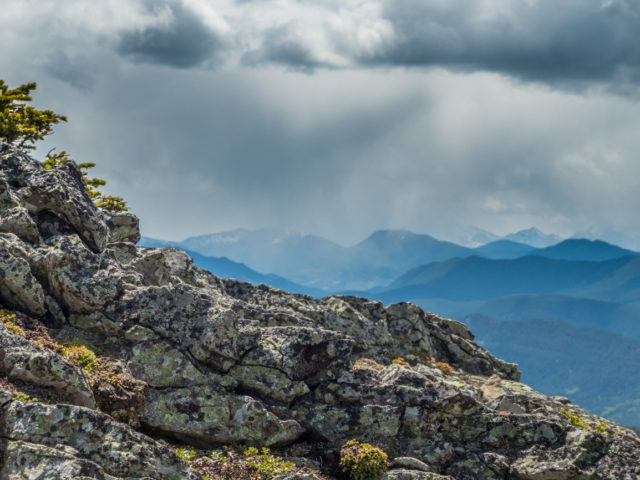
A storm just south of us.
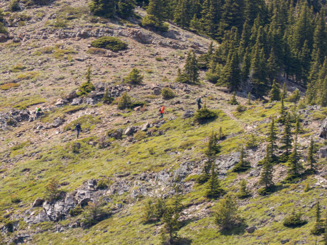
The only other people we saw this day.
Heading down.
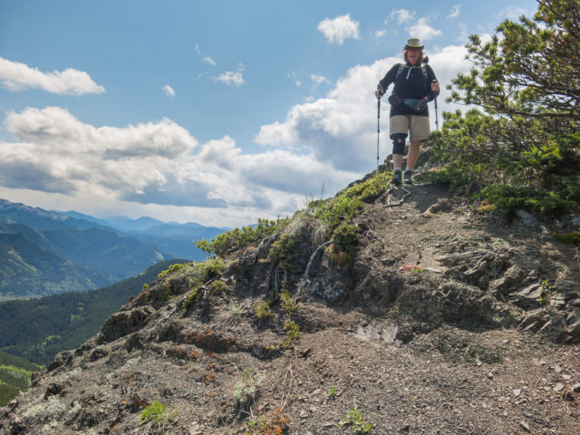
A happy hiker.
Snow gets dumped on peaks in the distance.
Soaking up the views.
The middle ridge in behind.
The going is steep but easy.
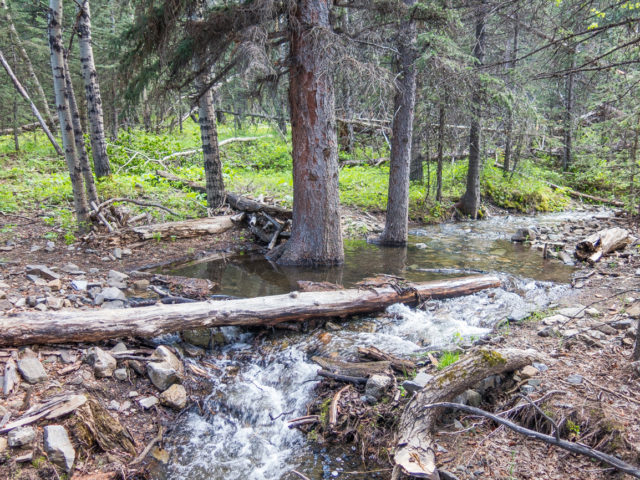
Tiny Marston Creek.
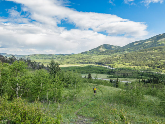
A short skip and jump from the parking spot.
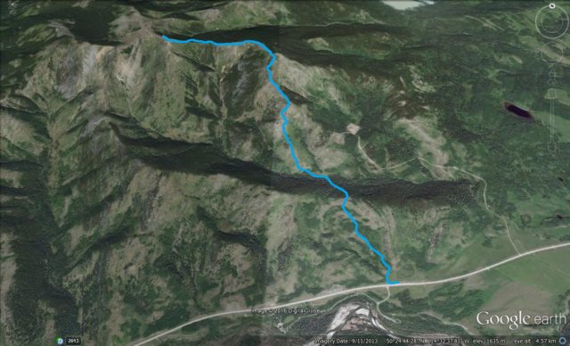
Bull Creek Hills – East Approach.


")


Soon, more places like this!
Yes, keep working it. Recovery is long and slow but if anyone can do it, there’s you.
I’m definitely not a hiker but do admire and appreciate what you do.
Thank you, we’re so glad to share these adventures with you.
Love the view!
The reward on making the summit. It never ceased to blow us away.
One of my favourite hikes, year-round. Special light in the hills.
That’s it’s in the transition zone where the plains and Rockies meet is what we really like. Looking out over that flat land to the east is so cool.
Being still in nature restores the very core of our soul.
Perfect! Nail on the head.
Hiked up to Bull Creek Hills last Thursday using the middle ridge for the ascent and yours for the down. No problems at all.
I think we’ll give that a try sometime. Eyed up that middle ridge the whole way up.
(via Facebook)
Was up here last week. Patches of snow at top.
Saw a few in sheltered areas but nothing else otherwise.