
Indian Oils
The Indian Oils Trail in Kananaskis is most often done as an out and back. Nice enough, but why not mix it up a bit? Try a far more interesting alternative making a modest length loop using the official route for the ascent leg then a connecting ridge for the descent. The rewards? Nice views and more of them, varied topography, and some fun off-trail bushwhacking and route finding (the way is fairly obvious).
This trail is kind of short and easy to access (it’s not too far from Calgary) meaning it’s a good choice if one lacks ambition or time…or both. We only had half a day to play in the woods, so it fit our needs perfectly. Something short, quick and close. The trail is official, so it’s signed with maps at strategic locations. It’s popular with equestrian riders so expect to see a horse or two when hiking it.
The trail head is at the Indian Oils day use area, highway #546m, along the Sheep River in Kananaskis just west of Turner Valley. From the parking spot, find the trail at the northwest corner of the lot. At the first junction, very soon in, turn right and not long after cross the highway.
Trend left and climb a little. In no time come to a good-sized cut exposing a coal seam. In years past the land here was home to several small coal mines or prospects, one of them called Indian Oils and years earlier, an oil well operation of the same name. The whole Kananaskis region is underlain by numerous coal seams and was explored early on, before it became a recreation area of sorts, but few mines were ever put into production. Today, they’d never allow it.
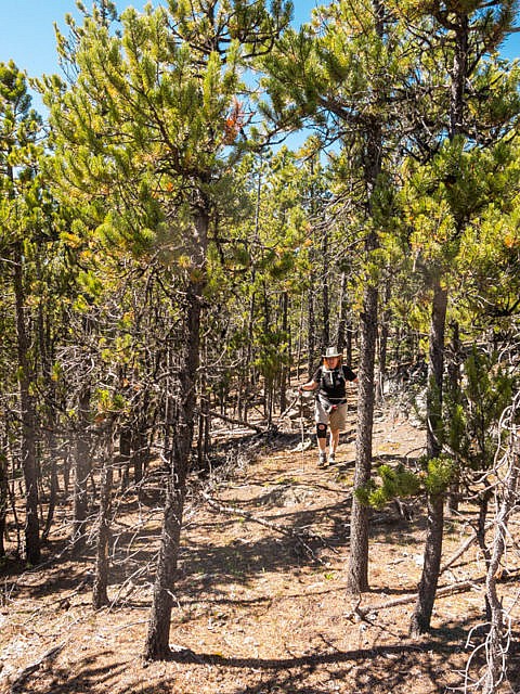
Cross a small creek and soon on come to a four way junction. Other paths are alternative starts to the same Indian Oils Trail. Bend right (north-ish) and start climbing. The grade is mostly gentle with a few short steep pushes here and there. A creek gurgles below in a deep canyon. It’s soon out of ear-shot.
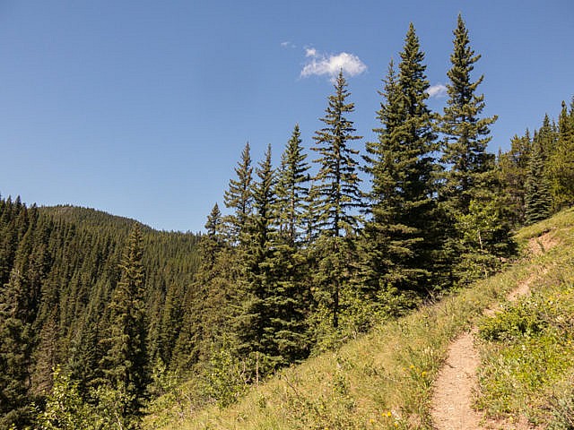
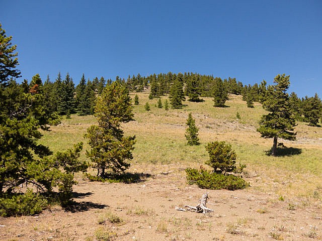
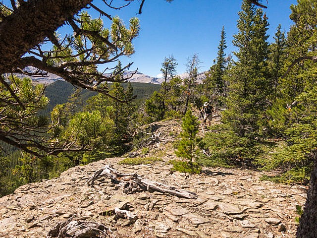
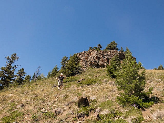
After a time, always climbing, come to a switchback. Since the coal mine the trail has been in the trees, but now things open up a bit. Trend right and reach the ridge crest. There’s a bench here, fully occupied by other hikers on our visit, and a place to tie up one’s steed. To the left the ridge rises a bit to a mostly open summit. It beckons but we ignored the call (stifling heat left us unambitious). Next time.
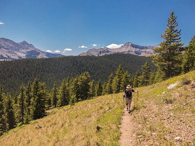
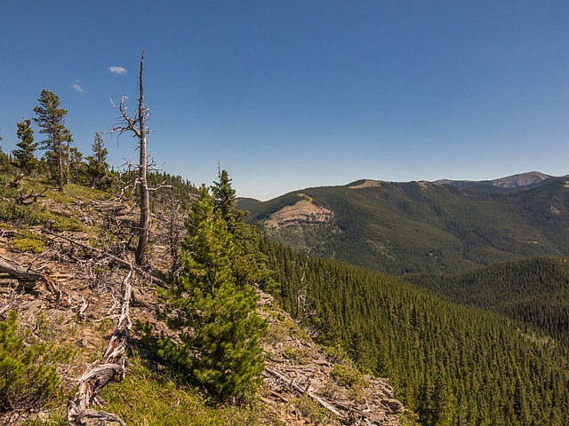
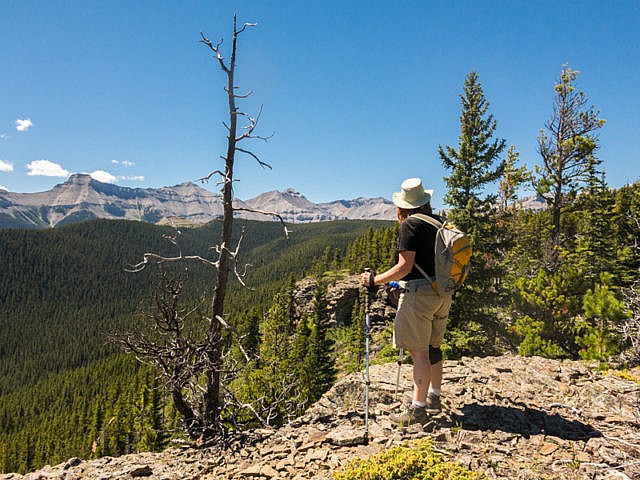
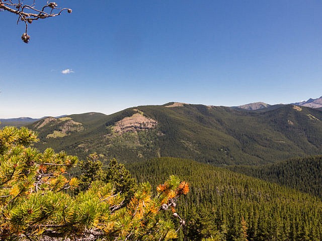
Check out the views. All around are rolling hills, most of them heavily treed. To the west and southwest are a wall of tall peaks – Shunga-La-She, Bluerock Mountain, Threepoint Mountain and many others. A obvious gap in them allows the Sheep River to exit the mountains. No views to the north or east – too many trees.
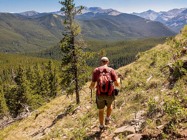
From here, turn right leaving the official Indian Oils Trail (if you’re curious, it continues east dropping down into the next valley over) and go off-route into the woods. Make sure you’re comfy travelling sans trail. Keep close to the top of a cliff band, west side of escapement, for the easiest going (fewest trees) and most things to see (those peaks in the west). This section of the ridge ends abruptly. To continue skirt left below the cliff band there, on steep grassy slopes and enter a meadow.
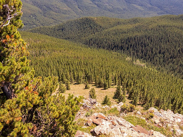
Mount Hoffmann (oftentimes spelled Hoffman – one n – I believe our usage is official) comes into view in the south across the river. We’ve been up it. It’s mostly treed like but has an open top and is a nice outing. Access is via an old logging road. Other green bumps surround it.
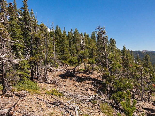
Back into the woods the lower ridge broadens. The trees are dense (and small) but the going is easy. Keep a roughly south-south-east trending line. At top of more cliffs, you could continue straight, picking your way between the rocks, or seeing a good opportunity, drop down left on shale slopes. Soon on, intercept the trail you came in on, turning left.
It’s a short hop, skip and jump back to the car, another fun and interesting woods outing under the belt.
We saw perhaps a dozen other hikers while on the official Indian Oils Trail, but none while bushwhacking. Recall, horses use this route. Be careful not to spook them on passing.
More ridge-walking fun…
Bull Creek Hills – east approach.
Powderface Ridge.
Wind Ridge.
If you wish more information on this route, by all means contact us!
Date of adventure: July, 2016.
Location: Sheep River area, Kananaskis, AB.
Distance: 8.5km loop.
Height gain maximum: 500m-guesstimate (our GPS said 725m but that’s highly suspect).
Height gain cumulative: 550m-ish.
NOTE: all distances and heights are approximate.
Technical bits: Some loose stuff, off trail navigation.
Reference: Kananaskis Trail Guides by the Dafferns.
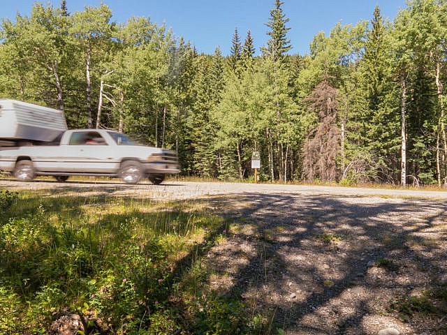
Crossing the highway near the start of the Indian Oils Trail.
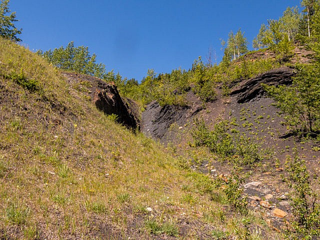
Scars from a small coal mine.
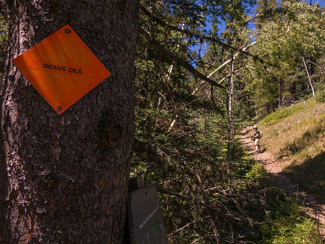
The way is signed.
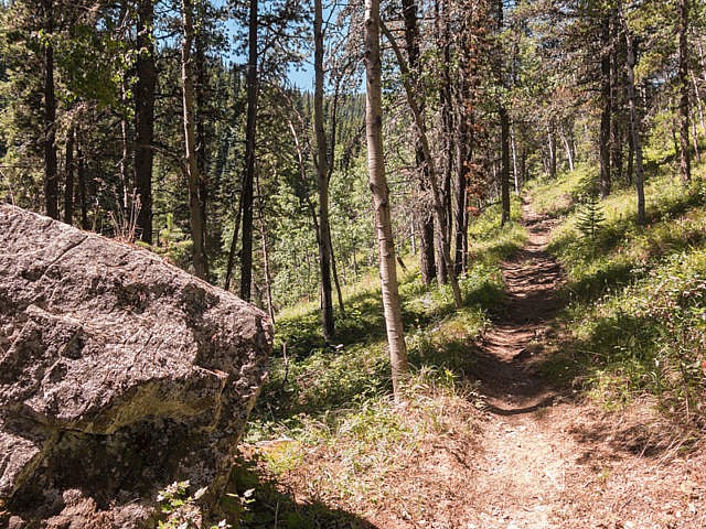
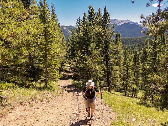
The trail stays in the trees for a the first couple clicks.
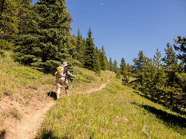
Finally, an opening in the trees.
A steep push here.
Almost at the crest of the ridge.
Looking back.
Next time we’ll visit this bump.
Off trail and on the ridge.
High peaks to the west.
Keeping to the top of a cliff band.
Connie’s never far behind.
The trail up is somewhere below in that valley.
Dropping down.
Mount Hoffmann in the south.
Almost back in the trees.
Bushwhacking it.
Break time!
About to intercept the Indian Oils Trail we used for the “up” leg.
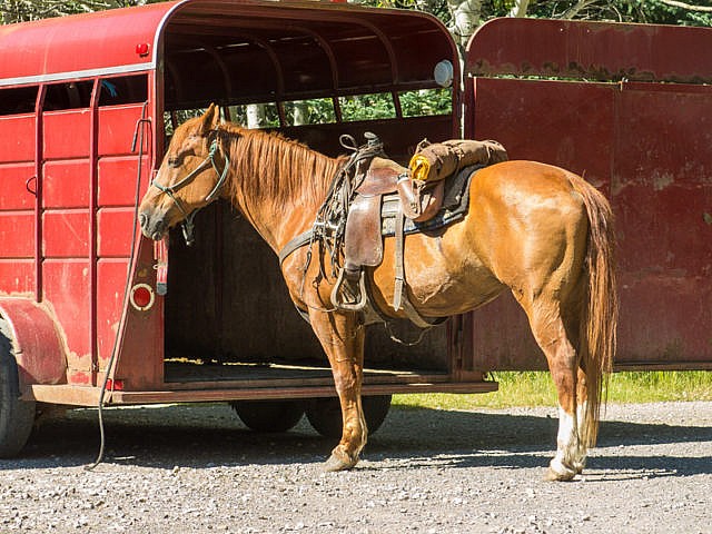
At the trailhead – the area is popular with equestrian riders.
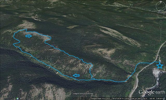
Our route…


")


WHAT is the name of this unnamed trail on google maps between Indian Oils parking lot and the U of C Biological Station (in Sheep River Park)? Google suggests that it runs along the north edge of the Sheep River, yet I can’t find any mention of it online anywhere. It isn’t in any other online open-source map, government map or hiking website. I don’t have the specific volume of the older trail book for this area to read into it.
It looks like a nice 4 km walk in the park, but it has no name. I’ll add it to Opencyclemaps.org if I can get more data on it. I was just past the area on 2018_05_19, and there were several black bears around.
Please help me identify this.
We know of it, and even talked of checking it out. It does look like a nice stroll in the woods, maybe for a lazy day. Those gorges look impressive. We’ve been asking around and no one seems to knows anything. Sorry, no help here. Maybe it’s your chance to name it and introduce it formally to the world? There seems to be a couple bears that hangs around the area. We almost always see one, or at minimum fresh signs of one, when hiking there. Thanks for commenting!
(via Facebook)
Gorgeous scenery all around you!! We do live in a beautiful part of the world, eh?
No argument here. We have the best playground ever!
(via Facebook)
Great hike & shots!
Thank you so very much. We love sharing our adventures.
(via Facebook)
Was just out there last week. You can get to the Blue Rock mountain From Indian Oils. Amazing!
I didn’t know that. Might have to look it up.
Hi Ardis! A group of us were out hiking from Indian Oils toward the Bluerock Knob Trail last week. The ridge walk is great! Would you have a gps track to share, of your best route please?
Thanks!
Jo from Sheep River Ramblers (Turner Valley)
Here’s hoping Ardis can help you out…