If you crave splendid full-on remote middle-of-nowhere not a soul around isolation, in a beautiful mountain setting, this is the hike for you. We picked it for just that reason. After an incredibly busy couple weeks documenting all manner of historic and industrial sites across Alberta. Saskatchewan and British Columbia, and interviewing those associated with them, we wanted to head into the wilderness to unwind. It just had to be away from the crowds and scenic.
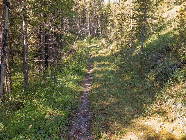
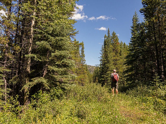
No pulling punches here, the hike in, all eight plus clicks each way is…well..a bit mundane, the path always in the trees and at times seemingly to go on forever. Worried? Don’t be, the reward at the end makes it ALL worthwhile, a valley rimmed one on side by beautiful forested hills and the other by impressive towering peaks. It’s gorgeous and chances are you’ll be sharing it with absolutely no one. It’ll be all yours. There’s the possibility of continuing on, potentially to even more breathtaking environs, if you’re feeling energetic and/or have lots of time.
Mountain Solitude: a trail that’s in the trees with little to see until its end…then its wow! A Chris & Connie Adventure!
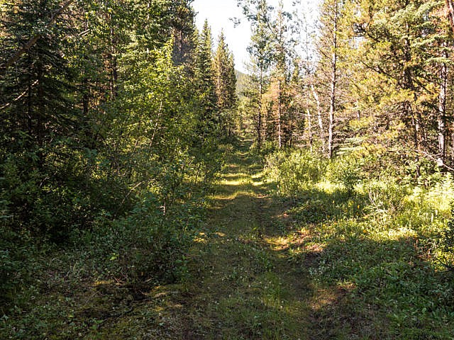
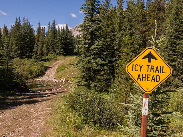
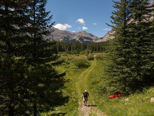
The route, officially the Baril Creek Trail, used by hikers, bikers and equestrian riders, follows an overgrown logging road. The going is easy with some minor ups and downs – nothing hard. There’s a few muddy areas. Navigation isn’t a challenge, even with many off-shoot roads (most overgrown), the route being marked by light blue rectangles painted on trees. This is prime bear country, so come prepared. We saw none this day, nor even any signs of them, but we know they’re there.
↓ ↓ ↓ ↓ Scroll down for photos and to comment ↓ ↓ ↓ ↓
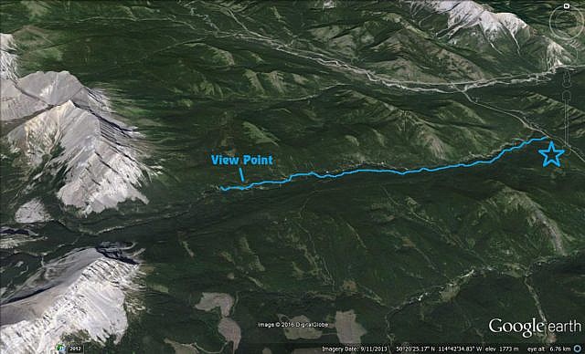
The trail head is along Highway #940 (gravel) in the southwestern part of Kananaskis, an area of rolling green hills and towering mountains. Find an obvious pull-off just past (south of) Baril Creek and take the trail heading north into the woods. Soon on, intercept that old logging. It follows a mostly westerly-trending line for the remainder of the trip. At some points Baril Creek is close and can be heard far below in a deep canyon.
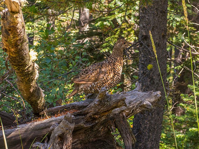
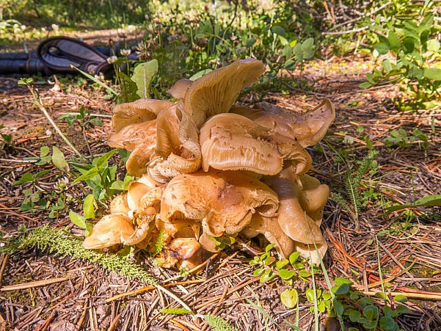
Notice all the Buffalo Berry bushes lining the path. The bright red fruit is edible, and even full of all kinds of goodness, but taste awful. Bears like them. With lots of rain recently, the forest floor was blanketed with mushrooms of many different colours and shapes and sizes. Wish I was better at IDing them. Have read numerous books, studied up on them, and just can’t seem to get it. Many Grouse were passed. These dumber than a post birds survive by blending in and not on wits. They can often be approached to the point of touching, giving this “what the hey” blank-stared look before sauntering away or half-heatedly flying off. If they even move at all.
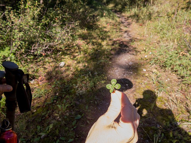
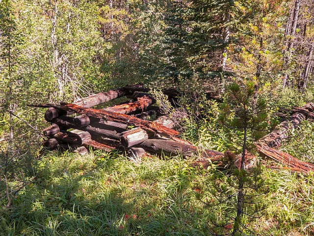
Come to the occasional meadow, otherwise it’s an endless parade of passing trees. If you’re like Connie, you can keep occupied by scanning the ground for four-leaf clovers or strawberries as you walk. Both seemed plentiful. At one point see the remains of the log loading ramp. Up until the 1970s (or thereabouts) the area was harvested of trees. Those former cut-blocks have grown in well since then and it’s hard to tell where they are. Isn’t nature resilient?
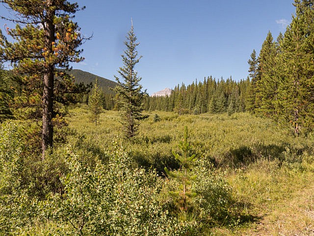
A few small streams are crossed. Look for the grassy sloped Coyote Hills to the north, where the trees thin. It’s an objective we’ve been eyeing up for some time. Every now and then, the big mountains in the west can be seen too. Stop teasing! We’ll be there yet!
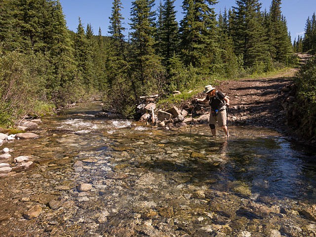
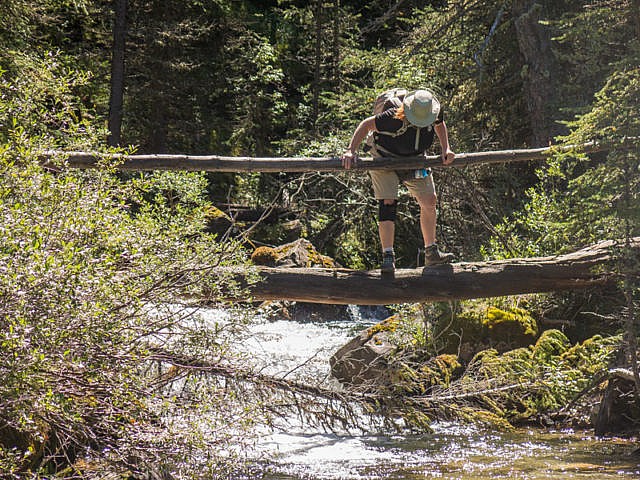
The going, while a little mind-numbing, is at least fast. Join up with a road, one much more used than the one just left. This route comes in from the next valley over in the south. Soon on come to Baril Creek. There’s a foot-bridge of sorts here, a bit out of sight upstream, that we could have used, had we noticed it before plunging into the damn chilly waters. Doh! We’ll use it on the return.
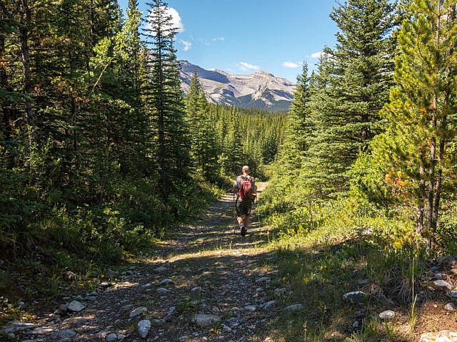
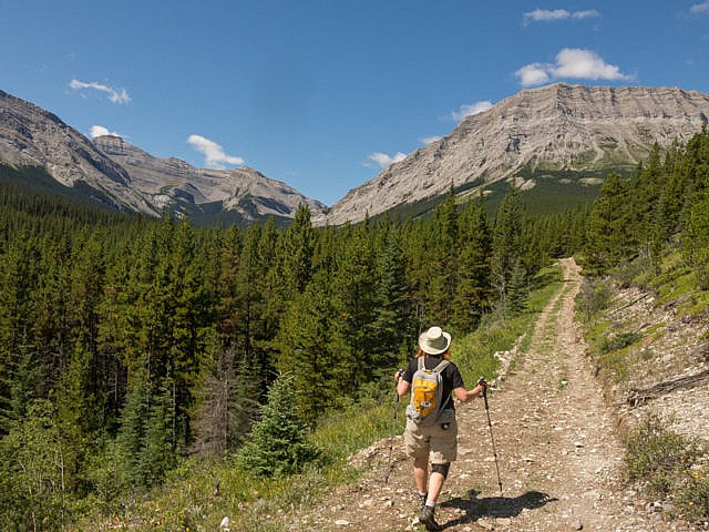
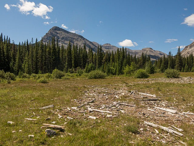
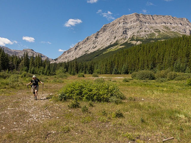
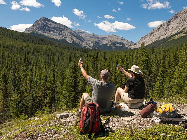
After a small rise, there’s a break in the trees. Finally, some views. And they’re glorious! The hills in back and to the west, an impenetrable wall of Limestone that is the Alberta Rockies. Worth the price of admission right here. From south to north, Baril Peak, Mount Cornwell and Mount Armstrong are the most prominent massifs. These sit right along the Continental Divide and incidentally the Alberta/BC border.
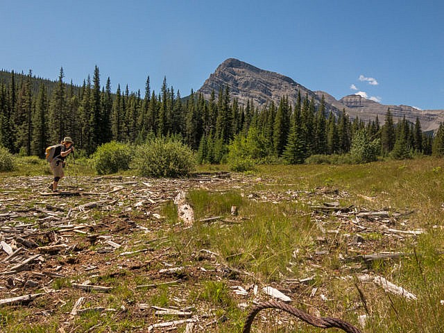
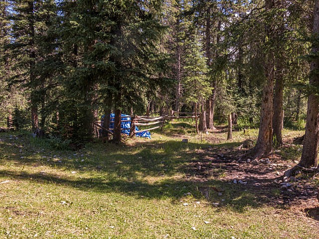
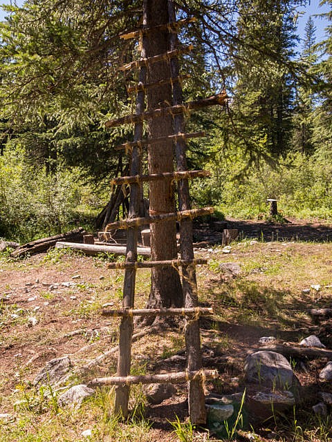
Back into the trees, temporarily, meandering a bit, soon on drop down to a large meadow (scan for bears). Notice the wood cut-offs scattered about, the remains of a small sawmill operation that once operated here. Do a three-sixty and take in those views more.
On the far side, back in the woods (again), just past a junction (Great Divide Trail), come to a campsite. I could see spending a night here…or anywhere in this valley for that matter. It appears as though the trail west would remain in the trees for the next while, and we already had our share of dense greenery, so we made this our turn around point. Unbeknownst to us, we could have continued on for a click or so and come to a lake. Not sure if it’s worth the visit or not. It looks small and rimmed by dense woods.
Further still, one could go up to Fording Pass but that’s for the ultra-ambitious. It’s probably not doable in a day unless you start real early and have tons more energy than us, biked some of it to save time, or set up base camp nearby and did it as part of a multi-day outing.
Don’t forget to LIKE or SHARE this post.
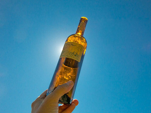
Head back the way you came. We take time to enjoy some well-deserved lunch at the first view point. The wine went down real easy. Finally, exhale! This is what we came for! Our return trip was uneventful and fast. Yours will likely be too. It’s mostly downhill (always a gentle grade). Keep in mind the potential for bears.
If the dull approach is a turn off, but the goal interesting, one could bike in saving some time. Recall, I said it was remote with likely no one around. We did bump into three people who had overnighted in the area, so we did have some company, albeit just briefly.
If you wish more information on this route, by all means contact us!
Date of adventure: August, 2016. Location: Southern Kananaskis AB. Distance: 17km in total there and back. Height gain maximum: 300m. Height gain cumulative: 400m-ish. NOTE: all distances and heights are approximate. Technical bits: This trail? Come on! Reference: Kananaskis Trail Guides by the Dafferns.
(via Facebook) I find camping at James Lake provides a great launch point for exploring the area including Fording Pass, Mt. Boulton and Armstrong. Extremely quiet. Been there twice and only ever saw a couple of people; those being day hikers.
We went in a bit blind and didn’t know about James Lake at the time, but I guess we got close. I definitely could see the possibilities of hanging around the area for a weekend or so.
We used to do something called the "pointless challenge" 🤪 and miss those days. It was so much silly fun and often frustrating as heck. In these we'd invite people to send in random photos of obscure locations, but not give any information, and then we'd track where it was and shoot something similar.
Most of these came from old family collections, as was the case here. Anyone up to resurrecting the series?
In hindsight, why didn't we pose someone in our shot?
Pointless: “Devoid of meaning (or) senseless” Merriam-Webster.
If you like what we do and want to support this ongoing project (12 years now), go here: https://www.BIGDoer.com/help-the-society/ Thanks to Connie for making this post possible.
Exploring history with Off the Beaten Path with Chris & Connie. Photo: ca1970 and 2014. Posted by Connie.
Captured on a cold, cold day many years ago. We've been passing this old house for decades and it's little changed in that time. At some point we expect to drive by and it'll be gone.
Exploring history with Off the Beaten Path with Chris & Connie. Photo: 2017. Posted by Connie.
When retired old railway cars usually get cut up for scrap. Sometimes, however, they find their way into the hands of the general public or whomever. Flat cars make good bridges, and boxcars can be transformed into storage buildings and the like. Case in point here. We see them used like this often enough and in this case, it's part of a corral.
Incidentally, this boxcar dates from 1950 and this was found by tracing the old road number, which is still visible.
Exploring history with Off the Beaten Path with Chris & Connie. Photo: 2017. Posted by Connie.
This central Alberta racetrack was never a commercial operation but instead just a fun place for car enthusiasts in the area to get together. Early '70s or thereabouts and it only lasted a few years. Even thought it's been abandoned for that long, there is no doubt what was here.
You know we like the the obscure stuff and this one fits the bill perfectly. Found by accident while backroad cruising and the history comes thanks to local car guy Mike.
Exploring history with Off the Beaten Path with Chris & Connie. Photo: 2022. Posted by Connie.
On top of little Myrtle Mountain in the Kimberley (BC) Nature Park.
There's some good wilderness fun to be had here and nice views as you can see, but the real reason we came is mining history. The whole area near the ski hill was extensively worked over a century ago and we were looking for evidence of this. We didn't find much in the area searched, but it's a big chunk of property and we hope to return to cover more ground again soon. Of all the subjects we cover, mining related is a favourite.
Still, it was a good hike and that can't be bad. Look to the comments for more info 👇.
Exploring nature and history with Off the Beaten Path with Chris & Connie. Photo: 2022. Posted by Connie.
It's a strange curiosity in south Kananaskis, there on a hillside and we have no idea who created it. We asked around and no one's completely sure about its history. In the past it showed the Canada 100 logo from 1967 but in 2017 someone changed it to reflect the country's 150th.
That's our friend Emily from DanOCan.com having a look.
Exploring history with Off the Beaten Path with Chris & Connie. Photo: 2017. Posted by Connie.


Looks like a wonderful day!
Any day in the mountains is!
(via Facebook)
I find camping at James Lake provides a great launch point for exploring the area including Fording Pass, Mt. Boulton and Armstrong. Extremely quiet. Been there twice and only ever saw a couple of people; those being day hikers.
We went in a bit blind and didn’t know about James Lake at the time, but I guess we got close. I definitely could see the possibilities of hanging around the area for a weekend or so.