
Adanac Ridge
Wanna’ a new hike in the Crownest Pass of Alberta? Some “fresh meat”? Try Adanac Ridge, a long north/south trending hill. It’s a fine objective, yet strangely visited by few even though it’s not terribly difficult to do and is easy to get to. There is no trail to speak of but getting to the top, really, is a no-brainier. There’s a pesky band of thick vegetation between you and where you need to be that can be sometimes challenging, but most of the time it’s super easy going with lots of grassy open slopes and minimal route finding issues.
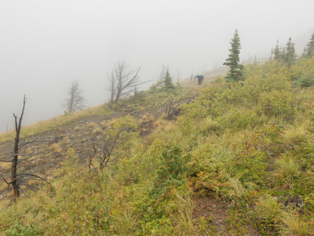
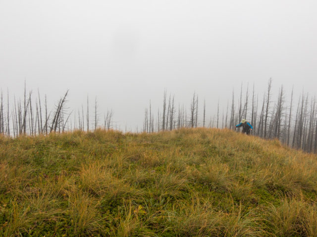
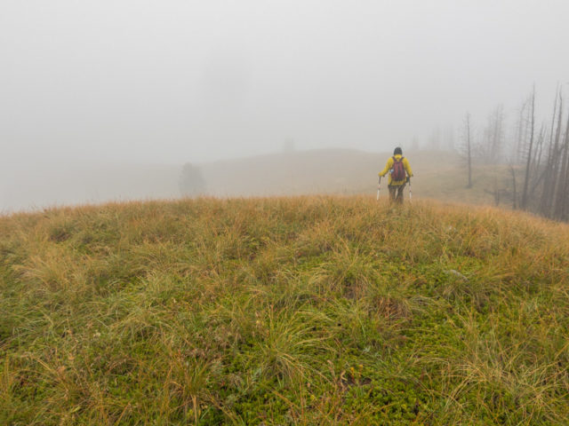
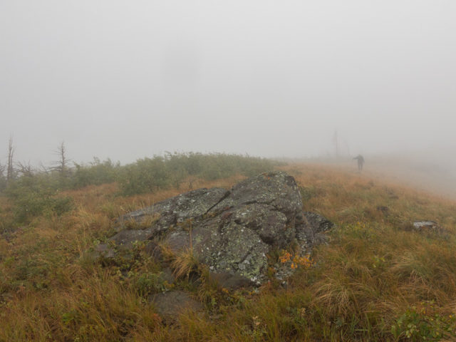
Views from the ridge crest, belying its modest stature, should be pretty good. Wait, what do you mean should? On our trip the summit was socked in by low clouds, so we didn’t get to see them. Still, we had a fun time, even with the limited visibility. We’ve had our share of “head in the cloud” hikes and they’re not so bad. They’re quite peaceful for one. With all the mist in the air though, we were soaked by the time we were done.
The ridge, for a time, was home to a coal mine. Signs from this operation can be found while hiking the route described, some old exploration roads, some of which you’ll use, mine subsidence pits (signs of collapsed underground workings) and that sort of stuff. The sealed up entrance is not seen if you follow our route, but can be visited as a short diversion on the drive out.
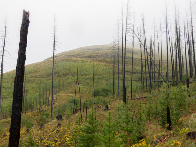
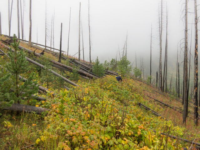
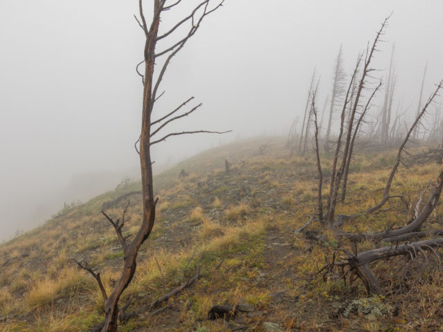
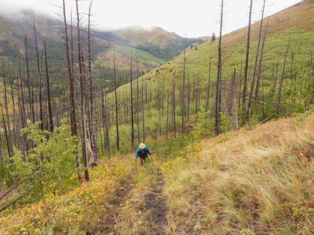
To start, head east down East Hillcrest Drive from the town of Hillcrest Mines to Adnanac Road (gravel). Turn south and follow it for 6.6 kms and park, Adnanac Ridge is directly east. Find a trodden cow path heading into the bush. All the dead trees seen are form the 2003 Lost Creek Fire. Pick your line carefully through the dead fall and lush vegetation. At the base of the ridge, trend left, head up and hit the mine road. Continue north, the going easy. Expect to see free range cows here. We did.
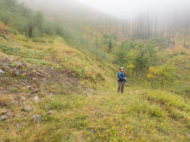
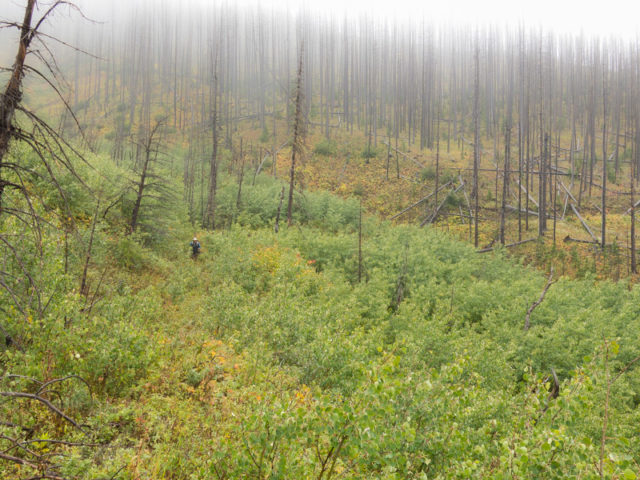
Come to a gully where the road splits. Either route works, since they eventually join up, although the lower one looses some elevation which then needs to be regained. We took one going up and the other down. Either way, they both pass through a burnt area so expect to jump over many fallen trees. There’s lots of thick brush to bulldoze through too.
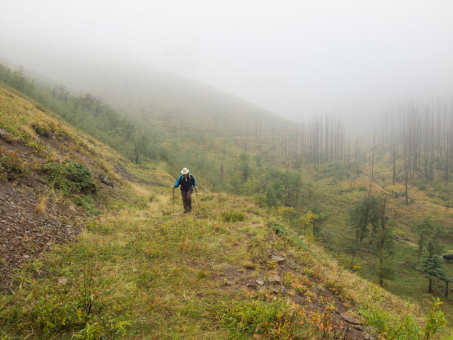
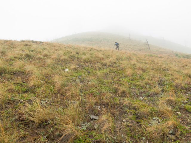
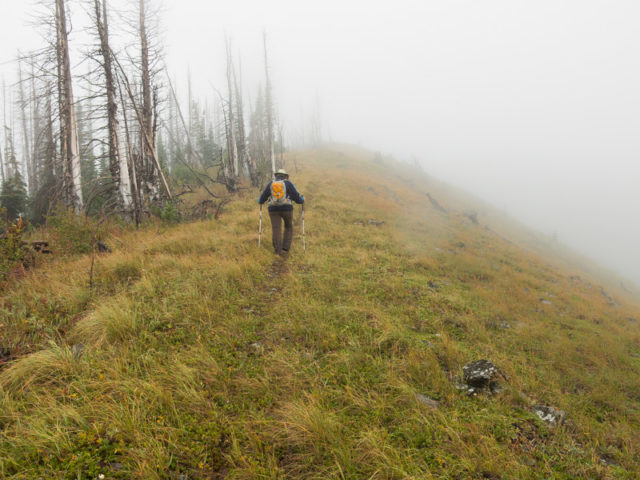
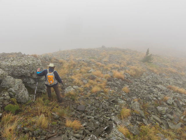
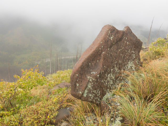
Soon on, at a grassy rib, head up. The going is moderately steep, but the footing is solid and sure. Trend left or right around some rock bands. As you gain elevation, the extent of that 2003 fire become clear. All the hills and ridges around, the whole valley, show signs of being effected. So many trees burned. Nature has a way of fixing itself and new growth is coming along nicely. Notice the occasional weather beaten pines on the slopes here reminding us just how tough conditions are here. The Pass is famous for its blustery winds – prepare for them although it was dead calm on our visit.
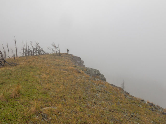
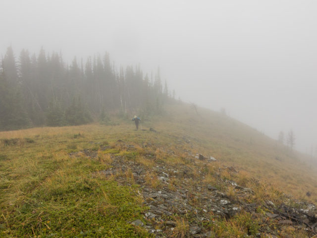
Top out at a rock outcropping. Turn left, a few trees, and hit the open ridge crest. Continue on south. The top undulates a bit, then climbs up to a couple high points. The going (even if the fog is thick) is obvious. At one point, a rudimentary trail comes into view. This is the only signs others have been here. Well that and a small summit cairn. Not sure why it isn’t a more popular destination since it has all the qualities of a good hike – easy access, pleasant going, views, unless of course it’s cloudy like on our trip, a bit of history, and so on.
Continue on, another high point or two, a few trees, and reach the summit. Success!
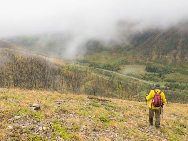
Now let’s pretend we can see things. Directly west is Hastings Ridge. Lots of burned trees on its flanks. If we could look down, we might see some subsidence pits connected to the old coal mine operation. There’s a good number of them on the ridge. While not dangerous in the sense they’ll collapse further and swallow anything up, they’re long since stabilized and nature has filled them in, still, they’re best viewed from a safe distance.
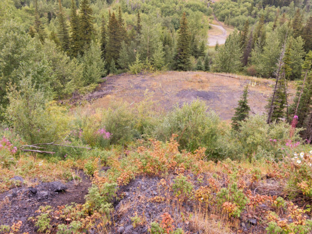
To the east forested ridges and hills transition to the plains. To the south it’s more minor hills. To the north see the ridge-top you came up. Further on, Hillcrest Mountain, just to the northwest, is the most prominent lump of rock around. The next day, we visited a secondary bump off that peak (which we call Hillcrest-Mohawk #5 Hill) to explore some other mine workings. Also seen roughly in the direction is Byron Hill. All around is evidence of the fire. Below, Adnanac Road can be clearly seen.
Soak it all up, maybe take some time for lunch, then return the way you came. Alternately you could drop down on any open rib and intercept that mine road used earlier. Just turn right on reaching it and continue on to where you first joined up with it. Watch for those subsidence pits. We choose to retrace our steps (the devil you know) given the limited visibility. Didn’t want to find ourselves at a cliff band, or worse still tackling thick dead fall in the many burned-out groves of trees below.
On the drive back, if time permits, make a stop to view the the sealed up portal of West Canadian Collieries Adanac Mine (No #2 level, No #1 level can be seen further below but the entry has been bulldozed over). Heading back to Hillcrest look for the very first ATV track heading right into the trees, maybe a click or so from where you parked, and walk down that road for a few minutes. The concrete collared entry is still visible. Adanac = Canada backwards. The ridge gets it name from that mine. This operation lasted from the mid-1940s to the late 1950s when failing markets forced it’s closure.
Our route is just one way up and down Adanac Ridge. You can mix it up as you see fit. We think ours is the best however.
The summit of Adanac Ridge is called Poker Peak. Other ridge summits in the area have names like Spades, Hearts and Clubs Peak. Wait…what, no Diamonds, or did I miss it when looking at Google Maps? Either way, who ever named them was an avid card player. I guess?
Hikes in the Pass…
Greenhill Mine Ridge.
One Mine Ridge.
Turtle Mountain.
If you wish more information about this trail, by all means contact us!
Date of adventure: September, 2016.
Location: Crownest Pass, AB.
Distance: 9km out and back.
Height gain maximum: 380m.
Height gain cumulative: 430m-ish.
NOTE: all distances and heights are approximate.
Technical bits: thick dead fall in the former burned-out areas.
Reference: Hiking the Historic Crowsnest Pass, by Jane Ross and William Tracy.
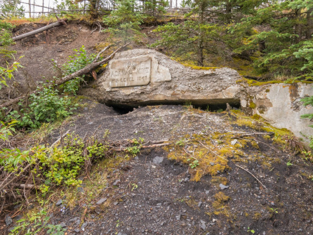
Before the hike, a visit to the Adanac Mine entry, #2 Level (1947).
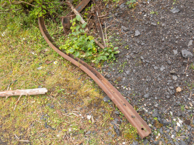
Twisted old mine rails.
The #1 Level was located below.
Getting ready to climb Adanac Ridge.
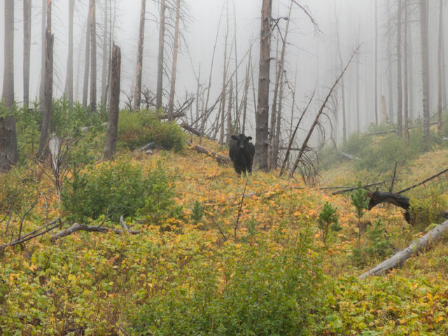
Expect to see free range cattle.
On the exploration road.
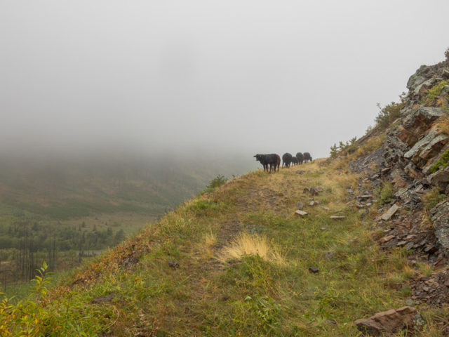
Some cows join us for a while.
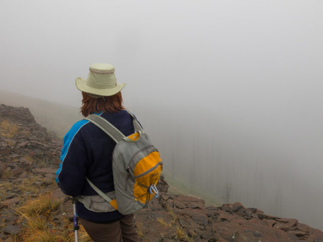
Connie follows…
Lots of dead fall and lush growth in the burned-out areas.
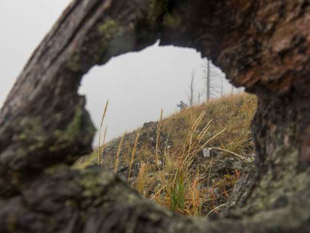
Almost lost Connie in the underbrush (and fog).
On open slopes and into the clouds.
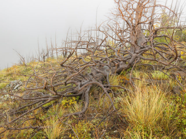
The corpse of a weather beaten pine.
Head in the clouds – the views here would be nice if not for them.
If we could look down, we’d see our car right below.
Pleasant going.
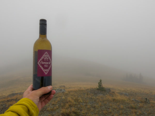
Screw It, we have wine!
All the burned stuff is from the huge 2003 Lost Creek Fire.
In the mist. By now we’re soaking wet.
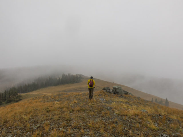
Almost at the summit of Adanac Ridge.
As high as it gets, on top of Poker Peak, the high point of Adanac Ridge.
Looking south (not that it matters).
Heading back. See Connie there?
It won’t clear until we head back down (naturally).
In spite of the lack of views this day, it was still a great hike.
Still on the ridge.
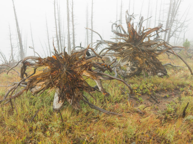
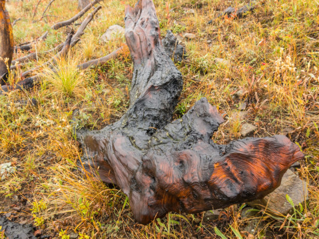
Medusa like roots on overturned trees.
Dropping down.
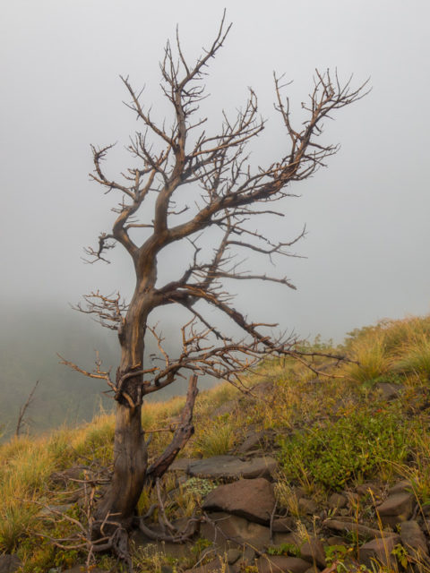
Trees here have a hard life – this one didn’t make it.
Adanac-Henge.
Back out of the clouds.
We’d visit the hill in centre the next day.
Subsidence pits on Adanac Ridge.
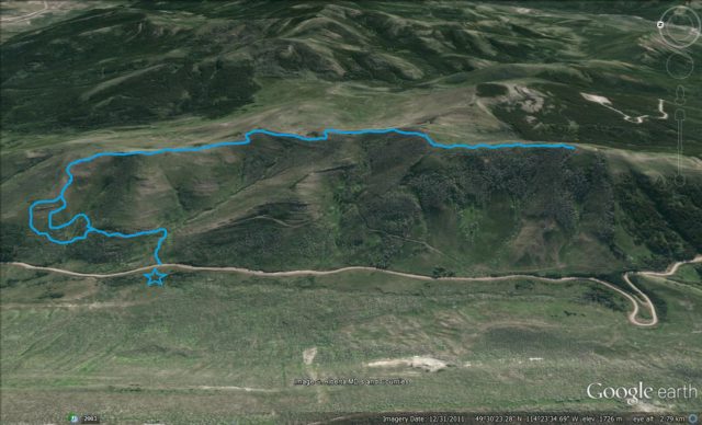
Our route up Adanac Ridge.


It’s always better with wine!
That’s a fact!
Awesome hike. Got soaked!
It’s more fun being wet.
Hidden history. Great.
Isn’t it!
In my childhood we had one home that used coal for heating. We saw in Europe big ships carrying huge loads of coal on one river. This was in early 2000’s. It does not look very secure in the photo, the way it is closed off. It would be an interesting hike though.
Using coal for domestic heating and cooking was once quite common. I’ve seen photos of those coal boats – cool! The portal is well sealed – there’s a big welded steel door behind the dirt and as I recall some huge tires blocking the way as well.
Life goes great with wine . . . especially if the wine has an attitude!
More true words have never been spoken.
So cool, so much history in the area!…all incredibly interesting.
Indeed, and it’s why we love the Pass.
Yes toe old Adanac mine.
That is Canada spelled backwards.
Old Italian trick.
Spent 7 years roaming them hills.
Yes, Canada sdrawkcab.
Most beautiful area, love the Crowsnest Pass.
I agree. The area is amazing. Lots of hiking, history and no crowds.
(via Facebook)
Gorgeous country!
I know, the Pass is amazing. Love hiking there.