
Rummel Lake
Another spectacular hike in the Smith Dorrien/Spray Lakes area of Kananaskis. This outing is a fairly easy going one on a well defined rail, with gentle grades and modest elevation gain. The goal is Rummel Lake, with wonderful Turquoise waters in a basin below a towering peak. But wait, there’s more. With a little extra work, not much really, one can easily hit the high country a bit to the east, a wide barren mountain flanked valley that is both stark and stunning. If you come in the fall, expect so see Golden Larches along the way.
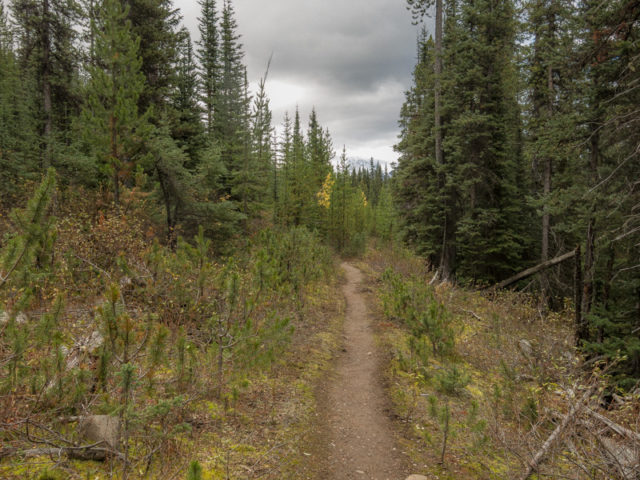
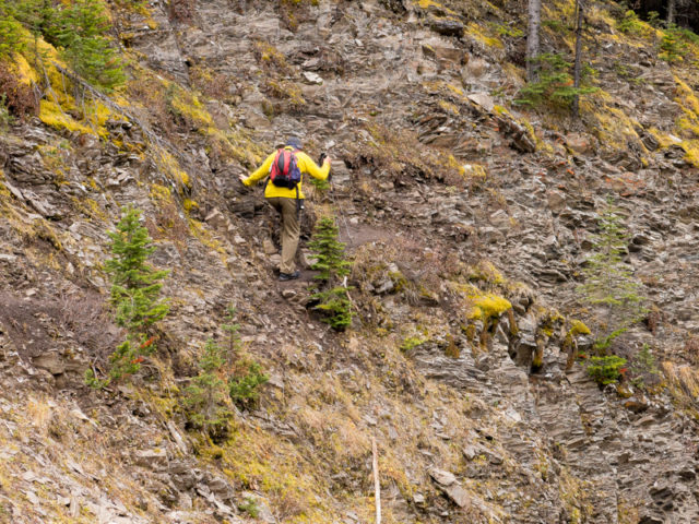
The trail begins opposite the Mount Shark turnoff on the Smith Dorrien/Spray Lakes Trail. Parking is along the road. Expect your car to be covered in dust on your return – of course you came in on the gravel highway, so it’s already dirty anyway. Take the obvious trail heading up and south. For a time it follows a reclaimed logging road.
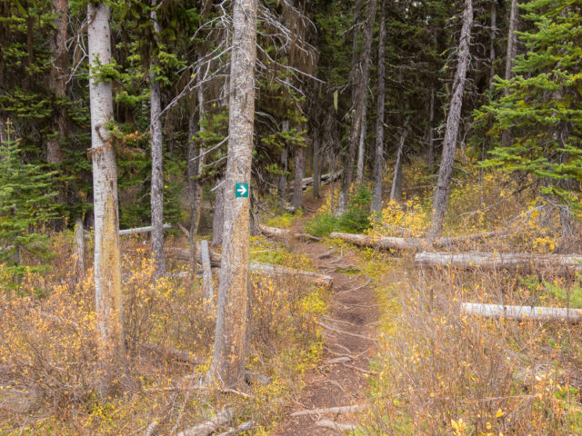
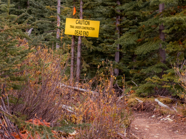
In an old cut-block (from the 1960s or 1970s I think), the trail takes as broad sweeping zig-zag, gaining elevation at a nice steady, but not too difficult pace (the theme the whole way). It’s undergoing some rerouting and other work on these lower sections so it’s possible your way up might differ a bit from ours. New sections can be muddy and slippery.
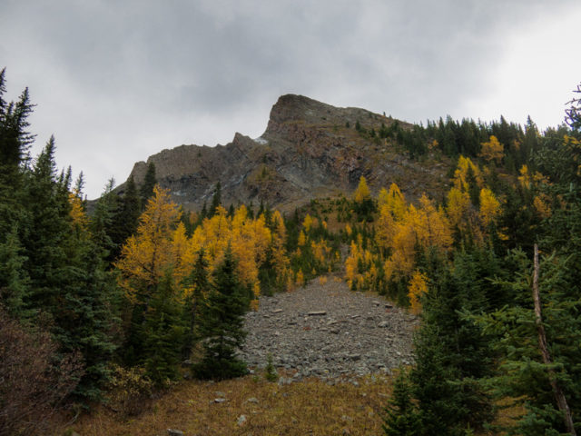
Trees thin here and there allowing the occasional view. Check out “The Fist” across the valley, and to the west, one of the Spray Lakes. Enter a second cut block trending east-ish, switch back one more time and and soon after plunge into a mature forest. There will be no real views for a time.
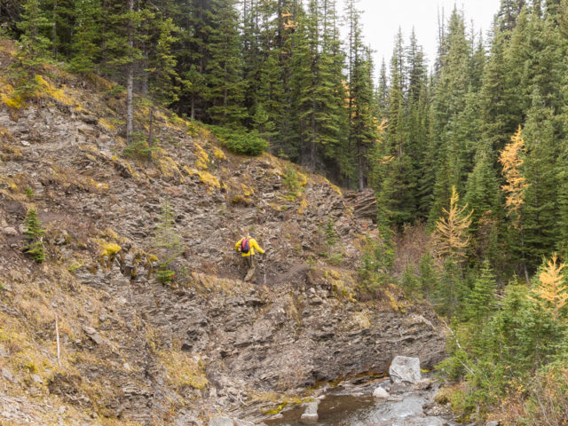
Now pointing south-ish enjoy the stroll through the trees, it’s all you have. The trail dips down temporarily here and here, but for the most part it gains a little height so you go. Listen for Rummel Creek through the trees to your left. Just when you think the trail is trending the wrong way, it makes a hard left. At this point notice the Larches begin (only meaningful in the fall). There’s a few to begin with, but there will be more soon on.
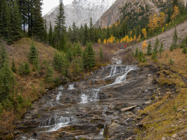
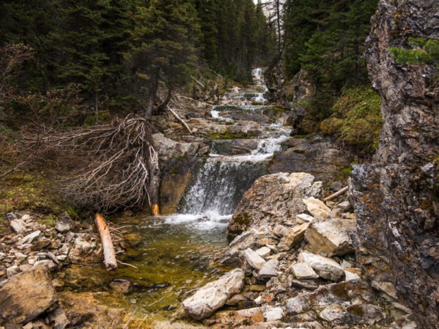
Dropping down to the creek, come to a junction. If snow, go left across the bridge. No snow? Go right, it’s far more interesting. At one point come to narrow slippery ledge. Take care, as a fall to the creek bed a fair distance below could be disastrous. There does not appear to be a bypass trail for this, although hiking guru Daffern mentions one. Right ahead is a picturesque cascading falls. What a lovely spot…slip..aaaaaaahhhhhh! Crunch!
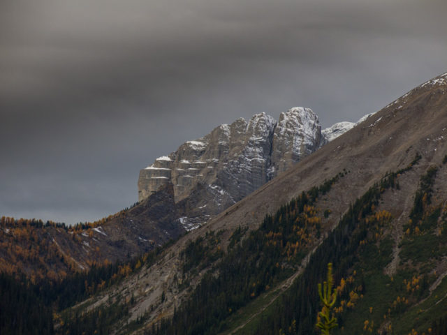
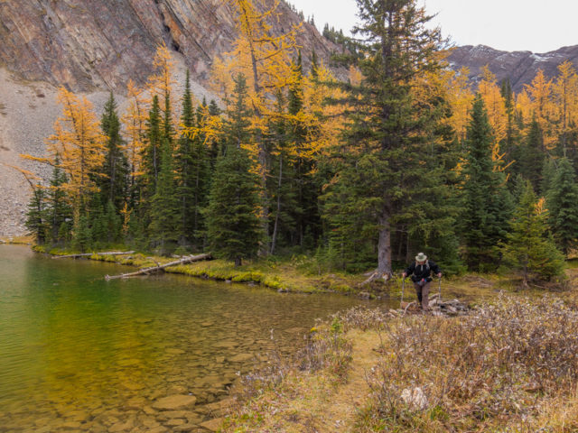
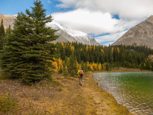
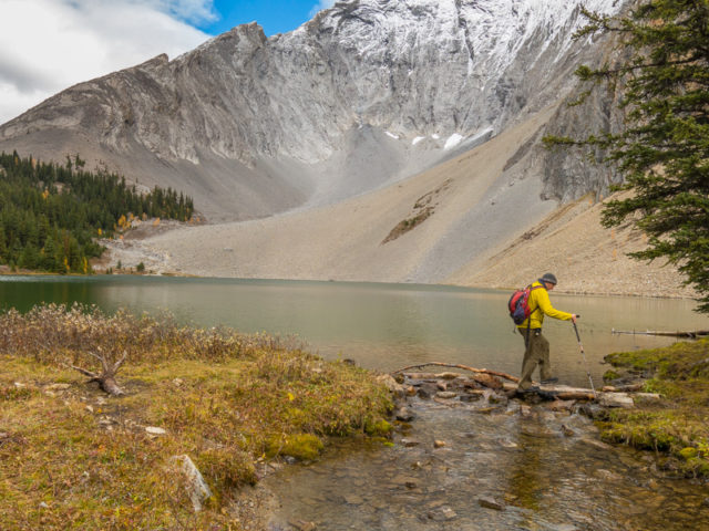
The Larches are more common now. At times you can see Mount Galatea high above. You’ll see more of it later. Keep gaining elevation. Pass another set of falls and a couple avalanche chutes (the reason for the winter bypass trail). Arrive at the lake. It’s stunning, a wonderful blue/green. Take it all in! The lake, it’s colours, those lovely yellow Larches (if it’s fall), the barren grey limestone mountain right above the lake (Galatea again). Stunning! We have the best playground in the world.
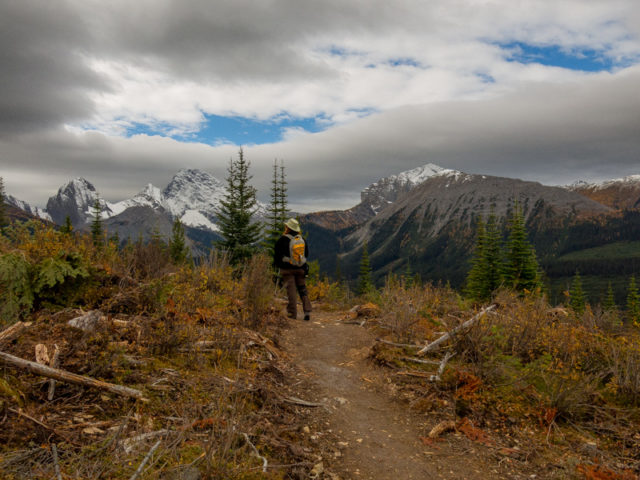
Many people make Rummel Lake their turn around point. No! We recommend continuing on, after the obligatory photos, of course, for even more scenic wonders. There’s gravy for those potatoes!
Follow a trail on the lake’s north shore (no shore like the north shore, that’s for sure, as an old associate would say…damn where’s my mind?). Leave the lovely waters behind, take the trail heading up and left though the trees. Pass some Karst Topography – here, Limestone rock that’s chock full of holes and pits that over eons has been eaten away at by mild acids carried by rainwater. Science moment!
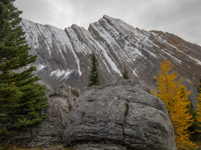
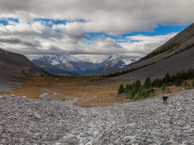
Top out and leave the trees behind. I fully expect up here it’s windy all the time but on our visit it was near insufferable, icy cold and blustery. But we’re tough, so on we go. The trail continues, less distinct then a it was before. Enjoy the views all around. To the left is The Tower, which looks scramble-able (is that even a word?) from here, and to the right old friend Galatea. They’re both hiiiigh above and both extend off east for some distance. A stunning setting!
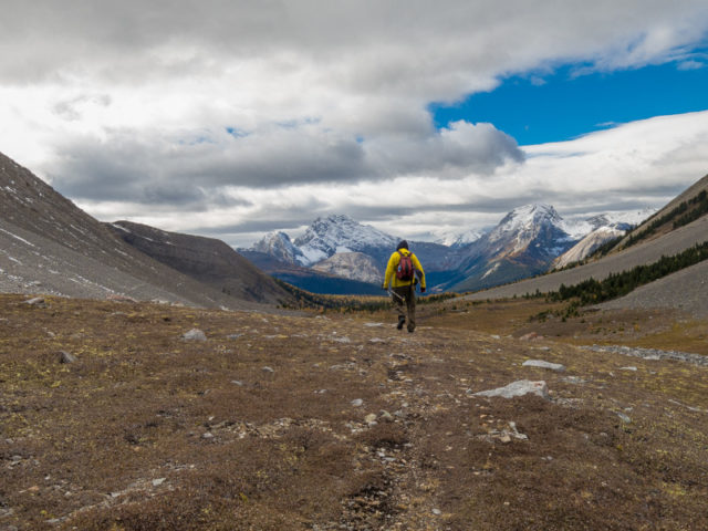
Turn around and bask in the wonder that is the view west. It looks mighty good from this direction. Wilderness at it’s best. Scenic, spiritual, and on this trip, all ours. Far off on the west are mountains in Banff Park.
Spin around and keep going straight ahead. Tackle a field of boulders and come to a small tarn. It’s not much to look at in the fall, but in spring is full before it eventually drains away. What little water is left our visit is covered in a sheet of ice. Yup, it’s cold up here.
This makes a good turn around point. Of course you can continue on if you like to the pass (out of view from this position) and even beyond., but the going is more difficult. For us, the biting wind kept us from even considering going further. It was a no brainer. We may be crazy, but… We make hasty retreat to the forest for lunch. I think we’d have a world record under our belt if anyone was timing us.
In the trees, ahhh, no wind. But what’s this? Nooooooo, I forgot the corkscrew! The hike’s ruined! Somehow lunch will be a little less special. For the first time in forever, we had no wine with which to celebrate with on the trail. Flags at half mast. I consider breaking the neck with a rock, but decide it’s probably not such a great idea.
When dropping down to Rummel Lake again, look for frost pockets on the flanks of Galatea, right in front of you. These small cave like depressions in the rock are caused by freezing and thawing cycles which eventually break chunks free. If time permits circle the lake clockwise towards the scree slope. Take in the Larches, again, but they’re good so it never gets old.
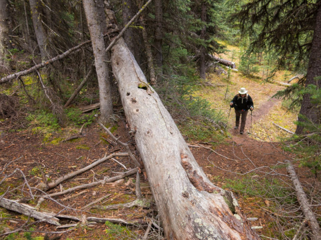
With one last one look behind at lake, plunge into the trees. The way down is fast and the going easy. Not a big fan of that ledge above Rummel Creek.
This hike seems moderately popular. We saw maybe a dozen hikers or so. A couple went beyond Rummel Lake but none joined us up in the high country.
Recommended hikes from the area…
Three Lakes Valley (the next valley south).
Amazing Burstall Pass.
Spectacular Buller Pass.
If you wish more information about this trail, by all means contact us!
Date of adventure: September, 2016.
Location: Spray Lakes area Kananaskis, AB.
Distance: 14km there and back – options to go further.
Height gain maximum: 510m.
Height gain cumulative: 560m-ish (more if you go further).
NOTE: all distances and heights are approximate.
Technical bits and notes: None.
Reference: Kananaskis Trail Guide by Gillean Daffern.
Starting out on the Rummel Lake Trail.
Across the valley, “The Fist”.
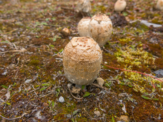
Shaggy Ink Cap, aka Lawyer’s Wig or Shaggy Mane – lots of these shrooms along the trail.
Gaining elevation the trees open up here. The view south-ish.
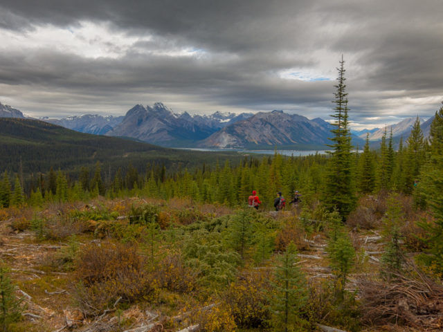
In back, the Spray Lakes.
Entering a mature forest.
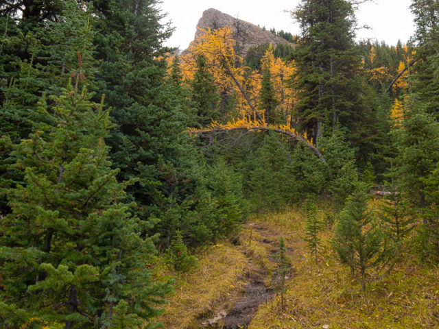
One of the first Larches – there will be more.
Up a small rise.
Mount Galatea towers above. Larches!
Cascading Falls on Rummel Creek.
More falls.
Arriving at Rummel Lake, turquoise waters and Golden Larches.
We’ll continue on past the lake…
Snow makes it appearance in the high country.
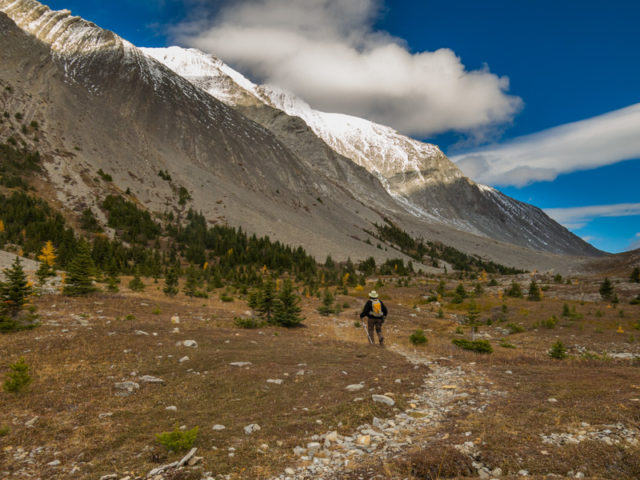
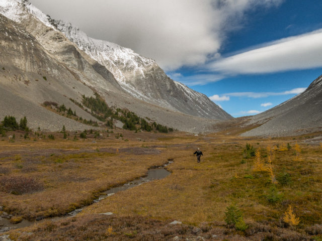
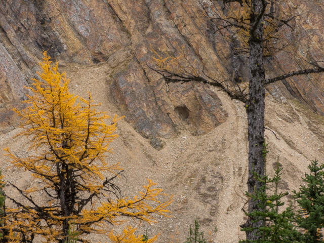
The open valley above and beyond Rummel Lake.
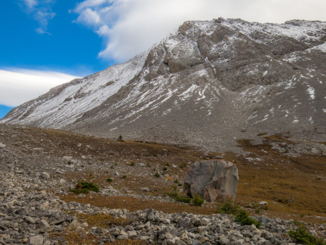
Not much grows up this way.
Looking back the way we came.
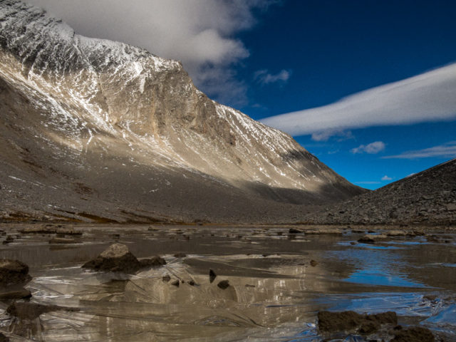
What’s left of the tarn above Rummel Lake.
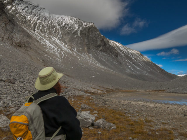
We’ll turn around here – at Connie’s left, “The Tower”.
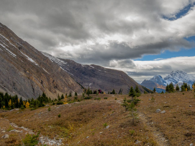
Heading down to a sheltered area for lunch.
What you can’t see: the wind. Oh, it was cold up there.
Nooooooooooo! The corkscrew? Where’s the corkscrew?
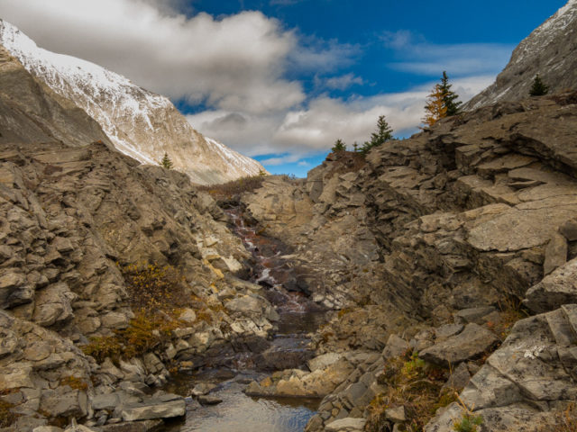
A small creek tumbles down a rock band.
What views.
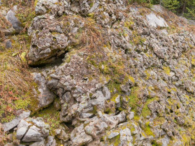
A Karst Formation – read the post to find out what it is.
A frost pocket above Rummel Lake.
Damn, we have the best playground in the world.
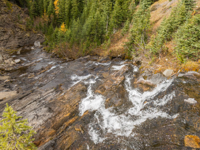
Rummel Creek tumbles over bedrock.
The narrow ledge above Rummel Creek.
A slip here could be disastrous.
Lower sections of the trail are being worked on.
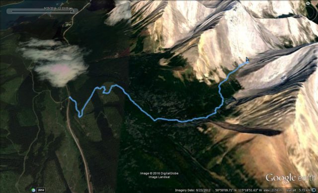
The Rummel Lake Route.


(via Facebook)
Was there a couple of weeks ago enjoying the larches.
They were sure nice on our visit!
I love the Rummel Lake! Was just there a month ago. Beautiful.
It’s truly an inspiring place. Thanks for commenting!
Nice hike! Thanks for posting!
It’s a great hike, highly recommended.