
Hillcrest-Mohawk #5
Time to take in another trademark BIGDoer.com history hike! This outing takes place in the Crowsnest Pass of Alberta, and allows hikers to summit a modest height bump, which we’ll call Hillcrest Mohawk #5 Hill, that long ago was home to an underground coal mining operation. Using old mine roads the going is both easy and technically simple. A no-brainier and it’d be real hard to go wrong here. Take in many views along the way and poke around some old mine ruins dating back some sixty to seventy years.
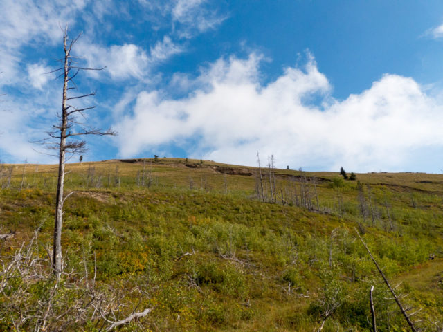
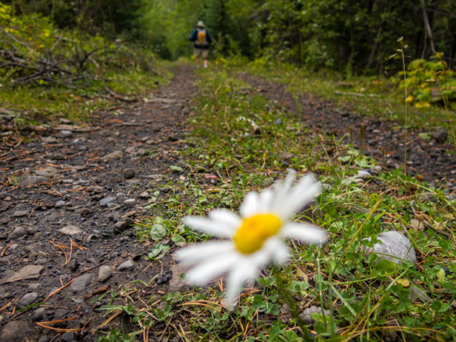
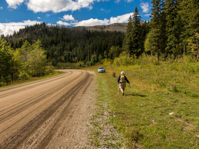
The trail begins along dusty Adanac Road (shown as 232rd St on Google) just east of the community of Hillcrest Mines. At a few kilometres in, were the road starts dropping down into a valley, look for an obvious track leaving the road on the right, at a fairly shallow angle. This is your trail. Park a bit beyond at a flat area where Adanac Road widens as it curves left.
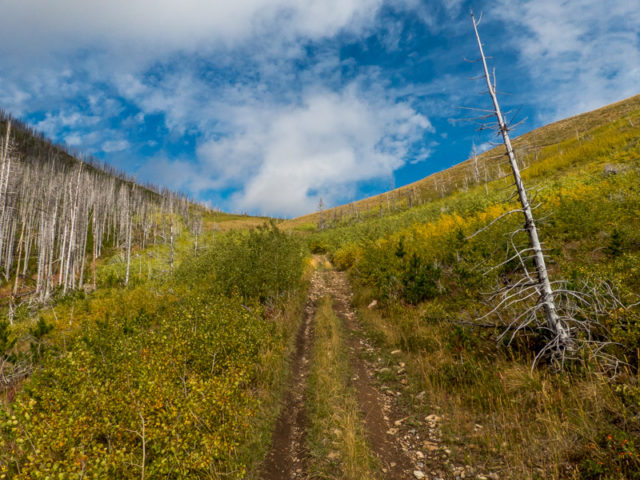
Once on the road follow it west-ish to start. It was once used by haul-trucks bouncing between the mine and processing plant down by the CPR tracks to the north. One wonders what could have happened if opposing vehicles had met on the road. It’s narrow with no real place to pass. Continue on in the trees. At a bend, listen for a creek gurgling down in a draw to your left. Looks for spilled coal scattered about underfoot.
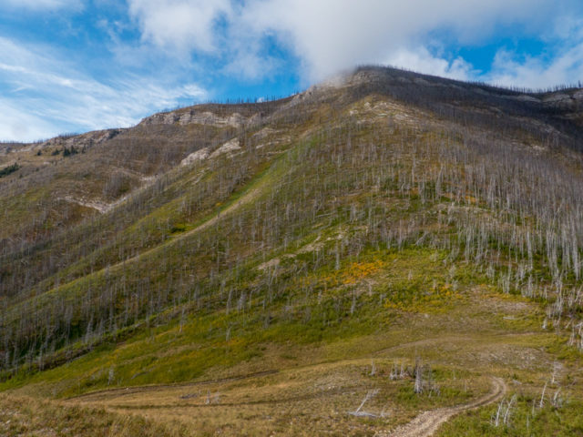
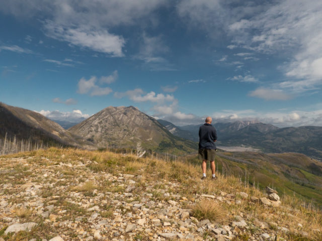
At a junction take the left fork. Soon the road takes turns hard left, gaining elevation at a slow but steady pace. Easy for hikers but no doubt a steep grade for laden coal trucks. Where the road trends right, following the contours of the hill, the trees open up. Looking south, take in Adanac Ridge to the left. We were there the day prior – in the fog. Adanac Road runs below in the valley. To the right is Hastings Ridge. Hard right is the southern flank of Hillcrest Mountain. We’ve been eyeing it up for some time now.
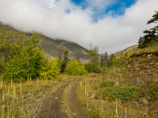
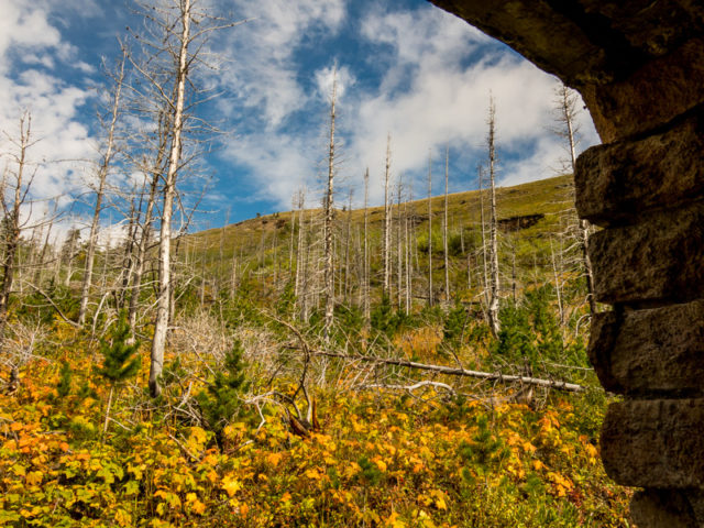
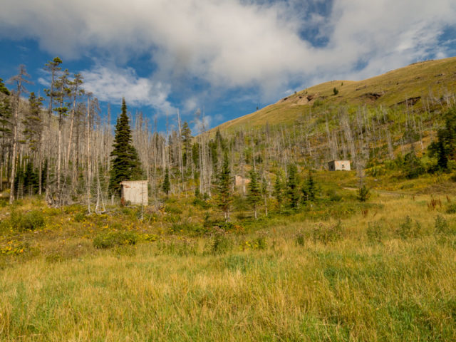
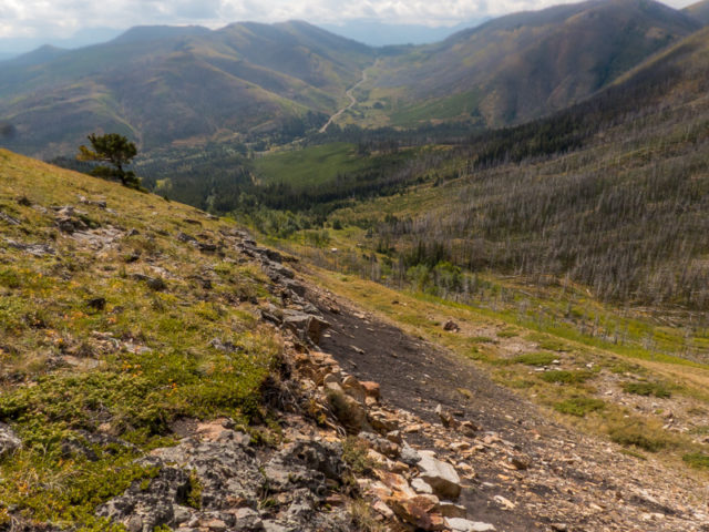
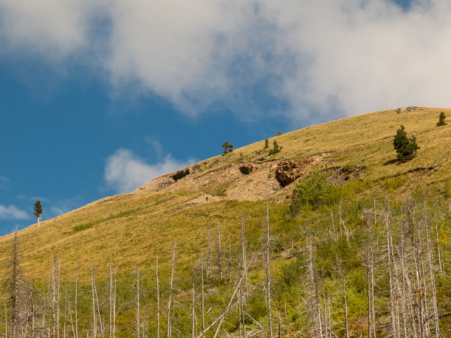
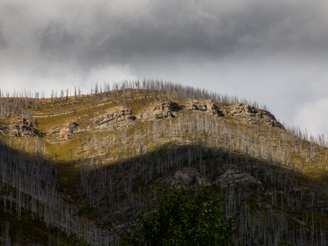
Notice all the destruction from the 2003 Lost Creek Forest Fire – it was a big one and burned a lot of trees. Many remain as standing skeletons. As bleak as it may look (I say it’s beautiful in a way), nature’s taking it all in stride. It’ll all grow back…it’s already started.
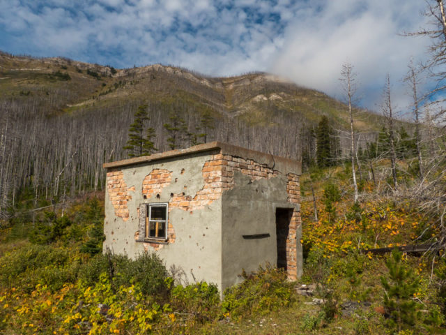
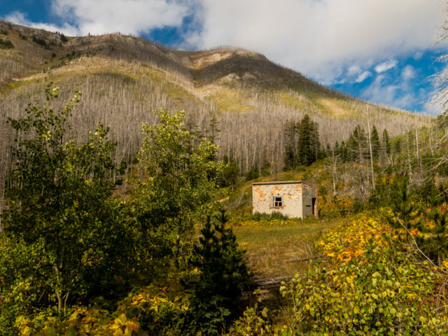
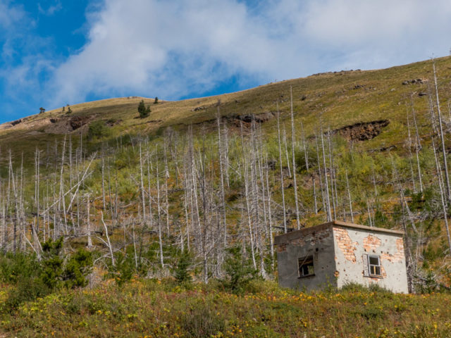
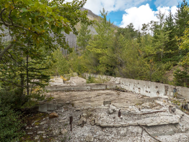
Gently trend north and soon on come to evidence of mining. There’s waste coal dumps here. A little further on come to structure remains, the large tipple foundation, and a couple small out buildings made of brick and/or concrete – one, we think, the old explosives storage shed. At a flat area look for a small sulphur stream emerging from the hillside beside a concrete retaining wall, marking where the mine opening used to be. Take some time to explore the site.
The mine, Hillcrest-Mohawk #5 (in some reports simply Mohawk #5) operated for only a short time in the late 1940s and early 1950s, although the company and a predecessor firm had an option on the property for some time prior. They exploited seams on a hill connected to Hillcrest Mountain (the latter towers over you to the west).
In the mine’s short history, the Hillcrest-Mohawk firm extracted some nine hundred thousand tonnes of coal from these workings. The seam was said to average about two and a half metres thick and in places dipped at sometimes extreme angles (making extraction a dangerous challange). Coal was trucked from here to the firm’s rail loading plant near Hillcrest (to see it, go here: Crowsnest River walk and Hillcrest-Mohawk Collieries plant)
The Hillcrest-Mohawk company came about, in the early 1940s, through an amalgamation of the firms Hillcrest Collieries and Mohawk Bituminous Mines. In the early 1950s, it was folded into the firm West Canadian Collieries and all its former holdings closed. Want to eliminate a competitor, buy ’em up and shut ’em down. In addition to this operation, Hillcrest-Mohawk also operated the Maple Leaf Mine to the north. Predecessor firm Hillcrest Collieries once had a mine on the far side of Hillcrest Mountain not that far away (we’ve visited it before: Hillcrest Collieries Mine)
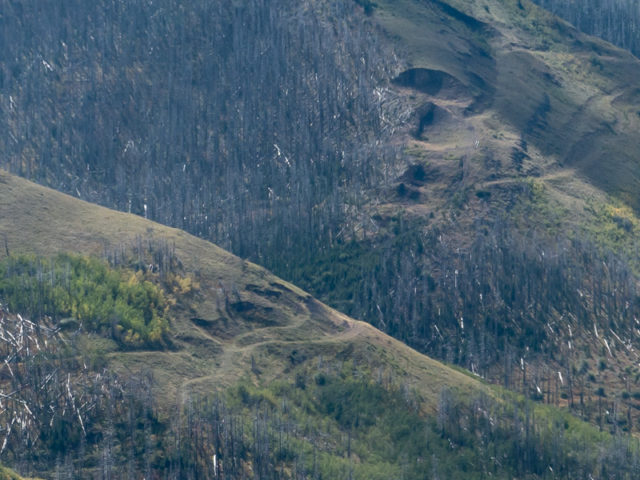
Take a rough ATV road heading north-ish and up aiming towards a saddle. There are many side roads here, most of which meet up eventually (we explored a few) and others heading off this way and that. The way is always obvious however. Travel through a burned-out area. To your right look for mine subsidence pits just below the sky-line ridge. You can view them up close later if you follow our line.
At the saddle trend right and and head up to the summit with one final push. An ATV track takes you there. You’re on top of the world now. Well, almost.
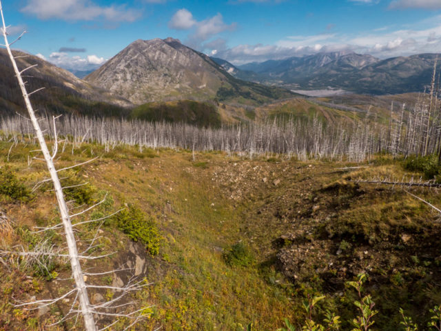
From here one has a good three hundred and sixty degree view of the surrounding country. In the west, Turtle Mountain can be seen, well it’s backside, and some of the boulder field connected to the Frank Slide that tumbled down from its north facing flanks so long ago, ruining many people’s lives in the process. The Crowsnest Highway can be spotted below it. North across the valley is what we call One Mine Ridge. Directly below, but a bit out of view is the community of Hillcrest Mines. Hillcrest Mountain looks quite doable from this angle. Mental note. In the east, hills transition to the plains. It’s all stunning! Soak up the views. Yes we use that phrase a little to much.
This bump is technically part of Hillcrest Mountain, but for simplicity’s sake we’ll call it Hillcrest-Mohawk #5 Hill (HW5 Hill for short). Its dipping north trending ridge looks like a nice objective for another day.
Head down off trail to check out those subsidence pits. These mark shallow underground workings that have collapsed – the mining companies were often a bit over zealous in their goal to extract as much coal as possible and mined large rooms of material which soon after work was done, given their was nothing to support the roof, would give way. Sometimes they even broke out to the surface. While posing no serious dangers, no the ground won’t open up further and swallow you whole – the workings have long since stabilized – still, explore them with caution. They have overhanging rock bands, loose material, boulders and other nasty bits. Of course, a natural cliff has similar dangers. Some of the pits are huge.
Notice coal scattered about. That’s what they were after. There was and still is a lot of it in the hill here (we’ve seen the inventory reports). The tilted nature of the strata is very obvious here. You can see how the seams were at crazy angles.
Drop down into the trees, bushwhack for a short time (through thick brush) and intercept the ATV road you came up on. From here, simply retrace your steps back to your car. It’s a pleasant stroll down. I take time to quickly explore some faint side roads on the return, there are a few of them, but find little of interest. You never know!
More hikes with mining history…
Protection Mountain Mine.
Greenhill Mine Ridge.
Cat Creek Hills.
If you wish more information on what you’ve seen here, by all means contact us!
Date: September, 2016.
Location: Crowsnest Pass, AB.
Distance: 9km there and back with loops – options to go further.
Height gain maximum: 400m.
Height gain cumulative: 420-ish (more if you go further).
NOTE: all distances and heights are approximate.
Technical bits and notes: None.
Article references and thanks: Coal Mine records at Alberta Energy, Hiking the Historic Crowsnest Pass, by Jane Ross and William Tracy.
Everything seen is on public land. Care should be taken around coal mine remains – stay safe and please, treat the site with respect.
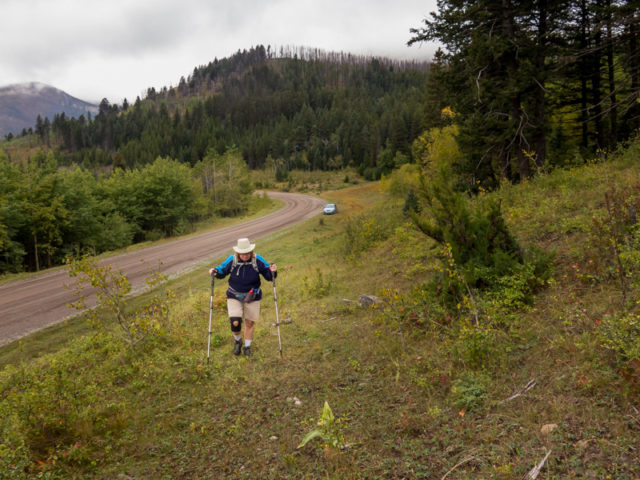
Starting out from Adanac Road.
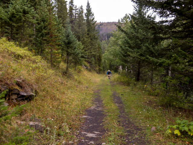
On the Hillcrest Mohawk #5 Mine Road.
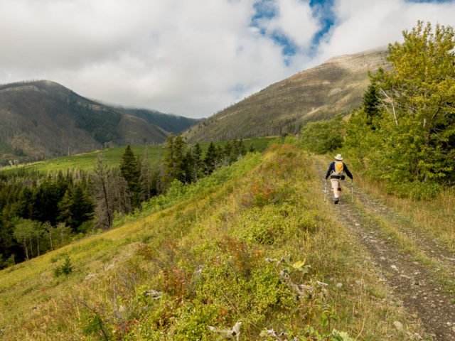
Left: the south shoulder of Hillcrest Mountain comes into view.
The going is always easy.
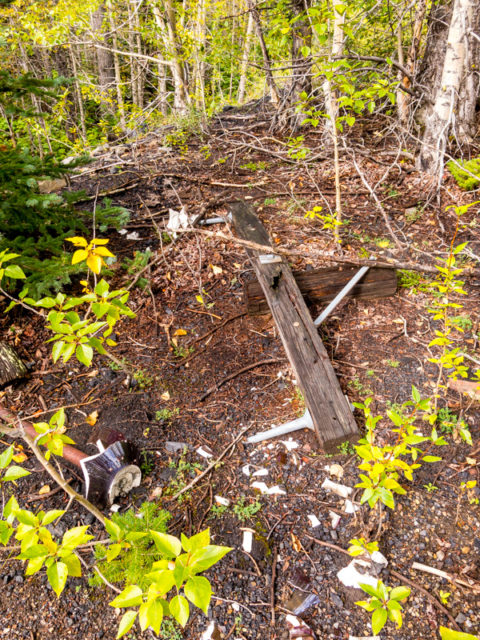
Bits from an old power line into the mine.
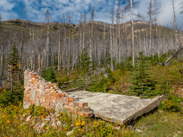
One of four building remains at the site.
Dead trees are from an early 2000s forest fire.
Looking up towards our objective.
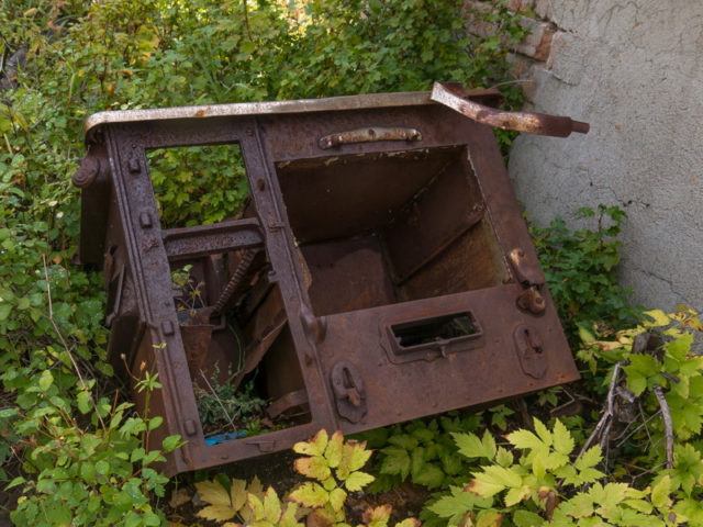
An old stove, one of many metal bits found in the bush.
Hillcrest Mountain behind.
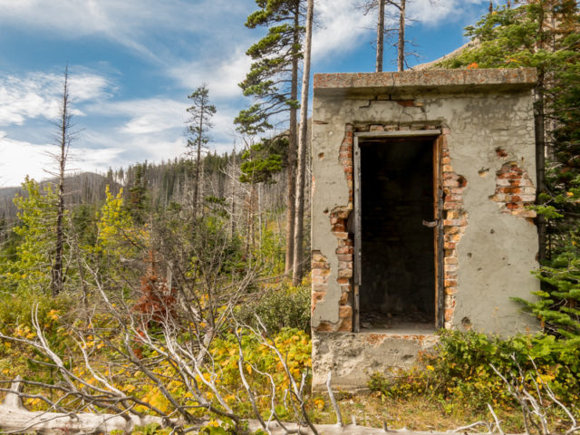
It’s believed this shed was for explosives storage.
This mine operated in the late 1940s and early 1950s.
A look up at subsidence pits (read the post to know more).
The road is now a rough ATV track.
At the saddle – Hillcrest Mountain looks easily doable from here.
Turtle Mountain left, mine subsidence pit directly below.
Obligatory standing on the summit shot – looking northwest-ish.
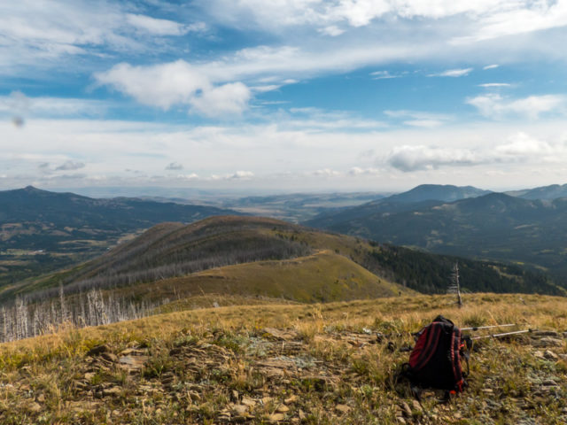
Eyeing up the northeast ridge of HM5 Hill as an objective for another day.
South: Adanac Ridge, back left, which we visited the day before.
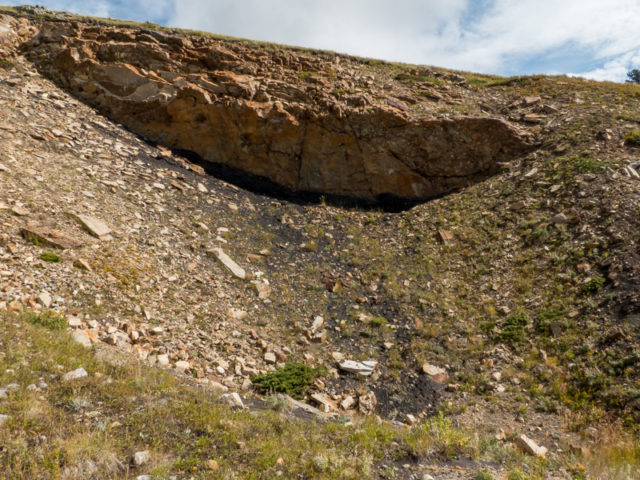
A closer look at one of the subsidence pits – note tilted strata.
For scale – I’m at the base of a pit…if you look close.
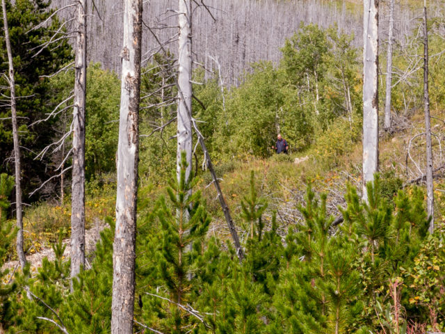
Bushwhacking it.
More pits on the slope behind.
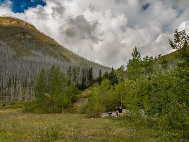
Connie enjoys a wine on the old tipple foundation.
Here’s a closer look…
The sun shines on Hillcrest Mountain.
Subsidence pits on Adandac Ridge.
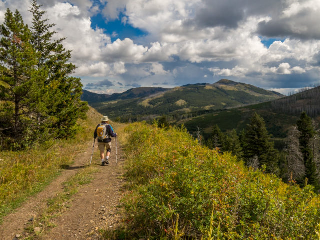
Heading down on the mine road, looking east.
Strolling along…
A great hike, sadly, at an end.
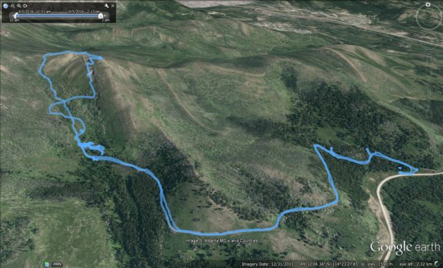
Our route…


Wow that was amazing ! Right in my back yard. Love it !
Heard that same thing from many people in the Pass. Seems few knew of this mine.
(via Facebook)
Wow very cool, love this stuff!
Make sure you keep coming back. There’s always new stuff in the pipeline.
You take great pics! Those craters are something else.
Thanks, we try hard and sometimes we do well. The pits are impressive, come could swallow a house.
Absolutely gorgeous!!
Thank you, kind words are appreciated.
(via Facebook)
Watch your step around here. You don’t want to be part of the subsidence!
Indeed, don’t trip there!
I was born and raised in Hillcrest but have never seen this area. Beautiful photos.
We heard from a good number of locals, all saying the same thing. A few old timers knew of it, of course, but that’s it. It is high up in the hills, out of sight, and from long ago, so I guess it’s not surprising. Glad you like the pics! It was a great day for photos.