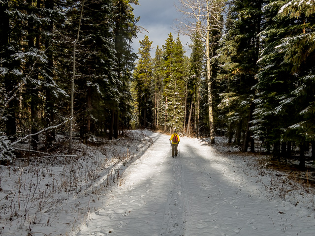
This is about the easiest hike ever. Following a series of multi-use trails in the West Bragg Creek area of Kananaskis, it makes a nice loop through an area of low rolling hills. It’s a very nice stroll through the woods (like that’s ever bad), with little in the way of challenges or demands. Talk about easy going! There are a good number of trails in the area, so there are plenty of options to mix it up, shortening or lengthening the jaunt, hitting hills or keeping it flat. What ever you like.
The trailhead is near the town of Bragg Creek, at the far end of West Bragg Road, right where it dead ends at the start of Kananaskis Country. There’s a huge parking lot here. Expect it to be busy, no matter the day nor the time of year. But everyone’s always jovial, so who cares? Once out on the trail people thin – there are just so many routes, there’s room for all. In fact, on our hike, we saw not a single person one once we got deeper into the woods (heard some though).
Iron Springs – Elbow: a pleasant loop hike through easy terrain. A Chris and Connie Adventure!
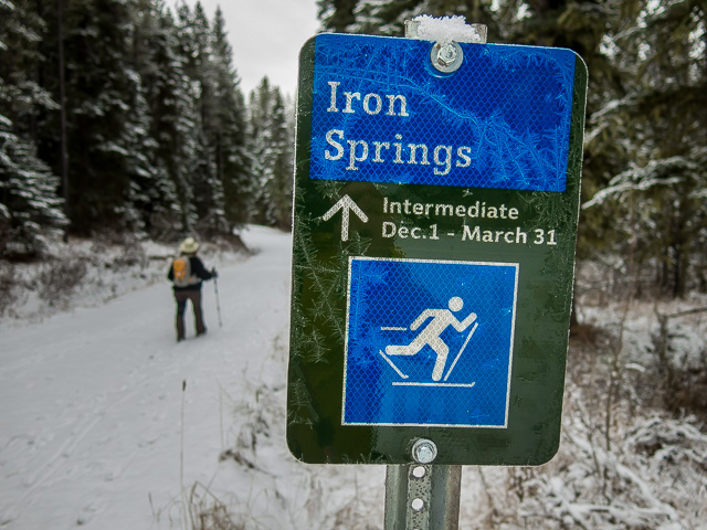
This trail and all the others in the area, depending on the time of year, will be used by hikers, mountain or fat tire bikers, equestrian riders, snowshoers, cross country skiers, Segway types, roller skaters and countless others. Okay, you got me on the last couple. In simple terms, everyone’s welcome! There are sometimes restrictions on who can use what trail at certain times of the year – for example the route we followed is for skier use exclusively once winter takes a better hold.
Scroll down for photos and to comment
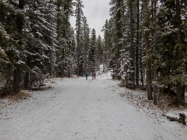
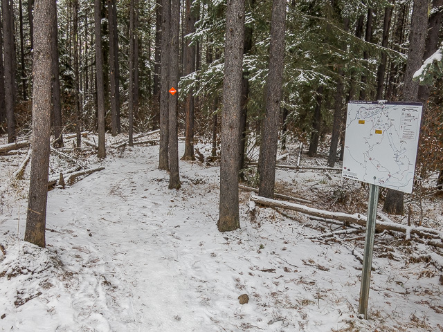
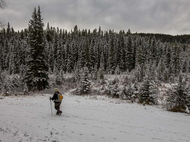
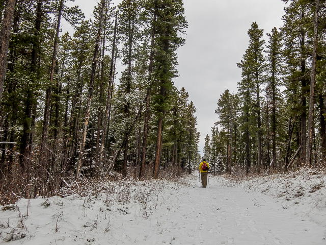
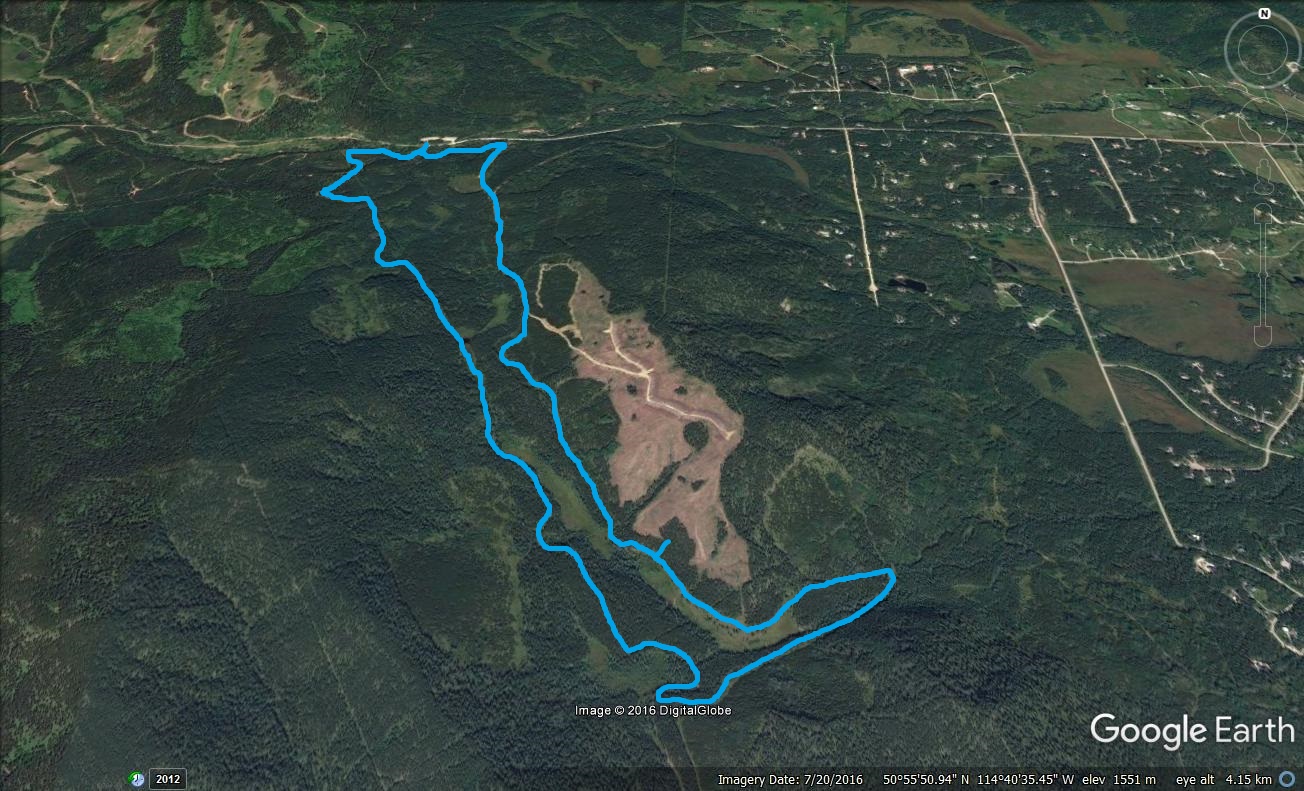
Given the place is a literal maze, junctions are marked and there’s maps seemingly everywhere, so you’d have to be a special kind of bad navigator to get lost. Kudos to the Greater Bragg Creek Trails Association for making it a no-brainier. The route we describe takes in several different trails, the major ones giving their name to this post. These ones are a mix of old logging and exploration roads and cut lines. Mostly in the trees, the trail is wide so you don’t feel all that closed in.
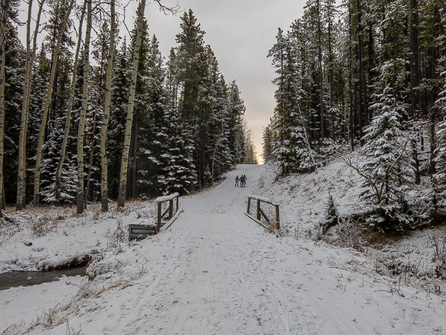
From the parking lot head south and soon on cross a small bridge. Turn left onto East Crystal Line Trail and follow it for a time. It rises and falls with the terrain, but it’s mere bumps, so no big deal. At a clearing, take a hard right onto the Sundog Loop Trail and head up at an easy grade. Soon on, at a junction, this route transitions to the Iron Springs Trail.
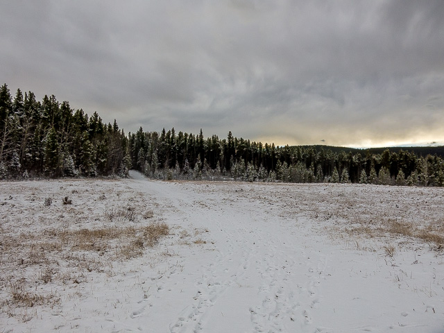
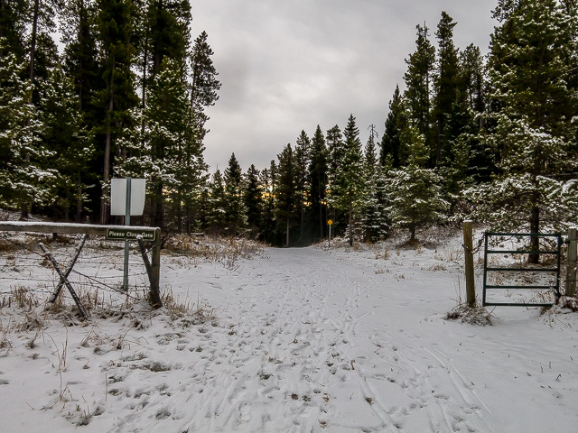
Enter a series of replanted cut blocks from decades ago, and also notice a new logging scar that’s more recent. Rise and fall, meander here and there and pass through a drift fence. Close the gate in summer so the moo-moos don’t get out – the area is also home to free range cattle. They’re all-inclusive here.
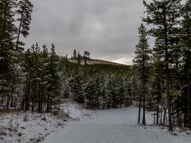
By this point you’ve passed a gazillion junctions. And there will be just as many to come. But again, there’s little worry of getting lost. On the ridge to the left, at its top above the logging scar, is a popular trail (it can be hiked but is more for bikes). We could hear squeals of delight from riders up there, but couldn’t see them. We biked it once – no report – and it was a ton of fun. Need break out the two-wheeled steeds more.
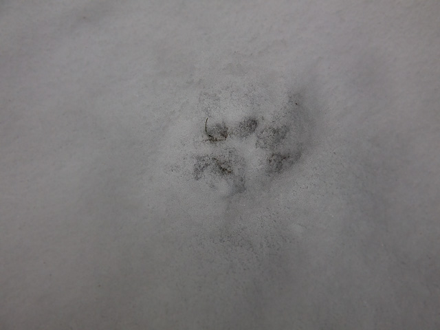
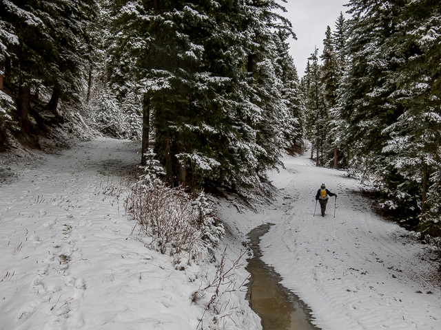
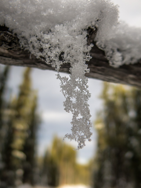
Drop down beside a marshy area, You might catch a moose here. Along this section we followed the footprints of a wild cat for a couple clicks. It stayed on the trail for a time. We’re not sure if it was a Lynx or Bobcat though. Our paw print IDing skills are lacking here.
Here kitty, kitty!
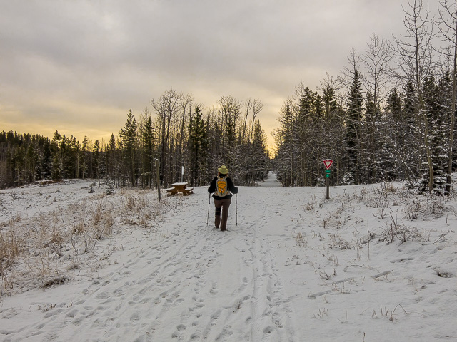
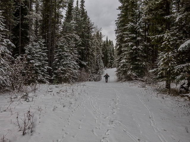
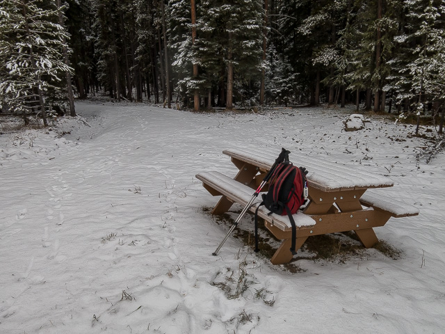
Trend east and soon on double back sharply. In a few moments go right at a small connector trail (at a picnic table – a nice lunch spot, but we elected to eat elsewhere later), leaving the Iron Springs section behind. Almost immediately intercept the Elbow Trail and turn right (north). Rise and fall some more. For the next while you’ll withing shouting distance of the Iron Springs section you were just on. You can even see it at times.
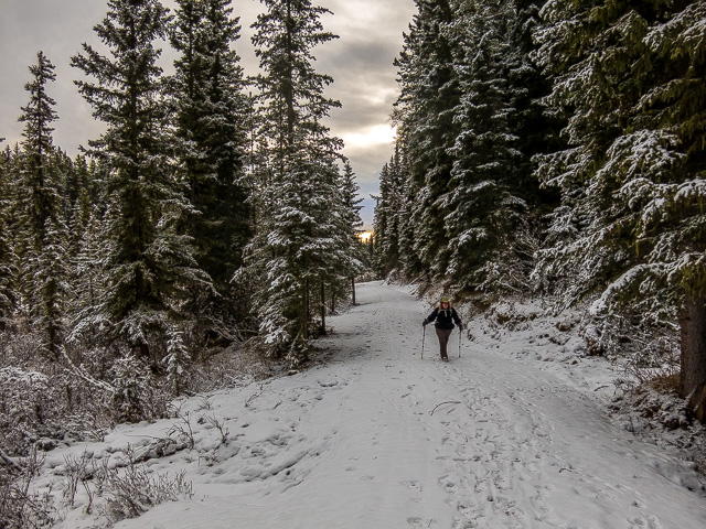
The trail splits. The lower (more easterly) route is a bypass for skiers not wanting to take in a big hill. And lazy hikers wanting to do the same. Take either, they soon rejoin. Pass more swampy areas. Drop down and hit the west leg of the Sundog Loop. Remember it? Turn right onto a short section of the West Crystal Line Trail. A couple hops later and you’re back at the car.
Now, wasn’t that easy?
Don’t forget to LIKE or SHARE this post.
Generally speaking, the trail we followed and others here aren’t heavily frequented by hikers when compared to others who use them. They’re most likely to see foot traffic in the shoulder season when the real good stuff is inaccessible or under snow. They’re also good when one is feeling more like a stroll than a true woods-trek (us this day). You know, something super easy? Nothing here is much of a workout that’s for sure. They’re handy to Calgary which makes them a good choice if one is disinterested in a long drive. Come here and follow our route, or pick one of many others.
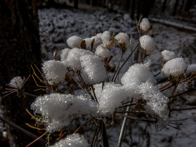
Scenery wise, there’s nothing spectacular here. But this is the extreme eastern edge of the Foothills. Still, it’s not without its charms and if you go with the mindset “any hike is a good hike”, like we always do, you’ll most certainly enjoy it. Always find the special in things. We like trees!
If you wish more information about this trail, by all means contact us!
Date of adventure: November, 2016. Location: West Bragg Creek area, Kananaskis, AB. Distance: 10km loop (lots of options to extend or shorten it). Height gain maximum: Maybe 50-80m-ish. Height gain cumulative: Maybe 120m-ish. NOTE: all distances and heights are approximate. Technical bits and notes: It’s a multi-use trail which varies with the season. Reference: Kananaskis Trail Guide by Gillean Daffern.
We used to do something called the "pointless challenge" 🤪 and miss those days. It was so much silly fun and often frustrating as heck. In these we'd invite people to send in random photos of obscure locations, but not give any information, and then we'd track where it was and shoot something similar.
Most of these came from old family collections, as was the case here. Anyone up to resurrecting the series?
In hindsight, why didn't we pose someone in our shot?
Pointless: “Devoid of meaning (or) senseless” Merriam-Webster.
If you like what we do and want to support this ongoing project (12 years now), go here: https://www.BIGDoer.com/help-the-society/ Thanks to Connie for making this post possible.
Exploring history with Off the Beaten Path with Chris & Connie. Photo: ca1970 and 2014. Posted by Connie.
Captured on a cold, cold day many years ago. We've been passing this old house for decades and it's little changed in that time. At some point we expect to drive by and it'll be gone.
Exploring history with Off the Beaten Path with Chris & Connie. Photo: 2017. Posted by Connie.
When retired old railway cars usually get cut up for scrap. Sometimes, however, they find their way into the hands of the general public or whomever. Flat cars make good bridges, and boxcars can be transformed into storage buildings and the like. Case in point here. We see them used like this often enough and in this case, it's part of a corral.
Incidentally, this boxcar dates from 1950 and this was found by tracing the old road number, which is still visible.
Exploring history with Off the Beaten Path with Chris & Connie. Photo: 2017. Posted by Connie.
This central Alberta racetrack was never a commercial operation but instead just a fun place for car enthusiasts in the area to get together. Early '70s or thereabouts and it only lasted a few years. Even thought it's been abandoned for that long, there is no doubt what was here.
You know we like the the obscure stuff and this one fits the bill perfectly. Found by accident while backroad cruising and the history comes thanks to local car guy Mike.
Exploring history with Off the Beaten Path with Chris & Connie. Photo: 2022. Posted by Connie.
On top of little Myrtle Mountain in the Kimberley (BC) Nature Park.
There's some good wilderness fun to be had here and nice views as you can see, but the real reason we came is mining history. The whole area near the ski hill was extensively worked over a century ago and we were looking for evidence of this. We didn't find much in the area searched, but it's a big chunk of property and we hope to return to cover more ground again soon. Of all the subjects we cover, mining related is a favourite.
Still, it was a good hike and that can't be bad. Look to the comments for more info 👇.
Exploring nature and history with Off the Beaten Path with Chris & Connie. Photo: 2022. Posted by Connie.
It's a strange curiosity in south Kananaskis, there on a hillside and we have no idea who created it. We asked around and no one's completely sure about its history. In the past it showed the Canada 100 logo from 1967 but in 2017 someone changed it to reflect the country's 150th.
That's our friend Emily from DanOCan.com having a look.
Exploring history with Off the Beaten Path with Chris & Connie. Photo: 2017. Posted by Connie.


")


Great company this day!
Indeed, love hiking with you!
(via Facebook)
Happy New Year Chris and Connie. Thanks for sharing this.
Same to you and you are very welcome!