Sixteen Clicks
We’ve trekked around the Glenmore Reservoir an awful lot. Most of the time we don’t record the outing, but it’s been a while since we posted a trip report on the place, so here we go. Usually you’ll find us here when there’s snow on the ground, the mountains of course being our playground once winter’s grip is loosened a bit. Still, it’s a fun outing, with a varied personality and never gets boring. And it’s fine to do it any time of the year.
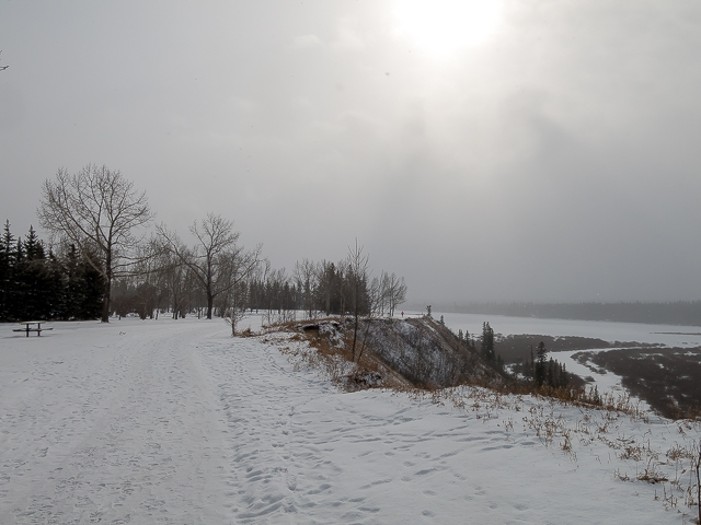
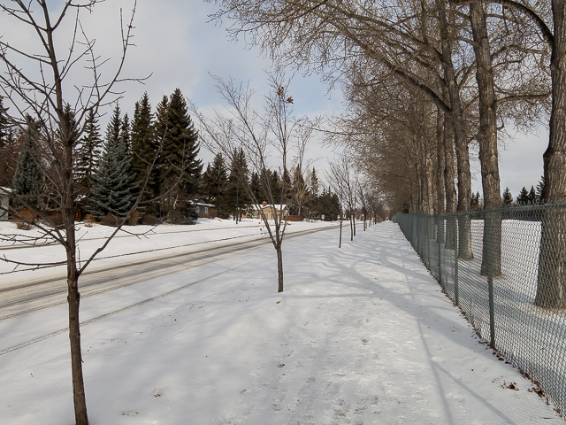
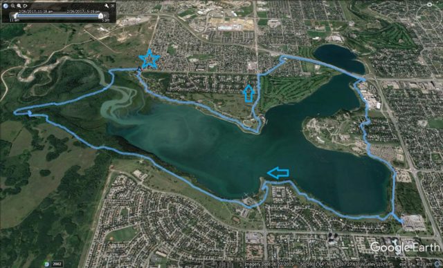
In sixteen clicks, the route’s total distance, expect to see dense woods and pastoral green spaces, noisy roads and peaceful side streets, places that are often busy and others where you may not see anyone. We’ll begin the adventure at 37th Street and 66th Ave SW, aka the Weaselhead/North Glenmore Parking Lot and will walk clockwise. Mix it up and start anywhere in the loop and head which ever direction pleases you. The route is fully paved and plowed in winter, except for the remote, heavily wooded section down on the river flats.
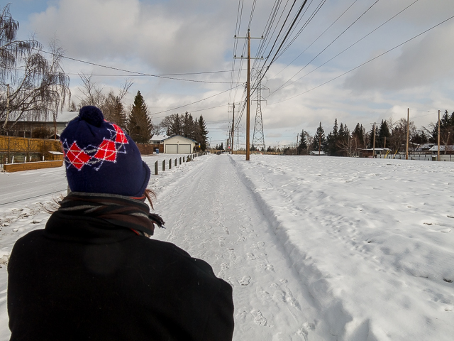
Putting feet to pavement, head north towards the reservoir and intercept the designated walking path. Here wheeled conveniences, bikes and rollerblades, and those on foot are separated but most of the time, due to limited space, share the same chunk of pavement. Head east at the edge of a high escarpment above the reservoir. Looking down there you’d be hard pressed to believe you’re deep in the city. Looks nothing the part. We’re so lucky!
Strolling along, enjoy the scenery. The section in North Glenmore Park is often times pretty busy. This day was cold (-20-ish) and rather blustery at times, even with when the sun broke through, so most of the trip here we had the place to ourselves. Just a few joggers, a few couples out for a stroll, Team BIGDoer well bundled up, and that’s about it. I suspect we were one of a few doing the complete loop. Most only do a section or two. If you visit come nice weather…well it’ll be more crowded.
Bend hard left, pass the rowing club and soon on hit Crowchild Trail. Look across to Heritage Park. That nice old grain elevator sure stands out.
Intercept the power line right of way and take the path under it. Hold on…the gas station across the way…full serve and repair bays? Retro! Mental note to self, take a closer look sometime. Come to a wall, at a pedestrian bridge, forcing you right (eastbound). Meet up with Glenmore Trail. The noise! Just after crossing the reservoir (dam can be seen back over there), head up and south into the trees. The din soon fades away, thank bloody goodness. Pass in behind sprawling Glenmore Rockyview General Hospital.
Enter a residential area, the community of Eagle Ridge. Lots of fine houses here. Or are they hotels – some are big enough. Back on the pathway, pass by the entrance to Heritage Park. The old train station, actually a reproduction of one from Calgary’s past, is particularly interesting. Back by the lake now continue south. Come to Glenmore Landing shopping centre. If your hungry, here’s the place to stop. There’s a couple restaurants, fast food joints and a pub here. The call was too powerful for us. Beer stop! It’s cold out here, there’s warmth in there and brewskis and burgers…it’s a no brainer.
Back to the walk, continue west. Initially down by the water (or in this case ice – the reservoir was completely frozen over), the path rises up gently into a wooded area jammed behind some houses. Pass the Glenmore Sailing Club and enter South Glenmore Park. Look north and see downtown. Moving on it’s open areas to your left, wooded slopes to your right. Soon on, enter the Weaselhead Natural Area. There’s no way this is inside Calgary.
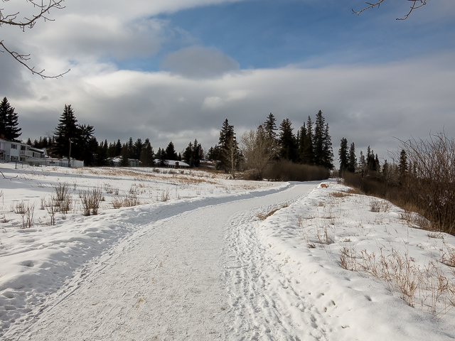
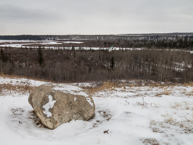
Drop down to Weaselhead Flats, the most “wild” area you’ll see this trip, and soon on turn north-ish. This section of pathway is not cleared of snow and the trampled down build up can get rather icy. Extra care and attention here guys.
Don’t be surprised to see deer here, or maybe even a moose or bear. Lots of side trails to explore. Prior to the 1980s, this was military land. Unexploded ordinance surface from time to time and signs let you know what to do if you spot one (summary: don’t touch and call authorities). The name Weaselhead is of First Nation’s origin and their reserve borders on the back (west) side of the park.
Cross over the Elbow River, the source of the reservoir you’ve been looping around, which is also Calgary’s main water supply. Nice spot here. Again, and for the last time, hard to think we’re in the city. Glenmore Park is such a treasure! A rare gem of green space, a huge green space in fact, open to all Calgarians, that allows everyone the chance, easily and with little work, to get in touch with nature. The reservoir dates from the 1930s. Before then, it was a deep river valley.
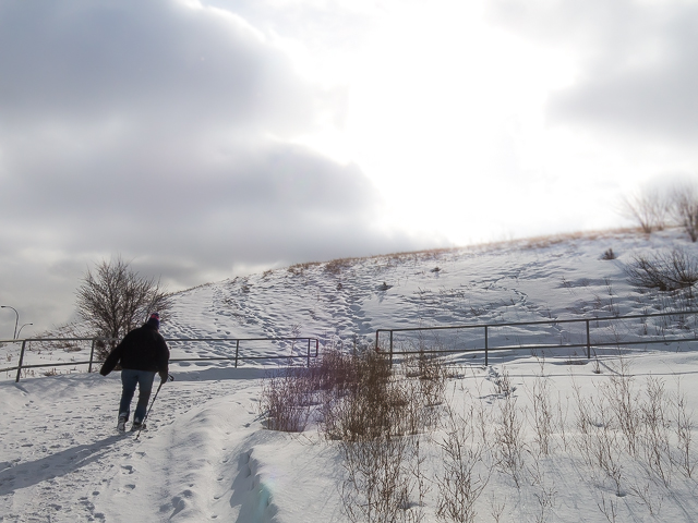
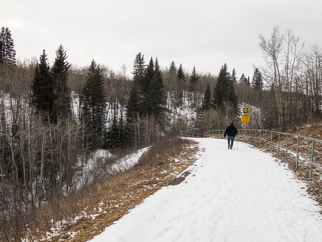
Now some work, a climb up to the top of the escarpment. Here’s one to get the legs barking. And there you are, at the top and back where your car is parked. Sixteen clicks under the belt, sixteen clicks of pure fun. Nice to “stretch” the legs. Follow our route and enjoy it.
Hoofin’ it in town…
Calgary’s Best Walks #10.
Urban Trek – Bow River Loop.
Calgary Pathways – Bow River and Nose Creek loop.
If you wish more information about this trail, by all means contact us!
Date of adventure: February, 2017.
Location: Calgary, AB.
Distance: 16km.
Height gain maximum: 60m
Height gain cumulative: 100m
NOTE: all distances and heights are approximate.
Technical bits and notes: Path can get busy on nice days.
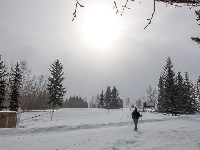
Starting out on the Glenmore Park Pathway – minus 20C this day.
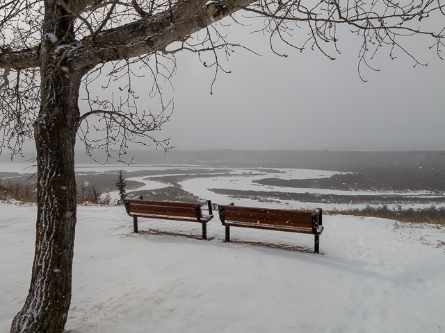
Below the “Weaselhead” and in back, the Glenmore Reservoir.
In North Glenmore Park.
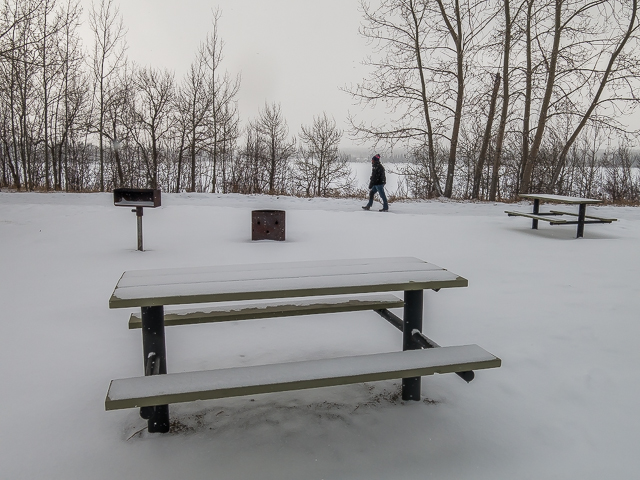
It was a cold day and the pathway pretty quiet.
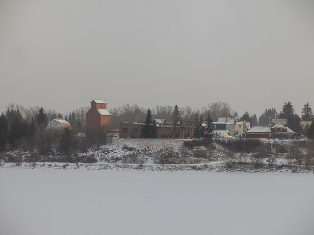
Heritage Park on the opposite bank.
Along Crowchild Trail…
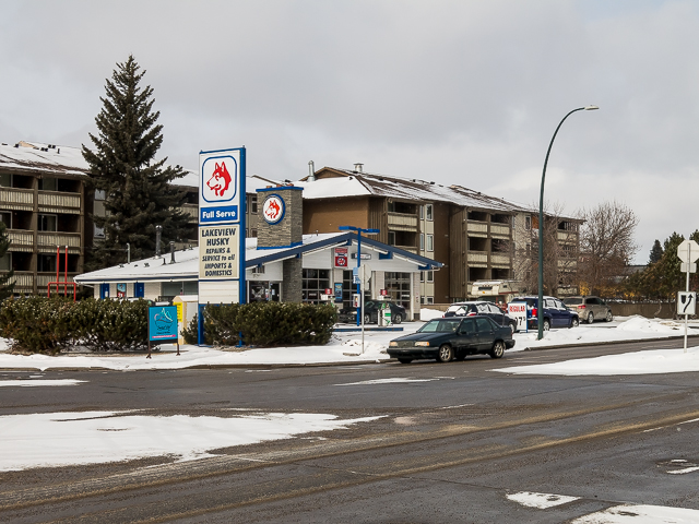
Lakeview Husky, full service and repair bays. Retro!
Under the powerlines.
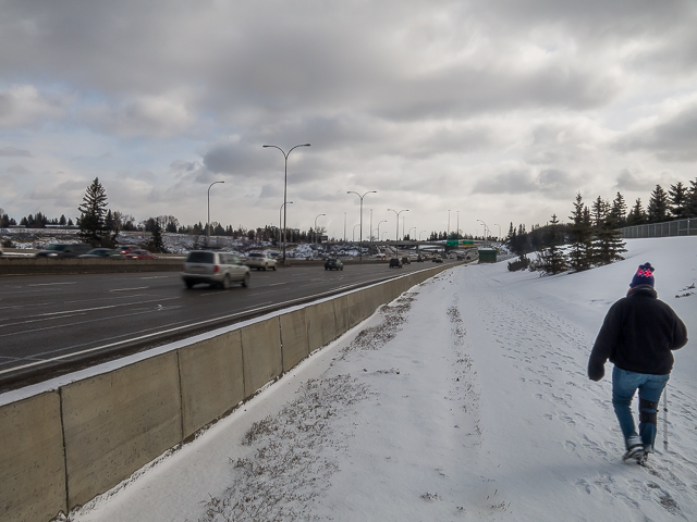
The nosiest section, along Glenmore Trail.
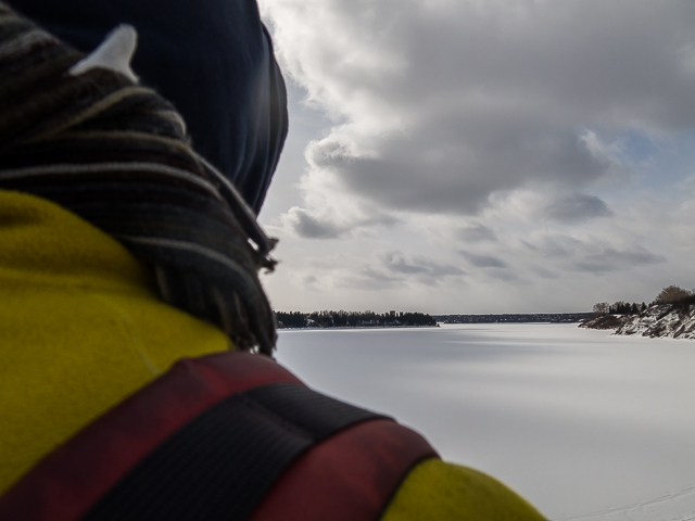
Looking out across the reservoir.
Up and away from the din.
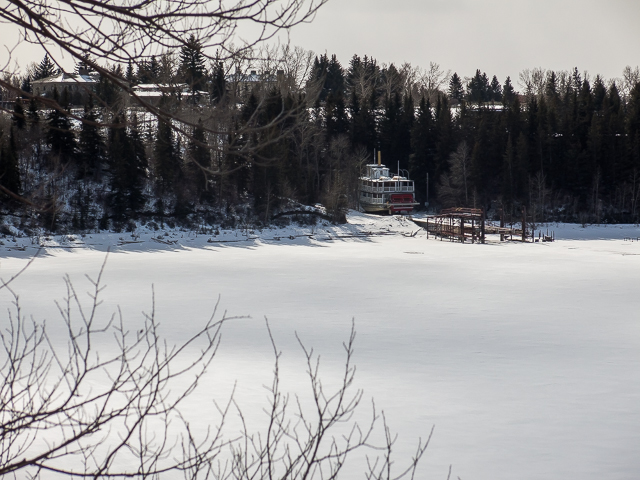
The SS Moyie parked for the winter.
In back of the Glenmore Rockyview General Hospital.
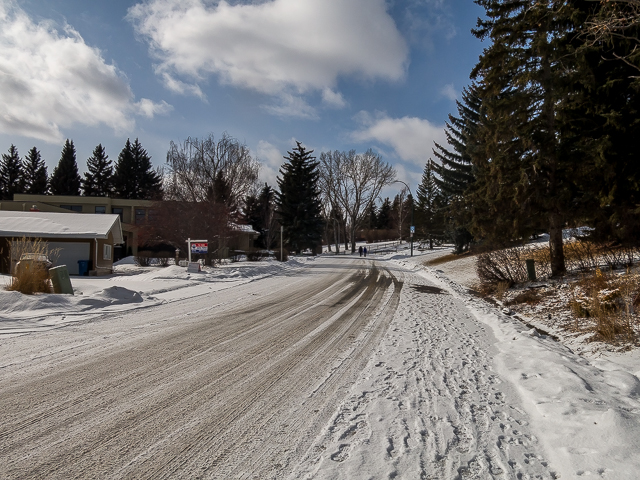
Taking to the road in Eagle Ridge.
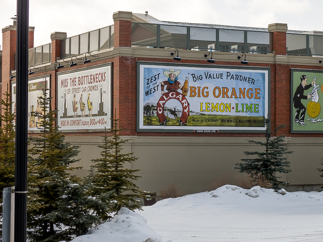
The Calgary Brewery didn’t only make beer.
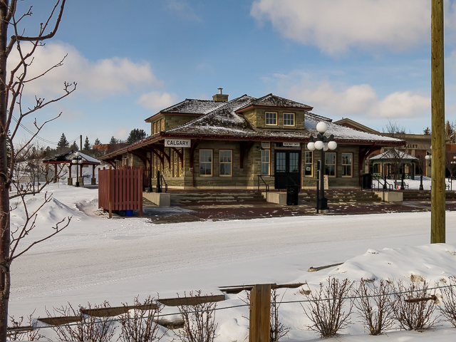
The entrance to Heritage Park.
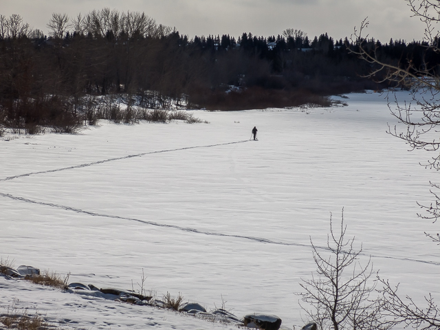
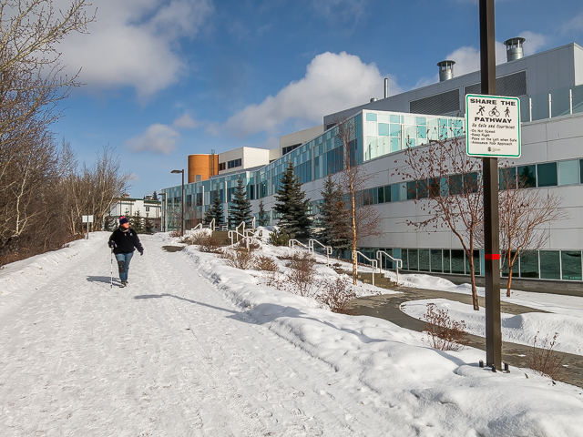
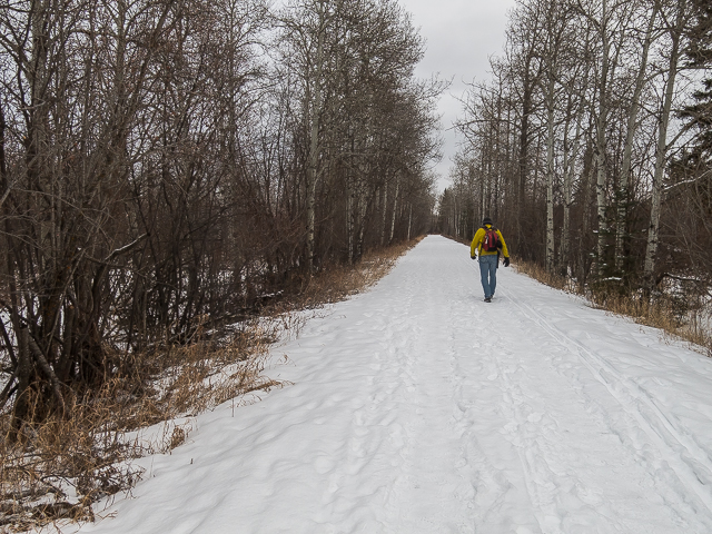
A lone XC skier…
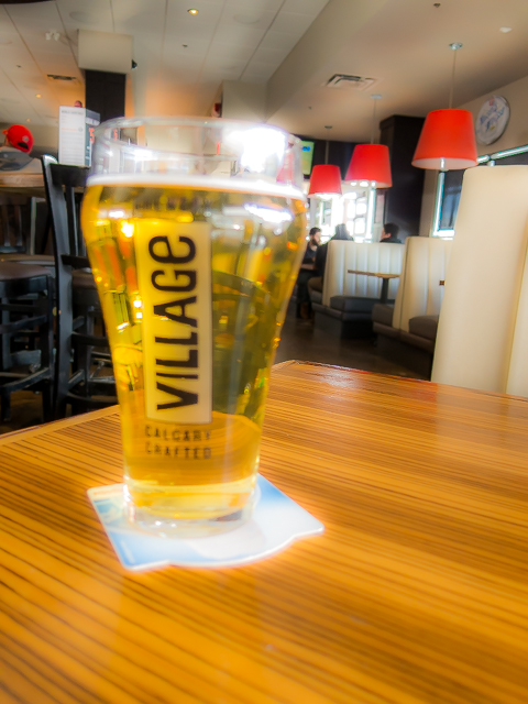
Beer stop!
On the south side now.
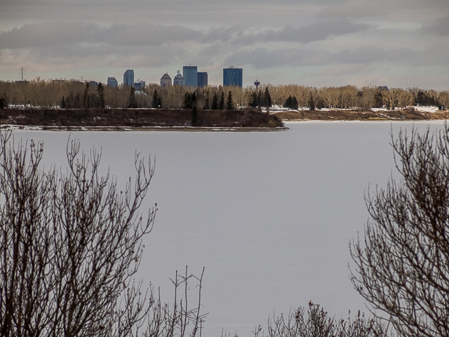
A view of downtown.

Horses are welcome in the south park, but we’ve never seen one.
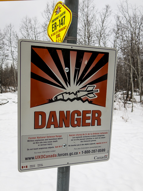
The Weaselhead was once used by the military – a warning sign.
Dropping down…
The wildest section of the trip.
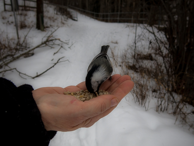
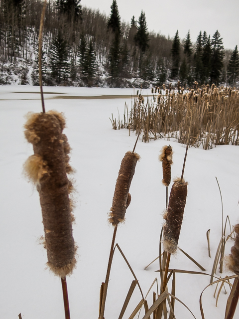
Dinner for Chickadees.
This section is the only not cleared of snow.
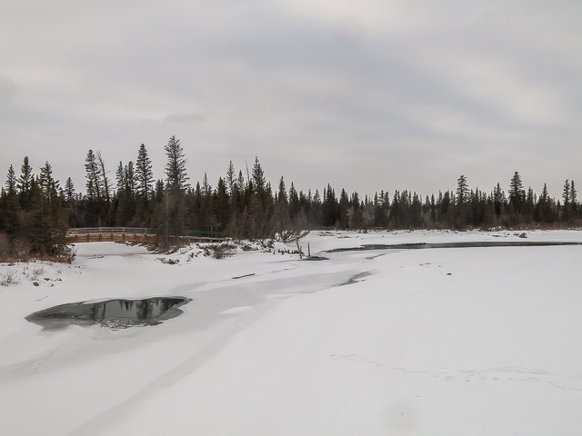
The frozen Elbow River, source of the Glenmore Reservoir.
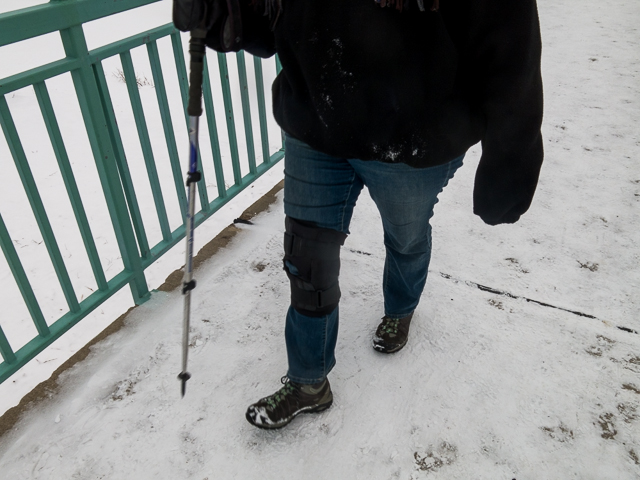
In spite of bad knee, Connie’s still able to do it.
Topping out, you car is moments away.
Sixteen clicks…
")


For reference, the hospital is actually called “Rockyview General Hospital”.
Anyway, it seems they’re working on a new trail segment that will run along the shore from the North Glenmore Park boundary to the bridge on Glenmore Trail. That will be a nice addition since it will avoid most of noisy bit running down the hill there.
Back when I drove delivery truck that’s what all the drivers and dispatchers called it. And it stuck I guess. I’m sure we’re not the only ones who use that unofficial moniker. Still, thanks for catching our mistake, which we’ve since fixed. Yes, we heard about what was going on with the reroute. That’ll be an improvement. Thanks for commenting!
That is beautiful! Bomb range?
The land was used for military maneuvers, so yes in a way. Not bombs though, but mortars. Like it matters – either is horribly dangerous.
I need to do this! Now that it’s springtime, I’ll dust off the ol’ hiking boots, and get busy. Great post!
Thanks, glad this post was some inspiration. Our boots are a bit dusty too – so many historic projects the last week or two, we’re looking forward to just getting outside.
No wonder I had such a blast last time I was there!
Ba-da-bum! Was waiting for someone to make a joke…