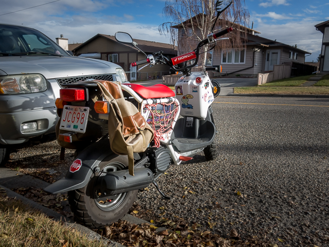
Here’s a crazy notion…let’s go back in time. Nothing out of an HG Wells novel, and there’s no magic machine to send us into yesteryear, instead let’s do this…pick the far end of a major walkable thoroughfare, in this case Centre Street, hike it in its entirety from the newest section of town it touches on, into the heart to downtown, the oldest, where it ends. Photographing what ever we see as interesting along the way, we’ll also record any sidewalk date stamps to show our progression backwards in history.
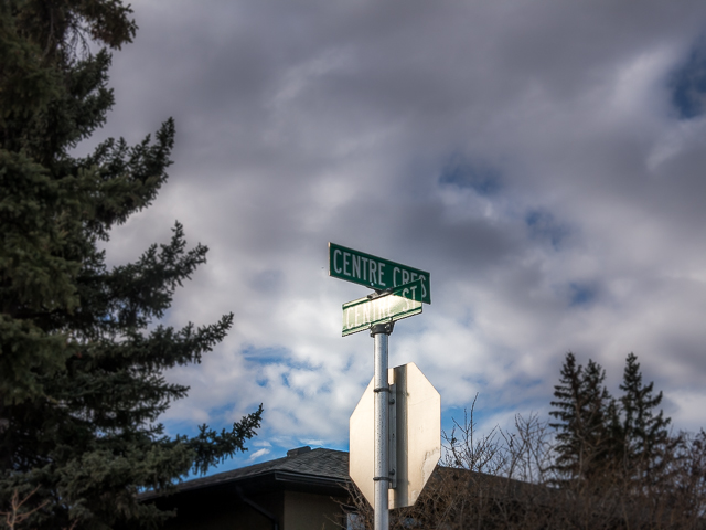
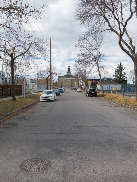
The far north end of Centre Street (officially Centre Street North – there is a small section of Centre South) ends unceremoniously at a side street just south of busy Beddington Trail. Here, it’s a quiet boulevard for a few blocks, but for most of its length is much more busy. Park at Bergen Crescent in the Beddington Heights Neighbourhood.
Centre Street: Back in Time – an urban trek starting in the 1990s and ending the century before. A Chris and Connie Adventure!
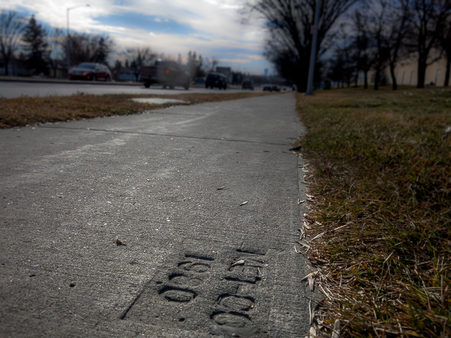
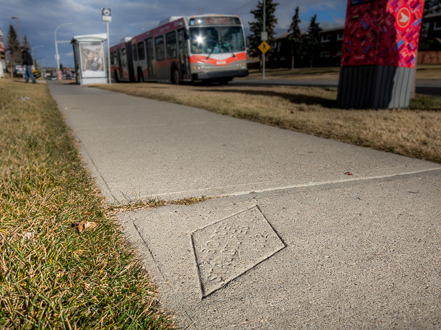
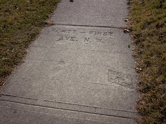
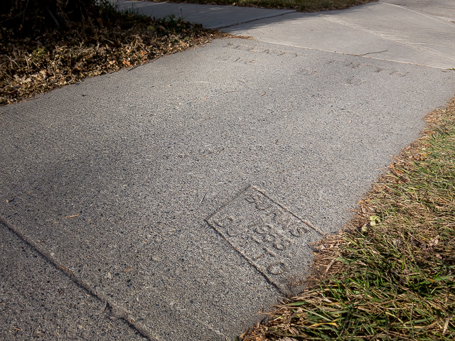
Hit Centre Street and head south, never leaving it until you hit your destination, the Calgary Tower in the core. Navigation is a no-brainer. Date stamps, commonly put on sidewalks here in Cow Town, tell us this first section is from the 1990s. These reflect when the community was built.
Doddle along passing strips malls and endless rows of houses. The street here is two lanes each way and divided. Later it narrows, sometimes the second lane being used for parking. Outside one sweeping S curve fairly early on in the walk, it’s arrow straight and perfectly aligned north/south. Time is a blur and date stamps showing the 1980s and 1970s are seen in quick succession.
Scroll down for photos and to comment
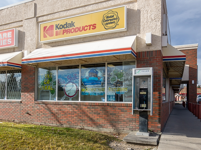
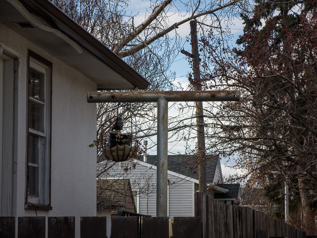
Welcome to Huntington Hill and the 1960s. Houses here, more so in the younger north end, have a very “Brady” feel about them. A corner drug store is passed. Remember those? Their sign tells us it’s a good place to drop off rolls of film for processing. A pay phone out front is another anachronism.
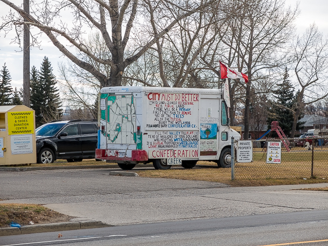
Entering Thorncliffe, the 1950s are reached. Someone has a beef with the city – an old panel van parked nearby and in plain sight of traffic, is a rolling billboard in protest of some land usage issues in the area. What will be made clear shortly. Read on.
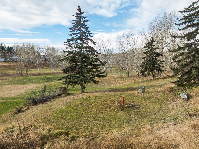
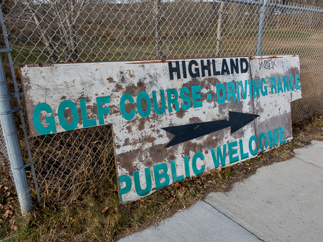
Come to the community of Highland Park dating from the late 1940s and early 1950s. There’s a golf course here, disused for the few years (see: Fore! No More). This green space is used as an informal park of sorts by residents and is potentiality slated for redevelopment (meaning housing). Locals are opposed to that. The van seen earlier…it”s theirs. Makes sense now. More 1950s era sidewalk date stamps are seen. Calgary was going through a boom then.
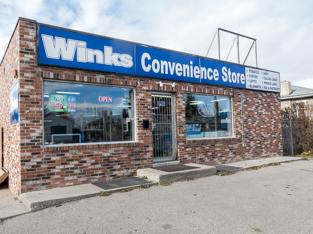
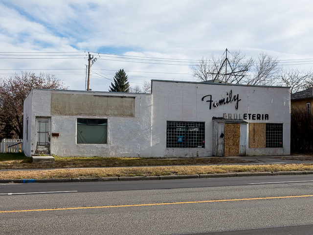
Closed for a few years now, Family Groceteria is passed. There was a time when there were a lot of these mom and pop corner stores. The 7-11s and Macs (and Winks) that replaced them seem sorta soulless in comparison.
We’re now in Tuxedo Park and Balmoral, communities dating from the 1910s and 1920s. We’re flying through time now! From here on no more date stamps are seen, the last was some blocks north and was from 1940-something. As we’ve travel south and back in time, the street becomes more retail oriented and few houses are seen. Truck spotting moment! A sleek International Lonestar. We now return you to the story. Looking down a side street, take in impressive Balmoral School. Many old schools like it in town are made similarly of Sandstone.
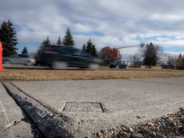
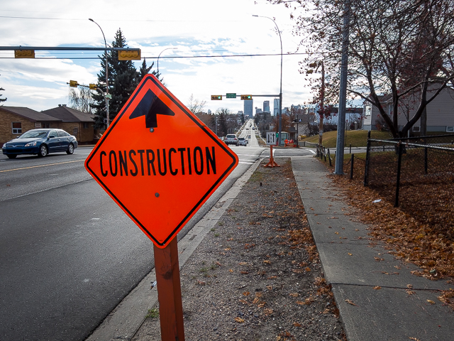
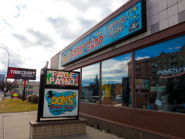
Come to 16th Avenue, one of the biggest thoroughfares seen. Do your best Frogger impersonation crossing it. Watch for bad drivers! Don’s Hobby Shop, a long time Calgary Institution, was a regular stopping place for this author when a teenager. It was downtown then. No more date stamps are seen (sidewalks having been replaced over time) but we’re still travelling back in time.
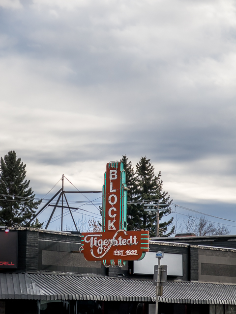
Centre Street is made up of more retail, shops, stores, and businesses. Not many old buildings are seen, most long since torn down and replaced by newer structures. One stand out that is relatively old, is the Tigerstedt Block, from the 1930s. The property is due to be redeveloped (cough, cough, gentrified!). They plan on keeping the old neon sign though! What saints.
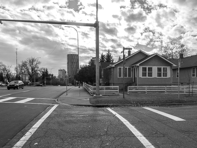
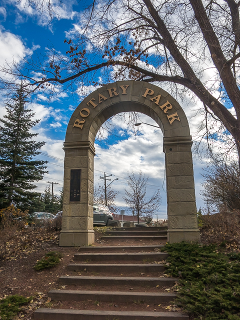
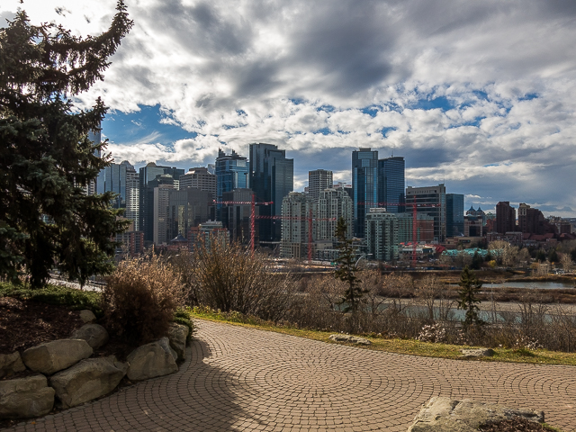
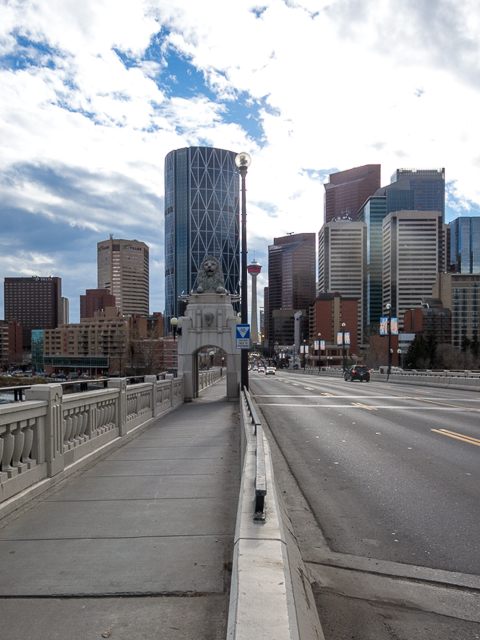
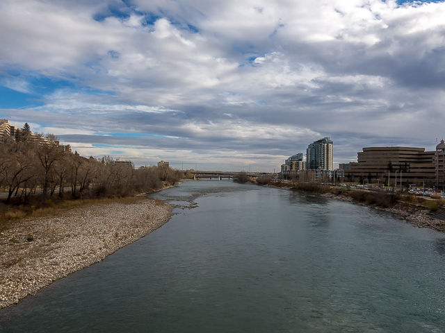
Cross and enter Rotary Park (paralleling Centre in the narrow draw here is best avoided). Take in the impressive Calgary Skyline before dropping down to the century old Centre Street Bridge over the Bow River. It’s fine structure, massive, made of concrete and guarded on each end by a pair of lions.
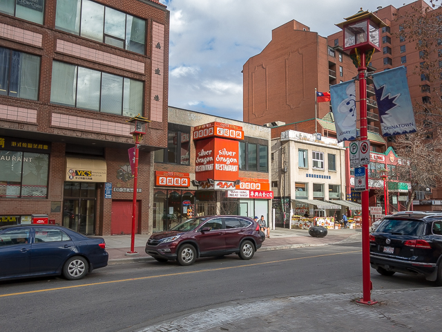
Come to Chinatown. Some of the oldest buildings seen on this trek are passed here, including bits of some dating back to the late ninetieth century. Lots of restaurants here from many Asian Cultures…and we’re getting hungry!
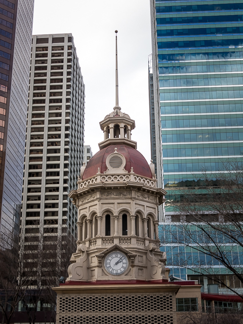
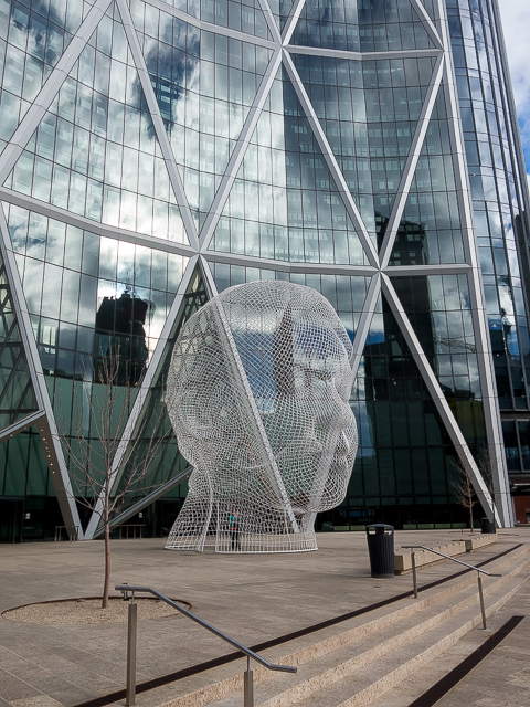
The old clock tower at the James Short Parade is interesting. It was saved when the early 1900s era school once located here (Central School) was demolished. Just to the east is the Bow Building “Head”. It’s a hugely popular subject for photographers. There was one inside, snapping away, as we passed.
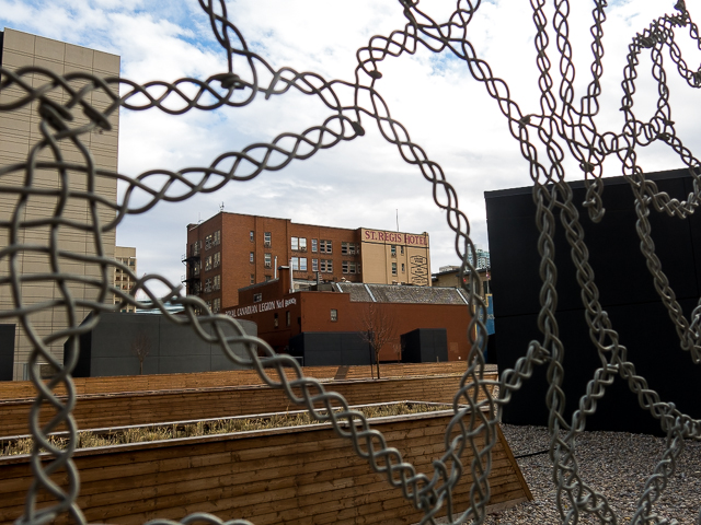
Just a few blocks to go. Background left, see the St Regis, or sometimes the “Regis”, one of the last dive hotels in the city, before it closed some years back. The folks…how do we say this…were winos and frequented the “beer parlour” there back in the 1970s. Plans are to do something with it. Eventually. The building is from the 1910s. We’re in old downtown.
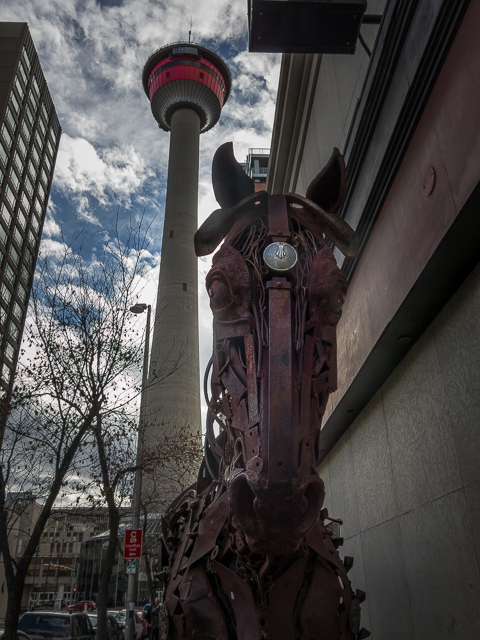
Next up is the “Mechanical Horse” made from all manner of scrap metal. It fits with the town’s cowboy vibe. Look waaaay up, it’s the Calgary Tower behind it. This 1960s built structure was once one of the tallest buildings in town but today gets lost in the clutter. Most skyscrapers in the core are higher than it. Still, it’s the city’s most iconic building. Stand at the base and take it in.
You’re now about smack dab in the oldest section of Calgary, even if the buildings around don’t reflect that. Here, say in the 1880s, was a few buildings, the CPR tracks and little else. Just over ten clicks from the starting point, you’ve gone from the 1990s to the 1880s. All by simply putting feet to pavement.
We’d love it if you SHARED this post.
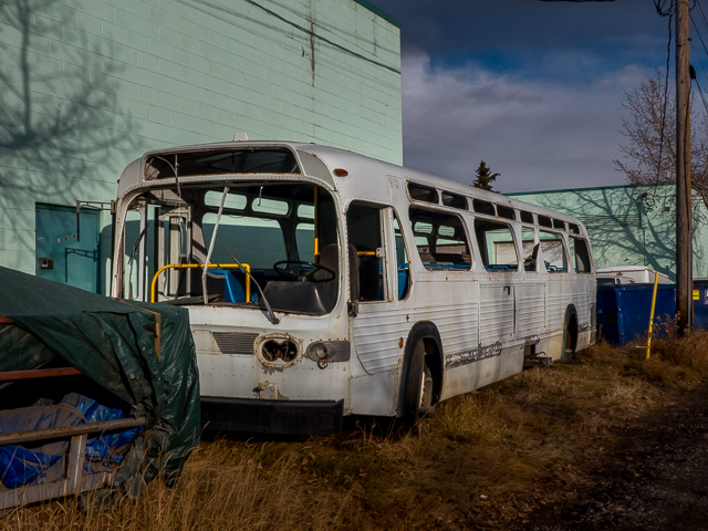
A walk back to the starting point would make for a particularly long strenuous day. Fortunately a bus follows Centre Street from end to end making things easy – we saw a lot of these pass as we walked.
Later the same day….
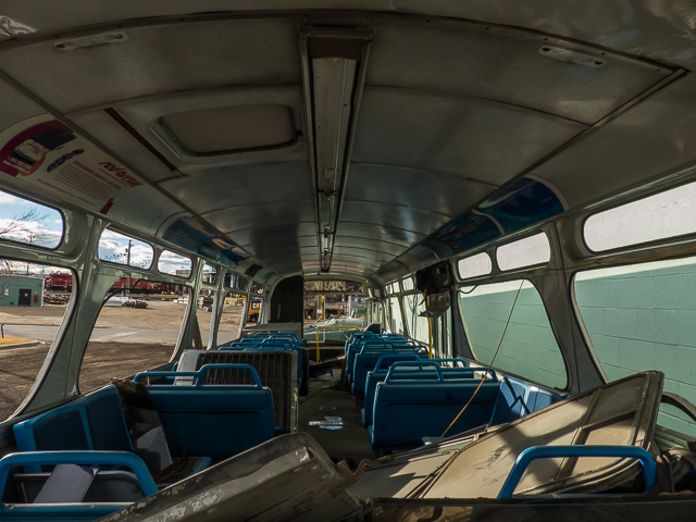
Withing sight of downtown, we find an old transit bus that’s been stripped down. This GMC “Fishbowl” (made from the 1960s-1980s) appears to be ex-Calgary Transit. We don’t know anything about it and soon it’d be gone. We like old buses, and rarely miss the chance to capture one and it makes a nice byline to this adventure (and it’s our website to do with as we please…so there). Maybe you rode this bus in the old days. Certain I did.
If you wish more information about this trail, by all means contact us!
Date of adventure: November, 2016. Location: Calgary, AB. Distance: 10.5km one way. Height gain maximum: 10m plus an 80m-ish (loss) NOTE: all distances and heights are approximate. Technical bits and notes: It’s a city hike – all the usual concerns.
When you went on this trip did you see the former Tuxedo Park School located just north of the (now-demolished) Family Groceteria? It’s very easy to see from Centre, about a block east on 28th Ave. If I remember correctly it was built in the 1920’s and served as a school up to the 2000’s, when it was occupied by Chinook Learning services until its closure around 2015-16. Might be an interesting topic for an article 😉
Love it, so many familiar places. I hope the awesome Orange Crush sign off the Family Groceteria went to a good home!! The Tigerstedt sign is a fave of mine too.
I hope so too. I always wanted to stop in that store when it was open, then guess what, one day it was closed. Missed out. That Tigerstedt sign will be the only thing saved when they tear down the block.
Great idea for a hike, Chris and Connie! Although the first concrete sidewalk in Calgary was poured in 1902, the oldest ones spotted so far are in the Beltline and are dated 1907. The contractor’s name for this stamp was Batchelor, Marshall and Skarin. Bob Marshall later became Calgary mayor, and later MLA, before moving to Edmonton with Crown Paving.
We used to do something called the "pointless challenge" 🤪 and miss those days. It was so much silly fun and often frustrating as heck. In these we'd invite people to send in random photos of obscure locations, but not give any information, and then we'd track where it was and shoot something similar.
Most of these came from old family collections, as was the case here. Anyone up to resurrecting the series?
In hindsight, why didn't we pose someone in our shot?
Pointless: “Devoid of meaning (or) senseless” Merriam-Webster.
If you like what we do and want to support this ongoing project (12 years now), go here: https://www.BIGDoer.com/help-the-society/ Thanks to Connie for making this post possible.
Exploring history with Off the Beaten Path with Chris & Connie. Photo: ca1970 and 2014. Posted by Connie.
Captured on a cold, cold day many years ago. We've been passing this old house for decades and it's little changed in that time. At some point we expect to drive by and it'll be gone.
Exploring history with Off the Beaten Path with Chris & Connie. Photo: 2017. Posted by Connie.
When retired old railway cars usually get cut up for scrap. Sometimes, however, they find their way into the hands of the general public or whomever. Flat cars make good bridges, and boxcars can be transformed into storage buildings and the like. Case in point here. We see them used like this often enough and in this case, it's part of a corral.
Incidentally, this boxcar dates from 1950 and this was found by tracing the old road number, which is still visible.
Exploring history with Off the Beaten Path with Chris & Connie. Photo: 2017. Posted by Connie.
This central Alberta racetrack was never a commercial operation but instead just a fun place for car enthusiasts in the area to get together. Early '70s or thereabouts and it only lasted a few years. Even thought it's been abandoned for that long, there is no doubt what was here.
You know we like the the obscure stuff and this one fits the bill perfectly. Found by accident while backroad cruising and the history comes thanks to local car guy Mike.
Exploring history with Off the Beaten Path with Chris & Connie. Photo: 2022. Posted by Connie.
On top of little Myrtle Mountain in the Kimberley (BC) Nature Park.
There's some good wilderness fun to be had here and nice views as you can see, but the real reason we came is mining history. The whole area near the ski hill was extensively worked over a century ago and we were looking for evidence of this. We didn't find much in the area searched, but it's a big chunk of property and we hope to return to cover more ground again soon. Of all the subjects we cover, mining related is a favourite.
Still, it was a good hike and that can't be bad. Look to the comments for more info 👇.
Exploring nature and history with Off the Beaten Path with Chris & Connie. Photo: 2022. Posted by Connie.
It's a strange curiosity in south Kananaskis, there on a hillside and we have no idea who created it. We asked around and no one's completely sure about its history. In the past it showed the Canada 100 logo from 1967 but in 2017 someone changed it to reflect the country's 150th.
That's our friend Emily from DanOCan.com having a look.
Exploring history with Off the Beaten Path with Chris & Connie. Photo: 2017. Posted by Connie.


")

")
")


")


When you went on this trip did you see the former Tuxedo Park School located just north of the (now-demolished) Family Groceteria? It’s very easy to see from Centre, about a block east on 28th Ave. If I remember correctly it was built in the 1920’s and served as a school up to the 2000’s, when it was occupied by Chinook Learning services until its closure around 2015-16. Might be an interesting topic for an article 😉
(Sorry for the delay in approving – we’re just recovering from a huge comment’s system crash.)
We’ve been eyeing up that school for some time now!
Thank you, we love producing these silly little posts. So fun, no work at all.
Love it, so many familiar places. I hope the awesome Orange Crush sign off the Family Groceteria went to a good home!! The Tigerstedt sign is a fave of mine too.
I hope so too. I always wanted to stop in that store when it was open, then guess what, one day it was closed. Missed out. That Tigerstedt sign will be the only thing saved when they tear down the block.
(via Facebook)
We lived off Centre in Tuxedo park for some years. I liked it a lot, lots of history and walking distance to everywhere.
Yeah, there’s pretty much everything close at hand there. Thanks for commenting!
I love our little walks where we can stretch our legs and see the sights.
I cherish them too. The silly little walks to and from nowhere mean a lot.
Great idea for a hike, Chris and Connie! Although the first concrete sidewalk in Calgary was poured in 1902, the oldest ones spotted so far are in the Beltline and are dated 1907. The contractor’s name for this stamp was Batchelor, Marshall and Skarin. Bob Marshall later became Calgary mayor, and later MLA, before moving to Edmonton with Crown Paving.
Awesome bit of trivia! Always wondered which were the oldest!