
James Walker Creek
Let’s see…a nice easy hike taking one to a stunning mountain rimmed valley, home to a charming little lake. What’s not to like? Here, the perfect choice when ambitions are lacking but the call of the nature is loud and strong. This is about the easiest lake destination hike in Kananaskis and while not the most spectacular of the many that exist in the area, it’s not without its own special charms. There’s options to go further if you so like.
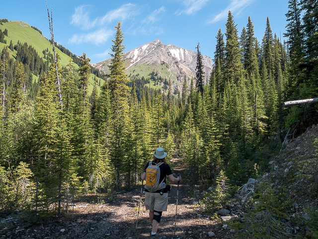
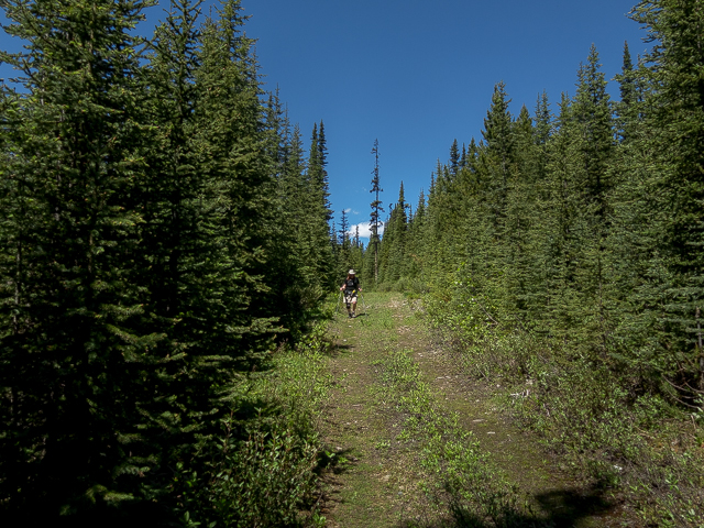
Make your way to the Sawmill Day Use Area on the Smith Dorrien/Spray Lakes “Highway” (gravel and dusty) just north of Peter Lougheed Provincial Park in K-Country. Behind the “facilities” follow a gravel wash up and east and come to a gate. Here’s the trail head, the path a reclaimed logging road. Follow it at as it trends north-ish.
The road rises and falls with the terrain. Pass many junctions, spurs off the main road. Most are overgrown and impassable or at best less trodden, so while there’s a literal maze of them, it’d be hard to loose one’s way. There’s the occasional map set up high for use by people out snowshoeing, who make good use of these trails come winter, but are a real stretch to see in summer. We believe this area was logged in the 1960s.
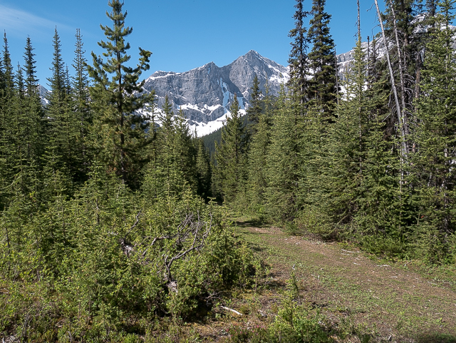
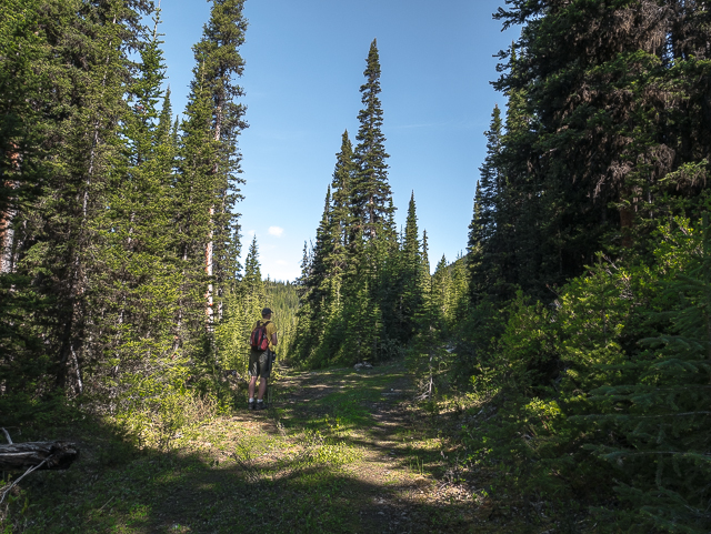
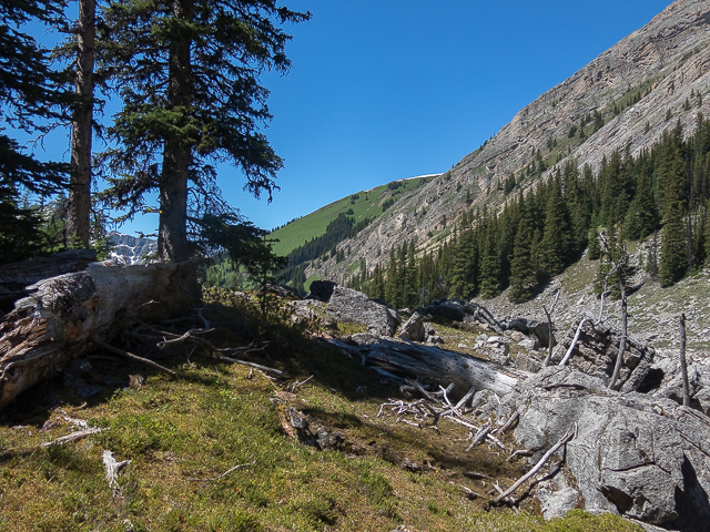
The trail is always deep in the trees and it won’t be until you get within shouting distance of your destination before they thin. Still, there’s the occasional view, now and then, mostly to the west. Strolling along, come to a split in the road, marked with a cairn, and go right. The road continues on, bending east-ish and gaining elevation a gentle and relaxed pace.
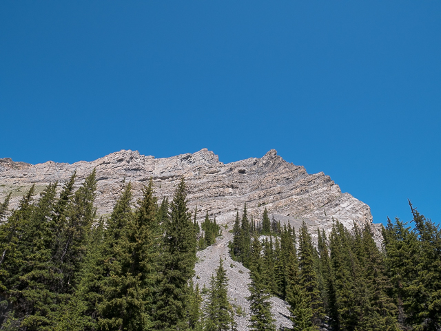
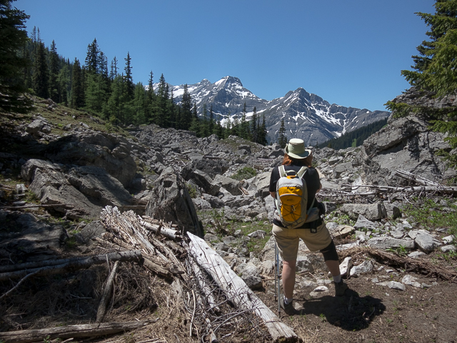
Where the road ends the trail becomes a single track, easy to follow and taking a line at the base of some rocky slopes. Some avalanche chutes are passed, two on our visit full of a jumble of rocks, debris, downed timber and still lots and lots of snow (in places deeper than my height…and I’m tall). And this was late June. They might still be there!
Avalanche Sharks: a D movie (or worse), staring no one you’ve ever heard of nor will hear of again. Stupid but fun. No doubt it was cashing in on the whole Sharknado thing that came and went quickly a couple years back. The story plays out like this – cliff notes version: a snow slide triggered by a snowboarder awakens a prehistoric snow shark (not making this up) that then goes on to terrorize visitors to a ski hill, many of the females, in true exploitation movie fashion, who just happen to be bikini clad. There you go.
Anyway, we viewed it a couple weeks prior and so while crossing these were reminded of that schlock-fest. Then came the giggles and feigned concern over being “jumped” by a great white.
God, that wandering brain of mine. We now return you to your regular programming…
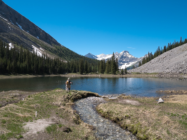
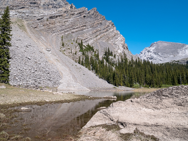
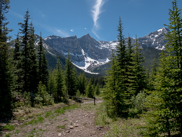
The ground becomes more rocky underfoot. James Walker Creek, the trail’s namesake, has been heard from time to time, gurgling below somewhere though the trees, now comes into view. The lake, which will be reached feeds it via an underground channel – limestone, of which the front ranges are made, is often quite porous, and so this sort of thing, underground streams, is not all that uncommon.
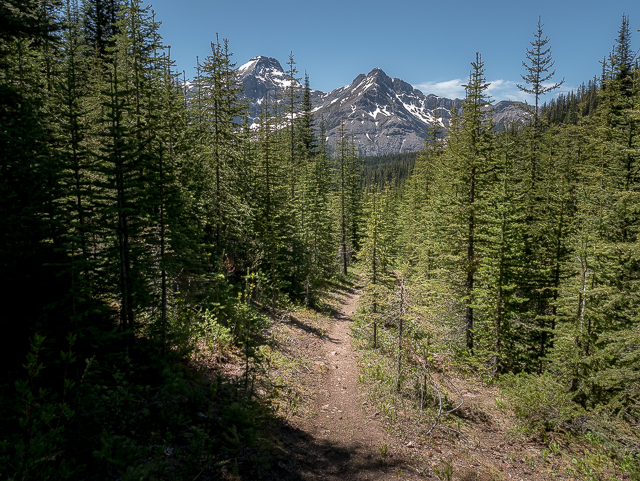
The trees end and the views open up. Welcome to this wondrous place.
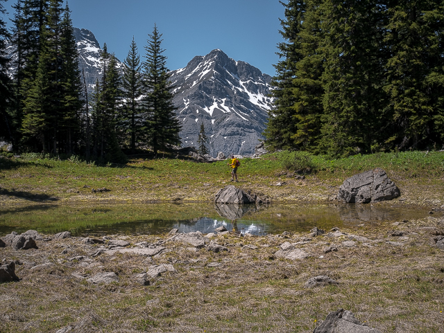
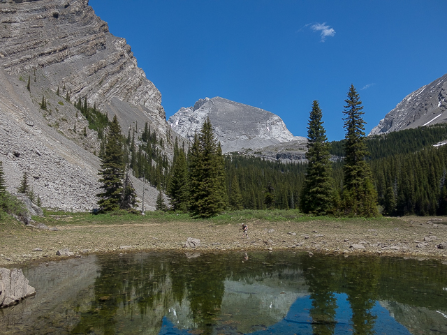
Soon on, arrive at the lake. It’s small, shallow, clear as glass and when the light hits it right, it becomes a glorious deep green colour. Do the full tour and circle it. There’s another small stream feeding it at the east, up valley end side. Anywhere along the shore is a good lunch spot.
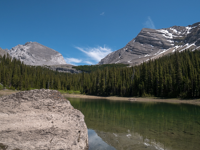
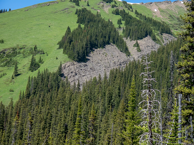
Drop you’re pack, and look around. Take in the mountains, those glorious towering hunks of barren stone, looming overhead. To east it’s the summit of Mt James Walker and to the north a long ridge coming off its west facing side. To the south interconnected Mt Inflexible and Mt Kent are seen. All can be scrambled.
If the lake has a name, we couldn’t’ find it. In fact, it’s more a tarn, a water filled cirque or bowl fed by rainwater or small streams. We’ll call it James Walker Lake or Tarn and be done with it. Any complaints?
Up and over the rock to the north is the Headwall Lakes Valley, then Chester Lake Valley and a continuation of it, Three Lakes Valley, and finally further north again, Rummel Lake Valley. All run in parallel, are similar in overall “personality” and have trails leading into them. Lots of good hikes like this in the area. Of all mentioned, James Walker Creek Trail seems the quietest. We saw no one this day. That the others are arguably a tad more spectacular – not that James Walker is in anyway a dog – I guess explains that. We like lesser used trails anyway.
There are options to go further, two branching valleys to the east, high up and barren and holding some more more tarns, just begging to be explored. Either requires scaling a headwall – no biggie I’m told. A shortage of time meant we’d have to leave them for another day…but they’re now on the to-do list. We like to go alllll the way when we can. Sometimes life gets in the way.
Once you’ve had your fill, retrace your steps back to your ride, the return leg nothing more than a pleasant “stroll through the woods” and thus ending your adventure. Now wasn’t that a good hike?
Naming conventions: James Walker, or Colonel Walker, in the late 1800s, a noted Calgary area businessperson. The mountains and creek were given this name in the late 1950s. Not sure what they were called before or if they even had names.
Surprise treat later that day…a Boler trailer, which most of you know we’re obsessed about, is found park in front of BIGDoer HQ. We’ve seen this same trailer from time to time on the street, but it was nice to have it there, plopped there, where we could see it right from our office window. I don’t know if the owners are aware how crazy we are for these things…probably not…we don’t tell many given most think us a bit nutty for doing it.
More valleys with lakes in the area…
Rummel Lake.
Three Lakes Valley.
Headwall Lakes.
If you wish more information about this trail, by all means contact us!
Date of adventure: June, 2017.
Location: Kananaskis AB, Smith Dorrien area.
Distance: 10km return.
Height gain maximum: 300m-ish.
Height gain cumulative: 340m-ish.
NOTE: all distances and heights are approximate.
Technical bits, warnings and notes: Sharks in the avalanche zones.
Reference: Kananaskis Trail Guide by Gillean Daffern.
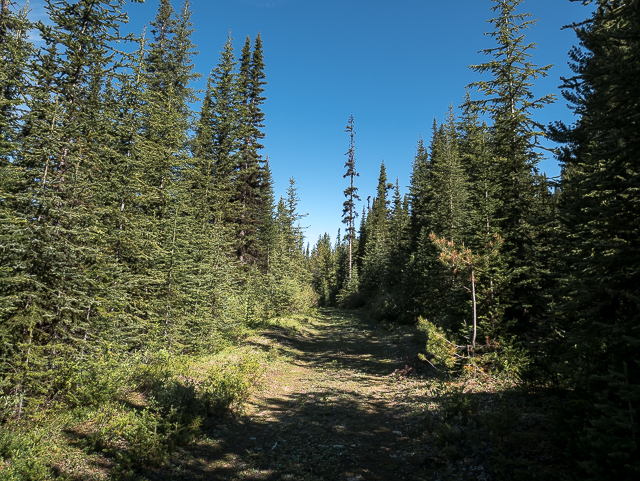
Staring out on the James Walker Creek Trail, Kananaskis.
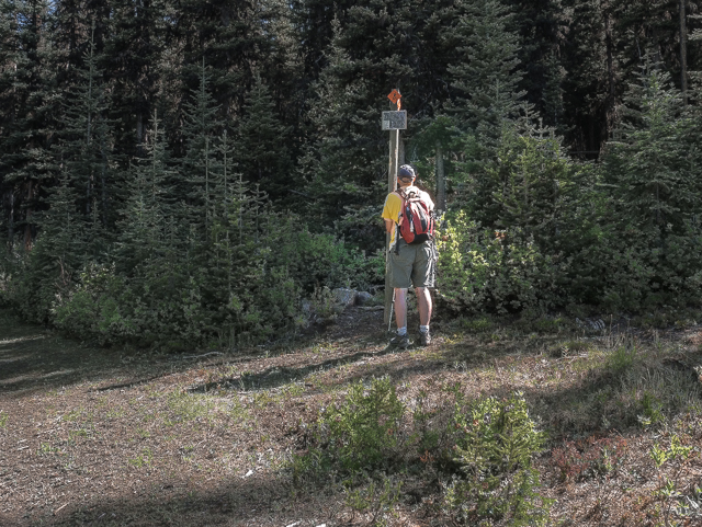
A map to help guide the way.
Looking back, this pleasant view.
Right at this split in the road.
Heading up the James Walker Creek Valley.
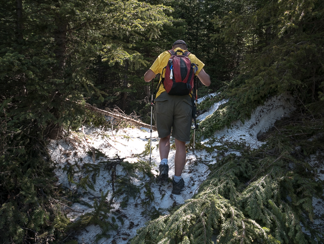
Crossing over the remains of a small avalanche…no sharks were seen.
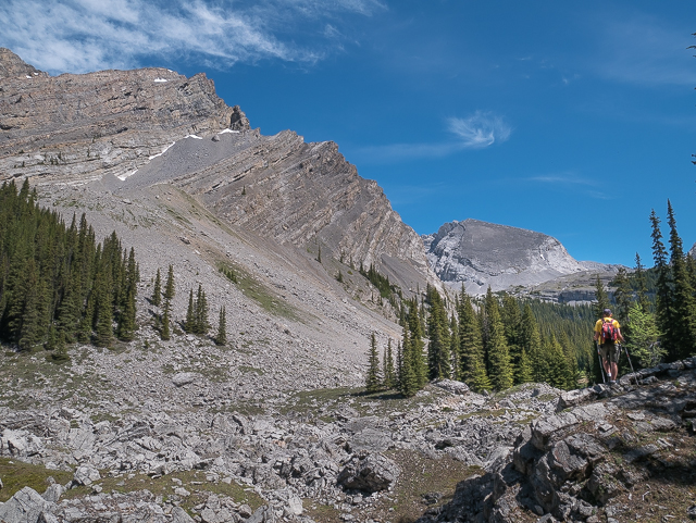
The trees thin, offering up these spectacular vistas.
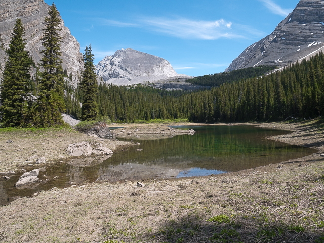
The small lake that feeds the creek.
Looping around…looking west here.
Glorious skies!
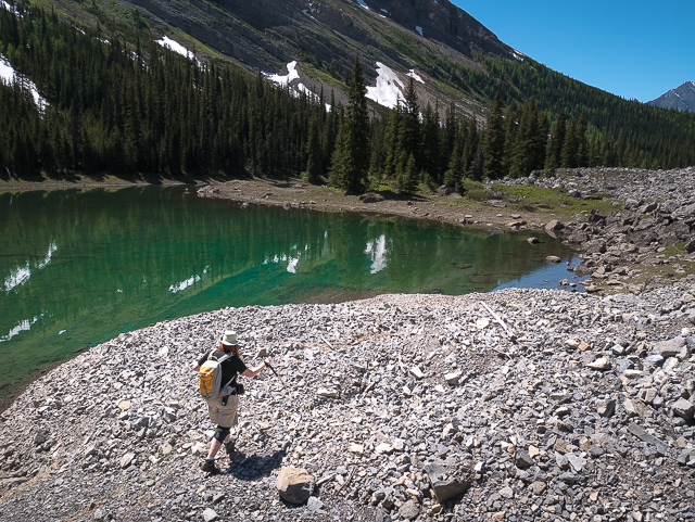
If the light hits it right the lake turns this amazing colour.
Looking east.
The views just keep coming.
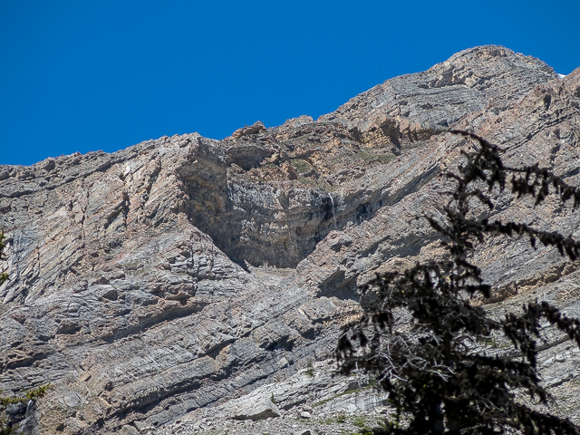
A small waterfall up there…way up there (centre).
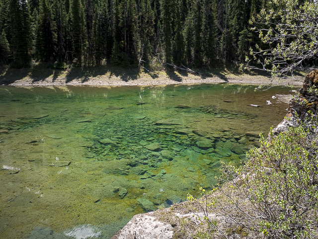
The water’s clear as glass.
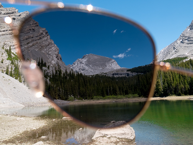
Mt James Walker.
The lake empties into the creek via an underground channel.
Connie’s not far behind.
One pleasant place…
A last look before heading into the trees.
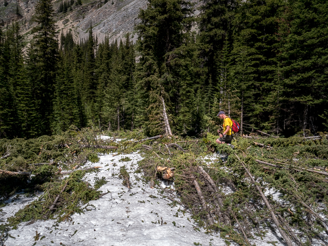
A second avalanche, a mess of snow. rocks and downed trees.
The going is easy…
Prime bear country up there.
The network of logging roads see good use in winter.
A stroll through the woods.
The gate at the start.
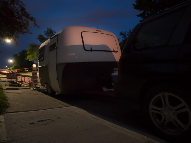
Later that night, this pulls up in front of BIGDoer HQ.
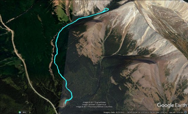
The James Walker Creek Route.


Reminds me of the water in Forget-me-Not Pond!
Yes, very much so, that nice green-ish colour. Thanks for commenting!
Boler! And now they’re coming to us.
I know. We’re a magnet for them! Come Bolers, come!
Too bad there is no fish in it (the lake). Nice waterfall further up.
We hoped to see it, but had to turn around early. Next time!