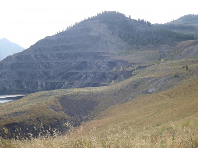
Tent Mountain was not only the last coal mine operating in the Crowsnest Pass, it was also one of the largest. Situated near the Alberta/BC border, portions of it were in either province. Production ended in the early 1980s and this closed the book on mining in The Pass. After some eighty years of sometimes very frenzied activity, the very last of the dozens of mines that once operated here went silent.
Some records on the mine are bit sketchy and contradictory. It seems that mining started in the late 1940s and continued, sometimes intermittently, until 1983 or so (some reports say a bit earlier or a bit later). In any case, most of the scars we see date from the last years of production and in that time they kept busy supplying the Japanese steel industry. It’s not sure what factors lead to its closing – perhaps the contract ended or maybe the mine became uneconomical to operate.
↓ ↓ ↓ ↓ Scroll down for photos and to comment ↓ ↓ ↓ ↓
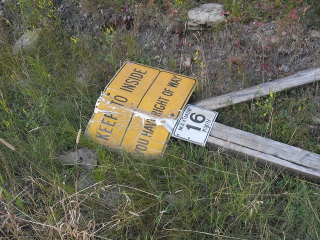
After extraction, the coal was trucked down to the Coleman Collieries processing plant in Coleman Alberta. This plant still remains but there has been talk of demolishing it. The mine road down is not terribly steep, unless you are driving a loaded coal truck. In that case, it’s a nightmare. Speed limits are posted at 16kmh and there are strategically placed runway lanes along the road. I wonder if they were ever used?
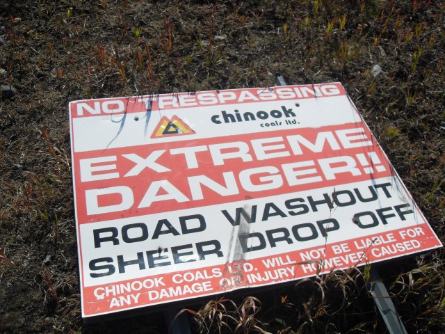
In all reports I’ve seen, the mine was said to be owned by Coleman Collieries, however some signs at the site say Chinook Coals. Perhaps this company bought or inherited the mine after it closed. Research is ongoing.
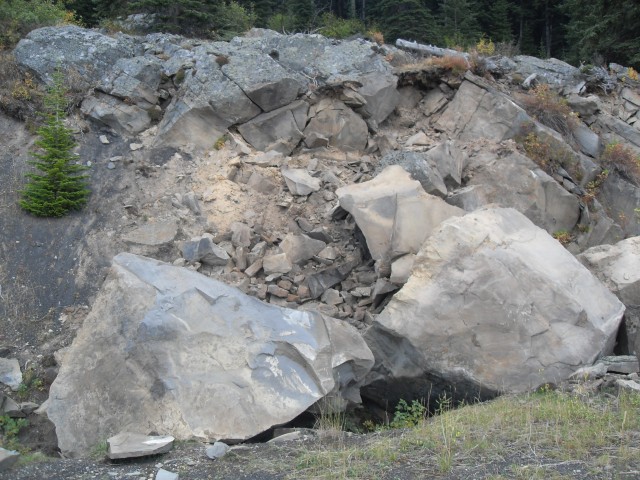
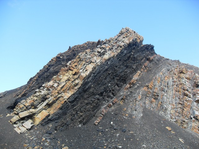
I am sure there is still some coal up there – many thick seams can still be seen in the pits.
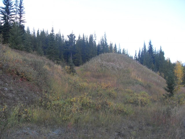
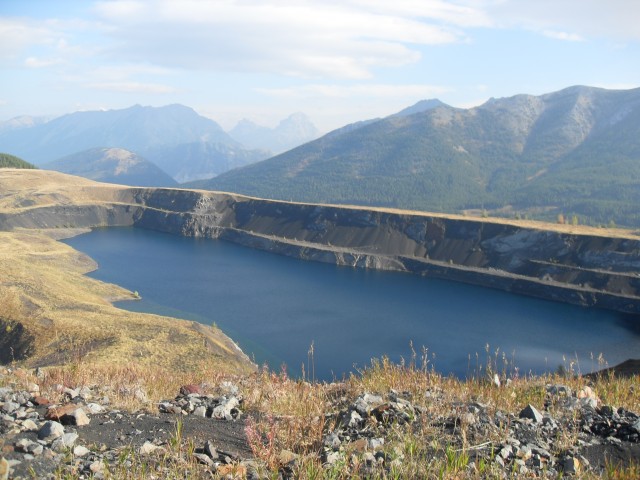
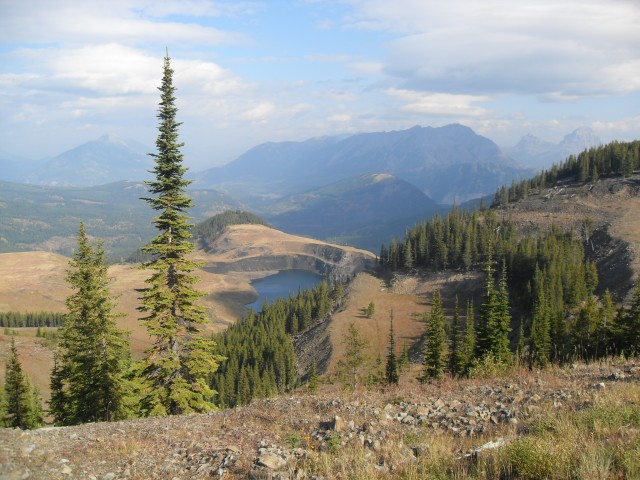
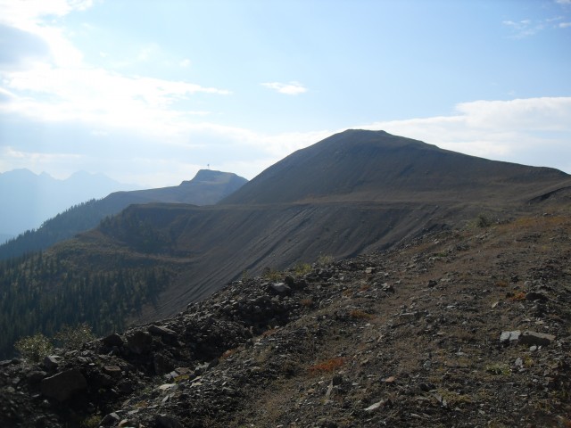
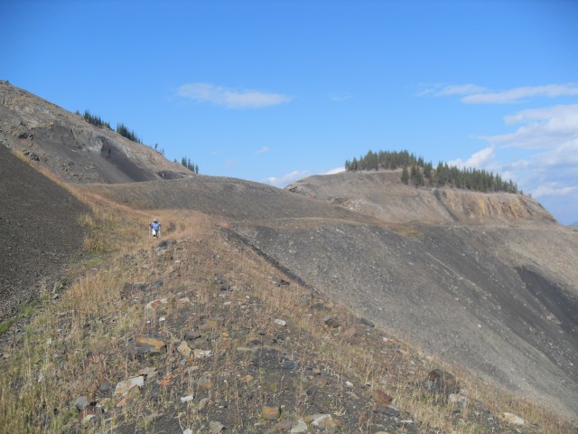
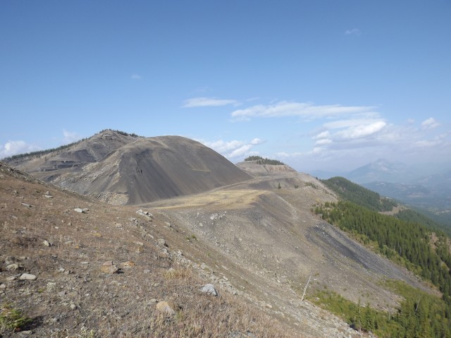
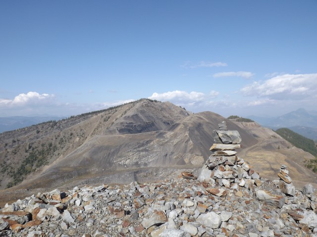
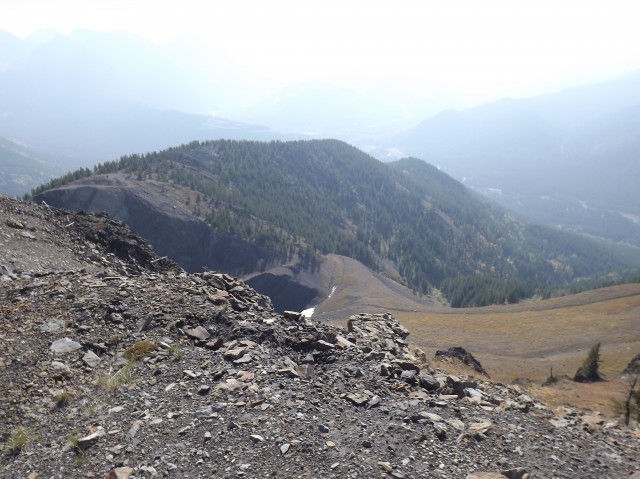
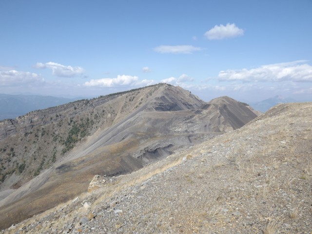
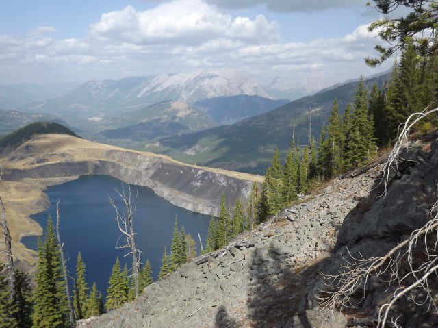
What’s amazing is how much material was moved. On arrival at the first pit, with it’s terraces and lake, it’s clear this was no small operation. However once you head up and over to the other side do you get to appreciate the sheer magnitude of the workings. There are a large number of very steep and deep gouges – no canyons – running parallel to each other. The mountain was torn a new one. Several new ones!
I have yet to see pictures of Tent Mountain before the mining, but it sure would be interesting to compare it to today.
Operating one mine across two provinces certainly made this a unique proposition. It’s likely regulations were different on each side and I am sure this presented some interesting challenges.
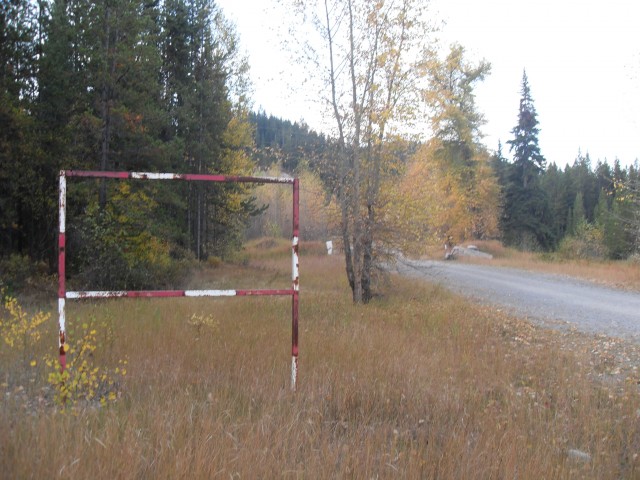
The trail head for this adventure is situated up the Chinook Coal road, which heads south off the highway just east of the BC border. There is a large limestone quarry at the turnoff, making the road easy to spot. Drive it for a few kilometres – supposedly it’s the the roadbed of a planned railway into the valley – and park at the gate.
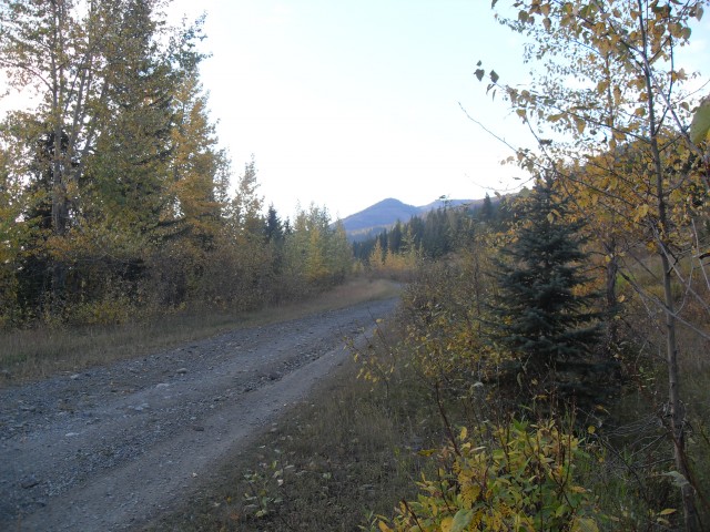
From there follow the mine road as it works its way up. It’s easy and not terribly steep (again, unless you are driving a coal truck) and perhaps it even a bit monotonous. Be mindful of bears on this section, we’ve seen lots of evidence of them. Also watch for ATVs. Along the way as you gain elevation, you catch occasional glimpses of the workings you’re heading up to.
After a couple switchbacks you come to a big gate – it lets you in but keeps the ATVs out. And from there, follow the obvious road as it skirts the coal dump. Shorty after you come to the first pit with its terraces and deep pit lake (how deep?). Most people think this is the entire mine, but in actually it’s only part of it. A zig-zag road takes you up and over to the other side of the mountain. Here the workings are even more extensive. Based upon what we’ve seen few people seem to venture this far.
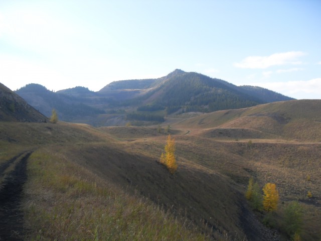
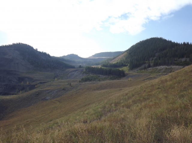
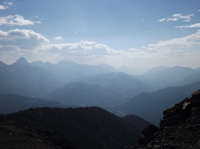
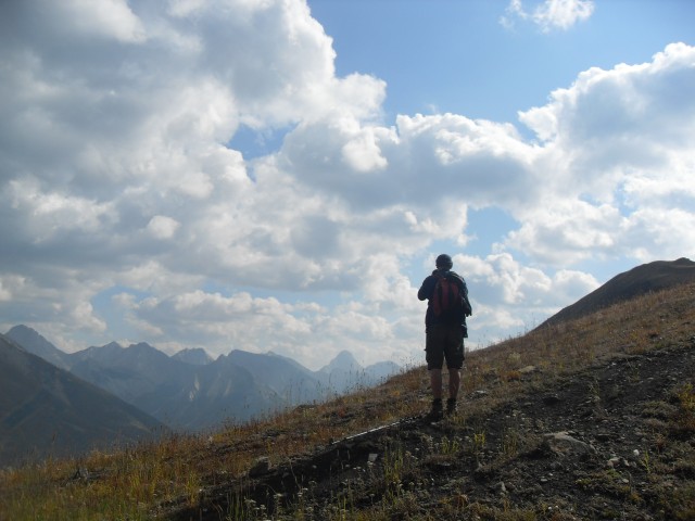
After checking out these north workings we make our way to that road mentioned earlier, that heads up and over a saddle. As we gain elevation we get a good look of the pits and dump we just visited. Normally we’d also have a good view of the mountains that surround us – Sentry Mountain, Crowsnest Mountain and others. Today, with all the haze, all we could see from this angle was Mt Tecumseh / Phillipps Peak a mountain with two summits with two names.
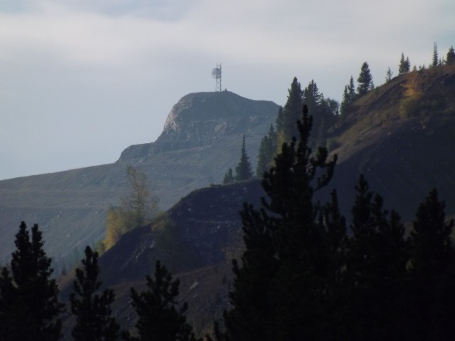
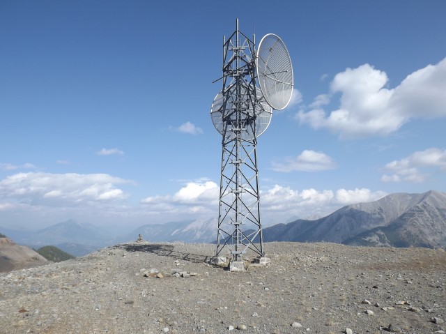
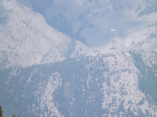
Our destination this trip is the radio tower that sits on high spot of land between two pits. It’s not the loftiest point on Tent Mountain, but it’s close and makes a suitable goal. Between all the parallel gouges there are several ridges that did not get mined and each of these could be summited if you so wish.
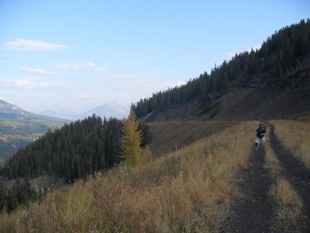
Anyone who frequents the Crowsnest Pass knows how windy it can get and the day of our visit was no exception. With each gust, the radio tower at the summit sang (I am not kidding) and if I can figure out how to eliminate the wind noise in the recording I took, I’ll post it here.
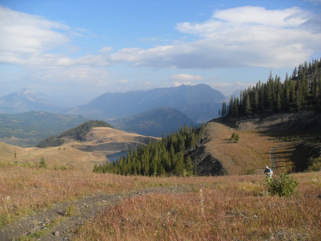
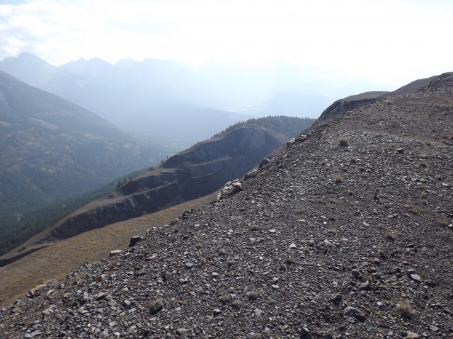
From the top one should be able to see the working Coal Mountain Mine situated across the valley near the ghost town of Corbin BC. However it was so hazy, it was hard to see that far.
On our visit, we just scratched the surface of the operation, and you could easily spend many days exploring the pits and workings. There does not appear to be any building remains at the site, but I am sure there must have been some, now gone.
After an enjoyable lunch, we trace our steps back down to the car. I’m not done with the Tent Mountain Mine and would love to return. Biking the old coal road up would be a good way to save some time and have some fun (zoooom on the way down). It would also be less monotonous – the road section is rather dull.
To see the Coleman Collieries plant where the coal from this mine was processed and loaded on trains, follow this link… Coleman Collieries plant and mine.
If you wish more information on this place, by all means contact us!
Date of adventure: September 2012. Location: Crowsnest Pass Alberta. Distance: 20km return. Height gain from start: 710m (this conflicts with other reports I have seen – is GPS even accurate?). Height gain cumulative: 710m. Technical bits: Notes: ATVs use the first few kilometres of the trail. A gate keeps them out of the mine property itself. This area has a large bear population. Reference: Hiking the Historic Crowsnest Pass, by Jane Ross and William Tracy.
Very interesting history. In the mid to late 1970s I used to regularly commute from Calgary down to Sparwood BC just across the border to help maintain mainframe computers used by Kaiser Resources in their operation down there. Occasionally, they would give me a guided tour of the coal mining operation. Very similar to your views here. I haven’t been down that way for a long time now, so do not know if the site is still working or not. They produced coking coal for the Asian market.
Yes, very similar. Only Tent Mountain, believe it or not, was small in scale compared to those across the border. The old Kaiser Mine still operates but is now owned by Teck. That firm in fact owns almost all the coal up that way, across many mines. Doubt you’d recognize the places you went. They’ve since moved mountains at that mine.
There was some talk recently in the news that an Australian firm wants to build a coal loadout facility in Blairmore and have been buying up some of the old coal mines in the area so could be a more ‘rosie’ future for us Heavy Equipment Operators in that area. Btw are ATV’s permitted to ride up there? Being from the flatlands of Manitoba I’d sure like to be able to take my SxS on some trails out there.
They’ve done some preliminary work up at the old Grassy Mountain Mine nearby, but with coal markets in the dumpster, I wouldn’t be surprised if work has or will be suspended for a time at least. Vehicles are not allowed into the Tent Mountain mine site but there are lots of ATV trails elsewhere in the Pass to keep you busy. Tread lightly.
Hi buddy! I just found your website and all can say is that it is great! There is a lots of of useful information in it. I’ve heard from a friend who works in Corbin that the mine there figures there is a couple years worth of coal still untouched in Tent Mountain. There is enough to make it interesting for them and since much of the infrastructure is already in place there (roads and pits), it might be a worthwhile temporary production site, while they ponder what to do next. Coal Mountain is almost finished and while other ridges in the area hold promise, they are not ready to be mined yet. Tent Mountain could hold them over for the time they need. It’ll be interesting to see what happens.
I used to work at the Coal Mountain mine in Corbin and often wondered about this place. You could clearly see the pits and terraces from where I worked and I though it was just part of the operation I worked for, and only found out it was Tent Mountain by reading this report. Looks like you had fun exploring it.
The day we were on Tent Mountain the haze was so bad that we could not see Coal Mountain. I could hear it though, between wind gusts that is. Tent Mountain was torn a new one but Coal Mountain has been obliterated. Wow, what a mine scar!
Yes, we had a blast exploring Tent Mountain. It took three tries to get up to the top. One time snow pack kept us out, another time it was a Grizzly.
My uncle worked at the mine around 1978 fixing and maintaining trucks. Most of his work was changing out brakes, they went through a lot of them account of the steep road down. He also told me they also broke a lot of shocks. For coal haulage to the processing plant they tried some lighter duty off the shelf highway trucks modified with dump bodies but these did not last long. They were not suited to the extreme service. Later they used some HD Kenworths and I believe some Pacifics and these fared better. I believe he said that they had one runaway on the road down, a greenhorn driver on one of his first trips. I see in your pictures that one runaway ramp is still easily recognizable.
Thanks, that’s very interesting! I bet the trip down was a real white knuckle affair – a speed limit sign says 16kmh. Pacific, was there ever a tougher truck?
We used to do something called the "pointless challenge" 🤪 and miss those days. It was so much silly fun and often frustrating as heck. In these we'd invite people to send in random photos of obscure locations, but not give any information, and then we'd track where it was and shoot something similar.
Most of these came from old family collections, as was the case here. Anyone up to resurrecting the series?
In hindsight, why didn't we pose someone in our shot?
Pointless: “Devoid of meaning (or) senseless” Merriam-Webster.
If you like what we do and want to support this ongoing project (12 years now), go here: https://www.BIGDoer.com/help-the-society/ Thanks to Connie for making this post possible.
Exploring history with Off the Beaten Path with Chris & Connie. Photo: ca1970 and 2014. Posted by Connie.
Captured on a cold, cold day many years ago. We've been passing this old house for decades and it's little changed in that time. At some point we expect to drive by and it'll be gone.
Exploring history with Off the Beaten Path with Chris & Connie. Photo: 2017. Posted by Connie.
When retired old railway cars usually get cut up for scrap. Sometimes, however, they find their way into the hands of the general public or whomever. Flat cars make good bridges, and boxcars can be transformed into storage buildings and the like. Case in point here. We see them used like this often enough and in this case, it's part of a corral.
Incidentally, this boxcar dates from 1950 and this was found by tracing the old road number, which is still visible.
Exploring history with Off the Beaten Path with Chris & Connie. Photo: 2017. Posted by Connie.
This central Alberta racetrack was never a commercial operation but instead just a fun place for car enthusiasts in the area to get together. Early '70s or thereabouts and it only lasted a few years. Even thought it's been abandoned for that long, there is no doubt what was here.
You know we like the the obscure stuff and this one fits the bill perfectly. Found by accident while backroad cruising and the history comes thanks to local car guy Mike.
Exploring history with Off the Beaten Path with Chris & Connie. Photo: 2022. Posted by Connie.
On top of little Myrtle Mountain in the Kimberley (BC) Nature Park.
There's some good wilderness fun to be had here and nice views as you can see, but the real reason we came is mining history. The whole area near the ski hill was extensively worked over a century ago and we were looking for evidence of this. We didn't find much in the area searched, but it's a big chunk of property and we hope to return to cover more ground again soon. Of all the subjects we cover, mining related is a favourite.
Still, it was a good hike and that can't be bad. Look to the comments for more info 👇.
Exploring nature and history with Off the Beaten Path with Chris & Connie. Photo: 2022. Posted by Connie.
It's a strange curiosity in south Kananaskis, there on a hillside and we have no idea who created it. We asked around and no one's completely sure about its history. In the past it showed the Canada 100 logo from 1967 but in 2017 someone changed it to reflect the country's 150th.
That's our friend Emily from DanOCan.com having a look.
Exploring history with Off the Beaten Path with Chris & Connie. Photo: 2017. Posted by Connie.
Javascript is required for this site to function. Please enable it in your browser settings and refresh this page.
Please log-in to continue... This allows unrestricted access to every post @BIGDoer.com, popups are eliminated, commenting is on and the "contact us" page is enabled.
Your social site may send you a routine notice of login.
Or signup, here: Subscriber Register ___ BIGDoer.com: Serving up POP HISTORY & other McFun!…(Mmmm, yummy bite-sized pieces.) One million plus words & tens of thousands of photos!


")


Very interesting history. In the mid to late 1970s I used to regularly commute from Calgary down to Sparwood BC just across the border to help maintain mainframe computers used by Kaiser Resources in their operation down there. Occasionally, they would give me a guided tour of the coal mining operation. Very similar to your views here. I haven’t been down that way for a long time now, so do not know if the site is still working or not. They produced coking coal for the Asian market.
Yes, very similar. Only Tent Mountain, believe it or not, was small in scale compared to those across the border. The old Kaiser Mine still operates but is now owned by Teck. That firm in fact owns almost all the coal up that way, across many mines. Doubt you’d recognize the places you went. They’ve since moved mountains at that mine.
There was some talk recently in the news that an Australian firm wants to build a coal loadout facility in Blairmore and have been buying up some of the old coal mines in the area so could be a more ‘rosie’ future for us Heavy Equipment Operators in that area. Btw are ATV’s permitted to ride up there? Being from the flatlands of Manitoba I’d sure like to be able to take my SxS on some trails out there.
They’ve done some preliminary work up at the old Grassy Mountain Mine nearby, but with coal markets in the dumpster, I wouldn’t be surprised if work has or will be suspended for a time at least. Vehicles are not allowed into the Tent Mountain mine site but there are lots of ATV trails elsewhere in the Pass to keep you busy. Tread lightly.
Hi buddy! I just found your website and all can say is that it is great! There is a lots of of useful information in it. I’ve heard from a friend who works in Corbin that the mine there figures there is a couple years worth of coal still untouched in Tent Mountain. There is enough to make it interesting for them and since much of the infrastructure is already in place there (roads and pits), it might be a worthwhile temporary production site, while they ponder what to do next. Coal Mountain is almost finished and while other ridges in the area hold promise, they are not ready to be mined yet. Tent Mountain could hold them over for the time they need. It’ll be interesting to see what happens.
Yes, it’ll be very interesting to see what happens. I know the Corbin people have or had their eye on a ridge to the west but not Tent Mountain. Hmmm…
Jesus, nice.
Beautiful. Nice write up!
I used to work at the Coal Mountain mine in Corbin and often wondered about this place. You could clearly see the pits and terraces from where I worked and I though it was just part of the operation I worked for, and only found out it was Tent Mountain by reading this report. Looks like you had fun exploring it.
The day we were on Tent Mountain the haze was so bad that we could not see Coal Mountain. I could hear it though, between wind gusts that is. Tent Mountain was torn a new one but Coal Mountain has been obliterated. Wow, what a mine scar!
Yes, we had a blast exploring Tent Mountain. It took three tries to get up to the top. One time snow pack kept us out, another time it was a Grizzly.
Far out!
My uncle worked at the mine around 1978 fixing and maintaining trucks. Most of his work was changing out brakes, they went through a lot of them account of the steep road down. He also told me they also broke a lot of shocks. For coal haulage to the processing plant they tried some lighter duty off the shelf highway trucks modified with dump bodies but these did not last long. They were not suited to the extreme service. Later they used some HD Kenworths and I believe some Pacifics and these fared better. I believe he said that they had one runaway on the road down, a greenhorn driver on one of his first trips. I see in your pictures that one runaway ramp is still easily recognizable.
Thanks, that’s very interesting! I bet the trip down was a real white knuckle affair – a speed limit sign says 16kmh. Pacific, was there ever a tougher truck?
Hayes is the only truck to give Pacific a run for it’s money.
How do you find the energy to do all these adventures?
Sometimes I wonder!!!