
Devils, Phantoms and Ghosts
Given the names in the area – Devil’s Gap, Phantom Crag and the Ghost Lakes – one might think it best to avoid this place, especially so near Halloween. In spite of the spooky names and sometimes dark history, one is treated to a nice hike along with some incredible vistas. Nothing scary at all!
You start by following the Ghost River road, just north of the village of Waiparous. It’s rough drive with washboards and deep and muddy potholes and is impassible to any vehicle without proper clearance. It’s slow going and it took us forty five minutes to travel the 15 kilometres to the trail head.
There is a very steep and loose hill at the very west end, and it’s on the return trip up that 4wd is needed. Otherwise 2wd is okay and in these cases you can park at the top of this hill and walk down (adding under 1km and some elevation to the hike). Heck, in 2008 we drove in by regular car most of the way, but the entire road has deteriorated badly in the meantime making passage by any vehicle difficult. I don’t know how these guys bring in their travel trailers. It must wreck them.
We park at the campsite area at the bottom of the big hill. You can however drive in further if you so wish. We came to hike.
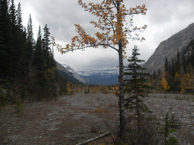
The trail is simple and to start just follow the expansive gravel flats east along the Ghost River. The river here is often dry, but looking at the scars along the bank, at times it must be a torrent. Paralleling the river and following your route in is a diversion canal that eventually feeds into the Ghost Lakes chain and finally into Lake Minnewanka in Banff Park.
While here enjoy the views of the surrounding peaks, including Blackrock Mountain with its old fire lookout perched on top. Sitting empty the building has stood abandoned for some sixty years. It’s held in place by cables anchored into the ground – the only thing that’s prevented it from flying away. Yes, the winds can be that bad here.
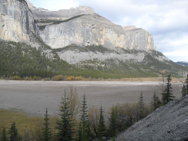
At the first side valley, turn right into the Devil’s Gap – Phantom Crag is right above you and Orient Point is on the far side of the valley. Following the gravel flats here is best. This is the easiest way to go since there are extensive ATVs trails in the narrowing valley that you might get lost in. This date we saw only a few 4×4 trucks roaming around. In the summer, I can imagine it’s a popular place with quaders and dirt bikers.
A short ways in you come to the boundary of Banff National Park and here is where motorized vehicles are suppose to turn around. From the looks of it most do but a few don’t and occasional evidence of them can be found deeper down the valley.
One thing you will notice here is the wind, and the day of our visit it was no exception. As a matter of fact, it was because of this we turned around before reaching our intended goal. Even bundled up and our ears covered, we still near froze at times and our ears ached.
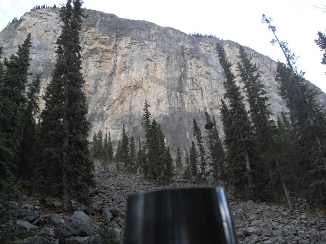
Also common to the area is the sheer cliffs that surround you. The whole valley is like this.
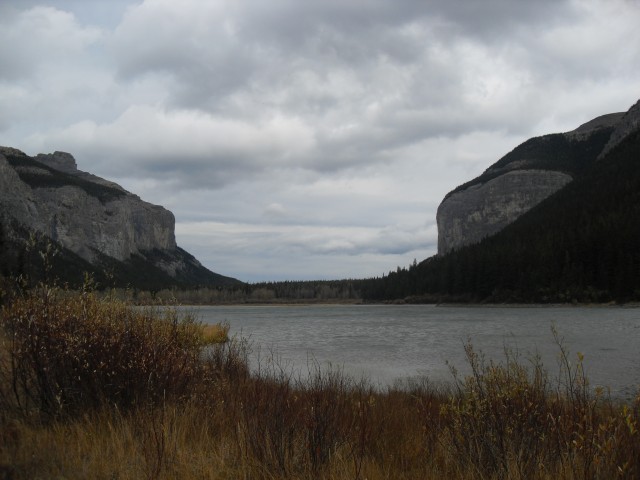
Shorty after entering the park you come to the first Ghost Lake. At most times it’s just a mud flat. At the north end are a series of small dunes, and with the wind this day we were blasted by the flying sand. The lake and the whole valley in fact was littler with the bleached bones of many dead trees. Many animal bones were found too. The dry mud made for some interesting patterns.
On the east side of the lake and about midway down, is a the side trail you should take. It’s a little hard to find and it leads to the main horse trail that goes down the valley. This makes for trouble free route finding from here on – since the forest gets dense at this point.
Making good time, you come to a dry creek bed that shows heavy scaring due to spring flooding. And just beyond, we come to the second Ghost Lake. It has a marshy bank and I am told can be dry at times too. But at the time of our visit it was full and large waves were being whipped up by the wind. And cold. cold mist filled the air.
It’s here we turned around. That was in spite of being fairly close to our objective, the third and by far the most beautiful of the Ghost Lakes. And Lake Minnewanka is just beyond – another stunning destination. We’ll return sometime to finish what we started, assuming the road in remains passable.
Found along here was some bear prints – we always find bear prints. Blanketing the forest floor in places were Bearberries which are edible but not very tasty.
The names given the area conger up all manner of scary imagery and I understand that this valley was often the site of fierce battles between warring Indian tribes. There are said to be a lot of graves in the area. Of course, some of the later names given the area are romanticized in keeping with the ghostly origins of the place. Visiting on this sombre blustery day only added to the spooky feeling that was in the air.
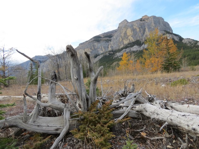
Heading back, we prepare ourselves for the jostling and bouncing awaiting us on the drive home. I like the area, but hate the drive in. On way out, at the top of the big hill, there is a clear view of Devil’s Head. This distinctive mountain can be seen all the way from Calgary.
We’ve been up to the Blackrock Mountain Fire lookout (almost) and to see that trip, follow this link…
Blackrock Mountain.
If you liked this hike, check these ones out…
Headwall Lakes.
Having as gas on Mt Gass.
If you wish more information on this trail, by all means contact us!
Date of adventure: October 2012.
Location: Kananaskis, Ghost Area.
Distance: 10km return.
Height gain from start: Negligible.
Height gain cumulative: Negligible.
Technical bits:
Notes: ATVs sometimes use parts of this trail, so keep an eye open for them.
Reference: Kananaskis Trail Guides by the Dafferns.
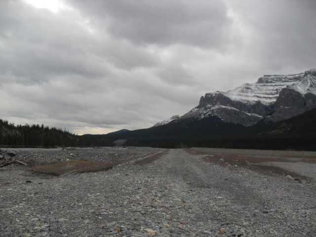
On the Ghost River gravel flats, looking east.
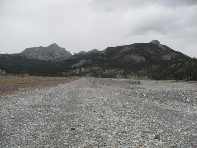
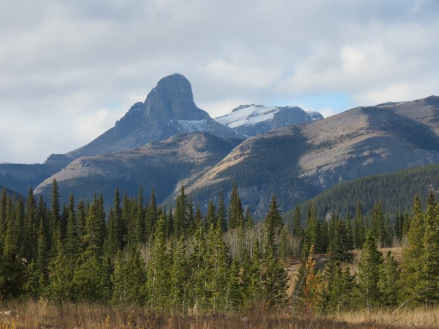
Looking west with Blackrock Mountain to the left. We’ve been up there.
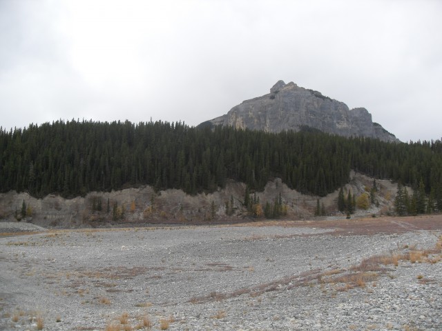
Phantom Crag.
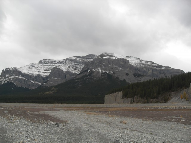
Devil’s Gap is just around the corner. Orient Point in back.
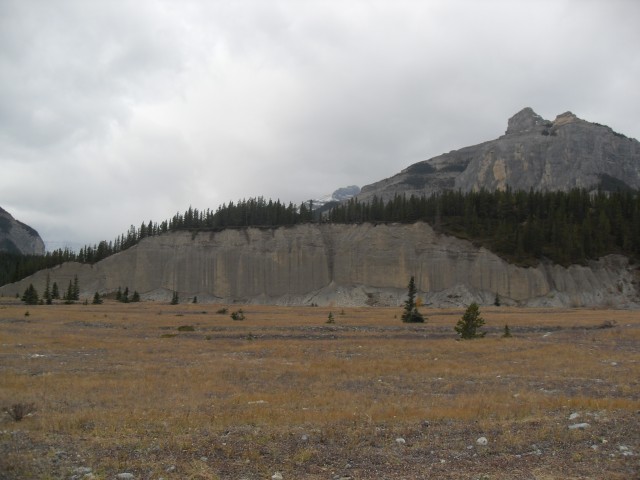
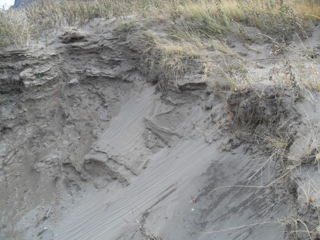
The hill in front is entirely composed of glacial till. Phantom Crag in back.
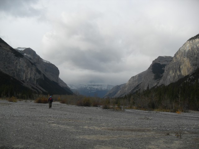
The gravel flats into Devil’s Gap.
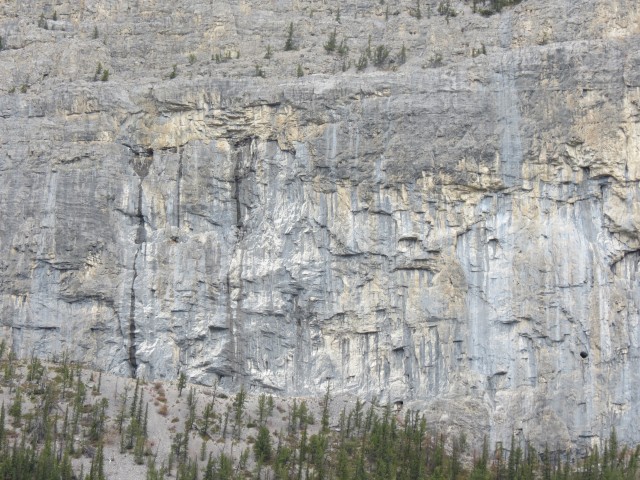
The sheer rock face of a surrounding peak.
The first Ghost Lake is often a mud flat.
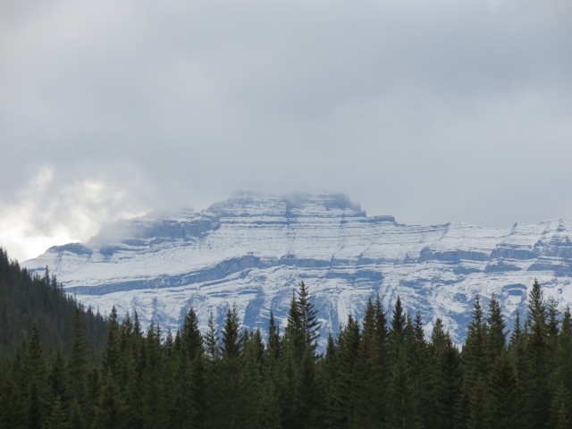
To the south a winter storm rolls in.
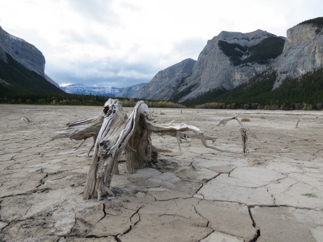
The bones of many dead trees litter the first Ghost Lake.
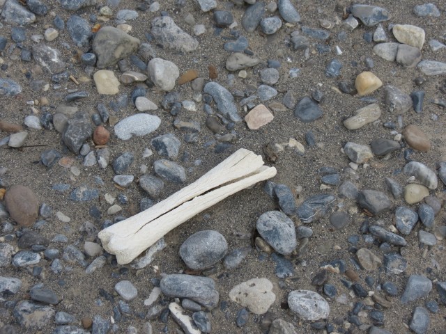
An old bone fits with the spooky theme.
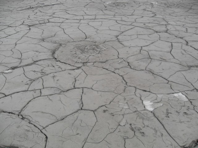
The drying mud makes an interesting pattern.
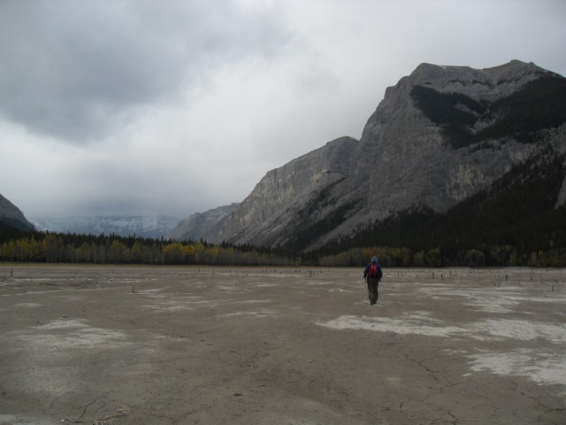
The valley between the first and second Ghost Lakes.
The second Ghost Lake and where we turned around.
Cliffs and wine.
Heading back, we traverse above the First Ghost Lake.
There were some small sand dunes near the north end of the first lake.
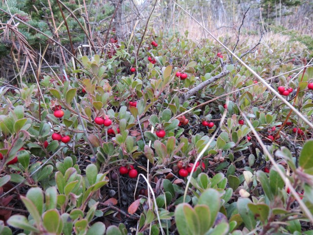
Bearberries, edible but not very tasty.
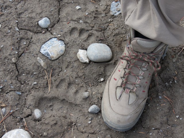
We see bear prints nearly every hike and this one is no exception.
The whole valley had a sombre feel this day.
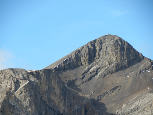
The Blackrock Mountain fire lookout, abandoned but still in place.
Devil’s Head, which can be seen from Calgary.
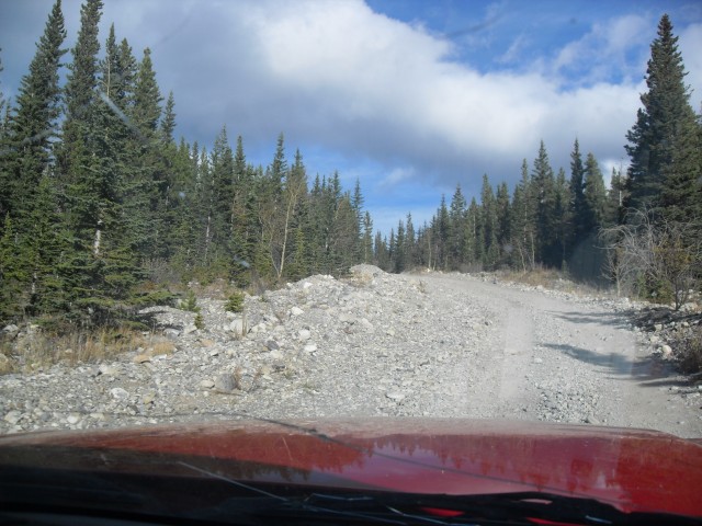
The Ghost River road, 15km in 45 minutes!
")


(via Facebook)
The fire lookouts make for great hikes!
Agreed, they’re some of our favourites.
Wow, the look out is a long ways up!
I know, what a view the lookout person had.
Here’s another I’ve never heard of. An interesting place, but sounds hard to get to.
The drive in is almost unbearable. The road it that bad. In 2008, we did it with a car, except for the last hill down. On out last trip we had a truck and even was a wild ride. The road has deteriorated that much. It is a nice area however and I would love to return.
What a great trip report! I can’t wait to visit here, although with snow in the region, it will be 2013 before that happens.
Your photographs are simply stunning! The road in sure looks rough too.
Rough is an understatement! Even with the truck, we were rarely above 30kmh.