
Headwaters of the Elbow River
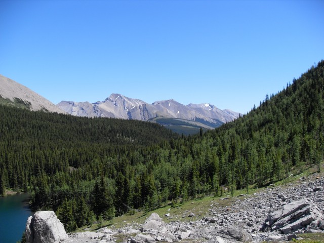
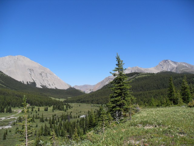
The area in and around the headwaters of the Elbow River is an amazing place, home to beautiful lakes nestled in a sub-alpine valleys surrounded by towering and barren limestone peaks. You’ll be in awe and never want to leave. You won’t be alone as many people will make the effort to get here. But you’ll be among friends who enjoy the things you do.
From the parking spot on the highway near Highwood Pass it’s a short but steep trek up to Elbow Lake, the source of the Elbow River. Here there is a nice back country campground and it’s a popular spot for fishing. It’s also a good base for those wishing to explore the area further. But rather than camp here, follow us on our trek past a second campsite – situated deeper in the valley where there is more to explore.
The campsite area and trail leading to it was busy, a bustling happy place, but beyond it was quiet and we only saw a few souls afterwards.
From the parking lot head up the busy trail – it’s a short but steep pull to the campground.
From the camping area follow the trail on the north side of the lake, eventually crossing over the infant Elbow River on a log footbridge. You’ll pass many fishermen along the way. In spite of its small size the river grows and eventually meets up with the Bow River in downtown Calgary. The Elbow River, the little stream you just crossed, is the source of the city’s water supply and here it’s crystal clear and cold as ice.
An old forest service road parallels the river east up the valley and this is your trail. It’s wide and well drained and the going is easy. After a number of kilometres in the widening valley, the Sheep River trail (it too an old road) comes in from the south. Shortly after a zig-zag down the valley you arrive at an outfitters camp. It’s a base for overnight trail rides and the riders come in via the Sheep River trail, the one you just passed.
Also here, just past the outfitters camp, is the Tombstone back county campsite. This is a gorgeous place to plop a tent and an even better base for exploring than the campsite at Elbow Lake. This is one I recommended earlier and being located near a four way junction, it offers you more in the way of options to explore. You can head up the Sheep River trail, the Big Elbow trail, the Little Elbow trail, or you can explore any number of grassy ridges in the area and streams and lakes abound nearby. On our trip we’ll be using the Little Elbow trail to access the Tombstone Lakes, our destination this trip.
Turning north we head up we leave the Elbow River valley behind. Shortly after there is a junction and we’ll take the footpath (no bikes allowed) heading off at a shallow angle to the left. Steadily gaining elevation as we go, you can hear a the creek gurgling in a gorge below you. Shortly after things level out, and here in places it gets a bit boggy, and not long after you arrive at the Tombstone Lakes. There used to be a back country campsite here, which you can still see evidence of. Why it was moved I can not say, since it’s a wonderful spot.
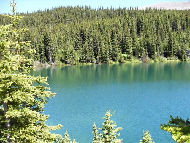
The lower Tombstone Lake is an amazing blue and is just teaming with fish. It’s crazy how many can be seen. The upper lake, which is shallow and muddy has no fish, and I am told is often dry by late summer. We skirted left around the lake and head over a small footbridge, which crosses a stream exiting from the lake and from here head to a rocky area directly below Tombstone Mountain. This looks like the best spot for lunch.
Enjoying our meal we watch people catching the small but very enthusiastic trout in the lake. Rarely did it take more than one cast before they had a fish on. In fact one kid was having a great time catching fish by just dropping his line in (not casting). The fishing here is good, but since it’s quite a trek in it’s probably not that heavily worked.
Above us is Tombstone Mountain, so named for all the gravestone looking boulders scattered about its base above the lake. It’s a mountain graveyard! This mountain can be scrambled, but it looks too technical for us.
To the southeast, we have a good view of Cougar Mountain and it’s many ribs and ridges.
Reluctantly we head back – sorry I think I say this with each hiking report. On the way we catch a glimpse of the very tiny Mount Rae glacier which sits to the south of Elbow Lake but can’t be seen from it. How long before it simply melts away?
On this trip, we happen to bump into Connie’s cousin Jim. He does a lot of mountain biking with buddies and on many occasions, we find him or he finds us sharing the same trail. Given all the trails in Kananaskis, that we run into him at all is an amazing coincidence.
I’d love to try biking the area one day and I’d also love to explore some of the ridges in the area. There are many and I am certain the views would be stunning.
If you liked this hiking report, check out these ones…
High Noon Hills.
Back to Brown Lowery.
Lake Minnewanka.
If you wish more information on this trail, by all means contact us!
Date of adventure: July 2010.
Location: Kananaskis, Highwood area.
Distance: 22km return from our turn around point.,
Height gain from start: 360m.
Height gain cumulative: 430m (some ups and downs).
Technical bits: None.
Notes: None.
Reference: Kananaskis Trail Guides by the Dafferns.
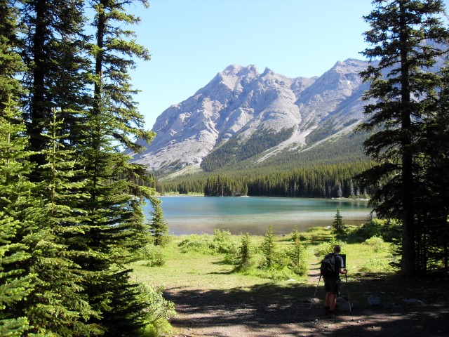
Elbow Lake, the source of the Elbow River.
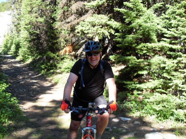
Connie’s cousin. It’s amazing how many time we unexpectedly bump into him on some remote trail.
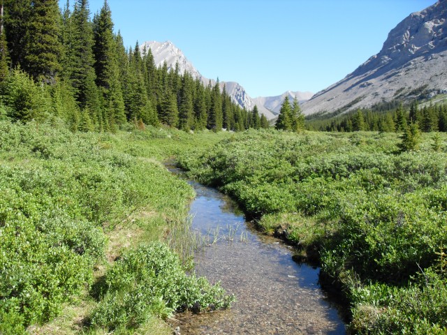
The headwaters of the Elbow River.
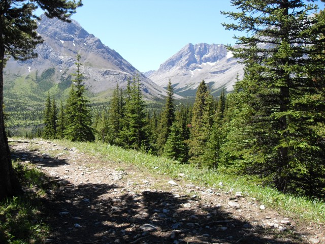
Stunning scenery along the trail.
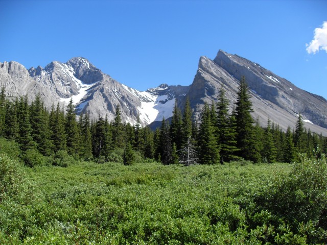
The very blue Tombstone Lake.
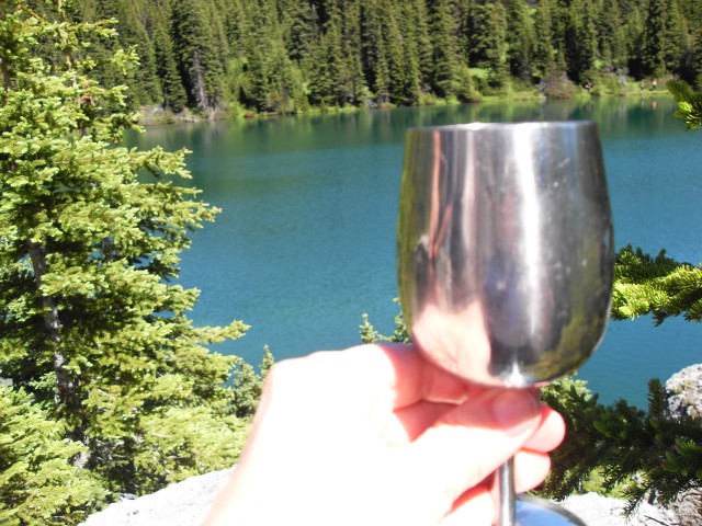
Wine. Of course.
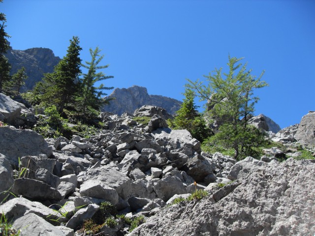
Rocky slopes above the lake.
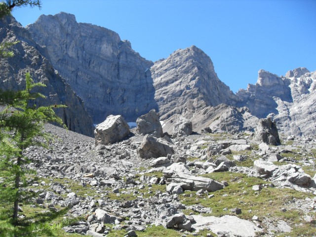
Tombstone Mountain, aptly named for all those grave stone looking boulders standing on end.
Looking southeast at Cougar Mountain.
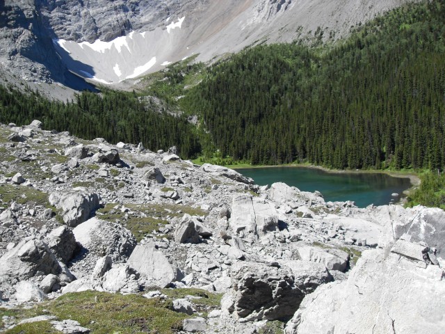
.Upper Tombstone Lake.
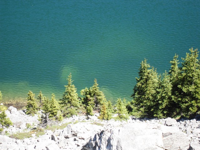
The deep blue waters of the lake are simply stunning.
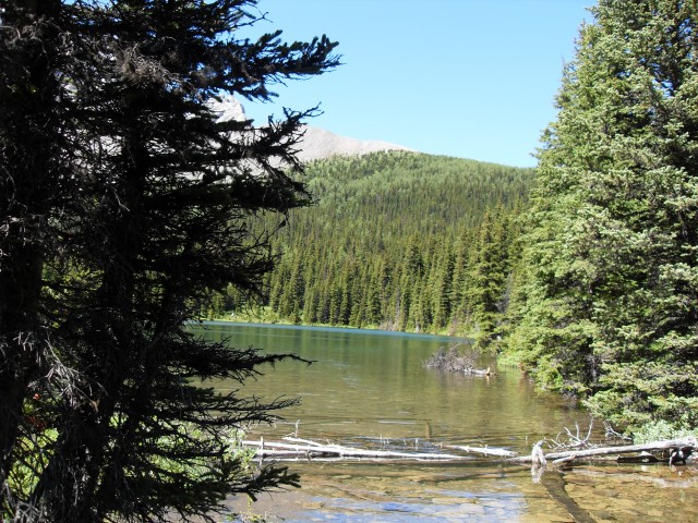
The outlet of the lake. What you can not see are the fish. It was teaming with them, an angler’s paradise (but quite a hike to get to).
Looking back, the trail can be seen below to the left.
The small glacier on Mount Rae.


Thank you!
Our pleasure!
So serene.
Could spend all day there.
Healing country 💕
For the body and the soul.
It’s a bit mind-blowing to think of this being the Elbow. Thank you for this beautiful picture and the info.
I know, that little trickle?! Glad you liked the piece.
Amazing.
We have the world’s most incredible playground.
Kananaskis is my playground! There use to be a sign at the Highway 40 turnoff that read “Life begins at Highway 40″!
Thank you! Me and my neighbor were just preparing to do a little research on this. I’m very glad to see such excellent info being shared freely out there.