
Brown-Lowery Provincial Park
In spite of being located not terribly far from Calgary, Brown Lowery Provincial Park is still not that well known. It’s a small oasis of wilderness in amongst farms and ranches and is home to lots of wildlife and a large network of hiking trails that you can enjoy. Often coming into season early it’s one of the first trails you might find us hiking in the spring.
South of Bragg Creek and near Millarville, the park is located along Plummer’s Road, which can be accessed from either Highway 22 in the east, or Highway 762 in the west. It’s not that hard to get to, yet it’s somewhat out of the way location means it’s not that busy. Especially so in summer when most hikers can be found deep in the mountains.
Outside of the trails there are no other facilities in the park except for biffys and a small parking spot.
There are numerous routes to explore and you can piece them together to make any number of loops of varying lengths. We typically just take the outer loop which is the longest in the park. There are signs at each intersection so you’ll never get lost and all streams are bridged. On this trip we’ll do the loop counter-clockwise.
The ecosystem here is montane, a good mix of coniferous and deciduous trees and mosses, along with boggy areas and gently rolling hills. It can be moist and muddy at any time of year.
Starting from the parking area it’s downhill for a bit until the first junction. Going right here, we climb up the only real hill of consequence on the route, until we top out at a lookout. Here there is an excellent view to the west – enjoy it! The mountain are far away and at the time of our visit were still cloaked in snow. This year spring was late and it would be a while before we could visit them.
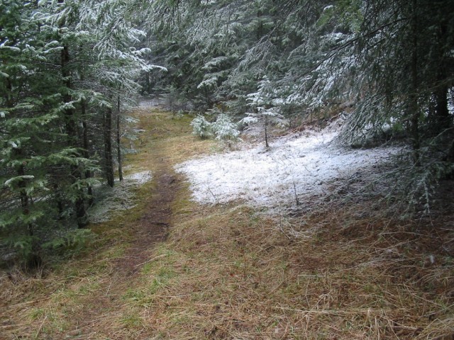
Leaving this spot we head south until we hit a cut line and a fence, which forces us to turn left. Heading down we continue past a number of junctions, but we’ll ignore them all. The trail here rises and dips as we make our way from small rolling hill to small rolling hill. Before long we turn left and the trail here is in a low draw, the wettest section and kind of marshy in places. At this point a snow squall moved in, blanketing the trees and ground in white.
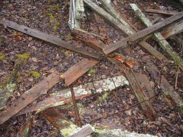
Before long we come to a clearing and according to the trail map this is the former location of a sawmill, although no evidence of it can be found. There are however some cabin remains nearby but it’s not clear if they were connected to the sawmill in any way.
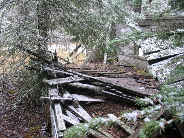
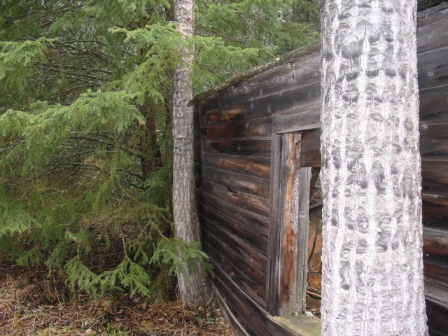
After crossing a stream it’s not long before we come to one of those aforementioned cabins. It lacks a roof and some of the walls are collapsed and only some trees prevent the other parts from following suit.
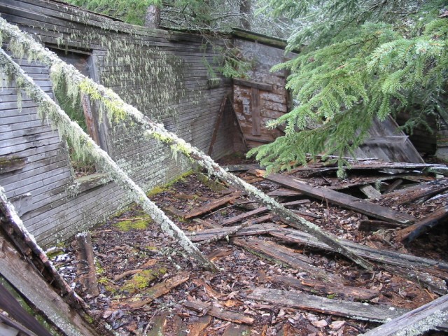
Inside there not much to be seen except for an old bed frame. Oddly, when ever we find an old cabin, and we come across lots of them, often there are bed remains to be found inside or nearby. Without much to work with, it’s not clear what era the cabin dates from. There appears to be no road or obvious trail leading to the site, outside of the route we came in on. Perhaps our trail follows the original in.
Leaving the cabin behind we follow the path as it gently rises and drops until we are back at the car. While it’s not an exciting place, or even that physically challenging, it nice that we have somewhere to go when the mountains are still snowed in. We’ve been to Brown Lowery park perhaps a half dozen times.
The land here was bestowed to the province sometime in the 1960s, although it would be the early 1990s before the park was officially opened. It’s a popular bird watching spot and many other animals can be seen too. We saw evidence off bear, deer, elk and coyote. It’s not clear where the name originated from, although I have heard Brown and Lowery may have been connected to the Home Oil Company who donated the land.
We returned in 2013…
Back to Brown Lowery.
To see some other “easy” hikes, follow these links…
High Noon Hills.
Big Hill Springs Park.
If you wish more information on this trail, by all means contact us!
Date of adventure: April 2006.
Location: Brown Lowery Provincial Park, between Bragg Creek and Millarville.
Distance: 8km loop – there are lots of other options for longer or shorter loops.
Height gain from start: 150m.
Height gain cumulative: 250m.
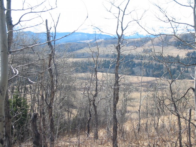
The high point of the park.
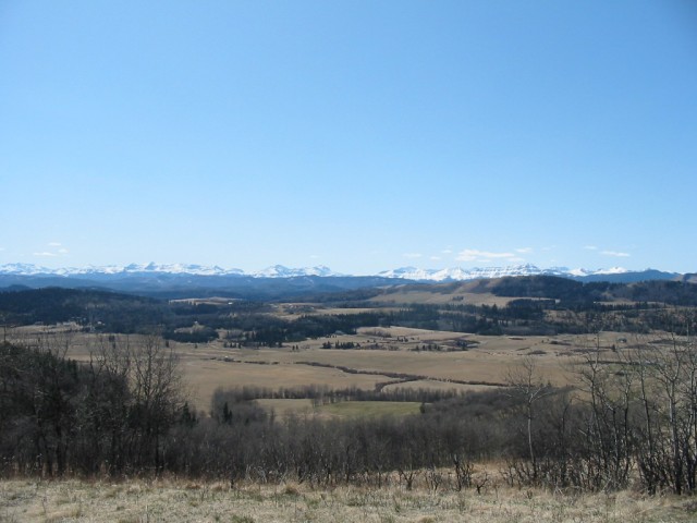
Looking west, the park is located between the prairies and foothills.
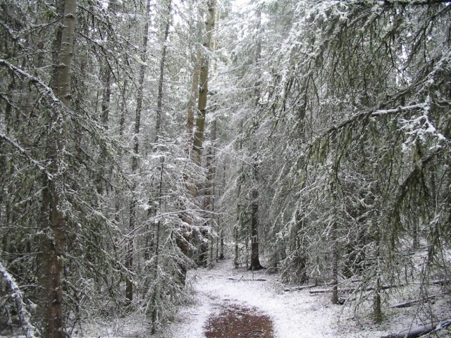
A snow squall just passed.
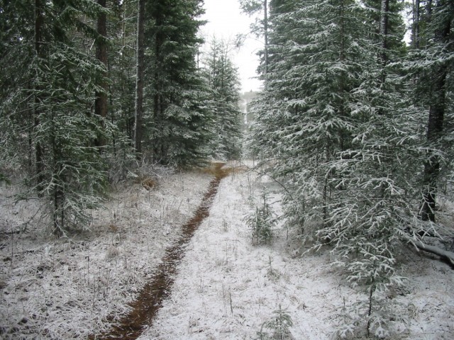
The trail is always easy and pleasant.
At this point we are near the sawmill site.
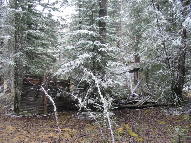
An old cabin.
I’m not sure if the cabin is connected to the sawmill, which used to sit nearby.
Nature is slowly taking over.
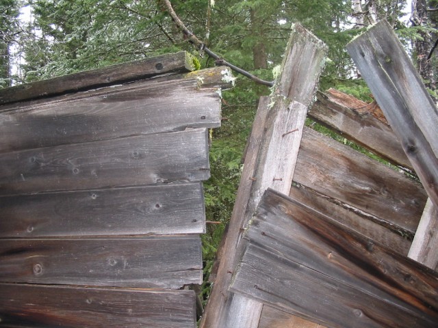
The roof is gone and the walls are near collapse.
This wall is being held up by the trees.
Oddly, if we find an old cabin, we almost always find a bed frame in it.


I’ve done this one, a nice easy hike with great scenery. Great photos as always!
I’ve heard the bird watching is good at the park. Have you seen anything exciting there?
I am afraid our bird spotting skills are very limited. There do seem to be lots of winged creatures there, there but outside of the usual suspects, gulls, crows, magpies, cheickadees, I was unable to identify any others I saw. I THINK we saw an eagle, and there were lots of small and fast birds that moved far too quickly to see.
We discovered this park last year and hiked it with our wee ones. As we never saw cabin remains it appears that we took a different route. My only caution is that when we hiked it during the early Summer it was quite wet and we had to battle swarms of mosquitoes the size of small dogs. Next time we’ll pack repellent and try the park either earlier or later in the year.
Yes, mosquitoes can be a real problem at the park. So I have heard that is, although we have only hiked here in the late fall and have never encountered them. The cabin is in the north east section of the park right at a junction. There is meadow nearby which is supposedly the former location of a sawmill, so marked on the maps. There is a remains of a second cabin just on the other side of the meadow.
Being new to hiking would you recommend this trail to us? We want to join the fraternity but need to ease into it lightly. Can it be biked? My wife asked about bears too. She is terrified of coming across one.
It’s a very easy trail and we recommend it if you are starting hiking. No bikes allowed though. We have seen bear signs on this trail but no sightings. If you are uncomfortable with an encounter, perhaps join a hiking club (there are many) so you can travel in larger groups. Bears hate groups.