
Upper Kananaskis Lake to The Forks
Always remember to charge your camera batteries!!!
For if you don’t you’ll find that it dies at the most inopportune time, like when you are deep in a gorgeous valley that just begs to be photographed. Oops, I’ll make sure that doesn’t happen again!
On this trip we do a reconnaissance mission to check out the back county campground located at the forks (or is it “The Forks”). Deep inside Peter Lougheed Provincial park in Kananaskis Country, the trail skirts the Upper Kananaskis Lakes, passes through a large rock slide and follows the Upper Kananaskis River before finally arriving at the destination mentioned here.
The trail starts at the North Interlakes parking lot and after crossing a small dam it immediately heads west. For the next few kilometres you’ll stay close to the Upper Kananaskis Lake and you can catch glimpses of through the trees. And we did and photographed its wonderful still waters, almost mirror like in appearance. Don’t let the calm fool you though and at times the lake can be whipped up into a frenzy by the wind and it can get very rough.
The trail here is an old forest service road and is wide, fairly level and well drained. Lots of berries can be found along here but none were ripe on our visit.
Before long you come to a signed junction, but stay right. The trail that descends steeply off to the left is for those accessing The Point back county campground or for the more ambitious folks making a loop around the lake. Your trail continues to head west and in addition to accessing The Forks, it goes even further in and there are many options for exploring beyond that.
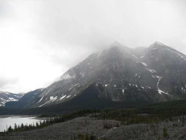
Before long you come to the the rock gardens, actually a giant slide that tumbled down from Mt Indefatigable which looms over you to the north. On its flanks there are some slabs, where the slide originated from, and they bend upwards at a crazy angle. On close examination there are lots of stress cracks and fractures and I have no doubt that another slide will happen again. Perhaps not today but sometime in the future. I have been unable to find any information when this slide came down but no matter how long ago it’s interesting that even now little vegetation grows in amongst the rocks.
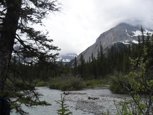
While at this spot, a storm rolls in and for the rest of the day it either raining (mostly lightly) or snowing and the sky remains an ominous grey. And a cold wind blows in. Across the way there is an amazing view of Mt Lyautey, partially shrouded in clouds, which towers above the lake.
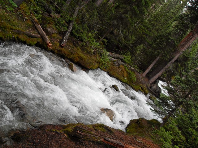
At this point we decide it’s worthwhile taking a side trip to the Kananaskis Falls, a short distance away. With all the heavy snow pack, melting now, plus the rain, they are sure to be spectacular and running high. We were were not disappointed.
These are what’s known as step falls and they tumble over a series of low ledges. Given how high the flow, you could them from some distance away. There is a bridge at the top and the trail always stay close to it, affording you a good look at nature’s spectacle. Just before the falls is a huge stump graveyard.
Back on the main trail again, we leave the slide zone and plunge into the forest and before long come to a small bridged steam. Normally it’s a little burbling brook, which you could hop over, but with all the melt water it’s a torrent. I am glad there was a bridge!
At this point the road ends and from here on in the route is a nice single track. Bikes are allowed to use the trail up to here and if the rider wishes to continue they have to carry on by foot. There is a bike rack here to lock up your steed.
After the bridge you plunge back into the deep forest and the trail here is very pleasant and nice and level. Heading west, we eventually meet up with the Kananaskis River again and cross it via a bridge above some falls. On the south side of the river for the rest of the trip, the trail takes an easy path along the base of the mountains that tower over this valley. The ecosystem here is almost rain forest like with large spruce and fir trees and lots of moss and ferns. The snow pack here in the winter must be incredible and some deep patches remained in areas where the sun hasn’t really reached yet.
And we arrive at The Forks. And the camera dies. Dead batteries, damn it! Mental note, always charge the camera as soon as you get home so that way it’ll be ready when you need it. It’s too bad as we had a lot left to photograph. The place was stunning.
This was an exploratory trip to check out the campground here and while we have not camped here yet, it’s on our to do list. Beyond here there is so much to explore and the area is just spectacular – a must do trip and we’ll return some day.
To see some other trails in the general area, follow these links…
Headwall Lakes.
Upper Kananaskis Lake in the glorious summer.
Burstall Pass.
If you wish more information on this trail, by all means contact us!
Date of adventure: June 2009.
Location: Upper Kananaskis Lake
Distance: 20km return – with a side trip to Kananaskis Falls.
Height gain from start: 220m.
Height gain cumulative: 320m.
Technical bits: None
Notes: This prime bear habitat and while we saw none on this trip, they are out there.
Reference: Kananaskis Trail Guides by the Dafferns.

Upper Kananaskis Lake from the start of the trail.
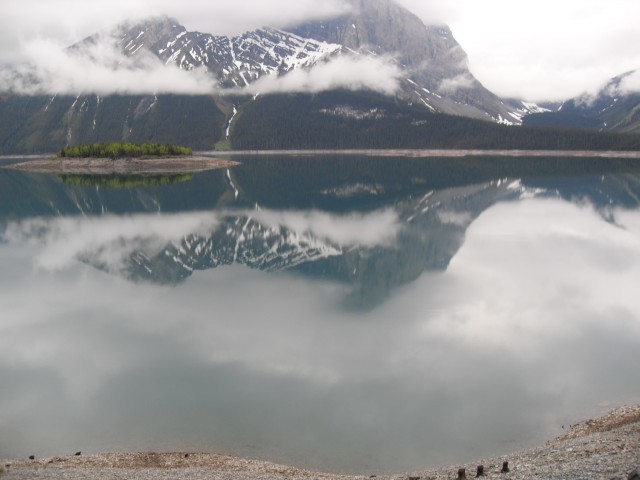
The water is so still and almost like a mirror-like.
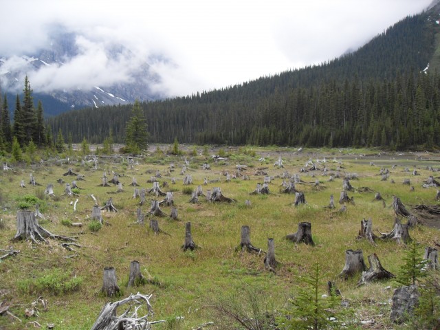
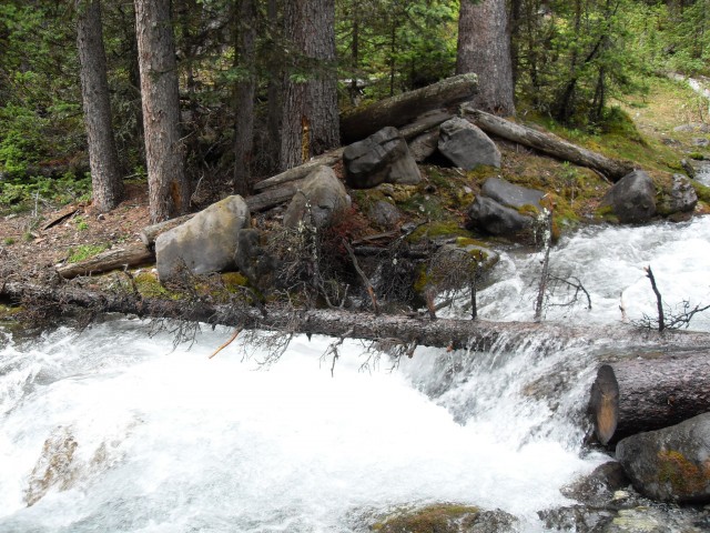
The stump graveyard at the west end of the lake.
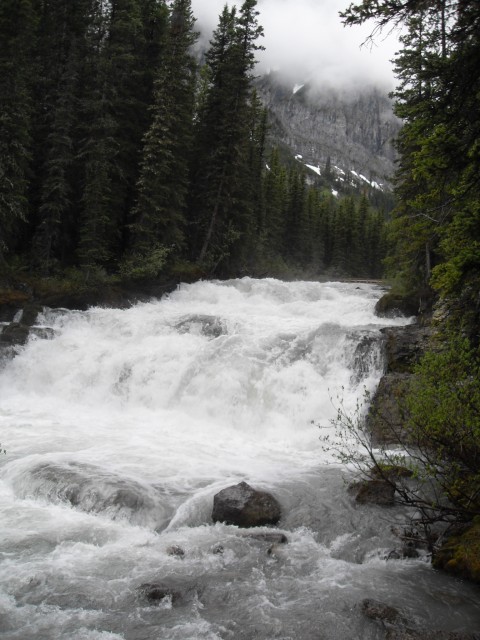
The Upper Kananaskis River falls.
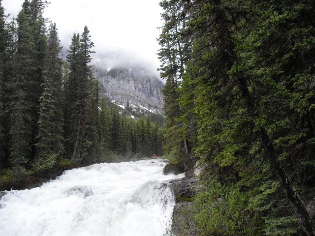
The river was running very high. Can you spot me?
Mt Lyautey seen across Upper Kananaskis Lake.
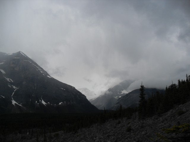
Some bad weather rolls in and it would rain (and snow) on and off all day.
The stunning rock slide below Mt Indefatigable.
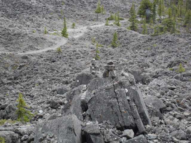
The rock here is perfect for making Inuksuks.
A side stream running high.
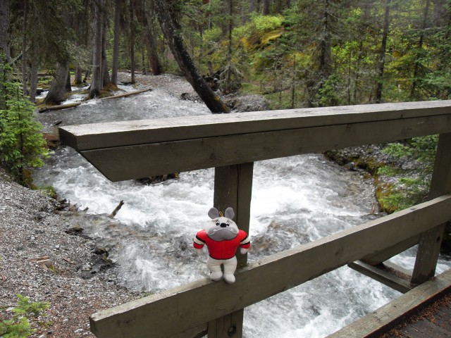
Somehow Bosco found his way into our pack.
Melting snow and lots of rain meant all water courses were running high.
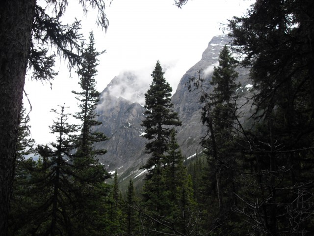
Deep in the Upper Kananaskis River valley.
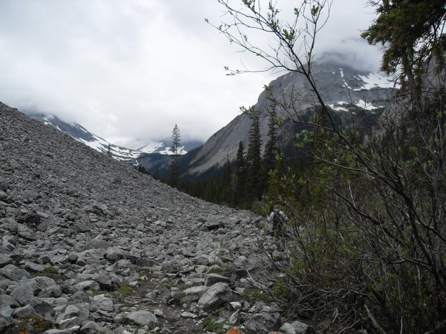
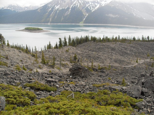
The trail here skirts a large rock slide.
At The Forks…and then the camera dies.


Might be good to mention that there’s another beautiful campsite about 9k further up the trail, also with creek access. It’s called Turbine Canyon and it’s on my top 5 campsites I’ve ever been to!
Yes, that one. Thanks. Always wanted to get up that way. Keep the comments coming!
What campsites would you recommend at Forks? Or are they all about the same? Also wondering if you can access the North Kananaskis River from the campground or not.. would be nice to do some fishing if it isn’t too hard to get down there. Thanks!!
They all looked pretty decent from what we could see. We’d like to spend some time there – of course, we want to do that nearly everywhere we go. The river is quite close by and easy to access, so no problems there.