
Mist Ridge
An old exploration road takes you within metres of the south high point of Mist Ridge. From there you can hike it for many kilometres, or you can stay put. Regardless of where you turn around the views are simply stunning.
The trail follows that road as it zigs and zags up a number of connecting hills. This means your trip is easy and rarely very steep. The trail drops down to a creek about mid point, meaning on return you’ll have some elevation to gain (booooo!).
Start by parking at the Mist Creek day use area, some 20km northwest of the Highwood House junction on Highway 40. Take the trail heading from the north part of the parking lot and almost immediately cross the highway. Coming to an old road, a leftover from the realignment of that same highway, head north at the sign.
Pass through a muddy and wet boggy area, the only soggy section you need worry about, and continue on the Mist Creek Trail until you come to a junction. Head right here following the exploration road, immediately gaining elevation as you go. The left path is a continuation of the Mist Creek Trail that may be of some importance to you should you go further along on the ridge and bail (more on this below).
Initially you are in the trees and always climbing, but not long there are breaks and you can catch glimpses of your objective. There is one more junction to worry about, unsigned, and it’s a branch of the exploration road you are on. This side road heads up and off to you right and takes you to the base of Picklejar Ridge. Instead, stay straight and top out on a flat section of the trail. Shortly after is that down section I spoke – where you loose a bit of elevation. And don’t forget you’ll need to come back up here, so make sure you have some energy reserves for this.
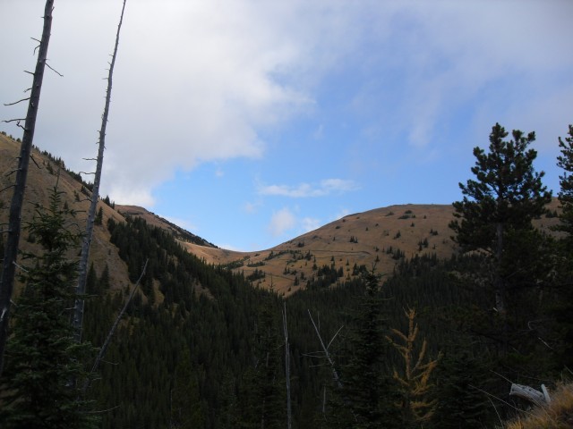
Crossing a small creek the trail continues on a side hill, it switchbacks once more (there is a shortcut here), then comes to a meadow. From here you can see the final section of trail as it makes it’s way up the hill in front of you. Following it, it’s not long before you are out of the trees.
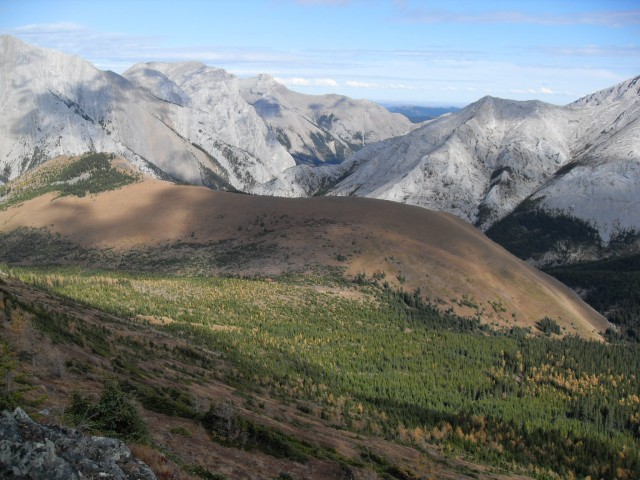
Leave the trail before it heads right on a small side ridge and make a bee-line for the summit to your right. The hillside is grassy and never steep and the footing good. Take a break at the south high point and take it all in. From here you can see the rest of the ridge extending off for many kilometres and you can turn around here (as we did – October days are too short) or continue on. There are lots of ups and down if you choose to continue, but nothing terribly bad.
At every spot along the ridge the views are fantastic. To the west Mist Mountain is the largest peak to see, to the north Gibraltar Mountain dominates the view and to the northeast there is a break in the mountains allowing you to see all the way to Calgary. Other rolling hills and ridges around you beg to be explored (a good excuse to return).
Along here on the grassy slopes, we find an odd cage. We see these all over Kananakis and I am not completely sure their purpose although a few have suggested they are in some way used in the study of animal grazing habits. Chime in if you know!
Short on time, we don’t go far along the ridge before turning back. Along here we find a nice spot to have lunch. We found some wild strawberries earlier which we add to the wine that we always bring on every hike. Yummy! We drank it out of plastic cups – how classy!
And then the hard part – it’s time to go home. It’s never easy to leave such a wonderful place, but we do so reluctantly, all the while remembering that last up section just past the creek. Going up it seems like a trudge.
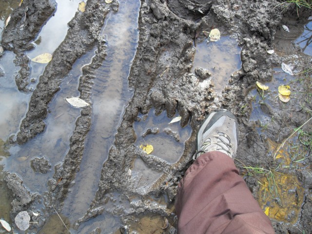
Alders in the lower trail make the going a bit tough at times. And bears, there’s lots of evidence of them so keep aware. This trip we had the trail to ourselves – no bears (just signs) or other people.
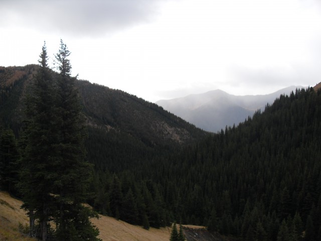
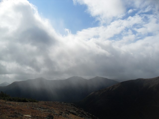
True to its name the area is often clouded in mist and this day was no exception.
The exploration road that is your trail most of the way is interesting. In the late 1940s and early 1950s a company was looking for coal in the area and these now wonderful hiking trails are the result of that work. They’d essentially send a cat into the hills in hopes they’d expose a workable seam as it cut across the slopes. There is indeed coal in the area although I don’t think they found any here. Similar coal exploration roads can be found on Pasque Mountain south of here, or Mt Lipsett not far away.
If you continue on the ridge you can bail out at nearly any point by heading west into the Mist Creek Valley. The ridge down is never that steep and there will be some bushwhacking, but eventually you’ll cross the Mist Creek Trail (the one you were on earlier). Turn left here and follow it back to your car.
On this trip we saw many bear signs and there were lots of prints and diggings. Always be alert!
We visited Mist Ridge again and to see that report, click the link below…
Mist Ridge redux.
Here some summits we’ve visited…
Bull Creek Hills.
Cox Hill.
If you wish more information on this trail, by all means contact us!
Date of adventure: October 2008.
Location: South Kananaskis.
Distance: 18km return. More if you wish to visit the whole ridge.
Height gain from start: 810m
Height gain cumulative: 935m due to some ups and downs.
Technical bits: None.
Notes: Judging by the signs, bears seem to frequent the area.
Reference: Kananaskis Trail Guides by the Dafferns.
We may have company.
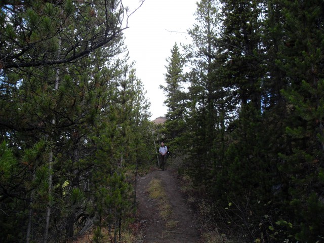
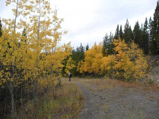
To start, the trail travels through some dense forest.
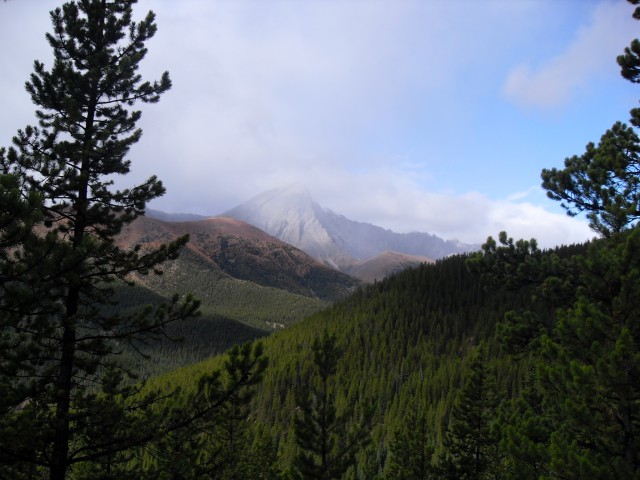
It’s misty around Mist Ridge. Mist Mountain in back (I see a pattern here).
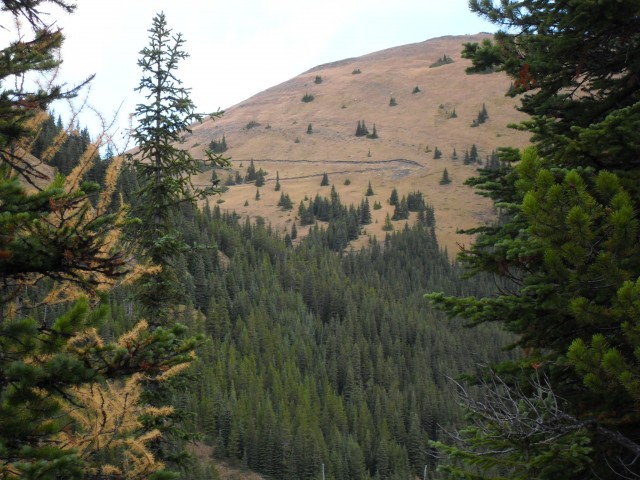
A glimpse of the zig zag road ahead of us.
We’ll eventually end up at the saddle you see ahead.
Looking back at the valley we came up.
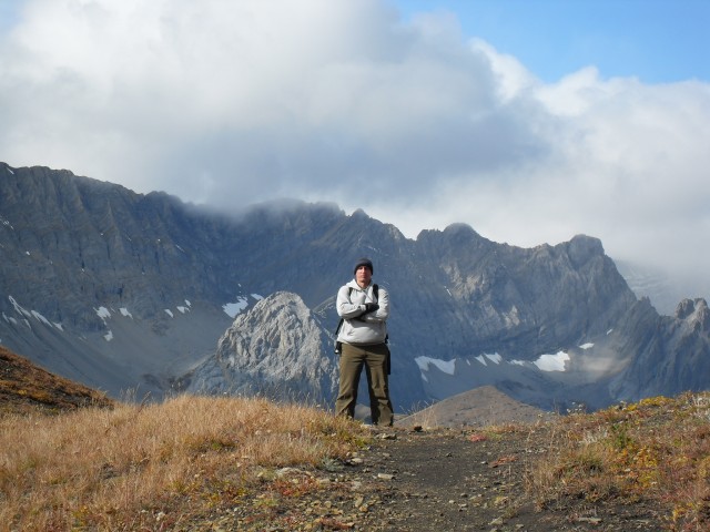
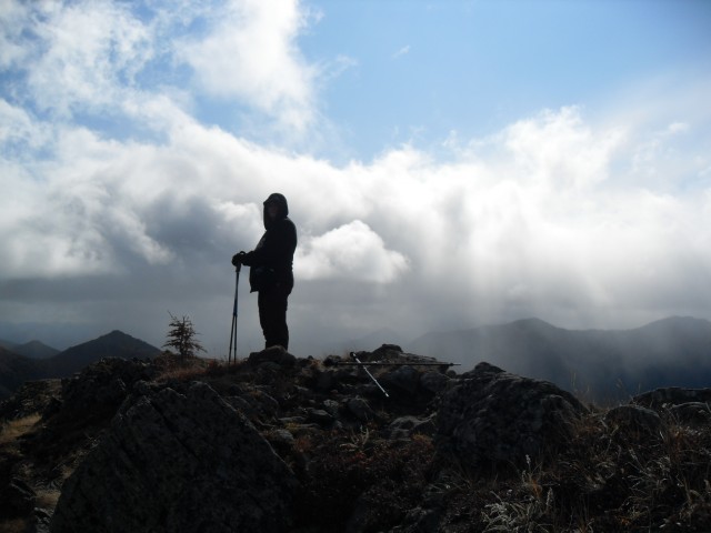
Me!
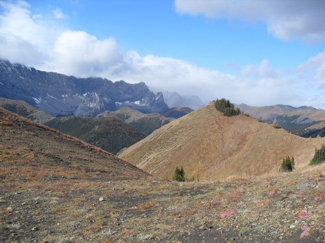
Looking roughly west-ish.
The ridge is aptly named.
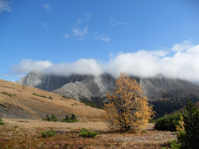
Gorgeous fall colours.
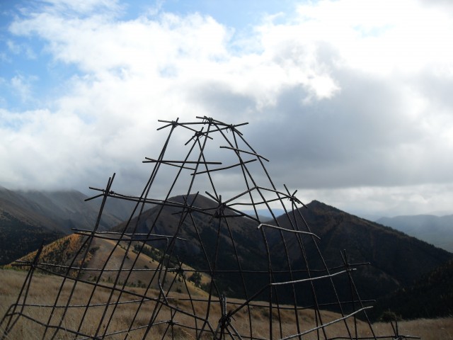
An odd cage high on the ridge.
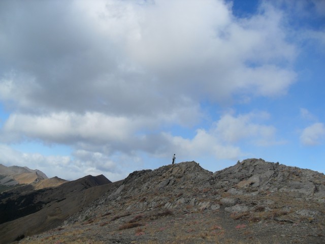
Ridge walking at its best.
Looking north east you can see Calgary through the break in the middle.
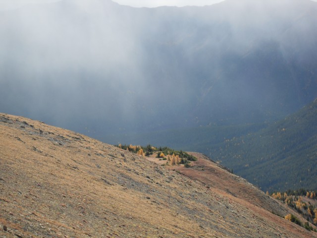
More mist.
A nice shot of Connie.
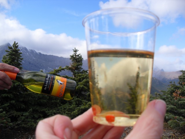
How classy, wine in a cup. I forgot the wine glasses – note the small strawberry we found.
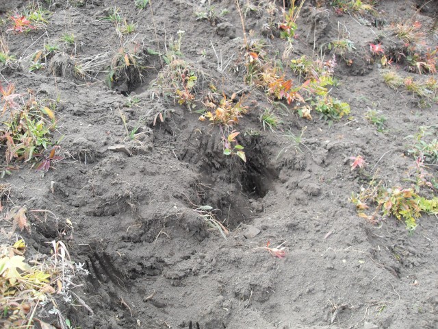
Bear diggings. Spot the claw marks!
Almost back at the car.


So thrilled to have stumbled (somewhere/sometime) to your site – you provide such background information on each article. Love continuing to follow you…
Love that you found us!
Great site and so much information and the name is so fitting. Thank you.
This made our day!
Another beautiful shot….
Hard to take a bad photo there!
Spectacular!
Thanks!
I was in Alberta for over a decade before I discovered CKUA, and it is something the same with Off The Beaten Path; glad I finally found you, and thank you for the info and entertainment. Hmm, Mist Ridge.
That’s a great compliment. Thanks!
Have to put this one on the list! I’m right by there, so looks like the first hike of spring/summer is this one!
Hopefully the road to Mist Ridge, which was damaged by the Spring 2013 floods, will get repaired soon. I want to go back!