
Stoney Trail – Marilyn Monroe combo
While not a terribly exciting hike, the route described here was none the less a delight for us. After all, it had been many months, back in 2012 in fact, since we got into the mountains, the heavy snow pack holding us at bay for that time. With that in mind, at this time of year ANY trail is a good one.
This route, an out and back with a loop at the end, takes in a number of official and unofficial trails, using parts of the Barrier Lake Fire Lookout route, Stoney Trail and what we call the Marilyn Monroe cut off (more on this in a moment). It’s one of the first areas to open up in spring but even so, there was still lot of snow and ice to content with. We passed a group on horseback, and saw some canoeists in the Kananaskis River, but otherwise we mostly had the trail to ourselves.
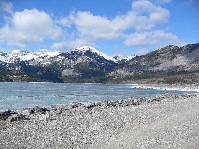
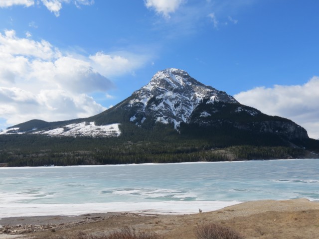
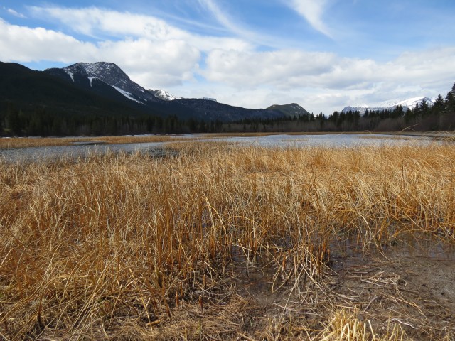
This route starts at the Barrier Lake dam. Immediately we head out across it, enjoying views of Mt Baldy looming over the still frozen lake. In the distance Mt Kidd is still covered in snow, a storm dumping more of the white stuff on it as we watch. To the right is McConnell Ridge, a popular hiking destination and home to the Barrier Lake Lookout on Yates Mountain, the latter being the unofficial name for high point of that ridge. We’ve been up there many times, but at this time of year there is still too much heavy snow at top. This day, we’ll stay low.
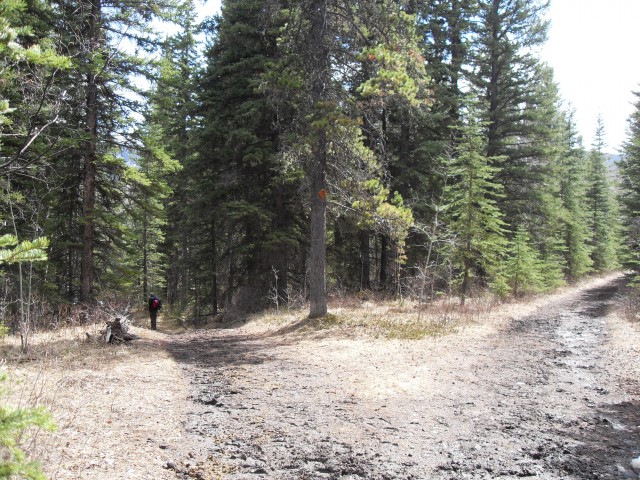
After crossing the dam (a place that is always windy) we come to a junction at some power lines. Head straight into the trees. Gaining some modest elevation, we hit some snow patches, the first of many we’d encounter this day. Before long, we come to another junction. Stoney Trail South heads off to the left and it can be used to make the Barrier Lake Lookout Loop, a great hike. The next left is a more direct route to that same destination. Ignoring all these we’ll go right and head down. We’ll see more snow patches and it’s clear we are the first people to use this trail recently as no footprints are seen, save for those of animals.
The first prints we encounter are cat tracks, a Lynx perhaps. Later we’d see larger ones belonging to a Cougar. Along this section (which is always heading down gently), we also see bear tracks in the mud. We spot some Sasquatch prints too…actually they are old bear tracks that have grown in size with the freeze and thaw cycles. These must be a few days old. Given how they look, I could see how someone might imagine them being made by that mythical creature, since they have a very humanoid-like look. No Kokanee bottles were found nearby.
Before long we are at yet another junction and it’s here where the loop section of the trail starts. Head left here leaving Stoney Trail behind. Before long you are heading down steeply and at the bottom of the hill you encounter Teepees (or Tipis) of Camp Chief Hector. This would be a busy place in summer, with lots of kids about. Today it’s quiet but it looks like preparations are underway to prepare the camp for the upcoming season.
Along here we encounter come people on horseback, guests of the Rafter Six Ranch, out for a ride. You can expect to encounter horses on most of he route we’ve described and as such it can sometimes be muddy or chewed up.
Just past the youth camp we take the unofficial Marilyn Monroe cut off – just skirt around a good sized pond, heading east the whole time. We give it this name as apparently some scenes from the 1954 movie “River of No Return” starring Marilyn were filmed around here. There was as I understand, a cabin used in the film somewhere very near here. We are not sure of the exact location, since nothing was left behind, but by using common sense and information from others, we take a guess where it could have been. I plan to do further research on this as it would be interesting to know exactly where it was.
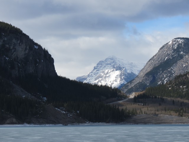
At this spot, we have good views of the mountains around us including flat faced Yamnuska in the north.
Heading east on an old decommissioned road, we enter a meadow between an esker and a treed hillside. There are a number of Native Lodges here, given the name Ti-Jurabi-Chubi. A plaque states this was the location of the Sacred Lodge Dance, a celebration of joy and thanks. A Mountain Bluebird is spotted here and it shadows us for a time, seemingly taking interest in what we are doing.
At a large rock, an easy land mark to spot, we head down to the Kananaskis River. Turning south now, the trail here (we’re back on Stoney Trail again) is wet and muddy and roughed up by the horses that come in from the nearby ranch. We never see the latter but it’s not terribly far away. We spot lots of canoeists having fun and we admire the river’s beautiful green colour. Before long it’s another junction again – you can take either in this case since they rejoin later, but we’ll take the left route staying close to the river. That’s more scenic.
It’s here we stop for lunch, at a nice private spot. With the river gurgling beside us, we enjoy a special first trip of the season picnic. We have some La Frenz Riesling wine (IMO this is the best winery in Canada), wild boar patte and some smoked German sausages. A great treat! We take our time, soaking up the whole experience.
Heading back out, we parallel the river, soon coming to a meadow where the trail riders usually stop for meals. There are picnic tables and corrals here. And of interest to someone like me, there are remains of an old bridge. This structure, what’s left of it, was built in the 1930s and part of the route we are on was the old road in, an early route into the northern reaches of Kananaskis.
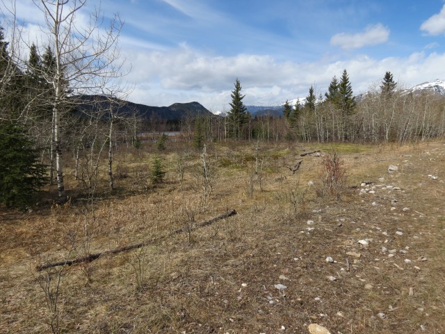
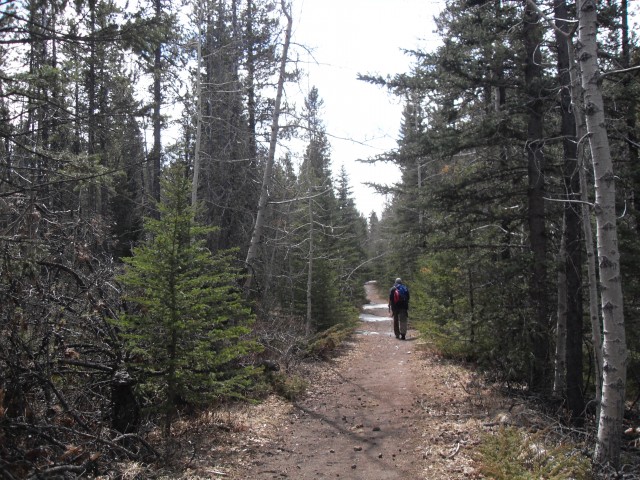
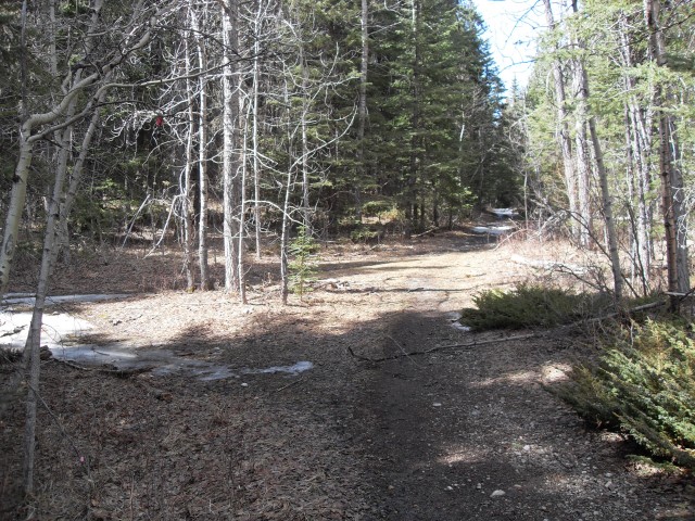
Heading away from the river on the old road, in no time we hit (you guessed it), another junction, and turn left. The trail coming in from the right was the one we left earlier. This section is a heavily treed area and is fairly mundane. We gain and loose a little elevation along the way. At yet another junction (lots of them), we continue straight, then switchback and head down. Crossing under the power lines, ignore the road head to the left. You’ll be going that direction soon, but at the next junction, which comes into view shortly. Go left and retrace your steps in.
Along the way back, we see some fallen trees whose bark had been eaten by Elk. That must be yummy!
Before long, we are at the dam, and as is always he case, it’s windy as hell here. And cold. Before long we’re back at the car, a fun day in the hills and mountains behind us. This will be the first of many hikes this season, we hope.
Stoney Trail is not named because it’s rocky (although it is in places), but rather after the Stoney Tribe who used to live and hunt in the area. That group was so named as they were said to “cook with stones”.
To see some other trails in the area, follow these links…
Stoney Trail, a hellish journey.
Barrier Lake lookout loop.
Wasootch Ridge.
If you wish more information on this route, by all means contact us!
Date of adventure: April, 2013.
Location: Kananaskis Barrier Lake area.
Distance: 17km out and back with a loop
Height gain from start: 75m (approx)
Height gain cumulative: 300m (approx)
Technical bits: Horse poop and mud in the area around Rafter Six Guest Ranch.
Reference: Kananaskis Trail Guides by the Dafferns.
To start, we cross the Barrier Lake dam.
Mount Baldy and the still frozen waters.
It’s still winter on Mount Kidd.
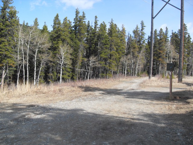
At this junction we head straight into the trees.
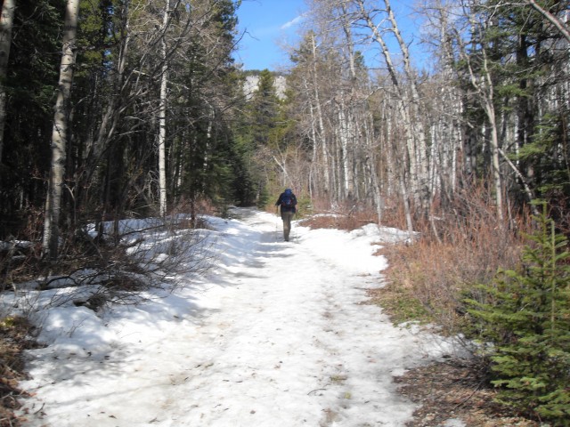
There is still a lot of snow around.
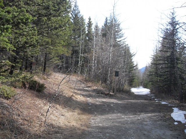
Another junction and here we’ll head straight.
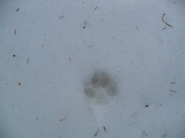
This was one of several wild cat footprints we’d come across.
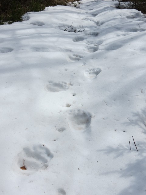
Sasquatch tracks! Actually old bear prints.
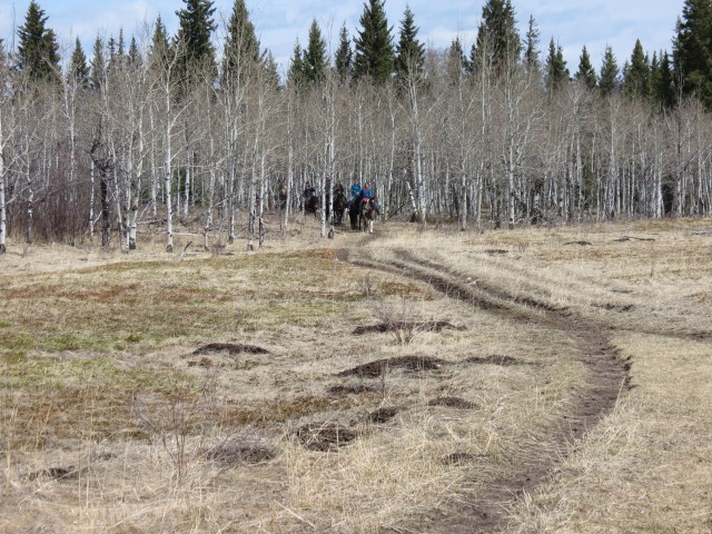
Riders coming in from the Rafter Six Guest Ranch.
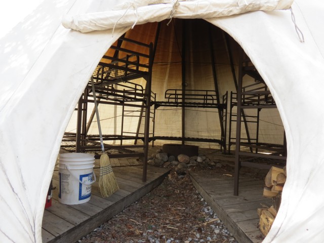
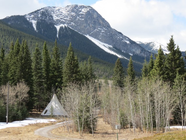
A teepee at Camp Chief Hector.
We’be been to the top of Yates Mountain (high point of McConnell Ridge) a few times.
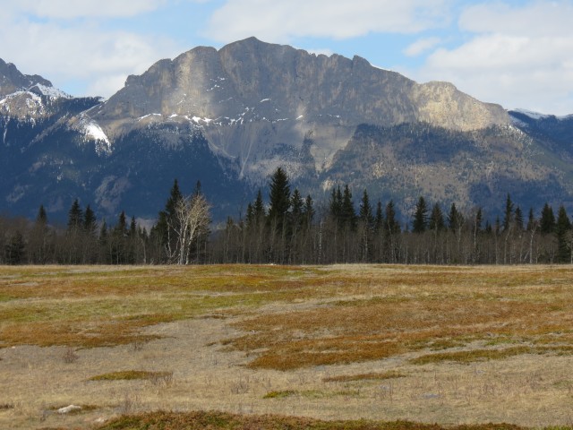
Flat faced Mount Yamnuska in the north.
The mountain on left is home to the Barrier Lake Lookout.
This may be the spot where the Marilyn Monroe cabin stood.
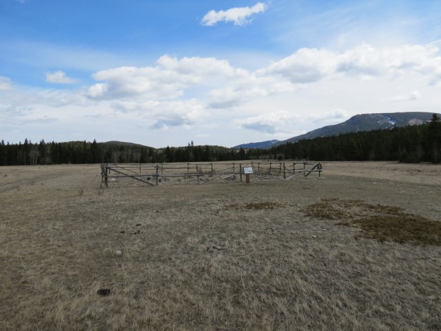
Site of the Sacred Lodge Dance.
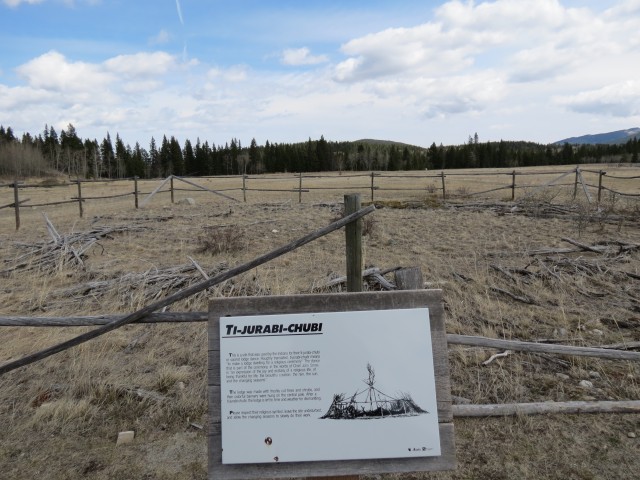
Called Ti-Jurabi-Chubi, this spot was host to sacred native ceremonies.
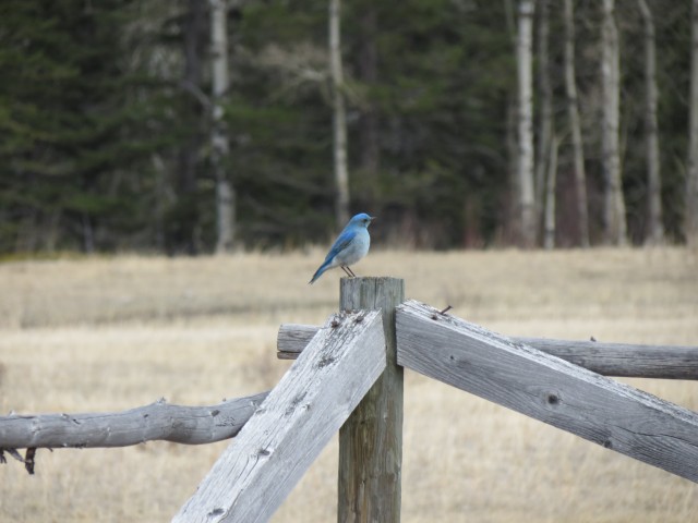
This Mountain Bluebird shadowed us for a time.
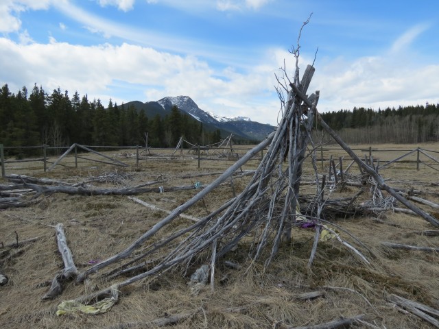
More lodge remains.
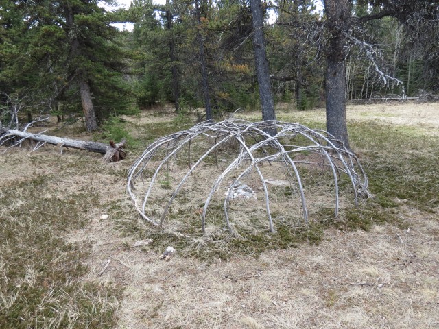
A Sweat Lodge.
At the big rock (on right), head down to the river.
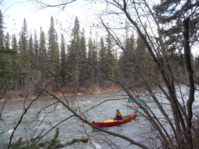
The Kananaskis River is popular with kaykers and canoeists.
At this junction we head left staying close to the river. You can head right too – both trails eventually rejoin.
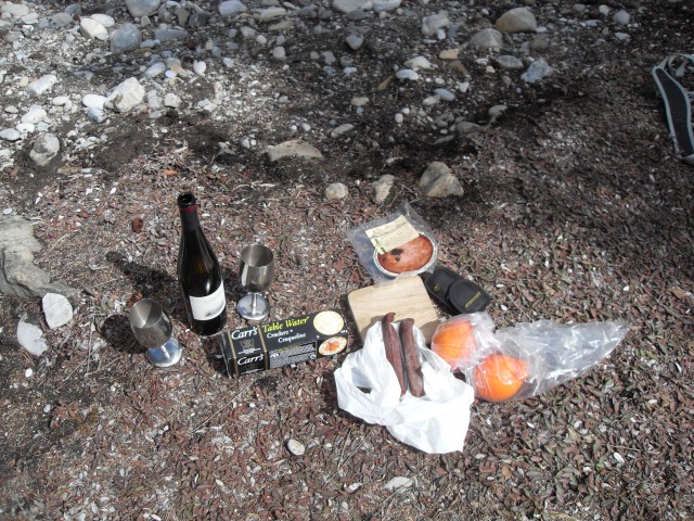
For our first trip of the year we bring some special treats – La Frenz Reisling, wild boar patte and smoked sausages.
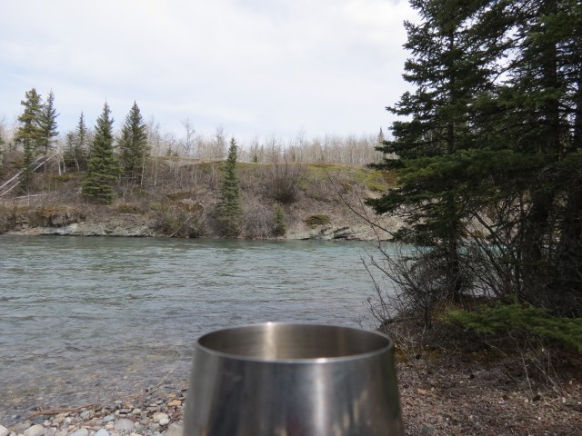
Wine along the Kananaskis River.
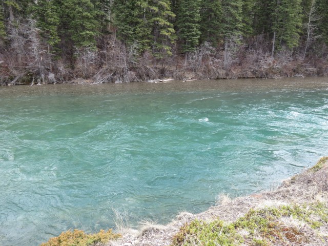
Its water’s are beautiful and clean.
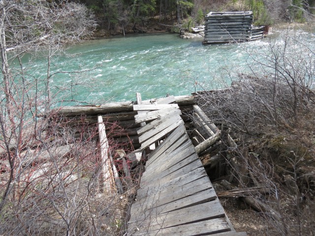
Bridge remains from an early road into the area.
The trail here is in the trees with little to see (unless you like trees a lot).
Completing the loop part of the route, we head left here and retrace our steps in.
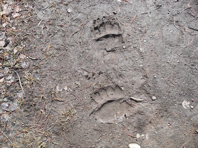
On nearly every trip we see bear prints.
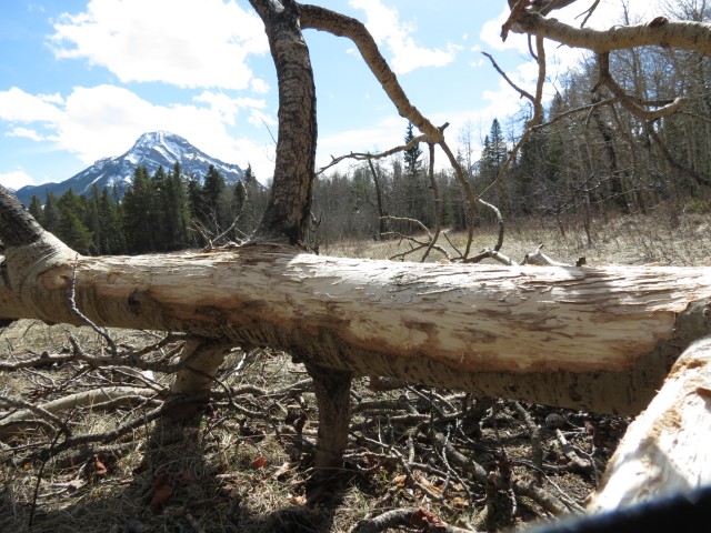
Elk have eaten the bark off this tree. Mt Baldy in back.


Another great report! We tried the lookout the same day (maybe you passed us on the dam?) and it was deep snow by the time we reached the old Pigeon Lookout. We were post holed it for a while before turning back. That bridge sure is interesting, where exactly is along the trail?
We like to save the Barrier Lake Lookout till later in May, so there is not as much snow. The bridge is found along the first section of Stoney Trail. It can be easily reached from Rafter Six Guest Ranch – just follow the trail by the river and on the second major junction, take the stub trail to the left to find it.