
Barrier Lake Lookout
Sometimes I wonder why we do what we do. All that hard work, all that huffing and puffing, all that anticipation and all we get to see from the Barrier Lake fire lookout is fog and clouds. How awful!
Sitting on the high point of Yates Mountain (also refereed to as McConnell Ridge), the lookout offers superlative views up and down the Bow River valley. When things are clear the views are great and there are countless things to see – other mountains around you, the busy Trans Canada highway, the Bow River, trains passing on the CPR mainline far below. It’s all so interesting.
This ridge is one of the very first real mountain you’ll pass when heading west on the Trans Canada highway. It’s instantly recognizable on account of the precipitous cliff that faces the highway. If you look hard you can even see the lookout.
The trail head for this adventure is located at the Barrier Lake dam day use area, some nine or ten kilometres south of the Trans Canada Highway along Highway 40. It can be a busy lot and parking is sometimes hard to find.
Heading out you immediately cross the Barrier Lake dam. Every time we venture out across it, without fail it’s either very windy or cold, or both. Today is no exception and because of this the distance across the dam seems much longer than it is.
At the power lines now, there is a junction. Keep heading west here – the road to your left can be used to access the Stoney Trail which parallels Barrier Lake and later the Kananaskis River that feeds it. Heading up gently, soon after there is another junction. Just keep heading west, the other route is the official Stoney Trail which meets up with that other one I spoke of later. From here on in it’s all up, the road gently zigging and zagging as it goes. It’s an old horse trail that was used to supply the Pigeon fire lookout (not the one we are heading to – more on this later). Always in the trees it will be a while before you have any views.
After the last switchback a trail comes in from the north, the fire lookout access route for young adventurers coming in from a youth camp situated at the north base of the mountain almost below. The trail turns south here and steeply heads up a spine of the ridge (still in the trees). Not long after a meadow announces your arrival at the location of old Pigeon Fire Lookout. Here’s where things open up and there are good views of Barrier Lake below and Mt Baldy directly across the way and Mary Barclay’s Mountain to the south. The lookout here was superseded by the Barrier Lake lookout sometimes in the early 1980s and it’s easy to see where the structure stood.
We find some Prairie Crocuses here, and it’s usually the first flower seen in the spring. It even grows through snow!
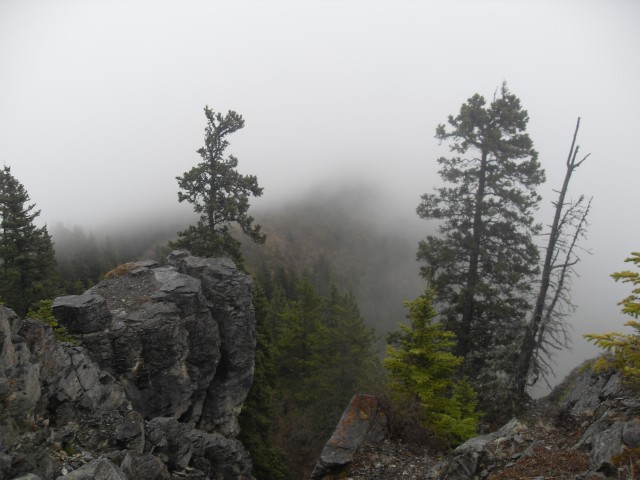
Just beyond here the fog rolls in and for the rest of the trip we’ll have very limited or even zero visibility.
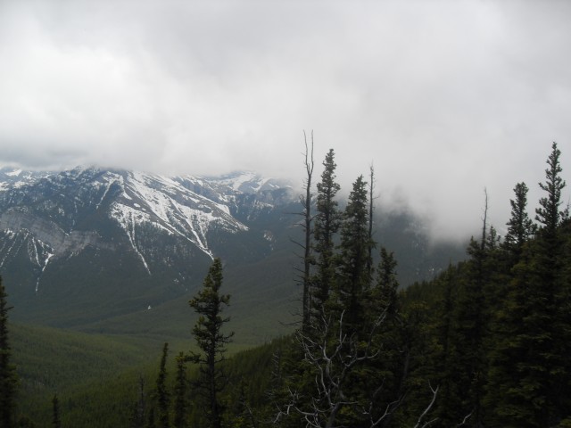
Continuing on, flat for a while, we come to the most challenging section. The old horse trail now behind us, there is a very steep section with some rocks to scramble up. It can super slippery here when wet. Picking your way up, moment later we come to the radio repeater, a drive in movie screen looking thing. Just beyond is a rocky outcropping at the top of some sheer cliffs. Facing east the vista from here are even better than the Pigeon Lookout just below. That is if the weather is cooperating. All we get to see is fog.
Oddly, here is where many people turn around. Perhaps they’ve used up all their strength or maybe they just don’t know that a short distance away the higher Barrier Lake lookout begs to be visited. The additional height gained is small, but the rewards are worth it. Very worth it. While up to here the trail has been fairly busy, for the final push to the lookout, we are alone and stay that way until we get back to this spot.
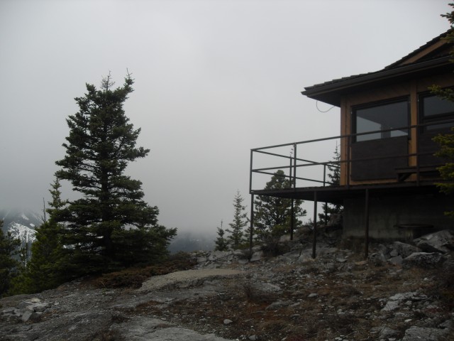
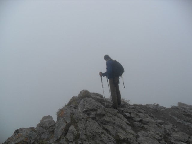
Arriving the the lookout, nothing much has changed weather wise. The fog is a heavy as ever and Connie are both are very disappointed. Maybe, just maybe, the clouds will break, but we have no such luck. Heck though, it’s still a good day and we enjoy a long lunch and each others company.
We are facing north here and normally there are good views of Mt Yamnuska situated almost directly across the Bow Valley from us. It’s sheer cliffs are a landmark. It can be scrambled and has a more gentle backside. We’ve never been.
This is a manned lookout, but given the fog and winter like conditions we encountered one can hardly understand what use it is on that day. On clear days, I am sure there is a lot for the person to do. This lookout, like all it the province are now supplied by helicopter.
Connie and I have done this trail three times now, always in the spring. It’s usually the first route with elevation to come into season.
We’ve been up before and to see that report, click the link below…
Barrier Lake Lookout (2).
Check out these mountains we’ve summited…
Bull Creek Hills.
Turtle Mountain.
If you wish more information on this trail, by all means contact us!
Date of adventure: May 2011.
Location: Kananaskis, Bow Valley area.
Distance: 12km return.
Height gain from start: 680m according to my GPS – on other trip reports I have seen anywhere from 600-750m and everything in between.
Height gain cumulative: 680m
Technical bits: None.
Notes: Bikes on the trail, keep a watch for ones coming down.
Reference: Kananaskis Trail Guides by the Dafferns.
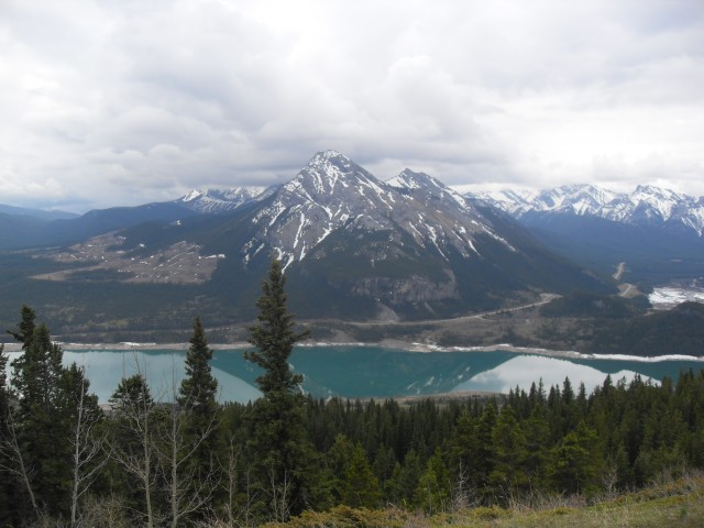
We break out of the trees at the original lookout location. Mt Baldy is seen across the lake.

Looking south down Barrier Lake. Mary Barclay Mountain right of centre.
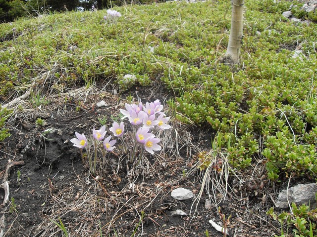
The first flowers seen each spring, the Prairie Crocus.
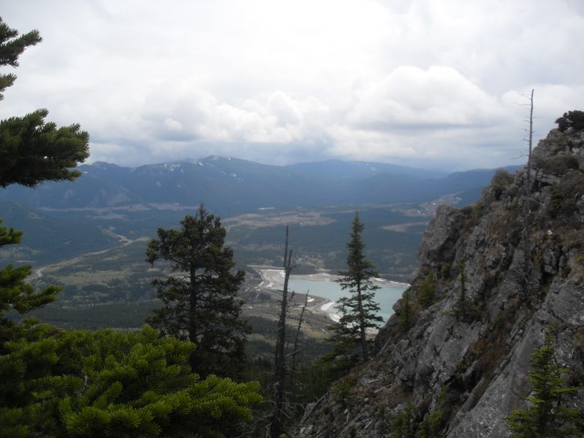
The south dammed end of Barrier Lake.
The last clear views we’ll have for a while.
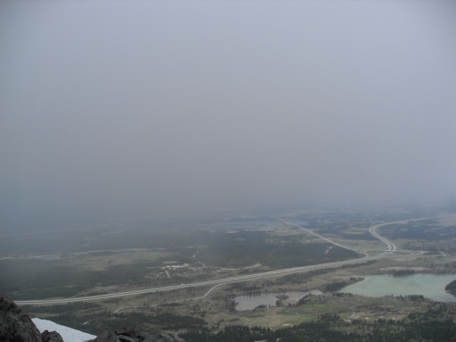
The Trans Canada Highway below us to the north.
The lookout, although it’s hardly much use today.
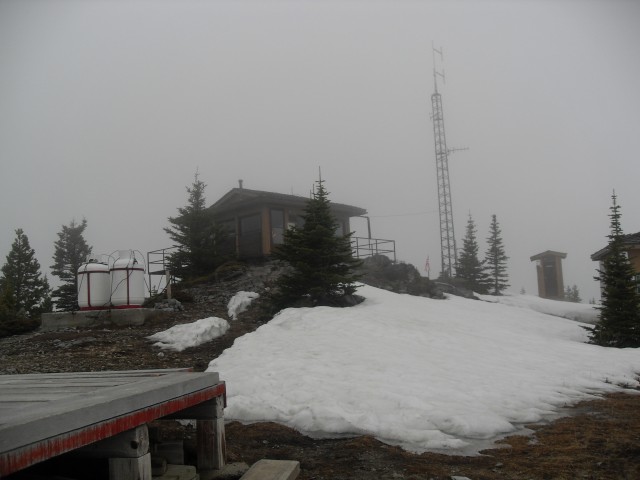
Not only is it foggy there is still a lot of snow.
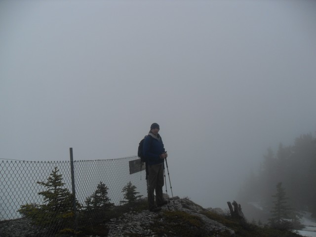
Behind me is a near straight drop down. Not that you’d ever know.
A quick glimpse over a cliff.
On the edge…honestly.


Great post Chris and Connie. Cheers!