
Turtle Mountain
A few times a year we find ourselves in the Crowsnest Pass, a favourite area of ours. A cabin we rent sits rights below Turtle Mountain and its famous slide and having spent many years admiring it all from below, we decided it was time to see it from the opposite angle.
Welcome to Turtle Mountain our first “Kane” scramble – so named after Alan Kane who’s book on the subject of climbing mountains is a bible for this hobby. It’s a rated easy by the author and is a short and popular route. Given its interesting history, the close proximity to town and the fun accent, I can see why.
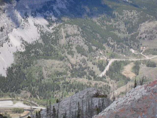
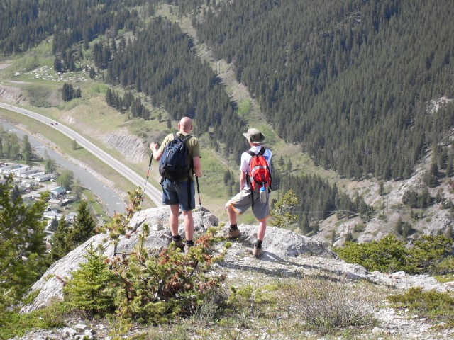
We start by driving to the parking spot, a mere three minutes from our cabin. That’s the shortest drive to a trail head we’ve ever done. The route starts at the base of the mountain right behind the town of Blairmore, almost in people’s back yards, along the obvious pipeline right of way just before it dips down steeply. Park here, walk down the dip and look for the yellow rocks. These announce the start of your adventure.
And then from there head up, and up and up and up without any real break until you reach the top. Initially in the trees, the trail sometimes braids but always meets back up. While steep, the going is mostly easy with only a few scree patches adding to the challenge. The trail stays along the mountain’s western spine, sometimes ducking into the trees, but otherwise it’s out in the open. At times you are on solid bedrock, but as you gain height there is a bit more scree – so be careful.
Before long you are at the top!
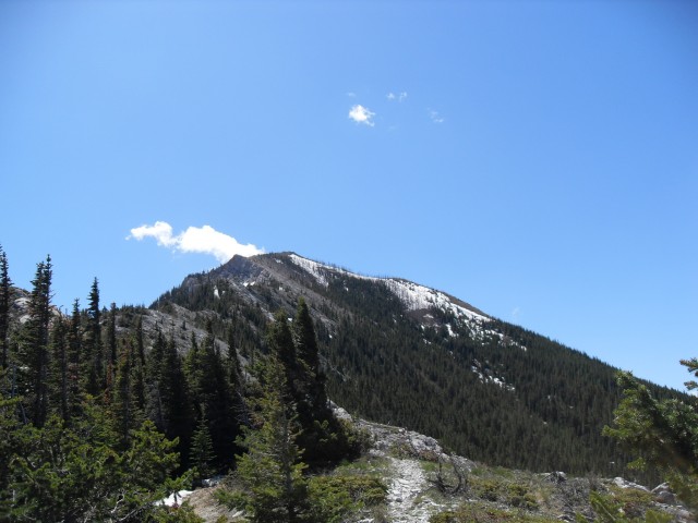
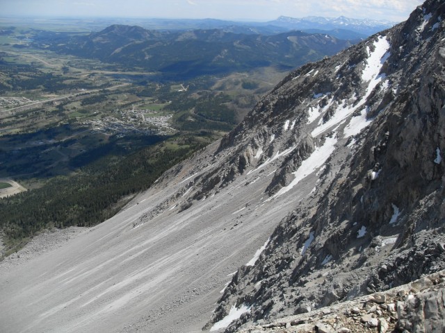
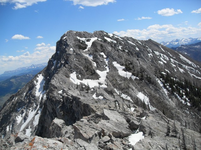
There are actually two peaks, the second east one being only marginally higher, separated by a fair size gap. However large deep fissures between, many partially hidden by lingering snow patches made it unsafe for us to traverse. The gap used to be mountain and that slide material down below originated from here. I imagine the mountain was somewhat higher before the slide. One thing is for certain, it sure was interesting to see whole Frank Slide mess from this perspective.
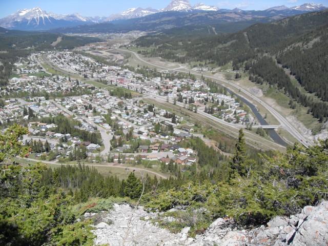
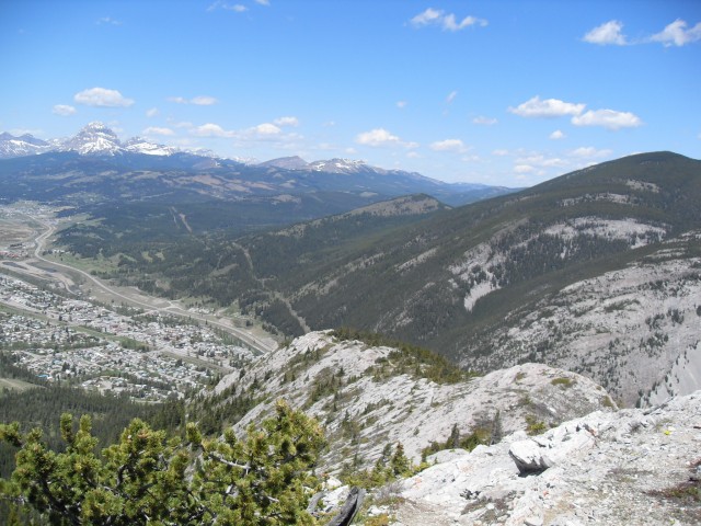
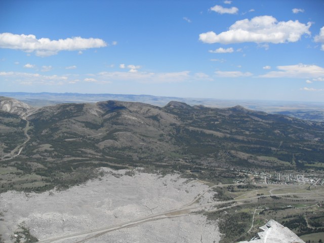
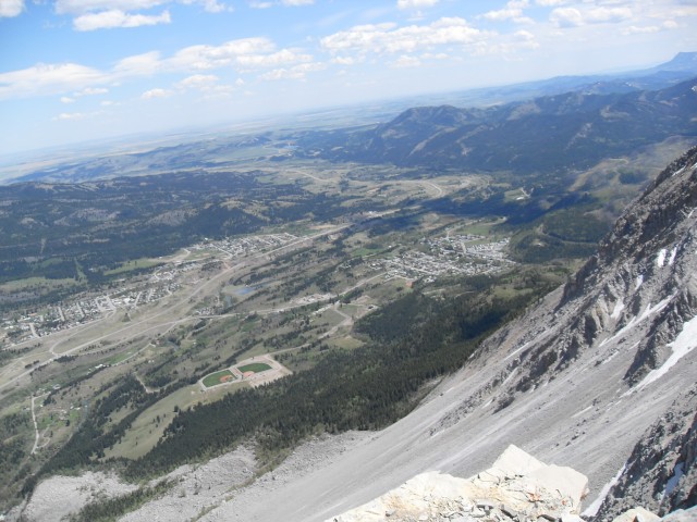
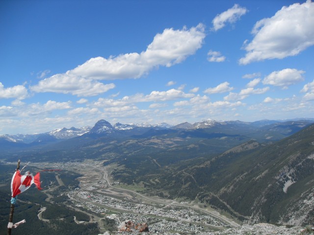
From the top of Turtle Mountain we were able to see every town in the Crowsnest pass. And there are a lot of them, each generally associated with a specific coal mine or mining company. Starting from the east there is Lundbreck, Passburg (gone), Burmis (gone), Bellevue, Hillcrest, Frank, Blairmore, Coleman, Sentinel (mostly gone), and finally Crowsnest at the BC border. Today they are collectively known as the Municipality of Crowsnest Pass, although for locals each former town is still often refereed to by its original name.
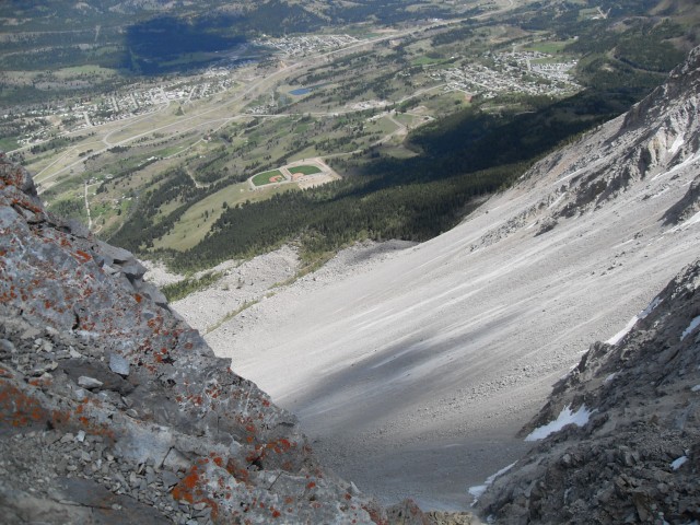
Far below us we had a good view of the highway and rail line as they pass through the slide path. We could easily see the Frank Slide Interpretive centre too, an interesting place in itself to visit. It’s a great museum dedicated to the slide and the people it affected.
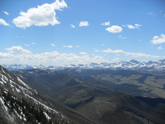
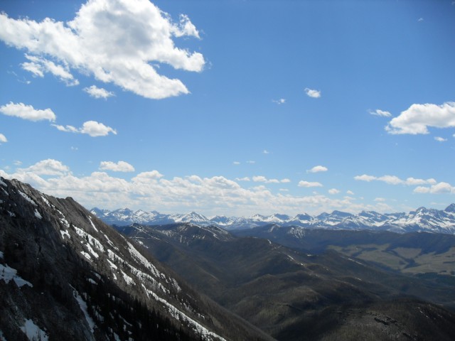
To the west we had a clear view of the pass’s namesake Crowsnest Mountain along with Sentry Mountain and Phillipps Peak / Mount Tecumseh (that mountain has two high points each with its own name). Directly below us and above our cabin is Bluff Mountain and all around there are other rolling hills to take in, including one we call One Mine Ridge, a place we’ve been up. Also seen in the north, if you know where to look, is the ghost town of Lille.
To the south is the Castle Wilderness and lots of ugly logging cut blocks – a necessary evil I guess, we all need wood.
On the way up a Canadian Forces CF-18 flew past and almost level with us (twice). I wish I had the camera out and ready, it was amazing! But alas, it went by far too fast to catch. I wonder to this day what it was doing here in The Pass.
This trip we shared the trail with perhaps a half dozen others and it looked like everyone had a great time.
The Frank Slide took place in 1903 and resulted the in the deaths of some 70-90 people. Missing the main part of town of Frank by an extremely narrow margin, it wiped out the coal mine, the railway and temporarily dammed the Crowsnest River, resulting in a further mess. The coal miners while trapped inside by the slide manged to dig their way out. It took many weeks for the CPR line to open.
Turtle Mountain still moves and there are many sensors up at the top, keeping an eye on things. Can it happen again?
This trip we were joined by our eldest son Will.
To see some other Crowsnest Pass adventures we’ve had, click any of the links below…
Tent Mountain was torn a new one.
A little of Lille and Mine Number 1.
DC3 plane crash.
If you wish more information on this trail, by all means contact us!
Date of adventure: May 2009.
Location: Crowsnest Pass.
Distance: 7.5km return.
Height gain from start: 890m.
Height gain cumulative: 890m
Technical bits: Some loose scree.
Notes: If bagging the second peak, watch for the fissures.
Reference: Bob Spirko’s Road Not Taken.
Starting up Turtle Mountain.
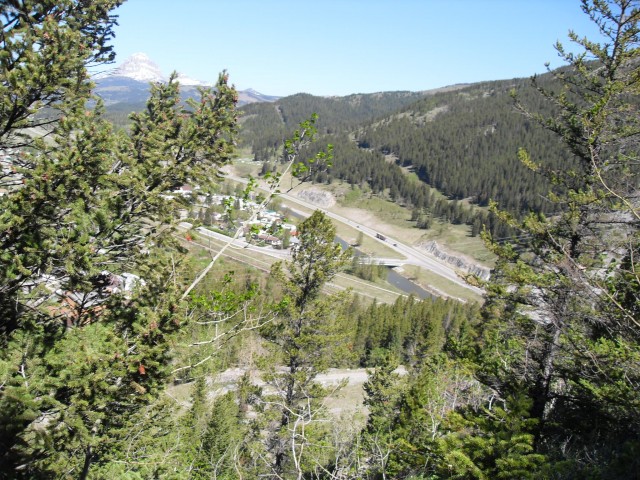
The town of Blairmore and in the distance, Coleman.
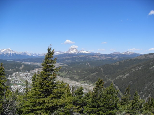
Standing alone in back is Crowsnest Mountain.
We’ll follow the skyline ridge up.
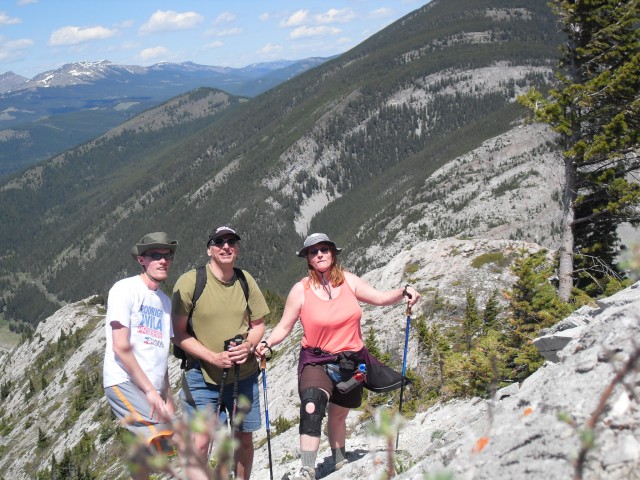
Chris, Connie and our eldest son Will.
Our route up was along this rocky rib.
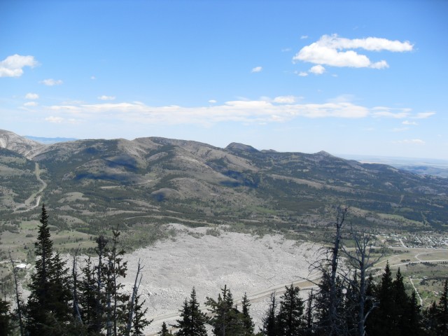
The slide zone is absolutely huge.
The views east to the prairies. Turtle Mountain is the first big peak to be seen when heading west.
We call the green hill on the left “One Mine Ridge”.
Below are the former coal towns of Bellevue on left and Hillcrest on right.
Looking south into the Castle Wilderness with its ugly logging scars.
Our cabin is at the base of Bluff Mountain right below.
Another view of Crowsnest Mountain, just left of centre.
The logging cutblocks sort of spoil the view, but I guess we all need wood. :>
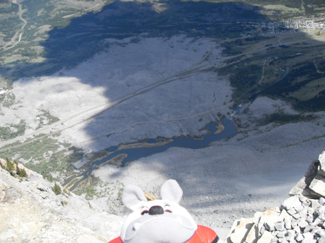
Bosco the summit dog. All that rock down there, used to be up here.
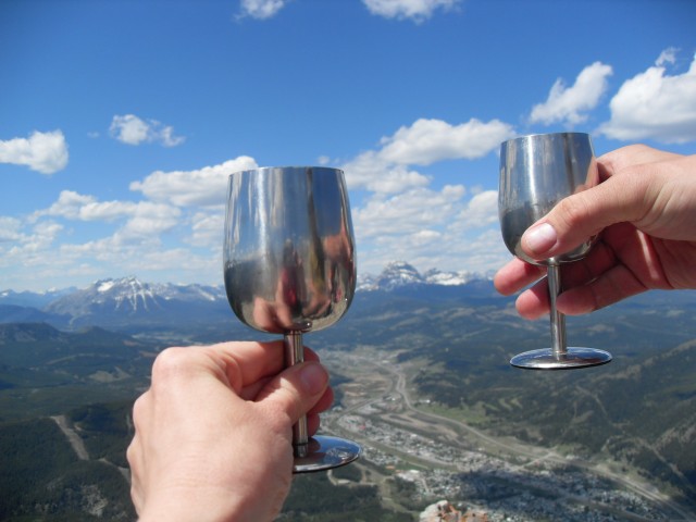
The obligatory wine shot.
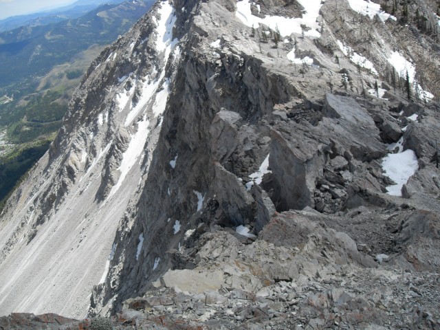
The gap between the east and west peaks of Turtle Mountain.
The slide face.
The east peak with all the those fissures in front.
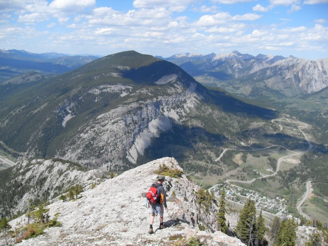
Heading down. Bluff Mountain in back.
One last look……
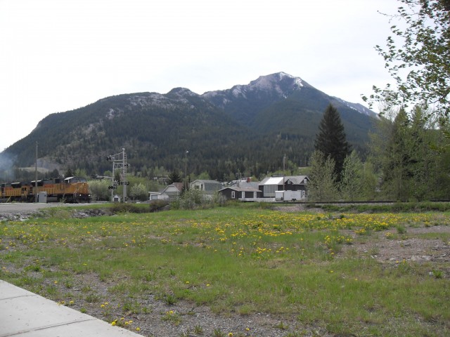
Turtle Mountain as seen from downtown Blairmore.


")


Awesome photography and documentation Chris. My dad and his parents moved from Pennsylvania to Fernie, then Coleman in 1910. My dad was ten years old and Turtle Mtn. was still very fresh for the people who lived there. In 1913, the family moved to the Peace River Country, north of Grande Prairie. My dad hated the mountains and after visiting the place many years later, I could understand his fear. My husband got transferred to Calgary in 1973 and hiking and photography became our passions. I enjoy every picture that you post and get to relive some of the hikes through your photography. Thank you for being special. 🙂
Thanks for sharing a bit of family history. We love that. And thank you for the kind words!
Great climb!
Sure was – hope one day we can do it again.
That was a lot of mountain displacement, just incredible and fortunate most of the towns people were spared.
Many folks living in Frank dodged a bullet. They came that close to disaster.
Amazing!
It is!
On my only brief visit to Frank Slide, over 30 years ago, I remember an eerie feeling. So many lives lost . . .
That most of the town was spared was a blessing. It could have been a whole lot worse.
A good perspective of how big it actually was.
It really is sobering.
Oh wow! Crazy different perspective from just driving through it.
A whole different view!
…that was a serious hike.
For us, yes. Pretty steep with some loose stuff. To put it into perspective how slow we are – we know of folks who did the same route in half the time of us, or more.
I recall the old highway 3, when it meandered through the huge rockfall. It felt like driving on the moon. Now the roadbed rides above the avalanche debris, making it feel so much smaller.
That old road is still there. Quite the difference compared to the highway today.
A new view, thanks!
It was AWESOME being up there!
I’ve been through there and the magnitude of the slide is something else !!
As I saw perhaps too often, it’s a mind blower.
Did you know, in terms of volume of rock displaced, the Hope Slide was bigger?
Wow, never knew. Checked and indeed you are right. Thanks for that interesting tidbit.
Those ugly cutblocks are actually wood that was salvaged in time to be used after the lost creek fire went through.
We can’t live without lumber. For sure, it’s necessary and we all should accept that. We get it. Harvesting that wood was a no-brainer. Still, cutblocks are unsightly. Not sure anyone could argue otherwise. Thanks for commenting.
Ooh, you’re brave to climb up Turtle Mountain. Awesome pictures!
It was a blast, a ton of fun and it was so neat to see the Frank Slide from a new angle. Be sure to visit our site often.
Great narrative, and excellent photos. I was up here with a hiking club I belong to in June 2008 and followed pretty much the same path. (and even got many of the same pictures!) Didn’t have a fly-by from an F18, but instead saw a helicopter flying by below us not that far away. A most memorable hike for me, I have driven by here so many times in the past and always wondered what it was like up top.
This was one of my favourite summits. Connie, that tough girl, was having some knee problems and still managed to get to the top. The CF-18 flyby was one of the most surreal experiences I’ve had while climbing a mountain. Thanks for sharing your Turtle Mountain stories!
This was one of my favourite summits. Connie, that tough girl, was having some knee problems and still managed to get to the top. The CF-18 flyby was one of the most surreal experiences I’ve had while climbing a mountain. Thanks for sharing your Turtle Mountain stories!
I’m not exactly of the flight path it would have
taken but several years ago there was an f18 that
flew from Alberta to, well over, Princeton BC
for their annual air show, in May of that year.
I’ve enjoyed looking thru your posts, thank you.
Kathy
Perhaps that was the same plane? It passed by twice, first heading west at near mountain top level and then perhaps an hour of less latter, going the opposite direction. Interesting!
Great hike up and down! That last push to the first peak is tough, but being able to look down the slide (or even hang your feet off) is amazing.
The view of the slide is amazing.
Me and a friend did this hike in the summer but we went up to the second peak. I had never climbed anything that high before so it was a little nerve wracking for me. All in all a good experience though.
We avoided the second peak. There was still a lot of snow covering many of the fissures there. Thanks for posting!
I have driven past here a million times and I often wondered what it would look like from the top. And now I know! Thanks for sharing!
Excellent pictures. I hear that turtle mountain is being monitored in case it collapses even further.
There are sensors up there keeping an eye on things, but given all the large cracks and fissures at the top it would not surprise me it more came down at some point. Perhaps only some large boulders.