
Pasque Mountain
Pasque Mountain is an amazing multi-kilometre ridge walk that is just a delight. It’s an easy push to the northwest summit and from there one can spend hours hiking merrily from high point to high point. And if you reach the end of the ridge you’ll be almost directly across from where you started.
If it’s windy however, this is not a very fun place. It was the latter for us this day. The gusts were so powerful in fact it hurt our ears and made it hard to walk. Because of that we decided to cut the trip short and retreat back down the trail after a quick lunch at the northwest summit. Vowing to return of course. So for now Pasque Mountain 1, us 0.
The trail itself is mostly an old exploration road that takes you to within metres of the ridge proper. Nice and easy. Initially in the cut blocks it is sometimes hard to follow here and this is were we made a mistake. Oops, we have to back track. But once at the base of the mountain the trail is very obvious and easy to follow.
The parking spot for this route is along along Forestry Trunk Road 940 (gravel) about 28km south of Highwood House and the junction with paved Highway 40. There is an old gated road here at the start and this is where you begin your adventure. Unless you find the road in an adventure in which case you are already having fun.
Start by following the road past the gate. After a bridge take the first right and follow it to the base of a hill. It’s here we went wrong and we headed straight (and up). That’s bad. Instead find a faint trail heading off to your left following a cut line. It’s a bit boggy here so tread carefully.
Emerging in a cut block, head across it and skirt to your left unit you see a rough road heading down to a small creek. Go here, cross the creek (rock hop), head up a bit and enter another cut block. In both clearings the route can be sketchy and you may loose the trail in places – go slow. In the second cut block head to your shallow left until you come to another road (heavily overgrown) heading down to yet another stream. Here’s where it gets easy and the route from here on in is mostly easy to follow.
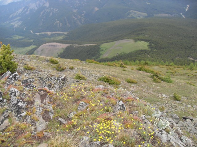
Cross a bit of corduroy road and head up. The road zigs and zags then tops out in a side ridge following it for a spell. All the gnarled trees here hint at the wind that blows here – there was none at the moment, but there would be lots later on as we got up higher. And the flowers – oh the flowers. There are meadows falling away from you and they are covered with gorgeous flowers of all colours.
Topping out in a saddle the trail disappears into a small meadow. Just head to the west and you’ll find the trail as it exits the clearing and heads back into the trees.
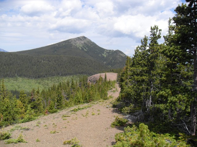
Ever climbing the road has some steep parts with a few flat bits where you can catch your breath. In no time you break out of the trees and the the grandeur of Pasque Mountain come into view. The trail switchbacks one last time and then end unceremoniously just a short distance from your destination.
From here you can bag the northwest summit and call it a day or you can ridge walk to your heart’s desire – assuming that ever-present wind is not blowing. The ridge horseshoe is always out of the trees and many kilometres long with lots of ups and downs. As I mentioned it was too windy for us so we elected to summit here then take refuge on the lee side of the ridge out of the wind. The whole time Pasque Mountain begged us to continue but we know that would be foolish.
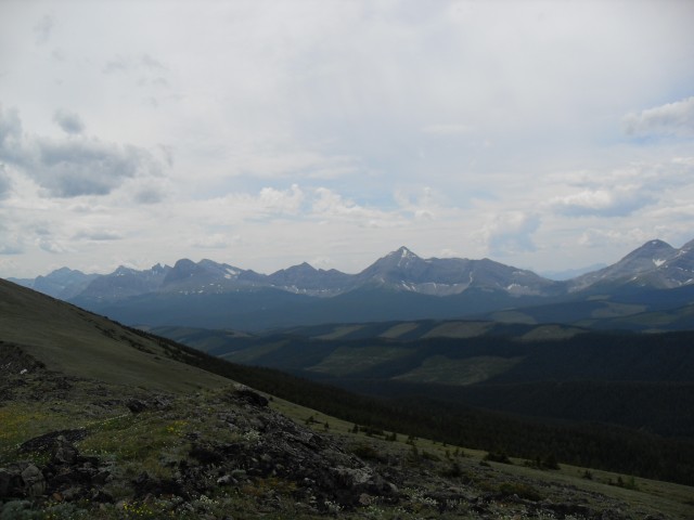
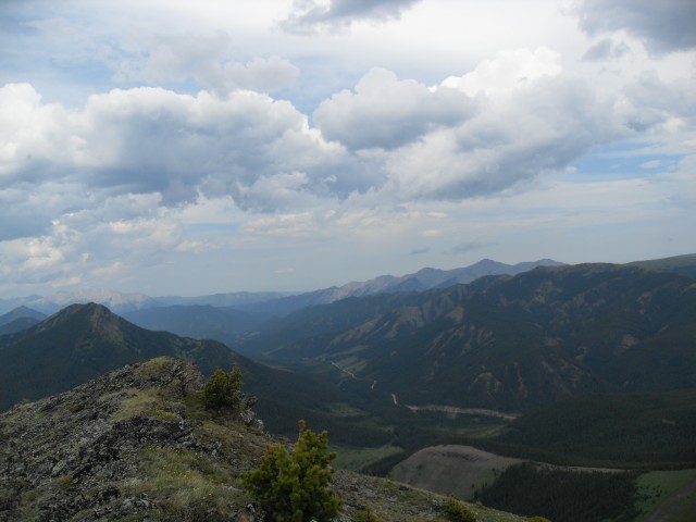
Other summits to be seen from here include Mt Burke to the northeast with it’s abandoned fire lookout and the aptly names Plateau Mountain almost directly east. It flat as can be and clearly stands out because of that. Also surrounding are a number of parallel ridges running north-south whose names elude me. To the west is an almost unbroken wall of peaks that sit right on the great divide (also the Alberta/BC border). I am ashamed to admit I don’t know many of their names. Right on the other side of them however is the Elk Valley in BC, home to many coal mines. If the wind is right you can clearly hear machinery and explosions from the open pits that are being worked.
This exploration road, like those on Mist Ridge, Picklejar Ridge, Mt Lipsett and others in the area, was used to search for coal. It does exist in the area and perhaps by randomly scraping the sides of hills they hoped find a good workable seam. Sort of a shot in the dark method of coal prospecting. It’s not a logging road, we know that much. Ridge tops are generally not good places to find trees. Who ever made it sure was crazy though – it travels where no Caterpillar should go!
Found along the upper trail were a large number of wild onions. Yum! But you have to be careful as there is a poisonous lookalike that also grows in the area. Known as Death Camas this onion impersonator will ruin your day. To make sure you have an onion, smell it. Death Camas has little scent, where as an onion, smells…well..like an onion. If you have any doubt, don’t eat it! Wild onions are great to add to soups.
If you recall, we made it a point to return for a second try. And we did. However like the first, it was just too windy and we had to retreat. To see that report, click the link below…
Pasque Mountain (2).
Check out these hills and mountains we’ve climbed…
Wind Ridge.
Turtle Mountain.
If you wish more information on this trail, by all means contact us!
Date of adventure: July 2009.
Location: South Kananaskis.
Distance: 11km return. More if you do the entire ridge.
Height gain from start: 690m. More if you do the entire ridge.
Height gain cumulative: 720m
Technical bits: Route finding in the boggy cut blocks is hard. The trail is very faint there. And of course, knock-you-down wind. Lots of that.
Notes: Lower down is prime bear habitat.
Reference: Bob Spirko’s Road Less Travelled and Kananaskis Trail Guides by the Dafferns.
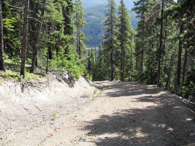
Opps, we start off on the wrong trail.
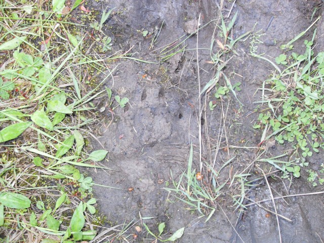
Connie finds some bear prints.
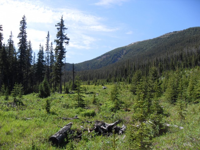
The trails passes through a cutblock and can be hard to follow.
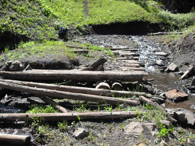
A corduroy road signals the start of the climb.
Looking north.
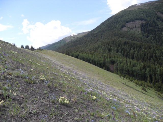
There were flowers everywhere.
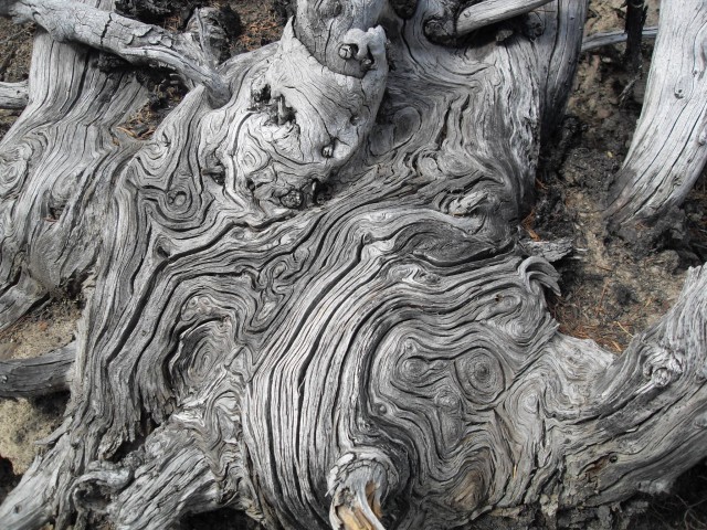
Old gnarled wood on the wind swept ridge.
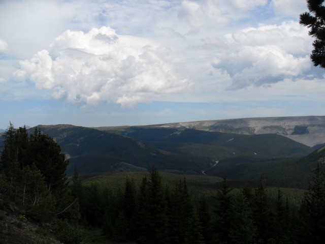
Across the valley is the aptly named Plateau Mountain.
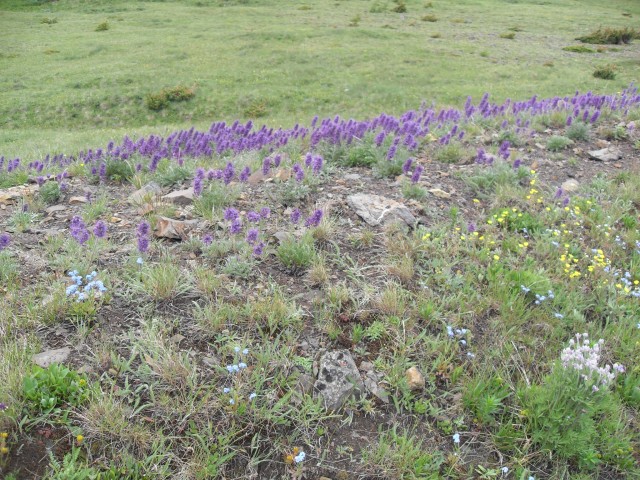
Flowers, flowers everywhere.
Looking southwest. BC is just on the other side of those peaks.

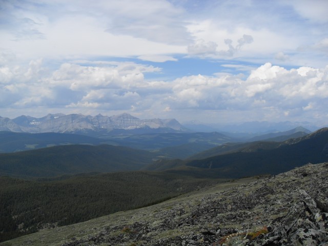
Looking directly west.
Mt Burke is the tallest mountain in back. You can also see the bare ridge we came up below.
Most of the route up Pasque Mountain can be seen here.
Looking northwest with lots of cutblocks in the distance.
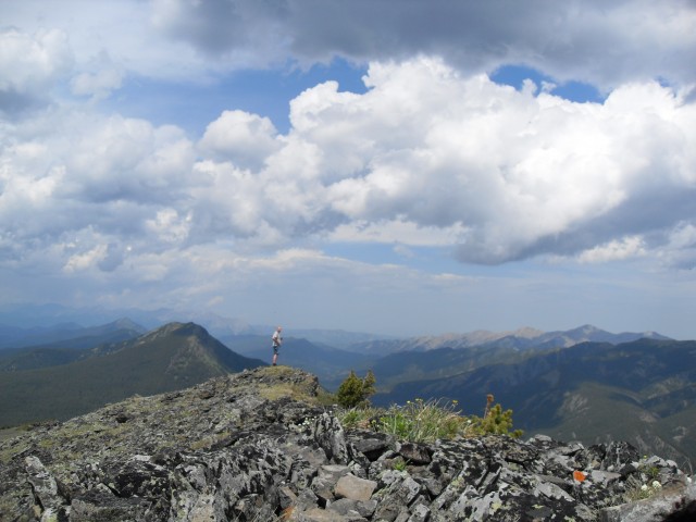
The northwest summit.
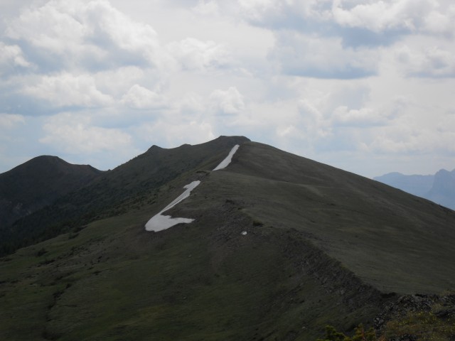
Pasque Mountain’s ridge extends for many kilometres. We did not go past here account the heavy winds.
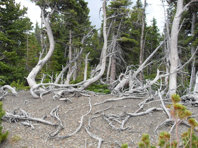
There were lots of these wind ravaged tree skeletons. It’s always windy here.


")


Comments are currently turned off