
Back to Brown Lowery
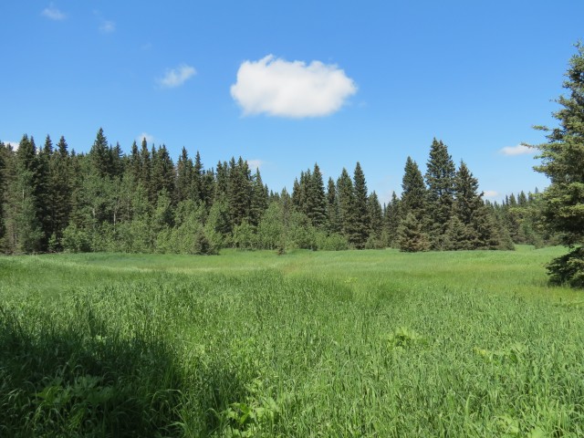
Recent flooding in the region had us scrambling for a place a hike. Most of Kananaskis was off limits or inaccessible due to heavy damage from that event, leaving very few options open. With that in mind, Brown Lowery Provincial Park seemed like a good objective, a place we’ve been many times and have always enjoyed. In a setting of gentle rolling hills, it is a green oasis surrounded by farms and ranches and it has numerous hiking trails to keep us busy. Some old abandoned cabins in the park add to the interest.
Given the recent rains and the lush nature of the park we were concerned about mosquitoes, which the park seems famous for. In the end however, few were seen. In fact, the only pests were huge swarms of house flies that buzzed around us annoyingly. Odd, where did they come from?
This heat this day was stifling (I’ve said it before, heat is our kryptonite) and we soon found ourselves overwhelmed by it. It was only the the cool shady woods and the easy trail here, short and with no real elevation, that made the hike possible. It turned out to be a blessing in fact. Even so we had to stop many times to cool down and we drank copious amounts of water.
Located between Bragg Creek and Millarville, not terribly far from Calgary, there is a small parking lot (easy to miss) just off Plummers Road and this is your trail head. The only facilities in the park are some biffies and a couple picnic tables. It’s a little known place, overshadowed by the nearby and much more interesting Kananaskis region just to the west, and because of this it’s normally fairly quiet.
There are many possible loops we could do, but we decide to explore the outermost one and do it in a counter clockwise direction. That way we’ll tackle any elevation gain (not much really) first before the heat of the day causes any problems. For this route we uses sections of the following trails (in order): Wildrose, Lookout, Pine Hill, Red Willow and Chickadee. Altogether it’s about 8km around and I also take small side trip, using parts of the Old Mill trail, to visit an old collapsed cabin, adding perhaps a km or two to the total.
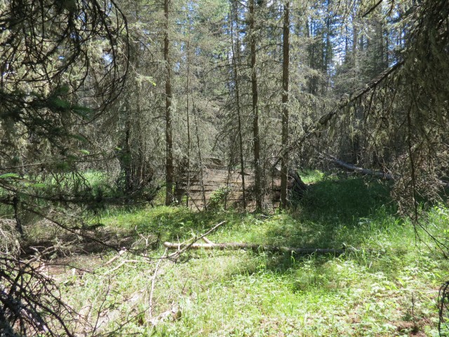
Every junction has a detailed map so it’d be hard to get lost. Many wet areas, and there are a lot of them, are bridged, but others aren’t and expect to get muddy.
Head down the only trail which heads off in a southwesterly direction. Almost immediately we pass over some boggy areas (on bridges), and you’ll soon come to the first of many junctions. Stay right here and do the same for the next two junctions, which come in quick succession.
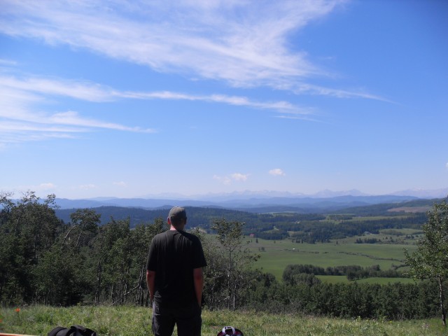
Shortly after you’ll gain some elevation, the only real huffing and puffing you’ll do, soon topping out at a nice view point. There are benches here, one looking east where you can see Calgary but the better one is west facing. There are fine vistas in front of you, the rolling hills in the foreground and bare limestone peaks in back. There is a haze in the air, so it’s hard to see the latter very well. The mostly open and grassy hillside drops away gently and this would be a nice lunch spot.
Moving along heading south. Soon we’ll hit a power line cut and we’ll turn left following it down. Where it bottoms out we head back into the trees (the cool shady trees), passing a number of junctions all which we ignore. Along here the trail undulates a bit but any elevation gained is minor. Topping out on a small hill, we head down again, sometimes steeply. At the bottom, in a swampy area, the trail takes a sharp left turn.
Passing more swampy spots, we occasionally break out the trees and pass through small meadows. In places the trail here is heavily overgrown and hard to follow – the recent heavy rains likely caused this explosive growth, plus the trails themselves see only modest use. This section of the trail is pretty flat and will be for the most part from this point on.
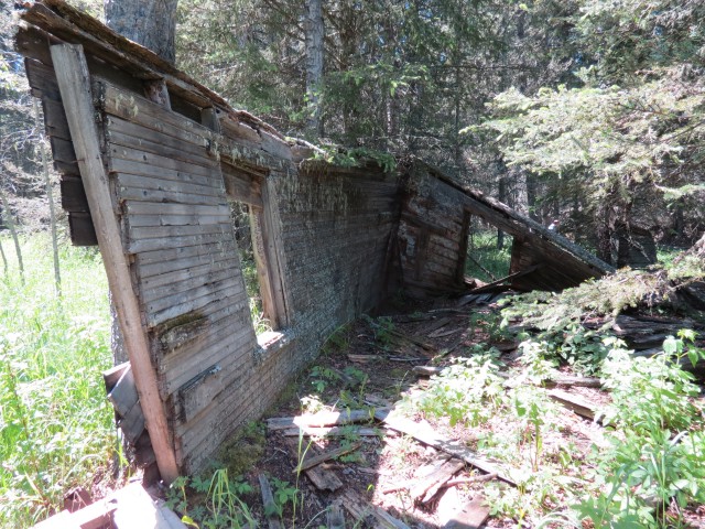
Crossing a small stream we notice how the recent flooding due to heavy rains has caused some of its banks to collapse. Even a small water course like this can have great power. Not long after, we’re at the first cabin, where we’ll have lunch. First however, I take pictures of the collapsed building and then taking a quick side trip, I head through a meadow, what was supposed to be an old sawmill site, to find a second cabin not far away.
Both cabins, if it were not for trees propping some of their walls up, would be on the ground. As mentioned there was a sawmill here, and perhaps both are in some way connected to that operation. Both were empty, save for an old bed frame in the larger one, the one neat our lunch spot (strange – we often see old beds in crumbling cabins).
I could find no evidence of the sawmill. Usually there would be something to hint at what was here – sawdust piles, old planks and cut offs, bits of machinery – some kind of sign, but I found none. Also strange I could not find any real trace of a road in but I guess it could be hidden by time and trees and undergrowth.
After an enjoyable lunch (with wine of course) we continue on our way and in a short time we are at the car. By this point, the temperature is 32c and both Connie and I are felling a bit dizzy from the heat. Or maybe it was the wine. In any case, it felt like we just climbed a mountain, that’s how bad the heat seemed. Normally a small 8km loop is nothing for us, a warn up, a stroll. This day however it was a big challenge.
Normally you’d never find us in Brown Lowery park in the summer and we usually only visit in the shoulder seasons when other more interesting trails in the west are under snow. None the less, we like the place. It’s pleasant.
The park as I understand it, is a good bird watching area, although it’s pretty heavily wooded in most places so I am unsure how one would spot them – from the viewpoint I guess. Many of the meadows are likely good places to see flowers too, although not many had bloomed yet on our visit. We have seen bear signs, paw prints and scratchings, on past trips, but saw no signs of wildlife this pass.
We visited the park in the spring of 2006 and to see that report, click the link below…
Brown-Lowery Provincial Park.
The trails here are easy and to see some other non-challenging hikes, go here…
High Noon Hills.
Glenbow Ranch western trails.
Big Hill Springs park.
If you wish more information on this route, by all means contact us!
Date of adventure: July, 2013.
Location: Brown Lowery Provincial Park, between Bragg Creek and Millarville.
Distance: 8km loop – there are lots of other trails you can take.
Height gain from start: 150m.
Height gain cumulative: 250m.
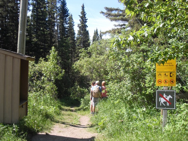
The start of our little adventure.
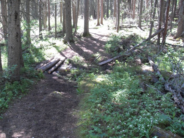
Expect to find boggy areas.
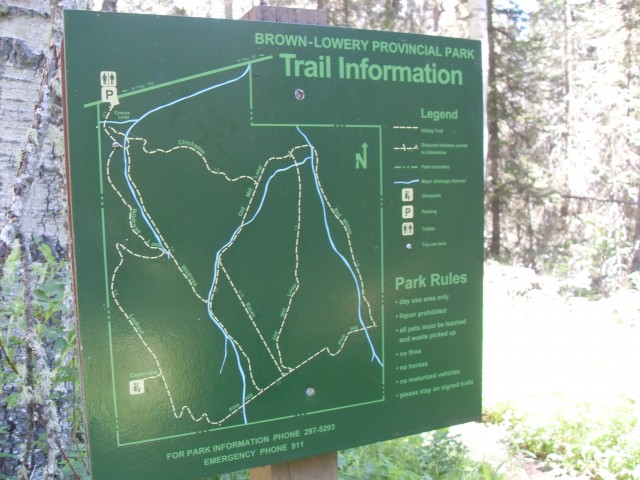
There is a map at every junction.
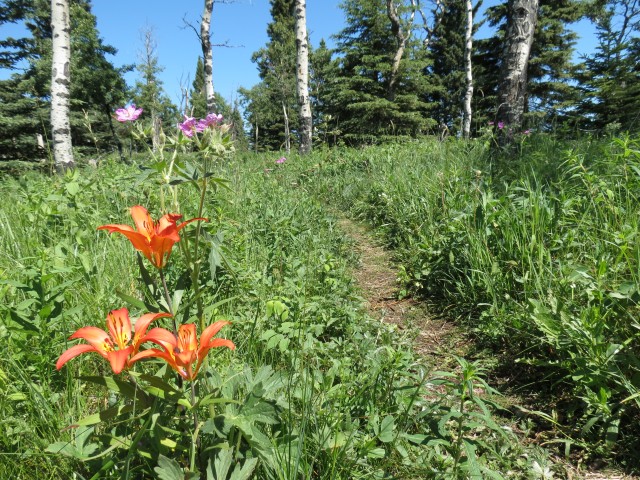
We saw lots of Tiger Lillies but many other flowers had not bloomed yet.
The west facing viewpoint, the highest place in the park.
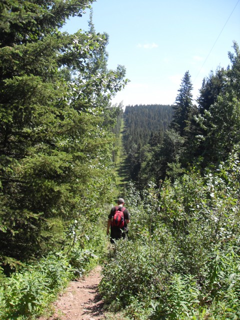
Dropping down a power line cut.
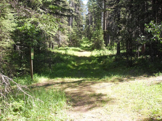
One of many (signed) junctions you’ll pass.
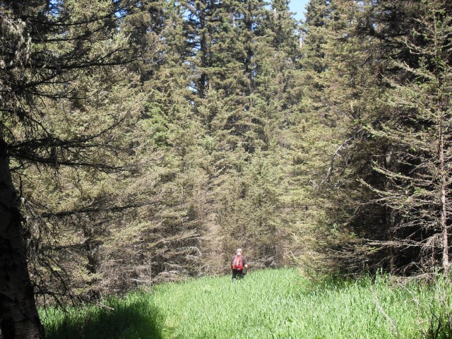
In places the trail is overgrown.

Damage from recent heavy rains can be seen.
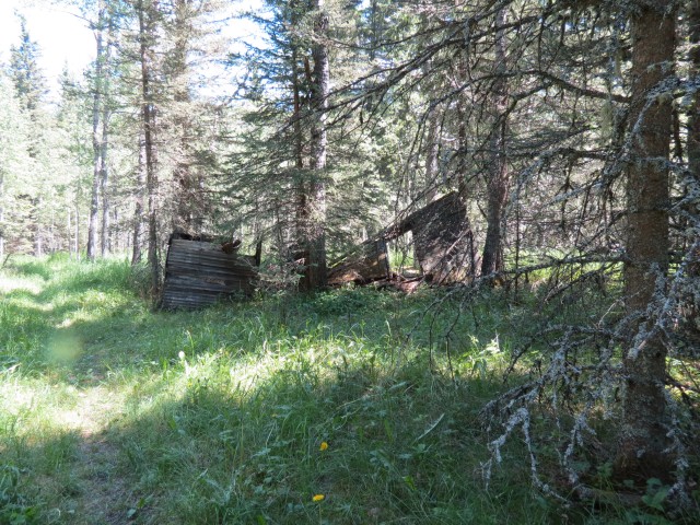
An old cabin in the bush.
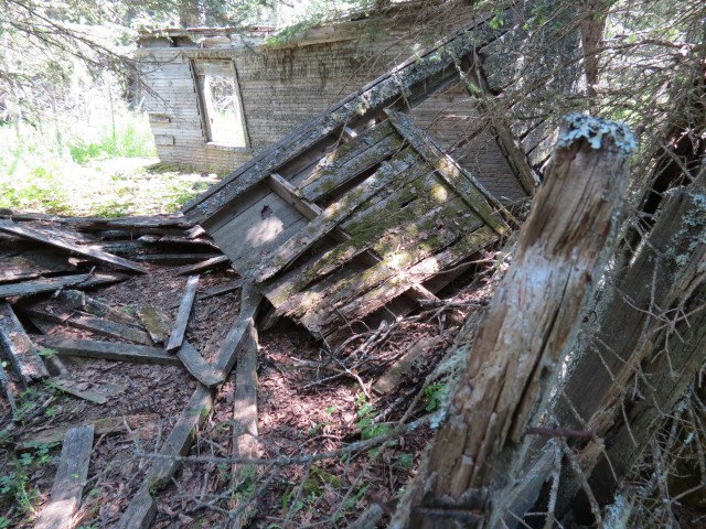
If not for trees holding up some walls, the entire building would be on the ground.
This is one of two cabins in the park.
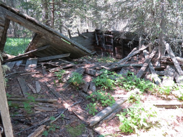
Nature takes over.
According to the maps, there was a sawmill here.
A second collapsed cabin is found near the sawmill site.
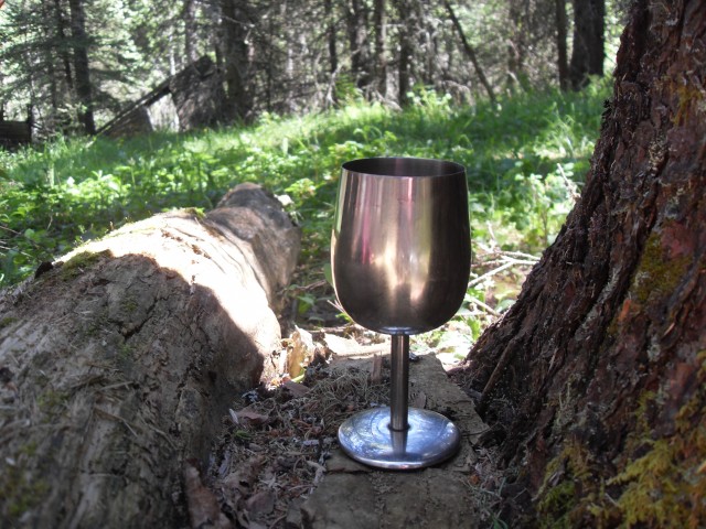
Enjoying lunch with wine.
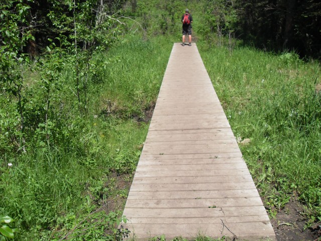
Most wet sections have bridges.


I’ve hiked these trails many times. Some of my favorites.
I like them a lot too.
I love Brown Lowery. Easy to get to, rarely busy. A great place to loose ones self.
My husband and I love your blog! We’re avid hikers and if it weren’t for your write up we would have never considered hiking Brown Lowery. We did a series of loops last week and had a great time. We enjoyed all the wildflowers and the flies that seemed to be pestering you were no where to be seen.
Glad you had fun!
Great report; I’ve been contemplating a visit a to Brown Lowery for some time. The wife and I are causal hikers, nothing too challenging or hard, and this looks to be perfect for us. I’d like to check out that old cabin!
I think you’ll like it then. The cabin is not shown on the maps, but it’s close to the sawmill meadows, which is.
I hiked Brown Lowery a couple days before you and was almost driven mad by the mosquitoes. I did a couples kms before they drove me back. Glad they had subsided by the time you visited. I too was looking for another place to hike but because of the floods had to settle for this park.
I’ve heard of the legendary Brown Lowery mosquitoes and was a bit worried this trip. We lucked out, except for all this house flies, which were a real pest, but at least they did not bite.