
Cataract Creek
A more boring trail could not be imagined. But in the end, it turned out a lot more interesting than expected which I’ll elaborate on shortly. We planned to bag one of the many nearby ridges, but incredible winds up high (which are common in this part of Kananaskis), forced us to stay in the valleys. This trail was our only close by alternative that did not require us driving further.
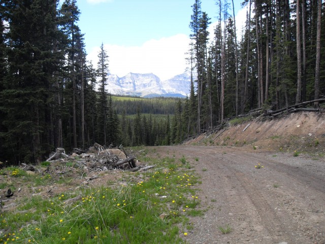
The trail is a an old logging road which is closed to vehicular traffic. At least public traffic, the were signs of recent tracked vehicle use. The road wanders up the valley passing by a number of cut blocks and open flower filled meadows along the way.
Just follow the trail, the old road or any of its offshoots, and turn around when you’ve had your fill. That’s what we did. Along the way there are some good views of the high mountains to the west and to the east Mt Burke, a former fire lookout location, is the most dominate peak. To the south Raspberry Ridge begs to be explored and a nice trail heads up it, topping out at the manned fire lookout there.
So what made this otherwise mind numbing trail worthy of a report? There are a many.
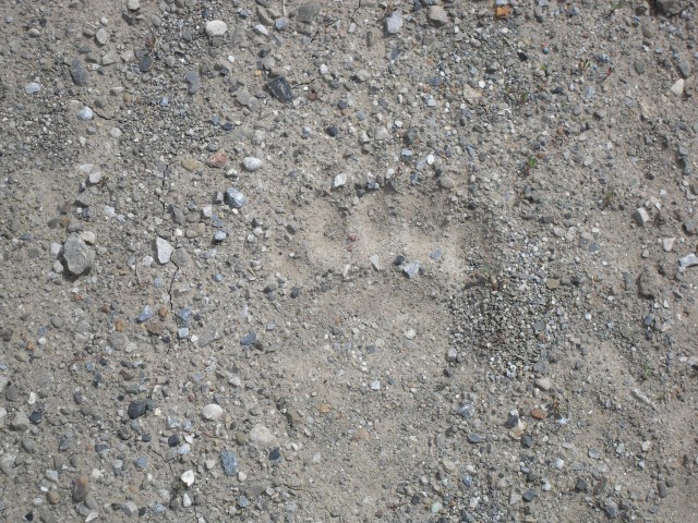
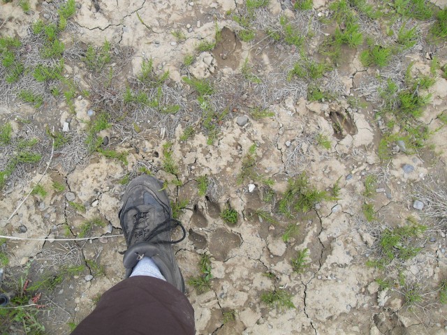
First, the huge number of animals tracks we saw were fascinating. We followed in the footsteps of a number of different bears, wolves, deer and elk. I understand that this valley is or was used as a bear study area. I can see why!
Second, many of the road cuts has wild onions growing on them. They are super yummy and we collected many. A warning, there is a plant called Death Camas that grows in the same area. It looks like an onion and not surprisingly given its name is lethal. The only real way to tell them apart is by smell. Death Camas does not have the odour of an onion. If in doubt, don’t touch!
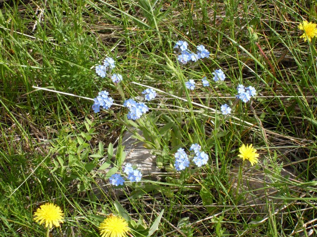
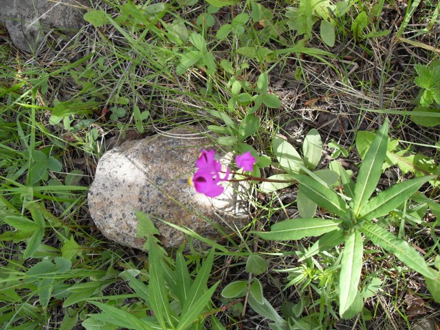
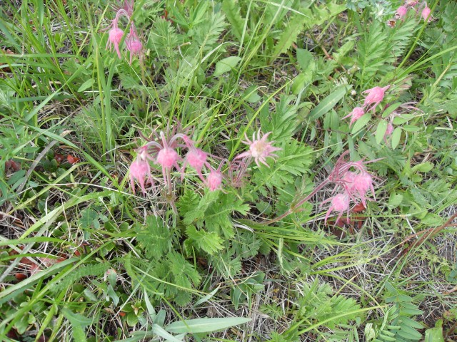
Third…..the beautiful flowers. Acres and acres of them blanketing every meadow. I am no flower expert, so I am not certain the names of them. Maybe in the winter I’ll bone up on flower identification.
And last, the bridges made from old railcars. If you know me, you know that I am crazy about train stuff. It was really interesting to see these recycled as bridges. One car, its number still visible (CN 680013), was built by the National Steel Car company in Hamilton Ontario in 1952 and was retired around 1999.
So even in spite of the down sides of this trail, it wasn’t a total write off. Nearly any hike can be a fun one if you learn to appreciate the small things.
To see some other trails we’ve visited, go here…
Lost under Yamnuska.
Spectacular Buller Pass.
Burstall Pass.
If you wish more information on this trail, by all means contact us!
Date of adventure: June 2008.
Location: South Kananaskis
Distance: 12km return. You can go further, much further if you wish.
Height gain from start: Negligible.
Height gain cumulative: Negligible.
Technical bits: Bears, Wolves and animals of all sizes.
Notes: None.
Reference: Kananaskis Trail Guides by the Dafferns.
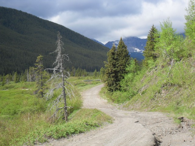
The start of the trail, an old logging road.
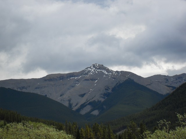
Mt Burke with the old fire lookout barely visible at the top.
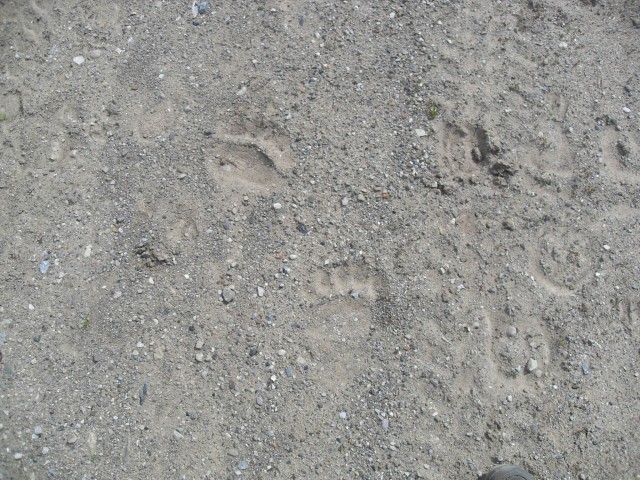
Bear tracks, one set of many we’d see this day.
A close up…
The long boring road.
Wolf tracks.
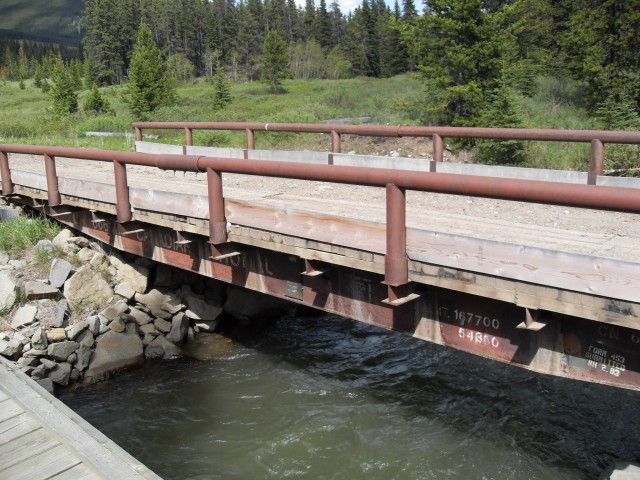
Old railway flat car used as a bridge. Good idea.
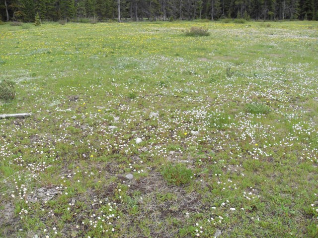
A blanket of flowers.
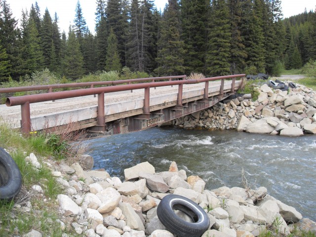
Another flat car bridge. The tires are not random garbage but are used to protect the deck when a cat tracked vehicle goes over it.


The trail is not a old logging road. No wonder you could not imagine a more boring trail – YOU WERE IN THE WRONG AREA. How could you assume, looking at your pictures, you had reached your proper destination?
People use this stuff as a resource. Your dribble and vanity could injure someone. I am aware this was written in 2012 but sheeesh
Okay, not a good troll but we’ll bite. It’s a logging road. Yes it is. Most recently, they did some tree cutting, I understand, not long after our visit. We didn’t really have a destination in mind, it was just walk and go and see what we find. Injured? How? By being bored to death? Not sure we’re talking about the same article.