
Wind Ridge
Having attempted Wind Ridge and failing to summit the week before, we wanted to return to take another stab at it. On the first pass we got turned around due to flood damage in the area and instead of reaching our objective, we wandered around the ridge’s base wondering where we went wrong. Armed with an updated map we had no trouble making our way to the top this time.
Wind Ridge is the treed mass directly south of Dead Man’s Flats. Its forested north facing side in fact looks uninviting, but out of sight the south side is grassy and open, a hiker’s delight. The route up is a mixture of exploration road and trails, some of the latter quite steep. You’ll also pass through several rocky sections, one which requires some unavoidable hands on scrambling.
The lower section of the trail has always been a bit challenging I am told. Wind Ridge is criss-crossed with old coal mine exploration roads where one can easily get lost in. Add to that, recent damage from flooding has obliterated or blocked some of the trail, requiring some off trail bushwhacking through dense forests.
The trail head is just below the old ski hill above Dead Man’s Flats, just south of a quarry. There is ample parking here and in addition to the trail leading to our destination, there are others that head to Centennial Ridge, Pigeon Mountain (we’ve been there) and Skogan Pass. From here the low eastern edge of our ridge can be seen through the trees.
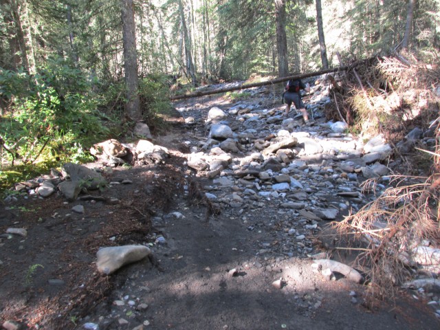
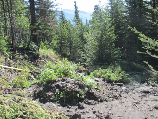
Start at the gate at the south end of the parking lot. Follow the wide trail past the power line and back into the trees. Before long the trail dips down to Pigeon Creek. There used to be a foot bridge here, but due to the June 2013 floods, it’s been washed away and presumably smashed to little bits. The floods also brought lots of broken trees, which you’ll have to carefully negotiate. Aim for the obvious road on the opposite side.
Breaking out of the mess you’ll come to a three way junctions. The left most trail is the official Centennial Ridge route (marked). Also to the left is an old exploration road – avoid it. We’ll head right instead and before long we’ll come to another creek, West Wind Creek, this one also badly chewed up by flooding. Pick your way though the maze of fall trees, wade though the creek, climb up the undercut bank and make you way to the obvious road.
Only a few dozen metres past here you’ll come to a junction. Head left here following an old road, badly messed up by flooding. In fact the road looks more like a creek bed than anything else. In places here you may need to bushwhack into the mossy forest to bypass extensive dead fall.
Eventually the road becomes more recognizable. None the less you’ll still see lots of damage from flooding. There are deep trenches cut by rivulets and many trees block your path. Do your best to bypass them.
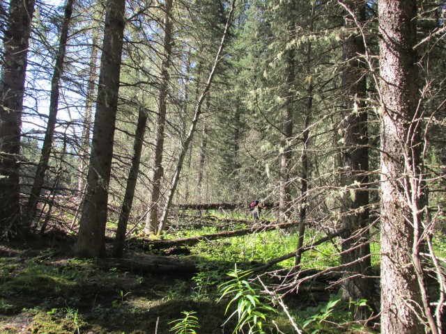
This trail roughly parallels West Wind Creek for a fair distance. Sometimes you can see it, other times not, but you can always hear the water flowing. Along here you’ll pass a number of junctions so be careful. Stay on the tail that is the most obviously well used that also keeps fairly close to the creek without crossing it. Do this and you’ll be fine.
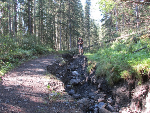
The trail rises and dips gently and there are occasional boggy sections to make things interesting. Eventually the old road makes a sharp right turn and almost immediately heads up, sometimes steeply. Until this point, it has been fairly flat. The going is pleasant and outside of some dead fall and later some mud, fallen trees and debris from a slump where the bank above the road gave way, there is little to slow you down.
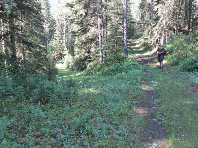
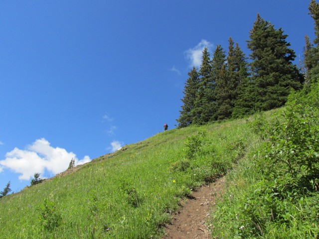
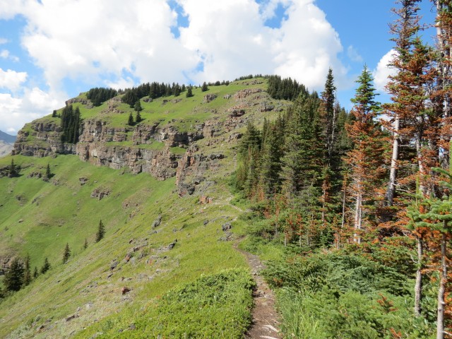
Before long the road levels out briefly and comes to to an important three way junction. Take the obvious route, another old road that doubles back to the left. Hard left. Gaining elevation as it goes, it soon breaks out of the trees, takes a sharp right heading up a steep grassy slope, before abruptly ending. From here on the route reverts to a trail, a strenuous, sometimes brutally steep and unforgiving affair.
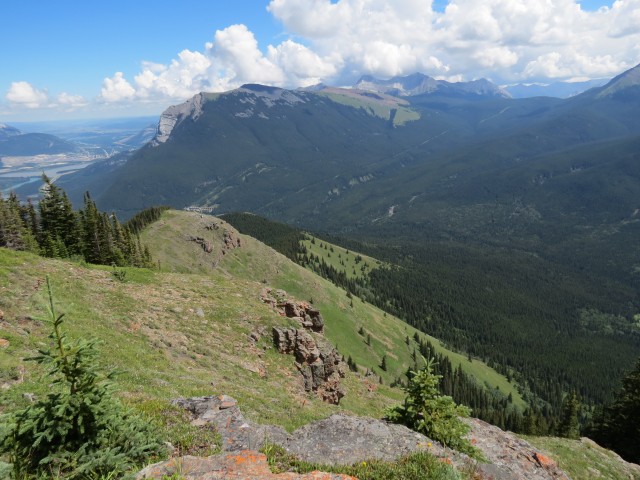
In no time you’ll gain the eastern ridge and from here on will traverse just below it all the way to the top. In the distance the summit appears protected by a number of rock bands, but most can be avoided or bypassed, except for one, which requires some hands on scrambling. The views here are stunning and they only get better as you gain elevation.
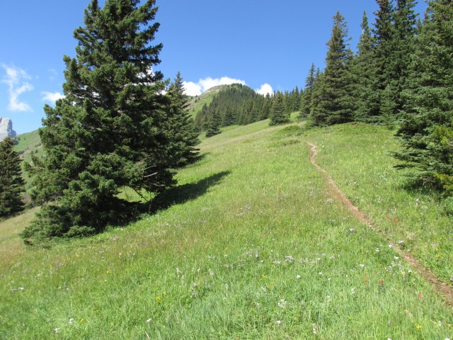
Heading up, the trail passes through flowery meadows before finally coming to the base of a cliff. One has two choices here, you can tackle the rocks head on – there are many ledges and lots of hand holds – but it is somewhat exposed. Or you can head right eventually making your way up a steep and loose trail in the trees. It’s still a hands on by this second route, but it’s less airy and less scary. In fact I found it a bit nerving coming down – one slip and I’d have been in big trouble. Either route can be considered the crux of the trip, a minor crux at that but one none the less. Otherwise the rest of the trip is just a hike.
And speaking of slipping, given how steep the trail is in places, it’s best done in dry conditions only.
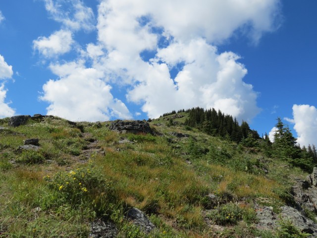
At the top of this first cliff band you break out of the trees only to see that the summit is still a way off. The trail passes though some more rocky sections to get there, all of them easily conquered and before long you’ll be at the summit.
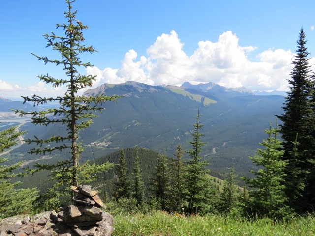
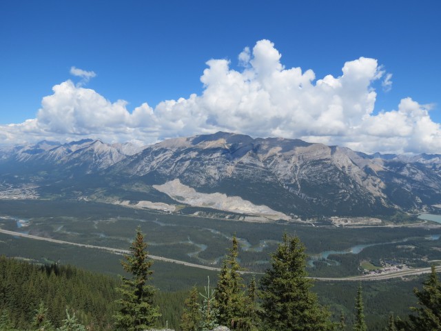
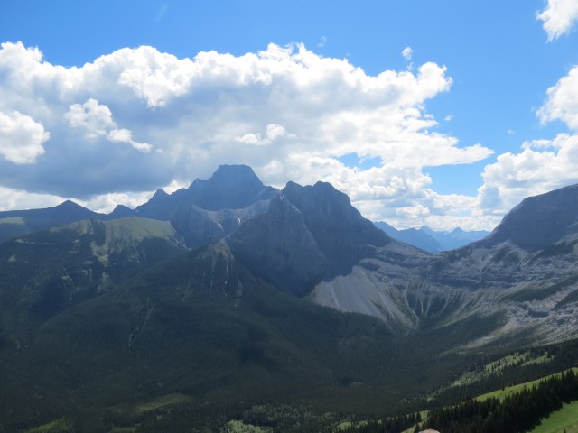
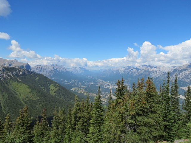
The scenery here is amazing and in the west one can see Canmore far below. To the north, the Bow River, the CPR mainline, and the Trans Canada Highway can be seen. Above them is Grotto Mountain whose flanks are scarred by quarrying. Other mining scars (limestone to make cement), can be seen to the north east. Directly east is the gently sloped Pigeon Mountain.
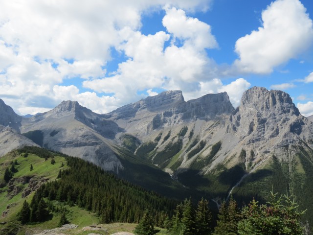
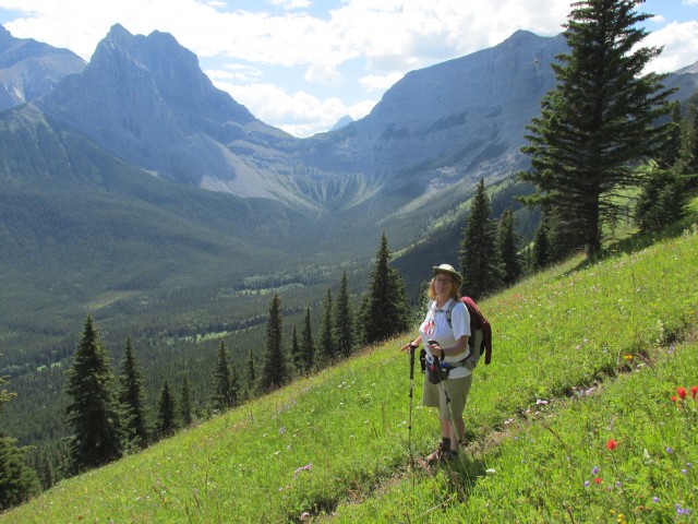
The best views from Wind Ridge however are to the south. There is a lovely forested valley below surrounded by a number of impressive peaks. Mount Lougheed dominates the view, it’s the tallest mountain in the area. Right beside it is Windtower, another mountain we’ve been up. From this angle it looks like it’d be impossible to summit it, what with all those cliffs and drop offs, but on the far side unseen is an easily sloped ridge that leads to the summit. Further right is Rimwall and the Three Sisters. There are lots of other mountains too, far too many to list here.
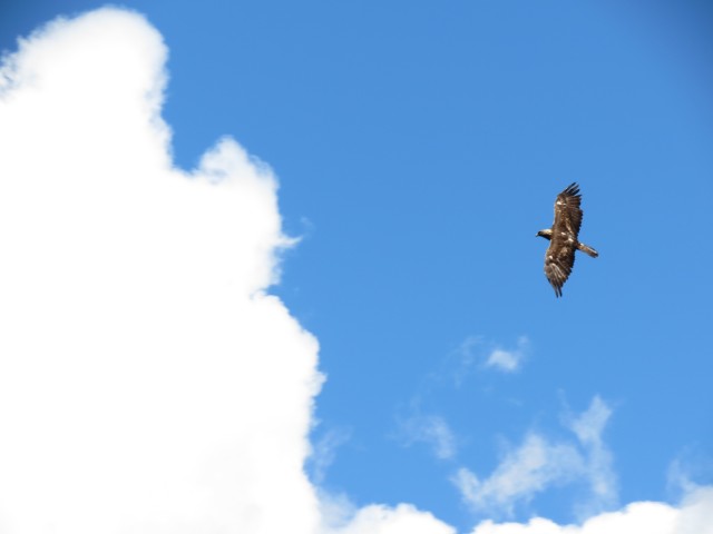
Near the summit we managed to find a Marmot sunning itself on the rocks. We also surprises a huge Golden Eagle who was perched on a rock at the summit. It stared back at us but flew away before we could get the camera focused. It circled overhead for a few minutes so we did get some pictures of it.
Also flying about, noisily, were an endless stream of tourist helicopters. It was a peaceful hike otherwise.
After half an hour at the top we reluctantly headed down. This the part we hate, leaving a gorgeous setting like this behind. We only saw three other people on this trail, a pair of hikers and one biker who was riding on the lower exploration roads.
Connie managed to find three four leaf clovers this trip, a record for her.
Wind Ridge and the mountains that surround it, appear prominently in the mid 1980s Pink Floyd music video Leaning to Fly. Watch it and you’ll recognize some of what you’ve seen here.
As mentioned, a company (Canmore Mines?) once looked for coal on this ridge. Since no mines were established here I assume the search was unsuccessful. However, I am researching this more to find out the facts. The road they left behind sure do make great hiking trails.
To see some other ridges we’ve summited, follow these links…
Windy Point Ridge.
One Mine Ridge.
Mist Ridge.
If you wish more information on this route, by all means contact us!
Date of adventure: August, 2013.
Location: Kananaskis near Dead Man’s Flats
Distance: 14km round trip.
Height gain from start: 805m.
Height gain cumulative: 850m.
NOTE: all heights and distances are approximate.
Reference: Kananaskis Trail Guides by the Dafferns.
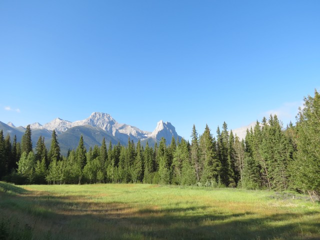
Mt Lougheed & Windtower from the trail head.
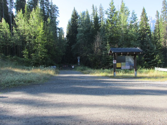
The trail starts at the south ending of the parking lot.
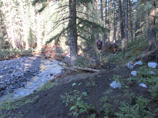
Flood damaged Pigeon Creek.
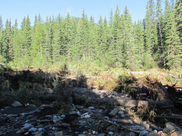
An even messier West Wind Creek.
The trail here is horrible, an old exploration road churned up by flooding.
Large areas of dead fall meant we had to bushwhack at times.
The road has been badly messed up by heavy rains.
Avoid any side roads like this – there are a lot of them on the lower sections.
A large slump where a section of the bank gave way.
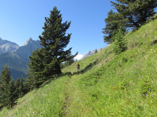
We break out of the trees and onto some grassy slopes.
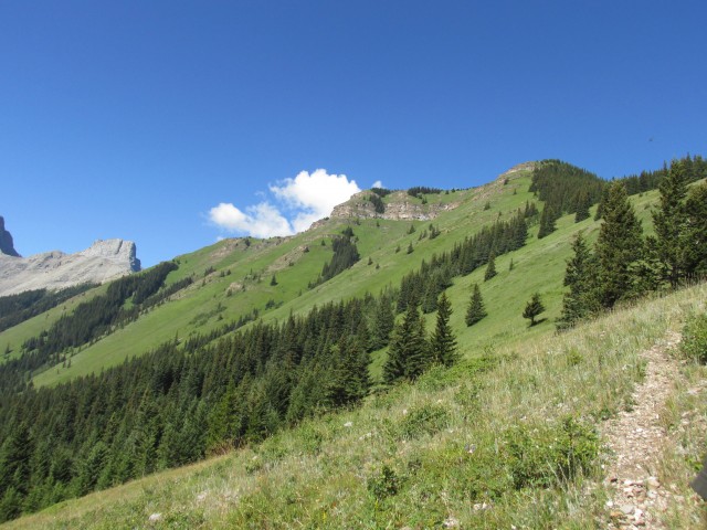
The summit far in the distance.
The upper trail is either steep or brutally steep.
One of the steepest sections.
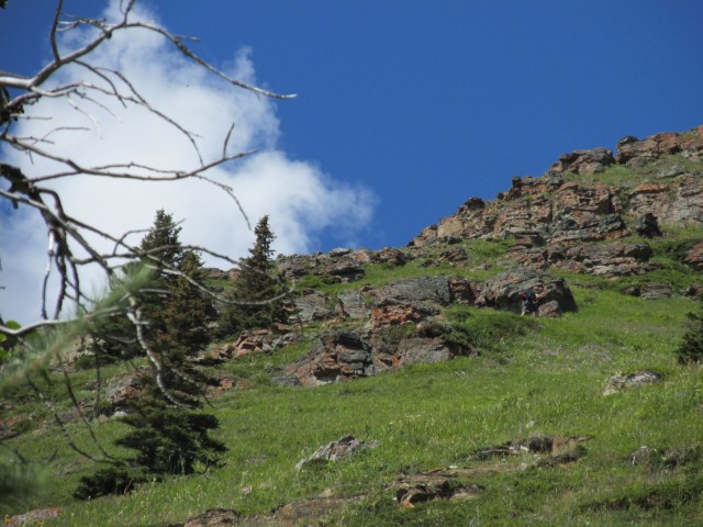
I make my way through a cliff band (middle right).
Pigeon Mountain in back.
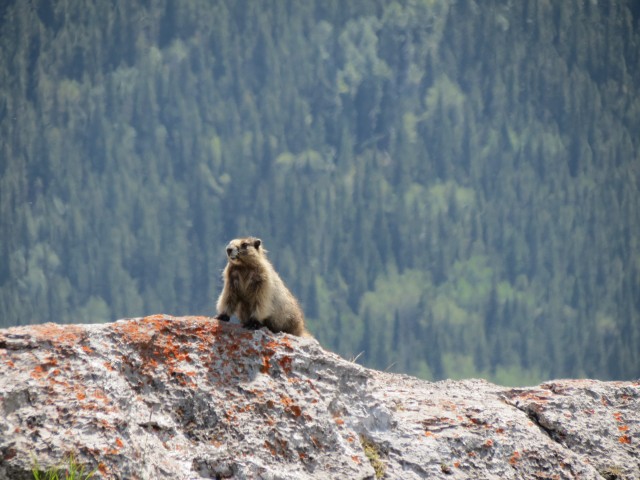
This Hoary Marmot took great interest in us.
The final approach is via the rock bands just left of the trees.
Grotto Mountain with huge mining scars on its flanks.
One final steep push.
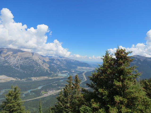
The view east down the Bow River valley.
Looking back at the ridge we came up.
We scared off this Golden Eagle. which was perched on a rock at the summit.
The Three Sisters.
Mount Lougheed, the taller one, and Windtower in front.
The town of Canmore in the west.
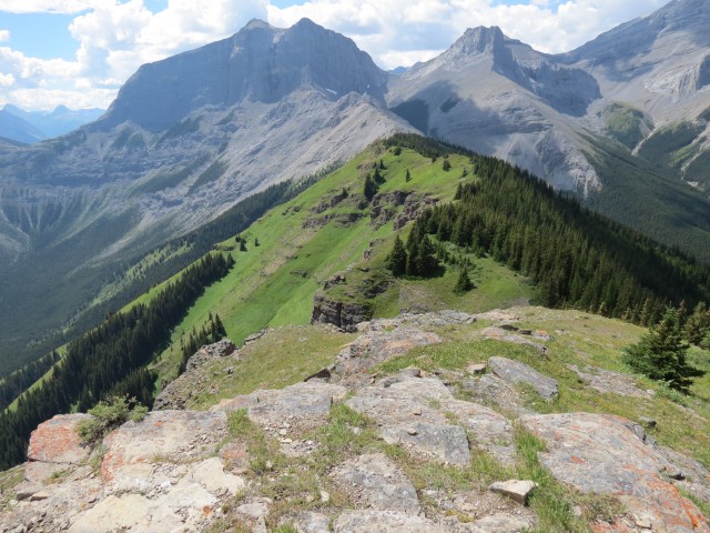
Rimwall on the left. Wind Ridge connects to it.
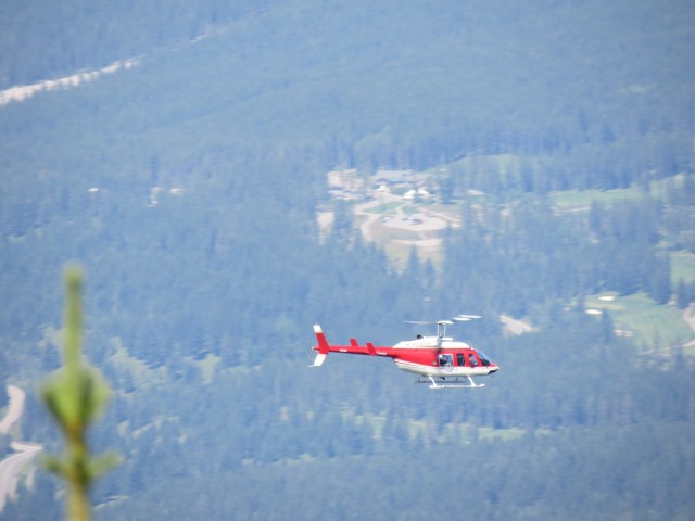
Every ten or twenty minutes a noisy tourist helicopter would fly by.
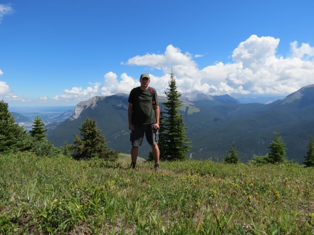
Your’s truly on the summit.
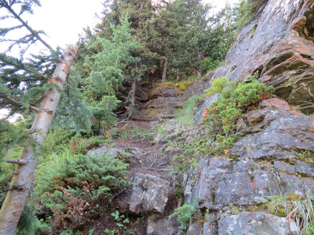
The crux is a loose and steep trail though a cliff band.
On the way down we pass through many flowery meadows.
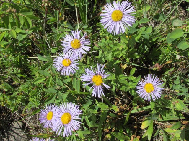
Fleabane was one of the more common flowers spotted.
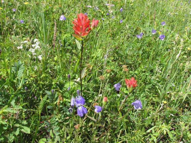
Indian Paintbrush and Harebell.
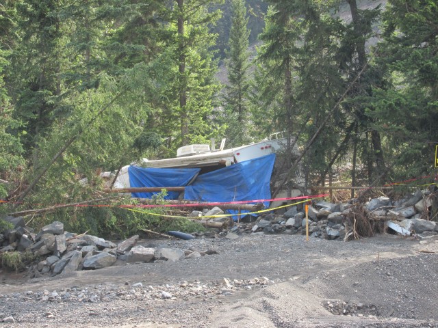
On the way out we see flood damage at the quarry including this smashed up trailer.
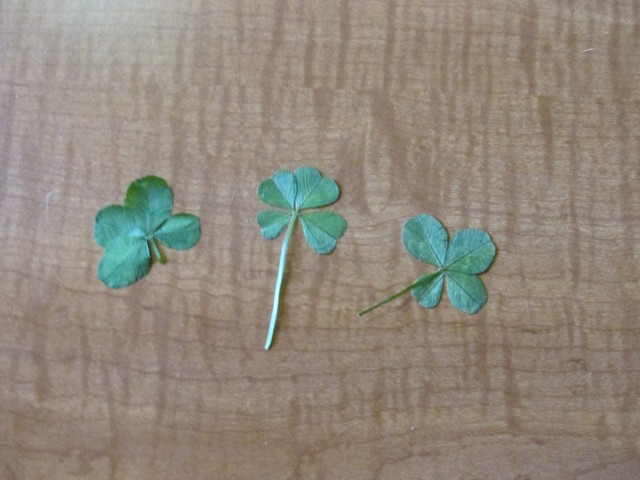
Connie finds not one, but three four leaf clovers on this trip. Wow!


")


I need to get myself to Canada.
It is a magical place. We are so lucky to live where we do.
Looks like a great hike.
A fantastic one! Thanks for commenting.
Pink Floyd’s video for “Learning to Fly” was filmed on the West Wind Ridge. Definitely a place I’d like to visit.
It’s a wonderful ridge walk, highly recommended.
Pink Floyd’s video was inspiration for this post…
https://www.bigdoer.com/10581/then-and-now/pink-floyds-learning-to-fly-mountain-scenes/
Superb! How could your day get any better?!!!
wow! watta hike!! love it…… I haven’t wandered in that neck of the woods, yet…..
It’s now one of my favourites.
Wow, that looks like one great hike!
It is, try it!
Wind Ridge is an awesome hike. I haven’t been there since 2010. The one rock band is likely a little too much for the dog and it seems like such a shame to go without him.
This is my favourite hike so far this year.
If you have the energy you can follow the ridge west, to the base of Rimwall (I believe). The views are amazing from that angle, not that there are any bad views from Wind Ridge.
I saw the trail from above but lacked the energy to do it, this time anyway.
Three four leaved clovers. Amazing find!
Connie is something else. It’s not like she goes looking for them, she just sees them while walking.
The cliff band route you show must be fairly new. On my last visit to Wind Ridge a few years back I took the usual route up, which was none too fun and it was a little too exposed for my liking. The path you took looks as challenging but at least it’s in the trees.
The earliest references to this bypass route I could find are only a couple years old, so yes it’s pretty new. I am certain it will see more use over time.
An awesome hike with some breathtaking scenery! 🙂 One of my favourites. Love those green slopes! I last did this trip in 2010 but your report has insured me to revisit it.
I loved this hike!
Nice, I have got to start following you around!
Any time!