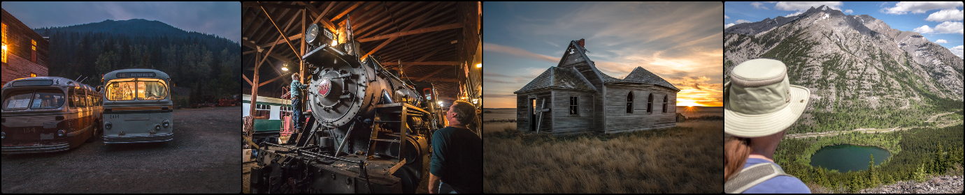
Stoney Trail, a hellish journey
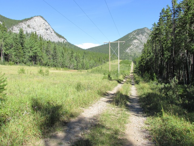
Stoney Trail in Kananaskis is a good choice for those who crave a nice, easy mountain bike ride – fun, nothing hardcore or overly taxing. Even though the route follows a power line right of way, it’s still pretty scenic. There are no major hills to worry about and normally it’s simply a pleasant outing.
Except for this year!
Things have changed and the trail has been made awful due to flood damage and the resultant construction that’s taking place to repair the power line access road, aka Stoney Trail, our route. It was a mess and this ride was no fun at all.
With the torrential rainfall that happened in June of this year, the trail sustained major damage. Creeks overflowed their banks taking large chunks of the road with them, banks collapsed, and fast flowing water cut deep trenches along the entire route. Add to that, the trail was heavily overgrown in places, no doubt due to all that wet weather we experienced earlier in the year. These all conspired to make travel difficult.
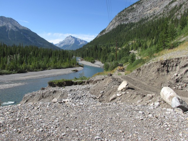
By far the biggest challenge was the mess from the construction taking place to repair the damage. Large dozers and excavators were hard at work along the path and where they travelled, they left long sections of softened road, Just pedalling took all my energy. In other places, several kilometre long sections were chewed up by their tracks – an endless bone-shaking rumble strip. I tried to ride in the grasses on the side, but they were too deep and thick. A no win situation.
It was a long, dusty, nightmare and I had to walk the bike in places. Many times in fact.
Don’t get me wrong, the work has to be done and I choose the trail knowing very well it might be difficult in places. I just didn’t realize it’d be that difficult. Given a year or two, I am sure the route will compact and will return to its former pleasant self.
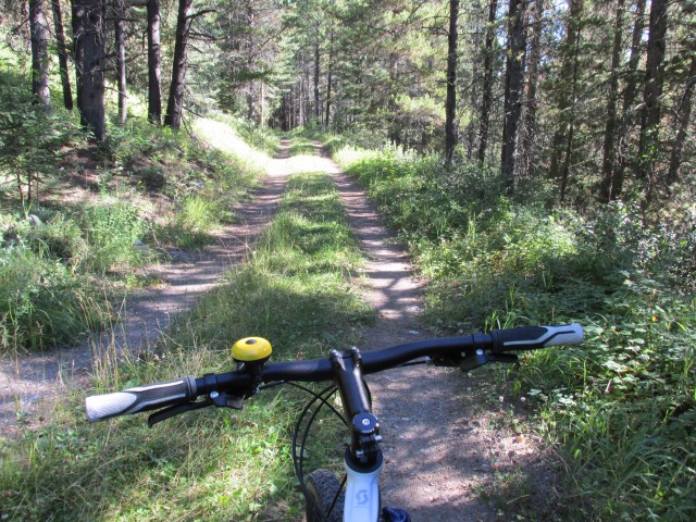
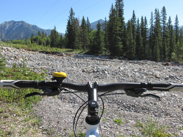
For this trip, I choose to ride (solo) the trail from the Nakiska Ski Hill to Jewel Bay and back, a roughly 28km round trip. Starting out the trail here is wide and well drained and shows only minor damage from the flooding. Even so there is some work being done, as nothing escaped totally unscathed. At a power station the road turns into a less travelled double track and here’s where the riding becomes more of a challenge. The water has cut some deep trenches in the road here, but they are not easy to see due to the heavy undergrowth crowding the trail. I fall into a few of them – thank goodness for shocks.
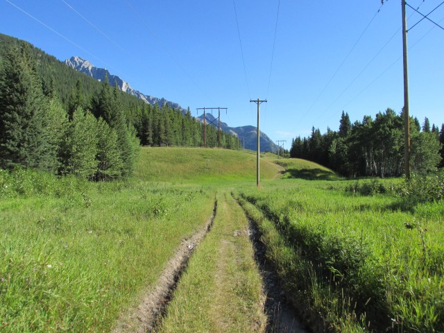
The trail gently undulates here – actually the whole route is like this – and for a time we dip down below the power lines, passing above a large beaver pond. In the cool shady trees (30 degree this day), this is one of the only pleasant sections of the trail, untouched by rushing waters and machinery and devoid of undergrowth.
Before long we’re back on a rough section of the trail and soon we’ll cross our first washout. The creek cut a wide swath, but it was easy to pick my way across. At one point juts beyond here, a faint side trails heads towards Mt Lorette (a moderate scramble) and here I find a memorial: Chris P. Lynn, 1966 – 2007.
Heading back into the trees, the trails drops down sharply for a short distance before levelling out. This section was also relatively untouched by the water.
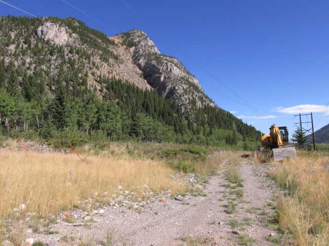
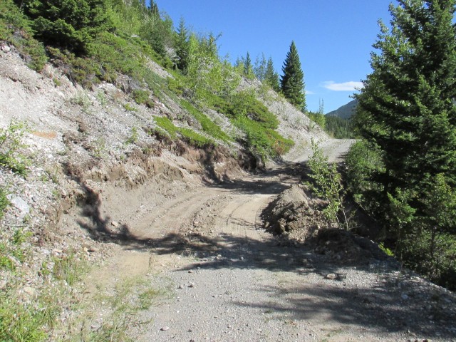
Back under the lines, just beyond is a another wash out, this one more extensive and hard to cross. It and the earlier one mentioned, will be “fixed” by the time I return and shortly I started encountering various types of heavy equipment working along the trail. I run into a fellow in a truck here and he radios all the operators to alert them I’m coming. This trail by the way is a power line access road first and an official Kananaskis trail second – none the less the dozer and excavator drivers were courteous on passing.
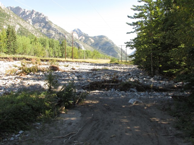
Heading up a bit we parallel the Kananaskis River here. The trees open up in places and we can see across the valley. The scars from flood damaged Wasootch Creek are incredible. Normally a trickle, or even totally dry, for a few days in June it was a torrent and the mess we see is from that event.
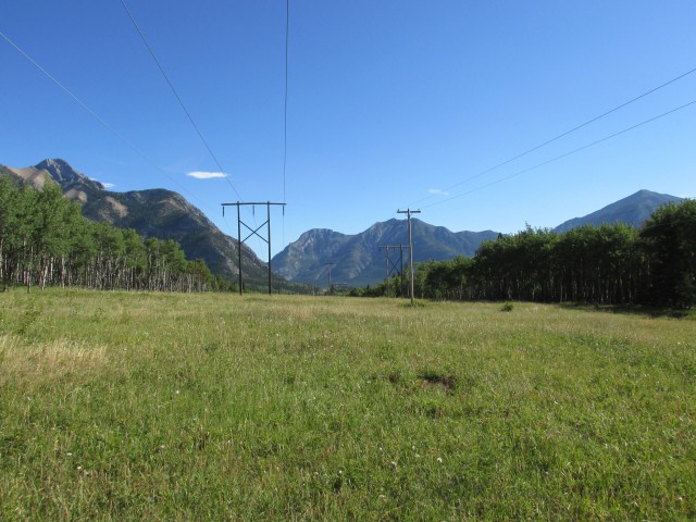
Also seen at this point are some of the mountains that surround us. To the west of the trail is Mt Lorette and Mary Barclay’s Mountain. To our north is McConnell Ridge (connected to Yates Mountain), which is home of the Barrier Lake Lookout, a place we’ve visited before.
To the east is an endless sea of peaks, including Baldy Mountain, Wasootch Peak and far too many others to mention. Diminutive in comparison is Wasootch Ridge, another place we’ve hiked up. It’s a green bump here, but as you travel up it, it opens up and gains more elevation. To the south, Mount Kidd is one of the more prominent peaks.
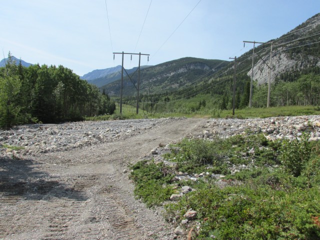
Passing more machinery, the trail becomes more difficult here. At a huge washout a large cat was pushing around boulders like they were toys and I had to wait for him to finish before I could continue. The trail traverses a steep hillside here, which is where most of the serious damage happened. The next couple kilometres are soft from the cat-treads, making travel very, very difficult. I thought of turning back here, but didn’t for some crazy reason.
Dropping down, it’s back into the heavy grass and undergrowth and water carved trenches – I can’t win. At this point we are at the south end of Barrier Lake, a man made reservoir. On another hill, there is another washout and another machine working. And more soft trail. It’s hard going.
Heading down now, gently, in no time I am at my goal, Jewel Bay. It’s a lovely spot, with deep green waters with a rocky shoreline, rimed with trees. There is a nice back country campground here which you can bike, hike, horseback ride or even kayak into. You can’t drive here though.
I find a nice shaded spot to enjoy my lunch, dreading the thought of riding back.
Reluctantly I have to go, retracing my unpleasant steps. On the way back, the cat has made its way further south, meaning even more soft and rough spots than on the trip in. A helicopter is seen buzzing around and it’s being used to transport the crews from spot to spot.
Last year, this route was fine, and I am sure next year it’ll get packed down and be more rideable then. This year however, it’s awful and I would not recommend it. I question why I chose it in the first place – but every trail is Kananaskis is a gamble after this year’s floods.
At times, I thought of abandoning my ride, but given my stubborn self, that wasn’t going to happen. Instead I took time to curse my very existence and every Deity I could think of. I am glad Connie did not come – I’d be sleeping in the doghouse for sure.
This Stoney Trail is not to be confused with a similarly named road in Calgary. While the trail I travelled was indeed rocky in places, it was not named for that and instead it was in reference to a local Indian tribe, the Nakodas, who were called the Stoneys by early settlers.
In 2011 I made an attempt on Wasootch Peak, mentioned in this post, and to see that report, click the link below…
Wasootch Peak (attempt).
We’ve hiked other parts of Stoney Trail and so see that report, refer to this link…
Stoney Trail – Marilyn Monroe combo.
If you wish more information on this trail, by all means contact us!
Date of adventure: August, 2013.
Location: Nakiska – Barrier Lake area, Kananaskis.
Distance: 28km return.
Height gain cumulative: 120m.
NOTE: all heights and distances are approximate.
Reference: Kananaskis Trail Guides by the Dafferns.
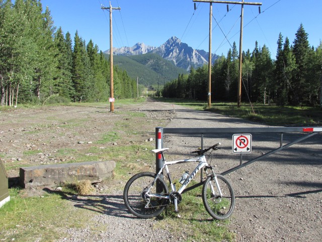
The start of the trail just below the Nakiska ski hill.
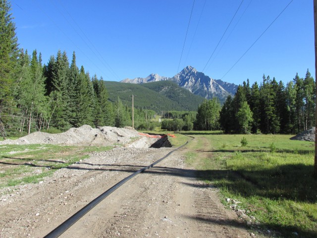
Some work being done on the trail (a common theme this day).
The water cut deep trenches on the road – it was rough.
A pleasant section of the trail.
Some serious flood damage.
Directly ahead, Mt Baldy.
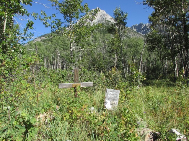
A memorial on the trail. Mt Lorette in back.
Another area washed out.
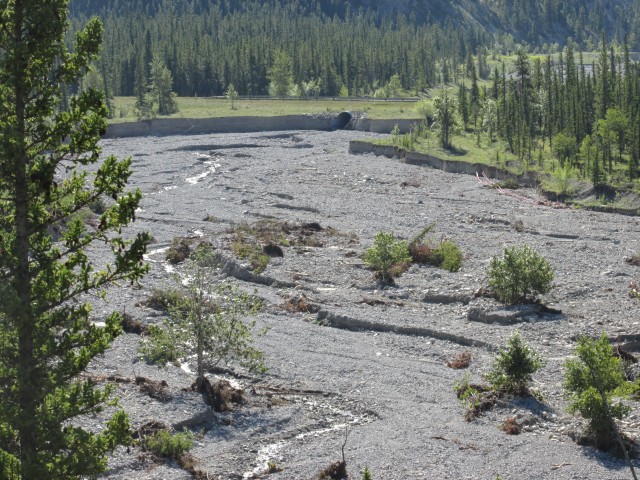
Looking across to Wasootch Creek, normally a trickle, but for a couple days in June it was a torrent.
Machinery on the trail – Mary Barclay’s Mountain in behind.
One of many repaired sections on the trail.
A large cat at work. Mt Kidd in the centre.
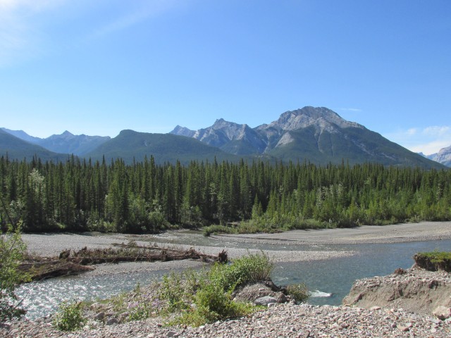
Looking east with the Kananskis River in front.
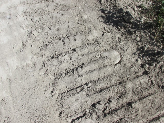
This pretty much summarizes it all – a soft sand-like road and rough machinery tracks. Not bike friendly!
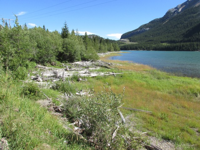
Arriving at Barrier Lake.
Almost at my destination…
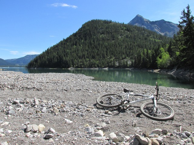
A tired steed at Jewel Bay.
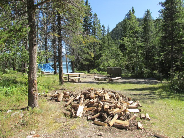
Jewel Bay campground.
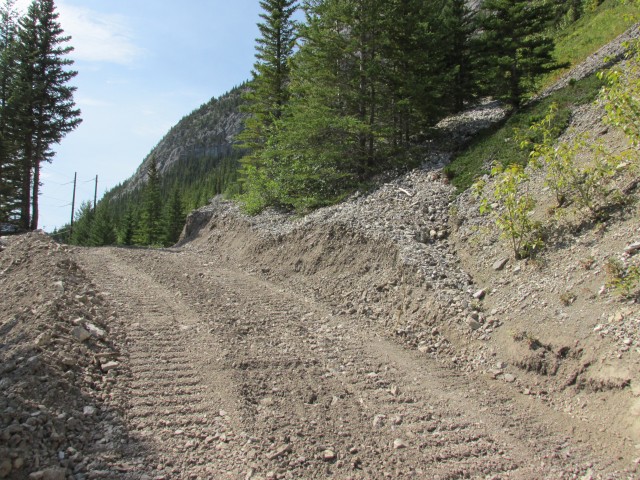
More signs of work being done. The road was so soft as to be almost unrideable.
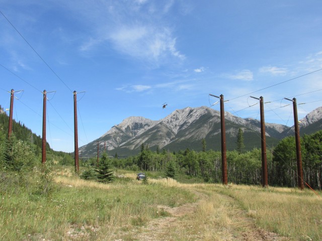
The helicopter seen was used to ferry around the equipment operators.
One of the washouts seen earlier, after repairs.


")

")


Cycled it last week and the track has been packed down nicely so the riding was easy.
Nice to hear conditions have improved!
It’s been a long time since I visited your blog. I am happy to be back. I love the scenery, what a nice bike ride.
Jalpie from Italy
Welcome back! The scenery is nice but the ride was tough.
Unbelievable! This was one of favourite bike trips, but given what you’ve shown us, we’ll avoid it for a while.
Sadly, I think it is a wash this year. Too soft and loose from all the machinery. Once it gets packed down, which may take some time, it should be back to being fine.