
Headwall Lakes
This amazing day has us visiting the Headwall Lakes in Kananaskis, two lovely green pools nestled is a steep-walled valley, surrounded by grey and barren limestone peaks. Along the way we’ll hike easy logging roads, we’ll make your way across scree slopes and we’ll climb steep trails, all to get to this wonderful destination.
This hike heads into one of the most stunning valleys in the area. It was recommended to us some time ago, but it took us till now before we could give it a try. There are some minor technical parts, but the views make it all worth while – trust us! These lakes are not only popular with hikers, but with anglers as well, and we saw many of the latter.
Nearly every trail in Kananaskis was affected by the spring 2013 floods and the Headwall Lakes hiking route is no exception. A sign at the starts hints at what’s to come and sure enough bridges are missing and in places stream banks have cut new channels and brought down much debris. All obstacles can be scrambled over or bypassed, but the damage does make route finding sketchy in places.
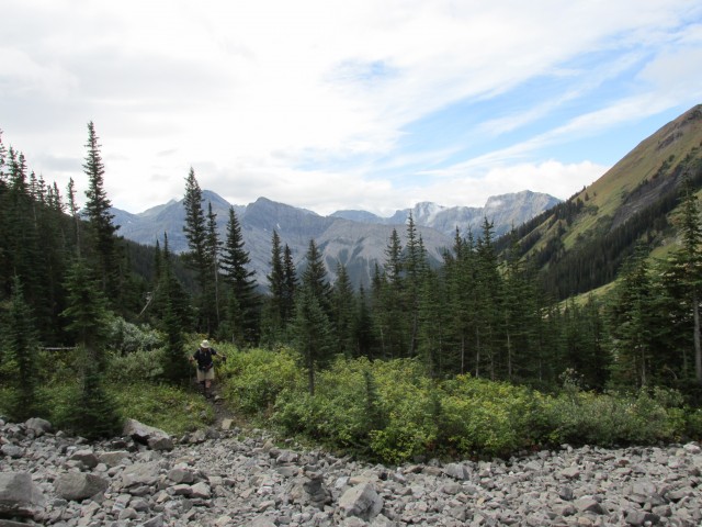
Our trail begins at the Chester Lake parking lot on the Smith Dorrien/Spray Trail. Take the old logging road, marked with snowshoe symbols, heading south. The other route on the north side is the trail to Chester Lake, a wonderful destination in itself.
Heading out, the going is easy as we meander though dense forests. There is one zig-zag early on, and not long after another ex-logging road trail comes in from the right – this a shortcut route, which we won’t recommend – using it requires you to park on the gravel highway which is a bad idea. Dusty cars!
Slowly gaining elevation, in no time we’ll pass a marked T junction. Stay straight here. At another signed junction, perhaps another kilometre on, turn right. Always going up, but always gently, we’ll turn east before passing yet another T junction (stay straight), before finally heading down to a creek. There are some other side roads in this section, a maze of them in fact – it is a old logging area after all – but these are unmarked and generally overgrown, and you can ignore them.
At the creek, Headwall Creek, we’ll see the first evidence of flood damage. The bridge is gone, buried by debris actually, and we’ll have to scramble over some dead trees and boulders to get past it. Turning left, then switch-backing right, then heading up, where the road flattens out we look for a large cairn and flagging. This foot path heading east is the trail we’ll take, leaving the logging road behind.
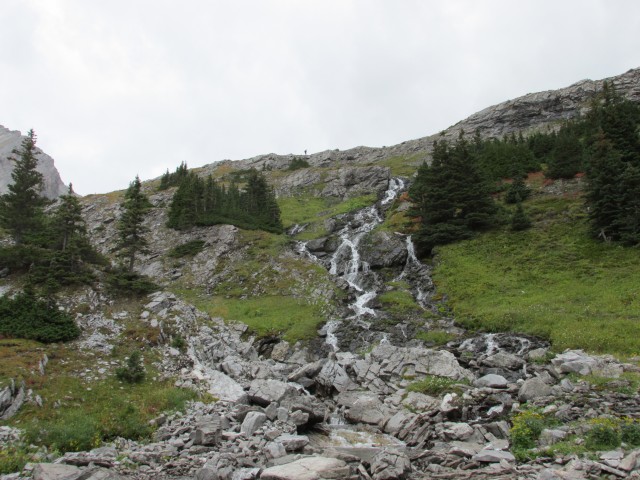
Initially we’re in the trees but before long we’re beside the creek and this is where things can get iffy. Much of the trail here has been obliterated by the floods (new channels, steep-cut banks, lots of fallen trees). There are Inukshuks guiding the way but one still has to be observant. Here we’ll scramble over rocks and dead fall and travel new, and sometimes slippery, bypass trails travelling through thick underbrush and dense wooded areas. Paying attention is important and it’d be easy to get off track. The flood damage from this minor little stream is simply amazing.
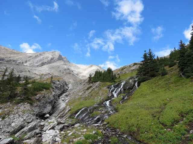
Before long, we break out of the woods near the base of a large scree slope and we make our way around it by going left.
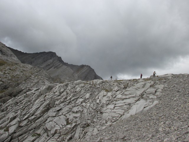
Ahead of us is the first of many headwalls we’ll have to negotiate this day, this one the toughest. The trail makes its way into the scrub trees and then heads up very steeply. The going is challenging, sometimes loose, further aggravated by rocks and boulders brought down by the floods mentioned earlier. Other times the going is slippery, Take care, as a trip or fall would be disastrous.
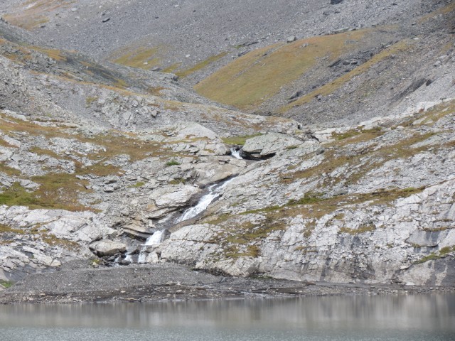
Topping out here, in quick succession there is a short flat section, then another good sized headwall to gain (take the obvious scree path), a flat section, and one more headwall, this one lower. Along here is a side trail overlooking a number of small waterfalls – they are hard to see however even from that angle. The stream in this section is intermittent, sometimes running underground.
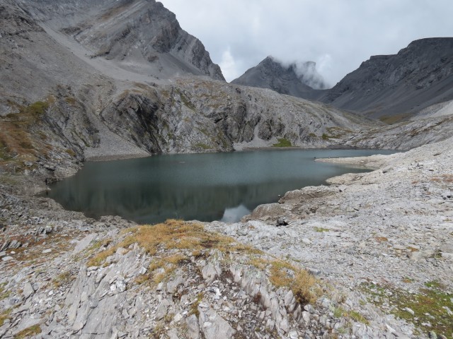
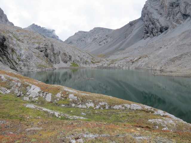
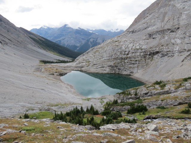
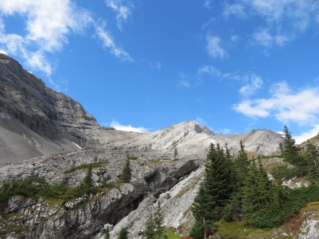
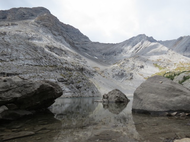
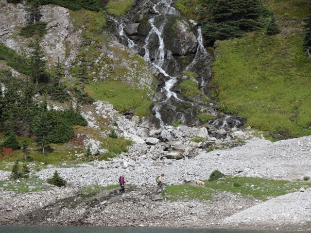
In no time we are at the first or Lower Headwall Lake. The view here, of the deep green lake nestled in a cirque, is amazing. On the opposite side, a cascade tumbling down from the Upper Headwall Lake is equally stunning. All around, barren peaks like Mt Chester loom over us. The limestone here is cracked and fractured and there are deep wide crevices, so if you go off trail, keep these potential dangers in mind.
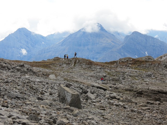
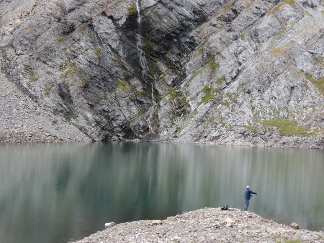
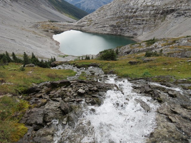
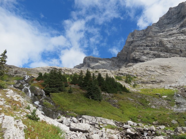
Passing anglers, we make our way around the south side of the lake before tackling one final headwall. Following the obvious path, two thirds of the way, we pass right above a spring, the birthplace of that lovely cascade, which travelled underground to here from the upper lake above us. Limestone, the base rock in the region, is often porous and so springs like this are not unusual.
Reaching the second or Upper Headwall Lake, we are treated to more stupendous views. The mountains tower over us, the waters sparkle, over our shoulder Lower Headwall Lake shimmers in the sun (the clouds broke for a moment). It’s all awe inspiring.
There were a couple more anglers on this lake and one of them told us the fishing on upper lake is far better, even if it is more work, than the lower.
A single solitary tree was found in the Upper Headwall Lake valley, a lonely Larch. Outside of it, scattered grasses were the only other plants to be seen and even they were stunted. This must be a harsh place in winter.
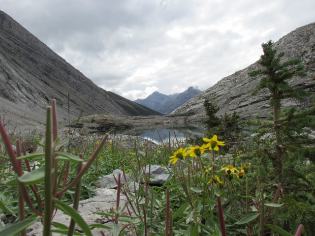
If we wished, we could have headed even east further up the same valley but that sounded like more work than we cared to do. At the its head is The Fortress, a mountain you can scramble up…if you’re ambitious that is.
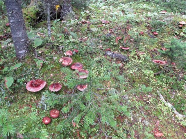
There were many mushrooms to be seen on this trip. I only wish I could identify them – I’ve tried and even have the books, but I just can’t get it.
Most of the day was overcast and rain even fell a time, but for a few precious minutes the clouds parted and we were treated to beautiful blue skies.
The very popular Burstall Pass hiking trail is nearby and it’s one we recommend. It’s stunning too.
Note: Regarding the trails in the lower sections, those on the logging roads – Gillean Daffern’s Kananaskis Trail Guide and other websites makes mention of coloured symbols that help guide the way through the potentially confusing maze of old logging roads. We saw none of them, just the occasional snowshoe symbol. All official junctions were marked with easy to understand maps however.
To see some other flood damage we’ve documented in Kananaskis, check out the link below…
Kananaskis is a mess!
There are a lot of spectacular hiking trails near the Headwall Lakes, and to see another nearby, click below…
Spectacular Buller Pass.
If you wish more information on this trail, by all means contact us!
Date of adventure: September, 2013.
Location: Kananaskis near Spray Lakes.
Distance: 15km round trip.
Height gain maximum: 465m
Height gain cumulative: 520m
Technical bits: The steep trail up the first headwall was loose and slippery.
NOTE: all heights and distances are approximate.
Reference: Kananaskis Trail Guides by the Dafferns.
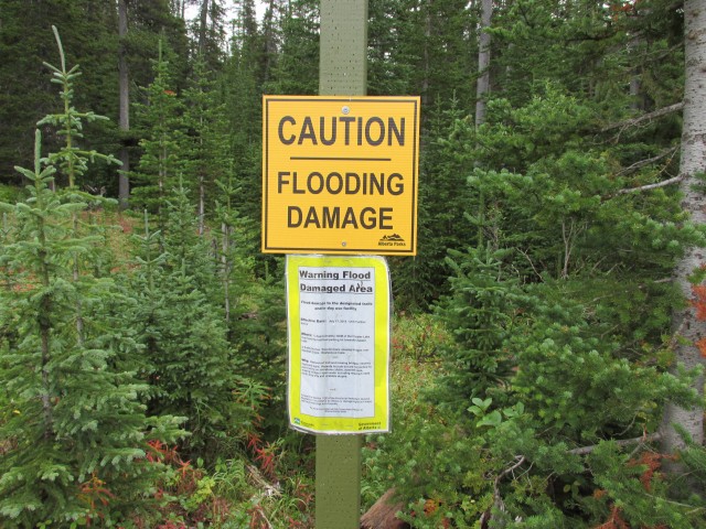
Almost every trail in Kananaskis sustained some sort of flood damage this spring, including this one.
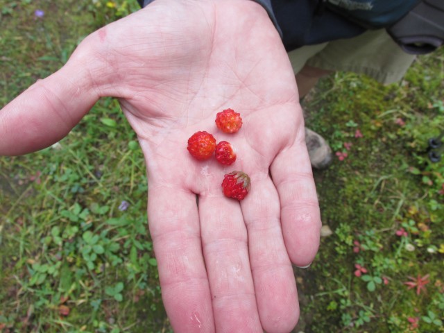
We found lots of wild strawberries.
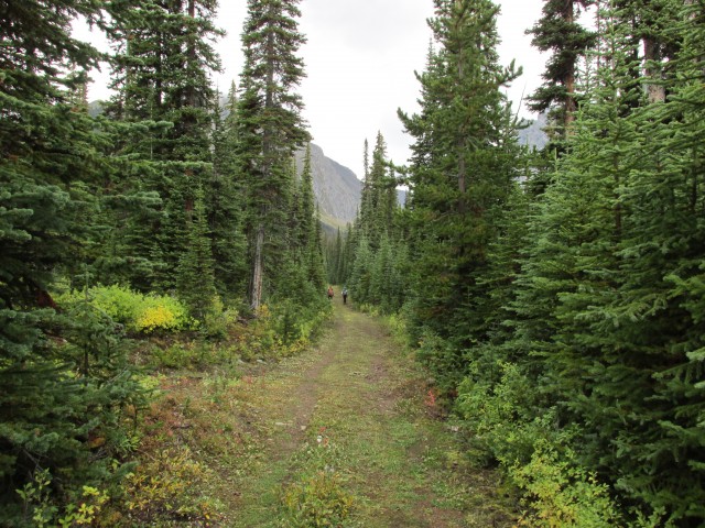
The first section of the trail is an easy stroll along an old logging road.
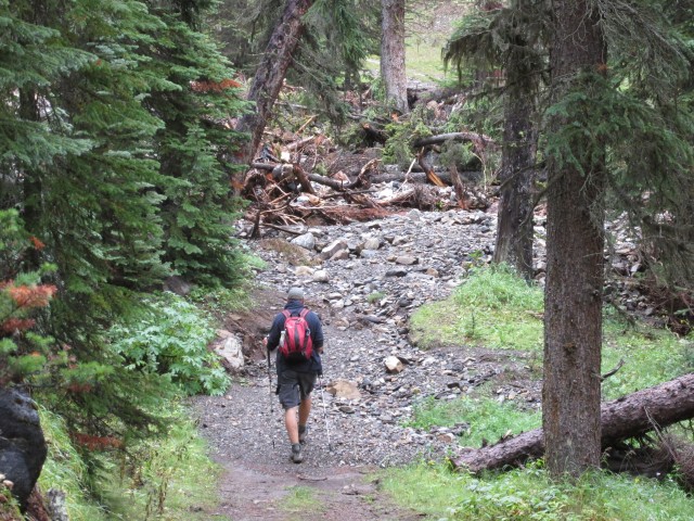
I approach a flood damaged area.
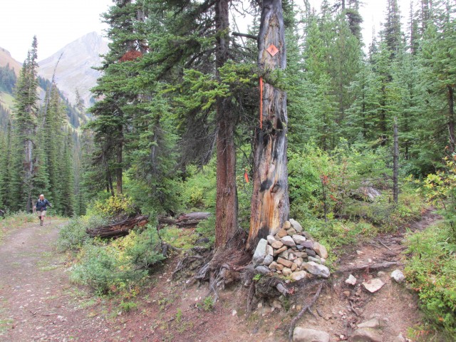
At this cairn take the single track (right) heading east.
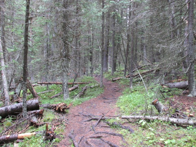
The trail meanders through dense forests.
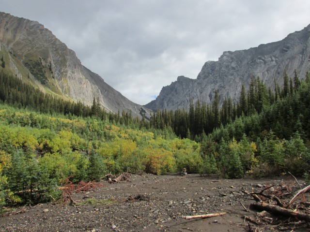
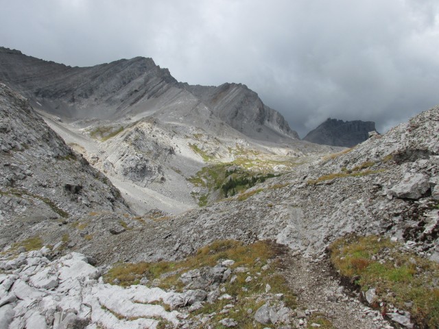
Our goal is the mountain rimmed valley ahead.
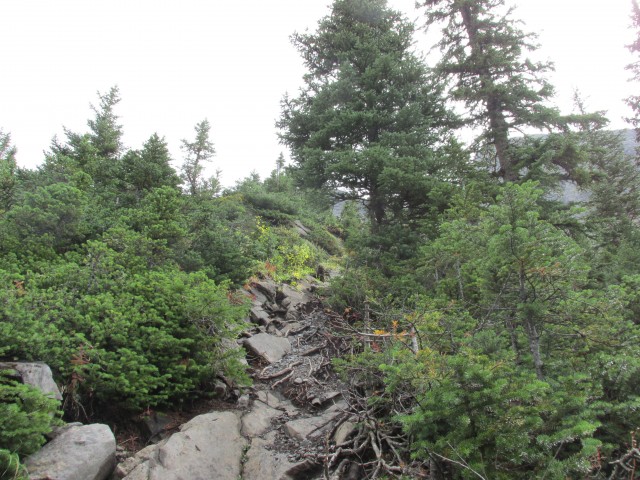
This steep section was a bit of a challenge – it was slippery and loose in places.
Looking back at the valley we came up.
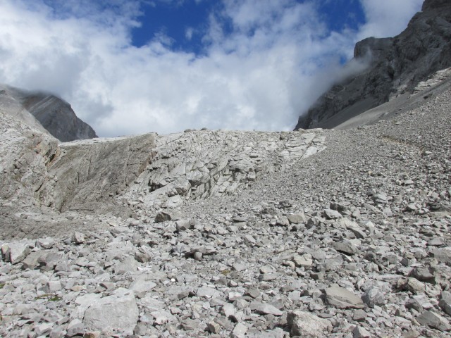
Heading up the scree.
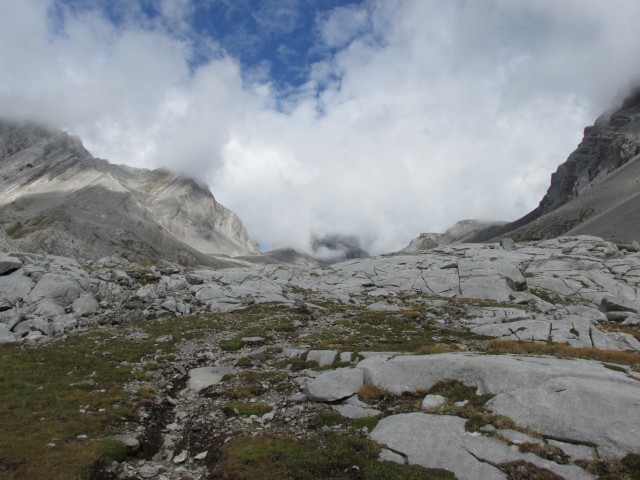
A nice view awaits us over this rise.
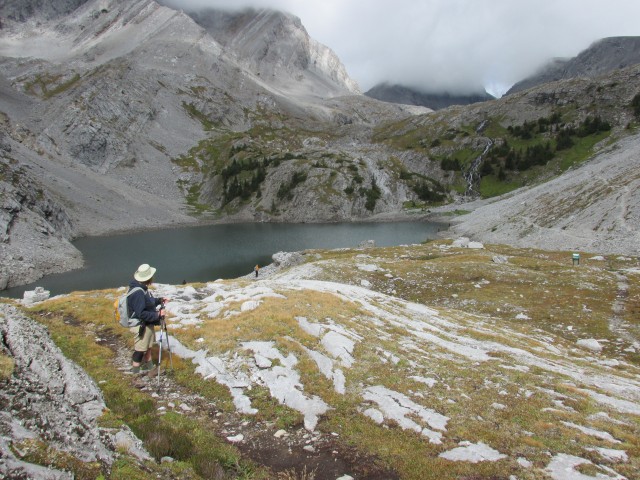
The first or lower Headwall Lake. Stunning!
The cascade tumbling down from above. You can spot me just above them.
The second or Upper Headwall lake, no less gorgeous than the first.
More hikers come in behind us.
I can’t think of a more beautiful fishing spot.
A stream empties into the upper lake.
Note the solitary angler. the same one as in a previous picture, on the right.
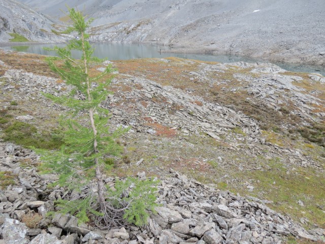
A single Larch in the upper valley.
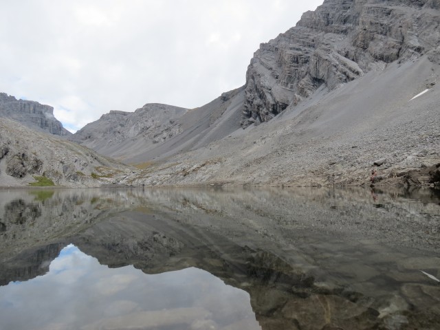
The water was clear as glass.
Peering over our shoulder, the lower lake is a lovely green.
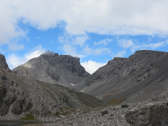
If you wish you can travel even further up the valley but we turned around here. The Fortress just left of centre.
The view down at the top of the cascades.
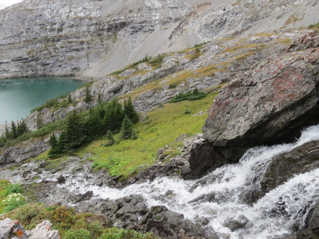
The water emerges here from an underground channel.
The sky was a dull grey all day, except for a five minute break when it was this glorious blue.
Note the large cracks in the rock. What a view!
It’s a stunning place.
Looking west.
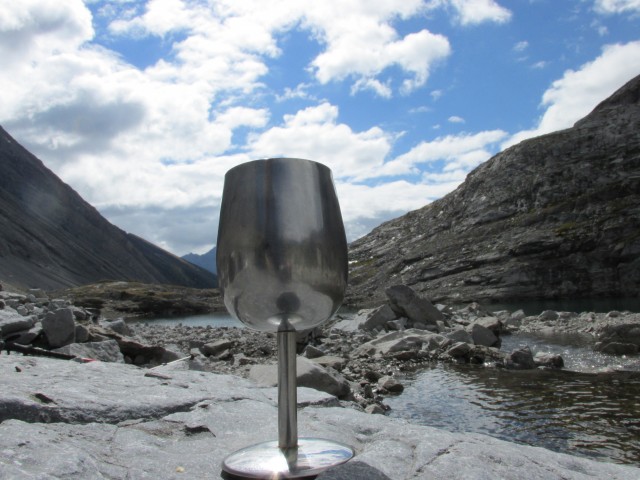
Those who read this blog know we always bring wine on a hike.
With a view like this who wants to leave?
Looking back as we head out.
Mt Chester above (left).
Connie and some other hikers on the headwall.
Mushrooms everywhere.


Love your page – I consult it fairly regularly! (Please keep posting!!)
Thank you for the kind words – we’ll keep trying as long as we can.
Nice shots. Beautiful!
Thank nature, she did a great job here!
Sounds interesting for sure .. how do I join in with the fun? and when is this?
Send us a private email if you’d like to join in on an adventure. We always welcome good company!
You take such beautiful photos!
Thank you, I don’t think they’re that great but we sure have fun taking them.
I’m speechless!
A demanding but very rewarding hike. I was there one year earlier with a hiking group I go out with. We stopped at the lower lake (time limit).
Visiting the upper lake is worth it. You can even go further if you like. What looks to be an easy to travel and open valley heads up from there.
Please summer, hurry up and get here!!!
Amen to that!
A great report and it really looks like you enjoyed yourselves.
We sure did!
Wow! Thanks for sharing! I’m adding all those photos to my dream list!
It’s a nice place isn’t it?
Great fishing at both lakes, but the upper one is slightly better. You can even see the schools of fish from the bank.
I was amazed at the number of anglers there. They worked hard for their catch!
Stunning scenery!
We hiked this with 2 kids aged 5yrs and 7yrs. Both managed it on their own, however was a hard day for them. We needed to hold onto their hands while taking in the steep portions of the hike, which were loose and slippery. Both enjoyed it but it was tough going for the little troopers!
Tough kids!
Enjoyed your views of the lakes. We only made it part way up the trail because one of our party was not capable of going further. We turned around part way up the first steep headwall. I really want to finish it sometime.
That’s too bad. Make sure you try again though, it’s a stunning place.
Lovely. The mushrooms I think are called Leccinum and are choice edibles like a Porcini.
I’ve tried my hand at mushroom identification, and simply gave up. For me anyway, it was just too hard and I was always worried about being wrong, which of course you know can be deadly. I’d suggest anyone planning on picking mushrooms like those seen here, check with a mushroom expert first before eating them.
An outstanding trail with spectacular views requiring not a whole lot of effort.
Downside, the lower flats are often wet and mucky, especially in June (especially THIS June).
This is a MUST DO hike for anyone. It is totally worth the time and effort! It is a good idea to bike the first part as it will give you more time to enjoy the high country. It is also best to do this hike in September as you will get to enjoy beautiful fall colors.
Calling it an outstanding hike is almost…well..an understatement!
Amazing views, rewarding hike, but be prepared for a workout. That steep part you mention was difficult for us.
Agree on everything! Connie found that one section hard.