
Burstall Pass
This report represents our third or fourth trip to Burstall Pass. We’ve gone so many times I can’t remember. Even though it is often a busy place – something I’m not really fond of but can live with – we always enjoy our visit and I am certain we’ll return again. It’s just that nice! And this explains why it’s so popular.
The trail head is off the Smith-Dorrien / Spray Lakes road south of Canmore AB or north of Peter Lougheed Provincial Park – you can approach from either direction. No matte what though, the road is a dusty and dirt affair and your car will need a good wash after visiting here. That’s a small price to pay I guess.
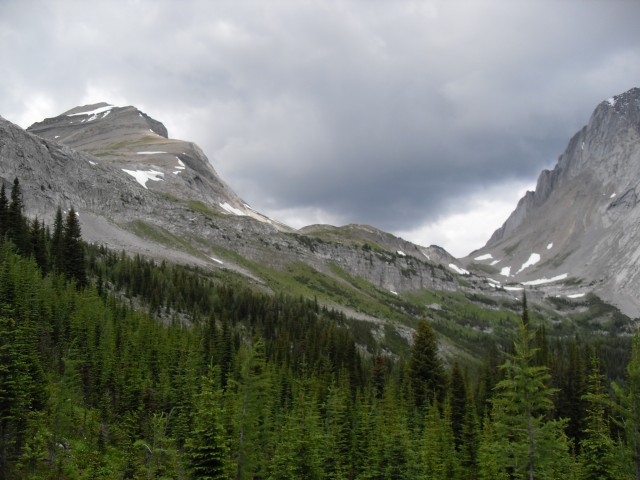
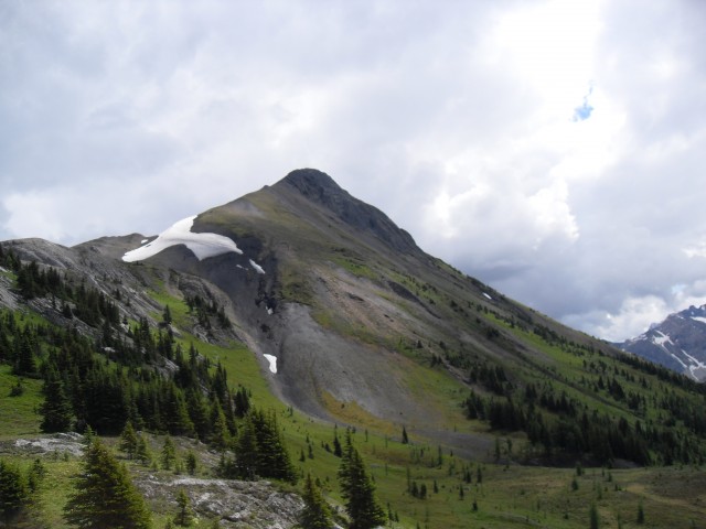
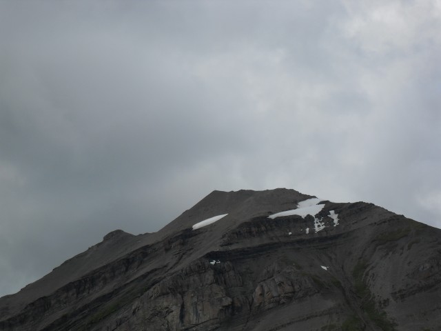
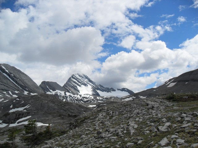
From the Burstall Pass parking area the trail initially follows an old logging road that gains elevation ever so slowly. It undulates a bit but is for the most part almost flat. We pass Mud Lake right at the start and then later the Burstall Lakes further up (all three of them). The later are fed by the Robertson Glacier which comes into view not long after the road ends. This glacier creates its own weather and in summer or winter it’s often blustery in the area around it.
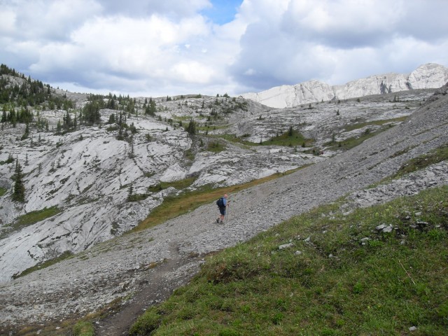
Before reaching the glacier, the logging road ends, becoming a single track. Continuing on, the going is easy and in no time the gravel flats below the glacier come into view. There are many braided streams (bring sandals) and lots of alders blocking the way and route finding can be a challenge. Head roughly west, following the footprints of others. As you get closer to the opposite side, the trail become more distinct.
Into the trees now, we head up a moderately steep section, zigging and zagging a bit, before plateauing into a hanging valley. Once there it’s nice and level for a bit giving everyone a good respite from the climb. Along here you’re in the sub-alpine zone.
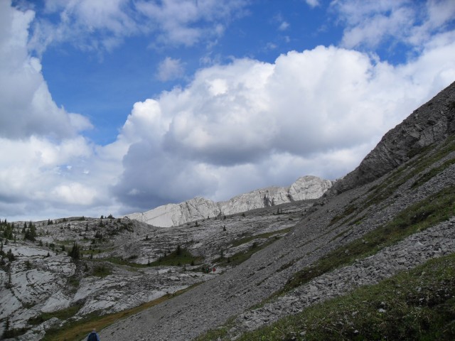
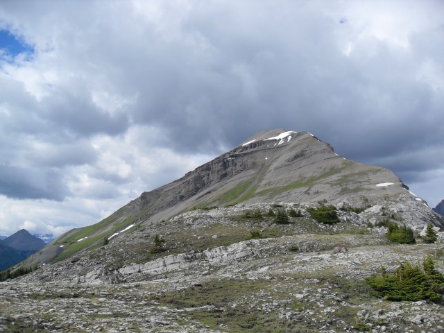
At the valley’s end we head south then there is more up. This is the final push to the pass and shorty after that you break out of the trees and are at your destination. Parts of the trail here are sometimes slippery if wet. The pass is broad and fairly flat and depending on where you stand has many personalities. Sometimes it’s stark and barren, other times an incredible lush green.
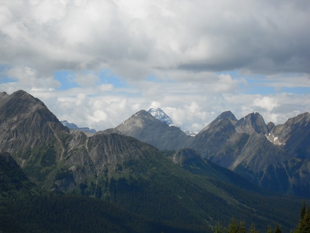
And the views are incredible! In the west Mount Assiniboine at the Alberta/BC border can be clearly seen. It is the tallest mountain in the region and is often compared to the Matterhorn in Switzerland (so I am told). On our visit, it reminded me more of the Sphinx in Egypt. Look close and you’ll see what I mean. Also seen in the west are Mount Leman, Mount Queen Elizabeth and a bunch of others – too many to mention.
Below and to the west is Leman Lake, located in Banff National Park. You can hike-in camp at the lake but it’s a bit work to get to. You have to go up and over Burstall Pass or you can approach it from the north. Neither is an easy task.
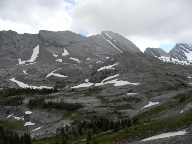
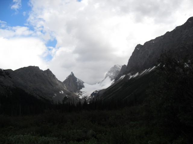
In the east, Mt Birdwood, the oddly named Pig’s Tail (also known as Shark’s Tooth) and Commonwealth Peak line the north valley and in front with its smooth slabs, Whistling Ridge dominates the view. I’ve mistakenly called this ridge Piggy Plus in the past. Yes, that is the name of a mountain, odd as it is, but that one sits one ridge east of here out of view. You can see it on the way out though, to the left of Robertson Glacier.
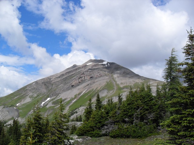
In the north Snow Peak is an easy scramble from the pass, and it begs to be climbed, although we have never done it. Some people were up there and in spite of the height difference (they are 450m higher than us), we could clearly hear them talking. In the south numerous small ridges can be explored and there is a very interesting and large sinkhole at the pass proper. It’s huge and for some odd reason we did not photograph it.
Up here there are only a few scattered and stunted trees and this hints at the bad weather than can come to the pass. We’ve been here during a late fall storm and it was wild with heavy winds and lots of blowing snow. It was almost impossible to see at times.
After soaking it all up and having some lunch, we return the way we came. Leaving is always the hardest part but it’s nice to know we’ll be back.
The area near Mud Lake is often blanketed in strawberry plants and this trip they were ripe. Yummy! But watch out for bears who like them too. Across from the Burstall Pass trail head is the start of the Chester Lake and Headwall Lakes trails. We’ve been both places and they are amazing and wonderful as well.
To see another trip we made up Burstall Pass, click this link…
Winter comes to Burstall Pass.
To see other spectacular hiking trails, go here…
Spectacular Buller Pass.
Grotto Canyon.
Page Lookout – Sherbrooke Lake.
If you wish more information on this trail, by all means contact us!
Date of adventure: August 2008.
Location: Kananaskis, Smith-Dorrien area.
Distance: 16km return. You can go further up various ridges if you wish, or into Banff National park.
Height gain from start: 465m.
Height gain cumulative: 465m.
Technical bits: None.
Notes: None.
Reference: Kananaskis Trail Guides by the Dafferns.
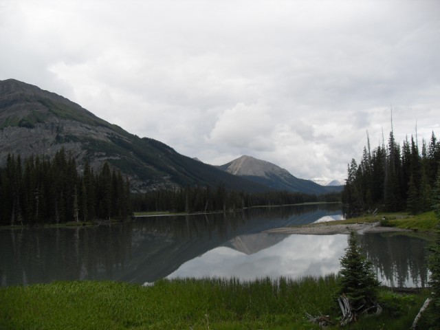
Mud Lake near the start of the Burstall Pass trail.
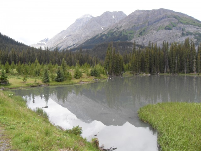
Looking west up the valley we’ll be visiting.
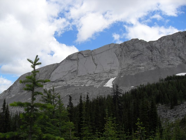
Smooth slabs on the west side of the Whistling Ridge.
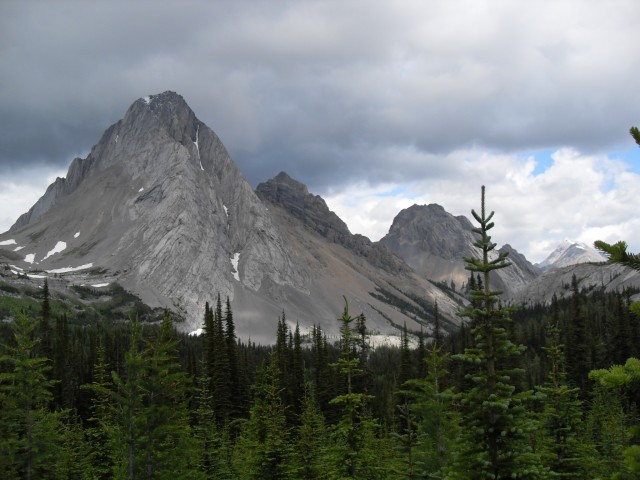
Mt Birdwood (l to r), Pig’s Tail and Commonwealth Peak in the east.
The col between Snow Peak on left and Mt Birdwood on right.
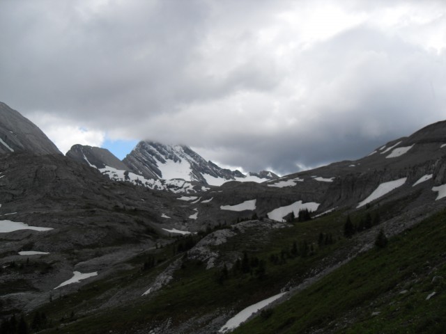
It’s barren once we get to the pass.
It’s a starkly beautiful place.

Looking west in to Banff National Park.
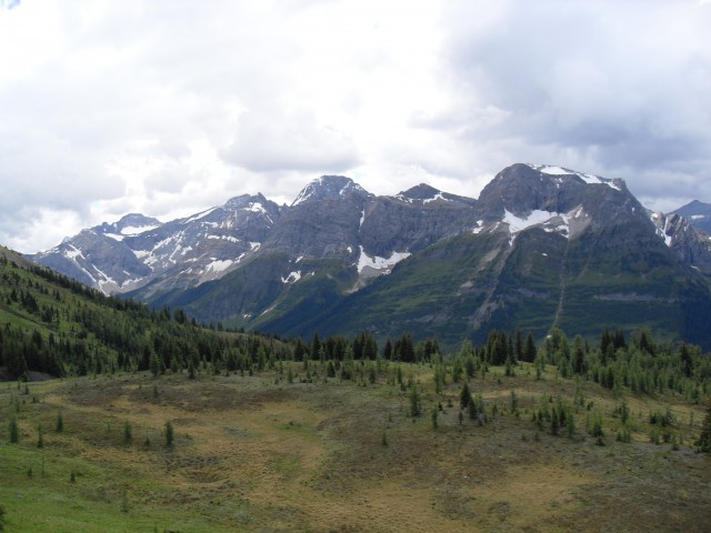
The view southwest. Mt Leman is right of centre.
Facing south we’re looking at one of the Burrstall Pass ridges.
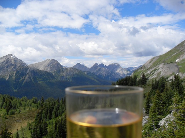
Bring wine on your hikes, it’s worth it!
Looking north to Snow Peak, an easy scramble we have yet to do.
In west Mt Assiniboine peeks out from behind another mountain. See the Sphinx?
We could clearly hear people talking from the summit of Snow Peak.
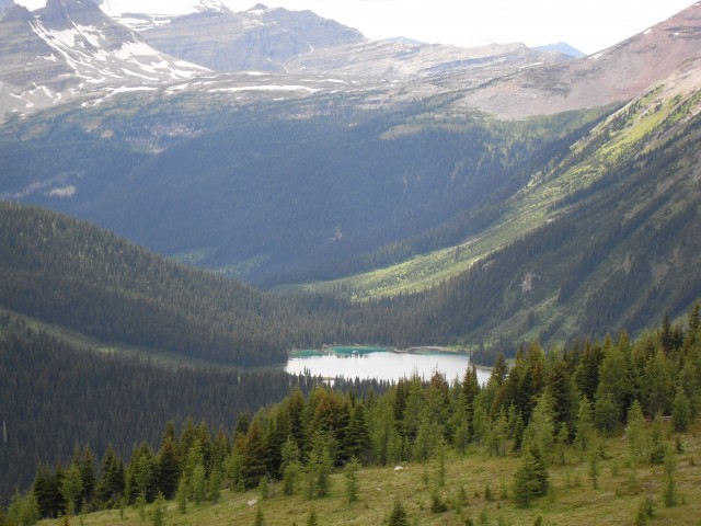
Leman Lake in Banff National Park.
These rocks are all limestone.
Near the sinkhole, but somehow we never took a picture of it.
The barren pass, looking east.
One last peek at Snow Peak on our way down.
Robertson Glacier on the way out.


Another stunning set of pictures!