
Grotto Canyon
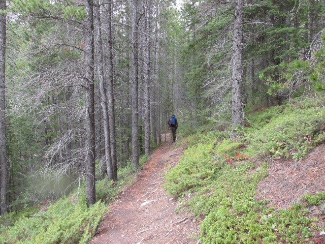
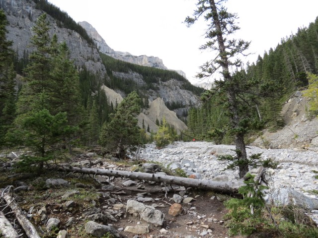
The hike up to Grotto Canyon is quite an easy trek, a stroll almost, yet there are rewarding views along the way. Travel is through a deep winding gorge before one emerges into a rocky valley surrounded by tall peaks. The creek bed is your trail much of the way and is for the most part dry, although evidence of flooding this spring is very evident along the whole route.
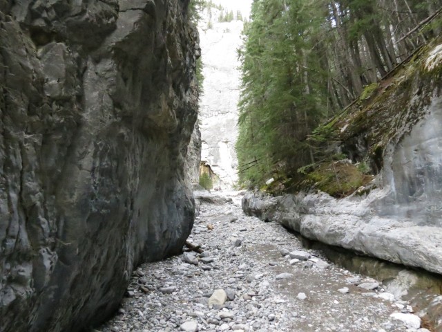
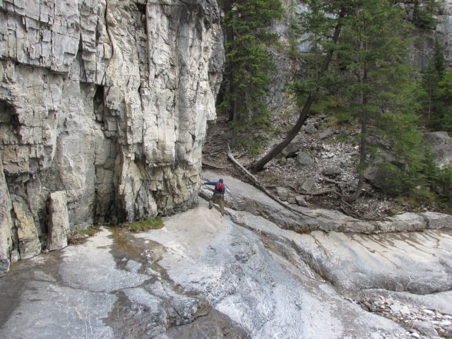
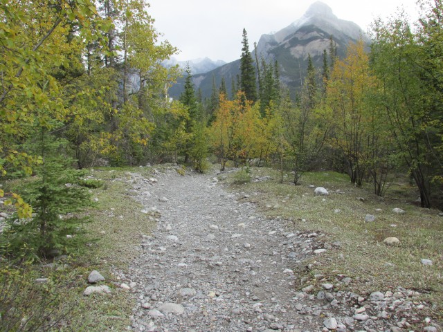
The trail head is at Grotto Mountain Pond, a popular fishing and picnic spot – it was too windy this day for either. It’s just west of Exshaw and it’s giant noisy and dusty cement plant. At the sign, follow the trail under the power lines. Almost immediately, on crossing a small dry stream, you’ll see evidence of the Spring 2013 floods (a sign at the start of the trail warns of this). There are rocks and boulders scattered everywhere, deep cuts from fast flowing water and of course uprooted trees. The trail overall is not in that bad of shape compared to others in Kananaskis that we’ve visited since that disastrous event.
I take the time to explore a small side canyon along the way, which quickly narrows and becomes choked with dead fall. Time to turn around.
Continuing on you’ll hear the noise from the nearby Baymag plant – they grind Magnesite here, which is used to make Magnesium Oxide used by industry and agriculture. Just before the plant, you cross a side road and some people use this spot as the access point for Grotto Canyon.
Along this whole route, you’ll see lots of side trails heading off to the right. Stay straight – the trail is signed anyway and it would be hard to get lost.
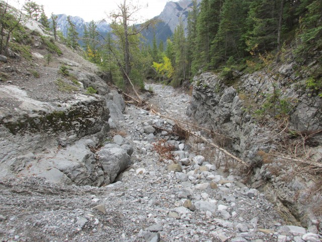
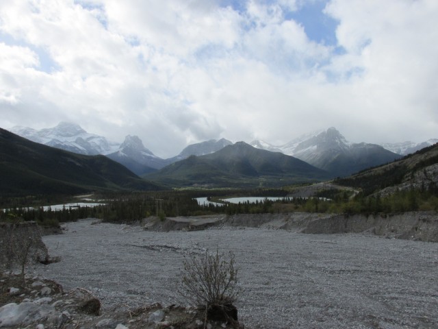
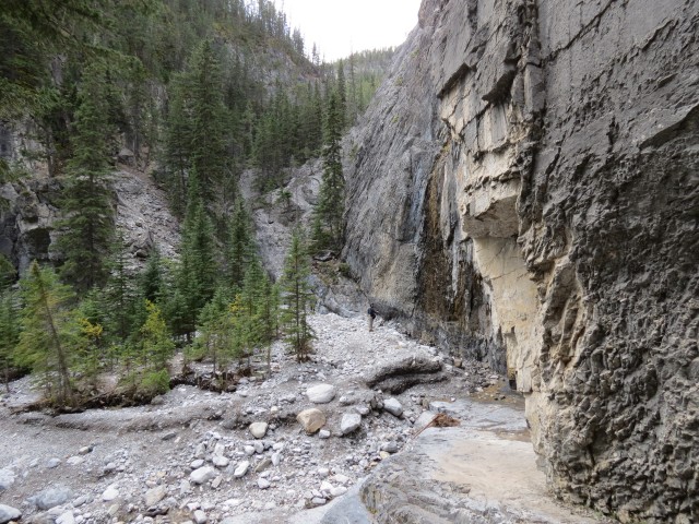
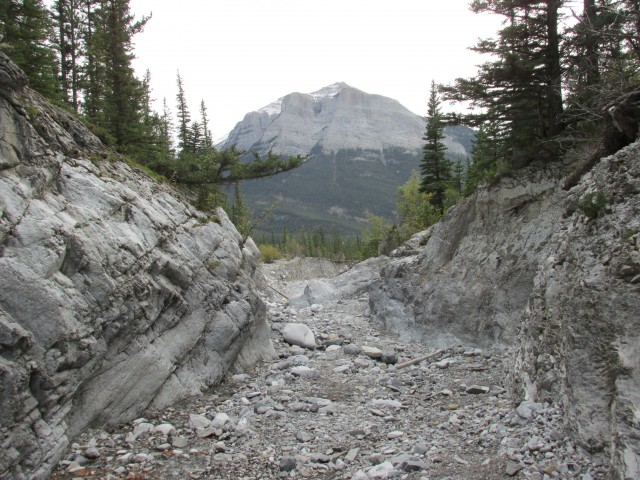
Right behind the plant now, we turn north and before long we intercept Grotto Creek at a view point with a bench. The creek bed is dry now, but earlier this year the rushing waters carved a deep wide path after they emerged from the canyon, probably at incredible speed. The damage is easily a hundred metres wide in places and at least five metres deep. Wow!
You have two options here, you can take the official trail which heads up to the right, traversing the hillside before dropping down. Or you can head into the canyon right away. Or do what we did and come in one way and exit the other.
On entering the canyon one immediately sees various anchors in the rock walls. This is a popular climbing spot as we’ll soon see.
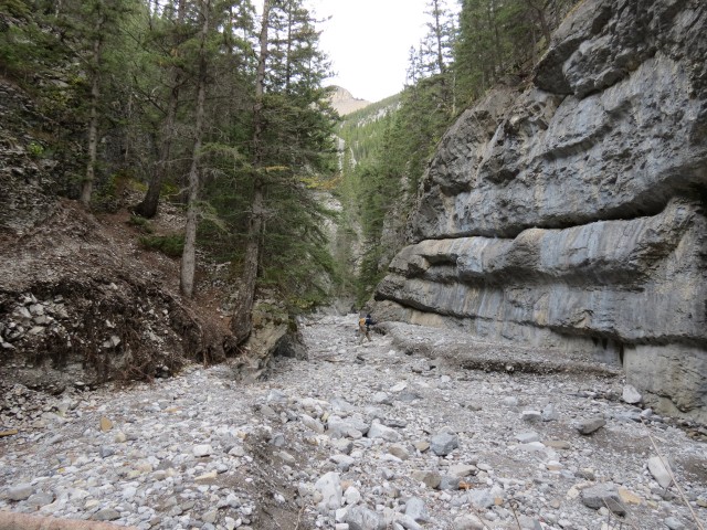
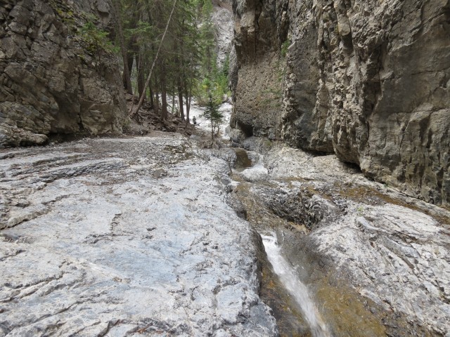
Heading upstream, Grotto Creek is a trickle here, but in most other places it’s dry, the water flowing underground. Looking at the canyon walls, one can see how fast the flow was during the height of the floods. They almost look like they’ve been scoured clean by the fast moving, sand and gravel saturated waters.
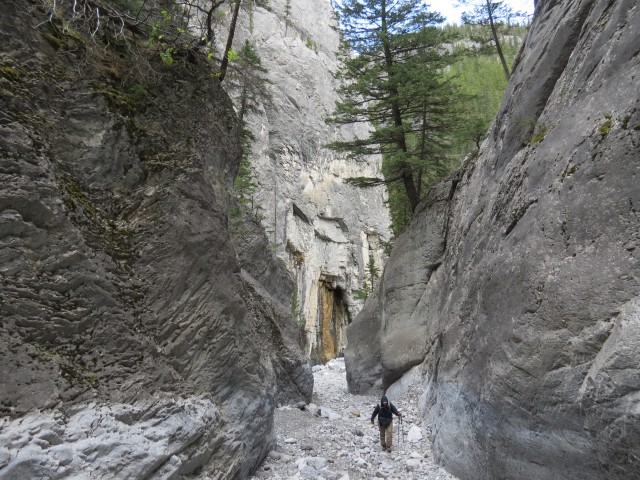
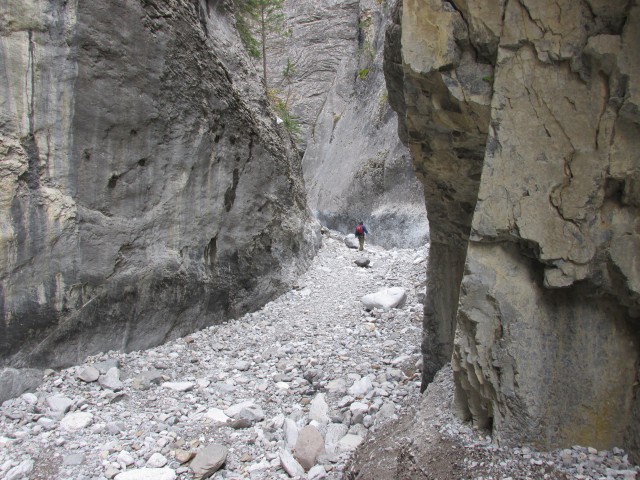
Heading up gently, the canyon narrows into what could be best described as a gorge, which meanders here and there. The near vertical walls extend up for hundreds of metres in some places and this feature is what gives the canyon its name.
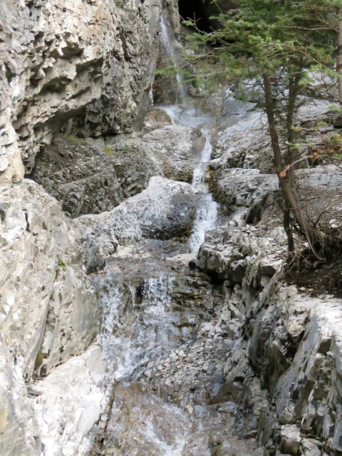
Not far from here, the main canyon, still deep and narrow turns sharply left (west). A smaller side canyon comes in from the right which has a stream flowing from it. You can follow it up, past gurgling pools and rushing channels, via some steep slabs to a point where it’s source, a picturesque waterfall, tumbles down from above. Watch your step here, the smooth rock and wet conditions make things slippery.
Heading back down, we follow the main canyon west. In spite of being in a deep gorge, the wind channels through here at an incredible speed. I’m not sure if it’s like this all the time. Soon, we break out into a widening valley and turn right. At this point we make a lunch stop. And for a special treat, we brought along a bottle of wine from our favourite vintner, La Frenz from the Okanagan Valley in BC (thanks Bean). This stuff is amazing!
Enjoying the views, we otherwise have a perfect lunch, if it were not for the crazy winds here. They actually blew the cairn we were sitting in front of, partially over. I had just photographed the wine in front of it – a close call!
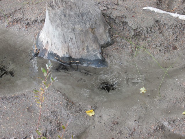
Along here, there is more evidence of flooding and the going is a bit challenging. There are large boulders to dodge and lots of loose gravel underfoot. We head towards some gravel formations upstream. At one time they were hoodoos, but the heavy rains this spring sort of washed that feature away. There is a cave in one, which was there last time we visited, but it’s clearly bigger now. We’ll find a good view point to photograph it, which will be where we turn around.
Some people make their way up to the entrance. Myself, I’d be worried – the whole bank and cave itself are made of loose and unstable material, just compacted gravel really. We go in mines, but I’d be reluctant to go in this one.
If one wishes they could head upstream for many more kilometres more but I’d suggest not, unless you like to punish yourself. It’s very loose and rocky and travel in those conditions is no fun.
Heading back, we pass some climbers along the way and that’s one activity I don’t think I could ever be brave enough to do.
We try to find the famous Grotto Canyon pictographs on the way down, but came up empty. We last saw them in 2005, and they were very faint even then. Either they’ve faded more and were missed, or they have been scoured away by the turbulent waters, or are buried under freshly deposited flood gravel. They showed what appear to be a representation of a person and I believe a horse and from what I understand they may be several hundred years or more old. Some say a thousand!
On the down route we by pass the official trail taking in the lower, less dramatic section of the canyon. In places it’s quite narrow and clogged with dead trees.
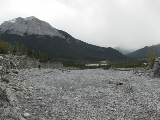
Breaking out into the Bow Valley, we’re greeted with nice views of some surrounding mountains, many of which we’ve been up. Directly south is Pigeon Mountain. To its left is the massive Mount Lougheed and to its left, Windtower. In front is the mostly treed Wind Ridge, our most recent conquest of the three.
With noise from the Baymag plant keeping us company, before long, we’re back at the car. We take some time to check out Grotto Mountain Pond and interestingly find a spring bubbling up from the ground near its shore.
This trail has a modest elevation gain, but the canyon is so enjoyable you’ll never notice it. Good footwear is important on this trip. The creek bed as mentioned is loose and rocky, and the footing is sometimes difficult. A twisted ankle is a good possibility.
Not far east of here is another fascinating canyon walk up Jura Creek.
To see some other hikes you might like, go here…
High Noon Hills.
Devils, Phantoms and Ghosts.
Spectacular Buller Pass.
If you wish more information on this trail, by all means contact us!
Date of adventure: September, 2013.
Location: Exshaw, AB.
Distance: 6km out and back.
Height gain maximum: 185m
Height gain cumulative: 200m
NOTE: all heights and distances are approximate.
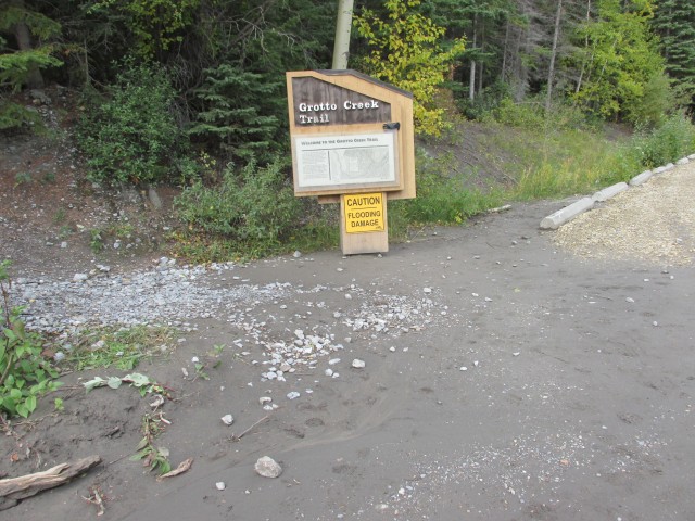
The start of the Grotto Canyon trail.
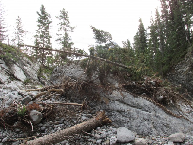
Flood damage is evident everywhere.
I check out a small side canyon.
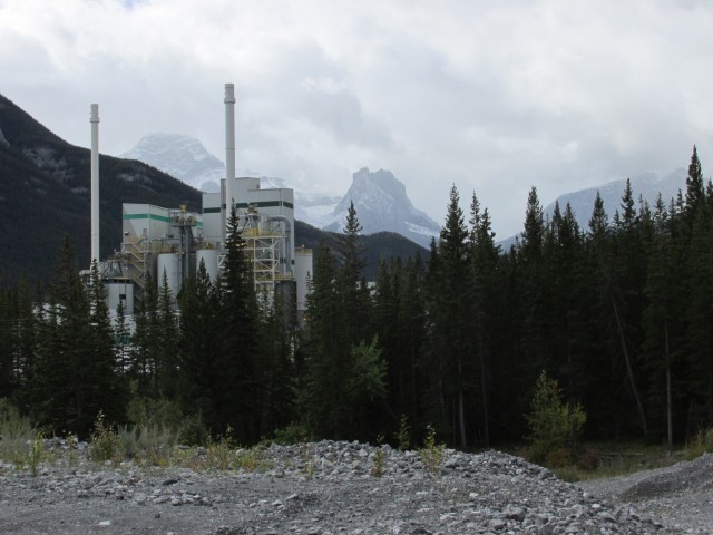
The trail passes the noisy Baymag plant. Windtower is the precipitous peak in the centre.
Grotto Creek below the canyon. Wind Ridge in centre.
The trail traverses a hillside before dropping down into the canyon.
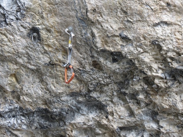
This is popular place with climbers and you’ll see evidence of that throughout the gorge.
The canyon narrows.
The creek is for most the year dry.
A side valley with its own stream.
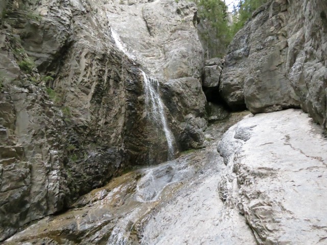
A small waterfall.
The water tumbles down through a series of channels and small pools.
The main canyon comes in from left and then turns west heading away from our vantage point (behind the trees).
Pretty soon we’ll break out into a rocky valley surrounded by mountains.
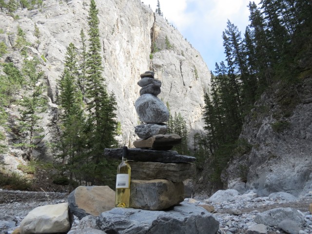
Lunch stop – La Frenz wine. Yummy!
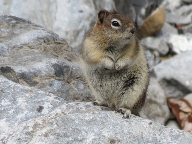
A curious ground squirrel watches us.
The valley widens – our goal will be the gravel formations in centre.
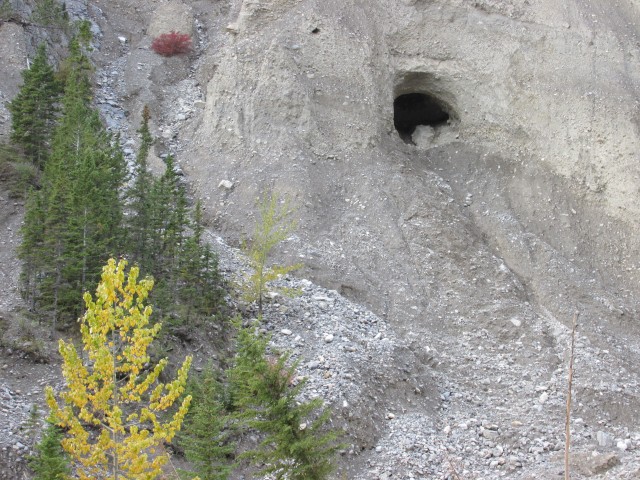
This cave has grown in size since we were last here eight years ago.
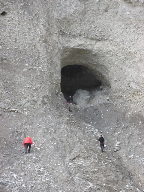
Some people head inside. This cave worries me as it looks loose and unstable.
Heading back.
On the way out, I peer up that side canyon.
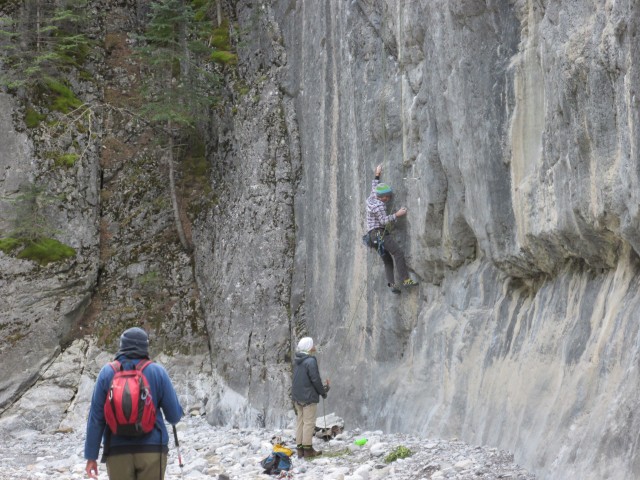
We pass some climbers.
The canyon opens up. Pigeon Mountain in back.
Spring floods caused Grotto Creek to cut a deep and wide channel here.
The lower trail. Pleasant. except for the noise from the nearby Baymag plant.
At the edge of Grotto Pond, a spring (that hole) bubbles up from below.
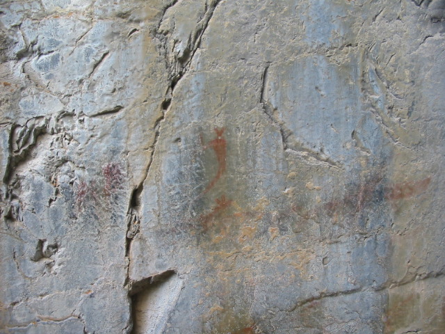
This picture is from 2005 and it shows the Grotto Canyon pictographs. We could not find them this visit.


")


The pictographs are still there – saw them August 28, 2018.
We failed to find them that last visit. Knew they were there, but missed them. Next time!
A great hike to enjoy either in the summer or winter months and each season it has a unique personality. We’ve hiked it a least a dozen times.
It’s an easy hike, but I really liked it. Thanks for posting!
It’s a beautiful place in the winter when the creek is fully frozen, though crampons or spiked (not coiled) traction for your boots is essential. It’s easy and enjoyable with kids of all ages. Have yet to do it in summer. Nice Blog!
I’d like, no love, to see it in winter. It’s on the to-do list. Thanks for posting!