Lost under Yamnuska
In this adventure we got “lost” under Mount Yamnuska. It’s our first wilderness hike of 2014 and we wander about aimlessly, as though adrift, going here and there, sometimes on trail, other times off. It looks at though we were lost but in the end we only loose ourselves in the moment.
This day we’re reminded it’s still winter and the weather would get cold and blustery at times and we’d have to bundle up. Interspersed with that, the sky would open and become a gorgeous blue and the air would warm considerably. The route we followed was easy with few technicalities or hills of any note. Overall, it was a pleasant day and it’s a trail we recommend you visit. Just bring a GPS or risk getting “lost”.
These trails are located in the Bow Valley Wildland Park, formerly called the the Yamnuska Natural Area. It’s a mix of dense woods and large open meadows and there are countless little lakes and ponds to see. The area is a maze of trails, some hiking trails, some game trails turned hiking trains, some pure game trails, some faint, some intermittent and in places none at all (aka bushwacking). We had a rough destination in mind but to get there we relied on nothing more our natural navigating skills backed up by a GPS compass and breadcrumb trail in case we really got lost.
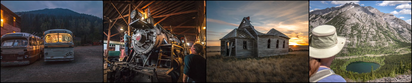
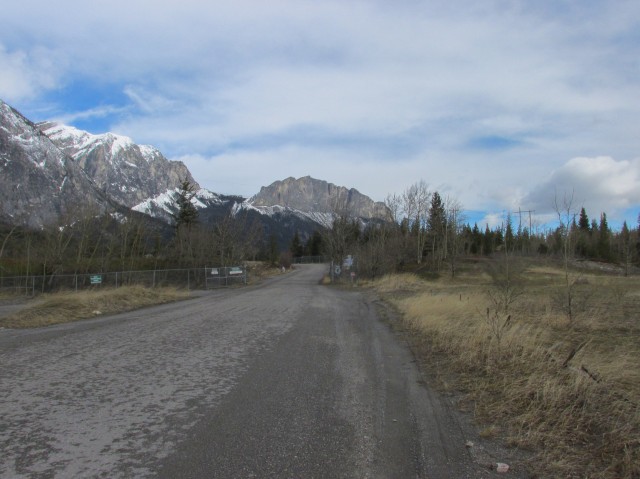
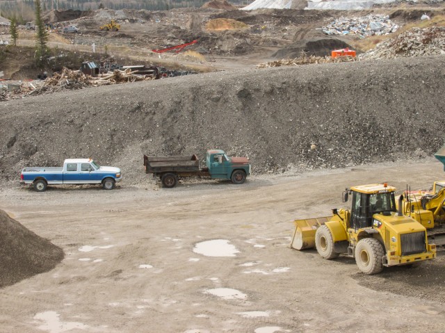
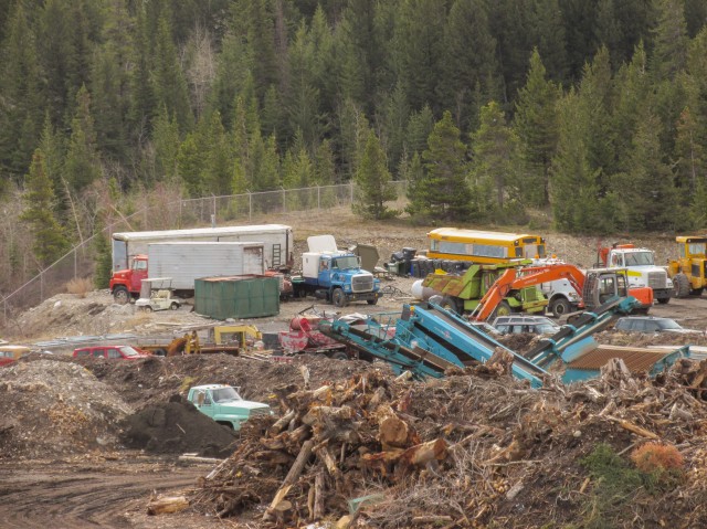
We begin our trip at the Francis Cooke Landfill. Now a dump is not the most pleasant start to a trail but it’s a necessary evil and anyway it’s soon out of sight. Park across from it, dodge trucks when crossing the road, head towards the main gate and take the trail that runs next to the fence. Enjoy the views – old refrigerators, mattresses, garbage bags. Wind here is a problem and some of the lighter garbage, plastic bags in particular litter the forest nearby and cling to the fence. Not pretty.
Along one section, an odd red dust coats the fence and nearby trees – strange. I have no clue what it could be. We find our first Prairie Crocuses here and they are a sure sign of spring.
There is the large collection of old trucks that call the dump home, which for me makes the place a little less ugly – I love old trucks. Some are out of service and other appears to be used to move things about the large compound. Included in the mix is a GMC or Chevrolet flat deck from the mid-1960s, a 1950s era International L Series, a Ford medium duty from the 1967-1979 period, several Ford L9000 trucks (1970s and 80s), along with a big green Euclid rock truck. I’d like to get permission to go inside, and shoot them all up close.
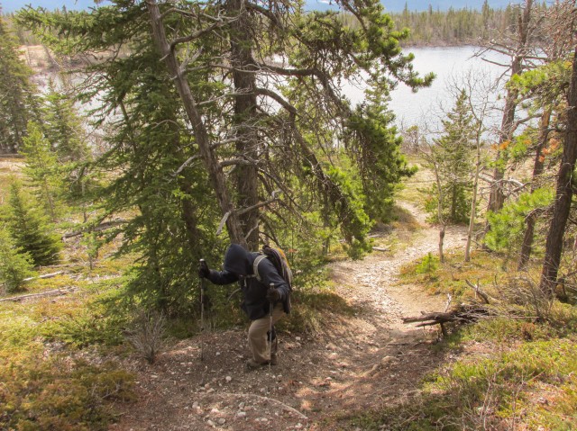
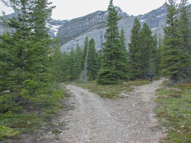
The trail here rises and falls. The fence soon turns left and so should you. In behind a pile of old wood shavings and scraps is a junction. Turn right, heading roughly northeast. Along here the trail is wide, well drained. distinct and flat. It’s easy going. A few snow patches linger here and there and in fact it looks like it snowed a little the very morning of our visit. We’re in the trees and have few views, but don’t worry, that will soon change.
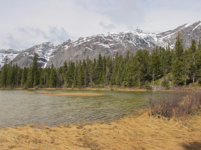
Making good time, we come to Reed Lake. From here we take side trip up to Hilltop Pond. We didn’t know it then but had continued on that trail we would have hit Crescent Lake not far away. I hear it’s photogenic.
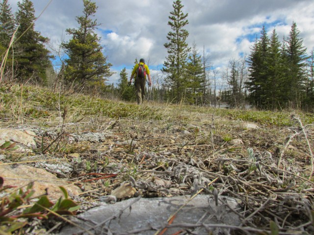
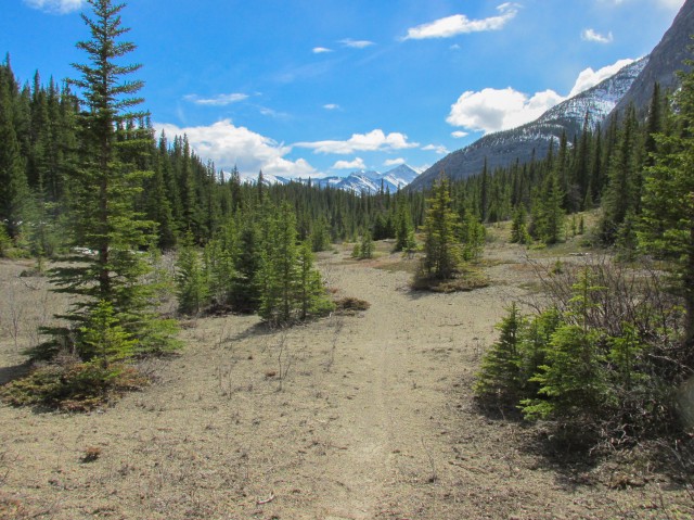
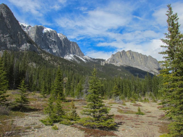
Back down on the main trail we continue east again. The trail heads into a wet area, which we elect to bushwhack around. In the summer it’s probably dry enough to use. Now off trail, we hit some power lines and follow them until they turn south. We go north and then east on a faint game trail. In this area are some open meadows and we have good views of Mt Yamnuska, Goat Mountain, Loder Peak and Door Jamb Mountain (more on them in a bit).
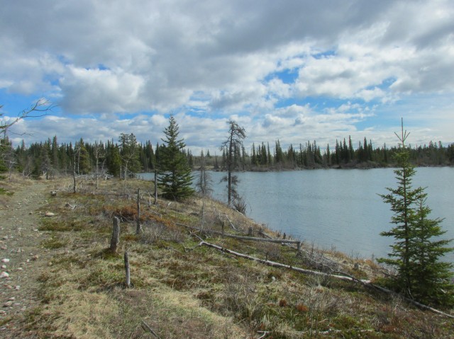
Coming to a fence and back on the trail, we head north again. We know the lake we wish to visit is roughly northeast of our current position. Passing a beaver pond we come to a gate and head uphill briefly after it. Arriving at a utility road, we realize we’ve overshot our objective. Not by much though and we turn tail and find a faint path leading to it.
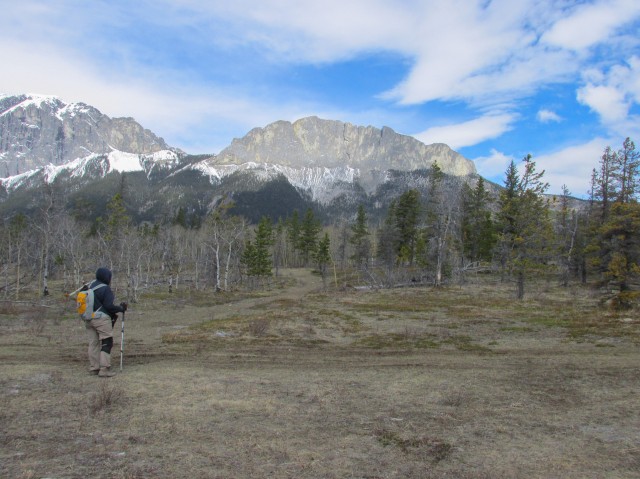
Arriving at Meadow Lake, our turn around point, we find a nice spot to have lunch. The skies open up as we eat we’re rewarded with amazing views of the mountains in front of us. This lake by the way, was a used as a setting in a movie (1987 – Gunsmoke: Return to Dodge – a film no one has seen) and I came here to not only soak up the views, but also to do one of our trade “then and now” series of shots around that subject. Watch for them soon.
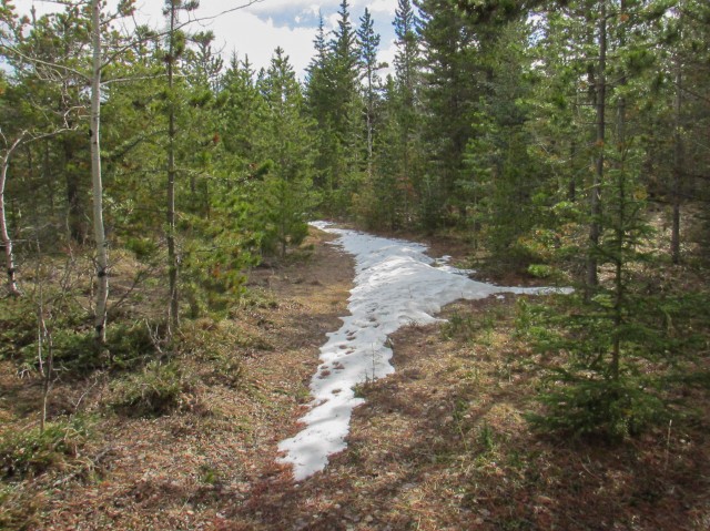
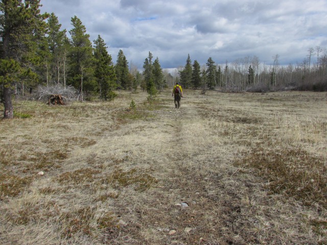
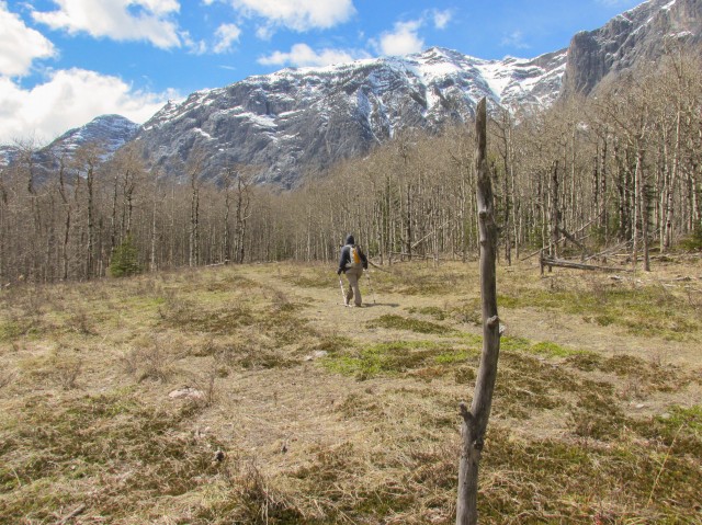
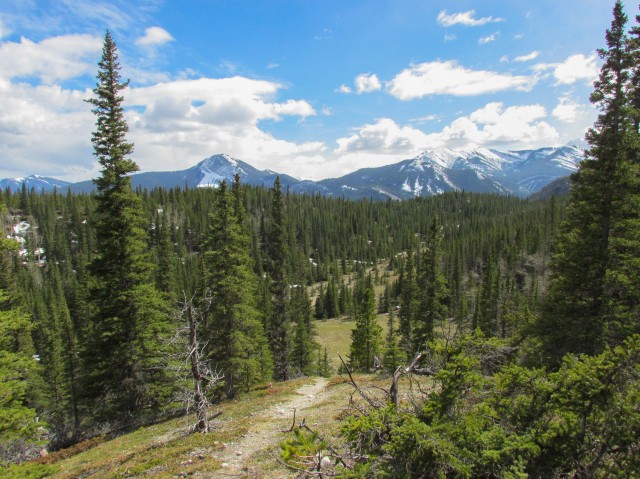
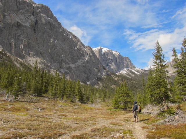
Back on the trail we take an obvious route that heads almost directly west. In the shade there is still a lot of snow in places and there is also some dead fall to negotiate. Joining back with the trail we came in on, we are back at that gate mentioned earlier. From here we strike out west, and for the next while will either be off-tail completely or will follow some very faints paths that are more game trail than people trail (we saw lots of Deer by the way). The going here is easy and even if off trail, the route finding no challenge. Sometimes we are in the trees, at times in very dense trees (what hiking guru Gillean Daffern calls the “Aspen Jungle”), other times we’re in broad meadows (what she calls the “Golf Course”). The views of the mountains around us, when we can see them, are stunning.
Along here I find a good patch of Juniper bushes and take some time to collect some berries. We use them to spice up meat (use sparingly).
After a couple kilometres, we intercept a well worn trail, which we then follow. It’s heading roughly the direction we planned to go anyway. It heads into a place called “Hidden Valley” (so named, again, by Gillean Daffern), a very pleasant place indeed. Along here, I (solo) check out some side trails, just to see where may lead – a brief exploratory visit. One climbed a hill which made for a good photo-op. Later I would find that one of the trails, had I gone further, would take me to a small natural spring. Missed it, oh well. Connie stayed on the main trail these while I did these.
Back on the main trail, and still in that shaded valley, we pass through some snow patches as we head west. To our right and looming over us is Goat Mountain. Connie finds a good sized burl near here. Interesting.
Turning south in a broad arc, we start downhill (funny it did not seem like we went up) and in no time we are at the dump and shortly after, back at the car. A storm has rolled in and all the mountains around us are socked in. It’s clearly snowing up high. There is a break in the clouds to the west and we see two mountains for a brief moment, Mt McGillivray and Pigeon Mountain (which we’ve been up). Another mountain seen but not photographed is Mt Yates, home of the Barrier Lake Lookout.
Mt Yamnuska, or simply Yamnuska or sometimes just Yam, is officially known as Mount John Laurie although I have never heard anyone call it that. In the Stoney Nakoda language it’s called Iyamnathka. It’s a popular scramble. It’s still winter up there, so I doubt anyone made the summit this day.
Goat Mountain is located directly west. Actually that name is applied to the highest point of Goat Ridge. Other high points have their own names, including Door Jamb Mountain (most southern high point) and Loder Peak (next high point). Interestingly some other high points, some higher than Door Jamb and Loder, have no names. Bizarre! There is a peak not terribly far away called Old Goat Mountain which sometimes causes more confusion (Google maps mistakenly shows Goat as Old Goat!).
Hiking below Yamnuska is a great early season option and it’s one of the first trail networks to open up in the spring. We highly recommend it. Other than the garbage dump section, it’s pure bliss. We saw no one on our visit. These trails are fairly new and only recently have they appeared in publication. I am sure over time the faint sections will get better defined.
To see that movie then and now report we spoke about earlier, go here…
Gunsmoke: Return to Dodge – then and now.
If you liked this hike, check these out…
Edworthy Park west trail – Brickburn and beyond.
Stoney Trail – Marilyn Monroe combo.
Spectacular Buller Pass.
If you wish more information on this trail, by all means contact us!
Date of adventure: April, 2014.
Location: Kananaskis AB, near Exshaw.
Distance: 15km loop with an out and back and many short side trips.
Height gain maximum: >100m
Height gain cumulative: 200m
NOTE: all heights and distances are approximate.
Reference: Kananaskis Trail Guides by the Dafferns.
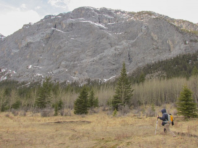
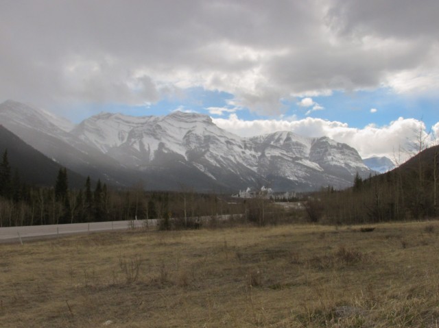
At the start of the trail, at a dump of all places- flat faced Mt Yamnuska in back.
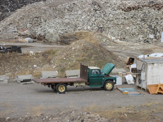
A mid-1960s Chevrolet or GMC truck at the landfill.
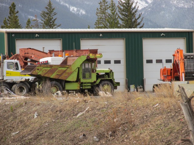
A Euclid rock truck.
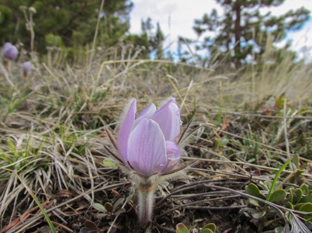
The Prairie Crocus is a sure sign of spring.
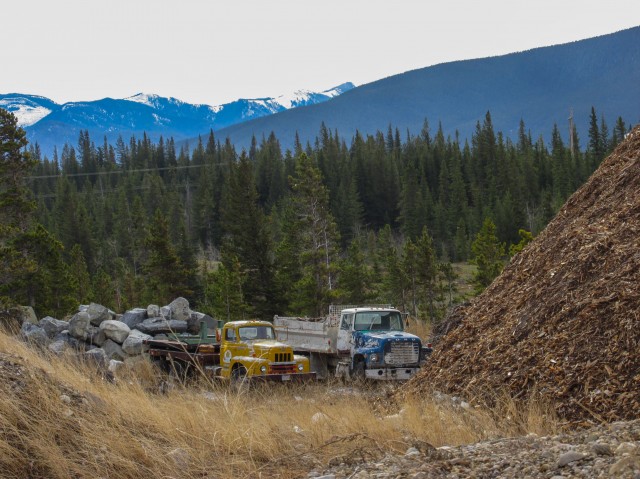
A 1950s International L Series and a 1970s/early 1980s Ford L9000.
An old Ford F Series medium duty.
There are lots of nice old trucks at the landfill.
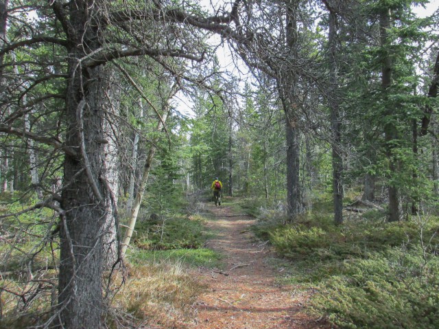
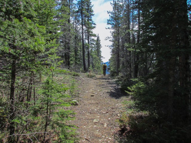
The trail here is wide and distinct.
Some lingering snow.
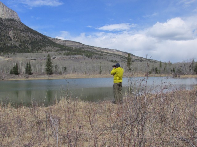
Enjoying our day out…
Reed Lake.
A side trip…
Hilltop Pond with Loder Peak in back.
Passing through a meadow.
In places, the trail is faint or nonexistent.
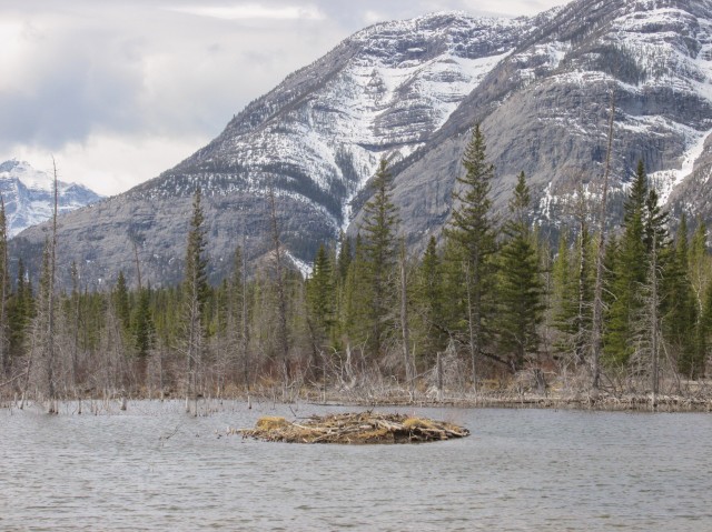
Passing some beaver ponds.
I’m standing in front of Meadow Lake.
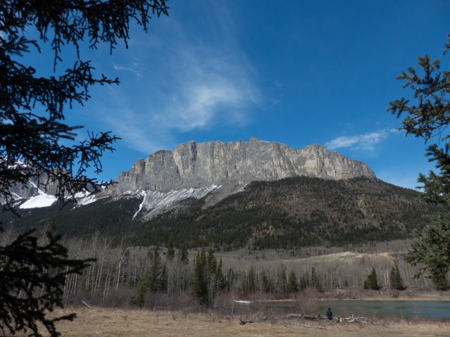
Mt Yamnuska in all its glory.
In the trees…
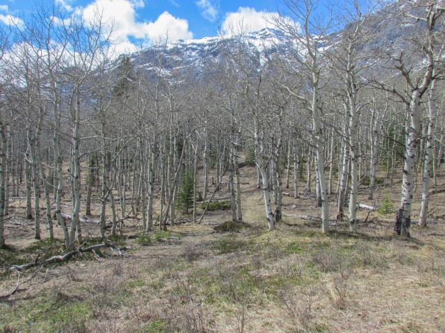
The trail disappears into the “Aspen Jungle”.
Out of the trees…
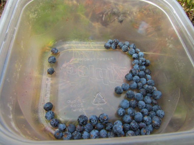
These Juniper Berries can be used to spice up meat.
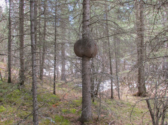
A good sized burl.
Goat Mountain to the northwest.
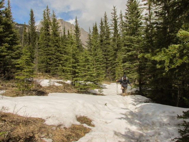
There were lots of snow patches along this section of the trail.
In “Hidden Valley”.
I climb a nearby hill to check out the view.
Looking back at Goat Mountain and Yamnuska.
For a time we’re rewarded with lovey blue skies.
Almost back at the landfill.
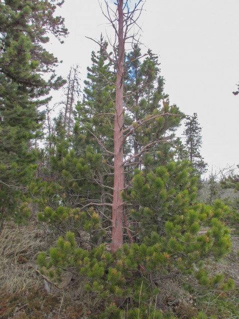
Trees downwind from the dump were stained this odd red colour.
Mt McGillivray (left of centre) and Pigeon Mountain (right).
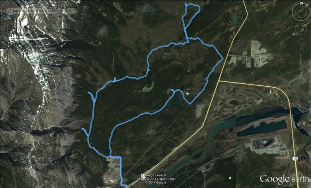
Our crazy route – stubs were exploratory.


")


(via Facebook)
Great place to get lost! Thank You for sharing your adventure!
What a pleasant day!
Sure do envy you Chris!!!
I forget sometimes just how many amazing places we go. Thanks for posting!
Yam is one of my favorite summits, although I’ve only done it once. Running/jumping down the scree slopes on the descent is something everyone should experience, as is crossing the Very Scary Traverse on the ascent.
It sure is a unique mountain – we’ve never been up.
I shared this post with /r/hiking on Reddit. Great photos!
Thanks, we appreciate it.
I thinking I’ll be following in your many footsteps soon. I want to go on this hike!
It’s a nice one!