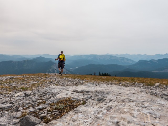
This hike I visit Prairie Mountain solo. It’s a relatively modest sized bump, west of Calgary but still close to the city and it has pretty decent views from the summit. It’s a well used trail, so much so that I’ll only consider it as an objective at certain times of the year when things are relatively quiet. Either during the week in summer, like this day (even then it was busy), or in the off season. I don’t dig crowds.
Prairie Mountain is popular for many reasons. It’s quickly and easily accessible all year round and for one this makes it a good early season conditioner when other mountains are inaccessible. The views from the summit are nice enough, I liked them, and its modest size means that getting to the top is not terribly difficult work, nor does it take much time. You can be up and down in a few hours if you wish. I hear people do it after work.
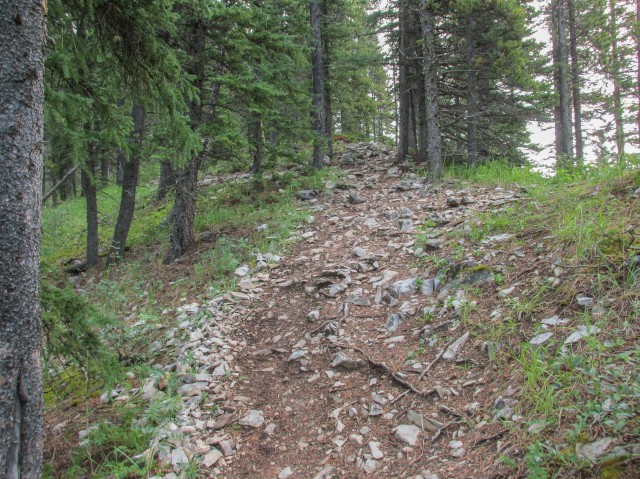
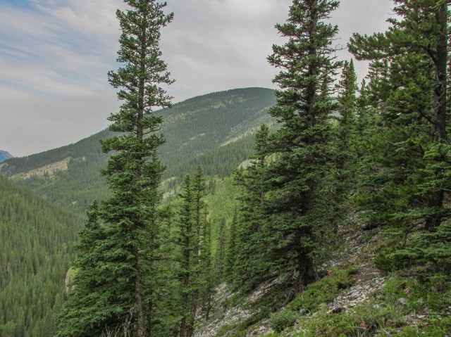
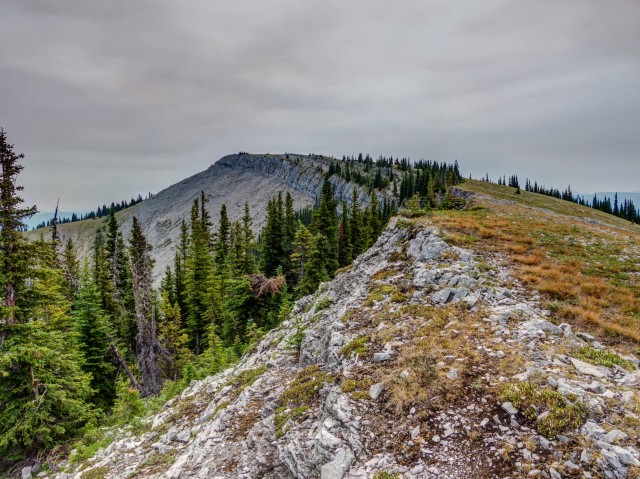
There is one downside to the hike, well two if you count the sometimes crowded trail and summit, and that’s the route up. It’s not that it’s hard or technical or anything like that. It’s just that the whole time you’re in the trees and the views are either limited or totally nonresistant, save for one or two spots where the forest thins a bit. In fact, you’ll almost have to reach the summit before you’re out of the woods.
This trip was a solo outing. Connie is still recuperating from a broken toe. Ouch!
↓ ↓ ↓ ↓ Scroll down for photos and to comment ↓ ↓ ↓ ↓
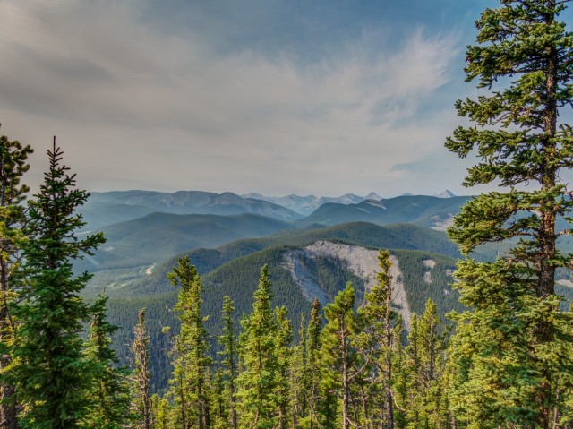
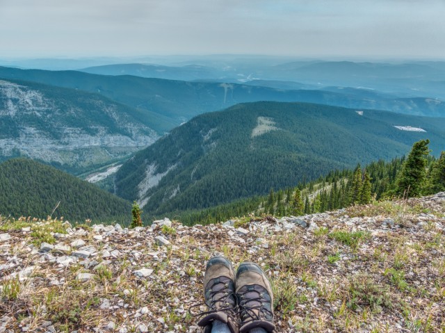
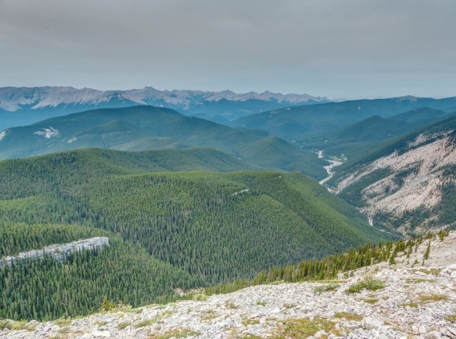
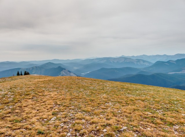
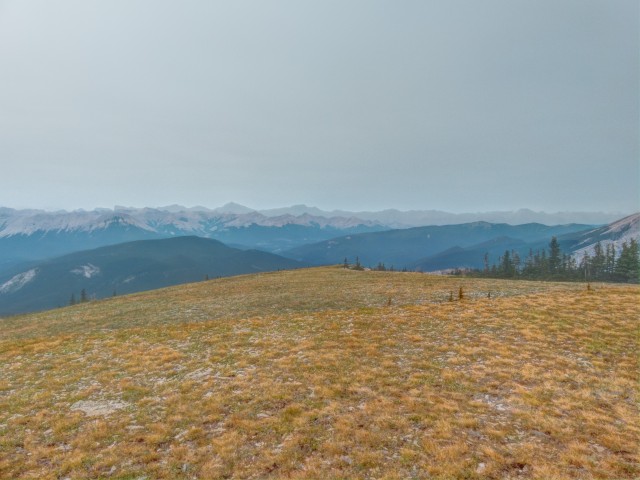
A number of forest fires in other parts of the continent caused a pale blue haze to hang in the air. It was not hard to breath but it sure made getting a good photo a bit of a challenge.
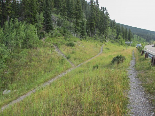
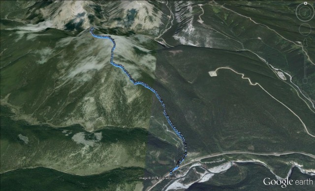
The trail starts near the Elbow Falls day use area. You can park at a designated spot just west of the trailhead.
Just east of Prairie Creek (marked with a road sign), take the trail heading up and north. Until you get to the summit this trail-within-the-trees is a pretty mundane affair. It’s steep in places, less so in others with few flat sections, save for one good sized stretch about a third of the way up. Catch your breath here. For the most part the trail is well packed down, but there are a few loose rocky sections and in many places it braids. Don’t worry all routes eventuality meet up. In a couple places there are some rock steps but they are nothing to worry about.
Our last and only other visit was in November a few years back. If there is snow, like there was then or if the trail is wet, expect slippery sections. That’s common sense anyway.
If one is in reasonable shape, the trail up can be done in short order; an hour or so for really fit people, or a couple hours for slow pokes like me.
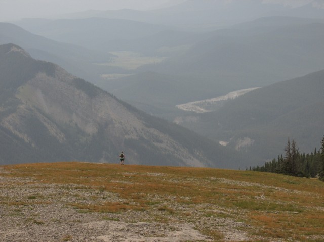
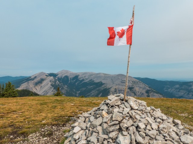
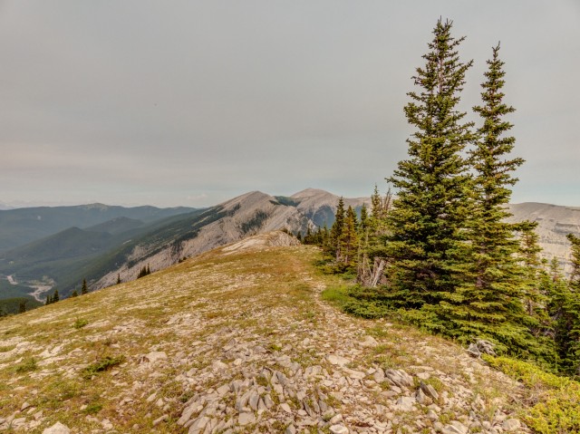
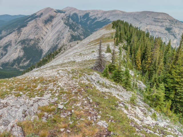
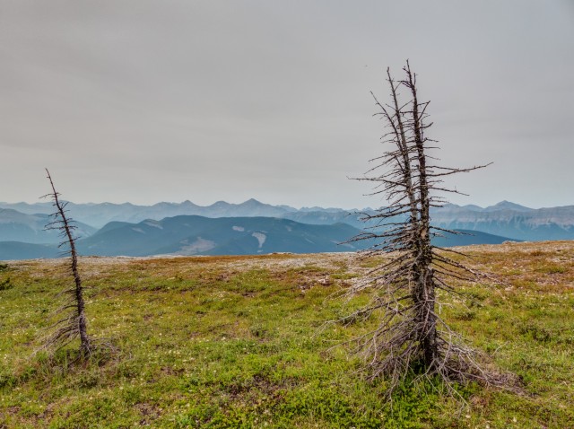
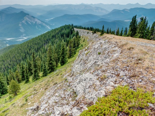
With most of the elevation gained, the trees thin and the grade eases. From here one need only follow a gently inclined grassy open slope to the summit. There are few trees islands here and there along the way. And there you have it, you’re done. You’ve summited Prairie Mountain. Sit back and enjoy the 360 degree views. There is a lot to see at the top.
Directly to the north is Moose Mountain. If you look hard you can see the fire lookout on its summit. To the west is a long rib connected to that same mountain. Further east, the hills and ridges transition into the prairies. Normally one can see Calgary, but with the haze, visibility was limited. Directly below to the north and east is Canyon Creek. The celebrated ice caves at the base of Moose Mountain and a good number of gas wells can be seen too.
To the south is an endless sea of rolling hills. In the west, we can spot two ridges we’ve been up – Forget-me-not Ridge and Powderface Ridge. In behind and forming an almost impenetrable wall are the barren limestone peaks of the front ranges. I won’t bother rattling off their names since they are too distant and too shrouded in haze to see clearly.
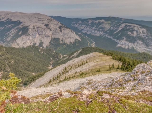
After lunch, I decided to follow a short ridge that heads north from the summit. It’s not a long one but some elevation is lost following it. It ends a high point, with a good view of Moose Mountain directly to the north. Hmm, it’s been a while since we visited that peak. Time to maybe hike it again.
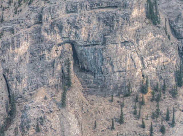
Heading back to the summit, I admire a series of cliffs on the mountain’s north face. There are more cliffs on the east side too. The grassy west face in contrast, falls away gently before becoming wooded.
After spending an hour or so at the top it was time to head down (reluctantly). In just over another hour, I’m back at the car.
This trip I saw a number of other hikers tackling the mountain. Included in that group were two fellows who ran up and down it – twice – in the time it took me to get to the summit. I feel so inadequate! Also seen was a good sized youth group, heading up while I was on my way down. Some did not look happy to be there. And for some the physical effort required was clearly too much. You could see it. A few looked a little green. On a busy weekends I’ve heard things can get pretty crowded on the trail. I saw one picture of the busy summit and there must have been several dozen people there. Yikes, that’s a bit to busy for my tastes.
The mountain was named in the 1920s according to most sources I’ve found. It’s not known if the moniker was a nod to the nearby plains or if the top, which is relatively flat and gassy and I guess somewhat prairie-like, was the reason.
You’ll never hear us say that Prairie Mountain is on our list of favourites. The trip up is just a bit too mundane. Even so, it does have its charms, like the views at the top. With that, any mountain is a good mountain.
To see our previous visit to Prairie Mountain, click the link below… Prairie Mountain.
If you wish more information on this trail, by all means contact us!
Date of adventure: August, 2014. Location: Kananaskis AB, Elbow River area. Distance: 9km out and back (8km to the summit, 1km more for the north ridge). Height gain maximum: 710m (a previous trip the GPS said 725m – the mountain is shrinking!). Height gain cumulative: 780m. NOTE: all heights and distances are approximate. Technical bits: a few loose sections of trail. Reference: Kananaskis Trail Guides by the Dafferns.
We used to do something called the "pointless challenge" 🤪 and miss those days. It was so much silly fun and often frustrating as heck. In these we'd invite people to send in random photos of obscure locations, but not give any information, and then we'd track where it was and shoot something similar.
Most of these came from old family collections, as was the case here. Anyone up to resurrecting the series?
In hindsight, why didn't we pose someone in our shot?
Pointless: “Devoid of meaning (or) senseless” Merriam-Webster.
If you like what we do and want to support this ongoing project (12 years now), go here: https://www.BIGDoer.com/help-the-society/ Thanks to Connie for making this post possible.
Exploring history with Off the Beaten Path with Chris & Connie. Photo: ca1970 and 2014. Posted by Connie.
Captured on a cold, cold day many years ago. We've been passing this old house for decades and it's little changed in that time. At some point we expect to drive by and it'll be gone.
Exploring history with Off the Beaten Path with Chris & Connie. Photo: 2017. Posted by Connie.
When retired old railway cars usually get cut up for scrap. Sometimes, however, they find their way into the hands of the general public or whomever. Flat cars make good bridges, and boxcars can be transformed into storage buildings and the like. Case in point here. We see them used like this often enough and in this case, it's part of a corral.
Incidentally, this boxcar dates from 1950 and this was found by tracing the old road number, which is still visible.
Exploring history with Off the Beaten Path with Chris & Connie. Photo: 2017. Posted by Connie.
This central Alberta racetrack was never a commercial operation but instead just a fun place for car enthusiasts in the area to get together. Early '70s or thereabouts and it only lasted a few years. Even thought it's been abandoned for that long, there is no doubt what was here.
You know we like the the obscure stuff and this one fits the bill perfectly. Found by accident while backroad cruising and the history comes thanks to local car guy Mike.
Exploring history with Off the Beaten Path with Chris & Connie. Photo: 2022. Posted by Connie.
On top of little Myrtle Mountain in the Kimberley (BC) Nature Park.
There's some good wilderness fun to be had here and nice views as you can see, but the real reason we came is mining history. The whole area near the ski hill was extensively worked over a century ago and we were looking for evidence of this. We didn't find much in the area searched, but it's a big chunk of property and we hope to return to cover more ground again soon. Of all the subjects we cover, mining related is a favourite.
Still, it was a good hike and that can't be bad. Look to the comments for more info 👇.
Exploring nature and history with Off the Beaten Path with Chris & Connie. Photo: 2022. Posted by Connie.
It's a strange curiosity in south Kananaskis, there on a hillside and we have no idea who created it. We asked around and no one's completely sure about its history. In the past it showed the Canada 100 logo from 1967 but in 2017 someone changed it to reflect the country's 150th.
That's our friend Emily from DanOCan.com having a look.
Exploring history with Off the Beaten Path with Chris & Connie. Photo: 2017. Posted by Connie.


Did it in the middle of winter. Nice hike, a few steep places.
Last time up for us was in November. It’s popular all year round!
A good shoulder season hike. Short and sweet.
No other summit trail I know of gets down to business as quick as this one.
Incredible views Chris!
Not bad at all!