
Horseshoe Canyon
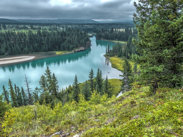
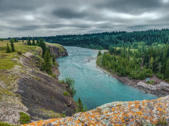
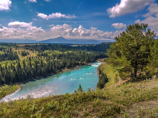
This adventure we hike the lovely Bow River Valley, travelling east from the Seebe Dam (sometimes called the Kananaskis Hydro Dam or Kananaskis Plant) on our way to Horseshoe Dam and Canyon and to points beyond. It’s an easy trail, but don’t think that makes it uninteresting. It offers the visitor stunning views, not only of the river itself (a lovely blue/green) but of numerous cliffs and high bluffs, pleasant meadows and many towering peaks off in the distance. In spite of all these wonderful things, the trail is not well known and little documented.
While most will come here for the scenery, we also have a few other reasons to visit. There are two dams to be seen along this hike, which of course are of great interest to us. Plus, there were a good number of movies were filmed in the immediate area and we hope these could be fodder for a few of our trademark “then and now” posts (search “movie” on this site to see what they are about).
The trail head can be found just north of the Kananaskis Dam. Make the first left and park just before that gravel road bends right.
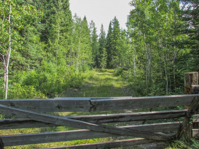
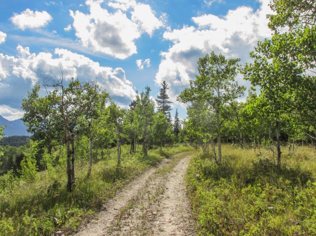
Head east into the bush. The first section is a bit wet in places, but otherwise the trail is for the most part dry and well drained. In no time come to a junction. The track heading right takes you to a pleasant spot below the dam (which was built over a hundred years ago), a nice side trip. There are lots of swimming holes and diving cliffs here, and further down the river, and this makes it a popular place on hot summer days. Today was cool however.
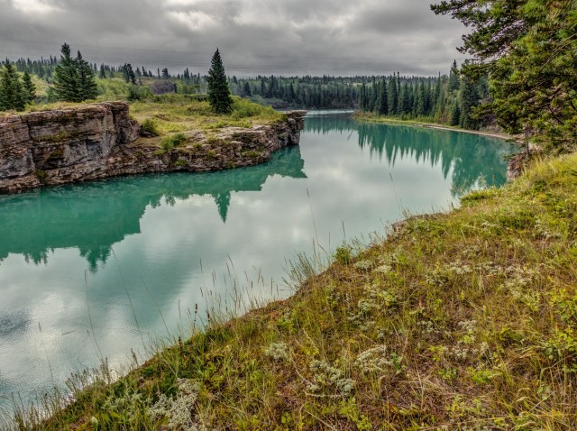
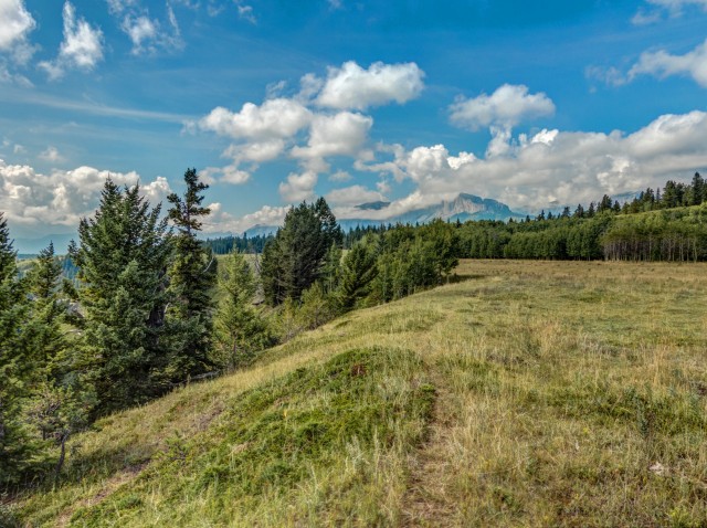
For a time the trail is right beside the river. What colours! Later is passes through alternating wooded areas and grassy meadows. The going is quick, easy and always pleasant, there is little elevation change and even if the track is faint in places it’s near impossible to get lost. And there are tons of photo ops. Not a bad mix. Hard core elevation junkies and those who crave remote rugged environments might not be so inspired by the trail. I think most however will appreciate it.
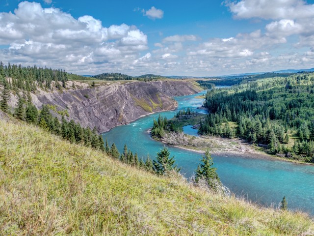
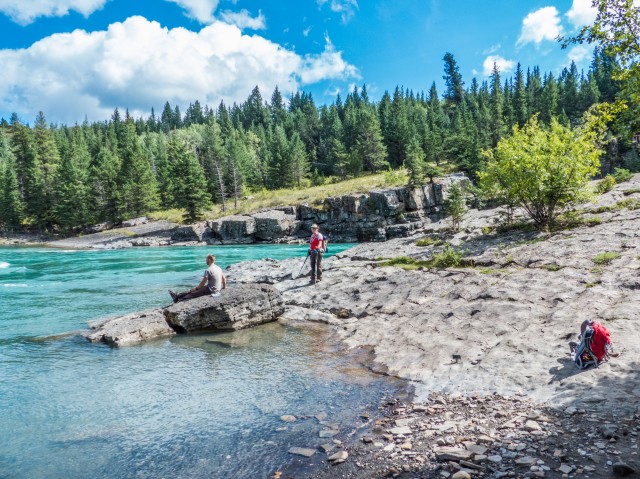
At one spot the river passes through a narrow canyon lined with low cliffs. Those on the opposite side were once popular with divers but I understand drive-in access is now restricted. I guess you could hike in on our side if you were ambitious. A memorial to a diver who perished can be seen there and this reminds us just how dangerous the waters can be. The river is deep, but I understand the current is strong.
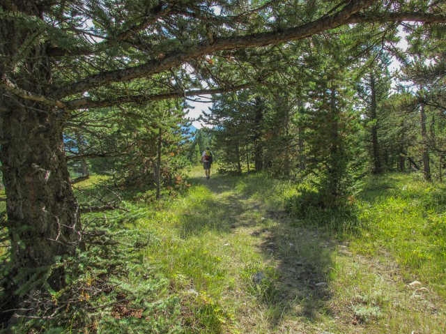
The trail heads up a bit and eventually merges with a cart track (faint road) coming in from the left. We spot an eagle along here, one of two we’d see this day. Not that far after, and leaving the road behind, we cross a small creek in a deep canyon. Heading back up, at the edge of a large pasture, we’re soon at the Horseshoe Dam. This, I understand, is where most people turn around. Not us though!
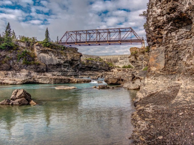
The trail east of here is indistinct, but it’s no worry as the way is always obvious (parallel the river – keep it close and you’ll be fine). At a bluff we have a good view of the dam. This structure is also around a century old and it, and the other will soon be the subject of their own report on the BIGDoer blog. I love large engineering works and certainly wouldn’t miss the opportunity to explore these fantasizing structures. We got very close to both.
A low rock ridge forces us left and we eventually hook up with another dirt road coming in from the nearby First Nation’s Reserve. According to Daffern this rough track may be part of the old Bow Fort Trail. This sounds completely plausible given most old routes followed rivers and the like.
At a second large pasture we come to the site of Harmonville from the 2003 cowboy movie Open Range. There is nothing to tell you the set was here. I can see why the movie makers picked it though. It screams old west. We may return here to shoot an Open Range then and now series. It’s not a great movie, so I’m not terribly motivated.
A side road drops down to the river. Any hikers who did not turn around at the second dam usually make this their destination instead (and it’s lovely spot). We’ll return to check it out on the return leg of our journey. We still have a way to go to reach our final objective, a location used in the movie Legends of the Fall.
Until now we’ve been on land manged by the company that owns the dams. Heading further east means entering the reserve. We had permission to explore further.
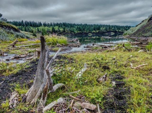
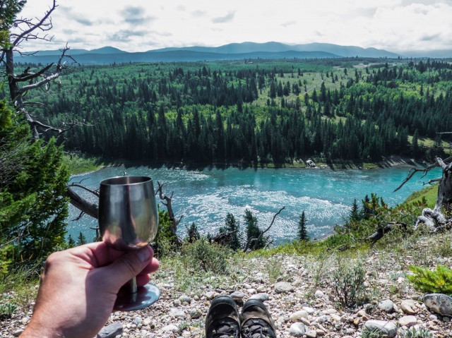
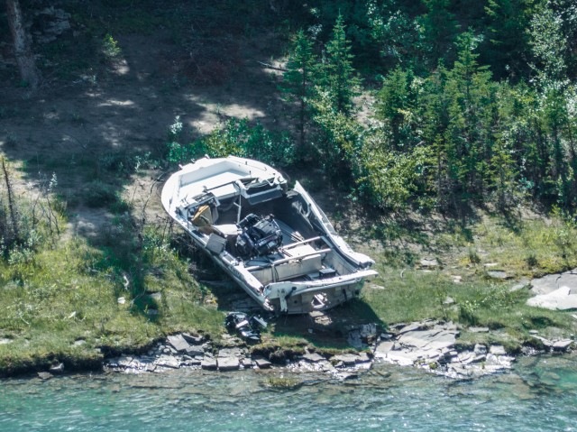
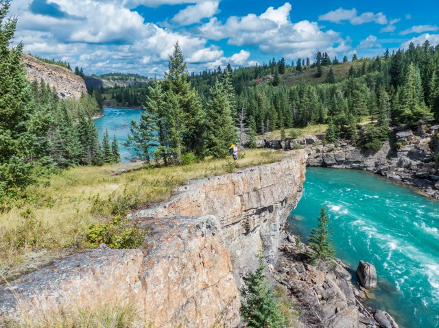
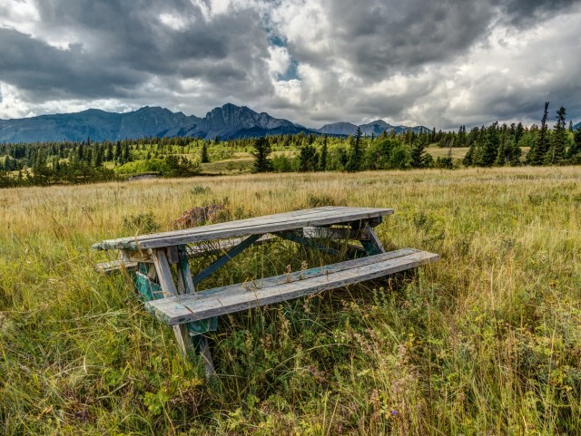
Following some old roads and cow tracks, we make our way to to a series of high bluffs. Very high bluffs! We pass through some woods and them break out into a pasture. At a particularly scenic overlook (our lunch spot), we spot something odd on the far bank of the river, a smashed up power boat. It must have come upstream from the Ghost Lake (the site of yet another dam) but how did it get wrecked?
On thing I noticed this whole trip, the river along here seemed to sustain little damage from the disastrous spring 2013 floods. There was no debris, water toppled trees or undercut banks to be seen.
We quickly find the Legends of the Fall filming location we came here for (watch for a then and now report soon). By the way, we found it using our detective skills only. It’s location is not common knowledge nor is it close to any roads and only with some deep research (and following some hunches) did we find it.
Just prior to leaving the reserve we come across a native ceremonial structure tucked away in the woods.
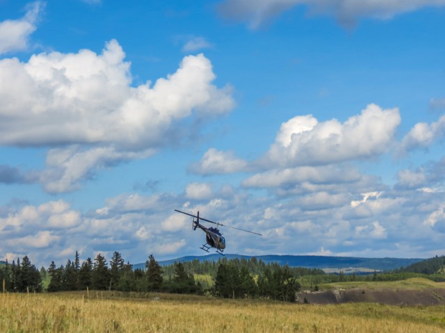
We’ve saw, or heard, lots of tourist helicopters in the sky this day but imagine our surprise when we turned a corner and found one parked on our very path. What’s going on? Is that a couple over there having a picnic? Yup, if you have the money, you can fly in and have lunch on the rock bluffs above the river. Like suckers we had to walk in. Interestingly, if we look at this location on Bing Maps (Google is low res), we can see a helicopter sitting at this same spot. This suggests these picnics are popular.
We found the chopper pilot down by the water’s edge and chit-chatted with him for a while. A nice fellow. Around here is what Daffern calls the “movie rapids” but is otherwise known as the lower reaches of Horseshoe Canyon which extends down from the Horseshoe Dam to this point. A scene from the River of No Return starring Marilyn Monroe was filmed here. Of course, we shot a then and now with this setting as the subject. The Bow River here is an even more brilliant colour, if that’s even possible. Some good timing – we caught a group of rafters tackling the canyon.
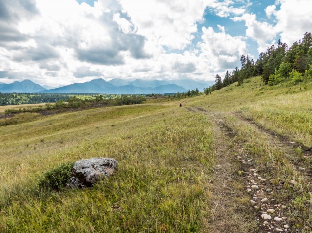
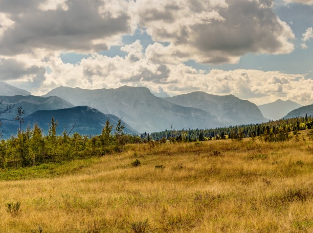
On the way in a storm threatened us but no rain fell. On the return trip the skies opened up as then did the views to the west. Mountains that earlier were shrouded in clouds could be clearly seen – Yamnuska with it prominent flat face, Yates Mountain to the southwest (home to the Barrier Lake Lookout) and in behind it, Heart Mountain, Mount McGillivray and Pigeon Mountain. Haze from forest fires made peaks further away hard to see.
We make good time and are soon back at the car. It was a very pleasant trip, one we recommend.
To see some other hikes in the area, go here…
Grotto Canyon.
Jura Creek.
Stoney Trail – Marilyn Monroe combo.
If you wish more information on this trail, by all means contact us!
Date of adventure: August, 2014.
Location: Kananaskis AB, Bow River area
Distance: 12km out and back with small side trips.
Height gain maximum: >100m.
Height gain cumulative: >100m.
NOTE: all heights and distances are approximate.
Reference: Kananaskis Trail Guides by the Dafferns.
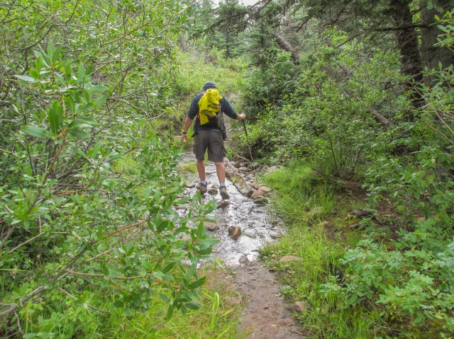
Crossing a wet area at the start of the Horseshoe Canyon hike.
The Seebe Dam, one of two such structures we’d see this day.
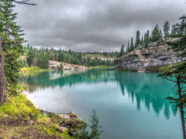
The river here is slow and deep and amazingly beautiful.
Looking west.
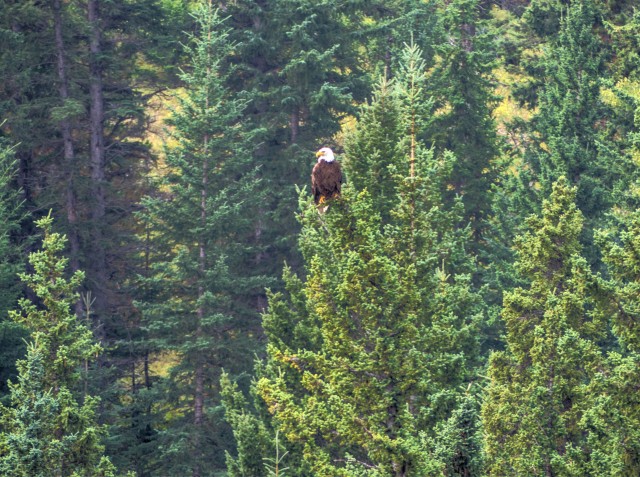
We spotted two eagles on this hike.
A storm brews above us, but the rain never fell.
We drop down to cross a side stream.
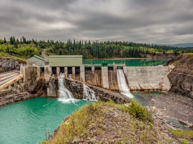
The Horseshoe Dam, built over a hundred years ago.
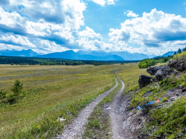
Following an old road.
We hike atop some high bluffs.
The view from our lunch spot. See something across the river?
…Anyone missing a boat?
The views were thoroughly enjoyable.
Scenes from the movie Legends of the Fall were filmed near here.
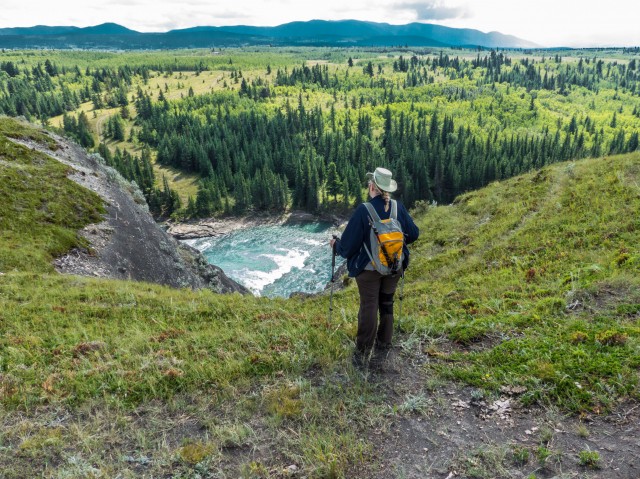
It’s a long way down.
Looking back – we turned around at the distant bluffs.
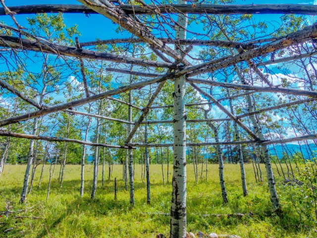
A First Nation’s ceremonial structure found along the trail.
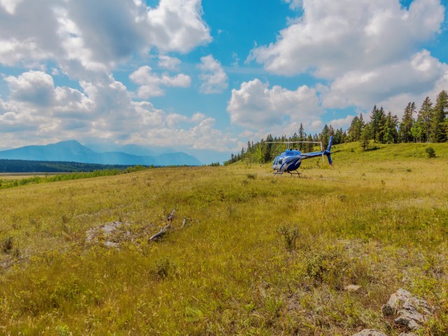
For a tidy sum you can fly in for a picnic. We prefer to walk.
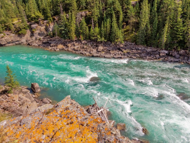
The “movie rapids” in Horseshoe Canyon.
A scene from the film River of No Return was shot here.
Connie chats up the helicopter pilot.
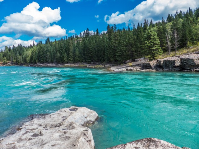
The colours were almost surreal.
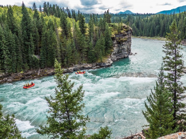
A group of rafters enjoying the river.
This cart track might be part of the old Bow Fort Trail.
And off they go…
This field was the site of Harmonville from the movie Open Range.
The haze is from forest fires.
Soon to be kindling.
Sometimes the trail follows a road.
A pleasant walk.
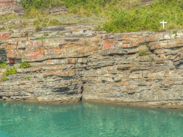
Note the cross…
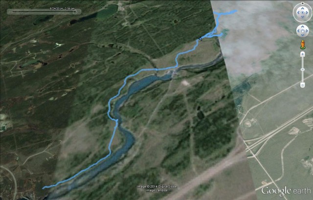
Our route (start from left).


This looks like a fantastic hike! Do you happen to have a map or coordinates to follow? I am planning on doing this tomorrow though I am unsure if I just park and follow the river or if there is a beaten trail to just follow.
Sorry did not see this until today. If it helps, the start is at the north end of the Seebe Dam. The obvious trail heads east from the parking area.
(via Facebook)
That’s just beyond beautiful!!
It amazed us with its beauty too.
Photos really are lovely. The “dwelling” is actually a sundance lodge. They build new ones fairly often.
Ah, that explains it. Thanks so much!
Amazing colors in those photos!
The river is such a wonderful blue/green there.
Wowzers! Amazing photos!
The colours were mind blowing!
Fantastic pictures,great story of your adventure.
Wonder where the boat came from,looks like the engine was ripped out of its mounts.
I would think it got there from the floods of 2013.
As for the cross,I seem to remember that some years ago there was a tragic swimming accident there.
Ive seen people jumping off the cliff into the cold water there.
Many thanks for sharing your adventures.
The boat must have come UP from Ghost Lake and then somehow got wrecked. The Horseshoe Dam, which is only a click away upstream, means it could not have come from that direction.
Wow, stunning photos!
The colours were amazing as you can see.
Awesome photos. I love the eagle.
Thanks, I like how they turned out. To bad the eagle was so far away.