
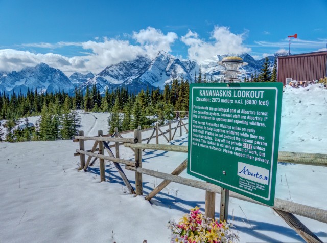
Kananaskis Fire Lookout
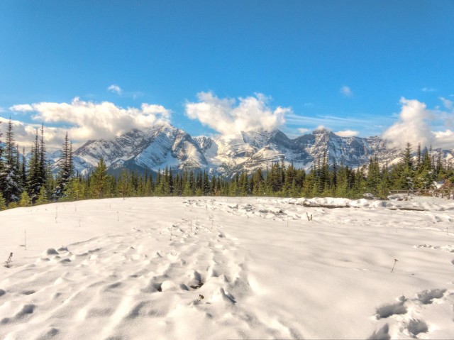
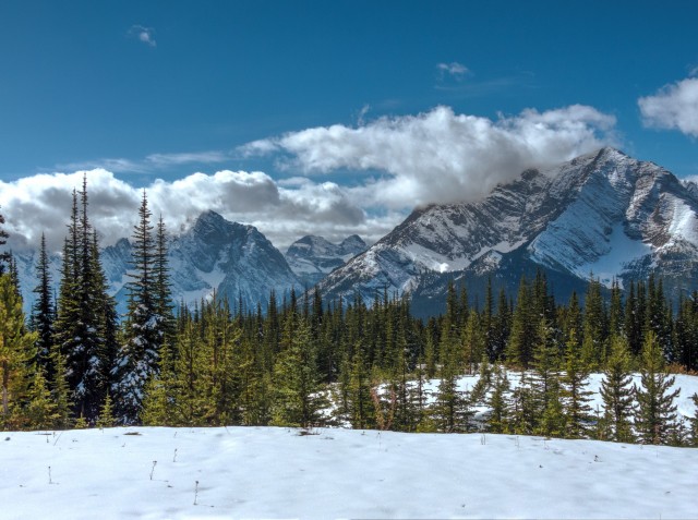
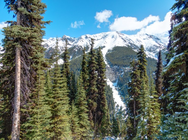
The hiking trail described here takes you up to the Kananaskis Fire Lookout and is a fairly easy affair. A wide track, it gains elevation ever so slowly. Deep in the trees most of the way, there is nary a view until the goal is reached. Admittedly it’s not the most exciting trip, but what awaits at the end makes it all worth while. Once at the top, a bald patch on an otherwise heavily forested hill, all around one is rewarded with amazing vistas – a sea of trees, rolling ridges, many tall barren peaks, wide valleys and large lakes tinged a lovely blue/green. Gorgeous!
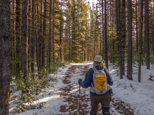
There are many possible starts to this trail, but we choose the Boulton Trading Post upper parking lot to begin our adventure. Go to the paved path on the east side. Turn right and at some biffies a couple hundred metres on, go left onto the wide and smooth gravel path.
For the next kilometre or so you’ll pass through the Boulton Campground, a busy, busy place in summer but not so much today. There are a number of road crossings, so keep an eye open for traffic.
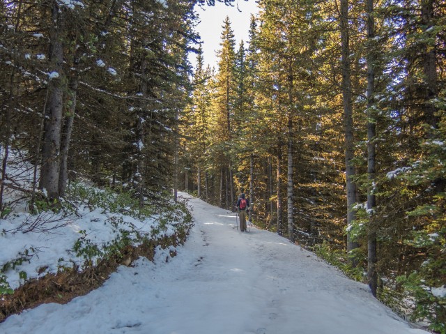
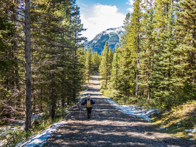
Heading in a roughly southeasterly direction, the trail for the most part gains elevation slowly, although there are a few steep sections here and there. The going is always easy however. The area was hit by some rather freakish late summer snow storms in the days leading up to our hike and by the time we got to the summit, it must have been 20-30cms deep. We were the first to use the trail since that weather event.
Before long we come to a junction where we turn hard right (south). There is a map here to help guide the way. There was also one at the beginning of the trail. The route coming up from the left originates on Highway 40 and is yet another possible starting point – it’s the shortest route with the least elevation gain, in fact. That section, plus what is yet to come, is occasionally driven by the lookout personnel.
In no time we arrive at a second junction, where we turn right again. The other route heads towards British Columbia, which is only a few kilometre away and according to hiking guru Gillean Daffern was built atop a long establish First Nation’s trail.
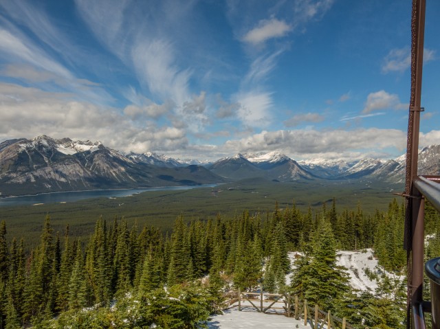
Continuing on in no time we’re at the lookout. There is a picnic table, benches, a viewpoint and a loo, all for your convenience. It’s a wonderful setting!
Enjoying our lunch (with wine, we always bring wine), some Whiskey Jacks (or Gray Jays) pestered us as we ate. They’ll often try to steal food when you’re not looking.
Let’s check out the wonderful views…
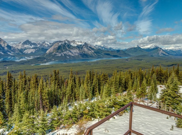
To the east Mount Pocaterra looms high above. To the south we can peer into the Elk Valley of BC. To the west we can see (l to r) Mounts Fox, Foch, Sarrail and Lyautey. Directly west there is Upper Kananaskis Lake (we’ve hiked around it), a stunning deep blue/green. To its right is Mount Indefatigable and below that peak, Lower Kananaskis Lake, it too an amazing colour and to the right, the South End of Lawson.
To the north are even more summits stretching off in the distance. The Kananaskis Lookout sits on a lowly hill with amazing vistas! Not unexpected but much better then we thought it would be.
Not long after arriving, an organized hiking group, a very large and noisy one at that, joined us here at this wonderful spot. They came in via the shorter, easier, highway 40 route, and soon left.
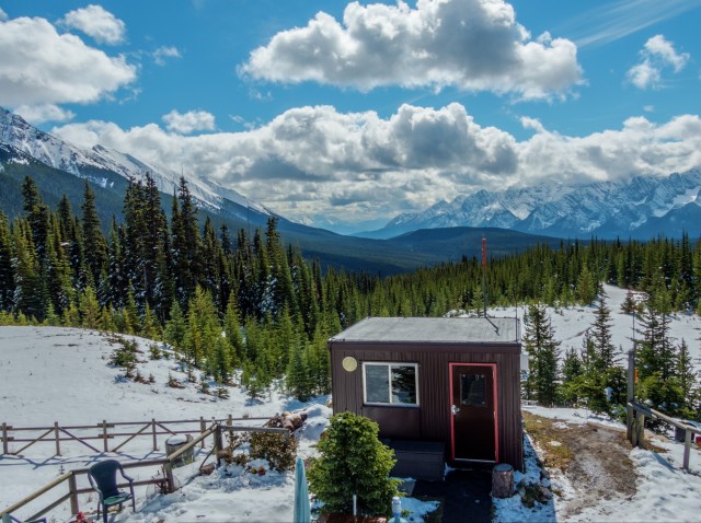
A very friendly couple, Joe and Dale, staff the facility and they invited us up for a look. Inside the lookout is a special scope system which allows them to scan the forests below for signs of smoke. No worry of fire this day, given the snow. Rounding out their job, they also take regular readings from the on-site weather station.
They’ve been the lookout personal at this facility for a number of years and their season extends from sometime early in June to the the first week of October (or thereabouts). They live in a small apartment on the lower floor and have done a great job of making the place pleasant and homey. Their supplies are brought in by helicopter.
A reminder if you visit a one of these places, the Kananaskis Lookout included, don’t bother the people working and living there and stay away from the buildings unless specifically invited in, as we were. Show respect and enjoy the views without disturbing these hard working individuals.
There has been a lookout at this location since the 1950s. The present structure dates from the mid-1970s and is one of a string of such facilities spread out across the Rockies. It’s the lowest altitude lookout we’ve ever visited. In spite of that however, the views were nothing short of spectacular.
Given that most fire lookouts have some sort of trail leading to them this makes them a natural attractant to outdoorsy types. Fire lookouts always have good views and who can resist that?
Reluctantly we head down. The rest of the trip is uneventful and in no time we’re back at the car. Much of the snow we saw on the way up had melted by the time we made the return trip down.
A good number of Spruce Grouse were spotted on this adventure. Not the smartest critters, they can often be approached to within touching distance before running off. They can fly, somewhat and very clumsily, but don’t do so often. You might hear people refer to them as Prairie Chickens.
This Kananaskis Lookout trail can also be biked or skied. It’s located inside Peter Lougheed Provincial Park near a very popular camping area.
To see some our favourite hikes, follow these links…
Wind Ridge.
One Mine Ridge.
Spectacular Buller Pass.
If you wish more information on this trail, by all means contact us!
Date of adventure: September, 2014.
Location: Kananaskis AB, Peter Lougheed Park.
Distance: 13km out and back.
Height gain maximum: 410m.
Height gain cumulative: 420m.
NOTE: all heights and distances are approximate.
Reference: Kananaskis Trail Guides by the Dafferns.
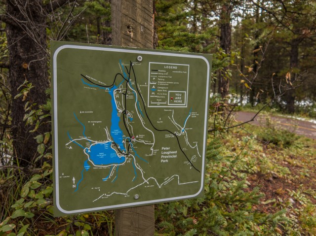
Maps help guide the way.
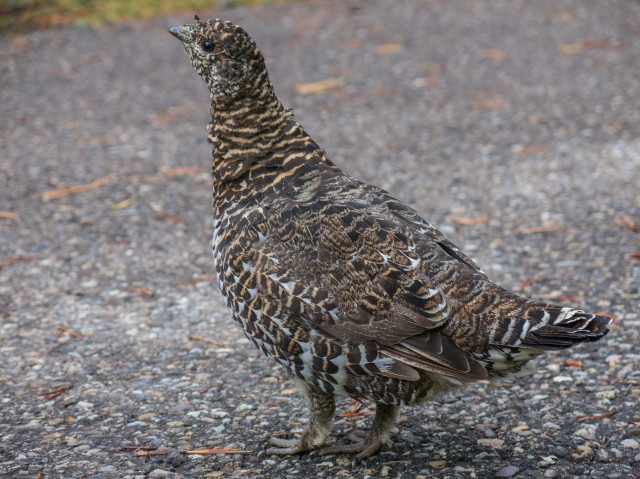
A none to smart Spruce Grouse.
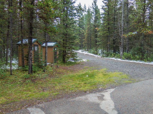
We leave the paved path at these biffies.
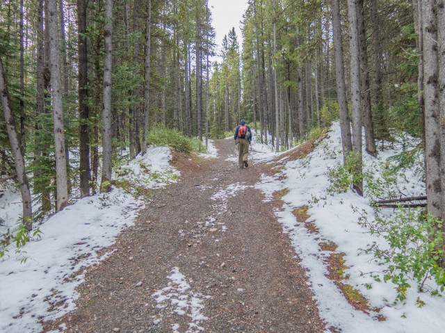
The trail is wide and the going easy.
Not until the end do we break out of the trees.
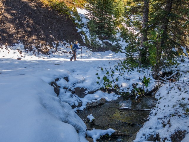
The snow gets deeper.
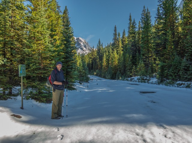
The first junction – turn hard right.
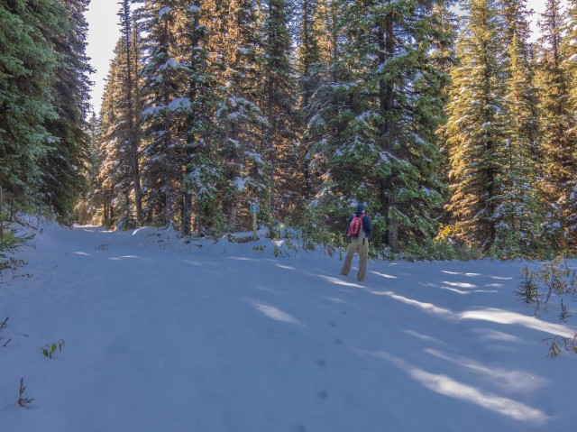
A second junction – right again.
Almost at the lookout.
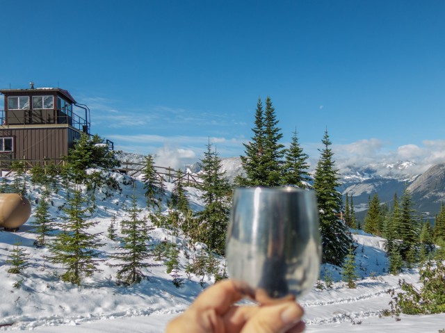
First, it’s time for lunch with wine.
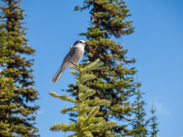
A Gray Jay or Whiskey Jack.
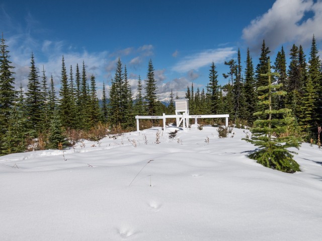
A weather recording station.
Looking roughly south.
Mounts Fox, Foch and Sarrail (l to r).
Mount Fox on the right.
To the east Mount Poctaerra dominates the view.
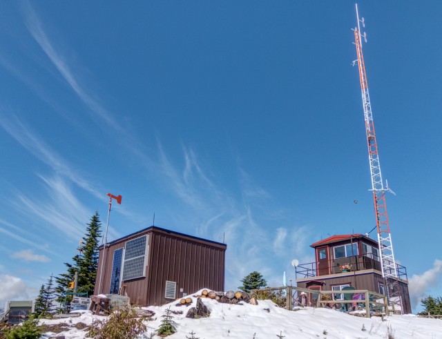
The lookout buildings.
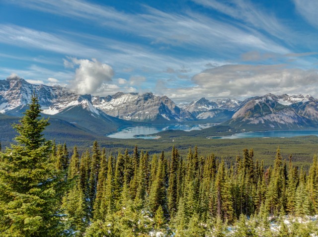
Upper Kananaskis Lake in back.
Lower Kananaskis Lake and in behind, Mt Indefatigable.
Looking south into British Columbia.
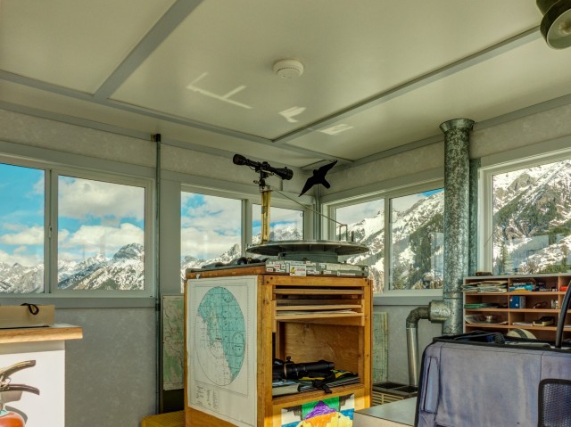
The spotting scope setup.
This section of Kananaskis is called Peter Lougheed Park.
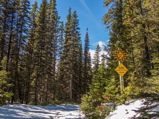
A warning to skiers.
Almost back at the car.
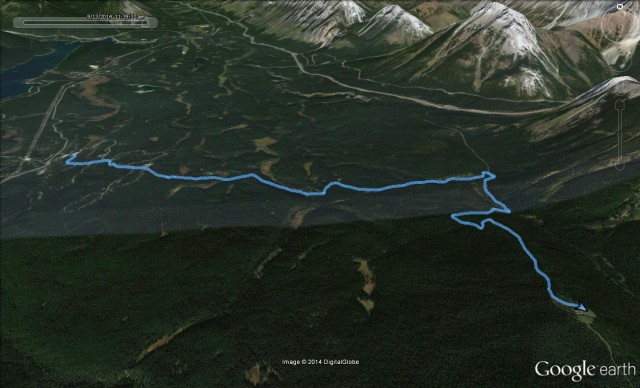
Our route…


Stunningly beautiful panoramic views!
For such a low elevation, it’s sure got the views!
Kananaskis sure has some awesome hikes!
It does. More then we could ever do in our lifetime.
That’s a wonderful hike. Haven’t been up there for a few years now though.
I didn’t have huge expectations for this hike, given the low elevation of the lookout. Was I wrong, the views were stunning!
Fantastic pictures Chris!
Good story of your adventure, Snow and all 😉
Thanks, it was a wonderful adventure, which we love to share.