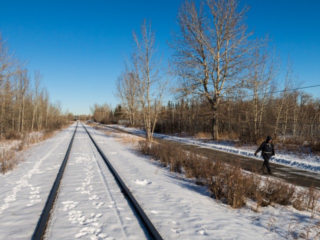
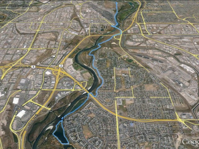
This “urban” hike we follow a route which parallels the Bow River southwards from a point just east of downtown Calgary, a journey that takes us through a huge number of varied environments. We pass though and by grimy industrial areas and railways yards, neglected city parks, wooded river flats, beside and under many busy and noisy roads and more. It’s got multiple personalities, not knowing minute to minute just what it’s supposed to be. This of course helps to keep things interesting.
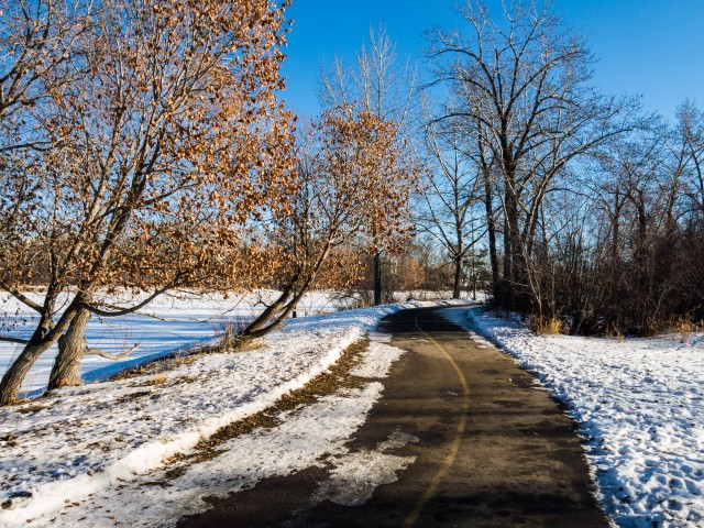
This outing takes place along official city of Calgary paved pathways. There is a huge network of them, so many in fact that if one did a hike a day, it’d be some time before you’d see the same stretch of trail twice. We use these convenient walking paths a lot in the winter, when the mountains are off limits due to heavy snow and the like. Many pathways are plowed this time of year, but one should always look out for icy or slippery sections.
We start at the Inglewood Bird Sanctuary, a facility closed since the spring 2013 floods.
↓ ↓ ↓ ↓ Scroll down for photos or to comment ↓ ↓ ↓ ↓
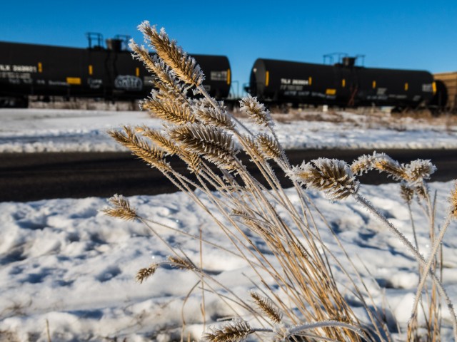
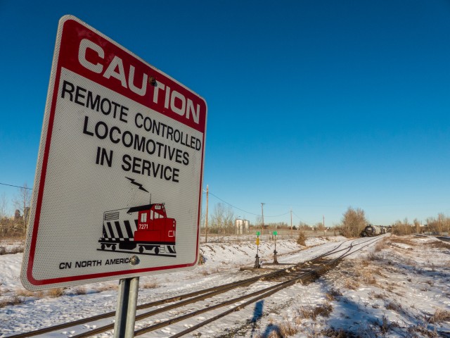
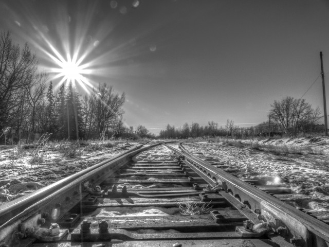
We take the pathway that runs right beside a train track. Some damaged freight cars, some with dents, some showing signs of being sideswiped or having derailed, sit on those tracks awaiting repair at a nearby railcar service facility. A sign proclaims that radio controlled locomotives can be found working this area. Any time is train time!
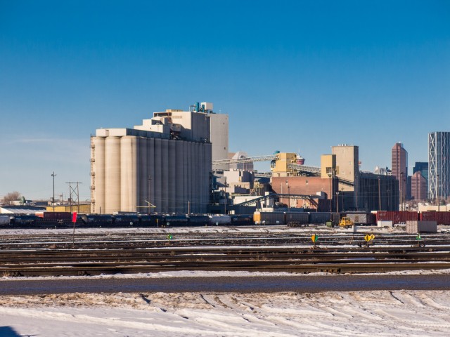
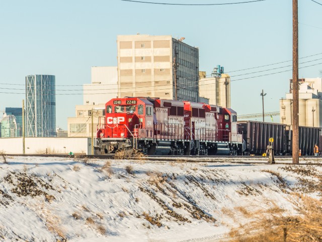
In short order we come to the CPR’s huge Alyth Yard. Oddly, the place is nearly empty and the only thing seen moving are a couple locomotives shunting cars about. A huge concrete gain elevator towers over the facility.
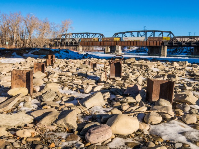
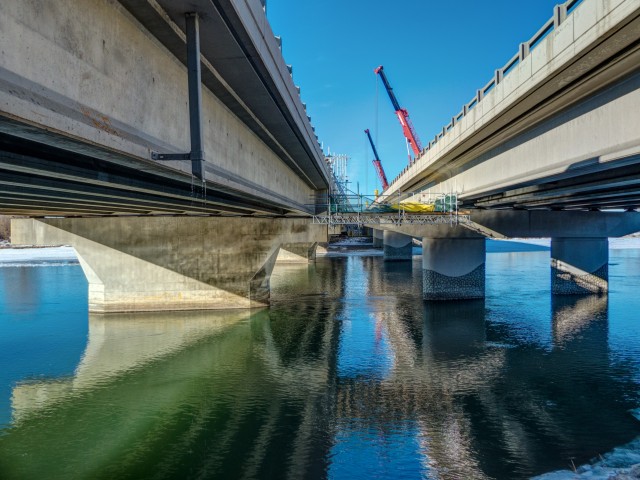
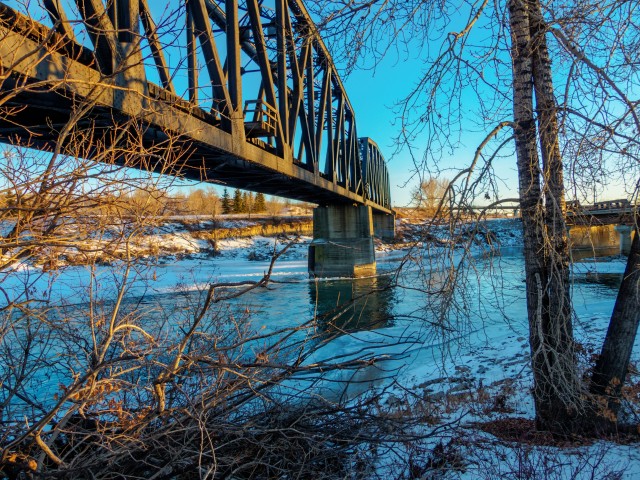
We pass under, in quick succession, two railway bridges, one belonging to the CNR, and the other, the CPR’s Bonnybrook Bridge, which during the spring 2013 floods, failed in a bad way. Some spans shifted and almost fell into the river, while a train crossed. Fortunately, the railcars remained upright. The structure was so badly damaged that it was only in 2014 that repair work on it was finished.
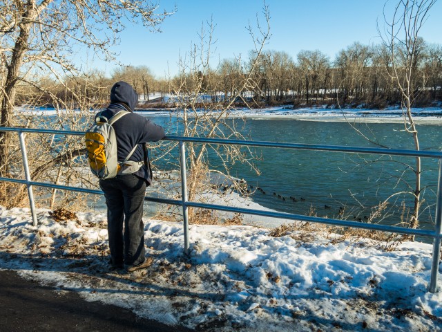
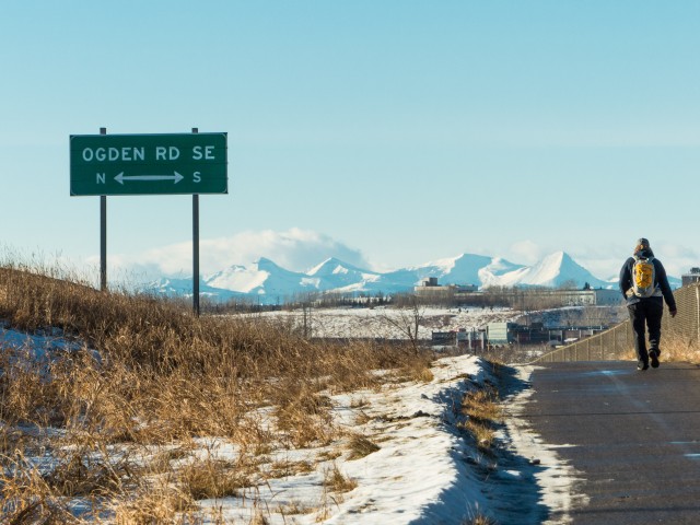
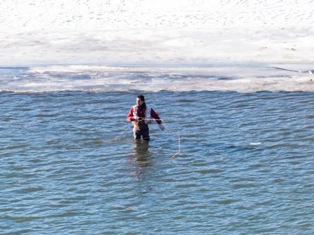
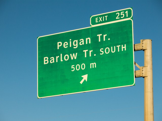
Passing under a road bridge (Ogden Road) we then use the same structure to cross over to the other side of the river. Lots of anglers were seen along this stretch of river.
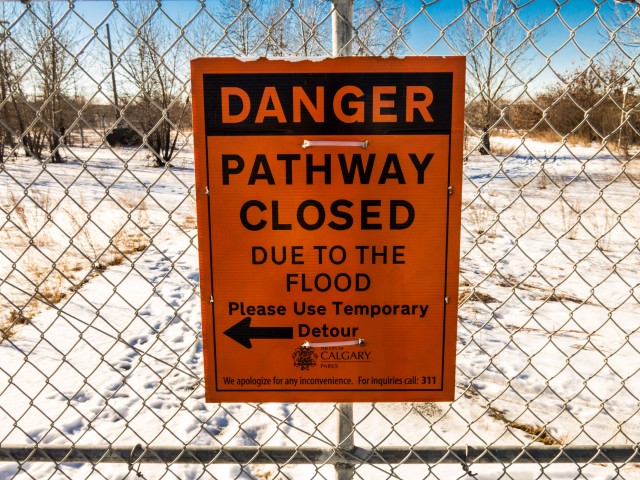
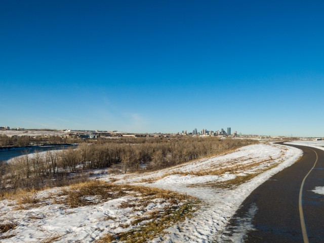
Just east of here is a detour. Normally one walks beside the river, but since there is flood mitigation work going on, we take to the streets for a few blocks. The skies this day are a nice blue and very clear and as such we have a good view of the mountains in the west.
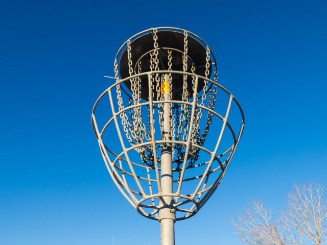
Paralleling the super noisy Deerfoot Trail for a bit we soon enter the Old Refinery Park, the former location of (you guessed it), a refinery. That complex is long gone, but I understand it’s legacy, yucky stuff in the ground, remains. The land is not suitable for housing or businesses, but I guess it’s okay as a park. Oddly, this is a dog off leash area and also doubles as a disc golf course. I wonder how many Frisbees have gone missing due to over zealous pooches snatching them while in play? I’d like to try my hand at this sport some time.
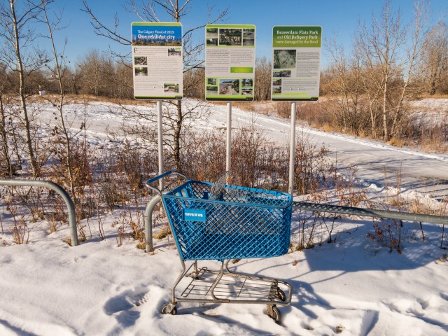
Passing under a railway bridge we enter Beaverdam Flats Park. This and the Old Refinery Park, both seem to be forgotten by the city and in places are a bit run down.
So far we’ve been roughly at river level, but we soon climb an escapement, only for a time though, before dropping back down again. Along this “lofty” section we pass behind a housing complex. To the north is the notorious community of Lynnview Ridge, now a series of vacant fields. That neighbourhood was built atop a section of that refinery land we spoke of earlier. Naturally nasty toxins were found in the soil and a decade of so all the residences there were torn down. Lesson here: old dirty industrial sites and housing generally don’t mix.
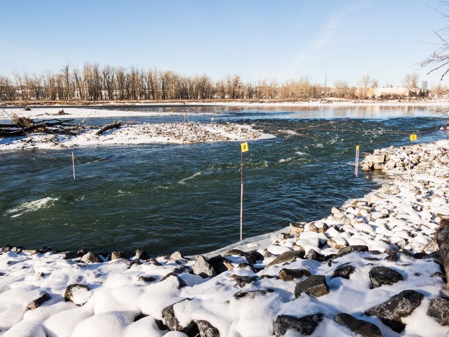
We pass under Glenmore Trail, another busy, busy thoroughfare before plunging into peaceful Carburn Park, the noise now behind us. Along here there used to be a large backwater pool, a big pond of sorts beside the Bow, but the spring 2013 floods (remember them) washed that all away and today there is a new river channel here. Someone has set up a kayak course at this spot.
Be sure to comment on this post (below pictures).
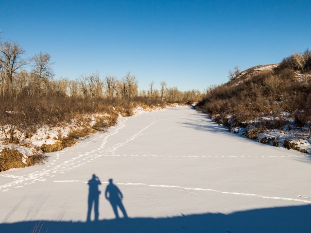
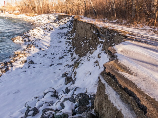
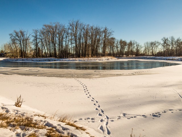
Passing a section of trail that has mostly washed away (need we saw flood damage) we come to a series of ponds, one set up for ice skating and another, which we loop around before heading back the way we came. Of course, we take time at this turn around point for lunch. A nearby sign warns that liquor is prohibited in the park. Oh-oh, we bring wine on every hike. What are we do? Thumb our noses at authority? Or do we simply not partake in this wonderful elixir? Connie and I, defiant rebellious rule breakers to the end, enjoy our bottle.
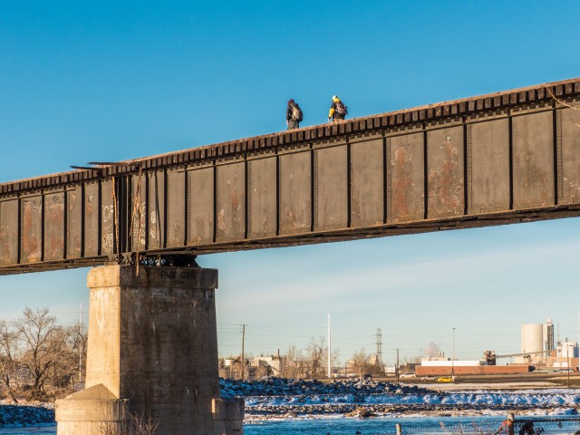
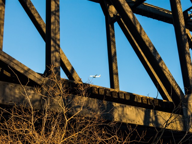
The trip back was pretty uneventful although watching a couple fellows crossing a train bridge, one we passed under earlier, was interesting. It’s a long drop down to the icy Bow River below! Fortunately for them I guess, this line, which serves some nearby industries, sees few trains. As a young stupid/fearless/invincible teenager I, along with my deviant friends, crossed many train bridges. It’s a wonder I made it to adulthood.
By the time we got back to the car, the sun had nearly set. The deep blues of the shadows contrasted nicely with the yellows of the sun. This time of the year, the days sure are short.
Was this trip exciting? No, but it had its charms and it was good exercise. So in that respect, how could it be bad?
If you wish more information on this trail, by all means contact us!
Date of adventure: December, 2014. Location: Calgary, AB. Distance: 16km. Height gain cumulative: >100m. NOTE: all heights and distances are approximate.
We used to do something called the "pointless challenge" 🤪 and miss those days. It was so much silly fun and often frustrating as heck. In these we'd invite people to send in random photos of obscure locations, but not give any information, and then we'd track where it was and shoot something similar.
Most of these came from old family collections, as was the case here. Anyone up to resurrecting the series?
In hindsight, why didn't we pose someone in our shot?
Pointless: “Devoid of meaning (or) senseless” Merriam-Webster.
If you like what we do and want to support this ongoing project (12 years now), go here: https://www.BIGDoer.com/help-the-society/ Thanks to Connie for making this post possible.
Exploring history with Off the Beaten Path with Chris & Connie. Photo: ca1970 and 2014. Posted by Connie.
Captured on a cold, cold day many years ago. We've been passing this old house for decades and it's little changed in that time. At some point we expect to drive by and it'll be gone.
Exploring history with Off the Beaten Path with Chris & Connie. Photo: 2017. Posted by Connie.
When retired old railway cars usually get cut up for scrap. Sometimes, however, they find their way into the hands of the general public or whomever. Flat cars make good bridges, and boxcars can be transformed into storage buildings and the like. Case in point here. We see them used like this often enough and in this case, it's part of a corral.
Incidentally, this boxcar dates from 1950 and this was found by tracing the old road number, which is still visible.
Exploring history with Off the Beaten Path with Chris & Connie. Photo: 2017. Posted by Connie.
This central Alberta racetrack was never a commercial operation but instead just a fun place for car enthusiasts in the area to get together. Early '70s or thereabouts and it only lasted a few years. Even thought it's been abandoned for that long, there is no doubt what was here.
You know we like the the obscure stuff and this one fits the bill perfectly. Found by accident while backroad cruising and the history comes thanks to local car guy Mike.
Exploring history with Off the Beaten Path with Chris & Connie. Photo: 2022. Posted by Connie.
On top of little Myrtle Mountain in the Kimberley (BC) Nature Park.
There's some good wilderness fun to be had here and nice views as you can see, but the real reason we came is mining history. The whole area near the ski hill was extensively worked over a century ago and we were looking for evidence of this. We didn't find much in the area searched, but it's a big chunk of property and we hope to return to cover more ground again soon. Of all the subjects we cover, mining related is a favourite.
Still, it was a good hike and that can't be bad. Look to the comments for more info 👇.
Exploring nature and history with Off the Beaten Path with Chris & Connie. Photo: 2022. Posted by Connie.
It's a strange curiosity in south Kananaskis, there on a hillside and we have no idea who created it. We asked around and no one's completely sure about its history. In the past it showed the Canada 100 logo from 1967 but in 2017 someone changed it to reflect the country's 150th.
That's our friend Emily from DanOCan.com having a look.
Exploring history with Off the Beaten Path with Chris & Connie. Photo: 2017. Posted by Connie.


A wonderful day for a hike with my best friend.
Awwwww….